Category: Agenda Packet

  • 2026-05-19 · Boards & Commissions · Agenda Packet · Downtown Development Authority · Agenda Packet

    2026-05-19 · Boards & Commissions · Agenda Packet · Downtown Development Authority · Agenda Packet

    2026-05-19 · Boards & Commissions · Agenda Packet · source: ccscrape-meetings · sha256 011a87a8 · pages 15 · method: text

    Full text — searchable
    DOWNTOWN DEVELOPMENT AUTHORITY OF THE CITY OF STOCKBRIDGE BOARD MEMBERS Kenya Cook, Chair Downtown Development Authority Meeting Agenda May 19, 2026 6:00 PM Warren Washington, Vice-Chair Jerry Mays, Treasurer Tariq Collins, Secretary Toseika Thomas, Board Member Darryl Stamper, Board Member Councilmember Elton Alexander ADMINISTRATION Shawn Edmondson, City Manager William Smith Economic Development Director Lisa Fareed Downtown Manager Tariq Collins, Recorder Vacant, Attorney STOCKBRIDGE DOWNTOWN CONNECTION CENTER 130 M L KING SR. HERITAGE TRAIL STOCKBRIDGE, GA 30281 Website: www.stockbridgega.org Phone: 770-389-7900 Fax: 770-389-7912 AGENDA DOWNTOWN DEVELOPMENT AUTHORITY MEETING CITY OF STOCKBRIDGE TUESDAY, MAY 19, 2026 6:00 PM I. II. III. IV. Call to Order 1. Invocation 2. Roll Call 3. Motions for additions or deletions to the proposed agenda 4. Approve Agenda 5. Approve Febriuary 17, 2026, Meeting Minutes 6. Approve March 11, 2026, Special Call Meeting Minutes 7. Approve January 21, 2026, Meeting Minutes 8. Approve April 21, 2026, Meeting Minutes Officers and City Staff Reports 9. Chairman's Comments - Cook 10. Vice Chair's Comments - Washington 11. Treasurer's Update - Mays 12. Secretary's Updates - Collins Old Business 13. Facade Grant 14. Projects Update 15. Marketing Plan 16. Legal Update New Business 17. V. Projects City Staff Report 18. City Council Liaison - Councilman Alexander 19. Economic Development Department William Smith 20. Main Street Advisory Board Liaison - LIsa Fareed VI. Executive Session (if needed) VII. Adjourn REGULAR MEETING SUMMARY MINUTES Tuesday, February 17th, 2026 @ 6 PM 130 MLK Senior Heritage Trail Stockbridge, GA 30281 Board Members Kenya Cook, Chair - Present Warren Washington, Vice-Chair - Absent Jerry Mays, Treasurer - Present Tariq Collins, Secretary - Present Darrell Stampler, Board Member - Present Toseika Thomas, Board Member - Present Elton Alexander, City Council Liaison - Present City Staff Cassandra Lester, Deputy City Clerk Economic Development Director - Vacant Lisa Fareed, Main Street Manager – Present Christine Chavis – Economic Dev Coordinator - Present Guest: Councilman Antwan Cloud Anthony Lawson Chairman Kenya Cook, called the meeting to order at 6:10pm, with an Invocation. Tariq Collins, Secretary proceeded with a roll call and quorum was established. Warren Washington, Vice-Chair absent. It was moved by Tariq Collins, Secretary and seconded by Jerry Mays, Treasurer that the agenda be approved and accepted. Motion carried. Minutes were sent out and posted on the website. No copies available at the meeting, we will revisit the minutes at the next meeting. Kenya Cook, Chairman mentioned we will be moving minutes in house from now on. Officer Reports Chairman’s Comments-Cook Chairman Kenya Cook, attended the main street meeting, also Toseika Thomas has been sworn in as an official board member. There were some discussions at the April 12-16 national conference on main street. Also, the public facility authority is moving forward with the sidewalk project on the MLK trial. Vice-Chair Comments-Washington No Updates as the Vice-Chair was absent. Treasurer Update – Jerry Mays Jerry Mays, Treasurer gave an update on the accounts. Projects Account: No activity. As of 30 January 2026 the balance is $160,353.44. Operating Account: There was a service charge of $5.00.00. As of 30 January 2026 the balance is $2, 731.24. Facade Account:No Activity. As of 30 January 2026 the balance is $ 41,133.50. It was moved by Kenya Cook, Chairman and seconded by Elton Alexander, Councilmember that the treasurer report be accepted and made a part of the record. Motion carried 4-0 Discussion: Kenya Cook, Chairman mentioned that we hold a lot of money in no interest bearing accounts. He questioned is that proper? Tariq Collins, Secretary said it should not be improper Page 1 of 4 REGULAR MEETING SUMMARY MINUTES Tuesday, February 17th, 2026 @ 6 PM 130 MLK Senior Heritage Trail Stockbridge, GA 30281 but a vote of the board should be necessary. Jerry Mays, Treasurer said you want to be careful with the everyday accounts being moved because it's a public account. It's best to have money that has not moved a lot to sit in those accounts. We can also look into removing the service charge. Elton Alexander, Councilmember said this why we need an attorney on board to ensure we are doing things legally IAW the city and laws that we are governed by. Kenya Cook, Chairman asked are we being good stewards of the people's money with it not growing and sitting in the account. Elton Alexander, Councilmember said we should be spending money and not holding on to the money. We need the attorney to help us be able to give out the grants to the business owners in the city Secretary Update-Tariq Collins Tariq Collins, Secretary, spoke about the lawyer he found and recommended to the board. The name was given to the Chair for further investigation. Old Business: Façade Grant Applications Update Kenya Cook, Chairman said we have CL Beauty Salon with a sent over outside facade grant and they need interior things done as well. There is no new info. There is some discussion about all the things she needs done with some of the interior things needed done due to the exterior grant being approved and it's all a part of the exterior grant approval. It was moved by Elton Alexander, Councilmember and seconded by Jerry Mays, Treasurer that we approve the exterior facade grant to include the interior work needed as a part of the exterior work being done for CL Beauty Salon. Motion Carried Kenya Cook, Chairman, asked about the Crown Pizza Grant. The Grants are ready to be voted on for Frozen Smoke and Crown Pizza. There was some discussion on voting with the members present. Because we had four members that established a quorum to open it was confusion on if we needed a quorum for votes. It was explained by Tariq Collins, Secretary that IAW Robert Rules of order, we need a quorum for us to officially meet, open, and conduct business. Once the meeting is open we can vote on all matters with the members present. It was moved by Kenya Cook, Chairman and seconded by Tariq Collins, Secretary that the application for Frozen Smoke be approved as is and signed off by the board tonight. MC with one abstention 3-0-1 It was moved by Tariq Collins, Secretary and seconded by Jerry Mays, Treasurer that we approve Crown Pizza application as is. MC with one abstention 3-0-1 Kenya Cook, Chairman, asked about the status of the interior grant. Christine did the updated application and we just need to send it to the attorney for review. Kenya Cook, Chairman, asked about the Burn Bootcamp outside Facade Grant. We needed a signature update. Page 2 of 4 REGULAR MEETING SUMMARY MINUTES Tuesday, February 17th, 2026 @ 6 PM 130 MLK Senior Heritage Trail Stockbridge, GA 30281 Projects Update: Kenya Cook, Chairman said we left off with the Daddy King Statue pending a resolution with the attorney. Elton Alexander, Councilmember said we are asking for the municipal park use of south Lee street to install the Daddy king statue and redo the park area as a tourist attraction. This is the busiest street outside of Eagles landing and the kids will see it on their way to the Stem school as well. We are also changing the name of Lee street to MLK since it is named after Robert Lee a confederate General. We are paying tribute to Daddy King as he lived here and walked the streets of Stockbridge. Kenya Cook, Chairman, asked about the update on the Rail Road Project. The city is going back to verify what agreement we have with the rail road for us to make a decision on how we can proceed. Elton Alexander, Councilmember said we are currently doing interviews for new Economic Development. Lisa Fareed, Downtown Manager gave an update on it and they will allow us to remove everything over in that space. Lets wait and see what the city comes back and say about how we will proceed with the demolition of the area. There will be 30 plus parking lots once it's cleared. Kenya Cook, Chairman mentioned that the Downtown Boundary has to be sent over to the attorney so it's in motion. Kenya Cook, Chairman mentioned we want to vote when everyone is back to do in house training. Kenya Cook, Chairman said no new update on the Mural Project. Kenya Cook, Chairman tabled the property Acquisition Marketing Plan: Kenya Cook, Chairman said we already have allocated money to support and help Main street for marketing. Vendor Proposal: No Update Legal Update: Kenya Cook, Chairman said we want to have three candidates come to the meeting. Two of them dropped out. We have one who is a great candidate. He would like to move forward with the one Attorney. We need to negotiate the terms. It was moved by Kenya Cook, Chairman and seconded by Tariq Collins, Secretary that we accept Attorney Wiggins as the new DDA Attorney. MC 4-0. New Business Page 3 of 4 REGULAR MEETING SUMMARY MINUTES Tuesday, February 17th, 2026 @ 6 PM 130 MLK Senior Heritage Trail Stockbridge, GA 30281 Grant Research- Kenya Cook, Chairman said we need to get someone as a grant writer and we should be going after the grant money that is out there. City Council Update: Elton Alexander – City Council Liason Elton Alexander, Councilmember said we are very excited about things coming downtown. A new business opened by April, the development of the fire department. The council is very active and keeps the ball rolling. The best gateway coming to town as well. We asked the council member to adopt a comprehensive area beautification plan. There is a rock quarry road extension program as well in the works. We currently put $2,000,000.00 in for the design. There is a Tim Horton coffee shop coming into town as well. Economic Development Director- Vacant Main Street- Lisa Fareed Lisa Fareed, Downtown Manager gave an update on the Burn bootcamp application saying he needs to do an updated application and afterwards we can do the review with the board and vote on it. There was a meeting with several groups for the projects the city has going on at the same time. The meeting offered for everyone to talk about the overlapping projects that were going on at the same time and it was a successful meeting on the trail to expand the side walks. We also needed to repair the sidewalk with the updates it needs. If we are going forward with the container project we need space for visitors. The alley way project was completed before December and finalized but waiting on approvals. They will go underground and update pipes, level the ground and grease traps, pad for trash collection and parking, utilities underground. The biggest news for this was the funding for the project and council member Alexander identified ear marked funds for this project which is close to one Million dollars. Ga Power does the EV station and they are working on a solution for that for us. There was some discussion on us updating the facade grant and letting the business owners know we have the grant to spend to improve the business infrastructure. Executive Session There was no executive session It was moved by Elton Alexander, Councilmember and seconded by Tariq Collins, Secretary that was close the meeting at 7:32pm Page 4 of 4 MEETING SUMMARY MINUTES Wednesday March 11th, 2026 @ 6:04 PM 130 MLK Senior Heritage Trail Stockbridge, GA 30281 Board Members Kenya Cook, Chairman Warren Washington, Vice-Chair Jerry Mays, Treasurer Tariq Collins, Secretary Darrell Stampler, Board Member Tosieka Thomas, Board Member Elton Alexander, Councilman City Staff William Smith, Economic Development Director Lisa Fareed, Main Street Manager - Present Guest: Anthony Jackson, Lisa Dyer CALL TO ORDER Roll Call & Meering Opening - Meeting called to order at 6:04 PM and began with a prayer and roll call of board members and attendees. - Guest Anthony Jackson was welcomed and William Smith was introduced as the new Economic Development Director. Approval of Agenda - Motion to approve the agenda passed. - Motion: Vice Chair Washington - 2nd: Treasurer Mays - Vote: 4 - 0 OFFICERS REPORTS Chairman’s Comments Confirmed travel to the Mainstreet Conference in Tulsa, Ok. The dates are April 13th - April 16th. The chairman will be reimbursed for travel by submitting receipts. The next conference will be hosted by The Georgia Downtown Association Annual meeting on August 17th – 20th, Rome Georgia. Vice Chairs Comments No comments Treasurer’s Update Will provide updates at the April 21, 2026 meeting Secretary’s Update No updates OLD BUSINESS Facade Grant - Discussion on expanding facade grant language to include landscaping, lighting, and permanent exterior improvements. - Differentiation between permanent enhancements (e.g., sodding, lighting) and movable items (e.g., planters). - No update on pending grant applications. - Action: Lisa and another board member to draft detailed language for the grant and review at a future meeting. Project Updates Power Lines & Sidewalk Improvements: - Stakeholder meetings with Georgia Power, architects, engineers, and trail planners are Page 1 of 3 MEETING SUMMARY MINUTES Wednesday March 11th, 2026 @ 6:04 PM 130 MLK Senior Heritage Trail Stockbridge, GA 30281 ongoing. - Plans for burying power lines, widening and leveling sidewalks for ADA accessibility, and removing unsafe half walls to improve curb appeal. - Coordination to minimize redundant construction and maximize efficiency. - Discussion about relocating trash compactor to improve aesthetics and free up parking. - Decision: Trash location suggestions noted for future planning. Railroad Space & Lease Agreement: - City is finalizing a lease agreement with Norfolk Southern for future demolition and construction. Project Timeline & Business Impact: - Construction documents are in progress; timeline will be clarified once a contractor is secured. - Suggestion to consider an impact fund for businesses during construction disruptions. To be discussed with the city manager. Beautification & Lighting - Proposal for new year-round pole lighting design (~$7,000 for 14 poles) to enhance downtown appeal. - Discussion about extending upgrades beyond the main block to the broader downtown district. - Emphasis on integrating aesthetic improvements with utility (e.g., outlets for events/vendors). - Motion passed to approve lighting expenditure. Motion: Vice Chair Washington 2nd: Treasurer Mays Vote: 7-0 - Plan to explore additional features such as two-sided banners and hanging baskets, with consideration for maintenance. Marketing Plan Downtown Events & Revenue Generation - Need for year-round events to increase foot traffic and support businesses. - $6,000 budget already approved for events. - Action: Discuss and plan a schedule of events, including potential Spring Fest and collaborations with local businesses. - Encouragement for business owners to take a more active role in organizing events. - Introduction of Anthony Jackson's upcoming event (cigars, bourbon, and house music) to diversify downtown activities. Legal Update - New attorney (Attorney Burns Wiggins) appointed at $285/hr for meetings and $650 per resolution. - Board confirmed rates are competitive. - Action: Attorney to create templates to reduce future costs; resolutions to be signed and sent for processing. New Business - Suggestion to broaden focus beyond MLK strip by creating unique downtown districts, each with its own identity and standards (e.g., historic signage). - Proposal to tie signage upgrades to facade grant requirements. - Action: Economic development team to engage business owners and develop district-specific guidelines. Page 2 of 3 MEETING SUMMARY MINUTES Wednesday March 11th, 2026 @ 6:04 PM 130 MLK Senior Heritage Trail Stockbridge, GA 30281 City & Staff Reports City Council Liaison: - Announced first amphitheater show (Mother's Day weekend with Jaheim, 112, Black Street). - Plans for road extensions, mixed-use developments, and new Tim Hortons. - STEM school construction update; expected to bring more students and staff to the area. - Master trail plan and transportation improvements funded and moving forward. Economic Development Department: - Introduction of new director William Smith, with expertise in economic development finance and incentives. - Discussion of pursuing Opportunity Zone designation for tax credits; will reconnect with state contacts for application support. - Interest in diversifying business types, including possible manufacturing, after community needs assessment. Main Street Updates: - Preparation for increased visitors due to a major event at Mercedes Benz Stadium, emphasizing hospitality and coordinated marketing. - Plans to partner with hotels and provide translated menus/QR codes for international guests. ADJOURN - Motion passed to adjourn meeting. Motion: Vice Chair Washington 2nd: Treasurer Mays Vote: 6-0 Page 3 of 3 MEETING SUMMARY MINUTES Tuesday, January 20, 2026 @ 6PM 130 MLK Senior Heritage Trail Stockbridge, GA 30281 Board Members City Staff Kenya Cook, Chair - Present Cassandra Lester, Interim City Clerk - Absent Warren Washington, Vice-Chair - Present Vacant, Economic Development Director Jerry Mays, Treasurer -Present Lisa Fareed, Main Street Manager - Absent Tariq Collins, Secretary - Absent Lawanda Powell, Administrative Assistant Darryl Stamper, Board Member - Present Guest: Anthony Lawson, Andrew Dyer, and Lisa Dall Dyer Toseika Thomas, Board Member - Present Elton Alexander, City Council Liaison - Present Call to Order The Downtown Development Authority meeting was called to order at 6:00 p.m. Board member Tariq Collins was absent. Approve Agenda Motion to approve the current agenda was made Treasurer Mays: seconded by Vice-chair Washington. Approve December 16,2025, Minutes Motion to approve December 16, 2025, minutes was made by Vice-chair Washington: seconded by Treasurer Mays Board member Toseika Thomas arrived at 6:12 p.m. Board member Darryl Stamper arrived at 6:16 p.m. Officers and City Staff Reports Chairman’s Comments The Chair provided updates regarding governance compliance, minutes preparation, officer responsibilities, and the process for selecting legal counsel. Board member Thomas has not been properly sworn in. Chair Cook stated she will be able to give input but not eligible to vote. The Board agreed to interview three attorney candidates and select counsel by the next meeting. Vice Chair’s Comments Update Vice-Chair reported survey activity for the Alleyway project, including presence of Georgia Power representatives. He raised the issue of potential business disruption impacts during construction and asked whether there is precedent for mitigation funding / impact support for affected downtown businesses. Treasurer’s Update As of December 31, 2025: ● Facade Grants account: $41,133.50 (no change) ● Operating account: $2,731.24 (activity includes checks written and a $5 service charge) ● Projects account: $160,353.44 (no change since last statement) Motion to approve the Treasurer's report made by Vice-Chair Washington; seconded by Board Member Stamper; the motion passed 5-0 Treasurer’s Report Approved (5–0). Chair Cook recommended transferring about $15,000 to the operating account based on prioryear expense patterns to reduce constant inter-account transfers. Motion to approve the transfer of funds from the Projects account to the Operations account in the amount of $15,000 to allocate funds appropriately for annual/normal bills (transfer implied/authorized) made by Vice Chair Washington; seconded by Treasurer Mays; the motion passed (5–0). City Council Liaison Councilman Alexander shared multiple project updates: ● Amphitheater: City set a $3M budget for shows; booking is underway; seeking a general manager. ● Rock Quarry Road widening: approx. $40M, estimated completion late 2027; includes multi-use path/sidewalk. ● STEM school: $73M, opening planned for 2027 school year. ● Alleyway project: estimated $800K–$1M, with dedicated city funding mechanisms described. ● Habitat homes: sewer work funded by the City; homes targeted for dedication in June. ● Recreation center: $32M project; funding strategy includes bonds + SPLOST + state/federal requests. ● Tim Hortons announced for Rock Quarry Rd/North Henry Blvd area (drive-thru concept). Economic Development Department Main Street Advisory Board Liaison Chair Cook recognized guests Anthony Lawson from Boot Camp Fitness, and Andrew Dyer and Lisa Dyer. Old Business Facade Grant Program Updates ● ArchDent Dental Clinic: Status remains pending. ○ Needs a 2nd quote from a different vendor ○ Revisit amount required ○ Confirm if permits are needed ● C.L. Beauty Salon: Update pending from staff. ○ Interior $8,500 ○ Exterior $14,800 = $23,300 Total Approved (DDA) ● Crown Pizza: Awaiting required documentation. ○ Awning Front and Back $17,856 ○ Permit $ 300 = $17,556 Total approved ○ Grant $15,000 ○ Balance - $2,556 X 33% ($744 Applicant); $1,812 (City) ● Frozen Smoke: ○ Need to complete/sign Agreement (minus concrete work 12/1) ○ Awning $16,270 ○ Door $1,947.63 need updated quote to reflect change in services $18,217.63 total ○ Grant $15,000, Balance $3,217.63 x 33% ($1,061 Applicant), $2,156 (City) ○ Scope reduced due to the City assuming responsibility for concrete work. ○ Total project cost decreased and remains below the originally approved amount. ○ Board consensus that no re-vote is required when scope and cost decrease. ○ Direction given to issue a confirmation letter documenting approval. No formal vote required. Interior Grant Program – Status Check ● Board discussed prior review of model programs (referenced as Griffin/Smyrna examples). ● Chair stated the full Board has not yet reviewed a final consolidated application package in a formal way (i.e., “pass it around, review, then vote”). ● Members agreed staff/committee should finalize a draft, then align resolution language with counsel. Decision direction (no formal vote recorded): ● Vice Chair Washington will coordinate with the Economic Development Coordinator and the Downtown Development Director (as needed) to refine the draft and return with a complete application. Projects Updates Daddy King Statue Project – Moving from Concept to Council Request ● Councilman explained the statue project has lingered for years due to lack of leadership and location debates. ● DDA intends to request City Council approval to: 1. allow the DDA to take leadership on the project, and 2. allow use of city property for the statue location. ● Costs are unknown; discussion included hypothetical ranges ($50K–$100K), but multiple members stated they need research and estimates. Decision direction (no formal vote recorded): ● Proceed with attorney-drafted resolution to put the request before City Council to start the process; DDA is not bound to final construction spending until later decisions/estimates. Railroad Property Structures – Demolition Discussion Tabled (5–0) ● Chair moved to table demolition discussion due to need for additional information. ● Passed 5–0. Downtown Boundary Expansion – Pending Attorney Resolution ● Boundary expansion requires attorney-prepared resolution; will be bundled with other items counsel must draft. Training & Development + Conference Attendance (Tulsa) ● Chair encouraged training to reduce “assumptions” about DDA powers and avoid process bottlenecks. ● Reminder: DDA members must meet annual training requirements; no formal tracking system currently exists. ● Main Street Now Conference (Tulsa, April 12–16) had been approved previously; during this meeting: ○ Chair confirmed intent to attend. ○ Two additional attendees expressed interest (as noted in discussion). ○ Cost estimates shared: registration ~$499 (member rate), and roughly $2,000 per person total trip budget (hotel/air/transport/per diem). ○ Likely reimbursement model: members may pay upfront and DDA reimburses. Decision direction (no formal vote recorded in this meeting): ● Chair to circulate specifics for final travel approvals/processing. Property Acquisition – Tabled Motion made by Vice-Chair Washington and seconded by Treasurer Mays 5-0 Discussion clarified City’s position: ○ City is maintaining the base allocation (~$45K). ○ Larger amounts (referenced up to ~$330K) are project-specific and case-bycase, not a blanket transfer. Marketing Updates - Tabled Motion made by Vice-Chair Washington and seconded by Treasurer Mays 5-0 Legal Updates ● A previously considered attorney could not proceed due to a conflict of interest (representation overlap with City matters). ● Another attorney candidate (recommended by Tariq) was still submitting credentials. ● Councilman advised it’s best practice to interview multiple candidates, including the CDA attorney as a potential option. One-off attorney for resolutions (discussion) ● Chair proposed a possible one-off attorney engagement to draft urgent resolutions (Interior Grant + Daddy King statue) so projects aren’t delayed while hiring counsel. ● After discussion, the group aligned around interviewing three attorneys and hiring one, rather than spending money on a one-off. Decision direction (no formal vote recorded): ● Interview 3 attorneys and select/hire counsel by the next meeting, potentially via a special called meeting or interviews at the start of the next regular meeting. ● Councilman preferred not to vote on attorney selection (liaison role), but emphasized the Board should make final selection. Action/need identified: ● The DDA still needed one additional attorney candidate beyond the two in discussion (Tariq’s + CDA attorney). New Business Mural Proposal ● Discussion with building ownership/representatives about placing a mural on an end/gateway building. ● Owners asked whether DDA already selected a design or if it would be open to artist submissions. ● Chair proposed connecting offline with the key point person (Therese via Lisa) and returning with a proposal. Decision direction (no formal vote recorded): ● Exchange contact info; develop options and return to Board. Renaissance Strategic Vision Plan ● No updates reported. Adjourn Chair Cook called for a Motion to adjourn at 7:41 p.m. Board member Stamper made the Motion, seconded by Vice Chair Washington. The motion passed unanimously. The minutes were recorded by Chair Cook.
  • 2026-05-13 · Boards & Commissions · Agenda Packet · Board of Ethics Committee · Agenda Packet

    2026-05-13 · Boards & Commissions · Agenda Packet · Board of Ethics Committee · Agenda Packet

    2026-05-13 · Boards & Commissions · Agenda Packet · source: ccscrape-meetings · sha256 6f2d802c · pages 4 · method: text

    Full text — searchable
    STOCKBRIDGE ETHICS COMMITTEE Alicia Barney-Duck – Chair ETHICS COMMITTEE MEETING AGENDA May 13, 2026 6:30 PM Angela Jenkins – Vice-Chair Mary Scott – Secretary Karen Charmaine – Member Johnnie Jenkins – Member MEETING LOCATION: STOCKBRIDGE CITY HALL LEVI MEETING ROOM 4640 NORTH HENRY BLVD. STOCKBRIDGE, GA 30281 STOCKBRIDGE CITY HALL 6:30 P.M. 4640 NORTH HENRY BLVD. STOCKBRIDGE, GA 30281 Website: www.stockbridgega.org Phone: 770-389-7900 Fax: 770-389-7912 AGENDA ETHICS COMMITTEE MEETING CITY OF STOCKBRIDGE WEDNESDAY, MAY 13, 2026 6:30 PM I. II. Call to Order 1. Roll Call 2. Approve Agenda 3. Approve October 22,2025 New Business 4. III. Ethics Committee Discussion/Updates Adjourn ETHICS COMMITTEE MEETING MINUTES February 18, 2026, 6:30 P.M. COMMITTEE MEMBERS Alicia Barney-Duck - Present Karen Charmaine - Present Angela Jenkins - Present Mary Scott - Present Johnnie Jenkins - Present The meeting was called to order by Chair Alicia Barney-Duck at 6:40 p.m. Roll call by Chair Alicia Barney-Duck with Committee members Angela Jenkins, Karen Charmaine, Johnnie Jenkins and Mary Scott present. Committee member Karen Charmaine asked that the agenda be changed to reflect that we would approve meeting minutes from October 22, 2025 rather than from June 11, 2025. Angela Jenkins asked that item 1 be removed from the agenda. The motion to approve the agenda with changes was made by Committee Member Karen Charmaine and seconded by Committee Member Johnnie Jenkins. Passed 5-0. The motion to approve the October 22, 2025, Meeting Minutes was made by Committee Member Karen Charmaine; seconded by Committee Member Angela Jenkins. Passed 5-0. New Business Election of Board Chair 1|Page Committee member Mary Scott nominated current Chair Alicia Barney-Duck to continue to serve in the role of Ethics Board Chair. Chair Barney-Duck declined. Committee member Karen Charmaine nominated Committee member Angela Jenkins for Board Chair. Chair Barney-Duck explained the duties of the role of Board Chair to Johnnie Jenkins, since he is new to this Board. Committee member Johnnie Jenkins motioned to go forward with the nomination of Committee member Angela Jenkins for Board Chair and was seconded by Committee member Karen Charmaine. Passed 5-0. Election of Board Vice-Chair Committee member Karen Charmaine declined a nomination for Board ViceChair, stating that she wished to remain a member at large. Committee member Karen Charmaine nominated committee member Mary Scott for Board Vice-Chair. Committee member Johnnie Jenkins moved that the nomination of Committee member Mary Scott for Board Vice-Chair move forward and the motion was seconded by Committee member Karen Charmaine. Passed 5-0. Election of Board Secretary Committee member Mary Scott nominated Committee member Johnnie Jenkins for Board Secretary and gave some information regarding what the role entails. Committee member Mary Scott made a motion that this nomination move forward and was seconded by Committee member Karen Charmaine. Passed 5-0. Discussion Reminders regarding the quarterly meeting times were made. There was also discussion about responding to emails regarding attendance. The move to adjourn the meeting at 7:03 p.m. was made by Committee Member Scott; seconded by Committee Member Charmaine. Passed 5-0. Meeting Minutes prepared by: Mary Scott, Ethics Board Secretary 2|Page
  • 2026-05-12 · Boards & Commissions · Agenda Packet · Citywide Development Authority · Agenda Packet

    2026-05-12 · Boards & Commissions · Agenda Packet · Citywide Development Authority · Agenda Packet

    2026-05-12 · Boards & Commissions · Agenda Packet · source: ccscrape-meetings · sha256 f97018c1 · pages 5 · method: text

    Full text — searchable
    City of Stockbridge Citywide Development Authority STOCKBRIDGE Development Authority Ariel Shaw, Chair Gadson Woodall, Vice Chair Citywide Development Authority Meeting Agenda May 12, 2026 6:00 PM LaKeisha Gantt, Secretary Gadson Woodall, Treasurer Monica Jones, Board Member Kim Mays, Board Member Ivy D. Sears, Board Member Jai Tazel, Board Member Jacqueline Humphries, Board Member William Smith Economic Development Director Elle Whigham, Recorder Location: City Hall Levi Meeting Room 4640 N. Henry Blvd. Stockbridge, GA 30281 Citywide Development Authority (DA) The work of development authorities is crucial for the ability for local government to create a legacy of sustained prosperity and requires strong leadership from board members, staff, and elected officials. The Citywide Development Authority is a (9) nine-member authority consisting of (8) residents of the City and/or business owners and operators preferably with subject-matter expertise such as attorneys, realtors, developers, and zoning experts and (1) member of the Governing Body. The directors shall be taxpayers residing in the county or municipal corporation for which the authority is created, and their successors shall be appointed as provided by the resolution provided for in Code Section 36-62-4 AGENDA CITYWIDE DEVELOPMENT AUTHORITY MEETING CITY OF STOCKBRIDGE TUESDAY, MAY 12, 2026 6:00 PM I. II. III. Welcome & Call to Order 1. Roll Call 2. Approve Agenda Old Business 3. Review and Approval of March 2026 Minutes 4. Minutes (no April Meeting) New Business 5. SHMF Golf Event - June 2, 2026 (Approval of Amount Needed) 6. 4th Annual CCC Economic Development Luncheon — June 18th (No vote Needed) CDA & ED will present with a table 7. GMA & Attorney Client Appreciation Dinner in Savannah, GA — June 27th. Chair Plus One Board Member. (Amount Not To Exceed $3000 Vote Needed) 8. Reminder of 2026 Approved Meeting Schedule — No Set Meetings for June & July. If Special Called Meeting Is Needed - We will alert you and it can be Virtual 9. GEDA May Luncheon — May 18, 2026. Please email Chair if you want to attend 10. Board Training - Reminder To Complete Trainings 11. Economic Development Department (As Needed) 12. Finance and Treasurer Updates IV. Executive Session to Discuss Real Estate Matters As Needed V. Adjournment Meeting Minutes Tuesday, March 10, 2026 Stockbridge City Hall, Levi Meeting Room 6 p.m. Ariel Shaw, Chair Present Gadson Woodall, Vice Chair /Treasurer Present LaKeisha Gantt, Secretary/Councilmember Absent Kim Mays, Board Member Absent Jacqueline Humphries, Board Member Present Monica Jones, Board Member Present Jai Tazel, Board Member Present Ivy D. Sears, Board Member Absent Call to Order Chair Shaw called the meeting to order at 6:07pm. Seconded by Monica. No discussion. Unanimous, Motion Passed. Roll Call Chair Shaw = Present Gadson Woodall = Present Councilwoman Lakeisha Gantt = Absent Monica Jones = Present Kim Mays = Absent Ivy Sears = Absent Jai Tazel = Present Jacqueline Humphries = Present A quorum was established. Chair Shaw made a motion to approve the agenda. Seconded by Director Jones. No discussion. The vote was unanimous. Motion Passed. Old Business Approval of January 13, 2026 Regular Meeting Minutes. Chair Shaw made a motion to approve the January 13, 2026 regular meeting minutes with an amendment to reflect that Director Woodall was present. Director Tazel seconded the motion. There was no discussion. The vote was unanimous. Motion Passed. 1|Page Approval of January 30, 2026 Special Called Meeting Minutes. Chair Shaw made a motion to approve the January 30, 2026 special called meeting minutes with an amendment to reflect that Director Woodall was present. Director Humphries seconded the motion. There was no discussion. The vote was unanimous. Motion Passed. Approval of February 10, 2026 Regular Meeting Minutes. Chair Shaw made a motion to approve the February 10, 2026 regular meeting minutes. Director Tazel seconded the motion. There was no discussion. The vote was unanimous. Motion Passed. Tommy Collins / T. Dallas Presentation. The Board tabled the item regarding the Tommy Collins / T. Dallas presentation due to Mr. Collins’ inability to attend the meeting. New Business Chair Updates: Chair Shaw provided several updates to the Board, including the following: • • • • • • • • • Board members are required to complete training through the Georgia Department of Community Affairs (DCA) and upload their certificates once completed. The Georgia Economic Developers Association (GEDA) luncheon will take place on March 18, 2026, and members discussed interest in attending. The Authority will sponsor the Small Business Conference scheduled for March 26, 2026. The State of Henry event will take place on April 2, 2026, and members discussed possible attendance. Piedmont Henry Hospital, located within the City of Stockbridge, will host a golf tournament at Crystal Lake on April 20, 2026. The Steve Harvey Golf Tournament is scheduled for June 2, 2026. An event featuring Chris Tucker is planned for August 2026, with the amphitheater being rented for what may become a full weekend event. The fourth annual Closers Connection Co. (CCC) event recently took place and was well attended by developers. Plans are underway for a Restaurant Week event in November 2026 to promote restaurants within the city limits. Chair Shaw requested volunteers to assist with coordination. Director Woodall volunteered. Director Jones volunteered. Director Humphries volunteered. Arrival of Director Gantt. Director Gantt entered the meeting at 6:28 p.m. Economic Development Update. Newly appointed ED Director introduced himself to the Board. Treasurer’s Report. Director Woodall provided the Treasurer’s update to the Board. 2|Page Executive Session Chair Shaw made a motion to enter Execution Session at 6:47pm Director Gantt seconded the motion. There was no discussion. The vote was unanimous. Motion Passed. Chair Shaw made a motion to exit Executive Session at 8:08pm Director Gantt seconded the motion. There was no discussion. The vote was unanimous. Motion Passed. Adjournment Chair Shaw made a motion to adjourn the meeting at 8:09pm Director Tazel seconded the motion. There was no discussion. The vote was unanimous, Motion Passed. 3|Page
  • 2026-05-11 · City Council · Agenda Packet · Regular Council Meetings · Agenda Packet

    2026-05-11 · City Council · Agenda Packet · Regular Council Meetings · Agenda Packet

    2026-05-11 · City Council · Agenda Packet · source: ccscrape-meetings · sha256 cb70ee7a · pages 449 · method: text

    Full text — searchable
    STOCKBRIDGE CITY COUNCIL Mayor Jayden L. Williams At-Large Council Meeting Agenda May 11, 2026 6:00 PM Mayor Pro Tem Elton Alexander Council District 5 Councilmember LaKeisha Gantt Council District 1 Councilmember Antwan Cloud Council District 2 Councilmember Kyle D. Berry, Sr. Council District 3 Councilmember Yolanda Barber Council District 4 CITY MANAGER STOCKBRIDGE CITY HALL Shawn Edmondson 4640 NORTH HENRY BLVD. INTERIM CITY CLERK Cassandra Lester CITY TREASURER Frank Milazi CITY ATTORNEY Quinton G. Washington Megan McCulloch STOCKBRIDGE, GA 30281 Website: www.stockbridgega.org Phone: 770-389-7900 Fax: 770-389-7912 Translation and Interpretation Services are available with (7) days prior notice. Please contact the City’s HR Manager at 770-389-7908 for assistance. AGENDA COUNCIL MEETING CITY OF STOCKBRIDGE MONDAY, MAY 11, 2026 6:00 PM CALL TO ORDER INVOCATION PLEDGE OF ALLEGIANCE ROLL CALL ADOPTION OF THE AGENDA ADOPTION OF THE MINUTES 1 Approval of the Work Session Summary Minutes April 28, 2026 Approval of the City Council Summary Minutes April 13, 2026 Approval of the Planning Retreat Summary Minutes Day 1 - March 4, 2026 Approval of the Planning Retreat Summary Minutes Day 2 - March 5, 2026 Approval of the Planning Retreat Summary Minutes Day 3 - March 6, 2026 PUBLIC COMMENTS - All persons wishing to speak for public comment must sign in with the City Clerk prior to the beginning of the meeting. You must sign your name, address, and phone number. You will be able to address the Mayor and Council for three (3) minutes. Speakers must respect all members of the elected body, officials, and staff. Defamation, unruliness and/or swearing will not be tolerated while meetings are in session. QUARTERLY REPORTS - Boards & Committees 2 Downtown Development Authority Quarterly Report - 1st Qtr. 2026 Citywide Development Authority Quarterly Report - 1st Qtr. 2026 Youth Council Quarterly Report - 1st Qtr. 2026 CEREMONIAL REVIEW - Move with Mayor Presentation; National Public Works Week Proclamation NEW BUSINESS Page | 3 3 4 APPEAL CASE #AP-2026-01. (Council District 4) Consideration of an appeal of the completed Zoning Verification Letter (ZVL) for two parcels at the southwest corner of East Atlanta Road and Stagecoach Road, including Parcel #047-01016001 with 2.64 acres and Parcel #02802021005 with 10.88 acres. Applicant / Property Owner: Samir Patel. Agent: Newton Galloway, Attorney. The ZVL was completed on March 27, 2026, and the applicant filed the appeal on April 19, 2026. - Presented by: Ryan Anderson Council Consideration For A Resolution Establishing A Council Voting Member As Intergovernmental Representative - Presented by: MAYOR'S COMMENTS (Jayden Williams) EXECUTIVE SESSION (Exemptions to the Georgia Open Meetings Acts) ANNOUNCEMENTS OF UPCOMING MEETINGS & EVENTS City Council Meetings are held on the second Monday of each month, and Work Sessions are held the last Tuesday of the month at the Stockbridge City Hall - City Council Chamber. Meeting times and dates may change. Please visit www.stockbridgega.org for updates. The City of Stockbridge adheres to the Americans with Disabilities Act (ADA). If you need auxiliary services to participate in the meetings, please contact City Hall at 770-389-7900 in advance. ADJOURNMENT May 11, 2026 6:00 PM 4640 N. Henry Stockbridge, GA 30281 Phone: (770) 389-7900 CITY COUNCIL WORK SESSION SUMMARY MINUTES TUESDAY APRIL 28, 2026 6:00 P.M. Mayor & City Council Mayor Jayden L. Willams At-Large Mayor Pro Tem Elton Alexander – Council District 5 Councilmember LaKeisha Gantt – Council District 1 Councilmember Antwan Cloud – Council District 2 Councilmember Kyle D. Berry, Sr. – Council District 3 Councilmember Yolanda Barber – Council District 4 Administration Shawn Edmondson – City Manager Frank Milazi – City Treasurer Cassandra Lester – Interim City Clerk Quinton Washington – City Attorney Megan McCullough – Associate Attorney Mission: To provide visionary leadership and superior municipal services that enhance the quality of life for citizens while creating a welcoming business atmosphere focused on sustainability and expansion of tourism and cultural events. Mayor Jayden Williams called the April 28, 2026 Stockbridge City Council Work Session meeting to order at 6:00 PM. Mayor Wiliams led the invocation and Pledge of Allegiance. Interim City Clerk Cassandra Lester conducted roll call. A quorum was established. Councilmember Kyle Berry was not present. Mayor Williams requested adoption of the agenda with two amendments: (1) addition of a council consideration to approve the Move with the Mayor initiative for the MLK Senior Trail Unity Walk, including a temporary road closure; and (2) addition of a presentation by Ms. Kim Denmark during the public comment/presentation portion of the meeting to allow sufficient time for her remarks. Motion to adopt the agenda as amended (Move with the Mayor initiative and Kim Denmark presentation) was made by Councilmember Cloud and seconded by Mayor Pro Tem Alexander. The motion passed 4-0. A secondary request was made by Councilmember Barber to add an item to the agenda to discuss the Tranquil Trail development, citing that she had not received responses to inquiries directed to Community Development, the City Manager, or legal staff, and noting that the development had required five council votes to approve. 1|Page Councilmember Gantt acknowledged that the matter was actively being addressed and that a town hall was being scheduled within approximately 15 days, stating that she had met with relevant parties that same morning and had visited the site multiple times. Councilmember Barber maintained that the full council was not being kept informed of discussions and that, as a voting member on the original approval, she was entitled to updates. The motion to add the Tranquil Trail item to the agenda failed for lack of a second. Councilmember Barber added for the record “What I have asked is to add an item to the agenda for discussion so that I can hear from legal, so that I can hear from community development so that I can hear from the city manager. I haven't heard anything. This is a development that took five votes to approve. If there are any changes to this, I'm expecting that it will come right back here to this governing body. I know no other details. I know nothing about a 15 day wait. Whatever discussions that are being had are not being had without the full council. I get, this is not in my district, but again, it took five votes to approve it. Me being one of the people who approved it, I approved this proposal based on what was presented to us. What I want is an update and because I'm not getting answers to the questions that I have sent to community development, to the city manager, to the zoning attorney, to the city's attorney, I'm asking to have a discussion right here, right now. These homeowners, they're here. Again, they're not going to stop coming until they have answers. They're not going to stop contacting any of us until they have answers. Rightfully so. I want to be able to give him an answer. I don't have an answer. The people who have the answers are not speaking or at least they're not sharing it with the full counsel. I want that for the record.” ADOPTION OF THE MINUTES April 13, 2026 City Council Summary Minutes and Planning Retreat Summary Minutes Day 1–3 (March 4–6, 2026) were submitted for review CEREMONIAL REVIEW Improving Mental Health Through the Move with the Mayor Mayor Williams recaptured the presented of a proclamation to Mr. Larry Malone (El Malone Fitness) in connection with the Move with the Mayor Spring Mental Health and Physical Activity Challenge, a National Forum initiative coinciding with Mental Health Awareness Month in May. The proclamation recognized the importance of physical activity and social connection, with particular emphasis on veterans and older adults. Mr. Malone briefly addressed the Council and expressed his honor in partnering with the city. PUBLIC COMMENTS Five speakers signed up for public comment. Four addressed the Council on matters related to the Tranquil Trail residential development adjacent to the Spivey Cove and Spivey Ridge subdivisions in Clayton County. The fifth public comment was deferred to allow additional time for a full presentation. Dave Murphy (2877 Mandy Court, Lake Spivey), a 30-year homeowner in the Spivey Cove subdivision, described the community as intentionally built and deeply connected, and expressed that the development as currently being executed differs materially from what was approved, including the removal of buffer trees. Blanca Velazquez (212 Hunting Court) expressed concerns about trees that were cleared in her backyard, noting that the remaining trees posed a risk of falling onto homes during storms. Kathy Walker (200 Hunting Court), HOA president of Spivey Ridge, stated that the natural tree buffer protecting residents had been stripped away and replaced with a proposal for a single row of trees, which she characterized as wholly inadequate. She called for true restoration of privacy buffers, proper drainage, backyard leveling, and full transparency regarding the project's 2|Page financial details and decision-making. She submitted copies of the developer's approved site and landscaping plans to the Council for review. Mike Adams (224 Hunting Court) described in detail the destruction of a natural buffer of over 100 feet of mature pines, maples, and oaks behind his property, stating that zero buffer remained. He reported witnessing multiple semi-trucks hauling away the mulched trees the previous day. He implored the Council to hold the developer accountable and to enforce the buffer requirements as mandated. PRESENTATION Walk Across America (Kim Denmark) Ms. Kim Denmark appeared before the Council to present her "Walk Across America" initiative, an effort she has sustained for sixteen years across sixteen states and over 6,500 miles to assist homeless veterans in finding housing and employment. A news segment was played illustrating her work. Ms. Denmark gave a personal testimony about the life experiences that led her to undertake the walk and described her plans to depart Stockbridge on May 23rd, walking approximately nine miles to Riverdale/Jonesboro. Ms. Denmark requested two forms of city support: (1) a police escort from City Hall to the Stockbridge city limits along North Henry Boulevard; and (2) hotel lodging for two rooms (one for herself and one for security) for one night as she passes through the area. Council members expressed admiration for Ms. Denmark's work. Mayor Pro Tem Alexander suggested connecting Ms. Denmark with retired Master Sergeant Patricia Bayden and her organization, Southern Crescent Veterans, noting natural synergy between the two efforts. Councilmember Cloud commended the work, noting he refers to homeless individuals as "people in need." Councilmember Barber thanked Ms. Denmark for shining a spotlight on the homeless and veteran communities. Mayor Pro Tem Alexander stated that Ms. Denmark's request for support was within the city manager's spending limit and could be addressed offline. QUARTERLY REPORTS City Treasurer's Quarterly Report – 1st Qtr. 2026 City Treasurer Frank Milazi reported that the FY 2026 adopted budget is $34.7 million (balanced). As of the report date, revenues received totaled $7.5 million (22%) and expenditures totaled $9.3 million (28%), with the expenditure lead attributable to revenue timing, particularly sales tax receipts. He reported 542 homestead exemption applicants processed between January and April across three exemption tiers (B1 basic, B2 age 62+, and B3 septic tank). The 2025 fiscal year closeout was underway, with the audit scheduled to begin May 4 and auditors arriving on-site May 11. Treasurer Milazi also noted that bank reconciliations were current through March 2026; a significant improvement from a six-month lag in 2024; and that the positions of Budget Manager and Senior Accountant had been filled. Public Works Quarterly Report – 1st Qtr. 2026 Public Works Director Decius Aaron presented the first quarter report. Highlights included: collection of 1,323 bags of litter totaling 15,876 pounds; 153 shopping carts, 39 mattresses, and 100 tires retrieved; approximately 10,100 residential sanitation customers serviced monthly; 18.8 million gallons of water produced and 47.9 million gallons purchased; 53.376 million gallons of wastewater treated (approximately 593,000 gallons per day) with no sewer spills; and 1,600 miles swept by street sweeper. Mr. Aaron noted that a third street sweeper was in the procurement discussion phase, which would significantly reduce the street-sweeping cycle. Councilmember Barber raised the issue of shopping carts scattered throughout the city and inquired whether cart owners could be identified. Mr. Aaron confirmed Walmart on Davis Road 3|Page as a primary source. Councilmember Barber suggested the Council consider requiring businesses to implement cart-containment technology. Mayor Pro Tem Alexander commended Public Works staff for their work on the Hudson Bridge Road community cleanup and noted that the transfer station in District 2 was scheduled to close on April 30th and was a long-sought result that would relieve neighboring residents of associated nuisances. Council discussion also touched on implementing projects from the Parks Master Plan, including playground equipment replacement, shade structures, park improvements at Memorial Park, Clark Park, and Gardner Park, and the development of a new park on Eagles Landing Parkway. Mr. Aaron confirmed that a meeting with City Manager Edmondson was being scheduled to prioritize low-hanging-fruit projects from the Master Plan. Councilmember Gantt additionally requested that staff explore a GMA grant opportunity for a skate park facility. Human Resources Quarterly Report – 1st Qtr. 2026 HR Director Dwayne Pollock reported an active workforce of approximately 194 employees, 11 separations (a turnover rate of under 0.7%), and 21 new hires during Q1. Six workers' compensation claims were filed; five were closed, with a total cost of $5,000. Notable wellness and training activities included a financial wellness workshop (80+ attendees), active shooter training (144 employees), and an onsite dental service day through Jet Dental (19 employees seen for cleanings and whitening). A compensation and classification study RFP was noted as currently open to ensure the city's wage structure is competitive within the broader metro Atlanta market, not just South Metro. A modern HR platform evaluation was underway, with a full presentation under Item 10 later in the meeting. Economic Development / Main Street Quarterly Report – 1st Qtr. 2026 Economic Development Director William Smith presented highlights including five active economic development projects engaging over 90 acres across the city; execution of the Norfolk lease for downtown parking; completion of Georgia Power underground utility surveys; finalization of the alleyway design and engineering documents; and planned expansion of the Main Street programming to twelve months of continuous downtown activities. The department also discussed revamping the city's incentive package to address both large-scale development and small business development, a new CVB-supported marketing campaign for downtown, and a TAD boundary realignment. Councilmember Cloud requested that he be kept informed of all Main Street board activities in his capacity as council advisor to that board. Councilmember Barber noted that downtown falls within her district and expressed her expectation to be included in all discussions affecting her constituents. Mayor Pro Tem Alexander requested the team explore Opportunity Zone or Empowerment Zone designation for downtown to potentially provide businesses with tax credits for new hires. Events Quarterly Report – 1st Qtr. 2026 Events Manager Charisma Webster reported that Q1 2026 events included the Alphonso Thomas African American Heritage Celebration and the Women's History Month Honors Celebration. Upcoming events include Tasty Tuesday food truck nights at Clark Park on May 5th and throughout the summer. The VyStar Amphitheater concert season was announced, including Mother's Day Show (Black Street, 112, Jaheem), and May/June concerts featuring Stephanie Mills, Karen White, Anthony David, Kem, and a gospel concert. It was also announced that Common will perform at the Juneteenth free concert and Bootsie and Pastor Troy will headline the July 4th free concert. 4|Page Councilmember Barber raised concerns about concert noise, parking management, and postevent litter near the adjacent church on the corner, noting that church members have services Sunday mornings. Ms. Webster confirmed concerts conclude by 11:00 PM, that parking attendants are on duty, and committed to extending litter cleanup to areas surrounding the venue. Mayor Williams requested an assessment of acoustic treatment options for Merle Mander Conference Center to improve sound quality at indoor events. . Municipal Court Quarterly Report – 1st Qtr. 2026 No presenter. The report was included in the quarterly departmental summary reviewed by Council. Police Department Quarterly Report – 1st Qtr. 2026 Assistant Chief Godfrey presented the Q1 2026 report. Key metrics included 10,820 calls for service, 202 arrests (41 felony, 161 misdemeanor), 2,600+ traffic stops, 2,200 citations, and 14 community events. Violent crime decreased 15.38% compared to Q1 2025, while property crime increased 2.9% and overall crime was up 1.8%. Priority one response time stood at 5.5% against a 5% target. The department's HEAT unit, approved in December 2025, was activated and actively addressing traffic violations and suspected DUI incidents. The department processed 2,711 reports and fulfilled over 1,100 open records requests. Recruiting gaps were noted as substantially closed, with new academy recruits beginning in May. The department is pursuing national accreditation through a CALEA self-assessment process and continuing discussions with Henry County regarding migration of the Tyler Technologies RMS from an onpremises to cloud-based system. Governing Body Quarterly Report – 1st Qtr. 2026 Executive Assistant to Mayor and Council Rosalynd Rawls reported on Q1 activities including support for the Meet with the Mayor program, Senior Bingo Bash events, an MLK Day Community Cleanup, a Clergy Roundtable facilitated by Councilmember Berry, a town hall meeting, and the ongoing Mayor for a Day program engaging young residents in local government. Mayor Pro Tem Alexander encouraged Ms. Rawls and her assistant Raven Eaton to assess their staffing needs and bring recommendations forward at the mid-year review, acknowledging the significant workload passed by the two-person team. Clerk's Office Quarterly Report – 1st Qtr. 2026 Interim City Clerk Cassandra Lester reported that the clerk's office prepared 52 meeting agendas, recorded 1,392 meeting minutes, attested to and archived 52 resolutions and 3 ordinances, and processed 242 open records requests in Q1. The clerk's office also coordinated four Youth Council outreach initiatives, supported the strategic planning retreat in Brookhaven Georgia, and maintained cemetery operations with two internments. Ms. Lester noted that cross-training between the clerk's office and governing body administrative staff had been implemented to redistribute tasks and reduce workflow gaps. A discussion took place about whether the coordination of council member training should be handled by the clerk's office or by the governing body staff. Councilmember Barber expressed her preference for the clerk's office to continue managing her training records. Councilmember Gantt noted that this is a personnel issue and relates to job descriptions, suggesting that this topic could be addressed during personnel discussions. Mayor Pro Tem Alexander encouraged Ms. Lester to assess staffing needs with the city manager and human resources and bring recommendations forward for consideration. Information Technology Report – 1st Qtr. 2026 IT staff member Dustin Allard presented the Q1 report, noting 406 total support tickets resolved across January (132), February (145), and March. Key activities included system evaluation and modernization, ongoing security hardening, an after-hours production upgrade completed without downtime, and growth planning for 2027. Councilmember Cloud raised the matter of 5|Page ADA website compliance, noting the city had received an extension on the compliance deadline. Dustin confirmed a plan was in place. Mayor Pro Tem Alexander requested improved display monitors in public access areas of the building. Community Development Quarterly Report – 1st Qtr. 2026 Community Development Director Ryan Anderson presented Q1 figures including 249 plan reviews, 66 zoning verification letters, 205 customer assistance meetings, 1,783 permits issued, 1,558 inspections, and 111 building permits. Business license activity included 40 new commercial businesses and 14 new home-based businesses. Total departmental revenue for Q1 was $3,179,077.98, encompassing permitting, business services, planning, zoning, and fire marshal activities. The department projected annual revenue in the range of $7 to 8 million. Mayor Pro Tem Alexander requested a follow-up review of hotel/motel tax revenue given the presence of extended-stay properties. CONSENT AGENDA Stockbridge Police Department Wrecker Service Assistant Chief Godfrey noted for the Council that the Wrecker One service had been removed from this contract renewal based on concerns raised at a prior meeting. The renewal before the Council was for wrecker services only through the Henry County Board of Commissioners with Supreme Trio LLC, d/b/a Swanson Towing and Recovery. Motion to approve the consent agenda item for the renewal of the piggyback wrecker contract with Supreme Trio LLC, d/b/a Swanson Towing and Recovery, was made by Councilmember Barber and seconded by Councilmember Cloud. The motion passed 3-0. OLD BUSINESS LIVABLE CENTERS INITIATIVE–FUNDING REQUEST. (Citywide) Community Development Director Ryan Anderson reported that the Council had previously approved a $30,000 local match at the February council meeting to support a grant application to the Atlanta Regional Commission (ARC) for a new LCI Study. Following submission, the ARC requested that the match be increased to $40,000, which would expand the grant award from $150,000 to $200,000. Staff indicated the proposal was well received and that the increased match significantly improves the probability of award. Motion to approve the increase in the local match commitment from $30,000 to $40,000 for the ARC LCI Study grant application was made by Mayor Pro Tem Alexander and seconded by Councilmember Gantt. The motion passed 4-0. NEW BUSINESS DONATION ACCEPTANCE OF 0.86 ACRES OF LAND FROM THE STOCKBRIDGE PRESBYTERIAN CHURCH. (Council District 4) Director Anderson presented a resolution authorizing the Mayor and City Clerk to execute documents accepting the donation of approximately 0.86 acres of real property located at 4740 North Henry Boulevard, at the northwest corner of North Henry Boulevard and Burke Street, from the Stockbridge Presbyterian Church at no cost to the city. The donation would leave the church with 2.5 acres and would provide a strategically located parcel in the downtown area that, when combined with adjacent city-owned parcels, could form a contiguous land assemblage suitable for a potential future recreation center or other municipal purposes. The church had originally sought approximately $200,000 for the parcel. Motion to approve the resolution accepting the donation of 0.86 acres from the Stockbridge Presbyterian Church was made by Mayor Pro Tem Alexander and seconded by Councilmember Gantt. 6|Page Councilmember Barber, noting the property is within her district, requested that the prior motion be rescinded so that she could make the motion for this item. Mayor Pro Tem Alexander rescinded his motion Motion to approve the resolution accepting the donation of 0.86 acres from the Stockbridge Presbyterian Church was made by Councilmember Barber and seconded by Mayor Pro Tem Alexander. The motion passed 4-0. Council consideration to Amend The Text Of The City Of Stockbridge Code Of Ordinances By Revising Chapter 8 (Buildings And Building Regulations) To Add Article XVI, "Water Efficiency Standards" Public Works Director Decius Aaron advised that as a member city of the Metropolitan North Georgia Water Planning District, adoption of the plumbing code amendment is mandatory for all member cities. Council was asked to approve the adoption accordingly. Motion to approve the ordinance amending Chapter 8 of the City Code to add Article XVI, Water Efficiency Standards, was made by Councilmember Cloud and seconded by Mayor Pro Tem Alexander. The motion passed 4-0. Council consideration to approve the renaming of the City cemeteries from Stockbridge Cemetery to Stockbridge Memorial Garden and Burk Cemetery to Burk Memorial Garden Director Aaron explained that the City is currently developing wayfinding signage and that many municipalities are moving away from the term "cemetery" in favor of "Memorial Garden," which reflects a trend in the industry toward more welcoming designations, particularly as historic cemeteries have become tourist attractions. The renaming was brought before Council to ensure the correct name is used when fabricating new signs. Motion to approve the renaming of the Stockbridge Cemetery to Stockbridge Memorial Garden and Burk Cemetery to Burk Memorial Garden was made by Councilmember Gantt and seconded by Councilmember Alexander. Discussion: Councilmember Barber, noting both cemeteries are within her district, stated the following for the record: “Anything that is affecting my district, the residents, the businesses, the streets, the buildings in city council, district four, I'm responsible for it. I like to have conversations about these matters, especially when they're added to the agenda because then I start getting calls and emails from homeowners and businesses regarding these actions and items. And I'm blindsided. Not that I oppose the renaming of these cemeteries, but it's just the principle of it. They want to continue disrespecting and by disrespecting me, you're disrespecting the homeowners and these businesses that I represent. So, I just wanted to make those points for the record.” The motion passed 4-0. Approval for Outbuilding Assistant Chief Godfrey requested Council approval for construction of a multipurpose outbuilding to serve the Police Department for training operations, large item evidence storage, crime scene processing, and equipment storage. The construction would be facilitated through Guardian cooperative purchasing, with Prime Construction Inc. as the contractor, the same firm engaged with Public Works for their new facility. Funding was identified within the traffic camera fund in the FY 2026 budget. Motion to approve the construction of the police department outbuilding was made by Councilmember Barber and seconded by Mayor Pro Tem Alexander. The motion passed 4-0. 7|Page Approval for Flock (LPR's, OS, PTZ) Assistant Chief Godfrey introduced Steve Hampton of Flock Safety, who presented an expansion of the city's existing Flock Safety partnership. The proposal covered three components: (1) renewal of the existing license plate reader (LPR) contract ($57,500/year, twoyear term, funded from general fund); (2) a new Drone as First Responder (DFR) program consisting of two drone dock units covering a 3.5-mile radius, with an average response time of 86 seconds and capability to clear 15–20% of low-priority calls without officer response ($100,000/year, three-year term, first year funded from traffic camera funds); and (3) an upgrade to Flock OS Premium tier, adding CAD integration, community camera registry, and a Flock 911 live call-streaming feature ($151,500 total, annual fee of $129,000, three-year term, first year funded through the Small Department Violent Crime Reduction Program grant). Motion to approve the Flock LPR, OS, and PTZ package was made by Councilmember Gantt and seconded by Councilmember Cloud. The motion passed 3-0, with Councilmember Barber abstaining citing not having received all supporting documents prior to the meeting. Councilmember Gantt clarified that the supporting documents were included in the agenda books and asked Steve Hampton of Flock Safety to provide his most recent presentation to mayor and council. Consideration and Approval of Paylocity Software Agreement for Human Resources and Payroll System and Services HR Director Dwayne Pollock presented a proposal to replace the city's current fragmented HR and payroll systems (UKG Kronos and Tyler Encode) with Paylocity, a unified cloud-based platform covering payroll processing, tax compliance, time and attendance, employee selfservice, performance management, learning management, benefits administration, and HR recordkeeping. The current payroll system requires manual distribution of pay stubs via email and employees must contact HR directly to update tax or address information. The Paylocity platform would place control of personal information directly in employees' hands via a secure portal and mobile access. Projected operational gains include up to 50% reduction in payroll processing time, 35% reduction in HR administrative workload, and 60% reduction in data errors.The proposed monthly cost is $5,019.23 (all-inclusive), compared to the current $4,000/month for UKG Kronos alone, with Tyler Encode continuing to serve as the system of record for general ledger and audit purposes. An export integration between Paylocity and Tyler Encode was included in the solution. A motion to approve the Paylocity Software Agreement for the Human Resources and Payroll System and Services was made by Councilmember Gantt and seconded by Councilmember Cloud. The motion passed 3-0, with Councilmember Barber abstaining, citing she had not received all the supporting documents prior to the meeting. Councilmember Gantt clarified that the rules established by the Georgia Code and statutes are followed. Occasionally, we may receive documents late. If additional documents arrive after the deadline, they are presented and the agenda is amended during the meetings. Council consideration for approval of the 2025 Year End Budget Amendment City Treasurer Frank Milazi presented the final 2025 fiscal year budget amendment, required to close out FY 2025 in preparation for the upcoming audit. The amended general fund budget was being adjusted from approximately $32.1 million (as amended in November 2025) to reflect final expenditure levels, with all departments having come in under their budgeted allocations. Total revenue and expenditure figures across all funds were adjusted to approximately $42 million from $40 million. 8|Page The most significant element of the presentation was the announcement of a $21 million transfer to the General Fund, comprising $19 million from the SPLOST V account and $2 million from the Hotel/Motel fund, representing funds that had been used over multiple prior years to finance capital projects and operations from those accounts without corresponding replenishment to the General Fund. The result will bring the General Fund balance to a minimum of $15 million, representing approximately 50% of the city's operating budget, an extraordinary turnaround from a negative fund balance of approximately $750,000 reported in 2024. Treasurer Milazi also noted that the city had submitted its financial statements to the Government Finance Officers Association (GFOA) and had been awarded the GFOA Certificate of Achievement for Excellence in Financial Reporting — the highest financial reporting recognition in the nation. City Manager Shawn Edmondson reiterated that 2026 was a stabilization budget year and emphasized that the money had existed all along in city accounts, noting that the issue was one of misallocation and improper tracking, not of missing funds. Councilmember Barber voted in opposition, stating that while she did not oppose the technical budget amendment process itself, she could not support ratifying what she characterized as unauthorized overspending that had occurred without council approval in prior fiscal years. She also noted the absence of regular monthly or quarterly financial reports to the full council since the budget was adopted in December 2025. Treasurer Milazi clarified that all departments came in under budget in 2025, and Mayor Pro Tem Alexander emphasized that no department exceeded its budget, countering any characterization of overspending. Motion to approve the 2025 Year End Budget Amendment was made by Councilmember Gantt and seconded by Mayor Pro Tem Alexander. The motion passed 3-1, with Councilmember Barber opposed. Roslin White Center Letter of Support for The Housing Affordability Breakthrough Challenge Community Development Director Ryan Anderson introduced Linda Anderson, a Henry County resident and custom home builder, who appeared before the Council to request a letter of support for her application to the Housing Affordability Breakthrough Challenge, a Wells Fargo/Empowerment grant program. Ms. Anderson described plans to build affordable owneroccupied homes priced under $300,000–$310,000, ranging from 900–1,700 square feet, within the City of Stockbridge. She noted she had also missed the Department of Community Affairs window for a workforce housing grant but intended to apply again when that window reopened. Motion to approve the issuance of a letter of support on behalf of the Roslin White Center and Quintessential Homes for Linda Anderson's application to the Housing Affordability Breakthrough Challenge was made by Councilmember Gantt and seconded by Councilmember Cloud. The motion passed 4-0. [AMENDED AGENDA ITEM] Move with the Mayor Initiative: MLK Senior Trail Unity Walk Mayor Williams requested Council approval to temporarily block off MLK Senior Trail and Jennings Way for the Daddy King Unity Walk, beginning at the downtown welcome center and proceeding to Memorial Park. The event is part of a friendly competition with the City of Jonesboro under the Move with the Mayor initiative. 9|Page Motion to approve the temporary road closure for the Move with the Mayor Unity Walk was made by Councilmember Cloud and seconded by Councilmember Gantt. The motion passed 4-0. MAYOR'S COMMENTS Mayor Williams called for a moment of silence in memory of the late Congressman David Scott, who had recently passed away. The Mayor noted that the Council had visited Congressman Scott's office just three weeks prior and that he would be lying in state at the Georgia State Capitol at 11:00 AM on Friday. Mayor Williams reminded residents that early voting was underway at Merle Mander Conference Center through Election Day on May 19th. He also announced that the Move with the Mayor competition against Jonesboro commences that Friday, with community engagement events scheduled across the city every Saturday. He encouraged residents to purchase VyStar Amphitheater concert tickets through Ticketmaster, noting they were selling quickly. EXECUTIVE SESSION (Exemptions to the Georgia Open Meetings Act) No executive session was held. ADJOURNMENT Motion to adjourn was made by Mayor Pro Tem Alexander and seconded by Councilmember Gantt. The motion passed 4-0. The meeting adjourned at 9:06 PM. Respectfully submitted by: ______________________________ Cassandra Lester, Interim City Clerk ______________________________ Jayden L. Williams, Mayor 10 | P a g e CITY COUNCIL MEETING SUMMARY MINUTES MONDAY APRIL 13, 2026 6:00 P.M. Mayor & City Council Mayor Jayden L. Willams At-Large Mayor Pro Tem Elton Alexander – Council District 5 Councilmember LaKeisha Gantt – Council District 1 Councilmember Antwan Cloud – Council District 2 Councilmember Kyle D. Berry, Sr. – Council District 3 Councilmember Yolanda Barber – Council District 4 Administration Shawn Edmondson – City Manager Frank Milazi – City Treasurer Cassandra Lester – Interim City Clerk Quinton Washington – City Attorney Megan McCullough – Associate Attorney Mission: To provide visionary leadership and superior municipal services that enhance the quality of life for citizens while creating a welcoming business atmosphere focused on sustainability and expansion of tourism and cultural events. Mayor Jayden Williams called the April 13, 2026 Stockbridge City Council meeting to order at 6:00 PM. Councilmember Kyle Berry led the invocation and Pledge of Allegiance. Interim City Clerk Cassandra Lester conducted roll call. A quorum was established. Councilmember LaKeisha Gantt arrived at 6:39pm. Mayor Williams noted that an amendment was needed to add an item regarding the police department piggybacking off an existing contract for records services. Councilmember Berry made a motion to adopt the agenda with the amendment. Councilmember Barber seconded. The motion passed 4-0. Adoption of the Work Session Meeting Minutes March 31, 2026 Councilmember Barber made a motion to approve the March 31st work session minutes. Mayor Pro Tem Alexander seconded. The motion passed 4-0. PUBLIC COMMENTS The interim clerk announced five public comments: Willie Carter (123 Wilson Avenue) addressed case number VR-2026-01, a variance on Wilson Avenue, stating it needs to be opposed and re-examined due to concerns about the plot. Mayor Pro Tem Alexander clarified that speakers on this item would have additional opportunity during the public hearing. 1|Page Charlene Woodruff (7914 Christian Court) discussed her 22-year residency and concerns about a proposed apartment development. She explained that in 2022 she was told by staff the development probably wouldn't happen due to incomplete paperwork but recently discovered surveyors on her property preparing for apartments. She reported that trees on her property had been cut down, which was verified by the developer. Mayor Williams acknowledged receiving her email and confirmed staff was working on a solution. Dave Murphy, (2877 Mandy Court) a 30-year Spivey Cove resident and community leader, provided background on developments in their area. He detailed the community's consistent opposition to apartment developments, noting 99% opposition at public meetings despite council approval of both proposed projects. He described a 2022 community meeting with a developer who lacked professional presentation materials and proposed 318 apartments and 50 townhomes. Kathy Walker, (200 Hunting Court) president of Spivey Ridge HOA, expressed concerns that the current development differs from what was presented in 2022. She reported that residents received no advance notice before tree clearing began, removing protective buffers between homes and construction. Walker noted that other nearby developments received significantly greater buffers (up to 50 feet) while their larger, higher-value homes received less protection. She requested immediate installation of temporary barriers, restoration of proper buffers, and accountability to ensure compliance with approved requirements. Evelyn Dixon (267 Spivey Ridge Circle) from Spivey Ridge raised communication concerns about the apartment development, noting inconsistent and inadequate updates to residents. She proposed enhanced communication including timely construction notices, clear impact information, and consistent communication channels with current information on the city website. CEREMONIAL REVIEW: Proclamations for Autism Acceptance and Black Bookstore Month Mayor Williams summarized the ceremonial portion held at 5:30 PM, noting three proclamations were presented: declaring April 2026 as Autism Acceptance Month for community inclusivity, Black Maternal Health Week (April 13-17) to foster public-health sector collaboration, and joining other mayors in recognizing Black Bookstore Day to promote literacy, culture, and diversity. PRESENTATION Presentation on Potential Small Area Studies to be Undertaken Community Development Director Ryan Anderson presented the city's plan for small area studies, explaining they had identified 10 targeted areas for detailed examination over the next 3-5 years with $200,000 budgeted for fiscal year 2026. The studies would focus on underutilized parcels, aging infrastructure, and areas needing revitalization rather than currently thriving areas. Mayor Pro Tem Alexander expressed concern that District 5 wasn't adequately represented on the priority list, noting the need for strategic distribution throughout the entire city rather than concentration in particular districts. He advocated for including Hudson Bridge Road and Eagles Landing Parkway to continue highquality development momentum, similar to successful Patrick Henry Parkway planning that attracted major retailers like Costco and Sprouts. 2|Page City Manager Shawn Edmonsdon responded that areas like District 5, which are already thriving, would be included in the upcoming comprehensive master plan, while these small area studies target pockets needing revitalization. Mayor Williams praised the data-driven framework and asked what the studies would mean for everyday Stockbridge residents. Anderson explained these grassroots-level studies would give residents in specific neighborhoods opportunity to influence what they want to see in their areas. He further confirmed this is a roadmap that will provide intentional rather than just reactive growth. Councilmember Barber expressed excitement about area studies. Citing that she had been asking for an area study for District 4, which had nine residential developments approved in her district. And it was annexed with 6,700 new residents in 2023. She sought confirmation that State Route 42 and Valley Hill Road areas would be encompassed, which Anderson confirmed. Barber then asked for clarification between the critical action and high priority ranking areas on the area study presentation. Anderson clarified that based on the planning analysis and the development trends and all the other data that we've taken into consideration, staff felt like there were the three areas they wanted to target first. Mayor Pro Tem Alexander provided population context stating “In, in 2020, retroactively the census and Atlanta Regional Commission went back, and they proactively put in the annexation numbers for the city.” Noting that despite perceptions of rapid growth, the net population increase from 2020 to 2026 was only 229 residents (from 35,740 to 35,969) when accounting for retroactive census adjustments that included annexation numbers. He contrasted this with McDonough's net growth of over 5,000 residents in the same period. Adding that for a threeyear period, there was not one rezoning that came to the city council between 2016 and almost to 2019, and then one came in 2019, it was denied. So there was a long period of time where there was no development in the city. PUBLIC HEARING Variance Case #VR-2026-01 Community Development Director Ryan Anderson presented the variance request for property on Wilson Avenue to allow construction of a single-family dwelling. The property's irregular shape and narrow dimensions require reducing front yard setback from 50 feet to 25 feet and rear yard setback from 40 feet to 20 feet. The 0.613-acre property is long and narrow, with insufficient space to meet standard SR district requirements. Anderson explained the property meets all seven variance criteria, noting there are 40 feet of city right-of-way that would accommodate future sidewalks without impact. The proposed 2,294 square foot home would have 1,370 square feet on the first floor and 924 on the second floor to minimize the footprint. Councilmember Cloud questioned recent variance approvals in the area and existing homes that might have required variances. Anderson explained that older homes were grandfathered in before current code enactment, though some existing homes in the area already encroach into the 50-foot setback requirement. Councilmember Cloud noted he had spoken with residents and community leadership who support new development but want it built to existing SR zoning requirements. He expressed openness to growth while respecting residents' rights to expect code compliance. 3|Page Councilmember Gantt suggested conditioning approval on sidewalk easement acceptance and noted modern development trends favor reduced setbacks near downtown areas, citing examples of high-value developments with minimal setbacks selling for premium prices. Anderson acknowledged this highlighted weaknesses in the current code, which only has two residential districts (SR and RR) compared to the previous code's four districts (R1-R4). Most homes in the area don't meet current SR requirements but are grandfathered in. Mayor Pro Tem Alexander confirmed staff recommended approval based on meeting all seven variance criteria, with Anderson noting it would be difficult to legally defend denial since the criteria are met and denial would create hardship. Councilmember Barber expressed concern about setting precedent, noting this would be one of the largest homes in the area. No speakers appeared for or against the variance during public comment periods. Motion to table VR-2026-01 made by Councilmember Cloud, seconded by Councilmember Gantt until the next meeting to allow the applicant to meet with residents for discussion. The motion passed 5-0. NEW BUSINESS Council consideration of purchase agreement for SPD K9 Moos to its current handler. Interim Chief Godfrey explained Lieutenant Blake Zimmerman's resignation to seek opportunities at a larger agency, requesting to purchase his six-year-old canine Moos. With approximately two years of service life remaining, finding and training a new handler would leave only about one year of service by completion. The specialized boarding requirements during transition would create substantial costs. Staff recommended the sale based on both the canine's best interests and city financial considerations. Councilmember Gantt asked about pricing methodology. Chief Godfrey explained they used a prorated amount based on original canine cost separate from training, resulting in a $2,000 sale price. City Attorney requested the motion include finding the canine and kennel unserviceable per city code. Motion to approve the sale of canine Moos and kennel, determining them unserviceable based on provided information, made by Councilmember Gantt, seconded by Councilmember Barber. The motion passed 5-0. Quitclaim Disposal of Remnant Tract at 2125 Jodeco Road Community Development Director Ryan Anderson presented the proposal to transfer a 0.77acre remnant tract to Tidal Wave Auto Spa. The city acquired the tract from Georgia DOT in 2023 for drainage maintenance, but the drainage system has been redirected, making only half the tract necessary for city purposes. The tract's protrusion into the Tidal Wave property creates development difficulties. The transfer follows OCGA requirements for conveying small strips to abutting property owners and includes conditions requiring staff presence during operations for litter control, adherence to submitted site plans with stacked stone and brick finishes, screening for cleaning stations, and developer reimbursement of legal costs. Mayor Pro Tem Alexander confirmed this followed standard city abandonment procedures and appreciated the significant brick and stone requirements to complement the Joe Deco 4|Page development. He emphasized the value of mixed-use development providing services like car washing on-site to reduce traffic burdens. Motion to approve declaring the property at 2125 Jodeco Road unserviceable and proceeding with the abandonment made by Mayor Pro Tem Alexander, seconded by Councilmember Barber. The motion passed 5-0. (First Reading) South Berry Street Renaming Anderson presented the first reading to rename South Berry Street to "Alphonso Thomas Street" honoring Councilmember Thomas's decades of public service. The renaming affects only two properties, and proper public notification was provided. Councilmember Cloud explained his thought process in spearheading this honor, noting Councilmember Thomas pioneered the Martin Luther King Sr. Heritage Trail and deserved recognition with his own street. He hoped Thomas would be honored by this gesture. Councilmember Berry expressed excitement about honoring such a beloved public servant who served as their predecessor. He emphasized Thomas as a curator of history who loved Stockbridge, noting this was an appropriate way to memorialize his legacy. Mayor Pro Tem Alexander praised Councilmember Thomas as a statesman and consensus builder, sharing personal appreciation for Thomas's support during difficult times and noting his faith-based leadership in the community. Councilmember Gantt emotionally endorsed the honor, calling Thomas a wonderful colleague whose legacy lives on, and praised Councilmember Cloud for stepping into Thomas's role effectively. Motion to approve the resolution renaming South Berry Street to Alphonso Thomas Street made by Councilmember Cloud, seconded by Councilmember Gantt. The motion passed 5-0. (First Reading) Text Amendment Case #TX-2026-02 Anderson presented the proposed text amendment to establish formal procedures for street and facility renaming, noting no current formal process existed in city code. The proposal included two pathways: city council initiation requiring legal advertisement and two readings, and community/resident initiation requiring 75% of affected neighbors' signatures plus petition to council. Councilmember Barber questioned whether the Lee Street renaming could be appealed under this policy, expressing concern about the timing and process and stated for the record; “The issue, the policy, the process that we took to rename a street in my district that was not initiated by me. If it's the mentality of this governing body to try to just erase history and close the door on residents’ businesses and the church that is affected by that change, I am vehemently opposed to it. They deserve to have an opportunity to appeal that decision. Unfortunately, the vote was approved by the council. Three, I voted against it, three approved it, one abstained. I cannot bring that vote back for reconsider reconsideration. Only those three who approved it, one of them would need to bring it back for reconsideration. Which is why I'm asking that those residents, businesses that are affected by this change, they deserve to have an opportunity to appeal the decision. But because there was no policy then you're now enacting a policy after we've approved the renaming of Councilmember Thomas. It just does not seem fair at all. I just want all of this for the record.” 5|Page Barber reiterated her question, asking, “So there is no current policy in which residents, business owners, or any stakeholder who's affected by that change, they don't have an outlet, they don't have an opportunity to appeal?” In response, Anderson stated, “The intent of this formal policy is because if staff is given a directive, we have to have something to work off. So we were just trying to formalize the process. But council has the right to make motions from the floor to make a street name proposal.” Barber then posed a question to city attorney representative Megan McCollugh “those residents, business owners and the church that is affected by the name change Lee Street, do they have an opportunity to appeal that? And if they do, what is the timeframe?” The city’s legal responded “I would actually defer to our zoning attorney and our planning and zoning attorney Valerie Ross, although she's not here right now. And if those residents are interested in appealing that, I would recommend that they contact their own counsel. I can't provide legal advice to residents on that.” Barber further asked, “I'm asking you on behalf of the governing body, me, as a member of the governing body who represents this district, is there an opportunity to appeal the name change?” And legal stated “what I'm saying is, ma'am, that I can't answer that question for you.” The discussion continued and Mayor Pro Tem Alexander strongly defended the Martin Luther King Jr. Way naming, calling it shameful to face "theatrics" for honoring Dr. King. He opposed any policy limiting council authority to name streets and noted that staff brought forward this policy without the required three council member votes requesting it. Councilmember Barber clarified that she never requested the policy, with Anderson confirming it was staff-initiated to provide working procedures. She supported having consistent policies for staff rather than random council decisions. Councilmember Gantt expressed concern about creating additional roadblocks, noting that adequate notice was provided on meeting agendas and residents could attend to comment. She opposed adding more processes that could cause delays, referencing previous issues with excessive procedures that stopped growth. A Motion to not move forward with a street name change policy made by Mayor Pro Tem Alexander. After discussion about letting items die versus voting, the motion was rescinded with staff understanding that no policy change was desired. Piggyback Henry County Records Contract Amendment Interim Chief Godfrey presented the final year extension of the piggyback contract with Henry County for Supreme Trio LLC (DBA Swanson's Towing) and Wrecker One Inc. Wrecker One received exclusive service rights for the I-75 corridor except during TRIP (Towing and Recovery Initiative Program) activations for commercial vehicles. The delay in bringing this forward was due to ownership changes following the original owner's death and probate proceedings. Motion to move forward with the piggyback contract made by Councilmember Berry, seconded by Councilmember Gantt. Discussion: Mayor Pro Tem Alexander asked for clarification on the service area of Swanson's Towing. Godfrey explained Swanson's handles city services while Wrecker One has exclusive service rights for the I-75 corridor, except during TRIP (Towing and Recovery Initiative Program) activations, which is required when commercial trucks are involved. 6|Page Mayor Pro Tem Alexander expressed personal concerns about one of the companies based on previous interactions and requested additional discussion. Interim Chief Godfrey indicated there will be no disruption to services on the interstate during the discussion period. Councilmember Berry rescinded the original Motion and made a Motion to table the contract extension to the work session for further discussion; seconded by Mayor Pro Tem Alexander. The Motion passed 4-0-1 with Councilmember Gantt abstaining. ADJOURNMENT Motion to adjourn made by Councilmember Berry, seconded by Councilmember Gantt. The motion passed unanimously 5-0. The meeting adjourned at 7:58p.m. Respectfully submitted by: ______________________________ ______________________________ Cassandra Lester, Interim City Clerk Jayden L. Williams, Mayor 7|Page CITY COUNCIL PLANNING RETREAT SUMMARY MINUTES WEDNESDAY, MARCH 4th, 2026 8:30 A.M. Mayor & City Council Mayor Jayden L. Williams Mayor Pro Tem Elton Alexander Dist. 5 Councilmember LaKeisha Gantt Dist. 1 Councilmember Antwan Cloud Dist. 2 Councilmember Kyle D. Berry, Sr. Dist. 3 Councilmember Yolanda Barber Dist. 4 Administration Shawn Edmondson, City Manager Frank Milazi, City Treasurer/CFO Cassandra Lester, Interim City Clerk Quinton Washington, City Attorney Megan McCulloch, Associate Attorney Mission: Is to provide visionary leadership and superior municipal services that enhance the quality of life for citizens while creating a welcoming business atmosphere focused on sustainability and expansion of tourism and cultural events. Facilitators: Michael McPherson & Pete Pyrzenski of Georgia Municipal Association Staff Present: Decius Aaron, Public Works Director; Ryan Anderson, Community Development Director; Tiffany Burke, Management Analyst; Lisa Fareed, Interim Economic Development Director; Richard Godfrey, Interim Police Chief; Demeatrius Ivy, Information Technology Director; Tranita Jones, Executive Assistant to City Manager; Dwayne Pollock, Human Resources Manager; Rosalynd Rawls, Executive Assistant to Mayor & Council; Genea Stanley, Court Administrator; Shana Thornton, Public Information Officer; Charisma Webster, Events Manager Day one of the City Council Planning Retreat commenced. The interim clerk visually confirmed attendance, and a quorum was established. Councilmember Kyle Berry was not present. Welcome, Outcomes, and Ground Rules The retreat began with facilitator Michael introducing himself and co-facilitator Pete from the Georgia Municipal Association (GMA). He shared his 30 years of local government experience, including 14 with GMA. Pete, with nearly 28 years in local government and 20 as a city manager. The facilitators set ground rules, emphasizing equality, a focus on the future, communitywide thinking, and the importance of trust and respect. They encouraged direct communication and followed with exercise where attendees shared one word about their feelings on the city's direction, with responses like "excited," "welcoming," and "historical." Pete Pyrzenski led a vision exercise where council members and staff chose cards representing their current vision for the city. Michael McPherson emphasized fundamental 1|Page governance principles, noting that "politics is perception" and that local issues impact higher political levels. The discussion highlighted the importance of leadership, with management setting the tone through their actions, impacting staff morale and public perception. Council members, unlike staff who require qualifications, rely on votes, making their example crucial. Professional conduct is essential, as any lapse can demoralize the public and staff. The session also addressed the council-manager government structure, where council members guide the community while under public scrutiny, and the city manager oversees daily operations. He also discussed the risk of ultra vires actions, which can create liability for the city when elected officials operate beyond their authority. The facilitators emphasized that building organizational trust requires not interfering with each other's roles, having written protocols in place (SOPs that protect both staff and council), understanding good governance principles, and operating under a comprehensive strategic planning process. The session concluded with emphasis on the fundamental principle that team formation requires the ability to count to three (achieve majority consensus), which depends on council members' ability to communicate effectively, understand each other's perspectives, and build the trust necessary for collaborative decision-making. The facilitators stressed that without this foundation, the council cannot effectively serve their constituents or move the city forward strategically. Governance and Team Operating Model The facilitator emphasized that while council members don't need to be personal friends, they must maintain professional relationships and understand each other's perspectives when conducting city business. The discussion highlighted the importance of regular communication among council members. The facilitator recommended that council members establish a routine schedule for communicating with each other - whether weekly or bi-weekly - to build understanding and trust. The conversation addressed the administrative responsibility of the City Manager Shawn Edmondson, who must balance communications from all council members while protecting staff from conflicting priorities and instructions. The facilitator explained that when staff receive conflicting directions from multiple leaders, it disrupts their ability to maintain proper priorities. Roles and Responsibilities A significant portion of the discussion focused on clarifying roles and responsibilities, particularly regarding who serves as the city's CEO. There was discussion about language in the city charter that references "CEO" under both the mayor's and city manager's responsibilities. The facilitator clarified that the CEO reference under the mayor's role applies only when there is no city manager in place, at which point all administrative responsibilities fall to the mayor until an interim or new city manager is appointed. 2|Page Councilmember Gantt raised concerns about staff feeling compelled to act on individual council member requests without proper council approval, noting instances where staff may have responded to persistent requests to avoid continued pressure. The facilitator emphasized that staff should only act on direction backed by council votes, regardless of the tone or persistence of individual requests. The discussion included recognition that some charter language needs clarification. There was mention of previous charter changes, including modifications that allowed the people rather than the council to select the mayor, and discussions about the mayor's veto power. Communication and Professional Relationships The discussion reinforced that while council members represent individual districts, they must work collaboratively as a whole since they don't vote by district. The goal is ensuring collaborative decision-making that benefits the entire city. The facilitator emphasized the importance of the mayor and city manager working in lockstep, particularly given the mayor's role as the face of the city. They need to establish regular communication schedules and coordinate their efforts to form consensus among council members and ensure ideas flow effectively. Strategic Plan Re-Anchor The facilitator discussed the comprehensive plan and its role in guiding city priorities. The discussion emphasized that while the comprehensive plan provides broad guidance, the council's priorities can be more specific and targeted, as long as they align with the comprehensive plan's overall direction. Governance and Team Operating Model The facilitator presented governance principles and organizational keystones for effective team operations. The discussion covered three primary groups involved in local government operations: elected officials, managers, and professional staff, emphasizing the importance of understanding each other's perspectives to remove friction and misunderstanding. The presentation highlighted that success depends on the ability of these three groups to work together effectively. Key principles of civility were discussed, including being considerate of others' opinions, managing emotions, making points about issues rather than people, active listening, and learning to engage respectfully. The facilitator emphasized the importance of the acronym "QTIP" - QUIT TAKING IT PERSONAL - and stressed the need for empathy in all interactions. Strategic Priorities Deep Dive (Part I) Presentation: Adam Price (Falcon) Adam Price from Falcon Engineering presented information about various infrastructure projects. The discussion covered multiple initiatives including downtown connectivity improvements and trail development. Price presented plans for a trail extension project downtown that would provide better access to the amphitheater and improve connectivity throughout the downtown area. He explained that the project would cost approximately $1.5 million and noted that the city had $2 million allocated in T-SPLOST funding. 3|Page Mayor Pro Tem Alexander suggested moving forward with authorizing the full design phase of the project to be ready for construction. Mr. Price explained they would need a task order from the council to proceed with the design work. Councilmember Cloud expressed strong support for the project, noting its importance for downtown development and access to the amphitheater. He emphasized that the current access from the eastern side was inadequate and that this extension was one of the key reasons the city wanted to expand downtown connectivity. Motion: Councilmember Barber moved to increase the task order for Falcon Engineering to five hundred thousand for phase one design plan. Councilmember Cloud seconded the motion. The motion passed unanimously 4-0 Additional discussions covered parking concerns for downtown events and the amphitheater. Councilmember Barber suggested implementing paid parking for special events, noting that while the city couldn't control all parking issues, they could establish policies to help manage downtown parking during concerts and events. Price also discussed Falcon Engineering’s role in overseeing construction projects and the bidding process. Price explained that they typically help the purchasing department oversee construction and bidding for all projects they design. He provided an example of a recent project where they recommended against accepting the lowest bidder due to incomplete documentation and past performance issues with change orders. Strategic Priorities Deep Dive (Part II) This session continued from Part I, focusing on refining and solidifying the city’s strategic priorities. Council members and staff analyzed ongoing projects and future initiatives that will impact downtown development, infrastructure, and community engagement. A significant portion of the discussion centered around downtown revitalization efforts: Pedestrian Pathways and Trails: There is a strong emphasis on expanding pedestrian pathways and trails. Planning and budgeting are underway for design and construction phases, with rough estimates indicating approximately $1,500,000 available for certain construction projects. Staff provided insights into project phasing to avoid bottlenecks with trail infrastructure and sidewalks. Parking and Business Community Concerns: The council deliberated on the current demand for downtown parking and concluded that demand is presently low. The consensus was to hold off on pursuing new parking projects until clearer demand emerges and feedback is received from downtown businesses. Additionally, they discussed potential parking fees for special events at the amphitheater to help manage resources responsibly. Infrastructure and Project Management: The city’s bid processes for construction projects were explained, highlighting the importance of using vetted contractors. Past experiences were cited where low bids were scrutinized for compliance and quality assurance. The council emphasized maintaining a contingency reserve of around 10% in project budgets to address potential change orders without needing additional council approval each time. Recent bid projects showed competitive pricing well below engineer estimates, reflecting shifting market conditions. 4|Page Sewer and Grease Trap Updates: Updates on sewer and grease trap infrastructure for downtown restaurants were reviewed. Task orders for necessary upgrades, including updated sewer plans, were discussed, with preparation underway to issue Requests for Proposals (RFPs) once approvals are secured. Coordination with Utilities: Staff assured ongoing collaboration with Georgia Power and other stakeholders for utility surveys and infrastructure needs in downtown project areas. Legal and Contracting Considerations: The possibility of using on-call contractors for specific pedestrian pathway improvements was discussed, pending legal review to determine the feasibility. Outcome: The city council agreed to proceed cautiously with downtown infrastructure and development projects, prioritizing strategic allocation of funds and responsive engagement with local businesses. They authorized moving forward with • Downtown trail and pedestrian pathway expansions — This encompassed expansions to trails within the downtown area to improve connectivity and access. • Sidewalk improvements — Particularly those in areas where the city already owns easements or property, such as the corner at Second and Tie streets • Back Alleyway project sewer and grease trap upgrades — Updates to existing sewer infrastructure and installing individual grease traps for downtown restaurants were also set to move forward pending task order approvals. Strategic Plan Presentations by Department (not all departments presented in person due to time constraints). Clerk Office Department: Interim City Clerk Cassandra Lester presented the Clerk’s Office strategic update, focusing on what was completed under the 2022–2026 plan and what needs to improve moving forward. The update centers on maintaining the Clerk’s core responsibilities while making internal adjustments to support consistency and long-term operations. Previous Plan Performance The 2022–2026 strategic plan was completed at an estimated 70%–100%, showing that most initiatives were carried out, though not all at the same level of consistency or impact. Shift to Internal Restructuring The next phase is not about adding more initiatives but restructuring tasks and workflows to better align with the Clerk’s office responsibilities as outlined by the city charter. Focus on Continuity & Role Clarity Efforts are centered on ensuring departmental continuity by clearly defining roles and making sure essential functions are consistently covered through cross-training and task restructuring. 5|Page Back to Core Function The Clerk’s Office is prioritizing its primary role of being the office of legislative history, legislative support, records management, and compliance without expanding beyond what the department is structured to sustain. Human Resources Department: Human Resources Manager Dwayne Pollock presented a forward-looking plan to modernize HR operations, strengthen leadership, and improve employee engagement across the city. While acknowledging that the city’s cultural transformation is still in progress, the strategy focuses on aligning workforce structure with leadership priorities, improving systems and processes, and building a more engaged, accountable, and servicedriven organization. Workforce Alignment & Job Analysis A comprehensive job and compensation analysis is being proposed to ensure every role and classification supports the Mayor and Council’s goals, helping better align staffing with city priorities. Employee Development & Engagement Focus New initiatives like the REACH customer service training, monthly “Lunch & Learn” sessions, and employee recognition programs aim to boost morale, reduce compliance issues, and create a more engaged workforce. Leadership & Onboarding Gaps Identified There is a strong push to implement structured new hire orientation and dedicated training for managers and supervisors, addressing gaps in leadership readiness and onboarding processes. Modernization of HR Systems & Processes A major priority is transitioning from inefficient paper-based systems to a fully integrated HRIS platform, improving payroll accuracy, data security, and overall operational efficiency from hiring through retirement. Executive Session The Council adjourned to executive session to discuss real estate, personnel, litigation, and cybersecurity matters. No actions were reported upon return. Adjourn: Day one of the Planning Retreat adjourned at approximately 5:46 PM. Respectfully submitted by: _______________________________ Cassandra Lester, Interim City Clerk ___________________________ Jayden L. Williams, Mayor 6|Page CITY COUNCIL PLANNING RETREAT SUMMARY MINUTES THURSDAY, MARCH 5th, 2026 8:30 A.M. Mayor & City Council Mayor Jayden L. Williams Mayor Pro Tem Elton Alexander Dist. 5 Councilmember LaKeisha Gantt Dist. 1 Councilmember Antwan Cloud Dist. 2 Councilmember Kyle D. Berry, Sr. Dist. 3 Councilmember Yolanda Barber Dist. 4 Administration Shawn Edmondson, City Manager Frank Milazi, City Treasurer/CFO Cassandra Lester, Interim City Clerk Quinton Washington, City Attorney Megan McCulloch, Associate Attorney Mission: Is to provide visionary leadership and superior municipal services that enhance the quality of life for citizens while creating a welcoming business atmosphere focused on sustainability and expansion of tourism and cultural events. Facilitators: Michael McPherson & Pete Pyrzenski of Georgia Municipal Association Staff Present: Decius Aaron, Public Works Director; Ryan Anderson, Community Development Director; Tiffany Burke, Management Analyst; Lisa Fareed, Interim Economic Development Director; Richard Godfrey, Interim Police Chief; Demeatrius Ivy, Information Technology Director; Tranita Jones, Executive Assistant to City Manager; Dwayne Pollock, Human Resources Manager; Rosalynd Rawls, Executive Assistant to Mayor & Council; Genea Stanley, Court Administrator; Shana Thornton, Public Information Officer; Charisma Webster, Events Manager Day Two – City Council Planning Retreat Day two of the City Council Planning Retreat commenced with the Interim City Clerk visually confirming attendance and establishing a quorum. Councilmembers Kyle Berry and LaKeisha Gantt were not present. Strategic Plan Presentations by Department (Note: Not all departments presented in person due to time constraints.) Police Department Interim Police Chief Richard Godfrey presented the City of Stockbridge Police Department’s 2022–2026 Strategic Plan. The plan outlines the rapid creation, growth, and continued evolution of a modern police agency built from the ground up. Following an intensive startup phase, stabilization, and state certification, the department is now entering a critical phase focused on refinement, accountability, and long-term sustainability. The strategic direction emphasizes a transition from rapid expansion to strengthening internal systems, leadership alignment, and overall organizational effectiveness. 1|Page Key Highlights: • Transition from Growth to Refinement: After establishing a fully operational department in under one year, the 2026 focus shifts toward evaluating, refining, and improving existing systems and structures. • Three-Phase Organizational Evolution: o Build (2021–2022): Rapid hiring, setup, and departmental launch o Stabilize (2023–2025): Policy refinement, training, and state certification o Refine (2026): Institutionalizing best practices, strengthening accountability, and aligning leadership • Enhanced Hiring and Leadership Systems: Early rapid hiring revealed gaps in vetting, cultural alignment, and performance management. The department is now prioritizing stricter hiring standards, clearer accountability metrics, and improved leadership structure. • Commitment to 21st-Century Policing: The department’s strategy is grounded in six core pillars, including community trust, technology, training, and officer wellness. This approach reinforces the vision of a highly professional, community-oriented agency focused on improving quality of life for both employees and residents. Following the presentation, Mayor Williams introduced an item from the March 4 executive session for a vote: Mayor Pro Tem Alexander made a motion to authorize the City Manager to appoint Dwayne Pollock as Human Resources Director; seconded by Councilmember Antwan Cloud and passed unanimously with a vote of 3–0. Intergovernmental Visit – Brookhaven City Hall As part of the Planning Retreat, the City of Stockbridge conducted an intergovernmental visit to the Brookhaven City Hall to observe municipal operations and exchange best practices. The tour was led by David Kano, Director of Events; Tim Grow, Executive Director of Explore Brookhaven; and Sheila Hayes, Executive Assistant to the Mayor and City Council. They provided a comprehensive overview of operations and key initiatives. Staff received the “Brookhaven Yes!” publication, highlighting major accomplishments and strategic priorities. Brookhaven Mayor Pro Tem John Funny delivered remarks on current initiatives, including the city’s affordable housing education program and mental health program. The visit supported knowledge-sharing and provided valuable context for evaluating municipal practices and potential partnerships. Return to Planning Retreat Session Finance Department Finance Director and CFO Frank Milazi presented an update on the Finance Department’s progress and strategic direction. He introduced new personnel supporting grant acquisition and management, emphasizing a coordinated, citywide approach to external funding. Mr. Milazi reported that approximately 90% of the department’s standard operating procedures (SOPs) have been implemented. He also outlined a forward-looking goal of increasing transparency by making financial processes publicly accessible online. Additionally, he clarified the purpose and timing of budget amendments. 2|Page The governing body engaged in discussion regarding current SPLOST 6 balances and explored potential funding strategies—including grants and bonds—for the proposed Youth and Senior Center. Key Highlights: • Structured Citywide Grant Strategy: The addition of a Grant Administrator and grant writer reflects a centralized and strategic approach to securing and managing grant funding. • Progress in Financial Infrastructure: With approximately 90% of SOPs implemented, the department is approaching full operational standardization. • Commitment to Transparency: Plans to publish SOPs and financial information online demonstrate a commitment to openness and public trust. • Advancing Funding Strategies: Leadership continues to evaluate SPLOST 6 balances and explore a combination of grants and bond financing for major capital projects, including the Youth and Senior Center. Major Projects and Capital Initiatives Management Analyst Tiffany Burke presented updates on capital projects across multiple departments: • Community Development: Unified Development Code (UDC), Planning Area Study, GICH Certification, and an RFP for the proposed Youth and Senior Center (to be named the “Stockbridge Recreation Center”). • Public Works: Curb and gutter sidewalk renovations, resurfacing projects, Reeves Creek Trail extension, Tye Street sidewalk plans (pending easements), curb and gutter installation from Shields Road to Clark Park, wayfinding signage, underground utility relocations, Norfolk Southern lot lease, downtown storage container project, and City Hall signage. • Trails: Brush Creek Trail design completed (easements in progress), with an additional neighborhood trail project currently in design. • Rock Quarry Projects: Road widening and extension projects are planned, with design phases forthcoming. • Infrastructure Improvements: Ongoing sewer system improvements and stormwater infrastructure evaluations. • Parks and Recreation: Development of a parks master plan is anticipated. • Information Technology: IT infrastructure refreshment and upgrades to the City Council Chamber were discussed. Community Development Director Ryan Anderson also provided a recap of all cityowned properties to the governing body. 3|Page Executive Session The Council adjourned into executive session to discuss matters related to real estate, personnel, litigation, and cybersecurity. Upon returning to open session, the following action was taken: • A motion was made by Mayor Pro Tem Alexander to approve Jonathan “William” Smith as Economic Development Director. The motion was seconded by Councilmember Antwan Cloud and passed unanimously with a vote of 3–0. Adjournment The second day of the Planning Retreat adjourned at approximately 5:54 PM. Respectfully submitted by: _______________________________ Cassandra Lester, Interim City Clerk ___________________________ Jayden L. Williams, Mayor 4|Page CITY COUNCIL PLANNING RETREAT SUMMARY MINUTES FRIDAY, MARCH 6th, 2026 8:00 A.M. Mayor & City Council Mayor Jayden L. Williams Mayor Pro Tem Elton Alexander Dist. 5 Councilmember LaKeisha Gantt Dist. 1 Councilmember Antwan Cloud Dist. 2 Councilmember Kyle D. Berry, Sr. Dist. 3 Councilmember Yolanda Barber Dist. 4 Administration Shawn Edmondson, City Manager Frank Milazi, City Treasurer/CFO Cassandra Lester, Interim City Clerk Quinton Washington, City Attorney Megan McCulloch, Associate Attorney Mission: Is to provide visionary leadership and superior municipal services that enhance the quality of life for citizens while creating a welcoming business atmosphere focused on sustainability and expansion of tourism and cultural events. Facilitators: Michael McPherson & Pete Pyrzenski of Georgia Municipal Association Staff Present: Ryan Anderson, Community Development Director; Tiffany Burke, Management Analyst; Lisa Fareed, Interim Economic Development Director;; Demeatrius Ivy, Information Technology Director; Tranita Jones, Executive Assistant to City Manager; Dwayne Pollock, Human Resources Manager; Rosalynd Rawls, Executive Assistant to Mayor & Council; Genea Stanley, Court Administrator; Charisma Webster, Events Manager Day three of the City Council Planning Retreat commenced with the Interim City Clerk visually confirming attendance and establishing a quorum. Councilmember Kyle Berry was not in attendance. Opening Comments The meeting began with positive remarks from Michael McPherson, who highlighted the successful retreat and the valuable discussions that improved the Council's readiness for the upcoming year and budget cycle. He emphasized that best practices discussed were vital for effective leadership and teamwork, which would enhance workplace culture and customer service. City Manager Shawn Edmondson thanked his team for their preparations and outlining their goals for 2026. He stressed the importance of identifying specific projects and associated funding to maintain focus and emphasized that follow-up would be crucial for progress. While acknowledging the challenges ahead, he expressed confidence in achieving their goals and the clear direction set for staff. 1|Page Edmondson urged the importance of completing ongoing projects that had been stalled, declaring a commitment to moving them forward in 2026. He concluded by thanking staff again for their dedication and encouraging them to stay flexible as they navigate the aggressive project timeline. Executive Session The Council adjourned into executive session to discuss matters related to real estate, personnel, litigation, and cybersecurity. Upon conclusion of the executive session, there was nothing to report. Return to Open Session The retreat reconvened, and the governing body began discussions regarding goals for TSPLOST (Transportation Special Purpose Local Option Sales Tax). District Infrastructure Priorities District 1 – Councilmember Gantt Councilmember Gantt discussed the need for the Walt Stephens Road expansion, as well as sidewalk and trail completion throughout the district. She identified the Speer Road intersection expansion as a priority, citing safety concerns due to hazardous conditions, including lack of road shoulders and inadequate drainage during rain events. District 2 – Councilmember Cloud Councilmember Cloud raised traffic safety concerns related to the Flippen Road expansion and highlighted issues at the intersection of Tye Street and North Henry Boulevard. He described the complexity of traffic patterns in the area, including bridge proximity, access to nearby commercial areas, and multiple converging traffic flows. It was noted that the Georgia Department of Transportation (GDOT) had previously declined to install a traffic signal at this location due to its proximity to the bridge. As a result, alternative solutions were discussed, including the potential extension of Nolan Street toward the church area. Councilmember Cloud emphasized the need for a comprehensive “traffic solution” to improve accessibility and functionality. He also requested the addition of a right-turn lane at the intersection of Old Atlanta Road and Flippen Road to improve traffic flow. District 3 – Councilmember Berry Not present. District 4 – Councilmember Barber Councilmember Barber outlined infrastructure priorities focused on sidewalk and trail development along Valley Hill Road, Davis Road, and Shields Road. She highlighted improvement opportunities along State Route 42 at its intersection with Valley Hill Road and requested that the City pursue an area study or master development plan to ensure connectivity of sidewalks and trails in that corridor. The discussion also touched on land acquisition matters. Councilmember Barber referenced prior discussions regarding annexation opportunities as a strategy for city growth and expanding developable areas. This topic was earmarked for future discussion. 2|Page District 5 – Mayor Pro Tem Alexander Mayor Pro Tem Alexander outlined priorities that included securing matching funds for Henry County’s planned road improvement projects. He noted that the County intends to widen Patrick Henry Parkway and Jodeco Road and emphasized the importance of incorporating trail infrastructure into those projects. He also identified Campground Road, Eagles Landing Parkway, and Hudson Bridge Road as priority areas for trail connectivity improvements. Additional Discussion Mayor Pro Tem Alexander noted potential opportunities to collaborate with developers on annexation efforts, particularly in areas near the interstate and along major transportation corridors. Councilmember Barber raised concerns regarding connectivity gaps within her district, specifically noting that the East Lake Parkway area has been underserved. She emphasized the need for stronger connections to Eagles Landing Parkway and along State Route 42 to support a more cohesive trail network. This led to a broader discussion, facilitated by the City Manager, regarding the relationship between annexation strategy and trail development. The governing body emphasized the importance of aligning these efforts to prevent disconnected infrastructure and ensure cohesive planning. Councilmember Gantt provided historical context on the City’s master trail plan and prior annexation efforts. She suggested engaging GDOT by presenting the City’s comprehensive trail plan, referencing past programs where GDOT provided funding support to municipalities with established plans. She recommended coordinating with both GDOT and Henry County to align infrastructure planning and maximize funding opportunities. Adjournment: The third day of the planning retreat adjourned at approximately 9:49 a.m. Respectfully submitted by: _______________________________ Cassandra Lester, Interim City Clerk ___________________________ Jayden L. Williams, Mayor 3|Page 2026 1st Quarter Report April 28, 2026 April 28, 2026 The Honorable Jayden Williams Mayor, City of Stockbridge 4640 North Henry Boulevard Stockbridge, GA 30281 Dear Mayor Williams, The Downtown Development Authority (DDA) of Stockbridge made significant progress during the first quarter of 2026, focusing on financial stewardship, downtown development, and strategic planning. Financially, the Authority maintained stable balances across its three primary accounts. The Operating Account recorded $15,000 in inflows with controlled expenses, while the Projects Account remains strong at over $145,000 after a strategic $15,000 transfer to support operational needs. The Facade Grant Account continues to be actively deployed, with approximately $18,000 in grant-related outflows supporting local business improvements. These actions reflect a disciplined approach to resource allocation while prioritizing visible downtown enhancements. From a governance perspective, the DDA strengthened its operational foundation by advancing the process to secure legal counsel, improving compliance procedures, and reinforcing board training and development. The Board also continued refining internal programs, including updates to the Facade Grant Program and the development of a new Interior Grant Program to expand support for local businesses. Project momentum remains strong across several key initiatives. The Authority is preparing to bring forward a formal request to City Council for the “Daddy King” statue, a catalytic placemaking project intended to anchor cultural identity downtown. Additional efforts include downtown boundary expansion, alleyway redevelopment, streetscape improvements, and coordination on major city-led investments such as the amphitheater, STEM school, and roadway enhancements. Economic development and placemaking continue to be central priorities. The DDA supported facade improvements for multiple businesses, explored public art opportunities such as murals, and initiated conversations around year-round programming and events to increase foot traffic. Overall, the first quarter reflects a focused, strategic approach—positioning the DDA to accelerate downtown revitalization, leverage public-private partnerships, and deliver longterm economic impact for the City of Stockbridge. Respectfully, Kenya Cook Kenya Cook Chair Board Members City Staff Kenya Cook, Chair - Present Cassandra Lester, Interim City Clerk - Absent Warren Washington, Vice-Chair - Present Vacant, Economic Development Director Jerry Mays, Treasurer -Present Lisa Fareed, Main Street Manager - Absent Tariq Collins, Secretary - Absent Lawanda Powell, Administrative Assistant Darryl Stamper, Board Member - Present Guest: Anthony Lawson, Andrew Dyer, and Lisa Dall Dyer Toseika Thomas, Board Member - Present Elton Alexander, City Council Liaison - Present Call to Order The Downtown Development Authority meeting was called to order at 6:00 p.m. Board member Tariq Collins was absent. Approve Agenda Motion to approve the current agenda was made Treasurer Mays: seconded by Vice-chair Washington. Approve December 16,2025, Minutes Motion to approve December 16, 2025, minutes was made by Vice-chair Washington: seconded by Treasurer Mays Board member Toseika Thomas arrived at 6:12 p.m. Board member Darryl Stamper arrived at 6:16 p.m. Officers and City Staff Reports Chairman’s Comments The Chair provided updates regarding governance compliance, minutes preparation, officer responsibilities, and the process for selecting legal counsel. Board member Thomas has not been properly sworn in. Chair Cook stated she will be able to give input but not eligible to vote. The Board agreed to interview three attorney candidates and select counsel by the next meeting. Vice Chair’s Comments Update Vice-Chair reported survey activity for the Alleyway project, including presence of Georgia Power representatives. He raised the issue of potential business disruption impacts during construction and asked whether there is precedent for mitigation funding / impact support for affected downtown businesses. Treasurer’s Update As of December 31, 2025: ● Facade Grants account: $41,133.50 (no change) ● Operating account: $2,731.24 (activity includes checks written and a $5 service charge) ● Projects account: $160,353.44 (no change since last statement) Motion to approve the Treasurer's report made by Vice-Chair Washington; seconded by Board Member Stamper; the motion passed 5-0 Treasurer’s Report Approved (5–0). Chair Cook recommended transferring about $15,000 to the operating account based on prior-year expense patterns to reduce constant inter-account transfers. Motion to approve the transfer of funds from the Projects account to the Operations account in the amount of $15,000 to allocate funds appropriately for annual/normal bills (transfer implied/authorized) made by Vice Chair Washington; seconded by Treasurer Mays; the motion passed (5–0). City Council Liaison Councilman Alexander shared multiple project updates: ● Amphitheater: City set a $3M budget for shows; booking is underway; seeking a general manager. ● Rock Quarry Road widening: approx. $40M, estimated completion late 2027; includes multi-use path/sidewalk. ● STEM school: $73M, opening planned for 2027 school year. ● Alleyway project: estimated $800K–$1M, with dedicated city funding mechanisms described. ● Habitat homes: sewer work funded by the City; homes targeted for dedication in June. ● Recreation center: $32M project; funding strategy includes bonds + SPLOST + state/federal requests. ● Tim Hortons announced for Rock Quarry Rd/North Henry Blvd area (drive-thru concept). Economic Development Department No Report Main Street Advisory Board Liaison Chair Cook recognized guests Anthony Lawson from Boot Camp Fitness, and Andrew Dyer and Lisa Dyer. Old Business Facade Grant Program Updates ● ArchDent Dental Clinic: Status remains pending. ○ Needs a 2nd quote from a different vendor ○ Revisit amount required ○ Confirm if permits are needed ● C.L. Beauty Salon: Update pending from staff. ○ Interior $8,500 ○ Exterior $14,800 = $23,300 Total Approved (DDA) ● Crown Pizza: Awaiting required documentation. ○ Awning Front and Back $17,856 ○ Permit $ 300 = $17,556 Total approved ○ Grant $15,000 ○ Balance - $2,556 X 33% ($744 Applicant); $1,812 (City) ● Frozen Smoke: ○ Need to complete/sign Agreement (minus concrete work 12/1) ○ Awning $16,270 ○ Door $1,947.63 need updated quote to reflect change in services $18,217.63 total ○ Grant $15,000, Balance $3,217.63 x 33% ($1,061 Applicant), $2,156 (City) ○ Scope reduced due to the City assuming responsibility for concrete work. ○ Total project cost decreased and remains below the originally approved amount. ○ Board consensus that no re-vote is required when scope and cost decrease. ○ Direction given to issue a confirmation letter documenting approval. No formal vote required. Interior Grant Program – Status Check ● Board discussed prior review of model programs (referenced as Griffin/Smyrna examples). ● Chair stated the full Board has not yet reviewed a final consolidated application package in a formal way (i.e., “pass it around, review, then vote”). ● Members agreed staff/committee should finalize a draft, then align resolution language with counsel. Decision direction (no formal vote recorded): ● Vice Chair Washington will coordinate with the Economic Development Coordinator and the Downtown Development Director (as needed) to refine the draft and return with a complete application. Projects Updates Daddy King Statue Project – Moving from Concept to Council Request ● Councilman explained the statue project has lingered for years due to lack of leadership and location debates. ● DDA intends to request City Council approval to: 1. allow the DDA to take leadership on the project, and 2. allow use of city property for the statue location. ● Costs are unknown; discussion included hypothetical ranges ($50K–$100K), but multiple members stated they need research and estimates. Decision direction (no formal vote recorded): ● Proceed with attorney-drafted resolution to put the request before City Council to start the process; DDA is not bound to final construction spending until later decisions/estimates. Railroad Property Structures – Demolition Discussion Tabled (5–0) ● Chair moved to table demolition discussion due to need for additional information. ● Passed 5–0. Downtown Boundary Expansion – Pending Attorney Resolution ● Boundary expansion requires attorney-prepared resolution; will be bundled with other items counsel must draft. Training & Development + Conference Attendance (Tulsa) ● Chair encouraged training to reduce “assumptions” about DDA powers and avoid process bottlenecks. ● Reminder: DDA members must meet annual training requirements; no formal tracking system currently exists. ● Main Street Now Conference (Tulsa, April 12–16) had been approved previously; during this meeting: ○ Chair confirmed intent to attend. ○ Two additional attendees expressed interest (as noted in discussion). ○ Cost estimates shared: registration ~$499 (member rate), and roughly $2,000 per person total trip budget (hotel/air/transport/per diem). ○ Likely reimbursement model: members may pay upfront and DDA reimburses. Decision direction (no formal vote recorded in this meeting): ● Chair to circulate specifics for final travel approvals/processing. Property Acquisition – Tabled Motion made by Vice-Chair Washington and seconded by Treasurer Mays 5-0 Discussion clarified City’s position: ○ City is maintaining the base allocation (~$45K). ○ Larger amounts (referenced up to ~$330K) are project-specific and caseby-case, not a blanket transfer. Marketing Updates - Tabled Motion made by Vice-Chair Washington and seconded by Treasurer Mays 5-0 Legal Updates ● A previously considered attorney could not proceed due to a conflict of interest (representation overlap with City matters). ● Another attorney candidate (recommended by Tariq) was still submitting credentials. ● Councilman advised it’s best practice to interview multiple candidates, including the CDA attorney as a potential option. One-off attorney for resolutions (discussion) ● Chair proposed a possible one-off attorney engagement to draft urgent resolutions (Interior Grant + Daddy King statue) so projects aren’t delayed while hiring counsel. ● After discussion, the group aligned around interviewing three attorneys and hiring one, rather than spending money on a one-off. Decision direction (no formal vote recorded): ● Interview 3 attorneys and select/hire counsel by the next meeting, potentially via a special called meeting or interviews at the start of the next regular meeting. ● Councilman preferred not to vote on attorney selection (liaison role), but emphasized the Board should make final selection. Action/need identified: ● The DDA still needed one additional attorney candidate beyond the two in discussion (Tariq’s + CDA attorney). New Business Mural Proposal ● Discussion with building ownership/representatives about placing a mural on an end/gateway building. ● Owners asked whether DDA already selected a design or if it would be open to artist submissions. ● Chair proposed connecting offline with the key point person (Therese via Lisa) and returning with a proposal. Decision direction (no formal vote recorded): ● Exchange contact info; develop options and return to Board. Renaissance Strategic Vision Plan ● No updates reported. Adjourn Chair Cook called for a Motion to adjourn at 7:41 p.m. Board member Stamper made the Motion, seconded by Vice Chair Washington. The motion passed unanimously. MEETING SUMMARY MINUTES Tuesday, 17 February 2026 @ 6PM 130 MLK Senior Heritage Trail Stockbridge, GA 30281 Board Members City Staff Kenya Cook, Chair- Present Cassandra Lester, Deputy City Clerk- Warren Washington, Vice-Chair- Absent Vacant, Economic Development Director Jerry Mays, Treasurer- Present Present Lisa Fareed, Main Street Manager- Tariq Collins, Secretary- Present Coordinator- Present Christine Chavis, Economic Development Darell Stampler, Board Member- Present Guest: Toseika Thomas, Board Member- Present Councilman Cloude Elton Alexander, City Council Liaison- Present Anthony Lawson Kenya Cook, Chairman called the meeting to order at 6:10PM, with an Invocation. Tariq Collins, Secretary proceeded with a roll call and quorum was established. Warren Washington, Vice-Chair absent. It was moved by Tariq Collins, Secretary and seconded by Jerry Mays, Treasurer that the agenda be approved and accepted. Motion carried. Minutes were sent out and posted on the website. No copies available at the meeting, we will revisit the minutes at the next meeting. Kenya Cook, Chairman mentioned we will be moving minutes in house from now on. Officer Reports: Chairman’s Comments-Cook Kenya Cook, Chairman attended the main street meeting, also Toseika Thomas has been sworn in as an official board member. There were some discussions at the April 12-16 national conference on main street. Also, the public facility authority is moving forward with the sidewalk project on the MLK trial. Vice-Chair Comments- Warren Washington No updates as the Vice-Chair was absent. Treasurer Update- Jerry Mays Jerry Mays, Treasurer gave an update on the accounts. Projects Account: No activity. As of 30 January 2026 the balance is $160,353.44. Operating Account: There was a service charge of $5.00.00. As of 30 January 2026 the balance is $2, 731.24. Facade Account:No Activity. As of 30 January 2026 the balance is $ 41,133.50. It was moved by Kenya Cook, Chairman and seconded by Elton Alexander, Councilmember that the treasurer report be accepted and made a part of the record. Motion carried 4-0 Discussion: Kenya Cook, Chairman mentioned that we hold a lot of money in no interest bearing accounts. He questioned is that proper? Tariq Collins, Secretary said it should not be improper but a vote of the board should be necessary. Jerry Mays, Treasurer said you want to be careful with the everyday accounts being moved because it's a public account. It's best to have money that has not moved a lot to sit in those accounts. We can also look into removing the service charge. Elton Alexander, Councilmember said this why we need an attorney on board to ensure we are doing things legally IAW the city and laws that we are governed by. Kenya Cook, Chairman asked are we being good stewards of the people's money with it not growing and sitting in the account. Elton Alexander, Councilmember said we should be spending money and not holding on to the money. We need the attorney to help us be able to give out the grants to the business owners in the city. Secretary Update- Tariq Collins Tariq Collins, Secretary, spoke about the lawyer he found and recommended to the board. The name was given to the Chair for further investigation. Old Business: Facade Grant Applications Update Kenya Cook, Chairman said we have CL Beauty Salon with a sent over outside facade grant and they need interior things done as well. There is no new info. There is some discussion about all the things she needs done with some of the interior things needed done due to the exterior grant being approved and it's all a part of the exterior grant approval. It was moved by Elton Alexander, Councilmember and seconded by Jerry Mays, Treasurer that we approve the exterior facade grant to include the interior work needed as a part of the exterior work being done for CL Beauty Salon. Motion Carried Kenya Cook, Chairman, asked about the Crown Pizza Grant. The Grants are ready to be voted on for Frozen Smoke and Crown Pizza. There was some discussion on voting with the members present. Because we had four members that established a quorum to open it was confusion on if we needed a quorum for votes. It was explained by Tariq Collins, Secretary that IAW Robert Rules of order, we need a quorum for us to officially meet, open, and conduct business. Once the meeting is open we can vote on all matters with the members present. It was moved by Kenya Cook, Chairman and seconded by Tariq Collins, Secretary that the application for Frozen Smoke be approved as is and signed off by the board tonight. MC with one abstention 3-0-1 It was moved by Tariq Collins, Secretary and seconded by Jerry Mays, Treasurer that we approve Crown Pizza application as is. MC with one abstention 3-0-1 Kenya Cook, Chairman, asked about the status of the interior grant. Christine did the updated application and we just need to send it to the attorney for review. Kenya Cook, Chairman, asked about the Burn Bootcamp outside Facade Grant. We needed a signature update. Projects Update: Kenya Cook, Chairman said we left off with the Daddy King Statue pending a resolution with the attorney. Elton Alexander, Councilmember said we are asking for the municipal park use of south Lee street to install the Daddy king statue and redo the park area as a tourist attraction. This is the busiest street outside of Eagles landing and the kids will see it on their way to the Stem school as well. We are also changing the name of Lee street to MLK since it is named after Robert Lee a confederate General. We are paying tribute to Daddy King as he lived here and walked the streets of Stockbridge. Kenya Cook, Chairman, asked about the update on the Rail Road Project. The city is going back to verify what agreement we have with the rail road for us to make a decision on how we can proceed. Elton Alexander, Councilmember said we are currently doing interviews for new Economic Development. Lisa Fareed, Downtown Manager gave an update on it and they will allow us to remove everything over in that space. Lets wait and see what the city comes back and say about how we will proceed with the demolition of the area. There will be 30 plus parking lots once it's cleared. Kenya Cook, Chairman mentioned that the Downtown Boundary has to be sent over to the attorney so it's in motion. Kenya Cook, Chairman mentioned we want to vote when everyone is back to do in house training. Kenya Cook, Chairman said no new update on the Mural Project. Kenya Cook, Chairman tabled the property Acquisition Marketing Plan: Kenya Cook, Chairman said we already have allocated money to support and help Main street for marketing. Vendor Proposal: No Update Legal Update: Kenya Cook, Chairman said we want to have three candidates come to the meeting. Two of them dropped out. We have one who is a great candidate. He would like to move forward with the one Attorney. We need to negotiate the terms. It was moved by Kenya Cook, Chairman and seconded by Tariq Collins, Secretary that we accept Attorney Wiggins as the new DDA Attorney. MC 4-0. New Business: Grant Research- Kenya Cook, Chairman said we need to get someone as a grant writer and we should be going after the grant money that is out there. City Council Update: Elton Alexander- City Council Liaison Elton Alexander, Councilmember said we are very excited about things coming downtown. A new business opened by April, the development of the fire department. The council is very active and keeps the ball rolling. The best gateway coming to town as well. We asked the council member to adopt a comprehensive area beautification plan. There is a rock quarry road extension program as well in the works. We currently put $2,000,000.00 in for the design. There is a Tim Horton coffee shop coming into town as well. Economic Development Director- Vacant Main Street- Lisa Fareed Lisa Fareed, Downtown Manager gave an update on the Burn bootcamp application saying he needs to do an updated application and afterwards we can do the review with the board and vote on it. There was a meeting with several groups for the projects the city has going on at the same time. The meeting offered for everyone to talk about the overlapping projects that were going on at the same time and it was a successful meeting on the trail to expand the side walks. We also needed to repair the sidewalk with the updates it needs. If we are going forward with the container project we need space for visitors. The alley way project was completed before December and finalized but waiting on approvals. They will go underground and update pipes, level the ground and grease traps, pad for trash collection and parking, utilities underground. The biggest news for this was the funding for the project and council member Alexander identified ear marked funds for this project which is close to one Million dollars. Ga Power does the EV station and they are working on a solution for that for us. There was some discussion on us updating the facade grant and letting the business owners know we have the grant to spend to improve the business infrastructure. Executive Session There was no executive session It was moved by Elton Alexander, Councilmember and seconded by Tariq Collins, Secretary that we close the meeting at 7:32PM Kenya Cook Tariq Collins Chairman Secretary MEETING SUMMARY MINUTES Wednesday, March 11, 2026 @ 6:00PM 130 MLK Senior Heritage Trail, Stockbridge, GA 30281 CALL TO ORDER Meeting Called to order at 6:04 PM Roll Call & Meeting Opening - Guest Anthony Jackson was welcomed and William Smith was introduced as the new Economic Development Director. Board Members City Staff Kenya Cook, Chair - Present Cassandra Lester, Interim City Clerk - Absent Warren Washington, Vice-Chair - Present William Smith, Economic Development Director Present Jerry Mays, Treasurer -Present Lisa Fareed, Main Street Manager - Present Tariq Collins, Secretary - Absent Lawanda Powell, Administrative Assistant Darryl Stamper, Board Member - Present Guest: Anthony Lawson, and Lisa Dow Dyer Toseika Thomas, Board Member - Present Elton Alexander, City Council Liaison - Present Approval of Agenda - Motion to approve the agenda passed. Motion: Vice Chair Washington 2nd: Treasurer Mays Vote: 4-0 OFFICER’S REPORTS Chairman’s Comments Confirmed travel to the Mainstreet Conference in Tulsa, Ok. The dates are April 13th - April 16th. The chairman will be reimbursed for travel by submitting receipts. The next conference will be hosted by The Georgia Downtown Association Annual meeting on August 17th - 20th, Rome Georgia. Vice Chairs Comments No comments Treasurer’s Update Will provide updates at the April 21, 2026 meeting Secretary’s Update No updates OLD BUSINESS Facade Grant - Discussion on expanding facade grant language to include landscaping, lighting, and permanent exterior improvements. - Differentiation between permanent enhancements (e.g., sodding, lighting) and movable items (e.g., planters). - No update on pending grant applications. - Action: Lisa and another board member to draft detailed language for the grant and review at a future meeting. Project Updates Power Lines & Sidewalk Improvements: - Stakeholder meetings with Georgia Power, architects, engineers, and trail planners are ongoing. - Plans for burying power lines, widening and leveling sidewalks for ADA accessibility, and removing unsafe half walls to improve curb appeal. - Coordination to minimize redundant construction and maximize efficiency. - Discussion about relocating trash compactor to improve aesthetics and free up parking. - Decision: Trash location suggestions noted for future planning. Railroad Space & Lease Agreement: - City is finalizing a lease agreement with Norfolk Southern for future demolition and construction. Project Timeline & Business Impact: - Construction documents are in progress; timeline will be clarified once a contractor is secured. - Suggestion to consider an impact fund for businesses during construction disruptions. To be discussed with the city manager. Beautification & Lighting - Proposal for new year-round pole lighting design (~$7,000 for 14 poles) to enhance downtown appeal. - Discussion about extending upgrades beyond the main block to the broader downtown district. - Emphasis on integrating aesthetic improvements with utility (e.g., outlets for events/vendors). - Motion passed to approve lighting expenditure. Motion: Vice Chair Washington 2nd: Treasurer Mays Vote: 7-0 - Plan to explore additional features such as two-sided banners and hanging baskets, with consideration for maintenance. Marketing Plan Downtown Events & Revenue Generation - Need for year-round events to increase foot traffic and support businesses. - $6,000 budget already approved for events. - Action: Discuss and plan a schedule of events, including potential Spring Fest and collaborations with local businesses. - Encouragement for business owners to take a more active role in organizing events. - Introduction of Anthony Jackson's upcoming event (cigars, bourbon, and house music) to diversify downtown activities. Legal Update - New attorney (Attorney Burns Wiggins) appointed at $285/hr for meetings and $650 per resolution. - Board confirmed rates are competitive. - Action: Attorney to create templates to reduce future costs; resolutions to be signed and sent for processing. NEW BUSINESS - Suggestion to broaden focus beyond MLK strip by creating unique downtown districts, each with its own identity and standards (e.g., historic signage). - Proposal to tie signage upgrades to facade grant requirements. - Action: Economic development team to engage business owners and develop districtspecific guidelines. 9. City & Staff Reports City Council Liaison: - Announced first amphitheater show (Mother's Day weekend with Jaheim, 112, Black Street). - Plans for road extensions, mixed-use developments, and new Tim Hortons. - STEM school construction update; expected to bring more students and staff to the area. - Master trail plan and transportation improvements funded and moving forward. Economic Development Department: - Introduction of new director William Smith, with expertise in economic development finance and incentives. - Discussion of pursuing Opportunity Zone designation for tax credits; will reconnect with state contacts for application support. - Interest in diversifying business types, including possible manufacturing, after community needs assessment. Main Street Updates: - Preparation for increased visitors due to a major event at Mercedes Benz Stadium, emphasizing hospitality and coordinated marketing. - Plans to partner with hotels and provide translated menus/QR codes for international guests. ADJOURN - Motion passed to adjourn meeting. Motion: Vice Chair Washington 2nd: Treasurer Mays Vote: 6-0 Meeting adjourned at 6:56 PM STOCKBRIDGE CITYWIDE DEVELOPMENT AUTHORITY 2026 1st QUARTER REPORT To: From: Date: Subject: The Mayor and City Council of the City of Stockbridge, Georgia Stockbridge Citywide Development Authority April 27, 2026 Stockbridge Citywide Development Authority 2026 Q1 Report EVENTS South Metro Development Conference. The Stockbridge Citywide Development Authority Board was in attendance at this event on February 11, 2026. Business Conference Attendance & Table The Stockbridge Citywide Development Authority (“Authority”) Board attended and participated in “Why Invest Now – Select Stockbridge” Panel on Thursday, March 26, 2026. The Board was also visible with a branded table and provided collaterals to conference attendees. Economic Development Luncheon The Stockbridge Citywide Development Authority (“Authority”) Board “Select Stockbridge” had presence with two board members at The GEDA and GA Chamber of Commerce State of Economic Development Luncheon on Wednesday, March 18, 2026. Highly Visible Golf Event The Stockbridge Citywide Development Authority (“Authority”) Board attended and provided “Select Stockbridge” collateral materials to golf event attendees and participants on Monday, April 6, 2026 and connected with those who want to Select Stockbridge for their business investment. Visibility The Stockbridge Citywide Development Authority (“Authority”) “Select Stockbridge” sponsored a hole with our leading and primary health care establishment, Piedmont Henry, on Monday, April 20, 2026. Engagement The Stockbridge Citywide Development Authority (“Authority”) “Select Stockbridge’s” Commercial Broker has planned an activation for specific sites within the City with other commercial brokers and developers. Invitation Only. MARKETING & BRANDING Think Link Media Outdoor Digital Billboard. The Authority’s public facing image “Select Stockbridge” has secured and actively running their marketing on 1-75N heading to Stockbridge, GA. Highlighting the City’s Businesses, Restaurants, and Hotels with the Messages “Invest, Grow, Innovate” and “Eat, Shop, Stay.” Updated Videos, Interviews and B-Roll. The Authority Board has received a contract to update BRoll with the City’s newest developments and Key Stakeholder Interviews. Interviews are currently being scheduled. Retention and Attraction. The Authority owns the domain names visitstockbridgega.com and visitstockbridgega.org and will activate these pages in anticipation of FIFA. As these will be used for redirects to an additional page on the Authority’s website to highlight the City's hotels, restaurants, and businesses. As a note, the Authority’s current website and public facing name, Select Stockbridge, is www.selectstockbridge.com. BUSINESS DEVELOPMENT Strategic Initiative Subcommittee. The Board is working with a Commercial Broker to strategically determine key real properties to secure for development and redevelopment opportunities. The Board will implement a business assistance program and/or a façade grant available citywide for 2026. Website Initiatives. The CDA Website has been updated and will continue to be updated with pertinent information on how to do business with Select Stockbridge, Why Stockbridge should be an investment, updating current board members on the website, providing updated developments within the city, as well as revealing the bonding documentation application as front-facing. Resolutions. The Authority authorized multiple Micro-Literacy Grants in November 2025 to support the Stockbridge local elementary schools to ensure there is a strong pipeline into our workforce and to ensure our feeder schools’ scores continue to rise; which directly impacts economic development and the type of businesses that will be attracted to the area. To be distributed in 2026. Page 2 of 3 Stockbridge Citywide Development Authority Quarterly Report Real Estate. The Board is in discussion, have met, as well as have participated, with several investor site visits interested in “Selecting Stockbridge.” The Board has also reviewed key properties for acquisition for development and redevelopment purposes, has worked with our Real Estate Representative to craft offers, and have done a citywide tour to identify areas for redevelopment. Page 3 of 3 Stockbridge Citywide Development Authority Quarterly Report Stockbridge Youth Council Overview • • • • SYC/AC Members Past Activities Upcoming Events Financial Report Stockbridge Youth Council Committee Youth Council (20) • 14 Active Members • 6 Seniors Graduating (Class of 2026) • 5 New Members (Upcoming School Year) • Advisory Committee (12) • 11 Active Members • • • • • • • • SYC/AC Monthly Meetings Area Beautification GMA Symposium Winter Wonderland Teen Skate Night MLK Beautification Day SYC Leadership Retreat SYC Youth Entrepreneur Expo Stockbridge Youth Council Past Activities January - March • • • SYC/AC Monthly Meetings Area Beautification SYC-SPD Dinner & Discussion (April 16, 2026) • • Mother’s Day Tea Senior Banquet (May 12, 2026) • Health and Wellness Initiative (Throughout the Summer- SYC Instagram/Facebook) • Recruitment Stockbridge Youth Council Events April - June Stockbridge Youth Council 2026 Budget Note: $2,500 will also be refunded back to the SYC budget for the recent trip to Selma bringing our remaining total to: $20,302.81 MAY 11, 2026 ✔ Ryan Anderson Community Development APPEAL CASE #AP-2026-01. Consideration of an appeal of the completed Zoning Verification Letter (ZVL) for two parcels at the southwest corner of East Atlanta Road and Stagecoach Road, including Parcel #047-01016001 with 2.64 acres and Parcel #028-02021005 with 10.88 acres. Applicant: Newton Galloway, Attorney. Property Owner: Samir Patel. The ZVL was completed on March 27, 2026, and the applicant filed the appeal on April 19, 2026. Mr. Patel wants to build a gas station, a commercial building with several tenants, and townhomes on the property. The ZVL states that the property is zoned as PUD, but the applicant believes that it is still zoned as PTD (a PUD predecessor) and that it is still governed by a 2001 Development Agreement. PUD zoning requires a Special Use Permit for a gas station and convenience store, while the PTD zoning did not. Staff Recommendation: Denial. ✔ $0.00 APPEAL CASE #AP-2026-01 DENIAL. Henry County, GA Overview Legend Parcels Roads 588 ft Parcel ID Property Address District 028-02021005 Class C Owner Acreage 10.88 Address City/Stockbridge PATEL SAMIR 1400 OLD CONYERS RD STOCKBRIDGE GA 30281 Land Value: Building Value: Misc Value: Total Value: $272,000 $0 $0 Last 2 Sales Date Price Reason Qual 1/22/2019 $250,000 n/a Q n/a $ n/a n/a $272,000 Parcel lines depicted on the maps do not re ect a true and exact representation of property boundaries and should not be relied upon for said purpose. Property boundary lines are depicted on recorded plats available at the Henry County Courthouse or can be determined by employing the services of a licensed surveyor. Date created: 11/27/2024 Last Data Uploaded: 11/27/2024 3:43:06 AM Developed by Henry County, GA Overview Legend Parcels Roads 588 ft Parcel ID Property Address District 047-01016001 Class C Owner Acreage 2.64 Address City/Stockbridge PATEL SAMIR 1400 OLD CONYERS RD STOCKBRIDGE GA 30281 Land Value: Building Value: Misc Value: Total Value: $230,000 $0 $0 $230,000 Last 2 Sales Date Price Reason Qual 2/7/2018 $0 OTHER U 5/2/2003 $300,000 n/a U Parcel lines depicted on the maps do not re ect a true and exact representation of property boundaries and should not be relied upon for said purpose. Property boundary lines are depicted on recorded plats available at the Henry County Courthouse or can be determined by employing the services of a licensed surveyor. Date created: 11/27/2024 Last Data Uploaded: 11/27/2024 3:43:06 AM Developed by 1 TO: Stockbridge Mayor and City Council Stockbridge Planning Commission FROM: Linda M. Logan, Senior Planner, Planning and Zoning Division CC: Ryan Anderson, Community Development Director Veronica Green, Chief Planner DATE: May 11, 2026 SUBJECT: Staff Report for Appeal Case #AP-2026-01: Parcel #047-01016001 and Parcel #028-02021005 on East Atlanta Road and Stagecoach Road (Council District 4) I. INTRODUCTION The applicant for Appeal Case #AP-2026-01 has filed an appeal against a Zoning Verification Letter (ZVL) that was completed on March 27, 2026 for his property at the southwest corner of East Atlanta Road and Stagecoach Road (Parcel #047-01016001 and Parcel #028-02021005). The applicant / owner, Samir Patel, is represented by his attorney (the agent), Newton Galloway, who filed the appeal (SAGES Case #APPEAL2026.04.0885) on April 20, 2026. Mr. Galloway submitted his ZVL application on March 27, 2026 (SAGES Case #ZVL-2026.03.0757), and the ZVL was completed by the Planning & Zoning Staff on the same day. The completed ZVL stated that the property is zoned as PUD (Planned Unit Development), whereas Mr. Galloway sought confirmation that the property is zoned as PTD (Planned Town Development). Mr. Patel proposes to build a mixed-use development on the property, including a gas station, convenience store, additional retail tenants, and townhomes. Mr. Galloway contends that these uses are allowed under PTD, but the current Stockbridge Unified Development Code (UDC) requires that properties which are located within the PMU (Parkway Mixed-Use) Overlay District be approved for a Special Use Permit to allow for a gas station and convenience store. A. Applicant’s Requested Form of Relief. Attorney Galloway’s requested form of relief in his appeal application is as follows: Reissuance of the Zoning Verification Letter that confirms the zoning on the Subject Property is PTD pursuant to the Development Agreement for Pine 2 Grove Community, LLC, entered December 21, 2021, amended January 9, 2002. B. Applicant’s Justification for the Appeal. Mr. Galloway contends that the subject property is zoned as PTD (Planned Town Development), rather than PUD, on the basis of the approval of Rezoning Ordinance #01-105, which rezoned the property from RA (Residential-Agricultural) to PTD (Planned Town Development) on November 19, 2001 as part of a larger tract for the Pine Grove Community containing 149.47 acres. He also believes that the associated Development Agreement for Pine Grove, which was authorized by the adoption of Resolution #01-17 on the same date, still governs the subject property. The Development Agreement, which was adopted on December 21, 2001 and was amended on January 9, 2002, allowed for the adoption and development of a Master Plan to include commercial and residential development. Mr. Galloway stated that the subject property is located within an area of the Master Plan that was designated for commercial development, and that the applicant now wishes to build such commercial development. He further cited, below, Section 13 of the Development Agreement to justify its continued applicability, to the subject property; and stated that Section 8.36.050(2) of the PTD Ordinance allows gas stations as a permitted use; and stated that the layout of the buildings on the proposed site plan complies with what is shown on the Master Plan within the Development Agreement. All development regulations, guidelines, standards, rules, and conditions of the City of Stockbridge and Henry County in effect as of the date of this Agreement and the regulations, guidelines, standards, rules, and conditions of this Agreement shall control over any future changes in the City of Stockbridge and Henry County regulations, guidelines, standards, rules, and conditions. II. DESCRIPTION OF THE SUBJECT PROPERTY The subject property consists of two parcels at the southwest corner of East Atlanta Road and Stagecoach Road, as are shown by the two aerial photographs below. Samir Patel is the owner of both parcels, which are undeveloped. Parcel #047-01016001 to the east contains 2.64+/- acres and Parcel #028-02021005 to the west contains 10.88 +/- acres. The Stockbridge Planning Commission approved the recombination of the two parcels into one parcel, upon the applicant’s request, on February 27, 2020 (six years ago). However, the Henry County Tax Assessors’ records still show the property as consisting of two parcels. The Planning & Zoning Office has not received a copy of a recorded plat, which the Tax Assessors’ Office will need as a basis for updating their records to show the property as being only one parcel. The City’s current Zoning Map shows both parcels as being zoned as PUD, and they are located within the Parkway Mixed-Use (PMU) Overlay District. The table within Section 2.4.13(B) of the UDC lists the types of permitted retail and business uses in the PUD district as being any use that is permitted in the OI, C-1, and C-2 districts. Section 3 2.5.2(C)(1)(a) for the PMU Overlay District identifies gas stations as “select uses”, and Section 3.2.14 states that gas stations are a “special use” within the C-2 zoning district, although they are a permitted use in the C-3 zoning district. The parcels have the future land use designation of Low-Density Residential, which does not allow commercial uses. This information is shown by the map excerpts below. 4 PARCEL #047-01016001 WITH 2.64+/- ACRES PARCEL #028-02021005 WITH 10.88 +/- ACRES 5 EXCERPT FROM THE CURRENT ZONING MAP Subject Parcels 6 EXCERPT FROM THE CURRENT OVERLAY DISTRICT MAP EXCERPT FROM THE CURRENT FUTURE LAND USE MAP Light Orange—Low-Density Residential Medium Orange—Medium-Density Residential 7 III. HISTORY OF THE PROPERTY A. Events in 2000 and 2001. On August 21, 2000, the subject property was annexed into the Stockbridge City Limits from unincorporated Henry County as part of a larger 14947+/- tract of land via Ordinance #200-00, and it was assigned the zoning district of RA (Residential-Agricultural) via Rezoning Ordinance #00-82. One year later, on November 19, 2001, the property was rezoned via Rezoning Case #RZ-01-26 and Ordinance #01105 from RA to PTD (Planned Town Development), with the requirement that a development agreement be prepared. Resolution #01-17 on the same date authorized the approval of an associated Development Agreement for the Pine Grove Community, which included a Master Development Plan. The agreement was made between the City of Stockbridge, property owners Edward H. Whiddon and Carole M. Whiddon, and the developer, China States Construction and Engineering Corporation, along with various other property owners. The Development Agreement specified various terms and conditions for the development of the property for a single-family residential component, a townhome component, and a commercial / retail component. Page 4 stated that the “validity and enforceability of this Agreement is conditional upon the City rezoning the Property to the zoning classification as follows: . . . [the] property . . . shall be rezoned from the R-A zoning classification to the PT (Planned Town Development zoning classification.” Further, Page 13 of the Development Agreement stated that the “rules, regulations and conditions of the Zoning Ordinance of the city shall apply to the acres of the Property designated commercial or retail within the Planned Town Development Classification.” Thus, it is important to note that the Development Agreement was prepared on the basis of the property being zoned as PTD, not PUD. Further, the existing two parcels comprising the subject property, in their current configurations, did not exist at the time of the rezoning of the parent property to PTD and the preparation of the Pine Gate Development Agreement. That means that the parcels were later subdivided from the parent property; thus, the PTD zoning, as well as the Pine Gate Development Agreement, no longer apply to the subject property. B. Events in 2019. On April 11, 2019, a Development Agreement for the Pine View Subdivision was approved by the Stockbridge City Council after the Pine View Subdivision had been “substantially developed” as a subdivided tract from the original Pine Grove Community. The agreement was made between the City and Drapac Group 32, LLC. It stated that Pine View was previously governed by the Development Agreement for Pine Grove under a Master Development Plan, but that “subsequent events” caused the Master Development Plan to be divided into “three separate” projects—Pine Grove, Pine View, and a Commercial Tract (including the subject property). With the adoption of the new Development Agreement for Pine View, Pine View was “released” from the control of the Pine Grove Development Agreement. However, the Pine Grove Development Agreement would remain “in full force and effect” for both the Pine Grove Community and the Commercial Tract, including the subject 8 property. However, as was stated above, since the subject property was rezoned in 2022 from PTD to PUD, and since the two parcels in their current configurations were subdivided from the original Pine Gate tract, the terms of the Pine View Development also no longer apply to the subject property. C. Events in 2020. On February 27, 2020, the Stockbridge Planning Commission approved the recombination of two parcels of land into one parcel for the owner of the subject property, Samir Patel. This included Parcel #047-01016001 with 2.64 +/- acres in Land Lot 100 of District 12 (located at the southwest corner of East Atlanta Road and Stagecoach Road) and Parcel #028-0202005 with 10.88 +/- acres in Land Lot 101 of District 12 (located at the southeast corner of Stagecoach Road and Woodall Road). The Planning & Zoning Division, however, has not received a copy of a recorded plat, and the Henry County Tax Assessors’ records still show the property as being two parcels rather than one. D. Events in 2021. Samir Patel had filed two applications to be heard by the Stockbridge Planning Commission on December 21, 2022. These included Comprehensive Plan Amendment Case #CP-2021-02 and Rezoning Case #RZ-2021-02. The applicant was represented by Sibley-Miller Surveying, the Agent. The purpose of CP-2021-02 was to change the subject property’s future land use designation from Low-Density Residential to Low-Density Vertical Mixed-Use, and the purpose of RZ-2021-02 was to allow the rezoning of the property from PTD to MUND (Mixed-Use Neighborhood Development) to allow for the development of a gas station, several commercial buildings, and a townhome community. However, the applicant withdrew both applications prior to the meeting, and the cases have not been revived since then. E. Events in 2022. On March 14, 2022, the Stockbridge City Council adopted a new Zoning Map and a new Overlay Districts Map, which included new zoning districts. The map adoptions coincided with the adoption of an updated Unified Development Code (UDC). One of the new zoning districts was the PUD (Planned Unit Development). One of the new zoning districts was the PUD (Planned Unit Development), which replaced the former PTD, MUNC, and TND districts. This caused the zoning of the subject property to change from PUD to PTD. F. Events in 2023. A pre-meeting was held in the Levi Conference Room of City Hall on December 4, 2023. Attending the meeting were the applicant, his attorney, the City Manager, and members of the Planning & Zoning Staff. G. Events in 2025. On June 18, 2025, the applicant submitted into SAGES (Case #SPEC-2025.06.0822) an application for a Special Use Permit for the purpose of requesting to build a gas station on the subject property. A survey and site plan were submitted, along with a Letter of Intent. H. Events in 2026. On March 27, 2026, the applicant applied for a Zoning Verification Letter (ZVL), and the ZVL was completed by the Planning & Zoning Staff on the same day. Then on April 20, 2026, the applicant filed an appeal. The appeal case, #AP-2026- 9 01, is scheduled to be heard by the City Council on May 11, 2026. IV. PROPOSED DEVELOPMENT As part of the applicant’s Special Use Permit application, the applicant submitted a site plan that was prepared by Sibley-Miller Surveying & Planning, Inc. as Project #B202085, which was dated 8/28/2024 with the title, “Master Development Plan: Samir Patel; 13.524 Platted Acres.” It showed a proposed mixed-use development that would include a gas station, a retail building, a commercial building, and 35 townhomes within seven (7) buildings at the rear. A gas station and convenience store would be located in the center building, and there would be six (6) business spaces altogether. The convenience store would have approximately 5,000 square feet. Although the proposed site plan encompasses both of the applicant’s parcels, the applicant has submitted a survey of only the smaller parcel adjacent to East Atlanta Road (where the gas station and commercial uses would be built), and the application is only for the smaller parcel. However, the applicant must either build the gas station and commercial uses separately from the townhomes on the small parcel only, or the applicant must have a recombination plat recorded so that the two parcels can be combined to form one parcel and the proposed site plan for both the commercial and residential uses may be used for both parcels. The applicant makes the statements below in his Letter of Intent, which signifies his acknowledgement that the property is zoned as PUD, and that a Special Use Permit (formerly known as a Conditional Use Permit) would be required to build a gas station on the property. However, the applicant also stated his belief that his proposed retail and commercial uses, as well as the townhomes, are allowed by right under the existing PUD zoning, and that only the proposed gas station requires a special use permit (f.k.a. conditional use permit). “The Owner / Applicant seeks rezoning from PUD to C-2/Conditional zoning . . . “ “Both tracts are currently zoned PUD. The Owner / Applicant presented a development plan for both tracts under PUD zoning.” “Because the development will include a gas station, conditional use approval is required under either PUD or C-2.” 10 APPLICANT’S PROPOSED SITE PLAN V. THE P.U.D. (PLANNED UNIT DEVELOPMENT) ZONING DISTRICT The City’s current PUD (Planned Unit Development) District was born on March 14, 2022 when the City adopted its new Unified Development Code (UDC), along with its new Zoning Map and Overlay District Map (which also merged other zoning districts), per Ordinance #OR22-497. At that time, changes were made to some of the existing zoning districts and new ones were added. Section 2.3 provides the following explanation: During the preparation of this new unified development code, some zoning districts were retained, some districts were converted to new districts or combined with other districts, some districts were eliminated, and new districts were added. Section 2.3(B) of the UDC provides the “City of Stockbridge Zoning District Conversion Chart”, which lists the previous zoning districts and the new zoning districts. A portion of the Chart is reproduced below. It shows that the PTD district, along with the MUND and TND districts, were merged to form the new PUD district. Thus, the PTD district no longer exists within the City of Stockbridge. 11 City of Stockbridge Zoning District Conversion Chart ______________________________________________________________________ Previous Zoning District Designation Zoning District Designation Under This Unified Development Code Three Mixed-Use Districts: New Mixed-Use District: PTD, Planned Town Development District MUND, Mixed-Use Neighborhood Dev. District TND, Traditional Neighborhood Development PUD-Planned Unit Development Section 2.4.14 of the UDC lists numerous requirements for PUD zoning. Among them are the following: 1. Area. The minimum area that is required for a PUD District shall be three (3) contiguous acres of land. 2. Uses. Each PUD final development plan must include at least two (2) different uses and / or two (2) types of varied housing options. F. PUD Master Development Plan Approval Request. A master development plan which incorporates the comments and modifications made by the community development department in its review of the preliminary concept plan shall be submitted with the application for rezoning. VI. COUNCIL ACTIONS ON OTHER PROPERTIES HAVING DEVELOPMENT AGREEMENTS In recent years, the Stockbridge City Council has been consistent in its treatment of properties that were subject to development agreements. For zoning modification cases, in which the applicants sought to make major changes to a previouslyapproved site plan but to maintain the same zoning district, the Council enforced or modified the terms of the existing development agreements. But for rezoning cases, in which the applicants sought to change the zoning of the property altogether, the Council gave the applicants a fresh start, free from the terms of the development agreements. Examples of these cases are listed below. Council Treatment of Zoning Modification Cases for Properties Whose Development Agreements Were Enforced or Modified: 1. ZM-2020-01 for Parcel #013-01019000 on Walt Stephens Road at Speer Road. The terms of a 1996 Development Agreement for Brentwood Subdivision (formerly Aberdeen Village) were enforced for this parcel, where Pulte Group proposed to build a mixed residential development on 155.2 acres. 12 2. ZM-2022-01 for Parcel #S07-01006005 on Brush Creek Court. The terms of the Brush Creek Commons Development Agreement from 2001 were modified to allow Pivotol Enterprises, LLC to build its proposed townhome development on this parcel within the existing MFR (Multiple Family Residential) zoning district on this parcel with 15.895 +/- acres. 3. ZM-2024-01 for Parcel #S07-01006005 on Brush Creek Court. The terms of the Brush Creek Commons Development Agreement from 2001 were further modified from the ZM-2022-01 approval to allow Pivotol Enterprises, LLC to build Phase 1 of its proposed townhome development on this parcel within the existing MFR (Multiple Family Residential) zoning district on this parcel with 15.895 +/- acres. Council Treatment of Rezoning Cases for Properties Whose Development Agreements Became Not Applicable: 1. RZ-2019-04 and RZ-2020-01 by TPA Residential for Parcel #032-01026000 on Hudson Bridge Drive. The terms of a Walmart Development Agreement and Master Plan for this parcel, which was annexed into the City of Stockbridge in 2002, were determined to be not applicable in rezoning this parcel, containing 20.367+/- acres, from C-2 to MUND to allow for a development with townhomes and commercial uses. The applicant withdrew its RZ-2019-04 application and returned to file RZ-2020-01 for a purely townhome development, but that application was denied by City Council. 2. RZ-2022-08 for Parcel #032-01026000 on Hudson Bridge Drive. The terms of The terms of a Walmart Development Agreement and Master Plan for this parcel, which was annexed into the City of Stockbridge in 2002, were determined to be not applicable in rezoning this parcel, containing 20.367+/- acres, from C-2 to MUND to allow Carter Acquisitions, LLC to rezone the property from C-2 to MFR to build an apartment community on 20.367+/- acres. 3. RZ-2024-01 for Parcel #032-01026000 on Hudson Bridge Drive. The terms of The terms of a Walmart Development Agreement and Master Plan for this parcel, which was annexed into the City of Stockbridge in 2002, were determined to be not applicable in rezoning this parcel, containing 20.367+/- acres, from C-2 to MUND to allow Lennar Georgia, LLC, to rezone the property from C-2 to MFR to build a townhome community on 20.367 +/- acres. 4. RZ-2023-05 for Three Parcels on Davidson Parkway at Walter Way. The terms of a 2003 Development Agreement with DRA Development for Northbridge Crossing were determined to be not applicable upon the rezoning of this property from C-3 to PUD to allow the applicant, D. R. Horton, Inc., to build a mixed-use development, Branford Crossing, on 78.864+/- acres. 13 VII. CONCLUSIONS Based on the foregoing information, the following conclusions are drawn for Appeal Case #AP-2026-01: 1. The subject property still consists of two parcels, even though the Planning Commission approved their recombination into one parcel. That is because the applicant apparently has not had the recombination plat recorded so that the Tax Assessors’ Office can update its property tax records. Yet, the applicant proposes building his proposed development over both parcels to include both the commercial and residential uses. His Special Use Permit application must therefore include a site plan for both parcels, even though the gas station would only be built on the smaller parcel. 2. The property’s future land use designation of Low-Density Residential does not allow commercial uses; thus, a Comprehensive Plan amendment would be needed. 3. The enforcement of the Development Agreement for the Pine Grove Community, as including the subject property (which was part of the commercial component), as well as the Development Agreement for the subsequent Pine View Subdivision, were based on the property being zoned as PTD, not PUD; thus, both Development Agreements no longer apply to the subject property. 4. The existing two parcels comprising the subject property, in their current configurations, did not exist at the time of the rezoning of the parent property to PTD and the preparation of the Pine Gate Development Agreement. That means that the parcels were later subdivided from the parent property. Thus, the PTD zoning and the Pine Gate Development Agreement no longer apply to the subject property. 5. Although the Development Agreement for the Pine View Subdivision, which was prepared after most of the Pine View Subdivision had been developed, stated that its terms are still in force for the remainder of the original Pine Grove property (including the subject property, representing the “Commercial Tract”), that was based on the property being remained zoned as PTD. 6. When the new Zoning Map and Overlay Map were adopted by City Council on March 14, 2022 via Ordinance #OR22-497, it included the new PUD zoning district, which replaced the former PTD zoning district (as well as the former MUND and TND zoning districts). Therefore, the PTD zoning district no longer exists. Further, the new Zoning Map showed the subject property as now being zoned as PUD. 7.The City Council has consistently enforced the terms of development agreements for properties whose applicants sought zoning modifications rather than rezonings for their properties, whereas the City Council has determined that development agreements for properties whose applicants sought to rezone their properties were no longer applicable. 14 8. In the applicant’s Special Use Permit Application, he acknowledges that the property is zoned as PUD. VIII. STAFF RECOMMENDATIONS In view of the conclusions above, the Staff makes the following recommendations for Appeal Case #AP-2026-01: 1. DENIAL of the applicant’s appeal via AP-2026-01. 2. Confirmation of the accuracy of the Zoning Verification Letter that was prepared for the subject property on March 27 2026, which states that the subject property is zoned as PUD. 3. Confirmation that the Development Agreement for the Pine Grove Community, the Development Agreement for the Pine View Subdivision, and the PTD Ordinance all no longer apply to the subject property. 4. Confirmation that the applicant must take the following actions in developing the subject property if the proposed development project is to include a gas station, other commercial uses, and residential uses all within a combined site plan encompassing both parcels: a. Have a recombination plat recorded to enable the property to become one parcel. b. Apply for a Special Use Permit for the proposed gas station. c. Apply for a Comprehensive Plan amendment to assign a new future land use designation to the property to allow for both commercial and residential uses at the appropriate density. Project/Case # ZVL-2026.03.0757 Parcel Number(s): Location Details: 047-01016001, 028-02021005 Corner of East Atlanta Road and Stagecoach Road Zoning Verification Letter Request Zoning Case Number: Ordinance Case Number: A Zoning Verification Letter (ZVL) is a statement from the Community Development Department – Planning, Zoning, & GIS Division located at 4602 North Henry Boulevard, Stockbridge, GA, 30281 that identifies and describes the zoning district in which a property is located and may include information about the permitted uses in the zoning districts. The letter is also used to submit to lenders for financing or for state/federal agencies. The Community Development Department – Planning, Zoning, & GIS Division will assist you in verifying the zoning of a parcel or parcels of land. Your Zoning Verification Letter will be completed within seven (7) business days upon receipt of the following items: Completed ZVL application Payment for $200 per parcel made payable to the City of Stockbridge. Survey or site plan of the property that identifies the property parcel size. Applications can be emailed to planning@stockbridgega.org. Should you need copies of building records or Certificates of Occupancy you must file an Open Records Request with the office of the City Clerk. Requestor Name: First Name Last Name Samir Patel (ZVL will be addresses and forwarded to this person) Company Name None Email fmsuperiwala@gmail.com Phone # (404) 717-6695 Zip: Mailing Address 247 Eagles Landing Way City: McDonough Subject Property Case Name: East Atlanta/Stagecoach Road Development Create your own case name. State: Georgia 30253 Current Use: District: Vacant District 4 Finder. Proposed Use: Commercial Shopping Center Development, Convenience Store, Gas Station Please refer to the SagesGov Council District Number of Parcels: 2 Describe the proposed use of building or property in a complete descriptive narrative and add any other information that would be necessary. The proposed commercial development lies on approximately 13.524 acres (the "Subject Property") located at the intersection of East Atlanta Road and Stagecoach Road in the northeast corner of the City of Stockbridge. The Subject Property is part of a larger tract that was zoned by Resolution 01-17 (the "Rezoning Resolution") on November 19, 2001. The Rezoning Resolution approved zoning development of the Pine Grove Community, LLC, a mixed use development. The Subject Property was zoned PTD (Planned Town Development)(Development Agreement, Section 2(a)). The Subject Property is part of the commercial development area. Rezoning was conditioned upon the execution of a Development Agreement between the Whiddons/China State (Owners/Developer) and City of Stockbridge. The Development Agreement was executed on December 21, 2001. The Applicant's request for a Zoning Compliance letter is set forth in more detail in documents attached hereto. https://search.gsccca.org/Imaging/HTML5Viewer.aspx?id=73564940&key1=16399&key2=41&county=75&countyname=HENRY&userid=68902&appi… 1/22 https://search.gsccca.org/Imaging/HTML5Viewer.aspx?id=73564940&key1=16399&key2=41&county=75&countyname=HENRY&userid=68902&appi… 2/22 https://search.gsccca.org/Imaging/HTML5Viewer.aspx?id=73564940&key1=16399&key2=41&county=75&countyname=HENRY&userid=68902&appi… 3/22 https://search.gsccca.org/Imaging/HTML5Viewer.aspx?id=73564940&key1=16399&key2=41&county=75&countyname=HENRY&userid=68902&appi… 4/22 https://search.gsccca.org/Imaging/HTML5Viewer.aspx?id=73564940&key1=16399&key2=41&county=75&countyname=HENRY&userid=68902&appi… 5/22 https://search.gsccca.org/Imaging/HTML5Viewer.aspx?id=73564940&key1=16399&key2=41&county=75&countyname=HENRY&userid=68902&appi… 6/22 https://search.gsccca.org/Imaging/HTML5Viewer.aspx?id=73564940&key1=16399&key2=41&county=75&countyname=HENRY&userid=68902&appi… 7/22 https://search.gsccca.org/Imaging/HTML5Viewer.aspx?id=73564940&key1=16399&key2=41&county=75&countyname=HENRY&userid=68902&appi… 8/22 https://search.gsccca.org/Imaging/HTML5Viewer.aspx?id=73564940&key1=16399&key2=41&county=75&countyname=HENRY&userid=68902&appi… 9/22 https://search.gsccca.org/Imaging/HTML5Viewer.aspx?id=73564940&key1=16399&key2=41&county=75&countyname=HENRY&userid=68902&app… 10/22 https://search.gsccca.org/Imaging/HTML5Viewer.aspx?id=73564940&key1=16399&key2=41&county=75&countyname=HENRY&userid=68902&app… 11/22 https://search.gsccca.org/Imaging/HTML5Viewer.aspx?id=73564940&key1=16399&key2=41&county=75&countyname=HENRY&userid=68902&app… 12/22 https://search.gsccca.org/Imaging/HTML5Viewer.aspx?id=73564940&key1=16399&key2=41&county=75&countyname=HENRY&userid=68902&app… 13/22 https://search.gsccca.org/Imaging/HTML5Viewer.aspx?id=73564940&key1=16399&key2=41&county=75&countyname=HENRY&userid=68902&app… 14/22 https://search.gsccca.org/Imaging/HTML5Viewer.aspx?id=73564940&key1=16399&key2=41&county=75&countyname=HENRY&userid=68902&app… 15/22 https://search.gsccca.org/Imaging/HTML5Viewer.aspx?id=73564940&key1=16399&key2=41&county=75&countyname=HENRY&userid=68902&app… 16/22 https://search.gsccca.org/Imaging/HTML5Viewer.aspx?id=73564940&key1=16399&key2=41&county=75&countyname=HENRY&userid=68902&app… 17/22 https://search.gsccca.org/Imaging/HTML5Viewer.aspx?id=73564940&key1=16399&key2=41&county=75&countyname=HENRY&userid=68902&app… 18/22 https://search.gsccca.org/Imaging/HTML5Viewer.aspx?id=73564940&key1=16399&key2=41&county=75&countyname=HENRY&userid=68902&app… 19/22 https://search.gsccca.org/Imaging/HTML5Viewer.aspx?id=73564940&key1=16399&key2=41&county=75&countyname=HENRY&userid=68902&app… 20/22 https://search.gsccca.org/Imaging/HTML5Viewer.aspx?id=73564940&key1=16399&key2=41&county=75&countyname=HENRY&userid=68902&app… 21/22 https://search.gsccca.org/Imaging/HTML5Viewer.aspx?id=73564940&key1=16399&key2=41&county=75&countyname=HENRY&userid=68902&app… 22/22 APPEAL CASE #AP-2026-01: Appeal of a Zoning Verification Letter For Parcel #047-01016001 and Parcel #028-02021005 On East Atlanta Road and Stagecoach Road Council District 4 CITY COUNCIL MEETING May 11, 2026 Community Development Department Ryan Anderson, Director INTRODUCTION (Slide #1) The applicant for Appeal Case #AP-2026-01 has filed an appeal against a Zoning Verification Letter (ZVL) that was completed on March 27, 2026 for his property at the southwest corner of East Atlanta Road and Stagecoach Road (Parcel #047-01016001 and Parcel #028-02021005). The applicant / owner, Samir Patel, is represented by his attorney (the agent), Newton Galloway, who filed the appeal (SAGES Case #APPEAL-2026.04.0885) on April 20, 2026. Mr. Galloway submitted his ZVL application on March 27, 2026 (SAGES Case #ZVL2026.03.0757), and the ZVL was completed by the Planning & Zoning Staff on the same day. The completed ZVL stated that the property is zoned as PUD (Planned Unit Development), whereas Mr. Galloway sought confirmation that the property is zoned as PTD (Planned Town Development). Mr. Patel proposes to build a mixed-use development on the property, including a gas station, convenience store, additional retail tenants, and townhomes. Mr. Galloway contends that these uses are allowed under PTD, but the current Stockbridge Unified Development Code (UDC) requires that properties which are located within the PMU (Parkway Mixed-Use) Overlay District be approved for a Special Use Permit to allow for a gas station and convenience store. INTRODUCTION (Slide #2) A. Applicant’s Requested Form of Relief. Attorney Galloway’s requested form of relief in his appeal application is as follows: Reissuance of the Zoning Verification Letter that confirms the zoning on the Subject Property is PTD pursuant to the Development Agreement for Pine Grove Community, LLC, entered December 21, 2021, amended January 9, 2002. B. Applicant’s Justification for the Appeal. Mr. Galloway contends that the subject property is zoned as PTD (Planned Town Development), rather than PUD, on the basis of the approval of Rezoning Ordinance #01-105, which rezoned the property from RA (Residential-Agricultural) to PTD (Planned Town Development) on November 19, 2001 as part of a larger tract for the Pine Grove Community containing 149.47 149.47 acres. He also believes that the associated Development Agreement for Pine Grove, which was authorized by the adoption of Resolution #01-17 on the same date, still governs the subject property. The Development Agreement, which was adopted on December 21, 2001 and was amended on January 9, 2022, allowed for the adoption and development of a Master Plan to include commercial and residential development. INTRODUCTION (Slide #3) Mr. Galloway stated that the subject property is located within an area of the Master Plan that was designated for commercial development, and that the applicant now wishes to build such commercial development. He further cited, below, Section 13 of the Development Agreement to justify its continued applicability, to the subject property; and stated that Section 8.36.050(2) of the PTD Ordinance allows gas stations as a permitted use; and stated that the layout of the buildings on the proposed site plan complies with what is shown on the Master Plan within the Development Agreement. All development regulations, guidelines, standards, rules, and conditions of the City of Stockbridge and Henry County in effect as of the date of this Agreement and the regulations, guidelines, standards, rules, and conditions of this Agreement shall control over any future changes in the City of Stockbridge and Henry County regulations, guidelines, standards, rules, and conditions. DESCRIPTION OF THE SUBJECT PROPERTY Location--Two parcels at the southwest corner of East Atlanta Road and Stagecoach Road, owned by Samir Patel: ~ Parcel #047-01016001 to the east contains 2.64+/- acres. ~ Parcel #028-02021005 to the west contains 10.88 +/- acres. Recombination of Parcels—Approved by the Planning Commission on February 27, 2020, but still shown as two parcels since a copy of a recorded plat has not been received by Staff, and Tax Assessors’ records have not been updated. Base Zoning--The current Zoning Map shows both parcels as being zoned as PUD. The table within Section 2.4.13(B) of the UDC lists the types of permitted retail and business uses in the PUD district as being any use that is permitted in the OI, C-1, and C-2 districts. Overlay District—The parcels also lie within the PMU (Parkway Mixed-Use) Overlay District, where Section 2.5.2(C)(1)(a) identifies gas stations as being “select uses”, and Section 3.2.14 states that gas stations are a “special use” within the C-2 zoning district, although they are a permitted use in the C-3 zoning district. Future Land Use Designation--Low-Density Residential, which does not allow commercial uses. AERIAL PHOTO FOR PARCEL #047-01016001 Contains 2.64 +/- Acres AERIAL PHOTO FOR PARCEL #028-02021005 Contains 10.88 +/- Acres EXCERPT FROM THE CURRENT ZONING MAP EXCERPT FROM THE CURRENT OVERLAY DISTRICT MAP EXCERPT FROM THE CURRENT FUTURE LAND USE MAP Light Orange—Low-Density Residential Medium Orange-Medium-Density Residential HISTORY OF THE PROPERTY (Slide #1) A. Events in 2000 and 2001. On August 21, 2000, the subject property was annexed into the Stockbridge City Limits from unincorporated Henry County as part of a larger 149-47+/- tract of land via Ordinance #200-00, and it was assigned the zoning district of RA (Residential-Agricultural) via Rezoning Ordinance #00-82. One year later, on November 19, 2001, the property was rezoned via Rezoning Case #RZ-01-26 and Ordinance #01-105 from RA to PTD (Planned Town Development), with the requirement that a development agreement be prepared. Resolution #01-17 on the same date authorized the approval of an associated Development Agreement for the Pine Grove Community, which included a Master Development Plan. The agreement was made between the City of Stockbridge, property owners Edward H. Whiddon and Carole M. Whiddon, and the developer, China States Construction and Engineering Corporation, along with various other property owners. HISTORY OF THE PROPERTY (Slide #2) The Development Agreement specified various terms and conditions for the development of the property for a single-family residential component, a townhome component, and a commercial / retail component. Page 4 stated that the “validity and enforceability of this Agreement is conditional upon the City rezoning the Property to the zoning classification as follows: . . . [the] property . . . shall be rezoned from the R-A zoning classification to the PT (Planned Town Development zoning classification.” Further, Page 13 of the Development Agreement stated that the “rules, regulations and conditions of the Zoning Ordinance of the city shall apply to the acres of the Property designated commercial or retail within the Planned Town Development Classification.” Thus, it is important to note that the Development Agreement was prepared on the basis of the property being zoned as PTD, not PUD. Further, the existing two parcels comprising the subject property, in their current configurations, did not exist at the time of the rezoning of the parent property to PTD and the preparation of the Pine Gate Development Agreement. That means that the parcels were later subdivided from the parent property; thus, the PTD zoning, as well as the Pine Gate Development Agreement, no longer apply to the subject property. HISTORY OF THE PROPERTY (Slide #3) B. Events in 2019. On April 11, 2019, a Development Agreement for the Pine View Subdivision was approved by the Stockbridge City Council after the Pine View Subdivision had been “substantially developed” as a subdivided tract from the original Pine Grove Community. The agreement was made between the City and Drapac Group 32, LLC. It stated that Pine View was previously governed by the Development Agreement for Pine Grove under a Master Development Plan, but that “subsequent events” caused the Master Development Plan to be divided into “three separate” projects—Pine Grove, Pine View, and a Commercial Tract (including the subject property). With the adoption of the new Development Agreement for Pine View, Pine View was “released” from the control of the Pine Grove Development Agreement. However, the Pine Grove Development Agreement would remain “in full force and effect” for both the Pine Grove Community and the Commercial Tract, including the subject property. However, as was stated above, since the subject property was rezoned in 2022 from PTD to PUD, and since the two parcels in their current configurations were subdivided from the original Pine Gate tract, the terms of the Pine View Development also no longer apply to the subject property. HISTORY OF THE PROPERTY (Slide #4) C. Events in 2020. On February 27, 2020, the Stockbridge Planning Commission approved the recombination of two parcels of land into one parcel for the owner of the subject property, Samir Patel. This included Parcel #047-01016001 with 2.64 +/acres in Land Lot 100 of District 12 (located at the southwest corner of East Atlanta Road and Stagecoach Road) and Parcel #028-0202005 with 10.88 +/- acres in Land Lot 101 of District 12 (located at the southeast corner of Stagecoach Road and Woodall Road). The Planning & Zoning Division, however, has not received a copy of a recorded plat, and the Henry County Tax Assessors’ records still show the property as being two parcels rather than one. HISTORY OF THE PROPERTY (Slide #5) D. Events in 2021. Samir Patel had filed two applications to be heard by the Stockbridge Planning Commission on December 21, 2022. These included Comprehensive Plan Amendment Case #CP-2021-02 and Rezoning Case #RZ-202102. The applicant was represented by Sibley-Miller Surveying, the Agent. The purpose of CP-2021-02 was to change the subject property’s future land use designation from Low-Density Residential to Low-Density Vertical Mixed-Use, and the purpose of RZ-2021-02 was to allow the rezoning of the property from PTD to MUND (Mixed-Use Neighborhood Development) to allow for the development of a gas station, several commercial buildings, and a townhome community. However, the applicant withdrew both applications prior to the meeting, and the cases have not been revived since then. E. Events in 2022. On March 14, 2022, the Stockbridge City Council adopted a new Zoning Map and a new Overlay Districts Map, which included new zoning districts. The map adoptions coincided with the adoption of an updated Unified Development Code (UDC). One of the new zoning districts was the PUD (Planned Unit Development), which replaced the former PTD, MUND, and TND districts. This caused the zoning of the subject property to change from PUD to PTD. HISTORY OF THE PROPERTY (Slide #6) F. Events in 2023. A pre-meeting was held in the Levi Conference Room of City Hall on December 4, 2023. Attending the meeting were the applicant, his attorney, the City Manager, and members of the Planning & Zoning Staff. G. Events in 2025. On June 18, 2025, the applicant submitted into SAGES (Case #SPEC-2025.06.0822) an application for a Special Use Permit for the purpose of requesting to build a gas station on the subject property. A survey and site plan were submitted, along with a Letter of Intent. H. Events in 2026. On March 27, 2026, the applicant applied for a Zoning Verification Letter (ZVL), and the ZVL was completed by the Planning & Zoning Staff on the same day. Then on April 20, 2026, the applicant filed an appeal. The appeal case, #AP2026-01, is scheduled to be heard by the City Council on May 11, 2026. PROPOSED DEVELOPMENT (Slide #1) As part of the applicant’s Special Use Permit application, the applicant submitted a site plan that was prepared by Sibley-Miller Surveying & Planning, Inc. as Project #B202085, which was dated 8/28/2024 with the title, “Master Development Plan: Samir Patel; 13.524 Platted Acres.” It showed a proposed mixed-use development that would include a gas station, a retail building, a commercial building, and 35 townhomes within seven (7) buildings at the rear. A gas station and convenience store would be located in the center building, and there would be six (6) business spaces altogether. The convenience store would have approximately 5,000 square feet. Although the proposed site plan encompasses both of the applicant’s parcels, the applicant has submitted a survey of only the smaller parcel adjacent to East Atlanta Road (where the gas station and commercial uses would be built), and the application is only for the smaller parcel. However, the applicant must either build the gas station and commercial uses separately from the townhomes on the small parcel only, or the applicant must have a recombination plat recorded so that the two parcels can be combined to form one parcel and the proposed site plan for both the commercial and residential uses may be used for both parcels. PROPOSED DEVELOPMENT (Slide #2) The applicant makes the statements below in his Letter of Intent, which signifies his acknowledgement that the property is zoned as PUD, and that a Special Use Permit (formerly known as a Conditional Use Permit) would be required to build a gas station on the property. However, the applicant also stated his belief that his proposed retail and commercial uses, as well as the townhomes, are allowed by right under the existing PUD zoning, and that only the proposed gas station requires a special use permit (f.k.a. conditional use permit). “The Owner / Applicant seeks rezoning from PUD to C-2/Conditional zoning . . . “ “Both tracts are currently zoned PUD. The Owner / Applicant presented a development plan for both tracts under PUD zoning.” “Because the development will include a gas station, conditional use approval is required under either PUD or C-2.” APPLICANT’S PROPOSED SITE PLAN (Encompasses Both Parcels) THE P.U.D. DISTRICT (Slide #1) The City’s current PUD (Planned Unit Development) District was born on March 14, 2022 when the City adopted its new Unified Development Code (UDC), along with its new Zoning Map and Overlay District Map (which also merged other zoning districts), per Ordinance #OR22-497. At that time, changes were made to some of the existing zoning districts and new ones were added. Section 2.3 provides the following explanation: During the preparation of this new unified development code, some zoning districts were retained, some districts were converted to new districts or combined with other districts, some districts were eliminated, and new districts were added. THE P.U.D. DISTRICT (Slide #2) Section 2.3(B) of the UDC provides the “City of Stockbridge Zoning District Conversion Chart”, which lists the previous zoning districts and the new zoning districts. A portion of the Chart is reproduced below. It shows that the PTD district, along with the MUND and TND districts, were merged to form the new PUD district. Thus, the PTD district no longer exists within the City of Stockbridge. City of Stockbridge Zoning District Conversion Chart _________________________________________________________________________ Previous Zoning District Designation Zoning District Designation Under This Unified Development Code ________________________________________________________________________ Three Mixed-Use Districts: New Mixed-Use District: PTD, Planned Town Development District MUND, Mixed-Use Neighborhood Dev. District PUD, Planned Unit Development TND, Traditional Neighborhood Development ________________________________________________________________________ THE P.U.D. DISTRICT (Slide #3) Section 2.4.14 of the UDC lists numerous requirements for PUD zoning. Among them are the following: 1. Area. The minimum area that is required for a PUD District shall be three (3) contiguous acres of land. 2. Uses. Each PUD final development plan must include at least two (2) different uses and / or two (2) types of varied housing options. (in addition, the table within Section 2.4.13(B) lists the types of permitted retail and business uses as being any use that is permitted in the OI, C-1, and C-2 districts. F. PUD Master Development Plan Approval Request. A master development plan which incorporates the comments and modifications made by the community development department in its review of the preliminary concept plan shall be submitted with the application for rezoning. COUNCIL ACTIONS ON OTHER PROPERTIES HAVING DEVELOPMENT AGREEMENTS (Slide #1) In recent years, the Stockbridge City Council has been consistent in its treatment of properties that were subject to development agreements. For Zoning Modifications—Enforced or modified the development agreement terms: 1. ZM-2020-01 for Parcel #013-01019000 on Walt Stephens Road at Speer Road—Enforced the terms of a 1996 development agreement for Brentwood Subdivision, where Pulte Group proposed to build a mixed residential development on 155.2 acres in MFR. 2. ZM-2022-01 for Parcel #S07-01006005 on Brush Creek Court, Original—Modified the terms of the 2001 development agreement for Brush Creek Commons to allow Pivotol Enterprises to build a townhome development on 15.895 +/- acres in the MFR district. 3. ZM-2024-01 for Parcel #S07-01006005 on Brush Creek Court, Phase 1—Further modified the terms of the 2001 development agreement to allow Pivotol Enterprises to build Phase 1 of Brush Creek Commons. COUNCIL ACTIONS ON OTHER PROPERTIES HAVING DEVELOPMENT AGREEMENTS (Slide #2) For Rezonings—Gave a fresh start, free from the development agreement terms: 1. RZ-2019-04 & RZ-2020-01 for Parcel #032-01026000 by TPA Residential on Hudson Bridge Drive—The terms of a Walmart Development Agreement and Master Plan for this parcel, which was annexed into the City of Stockbridge in 2002, were determined to be not applicable in rezoning this parcel, containing 20.367+/- acres, from C-2 to MUND to allow for a development with townhomes and commercial uses. The applicant withdrew its RZ-2019-04 application and returned to file RZ-2020-01 for a purely townhome development, but that application was denied by City Council. 2. RZ-2022-08 for Parcel #032-01026000 on Hudson Bridge Drive—The same action was taken for Carter Acquisitions, LLC, who sought to rezone the property from C-2 to MUND to build an apartment community on 20.367 +/- acres. COUNCIL ACTIONS ON OTHER PROPERTIES HAVING DEVELOPMENT AGREEMENTS (Slide #3) For Rezonings—Gave a fresh start, free from the development agreement terms. 3. RZ-2024-01 for Parcel #032-01026000 on Hudson Bridge Drive—The same action was taken to allow Lennar Georgia, LLC to rezone the property from C-2 to MFR to build a townhome community on 20.367 +/- acres. 4. RZ-2023-05 for Three Parcels on Davidson Parkway at Walter Way. The terms of a 2003 Development Agreement with DRA Development for Northbridge Crossing were determined to be not applicable upon the rezoning of this property from C-3 to PUD to allow the applicant, D. R. Horton, Inc., to build a mixed-use development, Branford Crossing, on 78.864+/- acres. CONCLUSIONS (Slide #1) Based on the foregoing information, the following conclusions are drawn for Appeal Case #AP-2026-01: 1. The subject property still consists of two parcels, even though the Planning Commission approved their recombination into one parcel. That is because the applicant apparently has not had the recombination plat recorded so that the Tax Assessors’ Office can update its property tax records. Yet, the applicant proposes building his proposed development over both parcels to include both the commercial and residential uses. His Special Use Permit application must, therefore, include a site plan for both parcels, even though the gas station would only be built on the smaller parcel. CONCLUSIONS (Slide #2) 2. The property’s future land use designation of Low-Density Residential does not allow commercial uses; thus, a Comprehensive Plan amendment would be needed. 3. The enforcement of the Development Agreement for the Pine Grove Community, as including the subject property (which was part of the commercial component), as well as the Development Agreement for the subsequent Pine View Subdivision, were based on the property being zoned as PTD, not PUD; thus, both Development Agreements no longer apply to the subject property. 4. The existing two parcels comprising the subject property, in their current configureations, did not exist at the time of the rezoning of the parent property to PTD and the preparation of the Pine Gate Development Agreement. That means that the parcels were later subdivided from the parent property. Thus, the PTD zoning and the Pine Gate Development Agreement no longer apply to the subject property. CONCLUSIONS (Slide #3) 5. Although the Development Agreement for the Pine View Subdivision, which was prepared after most of the Pine View Subdivision had been developed, stated that its terms are still in force for the remainder of the original Pine Grove property (including the subject property, representing the “Commercial Tract”), that was based on the property being remained zoned as PTD. 6. When the new Zoning Map and Overlay Map were adopted by City Council on March 14, 2022 via Ordinance #OR22-497, it included the new PUD zoning district, which replaced the former PTD zoning district (as well as the former MUND and TND zoning districts). Therefore, the PTD zoning district no longer exists. Further, the new Zoning Map showed the subject property as now being zoned as PUD. CONCLUSIONS (Slide #4) 7. The City Council has consistently enforced the terms of development agreements for properties whose applicants sought zoning modifications rather than rezonings for their properties, whereas the City Council has determined that development agreements for properties whose applicants sought to rezone their properties were no longer applicable. 8. In the applicant’s Special Use Permit Application, he acknowledges that the property is zoned as PUD. STAFF RECOMMENDATIONS (Slide #1) In view of the conclusions above, the Staff makes the following recommendations for Appeal Case #AP-2026-01: 1. DENIAL of the applicant’s appeal via AP-2026-01. 2. Confirmation of the accuracy of the Zoning Verification Letter that was prepared for the subject property on March 27 2026, which states that the subject property is zoned as PUD. 3. Confirmation that the Development Agreement for the Pine Grove Community, the Development Agreement for the Pine View Subdivision, and the PTD Ordinance all no longer apply to the subject property. STAFF RECOMMENDATIONS (Slide #2) 4. Confirmation that the applicant must take the following actions in developing the subject property if the proposed development project is to include a gas station, other commercial uses, and residential uses all within a combined site plan encompassing both parcels: a. Have a recombination plat recorded to enable the property to become one parcel. b. Apply for a Special Use Permit for the proposed gas station. c. Apply for a Comprehensive Plan amendment to assign a new future land use designation to the property to allow for both commercial and residential uses at the appropriate density. J a yd en L . W i l l i a ms MAYOR L a Kei s h a G a n Di s t r i c t 1 A n twa n C l o u d Di s t r i c t 2 Kyl e D. B er r y, S r. City of Stockbridge Planning & Zoning Division Of Community Development 4640 North Henry Boulevard Stockbridge, GA 30281 Di s t r i c t 3 Yolanda B arber Ryan Anderson DIRECTOR D i s tri ct 4 E lton A lexander Shawn Edmondson Ma yo r P r o Te m /D i s tri ct 5 CITY MANAGER 3/27/2026 RE: ZONING VERIFICATION LETTER FOR PARCELS #047-01016001, 028-02021005 Dear Mr. Patel, This letter is in response to your request for verification of zoning for the properties identified by Parcel IDs #047-01016001 and 02802021005. Based on the City of Stockbridge’s official zoning map, the subject properties are zoned as PUD (Planned Unit Development) and falls within the PMU (Parkway Mixed Use) Overlay District, which supersedes the PUD designation in the event of any conflict. Further information about the PUD and PMU districts, including a list of all permitted and special uses, can be found on Pages 50 and 59, respectively, of the Stockbridge Unified Development Code (UDC), or at the link above. Under current zoning regulations, two of the three proposed uses, i.e., convenience stores and gasoline service centers, are allowable on the properties of interest, provided that the applicant receives a special use permit for each proposed use pursuant to Section 3.2.14. of the Stockbridge UDC. Furthermore, the proposed use of a shopping center development allows any retail or commercial use permitted in either the C1 (Neighborhood Commercial), C2 (General Commercial), or OI (Office Institutional) Districts, subject the conditions listed under the PMU Overlay District. For a succinct summary of generally allowable uses for each zoning district, please see Section 3.1. of the Stockbridge UDC. Please note that this letter serves only as a verification of compatible zoning, and it is possible your use may require meeting additional State and local regulations before obtaining a business license. Further requirements may be needed to approve the use at this location, such as permits from agencies, including, but not limited to, the State of Georgia Department of Community Health, Fire Inspection, etc. This zoning verification excludes other information which may apply to the subject property, such as grandfathered uses without a City Council ruling; official interpretations by any entity or official other than the City Council; variances, interpretations, and conditional uses granted by any entity or official other than the City Council; special restrictions on certain uses within the general zoning ordinance; setbacks, buffers, and construction standards in the general zoning ordinance; and requirements and restrictions imposed in the general zoning ordinance by any overlay district. Please note that zoning codes and regulations are subject to change. If you have any questions concerning this matter or if I can be of any further assistance, please contact me at 678-833-3332 or via email at breilly@stockbridgega.org. Respectfully, Brennen Reilly, GIS Analyst/Planner II https://stockbridgega.org/departments/community-development
  • 2026-04-28 · City Council · Agenda Packet · Work Session Meeting · Agenda Packet

    2026-04-28 · City Council · Agenda Packet · Work Session Meeting · Agenda Packet

    2026-04-28 · City Council · Agenda Packet · source: ccscrape-meetings · sha256 29f1e9fb · pages 228 · method: text

    Full text — searchable
    STOCKBRIDGE CITY COUNCIL Mayor At–Large Work Session Meeting Agenda April 28, 2026 6:00 PM Jayden L. Williams Mayor Pro Tem Elton Alexander Council District 5 Councilmember LaKeisha Gantt Council District 1 Councilmember Antwan Cloud Council District 2 Councilmember Kyle D. Berry, Sr. Council District 3 Councilmember Yolanda Barber Council District 4 CITY MANAGER Stockbridge City Hall Shawn Edmondson 4640 N. Henry Blvd. INTERIM CITY CLERK Stockbridge, GA 30281 Cassandra Lester CITY TREASURER Frank Milazi CITY ATTORNEY Quinton G. Washington Website: www.stockbridgega.org Phone: 770-389-7900 Fax: 770-389-7912 Translation and Interpretation Services are available with (7) days prior notice. Please contact the City’s Human Resource Manager at 770-389-7908 for assistance. AGENDA WORK SESSION MEETING CITY OF STOCKBRIDGE TUESDAY, APRIL 28, 2026 6:00 PM CALL TO ORDER INVOCATION PLEDGE OF ALLEGIANCE ROLL CALL ADOPTION OF THE AGENDA ADOPTION OF THE MINUTES 1 Approval of the City Council Summary Minutes April 13, 2026 Approval of the Planning Retreat Summary Minutes Day 1 - March 4, 2026 Approval of the Planning Retreat Summary Minutes Day 2 - March 5, 2026 Approval of the Planning Retreat Summary Minutes Day 3 - March 6, 2026 PUBLIC COMMENTS - All persons wishing to speak for public comment must sign in with the City Clerk prior to the beginning of the meeting. You must sign your name, address, and phone number. You will be able to address the Mayor and Council for three (3) minutes. Speakers must respect all members of the elected body, officials, and staff. Defamation, unruliness and/or swearing will not be tolerated while meetings are in session. QUARTERLY REPORTS 2 City Treasurer's Quarterly Report - 1st Qtr. 2026 Public Works Quarterly Report - 1st Qtr. 2026 Human Resources Quarterly Report - 1st Qtr 2026 Economic Development / Main Street Quarterly Report - 1st Qtr. 2026 Events Quarterly Report - 1st Qtr. 2026 Municipal Court Quarterly Report - 1st Qtr. 2026 Police Department Quarterly Report - 1st Qtr. 2026 Governing Body Quarterly Report - 1st Qtr 2026 Clerk's Office Quarterly Report - 1st Qtr 2026 Information Technology Report - 1st Qtr.2026 Community Development Quarterly Report - 1st Qtr. 2026 Page | 3 CEREMONIAL REVIEW - Improving Mental Health Through the Move with the Mayor CONSENT AGENDA 3 Stockbridge Police Department Wrecker Service Council consideration to approve the renewal of the piggyback wrecker contract through the Henry County Board of Commissioners with Supreme Trio LLC, d/b/a Swanson Towing and Recovery. - Presented by: OLD BUSINESS 4 LIVABLE CENTERS INITIATIVE--FUNDING REQUEST. (Citywide) Consideration of Community Development's request for a letter of financial commitment for a local match not to exceed $40,000 to support the City's effort to compete for a grant from the Atlanta Regional Commission (ARC) to undertake a new LCI Study for the City. - Presented by: Ryan Anderson PUBLIC HEARING NEW BUSINESS 5 DONATION ACCEPTANCE OF 0.86 ACRES OF LAND FROM THE STOCKBRIDGE PRESBYTERIAN CHURCH. (Council District 4) Consideration of a resolution authorizing the Mayor and City Clerk to execute all documents that are necessary to accept the donation of approximately 0.86 acres of real property from the Stockbridge Presbyterian Church. Acceptance of the donation would transfer ownership of the property to the City at no cost. - Presented by: Ryan Anderson 6 Council consideration to Amend The Text Of The City Of Stockbridge (“City”) Code Of Ordinances By Revising Chapter 8 (Buildings And Building Regulations) To Add Article XVI, “Water Efficiency Standards,” To Adopt Local Amendments To The Georgia State Minimum Standard Plumbing Code Pursuant To O.C.G.A. § 8-2-25(C); To Provide For Water Efficiency Requirements Consistent With The Metropolitan North Georgia Water Planning District; And For Other Purposes. - Presented by: Decius Aaron 7 Council consideration to approve the renaming of the City cemeteries from Stockbridge Cemetery to Stockbridge Memorial Garden and Burk Cemetery to Burk Memorial Garden. - Presented by: Decius Aaron 8 Approval for Outbuilding - Presented by: Richard Godfrey 9 Approval for Flock (LPR's, OS, PTZ) - Presented by: Richard Godfrey 10 Consideration and Approval of Paylocity Software Agreement for Human Resources and Payroll System and Services - Presented by: Dwayne Pollock 11 Council consideration for approval of the 2025 Year End Budget Amendment - Presented by: Frank Milazi 12 Roslin White Center Letter of Support for The Housing Affordability Breakthrough Challenge April 28, 2026 6:00 PM 4640 N. Henry Stockbridge, GA 30281 Phone: (770) 389-7900 Page | 4 Request Council approval to authorize the issuance of a letter of support on behalf of the Roslin White Center and Quintessential Homes in support of Linda Anderson’s application to the Housing Affordability Breakthrough Challenge. The letter will affirm the Council’s support for efforts to advance innovative and sustainable affordable housing initiatives within the community. - Presented by: Ryan Anderson MAYOR'S COMMENTS (Jayden L. Willams) EXECUTIVE SESSION (Exemptions to the Georgia Open Meetings Acts) ANNOUNCEMENTS OF UPCOMING MEETINGS & EVENTS Council meetings will be held in the City Council Chamber, while some Board and Committee meetings will take place via Zoom. Meeting dates and times may change, so please check the city's website at www.stockbridgega.org or contact City Hall at 770-389-7900 for updates. The City of Stockbridge complies with the Americans with Disabilities Act (ADA) and does not discriminate based on disability. Individuals requiring auxiliary services for meeting participation should contact City Hall at 770-389-7900 in advance. ADJOURNMENT April 28, 2026 6:00 PM 4640 N. Henry Stockbridge, GA 30281 Phone: (770) 389-7900 CITY COUNCIL PLANNING RETREAT SUMMARY MINUTES WEDNESDAY, MARCH 4th, 2026 8:30 A.M. Mayor & City Council Mayor Jayden L. Williams Mayor Pro Tem Elton Alexander Dist. 5 Councilmember LaKeisha Gantt Dist. 1 Councilmember Antwan Cloud Dist. 2 Councilmember Kyle D. Berry, Sr. Dist. 3 Councilmember Yolanda Barber Dist. 4 Administration Shawn Edmondson, City Manager Frank Milazi, City Treasurer/CFO Cassandra Lester, Interim City Clerk Quinton Washington, City Attorney Megan McCulloch, Associate Attorney Mission: Is to provide visionary leadership and superior municipal services that enhance the quality of life for citizens while creating a welcoming business atmosphere focused on sustainability and expansion of tourism and cultural events. Facilitators: Michael McPherson & Pete Pyrzenski of Georgia Municipal Association Staff Present: Decius Aaron, Public Works Director; Ryan Anderson, Community Development Director; Tiffany Burke, Management Analyst; Lisa Fareed, Interim Economic Development Director; Richard Godfrey, Interim Police Chief; Demeatrius Ivy, Information Technology Director; Tranita Jones, Executive Assistant to City Manager; Dwayne Pollock, Human Resources Manager; Rosalynd Rawls, Executive Assistant to Mayor & Council; Genea Stanley, Court Administrator; Shana Thornton, Public Information Officer; Charisma Webster, Events Manager Day one of the City Council Planning Retreat commenced. The interim clerk visually confirmed attendance, and a quorum was established. Councilmember Kyle Berry was not present. Welcome, Outcomes, and Ground Rules The retreat began with facilitator Michael introducing himself and co-facilitator Pete from the Georgia Municipal Association (GMA). He shared his 30 years of local government experience, including 14 with GMA. Pete, with nearly 28 years in local government and 20 as a city manager. The facilitators set ground rules, emphasizing equality, a focus on the future, communitywide thinking, and the importance of trust and respect. They encouraged direct communication and followed with exercise where attendees shared one word about their feelings on the city's direction, with responses like "excited," "welcoming," and "historical." Pete Pyrzenski led a vision exercise where council members and staff chose cards representing their current vision for the city. Michael McPherson emphasized fundamental 1|Page governance principles, noting that "politics is perception" and that local issues impact higher political levels. The discussion highlighted the importance of leadership, with management setting the tone through their actions, impacting staff morale and public perception. Council members, unlike staff who require qualifications, rely on votes, making their example crucial. Professional conduct is essential, as any lapse can demoralize the public and staff. The session also addressed the council-manager government structure, where council members guide the community while under public scrutiny, and the city manager oversees daily operations. He also discussed the risk of ultra vires actions, which can create liability for the city when elected officials operate beyond their authority. The facilitators emphasized that building organizational trust requires not interfering with each other's roles, having written protocols in place (SOPs that protect both staff and council), understanding good governance principles, and operating under a comprehensive strategic planning process. The session concluded with emphasis on the fundamental principle that team formation requires the ability to count to three (achieve majority consensus), which depends on council members' ability to communicate effectively, understand each other's perspectives, and build the trust necessary for collaborative decision-making. The facilitators stressed that without this foundation, the council cannot effectively serve their constituents or move the city forward strategically. Governance and Team Operating Model The facilitator emphasized that while council members don't need to be personal friends, they must maintain professional relationships and understand each other's perspectives when conducting city business. The discussion highlighted the importance of regular communication among council members. The facilitator recommended that council members establish a routine schedule for communicating with each other - whether weekly or bi-weekly - to build understanding and trust. The conversation addressed the administrative responsibility of the City Manager Shawn Edmondson, who must balance communications from all council members while protecting staff from conflicting priorities and instructions. The facilitator explained that when staff receive conflicting directions from multiple leaders, it disrupts their ability to maintain proper priorities. Roles and Responsibilities A significant portion of the discussion focused on clarifying roles and responsibilities, particularly regarding who serves as the city's CEO. There was discussion about language in the city charter that references "CEO" under both the mayor's and city manager's responsibilities. The facilitator clarified that the CEO reference under the mayor's role applies only when there is no city manager in place, at which point all administrative responsibilities fall to the mayor until an interim or new city manager is appointed. 2|Page Councilmember Gantt raised concerns about staff feeling compelled to act on individual council member requests without proper council approval, noting instances where staff may have responded to persistent requests to avoid continued pressure. The facilitator emphasized that staff should only act on direction backed by council votes, regardless of the tone or persistence of individual requests. The discussion included recognition that some charter language needs clarification. There was mention of previous charter changes, including modifications that allowed the people rather than the council to select the mayor, and discussions about the mayor's veto power. Communication and Professional Relationships The discussion reinforced that while council members represent individual districts, they must work collaboratively as a whole since they don't vote by district. The goal is ensuring collaborative decision-making that benefits the entire city. The facilitator emphasized the importance of the mayor and city manager working in lockstep, particularly given the mayor's role as the face of the city. They need to establish regular communication schedules and coordinate their efforts to form consensus among council members and ensure ideas flow effectively. Strategic Plan Re-Anchor The facilitator discussed the comprehensive plan and its role in guiding city priorities. The discussion emphasized that while the comprehensive plan provides broad guidance, the council's priorities can be more specific and targeted, as long as they align with the comprehensive plan's overall direction. Governance and Team Operating Model The facilitator presented governance principles and organizational keystones for effective team operations. The discussion covered three primary groups involved in local government operations: elected officials, managers, and professional staff, emphasizing the importance of understanding each other's perspectives to remove friction and misunderstanding. The presentation highlighted that success depends on the ability of these three groups to work together effectively. Key principles of civility were discussed, including being considerate of others' opinions, managing emotions, making points about issues rather than people, active listening, and learning to engage respectfully. The facilitator emphasized the importance of the acronym "QTIP" - QUIT TAKING IT PERSONAL - and stressed the need for empathy in all interactions. Strategic Priorities Deep Dive (Part I) Presentation: Adam Price (Falcon) Adam Price from Falcon Engineering presented information about various infrastructure projects. The discussion covered multiple initiatives including downtown connectivity improvements and trail development. Price presented plans for a trail extension project downtown that would provide better access to the amphitheater and improve connectivity throughout the downtown area. He explained that the project would cost approximately $1.5 million and noted that the city had $2 million allocated in T-SPLOST funding. 3|Page Mayor Pro Tem Alexander suggested moving forward with authorizing the full design phase of the project to be ready for construction. Mr. Price explained they would need a task order from the council to proceed with the design work. Councilmember Cloud expressed strong support for the project, noting its importance for downtown development and access to the amphitheater. He emphasized that the current access from the eastern side was inadequate and that this extension was one of the key reasons the city wanted to expand downtown connectivity. Motion: Councilmember Barber moved to increase the task order for Falcon Engineering to five hundred thousand for phase one design plan. Councilmember Cloud seconded the motion. The motion passed unanimously 4-0 Additional discussions covered parking concerns for downtown events and the amphitheater. Councilmember Barber suggested implementing paid parking for special events, noting that while the city couldn't control all parking issues, they could establish policies to help manage downtown parking during concerts and events. Price also discussed Falcon Engineering’s role in overseeing construction projects and the bidding process. Price explained that they typically help the purchasing department oversee construction and bidding for all projects they design. He provided an example of a recent project where they recommended against accepting the lowest bidder due to incomplete documentation and past performance issues with change orders. Strategic Priorities Deep Dive (Part II) This session continued from Part I, focusing on refining and solidifying the city’s strategic priorities. Council members and staff analyzed ongoing projects and future initiatives that will impact downtown development, infrastructure, and community engagement. A significant portion of the discussion centered around downtown revitalization efforts: Pedestrian Pathways and Trails: There is a strong emphasis on expanding pedestrian pathways and trails. Planning and budgeting are underway for design and construction phases, with rough estimates indicating approximately $1,500,000 available for certain construction projects. Staff provided insights into project phasing to avoid bottlenecks with trail infrastructure and sidewalks. Parking and Business Community Concerns: The council deliberated on the current demand for downtown parking and concluded that demand is presently low. The consensus was to hold off on pursuing new parking projects until clearer demand emerges and feedback is received from downtown businesses. Additionally, they discussed potential parking fees for special events at the amphitheater to help manage resources responsibly. Infrastructure and Project Management: The city’s bid processes for construction projects were explained, highlighting the importance of using vetted contractors. Past experiences were cited where low bids were scrutinized for compliance and quality assurance. The council emphasized maintaining a contingency reserve of around 10% in project budgets to address potential change orders without needing additional council approval each time. Recent bid projects showed competitive pricing well below engineer estimates, reflecting shifting market conditions. 4|Page Sewer and Grease Trap Updates: Updates on sewer and grease trap infrastructure for downtown restaurants were reviewed. Task orders for necessary upgrades, including updated sewer plans, were discussed, with preparation underway to issue Requests for Proposals (RFPs) once approvals are secured. Coordination with Utilities: Staff assured ongoing collaboration with Georgia Power and other stakeholders for utility surveys and infrastructure needs in downtown project areas. Legal and Contracting Considerations: The possibility of using on-call contractors for specific pedestrian pathway improvements was discussed, pending legal review to determine the feasibility. Outcome: The city council agreed to proceed cautiously with downtown infrastructure and development projects, prioritizing strategic allocation of funds and responsive engagement with local businesses. They authorized moving forward with • Downtown trail and pedestrian pathway expansions — This encompassed expansions to trails within the downtown area to improve connectivity and access. • Sidewalk improvements — Particularly those in areas where the city already owns easements or property, such as the corner at Second and Tie streets • Back Alleyway project sewer and grease trap upgrades — Updates to existing sewer infrastructure and installing individual grease traps for downtown restaurants were also set to move forward pending task order approvals. Strategic Plan Presentations by Department (not all departments presented in person due to time constraints). Clerk Office Department: Interim City Clerk Cassandra Lester presented the Clerk’s Office strategic update, focusing on what was completed under the 2022–2026 plan and what needs to improve moving forward. The update centers on maintaining the Clerk’s core responsibilities while making internal adjustments to support consistency and long-term operations. Previous Plan Performance The 2022–2026 strategic plan was completed at an estimated 70%–100%, showing that most initiatives were carried out, though not all at the same level of consistency or impact. Shift to Internal Restructuring The next phase is not about adding more initiatives but restructuring tasks and workflows to better align with the Clerk’s office responsibilities as outlined by the city charter. Focus on Continuity & Role Clarity Efforts are centered on ensuring departmental continuity by clearly defining roles and making sure essential functions are consistently covered through cross-training and task restructuring. 5|Page Back to Core Function The Clerk’s Office is prioritizing its primary role of being the office of legislative history, legislative support, records management, and compliance without expanding beyond what the department is structured to sustain. Human Resources Department: Human Resources Manager Dwayne Pollock presented a forward-looking plan to modernize HR operations, strengthen leadership, and improve employee engagement across the city. While acknowledging that the city’s cultural transformation is still in progress, the strategy focuses on aligning workforce structure with leadership priorities, improving systems and processes, and building a more engaged, accountable, and servicedriven organization. Workforce Alignment & Job Analysis A comprehensive job and compensation analysis is being proposed to ensure every role and classification supports the Mayor and Council’s goals, helping better align staffing with city priorities. Employee Development & Engagement Focus New initiatives like the REACH customer service training, monthly “Lunch & Learn” sessions, and employee recognition programs aim to boost morale, reduce compliance issues, and create a more engaged workforce. Leadership & Onboarding Gaps Identified There is a strong push to implement structured new hire orientation and dedicated training for managers and supervisors, addressing gaps in leadership readiness and onboarding processes. Modernization of HR Systems & Processes A major priority is transitioning from inefficient paper-based systems to a fully integrated HRIS platform, improving payroll accuracy, data security, and overall operational efficiency from hiring through retirement. Executive Session The Council adjourned to executive session to discuss real estate, personnel, litigation, and cybersecurity matters. No actions were reported upon return. Adjourn: Day one of the Planning Retreat adjourned at approximately 5:46 PM. Respectfully submitted by: _______________________________ Cassandra Lester, Interim City Clerk ___________________________ Jayden L. Williams, Mayor 6|Page CITY COUNCIL PLANNING RETREAT SUMMARY MINUTES THURSDAY, MARCH 5th, 2026 8:30 A.M. Mayor & City Council Mayor Jayden L. Williams Mayor Pro Tem Elton Alexander Dist. 5 Councilmember LaKeisha Gantt Dist. 1 Councilmember Antwan Cloud Dist. 2 Councilmember Kyle D. Berry, Sr. Dist. 3 Councilmember Yolanda Barber Dist. 4 Administration Shawn Edmondson, City Manager Frank Milazi, City Treasurer/CFO Cassandra Lester, Interim City Clerk Quinton Washington, City Attorney Megan McCulloch, Associate Attorney Mission: Is to provide visionary leadership and superior municipal services that enhance the quality of life for citizens while creating a welcoming business atmosphere focused on sustainability and expansion of tourism and cultural events. Facilitators: Michael McPherson & Pete Pyrzenski of Georgia Municipal Association Staff Present: Decius Aaron, Public Works Director; Ryan Anderson, Community Development Director; Tiffany Burke, Management Analyst; Lisa Fareed, Interim Economic Development Director; Richard Godfrey, Interim Police Chief; Demeatrius Ivy, Information Technology Director; Tranita Jones, Executive Assistant to City Manager; Dwayne Pollock, Human Resources Manager; Rosalynd Rawls, Executive Assistant to Mayor & Council; Genea Stanley, Court Administrator; Shana Thornton, Public Information Officer; Charisma Webster, Events Manager Day Two – City Council Planning Retreat Day two of the City Council Planning Retreat commenced with the Interim City Clerk visually confirming attendance and establishing a quorum. Councilmembers Kyle Berry and LaKeisha Gantt were not present. Strategic Plan Presentations by Department (Note: Not all departments presented in person due to time constraints.) Police Department Interim Police Chief Richard Godfrey presented the City of Stockbridge Police Department’s 2022–2026 Strategic Plan. The plan outlines the rapid creation, growth, and continued evolution of a modern police agency built from the ground up. Following an intensive startup phase, stabilization, and state certification, the department is now entering a critical phase focused on refinement, accountability, and long-term sustainability. The strategic direction emphasizes a transition from rapid expansion to strengthening internal systems, leadership alignment, and overall organizational effectiveness. 1|Page Key Highlights: • Transition from Growth to Refinement: After establishing a fully operational department in under one year, the 2026 focus shifts toward evaluating, refining, and improving existing systems and structures. • Three-Phase Organizational Evolution: o Build (2021–2022): Rapid hiring, setup, and departmental launch o Stabilize (2023–2025): Policy refinement, training, and state certification o Refine (2026): Institutionalizing best practices, strengthening accountability, and aligning leadership • Enhanced Hiring and Leadership Systems: Early rapid hiring revealed gaps in vetting, cultural alignment, and performance management. The department is now prioritizing stricter hiring standards, clearer accountability metrics, and improved leadership structure. • Commitment to 21st-Century Policing: The department’s strategy is grounded in six core pillars, including community trust, technology, training, and officer wellness. This approach reinforces the vision of a highly professional, community-oriented agency focused on improving quality of life for both employees and residents. Following the presentation, Mayor Williams introduced an item from the March 4 executive session for a vote: Mayor Pro Tem Alexander made a motion to authorize the City Manager to appoint Dwayne Pollock as Human Resources Director; seconded by Councilmember Antwan Cloud and passed unanimously with a vote of 3–0. Intergovernmental Visit – Brookhaven City Hall As part of the Planning Retreat, the City of Stockbridge conducted an intergovernmental visit to the Brookhaven City Hall to observe municipal operations and exchange best practices. The tour was led by David Kano, Director of Events; Tim Grow, Executive Director of Explore Brookhaven; and Sheila Hayes, Executive Assistant to the Mayor and City Council. They provided a comprehensive overview of operations and key initiatives. Staff received the “Brookhaven Yes!” publication, highlighting major accomplishments and strategic priorities. Brookhaven Mayor Pro Tem John Funny delivered remarks on current initiatives, including the city’s affordable housing education program and mental health program. The visit supported knowledge-sharing and provided valuable context for evaluating municipal practices and potential partnerships. Return to Planning Retreat Session Finance Department Finance Director and CFO Frank Milazi presented an update on the Finance Department’s progress and strategic direction. He introduced new personnel supporting grant acquisition and management, emphasizing a coordinated, citywide approach to external funding. Mr. Milazi reported that approximately 90% of the department’s standard operating procedures (SOPs) have been implemented. He also outlined a forward-looking goal of increasing transparency by making financial processes publicly accessible online. Additionally, he clarified the purpose and timing of budget amendments. 2|Page The governing body engaged in discussion regarding current SPLOST 6 balances and explored potential funding strategies—including grants and bonds—for the proposed Youth and Senior Center. Key Highlights: • Structured Citywide Grant Strategy: The addition of a Grant Administrator and grant writer reflects a centralized and strategic approach to securing and managing grant funding. • Progress in Financial Infrastructure: With approximately 90% of SOPs implemented, the department is approaching full operational standardization. • Commitment to Transparency: Plans to publish SOPs and financial information online demonstrate a commitment to openness and public trust. • Advancing Funding Strategies: Leadership continues to evaluate SPLOST 6 balances and explore a combination of grants and bond financing for major capital projects, including the Youth and Senior Center. Major Projects and Capital Initiatives Management Analyst Tiffany Burke presented updates on capital projects across multiple departments: • Community Development: Unified Development Code (UDC), Planning Area Study, GICH Certification, and an RFP for the proposed Youth and Senior Center (to be named the “Stockbridge Recreation Center”). • Public Works: Curb and gutter sidewalk renovations, resurfacing projects, Reeves Creek Trail extension, Tye Street sidewalk plans (pending easements), curb and gutter installation from Shields Road to Clark Park, wayfinding signage, underground utility relocations, Norfolk Southern lot lease, downtown storage container project, and City Hall signage. • Trails: Brush Creek Trail design completed (easements in progress), with an additional neighborhood trail project currently in design. • Rock Quarry Projects: Road widening and extension projects are planned, with design phases forthcoming. • Infrastructure Improvements: Ongoing sewer system improvements and stormwater infrastructure evaluations. • Parks and Recreation: Development of a parks master plan is anticipated. • Information Technology: IT infrastructure refreshment and upgrades to the City Council Chamber were discussed. Community Development Director Ryan Anderson also provided a recap of all cityowned properties to the governing body. 3|Page Executive Session The Council adjourned into executive session to discuss matters related to real estate, personnel, litigation, and cybersecurity. Upon returning to open session, the following action was taken: • A motion was made by Mayor Pro Tem Alexander to approve Jonathan “William” Smith as Economic Development Director. The motion was seconded by Councilmember Antwan Cloud and passed unanimously with a vote of 3–0. Adjournment The second day of the Planning Retreat adjourned at approximately 5:54 PM. Respectfully submitted by: _______________________________ Cassandra Lester, Interim City Clerk ___________________________ Jayden L. Williams, Mayor 4|Page CITY COUNCIL PLANNING RETREAT SUMMARY MINUTES FRIDAY, MARCH 6th, 2026 8:00 A.M. Mayor & City Council Mayor Jayden L. Williams Mayor Pro Tem Elton Alexander Dist. 5 Councilmember LaKeisha Gantt Dist. 1 Councilmember Antwan Cloud Dist. 2 Councilmember Kyle D. Berry, Sr. Dist. 3 Councilmember Yolanda Barber Dist. 4 Administration Shawn Edmondson, City Manager Frank Milazi, City Treasurer/CFO Cassandra Lester, Interim City Clerk Quinton Washington, City Attorney Megan McCulloch, Associate Attorney Mission: Is to provide visionary leadership and superior municipal services that enhance the quality of life for citizens while creating a welcoming business atmosphere focused on sustainability and expansion of tourism and cultural events. Facilitators: Michael McPherson & Pete Pyrzenski of Georgia Municipal Association Staff Present: Ryan Anderson, Community Development Director; Tiffany Burke, Management Analyst; Lisa Fareed, Interim Economic Development Director;; Demeatrius Ivy, Information Technology Director; Tranita Jones, Executive Assistant to City Manager; Dwayne Pollock, Human Resources Manager; Rosalynd Rawls, Executive Assistant to Mayor & Council; Genea Stanley, Court Administrator; Charisma Webster, Events Manager Day three of the City Council Planning Retreat commenced with the Interim City Clerk visually confirming attendance and establishing a quorum. Councilmember Kyle Berry was not in attendance. Opening Comments The meeting began with positive remarks from Michael McPherson, who highlighted the successful retreat and the valuable discussions that improved the Council's readiness for the upcoming year and budget cycle. He emphasized that best practices discussed were vital for effective leadership and teamwork, which would enhance workplace culture and customer service. City Manager Shawn Edmondson thanked his team for their preparations and outlining their goals for 2026. He stressed the importance of identifying specific projects and associated funding to maintain focus and emphasized that follow-up would be crucial for progress. While acknowledging the challenges ahead, he expressed confidence in achieving their goals and the clear direction set for staff. 1|Page Edmondson urged the importance of completing ongoing projects that had been stalled, declaring a commitment to moving them forward in 2026. He concluded by thanking staff again for their dedication and encouraging them to stay flexible as they navigate the aggressive project timeline. Executive Session The Council adjourned into executive session to discuss matters related to real estate, personnel, litigation, and cybersecurity. Upon conclusion of the executive session, there was nothing to report. Return to Open Session The retreat reconvened, and the governing body began discussions regarding goals for TSPLOST (Transportation Special Purpose Local Option Sales Tax). District Infrastructure Priorities District 1 – Councilmember Gantt Councilmember Gantt discussed the need for the Walt Stephens Road expansion, as well as sidewalk and trail completion throughout the district. She identified the Speer Road intersection expansion as a priority, citing safety concerns due to hazardous conditions, including lack of road shoulders and inadequate drainage during rain events. District 2 – Councilmember Cloud Councilmember Cloud raised traffic safety concerns related to the Flippen Road expansion and highlighted issues at the intersection of Tye Street and North Henry Boulevard. He described the complexity of traffic patterns in the area, including bridge proximity, access to nearby commercial areas, and multiple converging traffic flows. It was noted that the Georgia Department of Transportation (GDOT) had previously declined to install a traffic signal at this location due to its proximity to the bridge. As a result, alternative solutions were discussed, including the potential extension of Nolan Street toward the church area. Councilmember Cloud emphasized the need for a comprehensive “traffic solution” to improve accessibility and functionality. He also requested the addition of a right-turn lane at the intersection of Old Atlanta Road and Flippen Road to improve traffic flow. District 3 – Councilmember Berry Not present. District 4 – Councilmember Barber Councilmember Barber outlined infrastructure priorities focused on sidewalk and trail development along Valley Hill Road, Davis Road, and Shields Road. She highlighted improvement opportunities along State Route 42 at its intersection with Valley Hill Road and requested that the City pursue an area study or master development plan to ensure connectivity of sidewalks and trails in that corridor. The discussion also touched on land acquisition matters. Councilmember Barber referenced prior discussions regarding annexation opportunities as a strategy for city growth and expanding developable areas. This topic was earmarked for future discussion. 2|Page District 5 – Mayor Pro Tem Alexander Mayor Pro Tem Alexander outlined priorities that included securing matching funds for Henry County’s planned road improvement projects. He noted that the County intends to widen Patrick Henry Parkway and Jodeco Road and emphasized the importance of incorporating trail infrastructure into those projects. He also identified Campground Road, Eagles Landing Parkway, and Hudson Bridge Road as priority areas for trail connectivity improvements. Additional Discussion Mayor Pro Tem Alexander noted potential opportunities to collaborate with developers on annexation efforts, particularly in areas near the interstate and along major transportation corridors. Councilmember Barber raised concerns regarding connectivity gaps within her district, specifically noting that the East Lake Parkway area has been underserved. She emphasized the need for stronger connections to Eagles Landing Parkway and along State Route 42 to support a more cohesive trail network. This led to a broader discussion, facilitated by the City Manager, regarding the relationship between annexation strategy and trail development. The governing body emphasized the importance of aligning these efforts to prevent disconnected infrastructure and ensure cohesive planning. Councilmember Gantt provided historical context on the City’s master trail plan and prior annexation efforts. She suggested engaging GDOT by presenting the City’s comprehensive trail plan, referencing past programs where GDOT provided funding support to municipalities with established plans. She recommended coordinating with both GDOT and Henry County to align infrastructure planning and maximize funding opportunities. Adjournment: The third day of the planning retreat adjourned at approximately 9:49 a.m. Respectfully submitted by: _______________________________ Cassandra Lester, Interim City Clerk ___________________________ Jayden L. Williams, Mayor 3|Page CITY COUNCIL MEETING SUMMARY MINUTES MONDAY APRIL 13, 2026 6:00 P.M. Mayor & City Council Mayor Jayden L. Willams At-Large Mayor Pro Tem Elton Alexander – Council District 5 Councilmember LaKeisha Gantt – Council District 1 Councilmember Antwan Cloud – Council District 2 Councilmember Kyle D. Berry, Sr. – Council District 3 Councilmember Yolanda Barber – Council District 4 Administration Shawn Edmondson – City Manager Frank Milazi – City Treasurer Cassandra Lester – Interim City Clerk Quinton Washington – City Attorney Megan McCullough – Associate Attorney Mission: To provide visionary leadership and superior municipal services that enhance the quality of life for citizens while creating a welcoming business atmosphere focused on sustainability and expansion of tourism and cultural events. Mayor Jayden Williams called the April 13, 2026 Stockbridge City Council meeting to order at 6:00 PM. Councilmember Kyle Berry led the invocation and Pledge of Allegiance. Interim City Clerk Cassandra Lester conducted roll call. A quorum was established. Councilmember LaKeisha Gantt arrived at 6:39pm. Mayor Williams noted that an amendment was needed to add an item regarding the police department piggybacking off an existing contract for records services. Councilmember Berry made a motion to adopt the agenda with the amendment. Councilmember Barber seconded. The motion passed 4-0. Adoption of the Work Session Meeting Minutes March 31, 2026 Councilmember Barber made a motion to approve the March 31st work session minutes. Mayor Pro Tem Alexander seconded. The motion passed 4-0. PUBLIC COMMENTS The interim clerk announced five public comments: Willie Carter (123 Wilson Avenue) addressed case number VR-2026-01, a variance on Wilson Avenue, stating it needs to be opposed and re-examined due to concerns about the plot. Mayor Pro Tem Alexander clarified that speakers on this item would have additional opportunity during the public hearing. 1|Page Charlene Woodruff (7914 Christian Court) discussed her 22-year residency and concerns about a proposed apartment development. She explained that in 2022 she was told by staff the development probably wouldn't happen due to incomplete paperwork but recently discovered surveyors on her property preparing for apartments. She reported that trees on her property had been cut down, which was verified by the developer. Mayor Williams acknowledged receiving her email and confirmed staff was working on a solution. Dave Murphy, (2877 Mandy Court) a 30-year Spivey Cove resident and community leader, provided background on developments in their area. He detailed the community's consistent opposition to apartment developments, noting 99% opposition at public meetings despite council approval of both proposed projects. He described a 2022 community meeting with a developer who lacked professional presentation materials and proposed 318 apartments and 50 townhomes. Kathy Walker, (200 Hunting Court) president of Spivey Ridge HOA, expressed concerns that the current development differs from what was presented in 2022. She reported that residents received no advance notice before tree clearing began, removing protective buffers between homes and construction. Walker noted that other nearby developments received significantly greater buffers (up to 50 feet) while their larger, higher-value homes received less protection. She requested immediate installation of temporary barriers, restoration of proper buffers, and accountability to ensure compliance with approved requirements. Evelyn Dixon (267 Spivey Ridge Circle) from Spivey Ridge raised communication concerns about the apartment development, noting inconsistent and inadequate updates to residents. She proposed enhanced communication including timely construction notices, clear impact information, and consistent communication channels with current information on the city website. CEREMONIAL REVIEW: Proclamations for Autism Acceptance and Black Bookstore Month Mayor Williams summarized the ceremonial portion held at 5:30 PM, noting three proclamations were presented: declaring April 2026 as Autism Acceptance Month for community inclusivity, Black Maternal Health Week (April 13-17) to foster public-health sector collaboration, and joining other mayors in recognizing Black Bookstore Day to promote literacy, culture, and diversity. PRESENTATION Presentation on Potential Small Area Studies to be Undertaken Community Development Director Ryan Anderson presented the city's plan for small area studies, explaining they had identified 10 targeted areas for detailed examination over the next 3-5 years with $200,000 budgeted for fiscal year 2026. The studies would focus on underutilized parcels, aging infrastructure, and areas needing revitalization rather than currently thriving areas. Mayor Pro Tem Alexander expressed concern that District 5 wasn't adequately represented on the priority list, noting the need for strategic distribution throughout the entire city rather than concentration in particular districts. He advocated for including Hudson Bridge Road and Eagles Landing Parkway to continue highquality development momentum, similar to successful Patrick Henry Parkway planning that attracted major retailers like Costco and Sprouts. 2|Page City Manager Shawn Edmonsdon responded that areas like District 5, which are already thriving, would be included in the upcoming comprehensive master plan, while these small area studies target pockets needing revitalization. Mayor Williams praised the data-driven framework and asked what the studies would mean for everyday Stockbridge residents. Anderson explained these grassroots-level studies would give residents in specific neighborhoods opportunity to influence what they want to see in their areas. He further confirmed this is a roadmap that will provide intentional rather than just reactive growth. Councilmember Barber expressed excitement about area studies. Citing that she had been asking for an area study for District 4, which had nine residential developments approved in her district. And it was annexed with 6,700 new residents in 2023. She sought confirmation that State Route 42 and Valley Hill Road areas would be encompassed, which Anderson confirmed. Barber then asked for clarification between the critical action and high priority ranking areas on the area study presentation. Anderson clarified that based on the planning analysis and the development trends and all the other data that we've taken into consideration, staff felt like there were the three areas they wanted to target first. Mayor Pro Tem Alexander provided population context stating “In, in 2020, retroactively the census and Atlanta Regional Commission went back, and they proactively put in the annexation numbers for the city.” Noting that despite perceptions of rapid growth, the net population increase from 2020 to 2026 was only 229 residents (from 35,740 to 35,969) when accounting for retroactive census adjustments that included annexation numbers. He contrasted this with McDonough's net growth of over 5,000 residents in the same period. Adding that for a threeyear period, there was not one rezoning that came to the city council between 2016 and almost to 2019, and then one came in 2019, it was denied. So there was a long period of time where there was no development in the city. PUBLIC HEARING Variance Case #VR-2026-01 Community Development Director Ryan Anderson presented the variance request for property on Wilson Avenue to allow construction of a single-family dwelling. The property's irregular shape and narrow dimensions require reducing front yard setback from 50 feet to 25 feet and rear yard setback from 40 feet to 20 feet. The 0.613-acre property is long and narrow, with insufficient space to meet standard SR district requirements. Anderson explained the property meets all seven variance criteria, noting there are 40 feet of city right-of-way that would accommodate future sidewalks without impact. The proposed 2,294 square foot home would have 1,370 square feet on the first floor and 924 on the second floor to minimize the footprint. Councilmember Cloud questioned recent variance approvals in the area and existing homes that might have required variances. Anderson explained that older homes were grandfathered in before current code enactment, though some existing homes in the area already encroach into the 50-foot setback requirement. Councilmember Cloud noted he had spoken with residents and community leadership who support new development but want it built to existing SR zoning requirements. He expressed openness to growth while respecting residents' rights to expect code compliance. 3|Page Councilmember Gantt suggested conditioning approval on sidewalk easement acceptance and noted modern development trends favor reduced setbacks near downtown areas, citing examples of high-value developments with minimal setbacks selling for premium prices. Anderson acknowledged this highlighted weaknesses in the current code, which only has two residential districts (SR and RR) compared to the previous code's four districts (R1-R4). Most homes in the area don't meet current SR requirements but are grandfathered in. Mayor Pro Tem Alexander confirmed staff recommended approval based on meeting all seven variance criteria, with Anderson noting it would be difficult to legally defend denial since the criteria are met and denial would create hardship. Councilmember Barber expressed concern about setting precedent, noting this would be one of the largest homes in the area. No speakers appeared for or against the variance during public comment periods. Motion to table VR-2026-01 made by Councilmember Cloud, seconded by Councilmember Gantt until the next meeting to allow the applicant to meet with residents for discussion. The motion passed 5-0. NEW BUSINESS Council consideration of purchase agreement for SPD K9 Moos to its current handler. Interim Chief Godfrey explained Lieutenant Blake Zimmerman's resignation to seek opportunities at a larger agency, requesting to purchase his six-year-old canine Moos. With approximately two years of service life remaining, finding and training a new handler would leave only about one year of service by completion. The specialized boarding requirements during transition would create substantial costs. Staff recommended the sale based on both the canine's best interests and city financial considerations. Councilmember Gantt asked about pricing methodology. Chief Godfrey explained they used a prorated amount based on original canine cost separate from training, resulting in a $2,000 sale price. City Attorney requested the motion include finding the canine and kennel unserviceable per city code. Motion to approve the sale of canine Moos and kennel, determining them unserviceable based on provided information, made by Councilmember Gantt, seconded by Councilmember Barber. The motion passed 5-0. Quitclaim Disposal of Remnant Tract at 2125 Jodeco Road Community Development Director Ryan Anderson presented the proposal to transfer a 0.77acre remnant tract to Tidal Wave Auto Spa. The city acquired the tract from Georgia DOT in 2023 for drainage maintenance, but the drainage system has been redirected, making only half the tract necessary for city purposes. The tract's protrusion into the Tidal Wave property creates development difficulties. The transfer follows OCGA requirements for conveying small strips to abutting property owners and includes conditions requiring staff presence during operations for litter control, adherence to submitted site plans with stacked stone and brick finishes, screening for cleaning stations, and developer reimbursement of legal costs. Mayor Pro Tem Alexander confirmed this followed standard city abandonment procedures and appreciated the significant brick and stone requirements to complement the Joe Deco 4|Page development. He emphasized the value of mixed-use development providing services like car washing on-site to reduce traffic burdens. Motion to approve declaring the property at 2125 Jodeco Road unserviceable and proceeding with the abandonment made by Mayor Pro Tem Alexander, seconded by Councilmember Barber. The motion passed 5-0. (First Reading) South Berry Street Renaming Anderson presented the first reading to rename South Berry Street to "Alphonso Thomas Street" honoring Councilmember Thomas's decades of public service. The renaming affects only two properties, and proper public notification was provided. Councilmember Cloud explained his thought process in spearheading this honor, noting Councilmember Thomas pioneered the Martin Luther King Sr. Heritage Trail and deserved recognition with his own street. He hoped Thomas would be honored by this gesture. Councilmember Berry expressed excitement about honoring such a beloved public servant who served as their predecessor. He emphasized Thomas as a curator of history who loved Stockbridge, noting this was an appropriate way to memorialize his legacy. Mayor Pro Tem Alexander praised Councilmember Thomas as a statesman and consensus builder, sharing personal appreciation for Thomas's support during difficult times and noting his faith-based leadership in the community. Councilmember Gantt emotionally endorsed the honor, calling Thomas a wonderful colleague whose legacy lives on, and praised Councilmember Cloud for stepping into Thomas's role effectively. Motion to approve the resolution renaming South Berry Street to Alphonso Thomas Street made by Councilmember Cloud, seconded by Councilmember Gantt. The motion passed 5-0. (First Reading) Text Amendment Case #TX-2026-02 Anderson presented the proposed text amendment to establish formal procedures for street and facility renaming, noting no current formal process existed in city code. The proposal included two pathways: city council initiation requiring legal advertisement and two readings, and community/resident initiation requiring 75% of affected neighbors' signatures plus petition to council. Councilmember Barber questioned whether the Lee Street renaming could be appealed under this policy, expressing concern about the timing and process and stated for the record; “The issue, the policy, the process that we took to rename a street in my district that was not initiated by me. If it's the mentality of this governing body to try to just erase history and close the door on residents’ businesses and the church that is affected by that change, I am vehemently opposed to it. They deserve to have an opportunity to appeal that decision. Unfortunately, the vote was approved by the council. Three, I voted against it, three approved it, one abstained. I cannot bring that vote back for reconsider reconsideration. Only those three who approved it, one of them would need to bring it back for reconsideration. Which is why I'm asking that those residents, businesses that are affected by this change, they deserve to have an opportunity to appeal the decision. But because there was no policy then you're now enacting a policy after we've approved the renaming of Councilmember Thomas. It just does not seem fair at all. I just want all of this for the record.” 5|Page Barber reiterated her question, asking, “So there is no current policy in which residents, business owners, or any stakeholder who's affected by that change, they don't have an outlet, they don't have an opportunity to appeal?” In response, Anderson stated, “The intent of this formal policy is because if staff is given a directive, we have to have something to work off. So we were just trying to formalize the process. But council has the right to make motions from the floor to make a street name proposal.” Barber then posed a question to city attorney representative Megan McCollugh “those residents, business owners and the church that is affected by the name change Lee Street, do they have an opportunity to appeal that? And if they do, what is the timeframe?” The city’s legal responded “I would actually defer to our zoning attorney and our planning and zoning attorney Valerie Ross, although she's not here right now. And if those residents are interested in appealing that, I would recommend that they contact their own counsel. I can't provide legal advice to residents on that.” Barber further asked, “I'm asking you on behalf of the governing body, me, as a member of the governing body who represents this district, is there an opportunity to appeal the name change?” And legal stated “what I'm saying is, ma'am, that I can't answer that question for you.” The discussion continued and Mayor Pro Tem Alexander strongly defended the Martin Luther King Jr. Way naming, calling it shameful to face "theatrics" for honoring Dr. King. He opposed any policy limiting council authority to name streets and noted that staff brought forward this policy without the required three council member votes requesting it. Councilmember Barber clarified that she never requested the policy, with Anderson confirming it was staff-initiated to provide working procedures. She supported having consistent policies for staff rather than random council decisions. Councilmember Gantt expressed concern about creating additional roadblocks, noting that adequate notice was provided on meeting agendas and residents could attend to comment. She opposed adding more processes that could cause delays, referencing previous issues with excessive procedures that stopped growth. A Motion to not move forward with a street name change policy made by Mayor Pro Tem Alexander. After discussion about letting items die versus voting, the motion was rescinded with staff understanding that no policy change was desired. Piggyback Henry County Records Contract Amendment Interim Chief Godfrey presented the final year extension of the piggyback contract with Henry County for Supreme Trio LLC (DBA Swanson's Towing) and Wrecker One Inc. Wrecker One received exclusive service rights for the I-75 corridor except during TRIP (Towing and Recovery Initiative Program) activations for commercial vehicles. The delay in bringing this forward was due to ownership changes following the original owner's death and probate proceedings. Motion to move forward with the piggyback contract made by Councilmember Berry, seconded by Councilmember Gantt. Discussion: Mayor Pro Tem Alexander asked for clarification on the service area of Swanson's Towing. Godfrey explained Swanson's handles city services while Wrecker One has exclusive service rights for the I-75 corridor, except during TRIP (Towing and Recovery Initiative Program) activations, which is required when commercial trucks are involved. 6|Page Mayor Pro Tem Alexander expressed personal concerns about one of the companies based on previous interactions and requested additional discussion. Interim Chief Godfrey indicated there will be no disruption to services on the interstate during the discussion period. Councilmember Berry rescinded the original Motion and made a Motion to table the contract extension to the work session for further discussion; seconded by Mayor Pro Tem Alexander. The Motion passed 4-0-1 with Councilmember Gantt abstaining. ADJOURNMENT Motion to adjourn made by Councilmember Berry, seconded by Councilmember Gantt. The motion passed unanimously 5-0. The meeting adjourned at 7:58p.m. Respectfully submitted by: ______________________________ ______________________________ Cassandra Lester, Interim City Clerk Jayden L. Williams, Mayor 7|Page CITY OF STOCKBRIDGE 2026 FIRST QUARTER FINANCIAL REPORT SUMMARY PRESENTED BY: Frank S. Milazi, City Treasurer APRIL 28, 2026 GENERAL FUND FIRST QUARTER SUMMARY BUDGETED YEAR TO DATE BALANCE PERCENTAGE REVENUES 34,768,690 7,597,057 27,171,633 78.00 EXPENDITURES 34,768,690 9,853,723 24,914,967 72.00 Estimated revenues of $34,768,690, 22% of that has been received as of March 31, 2026. At the same time, estimated expenditures of $34,768,690, 28% of that has been incurred. Note that our property tax revenues are received at the end of our fiscal year. 2026 HOMESTEAD EXEMPTION SUMMARY Our second year Homestead Exemption process went extremely well. 543 Residents applied for homestead exemption as follows: 1. 189 B1 or Basic applicants – a homeowner 2. 329 B2 or those that are 62 yrs and above applicants 3. 25 B3 or those with septic tank on the property. 4. April 1, 2026 at 5:00 pm was the closing day to accept homestead exemption for 2026. UPDATES • Closed our 2025 Fiscal Year in preparation for the 2025 audit. • Budget Manager and Senior Accountant positions have been filled; and both are doing excellent job. • Bank reconciliation is current through March 2026. • 2025 audit field work to start on May 4, 2026. THANKS DEPARTMENT OF PUBLIC WORKS FY 2026 FIRST QUARTER UPDATE General Maintenance FY 2026 1st Quarter Synopsis Services January February March Total Bags of Litter 444 471 408 1,323 Pounds of Litter 5,328 5,652 4,896 15,876 Work Orders 27 35 28 90 Shopping Carts 48 56 49 153 Mattresses 28 7 4 39 Tires 30 40 30 100 Sanitation FY 2026 1st Quarter Synopsis GFL Services January February March Residential Customers 10,110 10,115 10,118 Residential 2nd Cart 163 175 179 Commercial Customers 30 30 28 Commercial 2nd Cart 16 16 16 Recycling Customers 4,032 4,042 4,058 Backdoor Customers 111 112 112 Bulk/Yard Waste 562 455 729 Missed Service 18 11 14 Water FY 2026 1st Quarter Synopsis Activity January February March Total Gallons of Water Produced 6,259,800 6,056,200 6,581,000 18,897,000 Gallons of Water Purchased 17,448,316 15,793,550 14,689,641 47,931,507 Connects 12 19 32 63 Disconnects 11 24 29 64 Occupants Changes 18 18 26 62 Leaks Reported 26 33 30 89 Leaks Repaired 17 21 18 56 Meters Changed 3 47 79 129 Manually Read Meters 142 97 73 312 Utility Locates 249 192 304 745 Service Request Completed 70 141 196 407 Sewer FY 2026 1st Quarter Synopsis Activity January February March Total Wastewater Treated (Month) 18,000,000 16,348,000 19,028,000 53,376,000 Wastewater Treated (Per Day)) 581,000 584,000 614,000 593,000 Biosolids Removed (Tons) 16.70 13.30 18.10 48.10 Utility Locates Completed 249 192 304 745 Liftstations Visits 390 355 370 1,115 Sewer Mains Cleaned (LF) 2,000 3,200 2,500 7,700 Sewer Spills 0 0 0 0 After Hour Calls 4 5 3 12 Permit Violations 0 0 0 0 Grease Traps Inspected 4 5 0 9 Sewer Taps Inspected 16 9 2 27 Stormwater FY 2026 1st Quarter Synopsis Activity January February March Total Complaints 3 0 5 8 Inspections (Structures) 56 0 63 119 Inspections (Pipes) 28 0 24 52 Inspections (Outfalls) 0 0 1 1 Work Orders 19 16 20 55 Street Sweeping (Miles) 226 454 910 1,590 Debris Collected (Tons) 12.19 10.19 34.52 56.90 * Streetsweeper down in January 2026. QUESTIONS Human Resources Quarterly Update Q1 - 2026 City of Stockbridge Executive Snapshot The City’s workforce remained stable during Q1 2026, supported by low turnover and active recruitment. Human Resources continued to prioritize employee wellbeing, workplace safety, and service continuity. Efforts this quarter focused on sustaining momentum while preparing for future operational needs. Workforce Stability Employees 250 200 150 100 50 0 Active Employees Separations Workforce Insight The City averaged approximately 194 active employees during the first quarter. Only 11 separations occurred, reflecting strong retention and organizational stability. This stability helps limit recruitment costs and preserve organizational knowledge. Turnover % 0.8 0.7 0.6 0.5 0.4 Turnover Rate 0.3 0.2 0.1 0 Q1 2026 Recruitment & Hiring Activity • • • Twenty-one employees were successfully onboarded during Q1. Active recruitment continued for technical, operational, and public safety positions. Hiring activity aligns with service demands and long-term workforce planning. Hiring Overview Headcount Open Positions New Hires 19.5 19.7 19.9 20.1 20.3 20.5 20.7 20.9 21.1 Workers’ Compensation Claims Claims Safety & Risk Management Six Six workers’ compensation claims were reported during the quarter. Five Five claims have already been resolved, with one remaining open. Total Total incurred costs remained under $5,000, indicating effective claim management. Training & Wellness Engagement Participants 160 140 120 100 80 60 40 20 0 Financial Wellness Active Shooter Training Jet Dental Technology & HR Systems Human Resources completed an evaluation of modern HRIS platforms. Vendor demonstrations and comparative analysis were conducted. A recommendation was presented to leadership to support future efficiency and reporting needs. Overall, Q1 2026 reflects a stable workforce and responsible risk management. Closing Summary Employee engagement and training participation remained strong. Human Resources continues to support City operations through proactive planning and modernization efforts. City of Stockbridge Department of Economic Development Quarterly Report – Q1 2026 William Smith Economic Development Director EXECUTIVE SUMMARY Mayor, Council— This quarter, the Department of Economic Development has been focused on moving the City from reactive growth to intentional, structured development. On the development side, we currently have multiple projects in motion. Project Titan is advancing with two PSAs issued and received, positioning us toward site control. Project Coal has reached a handshake agreement and will move forward through the Development Authority. Project Estel is under review by ownership, and Project Rice requires a coordinated multi-owner acquisition strategy. Together, these efforts represent a broader land assembly strategy to control key redevelopment corridors. We are also supporting a major 50-acre mixed-use development along Patrick Henry Parkway, where the developer is working through land acquisition and right-of-way approvals. The project is now aligned with the Development Authority to explore revenue bond financing, signaling a strong public-private partnership opportunity. On infrastructure, several critical projects are advancing. The alleyway improvement project is in final design, addressing drainage, waste management, and service operations. Additionally, we are working with Georgia Power to underground utilities downtown—an investment that will significantly improve aesthetics, reliability, and long-term development potential. From a policy standpoint, we identified that our incentive programs needed restructuring. We are correcting and strengthening those programs while developing a new small business incentive strategy designed to help local businesses enter and scale within larger developments. We are also recalibrating our Tax Allocation District (TAD). While initial approvals were secured, the boundary was too limited. We are redrawing the map to maximize long-term tax increment before proceeding with final approvals, ensuring this tool delivers meaningful impact. On downtown activation, we are expanding Main Street programming to a full 12-month schedule and proposing a Downtown Special Events Program to incentivize smaller, frequent events that increase foot traffic and support local businesses. Finally, we’ve strengthened coordination with the Henry County Convention & Visitors Bureau and Chamber, implementing performance-based oversight of tourism funding to ensure greater investment in downtown visibility and activity. DEVELOPMENT & REDEVELOPMENT PIPELINE Project Titan Summary: Active land assembly initiative with two Purchase and Sale Agreements (PSAs) issued and received. Represents a high-priority redevelopment opportunity. Important Items: Two PSAs issued and received Advancing toward site control Key catalytic redevelopment opportunity Project Coal Summary: Early-stage redevelopment project with agreed-upon pricing and terms. Will be advanced through the Development Authority. Important Items: Handshake agreement reached with ownership To be presented to DDA as active conduit Structuring and financing phase upcoming Project Estel Summary: Land-based opportunity currently under review by property owners. Important Items: Terms submitted to ownership Owners actively evaluating proposal Continued negotiations required Project Rice Summary: Multi-owner acquisition strategy requiring coordinated engagement. Important Items: Two ownership groups identified One owner reviewing terms Second owner pending initial outreach MAJOR DEVELOPMENT INITIATIVE Patrick Henry Parkway Development Summary: 50± acre mixed-use development including recreation, hospitality, residential, and commercial uses. Developer working through land acquisition and approvals. Important Items: Critical parcel acquisition required Right-of-way approvals needed Developer coordinating with Development Authority for revenue bond financing Ongoing monitoring by Economic Development INFRASTRUCTURE & CAPITAL IMPROVEMENTS Norfolk Southern Parking Lot Lease Summary: Lease agreement pending execution to create additional downtown parking capacity. Important Items: Lease completed on City side; awaiting Norfolk Southern execution ~0.5 acres to be converted 35–40 new parking spaces planned Supports Main Street businesses and event overflow Georgia Power Utility Undergrounding Summary: Initiative to relocate overhead utilities underground within the downtown corridor. Important Items: Engineering assessment underway with Georgia Power GIS surveys in progress for two incomplete areas Enhances aesthetics, reliability, and development readiness Key dependency for long-term downtown transformation Alleyway Improvement Project Summary: Infrastructure upgrade to service corridor supporting downtown businesses. Important Items: 60% design drawings approved Final 40% in progress Includes resurfacing, drainage, grease traps, and dumpster pad Improves operational efficiency and sanitation DOWNTOWN & MAIN STREET ACTIVATION Main Street Program Expansion Summary: Evaluation and expansion of Main Street programming to year-round activation. Important Items: Transition to 12 months of programming Increased focus on consistent downtown activation Alignment with tourism and economic development goals Downtown Special Events Program (Proposed) Summary: Reintroduction of micro-grant program to incentivize small-scale public events. Important Items: Up to $2,500 per event Supports festivals, markets, runs, and cultural events Eligible expenses include marketing, equipment, and security Designed to increase foot traffic and private participation INCENTIVE POLICY REFORM & SMALL BUSINESS STRATEGY Incentive Program Restructuring Summary: Comprehensive review identified need for improved structure, compliance, and performance tracking. Important Items: Restructuring large-scale incentives Implementing staff training Establishing performance metrics and accountability Strengthening compliance and oversight Small Business Incentive Development Summary: New incentive framework to support local business participation in larger developments. Important Items: Focus on scaling local businesses Support for entry into commercial developments Tools under consideration: Tenant improvement assistance Rent support Buildout assistance Emphasis on local ownership and economic inclusion STRATEGIC PARTNERSHIPS & TOURISM FUNDING Chamber & CVB Coordination Summary: Strengthened partnerships with Chamber and Visit Henry to improve alignment and accountability. Important Items: Annual budget and performance plans due by September 30 Economic Development providing oversight of CVB funds Increased focus on downtown marketing and activation Shift toward performance-based funding POLICY & PLANNING INITIATIVES Tax Allocation District (TAD) Realignment Summary: TAD structure under review to improve long-term financial impact. Important Items: Current map determined to be too limited Boundary to be redrawn and expanded Requires: Council approval Resubmission to Henry County Subsequent Board of Education approval Goal: maximize tax increment and redevelopment potential EVENTS & ENGAGEMENTS ATTENDED (Q1 2026) Business & Economic Development Engagements Ribbon Cutting – Bank of Ozk Ribbon Cutting – Honeybee Pediatrics Groundbreaking – Primrose School of West Stockbridge Professional Development & Industry Engagement “Filling Retail Storefronts: Business Recruitment for Downtowns” (Webinar) Metro South Association of Realtors Engagement Community & Business Outreach Southern Crescent Women in Business Conference Table Setup – Women in Business Conference Government & Regional Engagement State of the County Address EVENTS DEPARTMENT 2026 Overview of 2026 Events : The core goal is to leverage the large attendance achieved in 2025 to drive deeper community engagement and Event Department goals. Handling a 10,000-person crowd requires world-class logistics. Our goal is to make that process faster, smarter, and less costly. 2026 Strategic Goals for the Events Department The event landscape is rapidly changing. These goals ensure the department remains on the cutting edge for a growing family-oriented community. For 2026, the goals should focus on three areas: Community Impact, Efficiency, and Innovation, which are key trends in events. STOCKBRIDGE MUNICIPAL COURT FIRST QUARTER 2026 (JANUARY, FEBRUARY, MARCH) Court Activities - 2026 (1st Quarter) New Citations Forwarded to Court Citations Scheduled for Court Criminal Warrant Applications (Walmart) Georgia State Patrol Henry County Animal Control Stockbridge Code Enforcement Stockbridge Police Department Individuals/Businesses Scheduled for Court RedSpeed Citations Scheduled for Court Citations Closed / Adjudicated Criminal Warrant Applications (Walmart) Georgia State Patrol Henry County Animal Control Henry County Police Henry County Sheriff Stockbridge Code Enforcement Stockbridge Police Department Citations Closed by Disposition Type Bench Trial (Guilty) Bench Trial (Not Guilty) Bond Forfeiture (Paid w/out Hearing) Bind Over to Juvenile Court Bind Over to State Court Deceased Dismissal/Nolle Prosse Pre Trial Diversion Completed Successful Plea Retired From Docket (Statute of Limitations Ran) Void Warning Offenders Granted Pretrial Diversion Offenders Granted Probation Warrants Issued Total Payments Collected Submitted by Genea Stanley 4/21/2026 Total 1631 1969 10 473 8 11 1467 1014 / 3 93 1634 2 411 8 13 2 14 1184 1634 4 7 786 1 51 1 128 193 424 14 21 4 105 70 60 $ 386,100.20 STOCKBRIDGE POLICE DEPARTMENT QUARTERLY REPORT - Q1 2026 QUARTER AT A GLANCE 10,820 CALLS FOR SERVICE 202 2,645 ARRESTS TRAFFICS STOPS 2,231| Cit ation: 1,218 | Warn ings: 1,013) CITATIONS 14 COMMUNITY EVENTS CRIME TRENDS & STATISTICS • • • • Violent Crime: Down 15.38% from Q1 2025 Property Crime: Up 2.97% from Q1 2025 Overall Crime: Up 1.86% from Q1 2025 Hotspot F o c u s Areas: Downto wn Corridor & W est sid e DEPARTMENT PERFORMANCE METRICS Priority 1 Re sponse Time 5.50 minutes (Goal: <5 mins) Officer Initiated Activity 5,624 INCIDENTS Reports Written 1,047 WRITTEN REPORTS OFFICER ACTIVITY HIGHLIGHTS Total Arrests:202 Felony Arrest:41 Misdemeanor Arrest:161 Stolen Vehicles Recovered:12 Firearms Seized:29 Focus: Proactive patrols, high-crime area saturation, and targeted enforcement efforts Criminal Investigation Division & Crime Scene Total C a s e s Assigned:383 C a s e s Cleared:19 (By arrest 10 exceptional 4 founded 5) Items Released/ Disposed:53 CODE ENFORCEMENT Total Cases Opened: 366 Resolved:352 Top Violations: Property Maintenance, illegal Signage, Parking Violations Ongoing Focus: Blight reduction in residential/commercial areas STOCKBRIDGE POLICE DEPARTMENT C O M M U N I T Y ENGAGEMENT Read Across America Event at Stockbridge Elementary Citizens Police Advisory Council Elderly Fraud Presentation School at the Oaks Subdivision Woodland High School Career Day Event Dutchtown High School Career Day Event Stockbridge High School Career Day Event Woodland High Career Day Event Pates Creek Elementary School Career Day Stockbridge Youth Council Dinner City Jo b Fair Georgia Cities Week- Coffee w/ Cop Georgia Cities Week Event – Ice Cream Social National Telecommunicator’s Appreciation Week HOA Coalition Meeting RECORDS & ADMINISTRATION • Reports Processed: 2711 • Open Records Requests Fulfilled: 1107 • Administrative Support to Divisions: HR, Payroll, Training, Procurement Coordination STAFFING & PERSONNEL UPDATE • Authorized Sworn: 68 | Actual: 59 • New Hires: 9 • In Background: certified 2 non-certified 0 • Resignations: 3 • Total Training Hours: 1452 • Applicant Background Checks Completed: 7 DEP ARTM ENT INI TI AT IVE S & I NN O V A T I O NS Mobile Crisis Response Pilot Launched New Traffic Enforcement Ca me ras Installed Revised Pursuit Policy Implemented Policy Review: 7 major SOPs updated Officially Launched the (HEAT UNIT) Highway Enforcement Aggressive Traffic BUDGET SNAPSHOT 3 GEOGRAPHIC LOCATIONS: $10.1 M FY 2026 PD BUDGET $1.9 M (1.87%) YTD SPENDING $223, 141.75 REDSPEED REVENUE ▪ North Henry Blvd ▪ Walt Stephens Road ▪ Highway 42 CURRENT SCHOOL ZONE CAM ER A CHALLENGES & OPPORTUNITIES Recruitment: Lateral hiring f oc u s I n c r e a s e d theft in retail corridors N e e d for u p g r a d e d R M S s y s t e m LOOKING AHEAD Launch new records management system Increase community patrols Begin CALEA self-assessment STOCKBRIDGE POLICE DEPARTMENT THANK YOU FOR YOUR ATTENTION GOVERNING BODY FY2026 Q1 Report (January 2026 - March 2026) Supporting Elected Officials Mayor Jayden L. Williams District 1 Councilwoman LaKeisha Gantt District 2 Councilman Antwan Cloud District 3 Councilman Kyle Berry District 4 Councilwoman Yolanda Barber District 5 Mayor Pro Tem Elton Alexander Department Support Executive Assistant : Rosalynd Rawls rrawls@stockbridgega.org 770.389.7900 ext 248 Administrative Assistant : Raven Eatmon reatmon@stockbridgega.org 770.389.7900 ext 220 January 2026 Initiatives & Events Meet with Mayor Jayden Williams • Mondays (10am - 12pm) • Wednesdays (10am - 12pm) • Fridays (10am - 12pm) District 5 MLK Day of Service Community CleanUp - Campground Rd. with Mayor Pro Tem Elton Alexander • Saturday, January 17, 2026 • 9am - 11am Senior Bingo Bash with Councilman Kyle Berry Sr. • Wednesday, January 21, 2026 • 10am - 12pm Council Meeting : Monday, January 12, 2026 at 6:00pm Council Work Session: Tuesday, January 27, 2026 at 6:00pm February 2026 Initiatives & Events Meet with Mayor Jayden Williams • Mondays (10am - 12pm) • Wednesdays (10am - 12pm) • Fridays (10am - 12pm) Senior Bingo Bash with Councilman Kyle Berry Sr. • Wednesday, February 18, 2026 • 10am - 12pm Council Meeting : Monday, February 9, 2026 at 6:00pm Council Work Session: Tuesday, February 24, 2026 at 6:00pm March 2026 Initiatives & Events Meet with Mayor Jayden Clergy Roundtable with Williams Councilman Kyle Berry Sr. • Mondays (10am - 12pm) • Wednesday, March 2, 2026 • Wednesdays (10am - 12pm) • 6:30pm - 8:30pm • Fridays (10am - 12pm) Senior Bingo Bash with District 5 Town Hall Meeting Councilman Kyle Berry Sr. with Mayor Pro Tem Elton • Wednesday, March 18, 2026 Alexander • 10am - 12pm • Thursday, March 19, 2026 • 7:00pm - 9:00pm Council Meeting : Monday, March 9, 2026 at 6:00pm Council Work Session: Tuesday, March 31, 2026 at 6:00pm Mayor for a Day with Mayor Jayden Williams • Monday, March 23, 2026 • 9:45am - 2:45pm CITY CLERK’S OFFICE Cassandra Lester, Interim City Clerk Quarterly Report – 1st Quarter 2026 City Clerk’s Office The Office of the City Clerk serves as a vital resource for legislative history and compliance. It includes several key positions, such as the Open Records Designee, Youth Council Liaison, Superintendent of Municipal Elections, and Records Coordinator. In addition, the Clerk's Office provides coordination of ten boards and/or committees and manages the city's historical cemeteries. Boards & Committees st City Clerk’s Office – 1 Qtr. 2026 The Clerk's office provided legislative support by preparing 52 meeting agendas and recording 1,392 meeting minutes; attesting to, publishing, and archiving 52 resolutions and 3 ordinances and many other legal documents, proclamations, oaths of office and letters of recognition. We completed 242 Open Records Requests. Provided support to the Stockbridge Youth Council through the coordination of four outreach events. We collaborated with city staff to coordinate the City’s Strategic Planning Retreat, along with a tour of the City of Brookhaven. Evolving municipal requirements and professional development standards were maintained through participation in GMA’s Clerk Training in February, Secretary of State Elections Training (ongoing), and Government Archives and Records Administration Program Training. Cross-training was provided to the Clerk’s Office Staff as well as the Governing Body staff, which helped reduce workflow gaps and strengthen internal capacity. Maintained operational continuity by managing temporary staffing, including onboarding and training a replacement to ensure uninterrupted service delivery. Cemetery operations were managed efficiently, with two interments conducted and 4 site visits made, while maintaining respect and care for the community. City Clerk’s Office – Congratulations! Congrats to Sharee Lane for completing the Government Archives and Records Administration (GARA) Certificate Program The GARA Certificate Program was created to recognize government officials' achievements in obtaining a knowledge base in Government Archives and Records Management. The certificate recognizes the completion of 40 Study Hours of approved archives and records management subjects, or “competencies,” within a 5-year period. Q UA R T E R LY INFRASTRUCTURE & O P E R AT I O N S R E P O R T ( J A N UA R Y – M A R C H ) REVIEWING PROGRESS AND PERFORMANCE FOR E A R LY Y E A R M O N T H S Q UA R T E R LY INFRASTRUCTURE & O P E R AT I O N S OVERVIEW Quarterly Overview and Purpose Infrastructure and Operations Focus The quarter emphasized system reliability, security, and operational efficiency to support daily activities and growth. Balanced Strategic Execution Efforts balanced strategic planning, system improvements, and consistent support to advance major initiatives. Operational Responsiveness Handling 406 tickets demonstrated responsiveness while enabling modernization and risk reduction. Future Readiness and Scalability Preparing self-hosted environments and scalable infrastructure ensures readiness for future production demands. January – Strategic Planning and Foundation Building System Evaluation and Modernization Conducted comprehensive system evaluations to identify modernization and scalability opportunities for sustainable growth. Reliability and Resilience Improvements Focused on improving system reliability and resilience to reduce disruptions and enhance recovery capabilities. Enhanced Monitoring and Security Upgraded monitoring, threat detection, and incident response to identify and resolve security issues faster. Operational Support and Ticket Resolution Maintained operational support by resolving 132 tickets, balancing execution with strategic planning. February – Execution, Stability, and Security Enhancements Operational Efficiency & Stability February focused on executing plans to streamline operations and update core systems for better stability and performance. Security Enhancements Continuous security hardening efforts protected sensitive data and strengthened compliance with security standards. Infrastructure Readiness Infrastructure configurations and testing were prioritized to ensure smooth future deployments and reduce risks. Ticket Resolution & Progress February saw the highest ticket volume with 145 resolved, balancing operational demands with strategic progress. March – Optimization, Upgrades, and Growth Readiness System Optimization and Security Regular system reviews and security hardening ensured compliance, stability, and resilience throughout March. After-hours Production Upgrade Successfully completed after-hours production upgrade minimized user impact while delivering essential improvements. Data-driven Evaluation and Licensing Inventory and technology reviews supported data-driven upgrade decisions and optimized licensing cost efficiency. Growth Planning and Stable Operations Initiated 2027 growth assessment stage while maintaining steady operational performance with consistent ticket resolution. Infrastructure and Security Enhancements Upgrades and security hardening improved infrastructure reliability and protection against threats this quarter. Operational Support and Ticket Resolution Resolving 406 tickets reflects strong support, ensuring smooth operations and addressing technical challenges effectively. Strategic Planning and Growth Readiness Quarterly Results and Organizational Impact Completed evaluations provide a roadmap for modernization, licensing optimization, and scalable infrastructure planning. Governance and Risk Management Efforts demonstrate responsible technology stewardship, reducing risks and supporting long-term operational stability. Quarterly Report January-March, 2026 RYAN ANDERSON RYAN ANDERSON Director City of Stockbridge, Dept. of Community Development 678.216.6902 (office) PURPOSE PURPOSE To support, foster and administer economic development opportunities that directly benefit the City of Stockbridge by way of educating stakeholders, managing land development, upholding property values and issuing permits, licenses/citations as required. CommDev Divisions FOUR BUSINESS UNITS CommDev Divisions FOUR BUSINESS UNITS Planning & Zoning Geographic Information Systems (GIS) Land Development & Inspections Business Services Planning, Zoning & GIS Divisions JANUARY- MARCH, 2026 STATISTICS Planning & Zoning Zoning Cases (Rezoning & Modification) 0 Geographic Information Systems (GIS) Plan Review (Commercial & Residential) 249 GIS/Zoning Compliance & Verification Letters 66 Customer Assistance/ Follow-Ups 205 Permits Inspections Division JANUARY-MARCH 2026 STATISTICS Permits & Inspections Division JANUARY-MARCH 2026 STATISTICS Land Development & Inspections Plan Reviews Civil Building 147 Permits Issued 36 LDP 111 Building Permit Revenue 1783 Inspections 21 LDP 1768 Building & OTC $856,878.74 1558 15 1543 Fire Marshal Division JANUARY-MARCH 2026 STATISTICS Business Services Fire Marshal Plan Reviews 89 Fire Marshal Inspections 92 Business Services NEW BUSINESSES JANUARY-MARCH 2026 Revenue from New Business $32,527.80 Home-Based 14 Commercial 40 Alcohol 2 Out of State Contractor 2 Military 0 Temporary Special Event 0 Licenses Issued 58 Business Services 1ST Quarter Revenue Sales Occupational Taxes $ 1,380,256.78 Financial Institutions 136,663.65 Alcohol Licenses 289,850.00 $46,455.00 $6,553.44 $254,645.00 $135,477.00 $37,340.00 $47,740.00 Miscellaneous Taxes .00 Administrative Fees 46,558.00 Late Fees 79,497.42 Insurance 42,197.00 Regulatory Fees 24,175.00 $1,432,202.37 Occupational Taxes Insurance Administrative Fees Financial Institute Alcohol Licenses Regulatory Fee Late Fees Film Permits Total $ 1,999,197.85 Business Hotel/Motel and Alcohol ST 1 Quarter Revenue Sales $17,582.25 $51,850.14 $28,205.31 $84,452.28 Hotel/Motel Beer Hotel/Motel $ 183,158.31 Consumption 33,369.58 Beer 49,136.96 Wine 20,935.90 Distilled Spirits 36,400.64 $291,529.91 Wine Distilled Spirits Consumption Total $ 323,001.39 Total Department 1ST Quarter Revenue Business Services $ 2,322,199.24 Permitting $ 805,239.64 Planning & Zoning $ 18,470.00 Fire Marshal $ 33,169.10 Total Revenue $ 3,179,077.98 04/28/2026 ✔ ✔ Ryan Anderson Community Development LIVABLE CENTERS INITIATIVE (LCI)—FUNDING REQUEST. Consideration of Community Development’s request for a letter of financial commitment for a local match not to exceed $40,000 to support the City’s effort to compete for a grant from the Atlanta Regional Commission (ARC) to undertake a new LCI study for the City. The City completed its last LCI study in 2001 and conducted a 10-year update in 2012 to reassess land use, transportation, housing, and redevelopment strategies in response to changing community and market conditions. Previous LCI efforts have guided improvements such as sidewalk expansions, streetscape upgrades, zoning overlays, and the Town Center Project framework. ✔ 40000 LIVABLE CENTERS INITIATIVE (LCI)—FUNDING REQUEST. Consideration of Community Development’s request for a letter of financial commitment for a local match not to exceed $40,000 to support the City’s effort to compete for a grant from the Atlanta Regional Commission (ARC) to undertake a new LCI study for the City. Approval for a letter of financial commitment Request for Financial Commitment Letter ARC Livable Centers Initiative Application Work Session April 28, 2026 Ryan Anderson, MPPA, CPM Director, Community Development Purpose of the Request • The Community Development is preparing an application for the Atlanta Regional Commission’s Livable Centers Initiative (LCI). • A formal letter of financial commitment is required to demonstrate local match support. Requested Action • We are requesting a letter of financial commitment from the Mayor and City Council. • The commitment should not exceed $40,000. Amended Request The original request for a financial commitment was presented to Mayor and City Council on February 9, 2026, in the amount of $30,000. Following subsequent discussions with the Atlanta Regional Commission (ARC), it was determined that an additional $10,000 would be required to fully satisfy the 20 percent local match requirement for the Livable Centers Initiative (LCI) grant. This adjustment brings the City’s total match commitment to $40,000, supporting a total project cost of $200,000. What is the Livable Centers Initiative? The Livable Centers Initiative (LCI) is a grant program created by the Atlanta Regional Commission (ARC) to help communities across metro Atlanta become more walkable, vibrant, connected, and economically competitive. The LCI program was created to: • Reduce vehicle miles traveled (VMT) by promoting walkable centers instead of car‑dependent sprawl. • Improve regional air quality by providing alternatives to car travel improves emissions and public health. • Encourage mixed-use, transit-supportive, healthy communities • LCI plans focus on integrating housing, jobs, services, and transportation choices in compact, people-centered places. How LCI Works • LCI grants cover 80% of project costs, funded by federal transportation dollars. • Local governments must provide a 20% match. • Grants can fund Planning studies, Transportation projects (sidewalks, trails, streetscapes, complete streets, intersection redesigns, road diets) Since the program began in 2000, LCI has invested: $390+ million in 126 communities ARC has allocated $1 billion for LCI-related transportation projects through 2050 Why This Matters • LCI funding supports planning and implementation projects that enhance walkability, mobility, and quality of life. • A local match demonstrates readiness and partnership commitment. 2012 STUDY AREA MAP About This Map This map shows the LCI study area. It includes a Focus Area along SR 138 and in the town center that reflects those parts of Stockbridge most likely to redevelop in 25 years. Study Area Park/Cemetery Miles 0 0.125 0.25 0.5 2012 LCI Recommendation Status • 48.8% of recommendations in the 2012 LCI are complete. • 45.3% of recommendations are currently in progress. By 2027 The City of Stockbridge will have completed 94.1% of all recommendations in the LCI. Next Steps 1 1. Approve issuance of commitment letter. 2 3 2. Submit letter to ARC declaring financial commitment. 3. Await ARC award announcements. Request for Council Consideration Community Development submitted a highly competitive Livable Centers Initiative application and has been advised by Atlanta Regional Commission staff that, should the City meet the full 20 percent local match requirement in the amount of $40,000, the application has a strong likelihood of being awarded grant funding. Staff requests Council consideration to increase the 20% matching contribution from $30,000 to $40,000 to strengthen the City’s financial commitment and enhance the overall probability of being award the $200,000 grant. Thank you. Ryan Anderson, MPPA, CPM Director, Community Development Randerson@stockbridgega.org Project/Case BIZ-2025.12.4439 BIZ-2025.12.3849 BIZ-2025.11.3164 BIZ-2025.11.3161 BIZ-2025.11.3127 BIZ-2025.11.3126 BIZ-2025.10.2967 BIZ-2025.10.2926 BIZ-2025.10.2920 BIZ-2025.10.2867 BIZ-2025.10.2782 BIZ-2025.10.2774 BIZ-2025.10.2732 BIZ-2025.10.2718 BIZ-2025.10.2699 BIZ-2025.10.2694 BIZ-2025.10.2693 BIZ-2025.10.2692 BIZ-2025.10.2691 BIZ-2025.10.2690 BIZ-2025.10.2689 BIZ-2025.09.2654 BIZ-2025.09.2515 BIZ-2025.09.2375 BIZ-2025.09.2335 BIZ-2025.09.2268 BIZ-2025.09.2137 BIZ-2025.09.2124 BIZ-2025.08.2020 BIZ-2025.08.1941 BIZ-2025.08.1908 BIZ-2025.08.1841 BIZ-2025.08.1704 BIZ-2025.08.1703 BIZ-2025.08.1702 BIZ-2025.08.1700 BIZ-2025.08.1699 BIZ-2025.08.1697 BIZ-2025.08.1695 BIZ-2025.08.1518 BIZ-2025.08.1380 BIZ-2025.06.0882 BIZ-2025.06.0786 Description Non-profit religious organization conducting worship services, prayer meetings, religio Non profit feeding community Scope of Work / Nature of Operations Academic Instruction Provide standards-align Prime abodes owns rental property in Henry county that we manage OJA's Innovative Development provides services in Leadership development, equipp Tourist Accommodation Hair braiding (Booth Renter ONLY) 11 Acres Inc. is a nonprofit organization focused on agricultural education, youth deve We provide educational services and supports including small groups, personalized le Submitted By Oneness in Christ Apostolic Church INC - Patrick Mullings (Company Admin) Sunflower Counseling Center - Danielle Munroe (Company Admin) Children's Healthcare of Atlanta Orthopedics and Sports Medicine - Teresa Rico-Villegas (Company Admi Linda Jones Uneeda M Smith-Sellers Imagine the View Preparatory, Inc. - Jacqueline Stephens (Company Admin) 11 Acres Inc - Dominic Reliford (Company Admin) Eagles Landing Christian Counseling Center, Inc. - Rhonda Burchette (Company Admin) Global Impact Christian Ministries - Shannon Daniels (Company Admin) Rob Ifland KICK HUNGER CORP - Beatrice Okirie (Company Admin) Ambassadors For Christ - Gwen Philon (Company Admin) Yams Center Inc - REGINA CARTER (Company Admin) CHILDRENS HEALTHCARE OF ATLANTA - SARAH BALL (Company Admin) Shiloh Christian Academy - Niomi James (Company Admin) Piedmont Henry Hospital - Sharon Holst (Company Admin) Piedmont Henry Hospital - Sharon Holst (Company Admin) Piedmont Henry Hospital - Sharon Holst (Company Admin) Piedmont Henry Hospital - Sharon Holst (Company Admin) Piedmont Henry Hospital - Sharon Holst (Company Admin) Piedmont Henry Hospital - Sharon Holst (Company Admin) Power of God Ministries International - Jackie Pendleton (Company Admin) Living Stream Vietnamese Christian Church - Dung Tran (Company Admin) M.D. Weight loss DBA Versalo Center - Abdul Odemuyiwa (Company Admin) flippen road bp - Militesega Mebrahtu (Company Admin) Huanyue CAO Hands of Hope Clinic - Chelsea Folds (Company Admin) Lighthouse Foster Care - Karen Chancey (Company Admin) Sykes Early Intervention Serices - Dianna Sykes (Company Admin) Esla Jacksoon The Guarantee Company of North America USA - Chris Brown (Company Admin) Timothy Hunter Uneeda M Smith-Sellers Starlett Bailey Uneeda M Smith-Sellers Uneeda M Smith-Sellers Uneeda M Smith-Sellers Uneeda M Smith-Sellers Uneeda M Smith-Sellers Shree Varadayini LLC - Kaushal Patel (Company Admin) Kedid.itt - Keshawna Newson (Company Admin) 11 Acres Inc - Dominic Reliford (Company Admin) Shiloh Christian Academy - Niomi James (Company Admin) Process Occupational Tax Certificate Application License Renewal License Renewal Occupational Tax Certificate Application License Renewal Occupational Tax Certificate Application License Renewal License Renewal License Renewal License Renewal License Renewal License Renewal License Renewal License Renewal License Renewal License Renewal License Renewal License Renewal License Renewal License Renewal License Renewal License Renewal License Renewal Occupational Tax Certificate Application License Renewal License Renewal License Renewal License Renewal License Renewal Occupational Tax Certificate Application License Renewal License Renewal License Renewal License Renewal License Renewal License Renewal License Renewal License Renewal License Renewal Occupational Tax Certificate Application Occupational Tax Certificate Application Occupational Tax Certificate Application Occupational Tax Certificate Application Status Review Cycle Approved Completed Completed - Archived Fees Pending Completed - Archived Completed Completed Completed Completed Completed Completed Fees Pending Fees Pending Completed - Archived Fees Pending Completed Completed Completed Completed Completed Completed Completed Fees Pending Completed - Archived Completed Completed - Archived Fees Pending Completed - Archived Completed - Archived Completed - Archived Completed Completed Fees Pending Fees Pending Fees Pending Fees Pending Fees Pending Fees Pending Fees Collected Completed Completed - Archived Completed - Archived Completed - Archived Sub Status Parcel # Address S32-03030000 4340 NORTH HENRY BLVD, STOCKBRIDGE, GA 30281 051-01043001 240 CORPORATE CENTER DR, STOCKBRIDGE, GA 30281 032-01026011 1492 HUDSON BRIDGE RD, STOCKBRIDGE, GA 30281 032-01031000 1375 ROCK QUARRY RD, STOCKBRIDGE, GA 30281 070-01017001 1940 BRANNAN RD, STOCKBRIDGE, GA 30281 031-01001000 125 RED OAK RD, STOCKBRIDGE, GA 30281 S02-01001000 35 DANIEL DR, STOCKBRIDGE, GA 30281 S27-01015000 125 ROCK QUARRY RD, STOCKBRIDGE, GA 30281 069D01103000100 GLENRIDGE WAY, MCDONOUGH, GA 30253 032-01026011 1496 HUDSON BRIDGE RD, STOCKBRIDGE, GA 30281 051I01001003 354 CORPORATE CENTER CT, STOCKBRIDGE, GA 30281 150 EAGLE SPRING CT, STOCKBRIDGE, GA 30281 150 EAGLE SPRING CT, STOCKBRIDGE, GA 30281 1757 ROCK QUARRY RD, STOCKBRIDGE, GA 30281 960 HOSPITAL DR, STOCKBRIDGE, GA 30281 1240 EAGLES LANDING PKWY, STOCKBRIDGE, GA 30281 1133 EAGLES LANDING PKWY, STOCKBRIDGE, GA 30281 029-01013002 6047 NORTH HENRY BLVD A, STOCKBRIDGE, GA 30281 013-01019002 3887 WALT STEPHENS RD, STOCKBRIDGE, GA 30281 051F01242000 849 COG HL, MCDONOUGH, GA 30253 013A01140011 3520 WALT STEPHENS RD, STOCKBRIDGE, GA 30281 S32-03030000 4340 NORTH HENRY BLVD, STOCKBRIDGE, GA 30281 051-01002009 1010 HOSPITAL DR, STOCKBRIDGE, GA 30281 165 Burke ST, STE 201, Stockbridge, GA 30281 050-01028013 550 EAGLES LANDING PKWY, STOCKBRIDGE, GA 30281 029-01013001 6055 NORTH HENRY BLVD B, STOCKBRIDGE, GA 30281 S26-02027000 4640 NORTH HENRY BLVD, STOCKBRIDGE, GA 30281 031B01018000 258 NORTHWIND DR, STOCKBRIDGE, GA 30281 S26-02027000 4640 NORTH HENRY BLVD, STOCKBRIDGE, GA 30281 S26-02027000 4640 NORTH HENRY BLVD, STOCKBRIDGE, GA 30281 S26-02027000 4640 NORTH HENRY BLVD, STOCKBRIDGE, GA 30281 S26-02027000 4640 NORTH HENRY BLVD, STOCKBRIDGE, GA 30281 S26-02027000 4640 NORTH HENRY BLVD, STOCKBRIDGE, GA 30281 S26-02027000 4640 NORTH HENRY BLVD, STOCKBRIDGE, GA 30281 S26-02027000 4640 NORTH HENRY BLVD, STOCKBRIDGE, GA 30281 051-01033000 195 COUNTRY CLUB DR, STOCKBRIDGE, GA 30281 051-01020023 831 FAIRWAYS CT, STOCKBRIDGE, GA 30281 071F01142000 700 TERRACE TRL, MCDONOUGH, GA 30253 051I01001003 354 CORPORATE CENTER CT, STOCKBRIDGE, GA 30281 Coordinator Stephanie Milton Uneeda M Smith-Sellers Uneeda M Smith-Sellers Uneeda M Smith-Sellers Uneeda M Smith-Sellers Stephanie Milton Uneeda M Smith-Sellers Uneeda M Smith-Sellers Uneeda M Smith-Sellers Uneeda M Smith-Sellers Uneeda M Smith-Sellers Uneeda M Smith-Sellers Uneeda M Smith-Sellers Uneeda M Smith-Sellers Uneeda M Smith-Sellers Uneeda M Smith-Sellers Uneeda M Smith-Sellers Uneeda M Smith-Sellers Uneeda M Smith-Sellers Uneeda M Smith-Sellers Uneeda M Smith-Sellers Uneeda M Smith-Sellers Uneeda M Smith-Sellers Uneeda M Smith-Sellers Uneeda M Smith-Sellers Uneeda M Smith-Sellers Uneeda M Smith-Sellers Uneeda M Smith-Sellers Uneeda M Smith-Sellers Uneeda M Smith-Sellers Starlett Bailey Uneeda M Smith-Sellers Uneeda M Smith-Sellers Starlett Bailey Uneeda M Smith-Sellers Uneeda M Smith-Sellers Uneeda M Smith-Sellers Uneeda M Smith-Sellers Uneeda M Smith-Sellers Uneeda M Smith-Sellers Uneeda M Smith-Sellers Uneeda M Smith-Sellers Stephanie Milton Submitted On Record Status Changed On 12/26/2025 1:51 PM 1/15/2026 8:01 AM 12/2/2025 1:02 PM 12/12/2025 12:30 PM 11/10/2025 5:09 PM 12/1/2025 1:27 PM 11/10/2025 1:29 PM 12/3/2025 2:34 PM 11/7/2025 8:03 AM 12/1/2025 12:30 PM 11/6/2025 5:29 PM 12/5/2025 8:28 AM 10/29/2025 10:57 AM 12/23/2025 3:15 PM 10/24/2025 3:05 PM 1/20/2026 9:18 AM 10/23/2025 4:26 PM 12/31/2025 9:54 AM 10/17/2025 2:12 PM 12/31/2025 10:01 AM 10/8/2025 4:03 PM 1/15/2026 2:25 PM 10/7/2025 6:24 PM 10/8/2025 12:35 PM 10/4/2025 9:38 AM 10/8/2025 3:40 PM 10/3/2025 8:25 AM 12/1/2025 1:13 PM 10/1/2025 6:48 PM 10/10/2025 10:35 AM 10/1/2025 3:19 PM 12/16/2025 10:03 AM 10/1/2025 3:15 PM 12/16/2025 10:04 AM 10/1/2025 3:12 PM 12/30/2025 6:36 PM 10/1/2025 3:08 PM 12/16/2025 10:07 AM 10/1/2025 3:04 PM 12/16/2025 10:09 AM 10/1/2025 2:57 PM 12/16/2025 10:11 AM 9/30/2025 4:49 PM 12/22/2025 4:58 PM 9/24/2025 11:25 PM 9/25/2025 8:34 AM 9/16/2025 11:19 AM 9/22/2025 9:39 AM 9/11/2025 6:06 PM 12/11/2025 12:05 PM 9/10/2025 11:52 AM 11/15/2025 11:14 AM 9/6/2025 10:54 PM 9/9/2025 9:04 AM 9/5/2025 1:02 PM 12/1/2025 12:20 PM 8/30/2025 1:30 PM 12/1/2025 12:38 PM 8/27/2025 11:04 AM 10/8/2025 4:42 PM 8/26/2025 3:03 PM 1/7/2026 5:38 PM 8/22/2025 2:52 PM 12/22/2025 11:29 AM 8/19/2025 3:44 PM 8/19/2025 3:45 PM 8/19/2025 3:41 PM 8/19/2025 3:43 PM 8/19/2025 3:40 PM 8/19/2025 3:41 PM 8/19/2025 3:34 PM 8/19/2025 3:38 PM 8/19/2025 3:29 PM 8/19/2025 3:29 PM 8/19/2025 3:25 PM 8/19/2025 3:26 PM 8/19/2025 3:20 PM 1/2/2026 5:11 PM 8/11/2025 12:49 PM 12/22/2025 1:37 PM 8/4/2025 11:23 AM 8/8/2025 8:11 AM 6/27/2025 11:17 AM 7/17/2025 2:55 PM 6/17/2025 8:25 AM 6/27/2025 12:30 PM Project_ID Project_Name DDA Façade Improvement DDA-GA-1 Program (GA) Category Downtown Development Authority Subcategory Façade Program DDA-GA-2 Support for Downtown Town Center via TAD Downtown Development Authority Redevelopment Finance DDA-GA-3 Downtown Pedestrian & Bicycle Connectivity (Support) Downtown Development Authority Mobility/Public Realm DDA-GA-4 Downtown Business Activation (with Main Street) Downtown Development Authority Recruitment & Promotions DDA-GA-5 Downtown Development DDA/EDD/CDA Joint Sponsorship – Amphitheater Authority Table Sponsorship DDA-GA-6 Downtown Vision Outreach Downtown Development – Mixed-Use Renderings Authority Public Engagement Description Location_Descriptor Geometry_Suggested Downtown Stockbridge Line/Area Offer façade (North Henry Blvd/SR grants/assistance to downtown businesses; 42 & core blocks) refine guidelines (future inclusion of outdoor furnishings under discussion). Funding_Type Public-Private Coordinate with City on Downtown & North Tax Allocation District Henry Blvd Corridor #1 (Downtown & N. Henry Blvd) to fund parking decks and infrastructure that enable Town Center mixed-use development. Area Public (TAD)/Private Advocacy/partnership Burke St, Love St, to implement the Lovejoy St, Jim Clark Downtown Ped & Bike Dr, SR 42 Connectivity Study (sidewalk/ADA fixes, Burke/Love/Lovejoy/Jim Clark & SR 42 links). Line/Area Public Business Downtown Core recruitment/retention and Main Street events (Small Business Blitz, promotions, public-art initiatives) to drive foot traffic downtown. Area Public-Private Stockbridge Joint sponsorship presence at Stockbridge Amphitheater Amphitheater to engage businesses and stakeholders. Point Public/Private Support City’s public East Atlanta Rd & Burke St engagement on downtown mixed-use vision (renderings along East Atlanta Rd & Burke St; parking decks). Area Public Source_Section DDA Minutes Oct 15, 2024 Notes Board discussed guideline refinements; façade, project accounts reported. TAD Plan Nov 2022; BOC Consent Jan 27, 2025 TAD expected to fund ~$30–40M infrastructure; Town Center ~$300M concept. Scoping Report Sept 2023 City-led; DDA/Main Street support for activation and frontage improvements. Stockbridge Main Programmatic/recurring; Street site DDA/Main Street coordination. DDA Minutes Oct 15, 2024 Supports business outreach and downtown brand awareness. News coverage Oct 23, 2024 & June 20, 2024 DDA to coordinate with City & Main Street on merchant outreach. APRIL 28, 2026 ✔ Ryan Anderson Community Development DONATION ACCEPTANCE OF 0.86 ACRES OF LAND FROM THE STOCKBRIDGE PRESBYTERIAN CHURCH. (Council District 4) Consideration of a resolution authorizing the Mayor and City Clerk to execute all documents that are necessary to accept the donation of approximately 0.86 acres of real property from the Stockbridge Presbyterian Church. Acceptance of the donation would transfer ownership of the property to the City at no cost. The church property is located at 4740 North Henry Boulevard, at the northwest corner of North Henry Boulevard and Burke Street. The church has voluntarily offered to donate a parcel of land, to be subdivided from the property in accordance with a proposed subdivision plat, to the City to support future municipal purposes and long-term planning goals. ✔ $0.00 DONATION ACCEPTANCE OF 0.86 ACRES OF LAND FROM THE STOCKBRIDGE PRESBYTERIAN CHURCH. APPROVAL. Henry County, GA Overview Legend Parcels Roads 147 ft Parcel ID Property Address District S18-03012000 4740 NORTH HENRY BLVD City/Stockbridge TAD Class Exempt Owner Acreage 3.1 Address STOCKBRIDGE PRESBYTERIAN CHURCH 4740 NORTH HENRY BLVD STOCKBRIDGE, GA 30281 Land Value: Building Value: Misc Value: Total Value: $387,500 $341,900 Last 2 Sales Date Price Reason Qual $35,700 12/29/1988 $75,000 U U 10/1/1977 $40,000 FM Q $765,100 Parcel lines depicted on the maps do not re ect a true and exact representation of property boundaries and should not be relied upon for said purpose. Property boundary lines are depicted on recorded plats available at the Henry County courthouse or can be determined by employing the services of a licensed surveyor. Date created: 4/20/2026 Last Data Uploaded: 4/20/2026 1:14:51 AM Developed by A Legal Description – As Surveyed – Parcel A All that tract or parcel of land lying and being in Land Lot 60 of the 12th District, City of Stockbridge, in Henry County, Georgia and being more particularly described as follows: Commencing at a 1/2” rebar with cap found at the right of way intersection of the southerly right of way of North Henry Boulevard (variable right of way) and the westerly right of way of Burke Street (50' right of way); thence along said right of way of North Henry Boulevard South 49°01'35” West 29.74 feet to a 5/8” rebar set with cap (LSF 0946); thence, continuing along said right of way, North 88°40'54” West 220.00 feet to a point; thence, North 01°19'06” East 9.00 feet to a point; thence, North 88°40'54” West 17.06 feet to a point at the Land Lot Line common to Land Lots 60 & 61; which is the Point of Beginning. Thence, South 01°06'08” East 6.11 feet to a point; thence, North 88°39'23” West 111.36 feet to a 5/8” rebar set with cap (LSF 0946); thence, leaving said right of way, North 02°19'55” East 355.20 feet to a 5/8” rebar set with cap (LSF 0946); thence, North 88°16'49” East 98.08 feet to a 5/8” rebar set with cap (LSF 0946) at the Land Lot Line common to Land Lots 60 & 61; thence, along said Land Lot Line, South 00°12'21” West 354.36’ feet to a 5/8” rebar set with cap (LSF 0946); which is the Point of Beginning. Said Parcel having an area of 0.86 acres, more or less. P/L L1 S49°01'35"W 29.74 BRICK WALL SIGN (SINGLE POST) L4 S01°06'08"E 6.11 L5 N00°32'05"E 10.00 PHOTOGRAPH MARKER S88°29'52"E 53.01 L7 S00°36'42"E 11.22 50' FRONT SBL CONC. STAIRS W/ HANDRAILS CONC. RAMP W/ HANDRAILS E L6 BRICK WALL 50' FRONT SBL P/L 17.06 P/L N88°40'54"W GENERAL UTILITY EASEMENT PER DB 11851 PG 180 P.O.B. PARCEL A BRICK WALL P.O.B. PARCEL B P.O.C. PARCEL A CONC. SIDEWALK 5/8" REBAR W/ CAP SET 1/2" RBC L1 (VARIABLE R/W PER DB 572, PG 237) (AKA STATE ROUTE 138 & STATE ROUTE 42) ASPHALT MONUMENT SIGN R/W SHOWN PER DB 572 PG 237 E NORTH HENRY BOULEVARD E SURVEY ORDERED BY: JEFF GRANT FIELDWORK COMPLETED ON: 6-11-25 A SEARCH WAS MADE FOR NGS MONUMENTS WITH HORIZONTAL VALUES AND NONE WERE FOUND WITHIN 500' OF SITE. As required by subsection (d) of O.C.G.A. Section 15-6-67, this plat has been prepared by a land surveyor and approved by all applicable local jurisdictions for recording as evidenced by approval certificates, signatures, stamps, or statements hereon. Such approvals or affirmations should be confirmed with the appropriate governmental bodies by any purchaser or user of this plat as to intended use of any parcel. Furthermore, the undersigned land surveyor certifies that this plat complies with the minimum technical standards for property surveys in Georgia as set forth in the rules and regulations of the Georgia Board of Registration for Professional Engineers and Land Surveyors and as set forth in O.C.G.A. Section 15-6-67. R RT YO S URV E E AL A N FU L ON G A No. 3535 TT 8/6/25 Professional Engineers & Surveyors https://land.engineering GA LSF #0946 8. MONUMENTS FOUND ARE AS INDICATED ON DRAWING. MONUMENTS PLACED ARE EITHER A 5/8” REBAR WITH CAP (INSCRIBED LSF0946) OR A NAIL WITH WASHER (INSCRIBED LSF0946). O R G I G ISTER E D RE No. 3535 ND AL SURVE A N FU L L Project Number: 1170-004 Drawn By: AJB Date: 8/6/2025 Client / Prepared for: SOUTHERN CONSULTING SERVICES, INC. 120 S ZACK HINTON PKWY MCDONOUGH, GA 30253 Project Name: STOCKBRIDGE PRESBYTERIAN CHURCH PROJECT LOCATION: 4740 N HENRY BLVD LAND LOTS: 60 & 61 DISTRICT: 12TH SECTION: CITY: STOCKBRIDGE COUNTY: HENRY STATE: GEORGIA DRAWING SCALE: 0 30' 60' Graphic Scale in Feet 1" = 30' SHEET TITLE: 9. THIS SURVEY WAS PREPARED BY LAND ENGINEERING, INC. GISTERE D RE LA SCO Scott Alan Fullerton, GA RLS #3535 7. THE SUBJECT PROPERTY IS CURRENTLY OWNED BY STOCKBRIDGE PRESBYTERIAN CHURCH, TAX PARCEL NUMBER S18-03012000. THE EXISTING OWNERSHIP SHOWN HEREON IS BASED UPON INFORMATION OBTAINED FROM THE HENRY COUNTY TAX ASSESSORS OFFICE AS OF 06/12/2025. O R G I ND 4. THE LOCATION AND DEPICTION OF UNDERGROUND UTILITIES IS BEYOND THE SCOPE OF SERVICES CONTRACTED FOR THIS PROJECT. NO ATTEMPT WAS MADE TO TRACE, MARK, OR SURVEY THE LOCATION OF UNDERGROUND UTILITIES. ONLY ABOVE GROUND APPURTENANCES BASED ON OBSERVED EVIDENCE ARE SHOWN HEREON. UNDERGROUND UTILITIES NOT OBSERVED OR LOCATED MAY EXIST ON THIS SITE, BUT NOT BE SHOWN, AND MAY BE FOUND UPON EXCAVATION. VERIFICATION OF EXACT UNDERGROUND UTILITY LOCATIONS SHOULD BE MADE PRIOR TO ANY CONSTRUCTION ACTIVITIES. SETBACKS ARE AS FOLLOWS: FRONT YARD SETBACK - 50' SIDE YARD SETBACK - 15' BETWEEN BUILDINGS - 20' REAR YARD SETBACK -20' 6. THIS PROPERTY IS NOT LOCATED IN A SPECIAL FLOOD HAZARD AREA, PER F.I.R.M. MAP OF HENRY COUNTY, GEORGIA. PANEL NUMBER 86 OF 305, MAP NUMBER 13151C0086D, MAP REVISED OCTOBER 6, 2016. SURVEYOR'S CERTIFICATION E 3. THIS MAP OR PLAT HAS BEEN CALCULATED FOR CLOSURE, PARCEL A IS FOUND TO BE ACCURATE WITHIN ONE FOOT IN 129,874 FEET AND PARCEL B IS FOUND TO BE ACCURATE WITHIN ONE FOOT IN 1,160,488 FEET. A ROBOTIC TOTAL STATION WAS USED TO OBTAIN THE LINEAR AND ANGULAR MEASUREMENTS USED IN THE PREPARATION OF THIS PLAT. THE FIELD DATA UPON WHICH THIS PLAT IS BASED HAS A CLOSURE OF ONE FOOT IN 190,253 FEET AND AN ANGULAR ERROR OF 01" PER ANGLE POINT AND WAS ADJUSTED USING THE COMPASS RULE ADJUSTMENT METHOD. ALL DISTANCES SHOWN HEREON ARE SURFACE DISTANCES. THE HORIZONTAL DATUM REFERENCED HEREON IS REFERENCED TO THE N.A.D. 83, GEORGIA WEST ZONE STATE PLANE COORDINATE SYSTEM. A CARLSON BRX7 WAS USED TO PERFORM A NETWORK ADJUSTED REAL TIME KINEMATICS G.N.S.S. SURVEY REFERENCED TO THE EGPS C.O.R.S. NETWORK. 5. ACCORDING TO INFORMATION FOUND ON THE CITY OF STOCKBRIDGE 2025 INTERACTIVE ZONING MAP THE PROPERTY IS CURRENTLY ZONED OI (OFFICE INSTITUIONAL DISTRICT). ANY DIMENSIONAL OR OTHER ZONING REQUIREMENTS SHOWN HEREON WERE OBTAINED FROM WWW.MUNICODE.COM AND MAY NOT REFLECT ANY ALTERNATE, CONDITIONAL OR ADDITIONAL REQUIREMENTS APPLICABLE TO THE SUBJECT PROPERTY. VERIFICATION OF ZONING AND DIMENSIONAL REQUIREMENTS SHOULD BE MADE PRIOR TO RELIANCE UPON THE INFORMATION SHOWN. THE SURVEYOR DOES NOT CERTIFY TO ANY MATTERS OF ZONING. E I HEREBY CERTIFY THAT THIS PLAT IS TRUE AND CORRECT AND WAS PREPARED FROM AN ACTUAL SURVEY OF THE PROPERTY MADE ON THE GROUND BY ME OR UNDER MY SUPERVISION, AND THAT THE MONUMENTS REFERENCED HEREON, EXIST AND THEIR SIZES, LOCATIONS AND MATERIALS ARE CORRECTLY SHOWN. 4 W R/ CONC. SIDEWALK E SURVEYOR'S CERTIFICATION N88°40'54"W 220.00' R/W E APPROXIMATE L.L.L. PER PB 22, PG 101 R/W WOODEN CROSS 3.13' L3 SIGN OVERHANG L4 E N88°39'23"W 111.36' L2 E R/W AJB SAF A L3 E 2. THIS SURVEY WAS CONDUCTED WITHOUT THE BENEFIT OF A CURRENT TITLE REPORT. EASEMENTS OF RECORD OR OTHER TITLE MATTERS AFFECTING THE SUBJECT PROPERTY MAY EXIST. LAND ENGINEERING, INC. AND THE LAND SURVEYOR WHOSE SEAL IS AFFIXED HEREON DO NOT GUARANTEE THAT ALL EASEMENTS WHICH MAY AFFECT THIS PROPERTY ARE SHOWN. TT MAILBOX BRICK CHURCH BUILDING ASPHALT LA 9.00 CONC. STAIRS SUBMIT FOR APPROVAL Professional Seal: SCO N01°19'06"E E E L2 CONC. BLOCK WALL & STEPS E # SIGN (MULTIPLE POSTS) 1. THIS DRAWING WAS CREATED ELECTRONICALLY. THIS MEDIA SHOULD NOT BE CONSIDERED A CERTIFIED DOCUMENT UNLESS IT HAS BEEN PROPERLY SEALED AND ORIGINALLY SIGNED BY A REGISTERED LAND SURVEYOR OF LAND ENGINEERING, INC. AUTHORITY OF O.C.G.A. 43-15-22. C 3 E Length E Direction ASPHALT BOLLARD Line # 8/6/25 REVIEWER GENERAL NOTES: CONC. SIDEWALK R/W AIR CONDITIONER UNIT 1 DRAFTER DESCRIPTION E Line Table UTILITY POLE E E IRRIGATION CONTROL VALVE DATE ON FIRE HYDRANT NO. / SUBMITTALS R PAVILION REVISIONS RT WATER VALVE BRICK PAVERS THIS DOCUMENT, TOGETHER WITH THE CONCEPTS AND DESIGNS PRESENTED HEREIN, AS AN INSTRUMENT OF SERVICES, IS INTENDED ONLY FOR THE SPECIFIC PURPOSE AND CLIENT FOR WHICH IT WAS PREPARED. REUSE OF AND IMPROPER RELIANCE ON THIS DOCUMENT WITHOUT WRITTEN AUTHORIZATION BY LAND ENGINEERING, INC. SHALL BE WITHOUT LIABILITY TO LAND ENGINEERING, INC. COPYRIGHT LAND ENGINEERING, INC. 2025 YO CONC. WALL WATER METER OWNER: STOCKBRIDGE PRESBYTERIAN CHURCH ZONED CITY OF STOCKBRIDGE: OI (OFFICE INSTITUTIONAL DISTRICT) LAND LOTS: 60 AND 61 COUNTY DISTRICT: 12TH TOTAL ACREAGE OF CURRENT PARCEL: 3.01 ACRES TOTAL ACREAGE OF PROPOSED PARCEL A: 0.86 ACRES TOTAL ACREAGE OF PROPOSED PARCEL B: 2.15 ACRES ADDRESS: 4740 NORTH HENRY BOULEVARD THIS PROPERTY IS LOCATED ON CITY OF STOCKBRIDGE WATER SYSTEM. THIS PROPERTY IS LOCATED ON CITY OF STOCKBRIDGE SEWER SYSTEM. THIS PROPERTY IS ON A PAVED STATE RIGHT OF WAY. THIS PROPERTY IS NOT PART OF A PLATTED SUBDIVISION. THIS PROPERTY IS NOT LOCATED IN A FLOOD PLAIN PER PANEL NUMBER 86 OF 305, MAP NUMBER 13151C0086D, MAP REVISED OCTOBER 6, 2016. THIS PROPERTY IS IN NOT IN A WETLAND AREA PER U.S. FISH AND WILDLIFE SERVICE NATIONAL WETLANDS INVENTORY. THIS PROPERTY IS NOT LOCATED IN A WATERSHED PROTECTION AREA PER HENRY COUNTY WATER AUTHORITY WATERSHED PROTECTION MAP. THIS PROPERTY DOES NOT HAVE BODIES OF WATER ON THE PROPERTY. E E BOLLARD (TYP.) E S00°47'47"E 199.14' METAL STAIRS (50' R/W PER PB 17, PG 93) CONC. PAD BURKE STREET ASPHALT 678.814.4346 R/W P.I.N.: S18-03012000 DB 1019, PG 237 PB 17, PG 93 ZONING: OI SITE NOTES: G 15' SIDE SBL N/F STOCKBRIDGE PRESBYTERIAN CHURCH 15' SIDE SBL N00°12'21"E 354.36' 3.01 ACRES GAS METER I GA West Grid S01°15'55"E 150.00' P/L PROPOSED PROPERTY LINE DIVIDING PARCEL A AND PARCEL B 15' SIDE SBL 15' SIDE SBL P/L N02°19'55"E 355.20' 2 DOUBLE WING CATCH BASIN DROP INLET CONC. SIDEWALK X 2.15 ACRES E SINGLE WING CATCH BASIN 3.37' E CALCULATED POINT E IRON PIN SET (5/8" REBAR W/ CAP) E P.I.N.: S18-03010005 DB 19325, PG 2008 ZONING: OI IRON PIN FOUND (DESCRIPTION) X WOODEN SHED PROPOSED PARCEL B X NORTH HENRY BURKE, LLC V-NOTCH WEIR SUBJECT PROPERTY E LEGEND N X N/F X WOODEN SHED PLAYGROUND AREA X 0.86 ACRES LANDSCAPE TIMBER X PROPOSED PARCEL A WOODEN SHED 1 TREELINE E ALSO KNOWN AS CONCRETE DEED BOOK DISTURBED OVERHEAD ELECTRIC LAND LOT LINE NOW OR FORMERLY NOT TO SCALE OVERHANG PLAT BOOK PAGE POINT OF BEGINNING POINT OF COMMENCEMENT PARCEL IDENTIFICATION NUMBER PROPERTY LINE REBAR CAPPED REBAR RIGHT OF WAY SETBACK LINE SQUARE FEET OVERHEAD COMMUNICATION E E AKA CONC. DB DIST. -EL.L.L. N/F N.T.S. O/H PB PG P.O.B. P.O.C. P.I.V. P/L RB RBC R/W SBL S.L. -U- GARAGE X ABBREVIATIONS 61 X 60 E 20' REAR SBL X 20' REAR SBL VICINITY MAP (N.T.S.) THIS BLOCK RESERVED FOR THE CLERK OF THE SUPERIOR COURT. L.L. 1.38' X CHAIN LINK FENCE 1/2" RB DIST. P/L 1601 S Zack Hinton Parkway McDonough, GA 30253 L7 L5 N88°16'49"E 98.08' L.L. WALL X P/L N HENRY BLVD L6 X P/L N89°18'45"E CONC. 198.70' X P/L X WARD ST. P.I.N.: S18-03014000 DB 18093, PG 316 ZONING: DT X BERRY ST. STOCKBRIDGE PUBLIC FACILITIES AUTHORITY P.I.N.: S18-03010000 DB 18093, PG 316 PB 22, PG 101 ZONING: DT D AR ST BURKE ST. N/F X ER NT TLA EA NT CE SITE N/F STOCKBRIDGE PUBLIC FACILITIES AUTHORITY X W BURKE ST. R/W SURVEY REFERENCES DB 56 PG 213 DB 320 PG 1 DB 572 PG 237 DB 3107 PG 300 DB 11851 PG 180 BOUNDARY SURVEY PREPARED BY LAND ENGINEERING DATED 07/02/2025 L ACREAGE NOTE: CURRENT ACREAGE 3.01 ACRES PROPOSED ACREAGE PARCEL A: 0.86 ACRES PARCEL B: 2.15 ACRES C:\Users\scott.fullerton.LAND\appdata\local\temp\AcPublish_24276\1170-004 Division Plat 8-6-25.dwg, 24x36, scott.fullerton, Aug 06, 2025 - 10:20am DIVISION PLAT REFERENCE NUMBER: 1170-004 1601 SOUTH ZACK HINTON PARKWAY, MCDONOUGH, GEORGIA 30253 OFFICE: (678) 814-4346 FAX: (678) 814-4348 WWW.LAND.ENGINEERING 1 PLAYGROUND AREA 2 BRICK CHURCH BUILDING 3 CONC. STAIRS & SIDE ENTRANCE 4 FRONT VIEW OF BUILDING & MONUMENT SIGN 10. THE LAST DAY OF FIELD WORK FOR THIS SURVEY WAS 06/11/2025. SHEET NUMBER TOTAL SHEETS REVISION NO. 1 1 0 Proposed Donation Of an 0.86-Acre Tract of Land from The Stockbridge Presbyterian Church To the City of Stockbridge COUNCIL WORK SESSION MEETING APRIL 28, 2026 PRESENTED BY RYAN ANDERSON, MPPA, CPM DIRECTOR, COMMUNITY DEVELOPMENT Request for Consideration WHAT Consideration of a resolution authorizing the City of Stockbridge to accept the donation of approximately 0.86 acres of real property from the Stockbridge Presbyterian Church at no cost to the City. WHERE The property is located at 4740 North Henry Boulevard (at the northwest corner of North Henry Boulevard and Burke Street) within the Stockbridge City Limits. WHY The proposed land donation would support future municipal purposes and long‑term planning goals. Aerial Photo of the Subject Property View of Church Building from Burke Street Property Overview • Location: 4740 North Henry Boulevard (northwest corner of North Henry Boulevard and Burke Street). • Current Zoning: OI (Office-Institutional). • Land Lots: 60 & 61, 12th District, Henry County. • Total Parent Tract: 3.01 acres • Proposed Parcel A (Donation): 0.86 acres • Utilities: Served by City water and sewer • Not located in floodplain or wetlands All that tract or parcel of land lying and being in Land Lot 60 of the 12th District, City of Stockbridge, Henry County, Georgia and being more particularly described as follows: Legal Description – Parcel A– As Surveyed • Commencing at a 1/2” rebar with cap found at the right of way intersection of the southerly right of way of North Henry Boulevard and the westerly right of way of Burke Street; • Thence along said right of way South 49°01'35” West 29.74 feet to a 5/8” rebar set with cap; • Thence North 88°40'54” West 220.00 feet; thence North 01°19'06” East 9.00 feet; • Thence North 88°40'54” West 17.06 feet to the Land Lot Line common to Land Lots 60 & 61, which is the Point of Beginning. • Thence South 01°06'08” East 6.11 feet; thence North 88°39'23” West 111.36 feet; • Thence North 02°19'55” East 355.20 feet; thence North 88°16'49” East 98.08 feet; • Thence South 00°12'21” West 354.36 feet to the Point of Beginning. Said Parcel having an area of 0.86 acres, more or less. Proposed Subdivision Plat Enlargement of Proposed Plat Analysis of Proposed Subdivision Plat (Slide #1) Proposal—Creation of two parcels within the OI zoning district: Parcel A Contains 0.86 acres with two existing wooden sheds. Parcel B Would contain 2.15 acres with the existing brick church building, a pavilion, a detached garage, a wooden shed, and a playground area. Total Land Area 3.01 acres. Analysis of Proposed Subdivision Plat (Slide #2) OI District Setback Requirements: §Front Yard Setback 50 feet §Side-Corner Setback 37.5 feet (for corner lots, 75 percent of front yard setback), per Section 4.3.2(D)(1) of the UDC. §Side Yard Setback 15 feet §Rear Yard Setback 20 feet Analysis of Proposed Setbacks: Parcel A Would meet these requirements. Parcel B Would not meet all of these requirements. The sidecorner setback must be at least 37.5 feet, but it would only be less than 15 feet due to the location of the existing church building too close to Burke Street. This would create a non-conforming lot. Benefits to the City § Acquisition of strategically-located property at no cost. § Supports future municipal and planning needs. § Preserves land for public purposes. § Aligns with long‑term community § development goals. Staff recommends approval of a resolution authorizing the acceptance of the 0.86-acre parcel donated by Stockbridge Presbyterian Church. Staff Recommendation Acceptance allows the City to secure ownership at no cost and preserve the property for future municipal use. Council Action Requested Approval of a resolution authorizing the City of Stockbridge to accept the donation of an approximately 0.86‑acre parcel of real property from Stockbridge Presbyterian Church, located along North Henry Boulevard and Burke Street, at no cost to the City, for future municipal and public purpose Ryan Anderson, MPPA, CPM Randerson@stockbridgega.org Director, Community Development Thank You April 28, 2026 ✔ Decius T. Aaron Public Works Public Works is requesting Council's approval to adopt the Metropolitan North Georgia Water Planning District's (MNGWPD) water efficiency ordinance. The Metropolitan North Georgia Water Planning District collaborates with 97 cities and 15 counties and the members are required to adopt this model ordinance. ✔ $0 ✔ Water efficiency ordinance. Public Works approve. STATE OF GEORGIA COUNTY OF HENRY CITY OF STOCKBRIDGE ORDINANCE NO. ______________________ AN ORDINANCE TO AMEND THE TEXT OF THE CITY OF STOCKBRIDGE (“CITY”) CODE OF ORDINANCES BY REVISING CHAPTER 8 (BUILDINGS AND BUILDING REGULATIONS) TO ADD ARTICLE XVI, “WATER EFFICIENCY STANDARDS,” TO ADOPT LOCAL AMENDMENTS TO THE GEORGIA STATE MINIMUM STANDARD PLUMBING CODE PURSUANT TO O.C.G.A. § 8-2-25(c); TO PROVIDE FOR WATER EFFICIENCY REQUIREMENTS CONSISTENT WITH THE METROPOLITAN NORTH GEORGIA WATER PLANNING DISTRICT; AND FOR OTHER PURPOSES. WHEREAS, the City of Stockbridge is a municipal corporation duly organized and existing under the laws of the State of Georgia is charged with providing public services to residents located within the corporate limits of the City; and WHEREAS, the current minimum water efficiency requirements for buildings in the City’s jurisdiction is the Georgia State Minimum Standard Plumbing Code (“Georgia Plumbing Code”) as approved and adopted by the Georgia Department of Community Affairs (“DCA”) from time to time; WHEREAS, the City is authorized under O.C.G.A. § 8-2-25(c) to adopt local requirements when needed that are more stringent than the Georgia Plumbing Code based on local climatic, geologic, topographic, or public safety factors; WHEREAS, based on its local climatic, geologic, topographic factors included in the regional water resources plan prepared by the Metropolitan North Georgia Water Planning District (“Metro Water District”), of which the City is a part, water conservation is especially important to City and the Metro Water District; WHEREAS, the long-term availability, reliability, and resiliency of water supplies is a critical need of the City and water efficiency is essential to meeting this need; WHEREAS, the City finds that water conservation and efficiency are critical to ensuring longterm water supply reliability and public welfare; and WHEREAS, water-efficient technologies are widely available and economically feasible; and WHEREAS, the Mayor and City Council have reviewed the recommendations of the Metropolitan North Georgia Water Planning District and find the amendments to be necessary for the health, safety, and welfare of the City and its residents. Page 1 of 9 NOW, THEREFORE, BE IT ORDAINED BY THE MAYOR AND CITY COUNCIL OF THE CITY OF STOCKBRIDGE, GEORGIA AS FOLLOWS: SECTION 1. AMENDMENT TO THE CITY CODE OF ORDINANCES. Having considered the proposed amendments, the City Council hereby amends the City of Stockbridge Code of Ordinances, Title 8 “Planning and Development”, Chapter 8.16 “Water Conservation” to add a new Article, Article IV, “Water Efficiency Standards” which shall read as follows: Section 8.16.400. Purpose and Authority. (a) This Article establishes water efficiency standards applicable to plumbing systems within the City. (b) This Article is adopted pursuant to O.C.G.A. § 8-2-25(c) as a local amendment to the Georgia State Minimum Standard Plumbing Code. (c) The provisions herein are intended to promote water conservation, reduce water demand, and support regional water resource planning efforts. Section 8.16.410. Adoption of Local Amendments to Plumbing Code. The Georgia State Minimum Standard Plumbing Code, prepared by the Metropolitan North Georgia Water Planning District (“Metro Water District”) in December 2022, is hereby adopted within the jurisdiction of the City of Stockbridge as provided in this Article. Where conflicts exist, the provisions of this Article shall control. The amendments contained herein are intended to revise and supplement applicable provisions of the Georgia Plumbing Code, including but not limited to Chapter 6 (Water Supply and Distribution), Chapter 13 (Nonpotable Water Systems), and Appendix E (Sizing of Water Piping System), as adopted and amended by the State, to establish more stringent local water efficiency requirements. Section 8.16.420. Definitions. A. As used in this Article: “Commercial building” means any building other than a residential building. “Kitchen faucet” or “Kitchen faucet replacement aerator” means a faucet or aerator that allows a flow of no more than 1.8 gallons per minute at 60 psi and complies with ASME standards. “Lavatory faucet” or “Lavatory faucet replacement aerator” means a faucet or aerator that allows a flow of no more than 1.2 gallons per minute at 60 psi and complies with WaterSense High Efficiency Lavatory Faucet Specification. Page 2 of 9 “Lawn or Landscape Irrigation system” is an assembly of component parts that is permanently installed for the controlled distribution of water to irrigate landscapes such as ground cover, trees, shrubs, and other plants. Lawn and Landscape Irrigation System refer to the same system. “Person” means any individual or legal entity. “Plumbing fixtures” includes toilets, urinals, showerheads, and faucets. “Residential building” means any building intended for dwelling purposes. “Shower head” means a device that allows a flow of no more than 2.0 gallons per minute and meets WaterSense requirements. B. With regard to landscape irrigation systems, the following definitions shall apply to this Article: “Flow sensor” is an inline device in a landscape irrigation system that produces a repeatable signal proportional to flow rate. “Master shut-off valve” is an automatic valve such as a gate valve, ball valve, or butterfly valve) installed as part of the landscape irrigation system capable of being automatically closed by the WaterSense controller. When this valve is closed water will not be supplied to the landscape irrigation system. “Pressure regulating device” is a device designed to maintain pressure within the landscape irrigation system at the manufacturer’s recommended operating pressure and that protects against sudden spikes or drops from the water source. “Rain sensor shut-off” is an electric device that detects and measures rainfall amounts and overrides the cycle of a landscape irrigation system so as to turn off such system when a predetermined amount of rain has fallen. “WaterSense irrigation controller” is a weather-based or soil moisture-based irrigation controller labeled under the U.S. Environmental Protection Agency’s WaterSense program, which includes standalone controllers, add-on devices, and plug-in devices that use current weather data as a basis for scheduling irrigation. “WaterSense spray sprinkler bodies” is a sprinkler body with integral pressure regulation, generating optimal water spray and coverage labeled under the U.S. Environmental Protection Agency’s WaterSense program. Section 8.16.430. Fixture Specifications and Installation Standards. A. All plumbing fixtures shall comply with maximum flow rates set forth in Table 8.16.430. B. These standards apply to all plumbing systems, including one- and two-family dwellings. C. Exceptions include: Page 3 of 9 i. Blowout design water closets having a water consumption not greater than 31/2 gallons (13 L) per flushing cycle; ii. Vegetable sprays; iii. Clinical sinks having a water consumption not greater than 41/2 gallons (17 L) per flushing cycle; iv. Laundry tray sinks and service sinks; v. Emergency showers and eye wash stations; and vi. Other uses as specified by state code. TABLE 8.16.430 MAXIMUM FLOW RATES AND CONSUMPTION FOR PLUMBING FIXTURES AND FIXTURE FITTINGS PLUMBING FIXTURE OR FIXTURE FITTING MAXIMUM FLOW RATE OR QUANTITYb Lavatory faucet and replacement aerators, private WaterSense Labeled & Lavatory faucet, public (metering) 0.25 gallon per metering cycle Lavatory, public (other than metering) 0.5 gpm at 60 psi 1.2 gpm at 60 psif WaterSense Labeled & Showerheada 2.0 gpm at 80 psif Kitchen faucet and replacement aerators 1.8 gpm at 60 psif, g Urinal 0.5 gallon per flushing cyclef Water closet 1.28 gallons per flushing cyclec, d, e, f Key for Table 8.16.430: For SI: 1 gallon = 3.785 L, 1 gallon per minute = 3.785 L/m, Page 4 of 9 1 pound per square inch = 6.895 kPa. a. A hand-held shower spray is a shower head. As point of clarification, multiple shower heads may be installed in a single shower enclosure so long as each shower head individually meets the maximum flow rate, the WaterSense requirements, and the US Department of Energy definition of showerhead. However, multiple shower heads are not recommended for water efficiency purposes. b. Consumption tolerances shall be determined from referenced standards. c. For flushometer valves and flushometer tanks, the average flush volume shall not exceed 1.28 gallons. d. For single flush water closets, including gravity, pressure assisted and electrohydraulic tank types, the average flush volume shall not exceed 1.28 gallons. e. For dual flush water closets, the average flush volume of two reduced flushes and one full flush shall not exceed 1.28 gallons. f. See 2014 GA Amendment to Section 301.1.2 'Waiver from requirements of high efficiency plumbing fixtures’. g. Kitchen faucets are permitted to temporarily increase the flow above the maximum rate, but not to exceed 2.2 gpm (8.3 L/m) at 60 psi (414 kPa) and must revert to a maximum flow rate of 1.8 gpm (6.8 L/m) at 60 psi (414 kPa) upon valve closure. Section 8.16.440. Clothes Washers. All residential clothes washers shall meet Energy Star program requirements. Section 8.16.450. Cooling Tower Water Efficiency. A. Once-through cooling using potable water is prohibited. B. Cooling towers and evaporative coolers shall be equipped with: i. Makeup water meters; ii. Blowdown meters; iii. Conductivity controllers; iv. Overflow alarms. C. Cooling towers shall be equipped with efficiency drift eliminators that achieve drift reduction to 0.002 percent of the circulated water volume for counterflow towers and 0.005 percent for crossflow towers. D. Water used for air conditioning, cooling towers shall not be discharged where the hardness of the basin water is less than 1500 mg/L. A. Exception: Where any of the following conditions of the basin water are present: total suspended solids exceed 25 ppm, CaCO3 exceeds 600 ppm, chlorides exceed 250 ppm, sulfates exceed 250 ppm, or silica exceeds 150 ppm. Page 5 of 9 Section 8.16.460. Landscape Irrigation Systems. A. Applicability. The requirements in Section 8.16.460 apply to all new landscape irrigation systems connected to the public water system except those (1) used for agricultural operations as defined in the Official Code of Georgia § 1-3-3; (2) used for golf courses; or (3) dependent upon a nonpublic water source. Nothing in this Code or this Section 8.16.460 is intended to require that landscape irrigation systems must be installed at all premises. The landscape irrigation efficiency requirements in this Section 8.16.460 apply only when someone voluntarily chooses, or is otherwise required by some requirement beyond this Code, to install a landscape irrigation system on premises. B. Design Standards: i. Pop-up type sprinkler heads shall pop-up to a height above vegetation level of not less than four (4) inches above the soil level when emitting water. ii. Pop-up spray heads or rotary sprinkler heads must direct flow away from any adjacent surfaces and must not be installed closer than four inches from impervious surfaces. iii. Areas less than ten (10) feet in width in any direction shall be irrigated with subsurface irrigation or by other means that produces no overspray or runoff. iv. Narrow or irregular shaped landscaped areas, less than four (4) feet in any direction across opposing boundaries shall not be irrigated by any irrigation emission device except sub-surface or low flow emitters with flow rates not to exceed 6.3 gallons per hour. C. Required Components: i. Rain sensor shut-off as close as possible to the point of connection of the water but downstream of the backflow prevention assembly; ii. Master shut-off valve for each component as close as possible to the point of connection of the water but downstream of the backflow prevention assembly; iii. Pressure regulating devices, such as valve pressure regulators, sprinkler head pressure regulators, inline pressure regulators, WaterSense spray sprinkler bodies, or other devices shall be installed as needed to achieve the manufacturer’s recommended pressure range at the emission devices for optimal performance; D. Except for landscape irrigation systems serving a single-family home, all other systems must also include: i. a WaterSense irrigation controller; and ii. at least one flow sensor, which must be installed at or near the supply point of the landscape irrigation system and shall interface with the control system, that when connected to the WaterSense controller will detect and report high flow conditions to such controller and Page 6 of 9 automatically shut master valves. The flow sensor serves to aid in detecting leaks or abnormal flow conditions by suspending irrigation. High flow conditions should be consistent with manufacturers’ recommendations and specifications. Section 8.16.470. Nonpotable Water and Reclaimed Water. A. Connections to water supply. Reclaimed water provided from a reclaimed wastewater treatment facility permitted by the Georgia Environmental Protection Division may be used to supply water closets, urinals, trap primers for floor drains and floor sinks, water features, and other uses approved by the Authority Having Jurisdiction, in motels, hotels, apartment and condominium buildings, and commercial, industrial, and institutional buildings where the individual guest or occupant does not have access to plumbing. B. Additional uses. Systems that may use water of lesser quality than potable water, including water chillers, car washes, or industrial processes, may be supplied with reclaimed water from reclaimed wastewater treatment facility permitted by the Environmental Protection Division. C. Outdoor irrigation limitations. The use of reclaimed water sourced from any new private reclaimed wastewater treatment system for outdoor irrigation shall be limited to golf courses and agricultural operations as defined in O.C.G.A. § 1-3-3. Such reclaimed water shall not be approved for irrigation of other outdoor landscapes, including ground cover, trees, shrubs, or other plants. D. Exceptions. The limitations in subsection (C) shall not apply to reclaimed water sourced from existing private reclaimed water systems or from existing or new governmentally owned reclaimed wastewater treatment systems. Section 8.16.480. Alternative Design Methods. Because of the variable conditions encountered in hydraulic design, it is impractical to specify definite and detailed rules for sizing of the water piping system. Accordingly, other sizing or design methods conforming to good engineering practice standards are acceptable alternatives to those set forth in the Georgia Plumbing Code. Without limiting the foregoing, such acceptable design methods may include, for multi-family buildings, the Peak Water Demand Calculator from the IAPMO/ANSI Water Efficiency and Sanitation Standard for the Built Environment, which accounts for the demands of water-conserving plumbing fixtures, fixture fittings, and appliances. Future versions of such standards, including those applicable to additional building types, shall also be considered acceptable design methods. Page 7 of 9 Section 8.16.490. Cross-Reference to Title 12 – Uniform Development Code. A. The requirements of this Article shall be administered in coordination with Title 12 of the Code of Ordinances (Uniform Development Code), including but not limited to provisions governing site development, landscaping, building permits, and inspections. B. Where landscape irrigation systems, site design, or development approvals are regulated under Title 12, compliance with this Article shall be required as a condition of development approval, permitting, and issuance of certificates of occupancy. C. In the event of a conflict between this Article and Title 12, the more stringent requirement shall apply, unless otherwise expressly provided. D. Nothing in this Article shall be construed to require the installation of landscape irrigation systems where such systems are not otherwise required under Title 12. Section 8.16.499. Administration and Enforcement. The Building Official or designee shall enforce this Article. Compliance shall be required as a condition of permit approval and inspection. SECTION 2. ADMINISTRATIVE IMPLEMENTATION. The City Manager, or their designee, is hereby authorized and directed to develop administrative procedures and to take all necessary steps to ensure consistent implementation and operation of this Ordinance. SECTION 3. REPEAL OF CONFLICTING PROVISIONS. All ordinances or parts of ordinances in conflict herewith are hereby repealed. SECTION 4. CITY ATTORNEY’S AUTHORITY. Pursuant to the City's charter and with explicit consent of the City Council, the City Attorney is duly authorized to make requisite amendments to all contracts, ordinances, resolutions, and documents, as may be necessary, in order to secure conformity with the express intent of the City Council and to ensure adherence to all pertinent laws and ordinances of the City. SECTION 5. SEVERABILITY. Should any section or provision of this Ordinance be declared invalid or unconstitutional by a court of competent jurisdiction, such decision shall not affect the validity of the remaining portions of this Ordinance. Page 8 of 9 SECTION 6. EFFECTIVE DATE. This Ordinance shall become effective immediately upon its adoption. SO ORDAINED THIS 28TH DAY OF APRIL, 2026. ______________________ Jayden Williams, Mayor ATTEST: APPROVED AS TO FORM: _______________________ Cassandra Lester, Interim City Clerk _______________________ Quinton G. Washington, City Attorney Page 9 of 9 04/282026 ✔ ✔ ✔ ✔ ✔ Assistant Chief Richard Godfrey Police Department Requesting council approval to move forward with the purchase of two Flock Drone First Responder's (DFR) units to initiate a new and innovative program within Henry County. We are also seeking approval to maintain an expiring contract with Flock Safety for our existing License Plate Readers that have been an invaluable tool for the past several years pertaining to crime solvability. Unmanned Aircraft Systems (UAS), commonly referred to as drones, provide an efficient and effective means of delivering real-time, critical information to law enforcement personnel responding to calls for service, emergencies, and criminal investigations. As part of this program, all operators will obtain FAA Part 107 certification and participate in regular monthly training across a variety of operational scenarios to ensure proficiency and effectiveness. ✔ $309,000.00 ✔ A core component of this initiative is the Drone as First Responder (DFR) model. Drones will be strategically prepositioned at two designated launch locations throughout the City and deployed in response to 911 calls for service or planned events. These systems will not be utilized for random patrol operations. With an average response time of under two minutes, drones will arrive on scene quickly and begin transmitting live video to responding officers and incident commanders. The implementation of the DFR program enhances officer safety and operational decision-making by allowing personnel to assess potential threats, identify hazards, and develop informed strategies prior to arrival. This proactive approach supports more effective incident management while reducing risk to both officers and the community. It is the recommendation to move forward with the following programs from Flock Safety. * Existing Flock LPR's: $57,500.00 per year for a two year term. (General Funds - 100-32100-523855) * Flock Drone First Responder Program (2): $100,000.00 (212-32100-523855), with an annual fee of $100,000.00 for a 3 year term. (First year paid from Traffic Camera Funds). * Flock OS Premium Solution, Flock 911, and Flock PTZ cameras (6): $151,500.00 (255-32100-542505), with an annual fee of $129,000.00 for a 3 year term (First year Grant Funds - Rural ad Small Department Violent Crime Reduction Program Grant). All three programs have been reviewed by the city's contracted legal team and the city's procurement division. Human Resources Information & Payroll System Proposal Dwayne Pollock HR Director April 28, 2026 Presentation Purpose The presentation aims to clarify the need for modernization and request approval for a new HR and Payroll system. Decision Required Approval to adopt Paylocity for Payroll and HR while keeping Incode as the financial system to balance modernization and governance. Purpose, Decision, & Current State Current Operational Challenges Payroll processing is slow and manual, causing inefficiencies, errors, with no employee self-service utilization. Organizational Capacity Constraints HR staff spend most time on administrative tasks, limiting focus on strategic workforce planning and development. Why Change? Workforce systems lag modern expectations Manual payroll touchpoints increase risk and staff burden Limited self-service constrains employee experience Fragmented HR lifecycle tools reduce effectiveness Paylocity: Payroll, Talent, Performance, Learning, HR, Time, ESS, Mobile (System of Engagement) Tyler Incode: General Ledger, Fund Accounting, Audit (System of Record) Controlled payroll register and GL export from Paylocity to Incode 3 The Solution: Paylocity An Integrated, Cloud-Based HR & Payroll System Payroll processing and tax compliance Human Resources and employee record management Employment Talent Engagement Performance Mgmt. 4 Time and attendance tracking Benefits administration Secure employee self-service portal Import Integration Discipline Learning Mgmt. Reporting and workforce analytics Key Benefits City Benefits Employee Benefits Efficiency: Automation reduces paperwork and manual tasks • Easy access to payroll, tax documents, and benefits Accuracy & Compliance: Built-in regulatory safeguards Transparency: Real-time access to workforce data Security: Secure cloud-based data management 5 • Self-service for personal updates and time-off requests • Improved communication and accountability • Modern tools that support engagement and retention Expected Operational Gains PAYROLL PROCESSING TIME REDUCED 30–50% HR ADMINISTRATIVE WORKLOAD REDUCED 25–35% PAYROLL AND DATA ERRORS REDUCED 40–60% 24/7 MOBILE EMPLOYEE SELFSERVICE Governance and risk controls - Roadmap 7 HR Owns employee data, payroll inputs, onboarding, ESS adoption Finance Owns GL posting, chart of accounts, reconciliation, audit trail IT Owns integration integrity, access, security, file transfer controls Vendor Owns configuration support, training, issue resolution, go-live support Financial Implication Current: UKG/Kronos - $4,000 monthly • Applicant Tracking • Performance Management • Time & Labor Tyler InCode (HR) – Finance bundle addition • Payroll and General Ledger 8 Proposal: Paylocity - $5,019.23 monthly One platform from Hire to Retirement • Payroll • General Ledger Import to Tyler • Human Resources • Performance Management • Learning Management (LMS) • Employee Self-Service • Time & Labor • Benefits Administration • Talent – Recruiting and Onboarding • Employee Experience/Engagement (Rewards) • Reporting and Insight • Dedicated Account Management and Support Conclusion & Recommended Motion • Supports operational excellence and innovation • Enhances compliance, accuracy, and accountability • Reduces administrative burden • Strengthens the employee experience Recommended Motion: Approve to cancel Kronos/UKG services and implement Paylocity as the City’s Human Resources Information and Payroll System, while retaining Tyler Incode as the financial system of record. Funding source: Information Technology’s Computer Software Budget Line 9 Subscription Services Agreement This Subscription Services Agreement (the “SA”, together with the Order, the “Agreement”) is entered into by and between the legal entity identified in the signature block (“Client”) and Paylocity Corporation (on behalf of itself and its Affiliates, “Paylocity”), each a “Party” and collectively the “Parties,” as of the earlier of the applicable Order Effective Date or Client’s access to the Services (“Effective Date”). In consideration of the mutual covenants, terms, and conditions set forth herein, and for other good and valuable consideration, the receipt and sufficiency of which are hereby acknowledged, the Parties agree as follows: SECTION 1: ACCESS TO AND USE OF THE SERVICES 1.1 Definitions; Services. a. b. c. d. “Subscription Services” means Paylocity’s proprietary software-as-a-service offerings leveraging its human resources, payroll, and spend management platforms, as applicable as identified in an Order. “Professional Services” means certain implementation and configuration services as identified in an Order or as otherwise requested by the Client and delivered by Paylocity in connection with the Subscription Services (“Professional Services”). Professional Services shall be governed by the Agreement and the Professional Services Terms incorporated herein and made available here (“Professional Services Terms”). “Order” means a Paylocity-issued ordering document signed by Client (or its Affiliate, as permitted under Section 1.5(b)) that describes the Services and is governed by the SA. “Services” means, collectively, the Subscription Services, Professional Services, documentation or materials provided by Paylocity that relate to the Services, and any other services and equipment specified in an Order, as provided by Paylocity or one of its Affiliates. 1.2 Licenses; Scope of Use. a. Subject to the terms of the Agreement, Paylocity hereby grants Client a limited, revocable, nonexclusive, non-sublicensable, nontransferable license to access and use the Services during the Subscription Term, as defined below, solely for Client’s internal business purposes and in accordance with the terms of the Agreement (including all terms incorporated therein). In the event that Client enables a feature, functionality or module as made available by Paylocity within the Service, the Agreement shall apply even if such feature, functionality or module is not expressly identified in the Order. b. Scope of Use. The Services include functionality for use by Client’s full-time and part-time employees, contingent laborers, contractors, and any other individuals who are authorized by Client to access and use the Services (“Authorized Users”). Client may designate certain Authorized Users as administrators with additional permissions to act on behalf of Client under the Agreement. In order to access the Services through a mobile app or a web browser, Authorized Users may be required to agree to be bound by the Paylocity Platform End User License Agreement, set forth within the application (the “EULA”). Client is responsible for Authorized Users’ access to and use of the Services, and Client will be liable for all breaches of the Agreement by an Authorized User Client permits to use the Services on its behalf, and for any breach of the EULA by any Authorized User. 1.3 Limitations on Use. The limitations and restrictions set forth in this Section 1.3 (Limitations on Use) will apply to Client’s access to and use of the Services. a. License and Use Restrictions. Client will not and will not permit or authorize any Authorized User or third party to: (i) reverse engineer, decompile, disassemble, or otherwise attempt to discover the source code, object code, firmware, or underlying structure, ideas or algorithms of the Services; (ii) modify, translate, or create derivative works based on the Services, or any portion thereof; (iii) copy (except for archival purposes), rent, lease, resell, distribute, pledge, assign, or otherwise transfer or allow any lien, security interest, or other encumbrance on the Services; (iv) use the Services as service provider, for timesharing or service bureau purposes, or otherwise for the benefit of a third party; (v) hack, manipulate, interfere with, or disrupt the integrity or performance of or otherwise attempt to gain unauthorized access to the Services or related systems, hardware, or networks, or any content or technology incorporated in any of the foregoing; (vi) remove, obscure, or alter any proprietary notices or labels of Paylocity, its licensors, or other service providers on the Services or any related documentation; (vii) create internet “links” to the Services, except to facilitate access by its Authorized Users; (viii) “frame” or “mirror” the Services on any other server, or wireless or internet-based device enabling access to the Services for a third party; or (ix) access or use the Services or related documentation to build or support, directly or indirectly, products or services competitive to Paylocity. Client will not provide access to any Services to any person who is not an Authorized User. Client will use the Services strictly in accordance with the terms of the Agreement and such use is subject to any restrictions, use levels, or additional terms page 1 paylocity.com | 1.800.520.2687 | Copyright © 2020 Paylocity. All Rights Reserved. Paylocity SA, v 30.0, July 2025 and conditions set forth in the Order, including the Service Specific Terms (available here and incorporated herein). b. Acceptable Use Policy. Client will not, and will not permit or authorize any Authorized User or third party to, use the Services: (i) in violation of any applicable law, for any illegal or fraudulent activity or for any activity outside the scope of use expressly permitted hereunder; (ii) to violate the rights of others; (iii) to threaten, incite, promote, or actively encourage violence, terrorism, or other serious harm; (iv) for any content or activity that promotes child sexual exploitation or abuse; (v) to violate the security, integrity, or availability of any user, network, computer or communications system, software application, or network or computing device; (vi) to distribute, publish, send, or facilitate the sending of unsolicited mass email or other messages, promotions, advertising, or solicitations (or “spam”); or (vii) in any manner that damages, disables, overburdens, or impairs any of Paylocity’s websites, servers, or otherwise interferes with any other party's use of the Services. 1.4 Account Security. Client is responsible for ensuring that each Authorized User maintains the confidentiality of the Service credentials and other account information that an Authorized User uses or creates to access or use the Services (collectively, the “Service Credentials”). Client will be fully responsible for administering Service Credentials, including assignment, maintenance, and removal of access to Authorized Users, and for any and all activities that occur under the Service Credentials. Client agrees to immediately notify Paylocity of any unauthorized uses of any Client passwords or accounts or any other breach of security with respect to the Services of which it becomes aware. Paylocity will not be liable for any loss or damage arising from Client’s failure to comply with Client’s account security obligations and this Section 1.4, including as it relates to fraudulent activity occurring under the Service Credentials. Notwithstanding the foregoing, Paylocity retains the right to require minimum security requirements for Service Credentials and access to the Services. 1.5 Affiliate Use of Services. Affiliates, as defined below, may only access the Services as follows: a. If Client wishes to permit one or more of its Affiliates to access or use the Services pursuant to the SA in effect between Client and Paylocity, Client: (i) must identify each such Affiliate in an Order signed by Client; (ii) agrees that Client is fully responsible and liable for each Affiliate’s use of the Services in compliance with the terms of the Agreement; (iii) agrees that Client is fully responsible for each Affiliate’s funding obligations hereunder; (iv) shall fully cooperate with Paylocity in enforcing all of Paylocity’s rights to, interests in, and protection of the Services, including in seeking equitable remedies against any Affiliate that breaches the Agreement and (v) represents and warrants that it has all requisite authority to enter into such Order on behalf of each such Affiliate. “Affiliate” means any entity that directly or indirectly controls, is controlled by, or is under common control with the subject entity, where "control" means direct or indirect ownership or control of more than 50% of the voting interests of the subject entity. If Client wishes to add additional Affiliates per the foregoing, Client may request a new Order identifying the applicable Affiliates to be added. b. If an Affiliate wishes to purchase Services from Paylocity directly, Paylocity may enter into a separate Order with such Affiliate for the purchase and performance of Services, provided that: (i) Affiliate signs an Order that incorporates by reference the terms of the SA in effect between Client and Paylocity and agrees to take on all of the rights and obligations of the Client under such SA in connection with the Order (ii) the following terms shall apply to any such Order: (a) Affiliate represents and warrants that it has all requisite rights and authority to enter into such Order pursuant to the SA and (b) Affiliate agrees that it is fully responsible and liable for its use of the Services in compliance with the terms of the Agreement, including all funding obligations thereunder. For clarity, in the case of an Affiliate purchase as set forth in this Section 1.5(b), the Subscription Term shall be as set forth in the applicable Affiliate Order. 1.6 Intellectual Property. a. Ownership. Client acknowledges that, as between the Parties and subject to the licenses in Section 1.2 (Licenses; Scope of Use), Paylocity owns any and all right, title, and interest in and to the Services and Usage Data, including all Intellectual Property Rights therein. As between the Parties and subject to the licenses in Sections 4.1 (Client Marks) and 4.2 (Client Data), Client owns all right, title, and interest in the Client Data and Client Marks, and all Intellectual Property Rights therein. “Intellectual Property Rights” means: (i) copyrights and other rights associated with works of authorship; (ii) trademark and trade name rights and similar rights including all goodwill associated therewith; (iii) trade secret rights; (iv) patents, designs, algorithms, utility models, and other industrial property rights, and all improvements thereto; and (v) all registrations, applications, renewals, extensions, continuations, divisions, or reissues now or in the future under the laws of any jurisdiction. b. Feedback. If Client or any of its Authorized Users provide Paylocity with suggestions, comments, or feedback regarding the features, functionality, or usability of the Services, or related documentation (“Feedback”), Client agrees that Paylocity shall own such Feedback and shall be free to use, disclose, reproduce, license, or otherwise distribute the Feedback. 1.7 Updates. The Services may be updated, modified, or enhanced from time to time as required by Paylocity in its reasonable discretion, including to make improvements or upgrades to, or provide bug fixes for, the Services. Such changes shall be applied consistently across similarly situated Paylocity clients. SECTION 2: TERM AND TERMINATION page 2 paylocity.com | 1.800.520.2687 | Copyright © 2020 Paylocity. All Rights Reserved. Paylocity SA, v 30.0, July 2025 2.1 Subscription Term. The SA begins on the Effective Date and will continue in effect until terminated as set forth herein. Each Order shall be effective for the period specified therein and the initial term for access to and use of the Services shall be as described in the applicable Order (“Initial Subscription Term”). Notwithstanding the foregoing, by accessing or using the Services at any time, Client agrees to be bound by and comply with the terms of the Agreement. After the Initial Subscription Term, the Services will renew automatically for the period specified in the Order (each a “Renewal Term”) unless either Party gives written notice to the other of its intent to not renew the Subscription Services in accordance with the notice periods specified in the applicable Order. The Initial Subscription Term and any Renewal Terms are collectively referred to herein as the “Subscription Term.” 2.2 Termination; Service Suspension. a. Termination. i. Either Paylocity or Client may terminate the Agreement upon written notice to the other Party: (i) if the other Party is in breach of the Agreement, and fails to cure that breach within 30 days of receiving written notice thereof, or (ii) effective immediately if the other Party seeks protection under any bankruptcy, receivership, trust deed, creditors arrangement, composition or comparable proceeding, or if any such proceeding is instituted against the other (and not dismissed within 90 days after commencement of one of the foregoing events). If an Order is terminated pursuant to this Section 2.2 (Termination; Service Suspension), the SA shall remain in effect solely with respect to any remaining Order. ii. In addition to the foregoing, Paylocity may also terminate the Agreement effective immediately upon written notice to Client: (i) if Client is in breach of its obligations under Sections 1.2 (Licenses; Scope of Use) or 1.3 (Limitations on Use); or (ii) Client is operating in an industry or jurisdiction that is or becomes a prohibited industry or jurisdiction such that Paylocity cannot deliver Services to Client due to a potential violation of applicable laws or regulations as determined by Paylocity in its reasonable discretion. iii. Subject to payment of any termination fees specified in the applicable Order(s) (“Termination Fees”), Client may terminate an Order for convenience at any time by providing written notice to Paylocity. If all Orders governed by an SA are terminated, the SA shall also terminate at such time. b. Service Suspension. i. Paylocity may immediately suspend Client’s access to (and/or Paylocity’s delivery of) the Services (1) pursuant to the terms of the Order, (2) if Client fails to communicate with Paylocity or provide required information needed by Paylocity to provide Services, or (3) Client otherwise ceases use of the Services to process payroll, if applicable. ii. In the event of suspension of Services hereunder, Paylocity will notify Client and provide Client with 24 hours from the time of notice to remedy the issue giving rise to the suspension, and Service Fees will continue to accrue during any such period of suspension. If Client fails to timely rectify the issue in accordance with the foregoing, Paylocity may terminate the SA effective immediately without any further liability and Section 2.3 (Effect of Termination) shall apply. 2.3 Effect of Termination. a. Upon termination or expiration of the SA or any Order, Client will immediately: (a) cease use of the applicable Service(s); (b) become solely responsible for any payment obligations to third parties owed relating to a Service (including, without limitation, tax filings); (c) except in the case of a termination by Client for Paylocity’s uncured material breach of the Agreement pursuant to Section 2.2(a)(i) above, pay any applicable Termination Fees; (d) reimburse Paylocity for any payments made hereunder on Client’s behalf to any third party; (e) pay any and all fees and charges for the Services rendered or made available prior to the effective date of termination; and (f) promptly return to Paylocity or destroy (with certification of destruction) all Paylocity Confidential Information, as defined in Section 5 (Confidentiality), including any documentation relating to the Services. Notwithstanding the obligations in subsection (f), Client shall not be required to destroy copies of Confidential Information stored on backup disks or systems that are automatically produced in the ordinary course of business and which are not accessible from employee workstations, provided that any such Confidential Information so retained will be held subject to the obligations of Section 5 (Confidentiality) for so long as it is retained. b. Client agrees that Paylocity shall be entitled to recoup all of the foregoing fees and amounts due pursuant to this Section 2.3 in accordance with the funding obligations specified in the applicable Order. c. The following provisions will survive any termination of the SA: Section 1.6 (Intellectual Property), Section 2.3 (Effect of Termination), Section 2.4 (Extended Access to Data), Section 5 (Confidentiality), Section 7 (Indemnification), Section 8 (Limitation of Liability), Section 10 (Client Funding), Section 11 (Governing Law; Venue), and Section 12 (Miscellaneous). 2.4 Extended Access to Data. For up to one (1) year following the effective date of termination or expiration of the applicable Order (“Data Access Period”), Client may request continued access to Client Data subject to additional fees as identified in a separately signed Order for such access, if required by Paylocity at the time of purchase (“Extended Access”). Upon the conclusion of the Data Access Period, Paylocity will page 3 paylocity.com | 1.800.520.2687 | Copyright © 2020 Paylocity. All Rights Reserved. Paylocity SA, v 30.0, July 2025 delete or anonymize such Client Data in accordance with its standard data retention policies. SECTION 3: SERVICE FEES AND CHARGES 3.1 Fees. Client agrees to pay the fees for Services and other charges pursuant to the Agreement (“Service Fees”). 3.2 General. Service Fees paid for all Services are non-refundable and non-cancellable. Client acknowledges that Service Fees are payable in full in accordance with the terms of the applicable Order regardless of whether Client accessed or used a Service during such period. Late payments shall be subject to an interest charge at the rate of 1.5% per month, and Client shall be responsible for all of Paylocity’s costs of collection of amounts due hereunder, including, without limitation, attorneys’ fees. 3.3 Ancillary Service Fees. Paylocity may deliver ancillary services in accordance with its standard procedures in order to fulfill the Services hereunder (which may include, without limitation, those related to late funding, insufficient funds notification and processing, emergency payment requests, tax registration, and amended tax returns) and in such cases, (i) those ancillary services will be deemed “Services” hereunder and (ii) Paylocity will charge any related fees to Client from time to time at the applicable rates as they occur. 3.4 Fee Disputes. Client must notify Paylocity in writing if Client disputes any portion of the Service Fees within 30 days of the applicable invoice date. Paylocity shall use commercially reasonable efforts to resolve any such dispute promptly. If Client does not provide Paylocity with such requisite written notice, Client will not be entitled to dispute the fees paid or payable under the applicable invoice. 3.5 Taxes. Client is responsible for the payment of all taxes including those assessed for prior periods relating to the provision of the Services where applicable, except to the extent a valid tax exemption certificate or other valid tax exemption document is provided to Paylocity and allowable by the applicable taxing authorities. SECTION 4: CLIENT MARKS, CLIENT DATA; SECURITY AND PRIVACY 4.1 Client Marks. If Client provides Paylocity with one or more of its trademarks, trade names or logos (“Client Marks”) for use in connection with the Services, Client grants to Paylocity a nonexclusive, non-transferable, worldwide license to use, reproduce, and display and distribute the Client Marks solely in connection with Paylocity’s performance of the Services. 4.2 Client Data. “Client Data” means any data or data files of any type that are uploaded or provided by Client for storage or processing in connection with the Services, and the content of any outputs created by Client or its Authorized Users through use of the Services that is based on Client Data, except Usage Data. Subject to Paylocity’s intellectual property rights contained in Section 1.6 (Intellectual Property), Client retains ownership of Client Data but grants Paylocity a nonexclusive, non-transferable, worldwide license to use, reproduce, and display Client Data for the purpose of operating, performing and maintaining the Services and for Paylocity’s obligations to comply with all applicable laws. Client will ensure that Client Data, and Authorized Users’ use and provision thereof to Paylocity, will not violate any limitations on use set forth in Section 1.3 (Limitations on Use) or any applicable law. 4.3 Accuracy of Client Data and Information. Client is solely responsible for reviewing and verifying the content, accuracy, and integrity of all Client Data. Client will provide Client Data to Paylocity in a form, at a time, and by the method specified by Paylocity. It is Client’s responsibility to review payroll data, spend management data, and/or other information prior to processing and to promptly identify any errors. Client acknowledges that Paylocity is entitled to rely conclusively on all Client Data, and Paylocity does not have any obligation to verify, correct, or otherwise ensure the accuracy or quality of any Client Data. Notwithstanding the foregoing, if Client Data provided to Paylocity is incorrect, incomplete, or not in proper form, and Paylocity agrees to make corrections to such data on Client’s behalf, Client agrees to pay Paylocity additional fees associated with making such corrections. Notwithstanding the foregoing, Client is solely responsible for any applicable penalties, fines, missed payments, judgments, or losses due to incorrect coverage, or any other losses incurred that result from incorrect, incomplete, or untimely Client Data. 4.4 Usage Data. “Usage Data” means (a) any aggregated and anonymized data that may be generated or derived from Client Data or Client’s use of the Services that cannot be used to identify or would not reasonably be expected to identify Client or any individual as the source of such data, and (b) any data specific to the commercial interactions between Paylocity and Client. 4.5 Data Privacy and Security. a. The Services involve transmissions of Client Data and other information over the Internet through a website hosted by or on behalf of Paylocity. Paylocity will use encryption and other industry-standard safeguards to protect such information when being transmitted over the Internet. Notwithstanding the foregoing, Client acknowledges that neither the security of transmissions over the Internet nor of the Client’s hardware used to access the Internet can be guaranteed by Paylocity. b. Paylocity will implement physical, technical, and administrative safeguards to maintain the security of Client Data used by Paylocity to perform the Services while in Paylocity’s control. c. Paylocity will process Client Personal Information (as defined in the DPA) in accordance with the Paylocity Data Protection Addendum page 4 paylocity.com | 1.800.520.2687 | Copyright © 2020 Paylocity. All Rights Reserved. Paylocity SA, v 30.0, July 2025 (“DPA”) which is available here. d. Client is responsible for securing, paying for, and maintaining connectivity to the Services via the Internet, including any related hardware, software, third party or ancillary services, and equipment and components for such connectivity, and other applicable applications that may relate to Client’s use of the Services (“Client Systems”). Paylocity will have no liability for such Client Systems, and Client will not be excused for any of its obligations under the Agreement due to the quality, speed, or interruption arising from the Internet or Client Systems. Client will be solely responsible for maintaining the security of its Client Systems. e. Client acknowledges that it is solely responsible for ensuring compliance with any legal or regulatory data retention requirements applicable to its business. Paylocity shall have no responsibility for such compliance. SECTION 5: CONFIDENTIALITY 5.1 Definition. “Confidential Information” means non-public, confidential, or proprietary information provided by or made available by a Party (the “Disclosing Party”) to the other Party (the “Receiving Party”) in connection with the subject matter of the Agreement that (a) is labeled or designated in writing as confidential or proprietary; (b) the Receiving Party is advised is proprietary or confidential; or (c) in view of the nature of such information and/or the circumstances of its disclosure, the Receiving Party knows or reasonably should know is confidential or proprietary, regardless of the form in which such information is conveyed. Paylocity’s Confidential Information includes, without limitation, Service pricing, Service documentation and technical specifications related to the Services. 5.2 Exclusions. Confidential Information does not include information which (a) is or becomes generally available to the public other than as a result of a disclosure by the Receiving Party in breach of this Section 5; (b) was in the Receiving Party’s possession without restriction prior to its receipt from the Disclosing Party; (c) is independently developed by the Receiving Party without use of or access to any Confidential Information of the Disclosing Party; or (d) is disclosed to the Receiving Party from any third party on a non-confidential basis, except where such disclosure constitutes a wrongful or tortious act by the third party. 5.3 Protection, Non-Use, and Non-Disclosure of Confidential Information. The Receiving Party will not use or disclose to any third party any Confidential Information disclosed to the Receiving Party by or on behalf of the Disclosing Party except to the extent required: (a) to perform or receive the benefit of the Services; (b) to enforce its rights under the Agreement, or (c) pursuant to federal, state, or local law, regulation, court order, legal process, or governmental investigation. The Receiving Party will safeguard such Confidential Information to the same extent that the Receiving Party safeguards its own Confidential Information, but in any case, will exercise at least reasonable care. 5.3 5.4 Notwithstanding any confidentiality obligations in the Agreement, Paylocity acknowledges that Client may be compelled to disclose Confidential Information pursuant to the Federal Freedom of Information Act and any state equivalents or other open-records or public disclosure laws appliable to Client. Paylocity acknowledges that, unless an exemption to disclosure or other law superseding the requirement for disclosure applies, Client may disclose only such Confidential Information to third parties upon written request solely to the extent compelled by such applicable laws; provided that, prior to any such disclosure, Client: (i) provides prior written notice of such compelled disclosure (to the extent legally permitted), (ii) provides reasonable assistance, at Paylocity’s cost, if Paylocity wishes to limit or contest the scope of the disclosure in whole or in part, and (iii) redacts categories of information contained within the Agreement (including exhibits, attachments, or related documents) which constitute trade secrets or proprietary information, such as (without limitation) service pricing, service documentation, and technical specifications related to the Services. SECTION 6: REPRESENTATIONS AND WARRANTIES 6.1 Mutual Representations and Warranties. Throughout the Subscription Term, each Party represents and warrants to the other that it has full power and authority to enter into the Agreement and to perform its obligations hereunder, and that the entering into of the Agreement and the performance of its obligations hereunder does not violate, and will not be in conflict with, any provision of its articles of incorporation, bylaws, or other governing documents, or any contract or agreement with a third party. 6.2 Client Representations and Warranties. Client represents and warrants that at all times during the Subscription Term: (a) it will use the Services in compliance with all applicable laws; and (b) it has all rights and permissions necessary to provide the Client Data and Client Marks to Paylocity. 6.3 Warranty Disclaimer. EXCEPT AS OTHERWISE PROVIDED IN THIS SECTION 6: a. PAYLOCITY EXPRESSLY DISCLAIMS ALL WARRANTIES OF ANY KIND, WHETHER EXPRESS OR IMPLIED, INCLUDING BUT NOT LIMITED TO THE IMPLIED WARRANTIES OF MERCHANTABILITY, FITNESS FOR A PARTICULAR PURPOSE, TITLE AND NON-INFRINGEMENT AS WELL AS ALL WARRANTIES ARISING BY USAGE OF TRADE, COURSE OF DEALING OR COURSE OF PERFORMANCE; AND b. PAYLOCITY MAKES NO WARRANTY THAT THE SERVICES WILL MEET THE CLIENT’S REQUIREMENTS, OR THAT THE SERVICES WILL BE UNINTERRUPTED, TIMELY, SECURE, OR ERROR FREE; NOR DOES PAYLOCITY MAKE ANY WARRANTY AS TO THE RESULTS THAT MAY BE OBTAINED FROM THE USE OF THE SERVICES; AND page 5 paylocity.com | 1.800.520.2687 | Copyright © 2020 Paylocity. All Rights Reserved. Paylocity SA, v 30.0, July 2025 Commented [TS1]: Per company policy, we do not execute standalone documents (such as a Trade Secret Affidavit) and instead require that all applicable terms and conditions be incorporated directly into the Subscription Agreement. This approach ensures clarity and consistency by avoiding multiple supplemental documents that we are unable to track internally. As a compromise (and in recognition of the City’s requirements under Georgia law), we have proposed specific confidentiality language within this Section 5 of the Agreement, updated the governing law to Georgia (11.1) and added Compliance with Laws (12.9). We hope these revisions address the City’s concerns and are acceptable. c. PAYLOCITY IS NOT AN ACCOUNTING OR LAW FIRM AND NO SERVICES WILL BE CONSTRUED BY CLIENT AS TAX, ACCOUNTING OR LEGAL ADVICE, NOR WILL PAYLOCITY BE DEEMED A FIDUCIARY OF CLIENT. ACCORDINGLY, CLIENT UNDERSTANDS THAT IT IS CLIENT’S RESPONSIBILITY TO PAY ANY FEE OR PENALTY ASSESSED BY THE INTERNAL REVENUE SERVICE OR OTHER STATE OR FEDERAL REGULATORY AGENCY. IT IS CLIENT’S SOLE RESPONSIBILITY AND DUTY TO ENSURE COMPLIANCE WITH ALL APPLICABLE LAWS AND REGULATIONS RELATED TO CLIENT’S BUSINESS, AND ENGAGING PAYLOCITY TO PERFORM THE SERVICES DOES NOT RELIEVE CLIENT OF ANY SUCH OBLIGATION. SECTION 7: INDEMNIFICATION 7.1 Client Indemnification. Client will defend Paylocity and its licensors from and against any claim, action, demand, or proceeding brought by a third party (each, a “Claim”) and will hold harmless and indemnify Paylocity against any resulting Losses that arise from or relate to: (a) the actions or omissions of Client in connection with its use of the Services, including any Claims brought by any Client personnel or Authorized Users, or dependents or heirs of such Client personnel or Authorized Users, arising out of Client’s use of the Services; (b) Client’s negligence, willful misconduct, or failure to comply with applicable laws in connection with the subject matter of the Agreement, (c) a Claim alleging that the Client Data or Client Marks infringe or otherwise misappropriate the Intellectual Property Rights or other proprietary rights of a third party; or (d) Client’s use of a Third-Party Service, as defined in Section 9.1 (Third-Party Services), through any integration with the Subscription Services. “Losses” means damages that are finally awarded by a court of applicable jurisdiction, or amounts agreed to in settlement by the indemnifying party. 7.2 Paylocity IP Infringement Indemnification. Paylocity will defend Client against a Claim alleging that the Subscription Services infringe a third party’s United States patent or registered copyright or misappropriate such third party’s trade secret (each, an “IP Claim”). Paylocity will indemnify Client against any Losses to the extent resulting from such IP Claim. Notwithstanding the foregoing, Paylocity shall have no obligation to indemnify and shall have no liability under this section to the extent (a) that an IP Claim arises from: (1) any software, hardware or components not owned by Paylocity, including Third-Party Services; (2) use of the Subscription Services in combination with other equipment, software or services; (3) any modification to the Subscription Services made by or on behalf of Client or any other third party; (4) Client’s failure to install any updates to or new versions of the Subscription Services made available by Paylocity; (5) use of the Subscription Services other than in the manner expressly authorized under the Agreement; (6) Client Data, Client Marks or other Client content or materials provided to Paylocity or otherwise processed by the Services or (b) that Client is in breach of the Agreement. If Client’s right to continue using the Subscription Services is likely to be enjoined, at Paylocity’s sole discretion, Paylocity may (i) attempt to obtain the right for Client to continue to use the infringing Subscription Service; or (ii) replace or modify the infringing Subscription Service so that it no longer infringes but functions in a substantially equivalent manner; or (iii) if neither (i) or (ii) is commercially practicable, Paylocity shall have the right to terminate the Agreement (or the applicable affected Order) and the rights and licenses granted hereunder upon written notice to Client and shall refund to Client any pre-paid amounts for the Subscription Service not yet incurred for the period following the effective date of termination. THE PROVISIONS OF THIS SECTION 7.2 AND SECTION 7.3 STATE CLIENT’S SOLE AND EXCLUSIVE REMEDY AND PAYLOCITY’S ENTIRE LIABILITY WITH RESPECT TO ANY IP CLAIM. 7.3 Indemnification Procedure. The Party seeking indemnification under this Section 7 will: (a) give the indemnifying Party prompt written notice of the Claim, (b) tender to the indemnifying Party control of the defense and settlement of the Claim (provided that a settlement may not impose on the indemnified Party any costs or obligation to admit liability without its prior, written consent), and (c) cooperate with the indemnifying Party in defending or settling the Claim. The indemnified Party will have the right to participate in any indemnification action or related settlement negotiations using counsel of its own choice at its own expense. SECTION 8: LIMITATION OF LIABILITY 8.1 IN NO EVENT SHALL PAYLOCITY BE LIABLE TO CLIENT, ITS AFFILIATES, THEIR RESPECTIVE AUTHORIZED USERS OR TO ANY THIRD PARTY FOR ANY CONSEQUENTIAL, INCIDENTAL, INDIRECT, EXEMPLARY, SPECIAL, OR PUNITIVE DAMAGES, INCLUDING BUT NOT LIMITED TO ANY LOSS OF USE, REVENUE, OR PROFIT OR LOSS OF DATA OR DIMINUTION IN VALUE, BUSINESS INTERRUPTION, THE COST OF ACQUIRING SUBSTITUTE OR REPLACEMENT SERVICES, OR ANY DAMAGES TO THE EXTENT CAUSED BY CLIENT DATA, CLIENT SYSTEMS, OR CLIENT’S APPLICATIONS, CLIENT’S ALLOWANCE OF UNAUTHORIZED THIRD PARTY ACCESS, OR CLIENT’S INTRODUCTION OF MALICIOUS CODE, OR FOR ANY ACTIONS TAKEN BY PAYLOCITY AT CLIENT’S DIRECTION, WHETHER ARISING OUT OF BREACH OF CONTRACT, TORT (INCLUDING NEGLIGENCE), OR OTHERWISE, REGARDLESS OF WHETHER SUCH DAMAGE WAS FORESEEABLE AND WHETHER OR NOT SUCH PARTY WAS ADVISED OF THE POSSIBILITY OF SUCH DAMAGES, AND NOTWITHSTANDING THE FAILURE OF ANY AGREED OR OTHER REMEDY OF ITS ESSENTIAL PURPOSE. 8.2 IN NO EVENT SHALL PAYLOCITY’S AGGREGATE LIABILITY ARISING OUT OF OR RELATED TO THE AGREEMENT, WHETHER ARISING OUT OF OR RELATED TO BREACH OF CONTRACT, TORT (INCLUDING NEGLIGENCE), OR OTHERWISE, EXCEED THE AGGREGATE AMOUNTS PAID TO PAYLOCITY FOR THE APPLICABLE SERVICE IN THE TWELVE (12) MONTH PERIOD DIRECTLY PRECEDING THE EVENT GIVING RISE TO THE CLAIM. SECTION 9: THIRD-PARTY SERVICES 9.1 Third-Party Services. Paylocity may provide the capability for Client to link or integrate Subscription Services with certain third-party products or services not owned by Paylocity (“Third-Party Services”). Such Third-Party Services shall be provided in accordance with the terms of the Order, or Section 9.2 (API). Client shall enter into a separate agreement with the third party providing the Third-Party Services. Paylocity is not responsible for and does not endorse any such Third-Party Services and disclaims any and all liability arising from or relating to the use of page 6 paylocity.com | 1.800.520.2687 | Copyright © 2020 Paylocity. All Rights Reserved. Paylocity SA, v 30.0, July 2025 such Third-Party Services by or on behalf of Client. 9.2 API. If included in an Order, Client may access and use certain pre-existing application programming interfaces created by or on behalf of Paylocity for the purpose of facilitating the integration of the Subscription Services with a Third-Party Service (each, an “API”) subject to the applicable API End User License Agreement and Paylocity Developer Tools Terms of Service found here. 9.3 Client is responsible for all rights, obligations, and liabilities related to any of its Third-Party Services provider’s access, use, handling, processing, storage, disclosure, and deletion of Client Data, as outlined in a separate agreement between Client and such Third-Party Services provider. SECTION 10: CLIENT FUNDING 10.1 Obligation to Remit Funds. Client is responsible for remitting timely funds to Paylocity for the performance of certain Services in accordance with the applicable terms set forth in the Agreement. SECTION 11: GOVERNING LAW; VENUE 11.1 The Agreement and all matters arising out of or related to the Agreement shall be governed by and construed in accordance with the laws of the State of GeorgiaIllinois without giving effect to any choice or conflict of law provision or rule of any other jurisdiction. Any legal suit, action, or proceeding arising out of or related to the Agreement shall be initiated in a United States federal or state court located in the State of GeorgiaIllinois, and each Party irrevocably submits to the jurisdiction of such courts in any such suit, action or proceeding. Each Party irrevocably and unconditionally waives any right it may have to a trial by jury in respect of any legal action arising out of or relating to the Agreement. 11.2 Tribal Entity Clients. If Client is a Governing Tribal Entity (as defined below), Client hereby irrevocably waives all immunity (whether on the basis of sovereignty or otherwise) from suit, judgment, damages, liabilities, jurisdiction, attachment (both before and after judgment) and execution to which it might otherwise be entitled in any action or proceeding in any court, arbitration, or other forum, arising out of or in connection with the Agreement (and any breach thereof) and agrees that it will not raise or claim or cause to be pleaded any such immunity at or in respect of any such actions or proceeding. Client expressly acknowledges and agrees that Paylocity is not subject to the jurisdiction of Client’s tribal court or any similar tribal forum. For purposes of the Agreement, “Governing Tribal Entity” may include, but is not limited to, authorized person, tribal legislative body, tribal council, tribal committee, bureau of Indian affairs, village council, or tribal business committee. 11.3 U.S. Government Clients and Authorized Users. As defined in FAR section 2.101, the Services are “commercial items” and, according to DFAR section 252.227-7014(a)(1) and (5), are deemed to be “commercial computer software” and “commercial computer software documentation.” Consistent with DFAR section 227.7202 and FAR section 12.212, any use, modification, reproduction, release, performance, display, or disclosure of such commercial software or commercial software documentation by the U.S. Government will be governed solely by the terms of the Agreement and will be prohibited except to the extent expressly permitted by the terms of the Agreement. 11.4 Export. The Services are subject to U.S. and local export control and sanctions laws. Client acknowledges and agrees to the applicability of such laws, and will not receive, use, transfer, export or re-export any Services, or any components thereof, in a way that would cause Paylocity to violate such laws. Without limiting the foregoing, Client or its Affiliate may not use the Services if: (1) it is in, under the control of, or a national or resident of Cuba, Iran, North Korea, Sudan or Syria or are on the U.S. Treasury Department's Specially Designated Nationals List or the U.S. Commerce Department's Denied Persons List, Unverified List or Entity List or (2) it intends to make the Services available for use in Cuba, Iran, North Korea, Sudan or Syria (or by a national or resident of one of these countries) or to a person on the Specially Designated Nationals List, Denied Persons List, Unverified List or Entity List. SECTION 12: MISCELLANEOUS 12.1 Assignment. Neither Party shall assign or otherwise transfer its rights or delegate its obligations under the Agreement, in whole or in part, without the prior written consent of the other Party, except that consent shall not be required if the Agreement is assigned by Paylocity in connection with a merger, acquisition, change of control, or sale of all or substantially all of the assets to which the Agreement relates. Any purported assignment or delegation in violation of this Section will be null and void. 12.2 Force Majeure. Neither Party will be deemed in breach hereunder for any interruption or delay in the performance of its obligations hereunder (not including any payment obligations) if the interruption or delay is due to unforeseen events which are beyond the reasonable control of such Party (each, a “Force Majeure”), which may include strikes, blockade, war, terrorism, riots, pandemics, epidemics, or natural disasters, insofar as such an event prevents or delays the affected Party from fulfilling its obligations and such Party is not able to reasonably prevent or avoid it. 12.3 Publicity. During the Subscription Term and at all times after its termination or expiration, Client must not make any media release or other public announcement relating to or referring to the Agreement without Paylocity’s prior written consent. Client acquires no right to use, without Paylocity’s prior written consent, the terms or existence of the Agreement, the names, trademarks, service marks, or copyrighted page 7 paylocity.com | 1.800.520.2687 | Copyright © 2020 Paylocity. All Rights Reserved. Paylocity SA, v 30.0, July 2025 materials of Paylocity in any advertising, publicity, press release, presentation, or promotion. Paylocity may identify Client as a Paylocity customer and use Client’s name, trademark, and logo in any and all media, including (without limitation), Paylocity’s advertising material, marketing materials, websites and lists of Paylocity customers. 12.4 Limitation of Actions. No action arising under or in connection with the Agreement may be brought by Client more than two (2) years after Client becomes or should reasonably have become aware of the events giving rise to the cause of action. 12.5 Notices. Any legal notice required or permitted under the Agreement will be in writing and sent to Client at the address set forth in the Order or to the email address set forth in the Client’s account within the Subscription Services and sent to Paylocity at Paylocity Corporation, Attn; Legal Department, 1400 American Ln, Schaumburg, IL 60173 or to legalnotices@paylocity.com. Such notice will be deemed to have been received by the addressee upon: (a) personal delivery; (b) the second business day after being mailed or couriered, postage or delivery prepaid; or (c) the day of sending by email (if sent on a business day, or else on the next business day), except for notices of breach (other than for non-payment) or an indemnifiable claim, which for clarity must be made by mail or courier, postage or delivery pre-paid. Notwithstanding the foregoing, Paylocity may also provide notices related to products and Services and changes to the terms of the Agreement electronically via postings on its website, in-product notices, or on its self-service portal or administrative center, as applicable. 12.6 Authorization to Review Credit. Client understands that the Agreement may be considered as an application for credit and hereby authorizes Paylocity to review the credit of Client, including reports from credit bureaus, references, bank account ownership and status, bank account transaction history, and other available financial information. 12.7 Integration; Order of Precedence. The Agreement sets forth the entire agreement between Client and Paylocity relating to the Services and supersedes all prior and contemporaneous oral and written agreements. Client agrees that its purchase of any Service is not contingent on the delivery of any future functionality or features, or dependent on any oral or written public comments made by Paylocity regarding future functionality or features. If there is a conflict between the SA and other agreements or ordering documents referenced herein, the following order of precedence will control: (a) the DPA (solely with respect to the Parties’ obligations to protect personal data, subject to the Limitation of Liability and other terms contained herein); (b) the Service Specific Terms (but only with respect to the applicable Service); (c) the SA; and (d) the Order or other Paylocity ordering document (but only with respect to the applicable Service). Client’s additional or different terms and conditions will not apply, whether included in a purchase order or otherwise. Paylocity reserves the right to update the terms of the Agreement from time to time (provided that the version and date of such update shall be identified in the document). 12.8 Waiver; Enforceability. No waiver will be implied from conduct or failure to enforce or exercise rights under the Agreement, nor will any waiver be effective unless in a writing signed by a duly authorized representative on behalf of the Party claimed to have waived. If any portion of the Agreement is determined to be invalid, illegal, or unenforceable, the remainder of the Agreement shall nonetheless remain in full force and effect. 12.812.9 Each party shall comply with all laws applicable to such party in its performance or receipt of the Services hereunder. IN WITNESS WHEREOF, the Parties have caused the SA to be executed by their duly authorized representatives as of the Effective Date. PAYLOCITY CORPORATION City of Stockbridge By: By: Name: Josh Scutt Name: Title: SVP - Sales Title: Date: Date: page 8 paylocity.com | 1.800.520.2687 | Copyright © 2020 Paylocity. All Rights Reserved. Paylocity SA, v 30.0, July 2025 04/28/2026 ✔ ✔ ✔ Dwayne Pollock/Demetrius Ivey, Paylocity Vendor Human Resources/Information Technology Approval of a Human Resources Information and Payroll System (HRIS) – Selection of Paylocity The City of Stockbridge currently operates using heavily manual, paper-based HR and payroll processes supported by disconnected systems and spreadsheets. These outdated methods create inefficiencies across departments, increase the risk of data entry errors and compliance gaps, and limit the City’s ability to provide timely, accurate workforce data. As the City continues to grow, the current system does not align with modern operational expectations or support strategic workforce planning, employee engagement, or accountability. Additionally, employees lack access to selfservice tools commonly expected in today’s workplace. To address these challenges staff evaluated solutions and identified Paylocity as a comprehensive cloud based ✔ $5,167.73 ✔ Approval to implement Paylocity as the City of Stockbridge’s Human Resources Information and Payroll System, replacing manual, paper-based processes with a modern, integrated, cloud-based solution to improve efficiency, compliance, and employee service. Staff recommends approval of Paylocity as the City’s Human Resources Information and Payroll System. This solution will modernize HR and payroll operations, enhance compliance and data accuracy, reduce administrative burden, and improve the overall employee experience. Funding is available through the Information Technology Department’s Computer Software budget. 2025 Year End Budget Amendment Request. Council consideration to approve our 2025 Year End Budget Amendment Request.
  • 2026-04-13 · City Council · Agenda Packet · Regular Council Meetings · Agenda Packet

    2026-04-13 · City Council · Agenda Packet · Regular Council Meetings · Agenda Packet

    2026-04-13 · City Council · Agenda Packet · source: ccscrape-meetings · sha256 e0acbecf · pages 253 · method: text

    Full text — searchable
    STOCKBRIDGE CITY COUNCIL Mayor Jayden L. Williams At-Large Council Meeting Agenda April 13, 2026 6:00 PM Mayor Pro Tem Elton Alexander Council District 5 Councilmember LaKeisha Gantt Council District 1 Councilmember Antwan Cloud Council District 2 Councilmember Kyle D. Berry, Sr. Council District 3 Councilmember Yolanda Barber Council District 4 CITY MANAGER STOCKBRIDGE CITY HALL Shawn Edmondson 4640 NORTH HENRY BLVD. INTERIM CITY CLERK Cassandra Lester CITY TREASURER Frank Milazi CITY ATTORNEY Quinton G. Washington Megan McCulloch STOCKBRIDGE, GA 30281 Website: www.stockbridgega.org Phone: 770-389-7900 Fax: 770-389-7912 Translation and Interpretation Services are available with (7) days prior notice. Please contact the City’s HR Manager at 770-389-7908 for assistance. AGENDA COUNCIL MEETING CITY OF STOCKBRIDGE MONDAY, APRIL 13, 2026 6:00 PM CALL TO ORDER INVOCATION PLEDGE OF ALLEGIANCE ROLL CALL ADOPTION OF THE AGENDA ADOPTION OF THE MINUTES 1 Approval of the Work Session Meeting Minutes March 31, 2026 PUBLIC COMMENTS - All persons wishing to speak for public comment must sign in with the City Clerk prior to the beginning of the meeting. You must sign your name, address, and phone number. You will be able to address the Mayor and Council for three (3) minutes. Speakers must respect all members of the elected body, officials, and staff. Defamation, unruliness and/or swearing will not be tolerated while meetings are in session. CEREMONIAL REVIEW: Proclamations for Autism Acceptance and Black Bookstore Month PRESENTATION 2 PRESENTATION ON POTENTIAL SMALL AREA STUDIES TO BE UNDERTAKEN. (Citywide) The Community Development Department has examined the possibility of undertaking one or more small area studies within the City. Ten (10) potential small areas have been identified and ranked for consideration, based on several factors. The studies would be coordinated with other City planning endeavors. - Presented by: Ryan Anderson PUBLIC HEARING 3 VARIANCE CASE #VR-2026-01. (Council District 2) Consideration of a variance application for the request of two variances, as are Page | 3 listed below, for Parcel #S20-03003000 on Wilson Avenue to allow for the construction of a new single-family detached dwelling. Property Owners: Laura Bernal Gopar and Luis A. Gopar-Carmona. Applicant: Jerry Robinson. The property is located in Land Lot 36 of District 12, and it contains 0.613 +/- acres. ~ Variance Request #1: Reduce the front yard setback from the required 50 feet to 25 feet within the SR (Suburban Residential) zoning district. ~ Variance Request #2: Reduce the rear yard setback from the required 40 feet to 20 feet within the SR (Suburban Residential) zoning district. - Presented by: Ryan Anderson NEW BUSINESS 4 Council consideration of a purchase agreement for SPD K9 Moos with his current handler, SPD LT. Zimmerman - Presented by: Richard Godfrey 5 QUITCLAIM DISPOSAL OF REMNANT TRACT AT 2125 JODECO ROAD. (Council District 5) Council consideration of the quitclaim disposal of a portion of the remnant tract at 2125 Jodeco Road, which is owned by the City, to allow the tract to be used by Tidal Wave Auto Spa in the development of its property. O.C.G.A. § 36-376(g) allows governments to convey a small strip of land to an abutting property owner without an auction or bidding process. Section 3.30.170(C) of Municode requires City Council to first declare the strip to be “unserviceable.” - Presented by: Ryan Anderson 6 (First Reading) SOUTH BERRY STREET RENAMING. (Council District 2) Council consideration of a resolution to rename South Berry Street to "Alphonso Thomas Street" to honor the longtime public servant's decades of service to the Stockbridge community. This action supports the City's continued efforts to recognize leaders who have made significant historical and civic contributions to the City. - Presented by: Ryan Anderson 7 (First Reading) TEXT AMENDMENT CASE #TX-2026-02. (Citywide) Consideration of a text amendment to the Stockbridge Municode to establish a process for requesting, initiating, approving, and implementing the renaming of streets and public facilities within the Stockbridge City Limits. - Presented by: Ryan Anderson MAYOR'S COMMENTS (Jayden L. Williams) EXECUTIVE SESSION (Exemptions to the Georgia Open Meetings Acts) ANNOUNCEMENTS OF UPCOMING MEETINGS & EVENTS Council meetings will be held in the City Council Chamber, while some Board and Committee meetings will take place via Zoom. Meeting dates and times may change, so please check the city's website at www.stockbridgega.org or contact City Hall at 770-389-7900 for updates. The City of Stockbridge April 13, 2026 6:00 PM 4640 N. Henry Stockbridge, GA 30281 Phone: (770) 389-7900 Page | 4 complies with the Americans with Disabilities Act (ADA) and does not discriminate based on disability. Individuals requiring auxiliary services for meeting participation should contact City Hall at 770-389-7900 in advance. ADJOURNMENT April 13, 2026 6:00 PM 4640 N. Henry Stockbridge, GA 30281 Phone: (770) 389-7900 CITY COUNCIL WORK SESSION SUMMARY MINUTES TUESDAY, MARCH 31, 2026 6:00 P.M. Mayor & City Council Mayor Jayden L. Willams At-Large Mayor Pro Tem Elton Alexander – Council District 5 Councilmember LaKeisha Gantt – Council District 1 Councilmember Antwan Cloud – Council District 2 Councilmember Kyle D. Berry, Sr. – Council District 3 Councilmember Yolanda Barber – Council District 4 Administration Shawn Edmondson – City Manager Frank Milazi – City Treasurer Cassandra Lester – Interim City Clerk Quinton Washington – City Attorney Megan McCullough – Associate Attorney Mission: To provide visionary leadership and superior municipal services that enhance the quality of life for citizens while creating a welcoming business atmosphere focused on sustainability and expansion of tourism and cultural events. Mayor Williams called the meeting to order at 6:03 p.m. Councilmember Berry led the invocation, followed by the Pledge of Allegiance. All members were present; Councilmember Gantt arrived at 6:39pm. Mayor Williams requested adoption of the agenda with an amendment to add item number 10 under New Business for the 2025 audit agreement from the city's auditor, as confirmed by City Treasurer Frank Milazi. Motion: Councilmember Berry motioned to amend and adopt the agenda to add item number 10 for the 2025 audit agreement; seconded by Councilmember Yolanda Barber. The Motion passed 4-0. Approval of the City Council Special Called Meeting Minutes February 12, 2026 Motion: Mayor Pro Tem Alexander motioned to approve the February 12, 2026 minutes; seconded by Councilmember Cloud. The Motion passed 4-0. Approval of the City Council Meeting Minutes March 09, 2026 Motion: Mayor Pro Tem Alexander motioned to approve the March 09, 2026 minutes; seconded by Councilmember Cloud. The Motion passed 4-0. 1|Page Interim Clerk Lester noted six public comments were submitted. Michelle Moody (100 Mimosa Drive) raised safety concerns about the intersection of Hillcrest Road and Bowen Drive, citing a dangerous creek with a steep drop-off and requesting consideration of a guardrail or barrier. She provided photographs and was directed to follow up with City Manager Mr. Edmondson. Charles Dubs (108 South Lee Street) spoke in opposition to the Lee Street name change, presenting documentation showing former Mayor Lee lived at 108 South Lee Street for years. He detailed Lee's contributions to Stockbridge, including helping establish Stockbridge High School, getting streets paved from McDonough to Atlanta, and bringing electricity to the city. Council voted 3-0-2 to allow him to complete his comments beyond the three-minute limit. Willie Carter (123 Wilson Ave) opposed the street name change, noting the city already has Martin Luther King Heritage Trail and expressing concern that changing the name would not benefit the underprivileged community area. Anthony Ford (708 Lilly Glenn Lane) spoke in favor of the street name change, explaining it would create MLK-named streets on both sides of downtown as it develops. He noted his personal connection to Dr. King through their shared fraternity membership and suggested adding "Doctor" to the proposed name. Ford believed this would make Stockbridge unique in having father and son honored on both sides of downtown. Judy Neal (174 Eagles Club Drive) opposed the name change, citing concerns about impacts on businesses like Pinehurst catering facility, potential delays in Google Maps updates, and costs. She referenced the estimated $95,000-$130,000 cost of statues in today's money and argued the city should focus on supporting Henry County School System initiatives instead of pursuing divisive street renaming. Charles Marshall (140 Somerset Hills) supported the street name change, noting that 955 streets have been named or renamed after MLK across 41 states and 1,000 other places worldwide. He emphasized the King family's historical connection to Stockbridge and the opportunity to honor Dr. King's legacy alongside the existing MLK Senior Heritage Trail. PRESENTATION Henry County Schools City of Stockbridge Update Presentation Assistant Superintendent Dr. Cemond Robinzine presented updates on behalf of Henry County Schools, joined by board members and principals from Stockbridge cluster schools. The presentation highlighted that Henry County Schools is the eighth largest district in Georgia with approximately 42,000 students and over 6,000 employees, making it the largest employer in Henry County. Key highlights included the community-inspired strategic plan with five strategic actions focusing on learning opportunities, educator retention, community connections, health and wellness, and operational culture. The district has achieved notable successes including Stockbridge Elementary School exiting the federal Target Support 2|Page Improvement designation, significant safety infrastructure investments totaling over $30 million, and expansion of arts and STEM programs. The presentation covered upcoming E-SPLOST VII initiatives and the development of a new five-year strategic plan. Mayor Williams opened the floor for discussion: Mayor Pro Tem Alexander asked about a previous study on school capacity that indicated pockets of high intensity but overall available seats in the school system despite community growth; Questioned how the recent school enrollment trends align with growth and capacity planning. Deputy Superintendent Summer Cox confirmed the district conducts periodic enrollment studies with external partners. She noted a slight overall reduction in school enrollment over recent years, consistent with state and national trends and projected some growth in enrollment at specific schools over the next 5-10 years, with plans for additions at Dutchtown Elementary and Tussahaw Elementary. Mentioned that community development does not always translate to increased school enrollment. Mayor Pro Tem Alexander asked about growth and capacity specifically for Flippin Elementary and Union Grove Elementary schools, noting that many students in his district attend these schools while having McDonough addresses. Mayor Pro Tem Alexander then requested data on these schools’ enrollments and expressed interest in pursuing safe routes to school funding for sidewalk connections in new neighborhoods near Hickory Flat Elementary and Flippin Elementary. Deputy Superintendent Summer Cox acknowledged the requests and indicated willingness to follow up on possible sidewalk projects and safe routes to school funding. Noting that the E-SPLOST VII plan is under review and that suggestions for sidewalk improvements may be considered for future projects. Councilmember Gantt inquired about population planning and expressed appreciation for reduced use of trailers and new school additions. CONSENT AGENDA Confirmation of the Chief of Police Scott Hamilton with an official start date of April 13, 2026. Motion: Mayor Pro Tem Alexander motioned to confirm Scott Hamilton as the new Chief of Police with an official start date of April 13, 2026; seconded by Councilmember Cloud. The Motion passed 5-0. Chief Hamilton addressed the governing body, thanking them for their confidence and promising to elevate the already respected Stockbridge Police Department to the next level with professionalism, transparency, and accountability. He introduced his family and committed to serving his new Stockbridge family. 3|Page Mayor Pro Tem Alexander noted that Chief Hamilton is the first African American police chief appointed in both the city of Austell and the city of Stockbridge. OLD BUSINESS Street Name Changes for North Lee Street and South Lee Street Community Development Director Ryan Anderson reported that staff conducted additional research through over 60 pages of documents but could not find conclusive evidence of who Lee Street was named after. Motion: Mayor Pro Tem Alexander motioned to rename North Lee Street and South Lee Street to Dr. Martin Luther King Jr. Way; seconded by Councilmember Gantt. Discussion: Councilmember Barber stated her opposition to the name change. She emphasized that North Lee and South Lee streets are in her district, and the initiative did not originate from her, but affects the residents and stakeholders in the district she is duly elected to represent. She expressed concern about impacts on homeowners and business owners who have lived on Lee Street for decades and noted their public comments opposing the change. Barber requested that council reconsider the initiative, stating it would not benefit her district. Councilmember Berry questioned Mr. Anderson about the research findings. Anderson confirmed they found evidence of former Mayor Lee living on Lee Street but could not locate definitive documentation stating the street was named after him. Based on typical street naming conventions involving largest property owners, first settlers, landmarks, or famous people, Anderson suggested it could “likely” be concluded the street was named after the Lee family. Councilmember Barber presented and referenced an administrator's deed of sale stamped by Henry County that showed William Jackson Lee's connection to the property, citing it supported the street being named after former Mayor Lee. Mayor Williams called for the vote: The Motion passed 3-1-1 (Councilmember Barber opposed, Councilmember Berry Abstained). NEW BUSINESS Council consideration to approve the increase in the City's paid Basic Life Insurance benefit from $10,000 to $50,000, effective April 1, 2026. Human Resources Director Dwayne Pollock presented the proposal using the EPAS model (enhance, provide, align, strengthen) to improve employee benefits. He noted that the current life insurance policy benefit amount of $10,000 is insufficient and is not enough to cover typical funeral expenses in today’s economy. The increase would raise monthly costs from $2.65 to $11.20 per employee, with a total annual cost increase of $19,000. Mr. Pollock emphasized that the adjustment would demonstrate the City’s commitment to employee well-being, provide stronger financial protection, improve competitiveness with peer municipalities, and support talent recruitment and retention. Councilmember Barber inquired about a specific budget line item, to which Mr. Pollack confirmed that the line item is described as "employee group life insurance." 4|Page Councilmember Barber then asked for the approved budgeted amount for this line item. Mr. Pollack responded, “when we receive the annual renewals for the carrier for insurance, the annual amount for this particular coverage is $5,846.00.” Motion: Councilmember Gantt motioned to authorize the increase of the city's basic life and AD&D benefit from $10,000 to $50,000 effective April 1, 2026; seconded by Mayor Pro Tem Alexander. The Motion passed 5-0. Council consideration to approve Dianna Hunt & Associates, Inc. to provide acquisition services for approximately 43 parcels in connection with the Tye Street Multi-Use Path Project right-of-way acquisitions - First phase of acquisition services estimated to forty thousand dollars. Funding source is from TSPLOST. Public Works Director Decius Aaron explained this is a TSPLOST project where plans have been prepared and easements drawn up. The request is to use Diana Hunt and Associates for the first phase of three phases of easement preparation. Motion: Councilmember Berry motioned to approve; seconded by Councilmember Cloud. Discussion: Councilmember Barber inquired about how many phases to the project has, to which Mr. Aaron confirmed there are three total phases to the project. Mayor Williams called for the vote: The Motion passed 5-0. Council consideration to approve piggybacking of Macon-Bibb County RFP No. 24-022-LH Traffic Signal Repairs and Maintenance Services, issued April 5, 2024, with Riverside Traffic Solutions, LLC. Mr. Aaron explained that as part of the renewed service delivery strategy and annexation, the city assumed responsibility for multiple traffic signals. Riverside Traffic Solutions previously performed work for Henry County and is familiar with the signals. The company has been responsive to traffic signal issues, and staff recommends continuing their services. Councilmember Barber asked if this would be the first time piggybacking off this specific contract to which Mr. Aaron clarified for “traffic signal maintenance. Yes, ma'am” Motion: Councilmember Gantt motioned to approve; seconded by Councilmember Cloud. The Motion passed 5-0. Council consideration to approve the purchase of two vehicles for departmental use at a cost not to exceed $94,910. The funding for this purchase is available in the fiscal year 2026 budget. Community Development Director Ryan Anderson explained the request is for two vehicles - one for the permitting and inspections division and one for the new business compliance officer position. He noted that in 2023, the city promised five vehicles when permitting and inspection was brought in-house, but this equipment had not been received until now and is presenting the request for two trucks. 5|Page Councilmember Barber asked if the purchase was included in the community development budget, to which Mr. Anderson confirmed, “Yes.“ Motion: Councilmember Gantt motioned to approve; seconded by Councilmember Berry. The Motion passed 5-0. 2025 Fiscal Audit Agreement City Treasurer Frank Milazi explained that this annual engagement agreement with the audit firm Mauldin and Jenkins is part of their five-year contract from 2023-2028. The agreement stipulates what the auditors will do when they come for the audit on May 4th 2026 and specifies documentation requirements and city responsibilities. Motion: Mayor Pro Tem Alexander motioned to approve; seconded by Councilmember Berry. The Motion passed 5-0 MAYOR'S COMMENTS Mayor Williams deferred his comments for executive session. EXECUTIVE SESSION Motion to adjourn to executive session for real estate, personnel, litigation, and cybersecurity was made by Mayor Pro Tem Alexander, seconded by Councilmember Cloud. The Motion passed 5-0. Motion to adjourn from executive session made by Councilmember Berry; seconded by Mayor Pro Tem Alexander. The Motion passed 3-0. Councilmembers Gantt and Cloud were not present on the dais. From executive session, associate attorney Megan McCullough presented to governing body a Norfolk Southern lease agreement for real property located at milepost 171.308, with the goal of converting the area into a parking lot for a vote. Motion: Councilmember Cloud motioned to approve the lease agreement; seconded by Councilmember Barber. The Motion passed 5-0. Motion to adjourn the meeting made by Councilmember Gantt; seconded by Councilmember Berry. The motion passed 5-0. The meeting adjourned at 8:56pm Respectfully submitted by: ______________________________ ______________________________ Cassandra Lester, Interim City Clerk Jayden L. Williams, Mayor 6|Page APRIL 13, 2026 ✔ Ryan Anderson Community Development PRESENTATION ON POTENTIAL SMALL AREA STUDIES TO BE UNDERTAKEN. The Community Development Department has examined the possibility of undertaking one or more small area studies within the City. Ten (10) potential small areas have been identified and ranked for consideration, based on several factors. The studies would be coordinated with other City planning endeavors. Cities conduct small area studies to first identify and understand the existing conditions of each small area, then to prepare plans or make recommendations for the improvement and well-being of those areas. The Staff identified the reasons why a particular small area might need to be studied. ✔ $0.00 PRESENTATION ON POTENTIAL SMALL AREA STUDIES TO BE UNDERTAKEN APPROVAL A STRATEGIC BLUEPRINT FOR CITY GROWTH A Strategic Blueprint for City Growth: Potential Small Area Studies TO: Stockbridge Mayor and City Council FROM: Brennen Reilly, GIS Analyst/Planner II, Planning and Zoning Division Ryan Anderson, Community Development Director April 13, 2026 CC: DATE: 1 A STRATEGIC BLUEPRINT FOR CITY GROWTH 2 Table of Contents 1. Purpose of the Staff Report ...................................................................................... 4 2. Overview of the Small Area Planning Approach ........................................................ 4 2.1 Definition of Small Study Area Analysis ............................................................... 4 2.2 Rationale for Corridor-Based and Neighborhood-Based Plans ............................. 4 3. Methodology ............................................................................................................ 4 4. Small Area Plans ...................................................................................................... 5 4.1 Area A – Rock Quarry Road, Northern Portion ..................................................... 5 4.2 Area B – Rock Quarry Road, Southern Portion .................................................. 11 4.3 Area C – Highway 138 West.............................................................................. 15 4.4 Area D – Davidson Parkway .............................................................................. 20 4.5 Area E – North Henry Boulevard / Highway 42 (Northern Segment) ................... 24 4.6 Area F – East Atlanta Road, Southern Section ................................................... 28 4.7 Area G – North Henry Boulevard, Central Section ............................................. 32 4.8 Area H – North Stockbridge ............................................................................... 37 4.9 Area I – Atlanta Highway / Highway 42 .............................................................. 41 4.10 Area J – Eastern Section of North Henry Boulevard ......................................... 44 5. Appendices ............................................................................................................ 50 5.1 Area A: Maps and Charts .................................................................................. 50 5.2 Area B: Maps and Charts .................................................................................. 50 5.3 Area C: Maps and Charts .................................................................................. 51 5.4 Area D: Maps and Charts .................................................................................. 51 5.5 Area E: Maps and Charts .................................................................................. 52 5.6 Area F: Maps and Charts .................................................................................. 52 A STRATEGIC BLUEPRINT FOR CITY GROWTH 3 5.7 Area G: Maps and Charts .................................................................................. 53 5.8 Area H: Maps and Charts .................................................................................. 53 5.9 Area I: Maps and Charts ................................................................................... 54 5.10 Area J: Maps and Charts ................................................................................. 54 5.11 All Areas: Demographic Maps .......................................................................... 55 A STRATEGIC BLUEPRINT FOR CITY GROWTH 4 1. Purpose of the Staff Report This staff report presents a consolidated Small Area Plans document for ten targeted study areas (A–J) across the City of Stockbridge. It translates the broad goals and policies of the City’s Comprehensive Plan into specific, location-based strategies that address unique local conditions while advancing citywide priorities for housing diversity, economic vitality, multimodal mobility, and neighborhood stability. By synthesizing detailed zoning analysis, existing conditions inventories, demographic data, and thematic mapping, the report equips the Mayor and City Council with clear, actionable recommendations, phased implementation steps, potential partners, and funding sources to guide near-term decisions and long-term growth in a coordinated, equitable manner. 2. Overview of the Small Area Planning Approach 2.1 Definition of Small Study Area Analysis Small study area analysis is a planning method that isolates defined geographic segments—typically corridors or neighborhoods—for detailed examination of land use patterns, zoning, built form, infrastructure, demographics, and environmental features. Each area is evaluated independently yet remains aligned with the Comprehensive Plan, enabling targeted recommendations that respond to the unique character and challenges of that specific location rather than applying uniform citywide solutions. 2.2 Rationale for Corridor-Based and Neighborhood-Based Plans Corridor-based and neighborhood-based plans are particularly effective in Stockbridge because many of the study areas follow major arterials or established residential clusters where development pressures, compatibility issues, and infrastructure needs are most concentrated. This scale allows the City to address linear systems (such as traffic flow, commercial frontage, and transit potential) alongside cohesive residential fabrics, ensuring that recommendations for housing strategies, economic revitalization, land-use coordination, or transportation improvements are both geographically precise and mutually reinforcing across adjacent areas. 3. Methodology The ten small area plans were developed through a systematic review of current zoning maps, parcel data, existing land-use inventories, and census-tract-level demographic indicators. Insights from thematic maps illustrating poverty rates, cost-burdened households, dependent-age populations, median age, birth rates, predominant housing occupancy, and racial/ethnic composition were integrated to reveal spatial patterns and A STRATEGIC BLUEPRINT FOR CITY GROWTH 5 disparities. All findings were cross-referenced with the City’s Comprehensive Plan chapters on Housing, Future Land Use, Economic Development, and Transportation to ensure full policy alignment. Recommendations were organized into short-term (0–2 years), mid-term (3–5 years), and long-term (5+ years) actions, with explicit identification of partners and funding sources to support immediate implementation. 4. Small Area Plans 4.1 Area A – Rock Quarry Road, Northern Portion 4.1.1. Executive Summary The northern portion of Rock Quarry Road serves as Stockbridge’s primary heavy industrial corridor, dominated by Heavy Industrial (HI) zoning across 72.95% of the area. Characterized by large-scale industrial uses including mining, warehouses, and fleet maintenance alongside limited multi-family residential pockets, the study area functions as a key employment node. Primary issues include underutilized parcels, aging infrastructure, conflicts at the industrial-residential interface, and sparse multimodal connectivity. The primary planning focus is Economic Development. Leveraging the ongoing GDOT Rock Quarry Road widening project, this plan envisions the corridor evolving into a modern, well-buffered heavy industrial district with upgraded flex-space facilities, improved site readiness, and enhanced compatibility with adjacent neighborhoods, delivering high-quality jobs while respecting residential character. 4.1.2. Purpose & Need for the Plan This study area requires focused planning attention because it contains the City’s largest contiguous concentration of Heavy Industrial zoning and uses, yet many parcels remain underutilized with aging infrastructure that limits job growth and expansion. Challenges include poor buffering and compatibility issues where industrial uses abut residential areas, limited sidewalk and trail connectivity, and a lack of unified identity or marketing for the industrial cluster. Opportunities exist to capitalize on the GDOT road widening project to improve access, upgrade utilities, and attract advanced manufacturing and logistics firms. The plan directly supports the Comprehensive Plan’s Economic Development and Future Land Use goals by promoting business retention, site readiness, and rational industrial development along this important corridor while protecting quality of life in nearby neighborhoods. 4.1.3. Study Area Description 4.1.3.1 Location & Boundaries Area A encompasses 66 parcels totaling 1,084 acres along the northern portion of Rock Quarry Road. As shown in Appendix 5.1, Map 1, the study area is positioned as a significant industrial node within the City of Stockbridge, with residential neighborhoods located along its eastern and southern edges. A STRATEGIC BLUEPRINT FOR CITY GROWTH 6 4.1.3.2 Existing Conditions The land use pattern in Area A is characterized by a mix of auto-related uses, multifamily residential units, and prevalent industrial activities, including mining operations, warehouses, and fleet maintenance facilities. Appendix 5.1, Figure 1 reveals that zoning is overwhelmingly industrial, with Heavy Industrial (HI) districts covering 72.95% of the land area, followed by Light Industrial (LI) at 17.96%. Smaller portions include Multi-Family Residential (MFR) at 8.14%, with minimal Suburban Residential (SR), C2, and C3 zoning. According to the demographic maps of Appendix 5.11, the surrounding census tracts show a notable presence of dependent age groups (under 18 and 65+), ranging from 30.5% to 40.2%, indicating a population with significant child and senior populations that may rely on local employment opportunities or require careful management of industrialresidential transitions. Housing occupancy varies, with renter-occupied units predominant in some tracts (up to 63.78%) and owner-occupied units stronger in others (up to 76.72%). Cost-burdened households range widely from 22.04% to 54.52%, suggesting varying levels of housing affordability pressure near the industrial corridor. Birth rates among women aged 15-50 in the past 12 months are relatively low in one tract (1.4%) but higher in another (13.0%), pointing to differing family formation trends. Median ages span from 28.4 to 38.9 years, reflecting a generally younger working-age population in some areas. Poverty rates remain modest, between 3.4% and 9.3%, which is consistent with an employment-focused industrial district that may provide job opportunities even as surrounding residential areas experience mixed economic conditions. The built environment reflects large-scale industrial parcels with supporting access roads, while environmental features include typical suburban topography with no major floodplains prominently noted in available data. Overall, the data portray an area with strong industrial capacity but transitional residential edges that require thoughtful compatibility measures. 4.1.3.3 Infrastructure & Mobility Transportation network (roads, sidewalks, transit, bike infrastructure) includes Rock Quarry Road, which is experiencing a road widening project with GDOT collaboration. The widening is expected to result in a short-term reduction in traffic congestion and an improvement in driver’s experience and comfort, while in the long-term traffic volume will increase. The road will be extending beyond its intersection at North Henry Boulevard, to Old Conyers Road and eventually from Old Conyers Road to the intersection of East Atlanta Road and Valley Hill Road. This project will likely balance traffic distribution along Rock Quarry Road, North Henry Boulevard, East Atlanta Road, Old Conyers Road, and Valley Hill Road. Rock Quarry Road is one of ten roads that are functionally classified as non-local roads in the City of Stockbridge according to the Georgia Department of Transportation, indicating the roadway’s higher traffic volume potential and its capacity for serving longer trips. The MLK Sr. Heritage A STRATEGIC BLUEPRINT FOR CITY GROWTH 7 Trail connects Rock Quarry Road to the downtown region, runs parallel to the Norfolk Southern Railway, and has sidewalks along it as part of a commemorative effort honoring the legacy of MLK Sr., a former resident of the City; however, the sidewalks do not extend to Rock Quarry Road. Red Oak Road has many residential units between this road and Banks Road. Banks Road has many industrial uses along the eastern portion of the road and many residential units between this road and Red Oak Road. Reeves Parkway is a corridor connecting Rock Quarry Road to Rum Creek Parkway with no uses along the corridor. Rum Creek Parkway extends from Reeves Parkway to a dead end with three known industrial uses along the corridor. Sidewalks have sparse presence throughout the area. They exist within the Elevate Apartment Complex and extend northward to Reeves Parkway and southward to the beginning of the deceleration lane at the apartment complex’s entrance. These sidewalks do not connect to any of the city’s commercial spaces, community amenities and centers, or other residential communities, indicating the sidewalks’ low connectivity and signifying low community usage rates. No transit or bike infrastructure is present at the location. Utilities and public infrastructure, along with known deficiencies or constraints, are documented in supporting materials. 4.1.4. Relationship to the Comprehensive Plan Relevant Comp Plan Elements include the Economic Development Goal to attract/retain high-quality, diverse employers with quality facilities (Chapter 4, p. 42), policies supporting business retention/expansion and reinvestment in declining/vacant industrial sites, Future Land Use policies encouraging rational commercial/industrial nodes and avoiding incompatible strip development (Chapter 4, p. 44), Action items ED.1–ED.3, ED.6 (Business Partnership, Economic Development Plan, Site Designation), and Transportation actions supporting Rock Quarry Road widening and multi-use paths (T.7). Alignment Explanation: The proposed vision and actions directly advance the Comprehensive Plan’s economic development framework by targeting reinvestment in the dominant HI-zoned industrial cluster along Rock Quarry Road, consistent with the Plan’s emphasis on industrial growth along SR 155/US 23 corridors and site readiness. By incorporating vegetative buffers and access management, the study reinforces Future Land Use policies for compatibility and “sense of place” while leveraging the Plan’s Transportation element for coordinated widening and trail extensions. These strategies position the area as a job-generating node that supports the City’s broader goal of balanced growth without encroaching on residential character. 4.1.5. Key Issues & Opportunities Issue/Opportunity 1: Underutilized Heavy Industrial parcels limiting job growth and site readiness. The large contiguous HI district contains older mining, warehouse, and fleetmaintenance uses with aging infrastructure that constrains expansion. Modern flexspace redevelopment can attract advanced manufacturing and logistics firms. A STRATEGIC BLUEPRINT FOR CITY GROWTH • • • 8 Priority Actions: o Short-Term (0–2 years): Conduct industrial site inventory and business retention survey. o Mid-Term (3–5 years): Upgrade utilities and access roads serving the core HI district. o Long-Term (5+ years): Redevelop underutilized HI parcels into modern industrial flex space with rail/truck access. Potential Partners: City Economic Development and Community Development Departments, Henry County Development Authority, existing industrial property owners. Potential Funding Sources: Georgia DCA Economic Development grants, U.S. EDA Public Works grants, local SPLOST, private developer contributions. Issue/Opportunity 2: Industrial-residential interface conflicts along eastern and southern edges. HI zoning directly abuts limited MFR and SR parcels, creating noise, visual, and traffic concerns at the transition zones visible on the zoning map. • • • Priority Actions: o Short-Term (0–2 years): Install wayfinding signage and basic landscaping buffers at residential-industrial interfaces. o Mid-Term (3–5 years): Implement voluntary façade and screening improvements through a matching grant program. o Long-Term (5+ years): Construct a dedicated industrial access road bypassing residential neighborhoods. Potential Partners: City Community Development Department, property owners. Potential Funding Sources: Local general fund, Georgia DCA CDBG, private performance agreements. Issue/Opportunity 3: Limited multimodal connectivity and sparse sidewalks. Sidewalks exist only within the Elevate Apartments and do not connect to commercial or other residential areas; no bike or transit infrastructure is present. • • • Priority Actions: o Short-Term (0–2 years): Extend MLK Sr. Heritage Trail sidewalks to Rock Quarry Road. o Mid-Term (3–5 years): Add pedestrian-scale lighting along key collector roads. o Long-Term (5+ years): Establish shared-use path connections to future city-wide trail network. Potential Partners: City Public Works Department, GDOT District 3. Potential Funding Sources: GDOT Transportation Alternatives Program (TAP), SPLOST. A STRATEGIC BLUEPRINT FOR CITY GROWTH 9 Issue/Opportunity 4: Opportunity to leverage ongoing Rock Quarry Road widening. GDOT widening will reduce short-term congestion but increase long-term volumes, creating a window for coordinated industrial access improvements. • • • Priority Actions: o Short-Term (0–2 years): Apply for quick-turnaround technical assistance for site readiness assessment. o Mid-Term (3–5 years): Develop an Industrial Business Park marketing plan. o Long-Term (5+ years): Establish a formal Industrial Park with shared infrastructure. Potential Partners: GDOT, City Economic Development, ARC. Potential Funding Sources: GDOT Local Government Road and Street Program, EDA grants. Issue/Opportunity 5: Lack of unified wayfinding and marketing for the industrial cluster. The area functions as an industrial node but lacks identity or coordinated promotion. • • • Priority Actions: o Short-Term (0–2 years): Host quarterly “Industrial Roundtable” with local manufacturers and install wayfinding signage. o Mid-Term (3–5 years): Create small business technical assistance program tailored to heavy industrial users. o Long-Term (5+ years): Launch targeted recruitment campaign for advanced manufacturing. Potential Partners: Henry County Chamber of Commerce, Georgia Department of Economic Development. Potential Funding Sources: Georgia Department of Labor workforce funds, local SPLOST. 4.1.6. Vision & Planning Framework By 2040, the Rock Quarry Road Northern Portion will evolve into a modern, well-buffered heavy industrial corridor that serves as Stockbridge’s primary economic engine. Dominated by Heavy Industrial (HI) zoning across 73% of the area, the district will feature upgraded flex-industrial facilities, shared infrastructure, and strategic rail/truck access while maintaining clear vegetative buffers and compatibility standards at interfaces with the limited Multi-Family Residential and Suburban Residential pockets. The vision delivers high-quality jobs, efficient goods movement, and reinvestment that respects adjacent neighborhoods, aligning with the City’s goal of targeted economic growth along established industrial corridors. 4.1.7. Recommendations Selected Category: Economic Development. Rationale: The zoning map is dominated by a large, contiguous block of HI – Heavy Industrial District A STRATEGIC BLUEPRINT FOR CITY GROWTH 10 (purple) occupying the majority of the northern portion, with smaller transitional pockets of MFR, SR, and limited commercial zoning along Rock Quarry Road. This spatial pattern points to an industrial cluster that offers the greatest planning impact through targeted economic strategies such as business recruitment, site readiness, and industrial revitalization rather than broad land-use rebalancing. The area’s scale and location make it a priority for near-term economic implementation. Key Indicators Observed: Large contiguous Heavy Industrial zoning, proximity of industrial uses to residential edges requiring compatibility management, potential underutilized or transitional parcels along the road corridor. Alternative Category: Land Use (secondary, as compatibility between industrial and residential is important but secondary to the economic opportunity presented by the dominant HI zoning). 4.1.8. Implementation Strategy 4.1.8.1 Priority Projects Short-Term (0–2 Years): Conduct industrial site inventory and business retention survey along Rock Quarry Road corridor. Launch targeted outreach to existing HI-zoned property owners for expansion/upgrade needs. Install wayfinding signage and basic landscaping buffers at residential-industrial interfaces. Host quarterly “Industrial Roundtable” with local manufacturers. Apply for quick-turnaround technical assistance grant for site readiness assessment. Mid-Term (3–5 Years): Upgrade utilities and access roads serving the core HI district. Develop an Industrial Business Park marketing plan and online portal. Implement voluntary facade and screening improvements through a matching grant program. Create a small business technical assistance program tailored to heavy industrial users. Long-Term (5+ Years): Redevelop underutilized HI parcels into modern industrial flex space with rail/truck access. Establish a formal Industrial Park with shared infrastructure. Construct a dedicated industrial access road bypassing residential neighborhoods. 4.1.8.2 Potential Partners City of Stockbridge Departments of Economic Development and Community Development, Henry County Development Authority, existing industrial property owners, Georgia Department of Economic Development, Atlanta Regional Commission (ARC) for workforce programs. 4.1.8.3 Funding Sources Local SPLOST or general fund for site inventory and signage, Georgia DCA Community Development Block Grant (CDBG) or Economic Development grants, U.S. Economic Development Administration (EDA) Public Works grants, Georgia Department of Labor workforce training funds, private developer contributions via performance agreements. A STRATEGIC BLUEPRINT FOR CITY GROWTH 11 4.2 Area B – Rock Quarry Road, Southern Portion 4.2.1. Executive Summary Area B along the southern portion of Rock Quarry Road is a predominantly residential neighborhood characterized by Multi-Family Residential (MFR) zoning (60.47%) and Suburban Residential (SR) zoning (7.89%). The area features aging housing stock, limited housing diversity, and sparse pedestrian connectivity to parks and commercial nodes. With notable cost-burdened households and younger median ages in some tracts, the primary planning focus is Housing Strategies. The plan envisions a stable, diverse residential neighborhood that capitalizes on its existing zoning to provide a range of housing choices for working families and seniors through rehabilitation, infill, and improved walkability while supporting broader city housing supply goals. 4.2.2. Purpose & Need for the Plan Focused planning is needed in Area B due to extensive aging multi-family and suburban residential development showing signs of deferred maintenance, which threatens neighborhood stability and property values. Additional challenges include limited housing type diversity under current zoning, affordability pressures, gaps in sidewalk infrastructure, and inconsistent rental property oversight. Opportunities exist for strategic infill, home repair programs, density bonuses, and pedestrian improvements, especially with planned Rock Quarry Road extensions. This plan advances the Comprehensive Plan’s Housing and Future Land Use elements by promoting preservation, rehabilitation, and increased housing choices while enhancing walkability and neighborhood quality of life. 4.2.3. Study Area Description 4.2.3.1 Location & Boundaries Area B encompasses 589 parcels totaling 572.0 acres along the southern portion of Rock Quarry Road. As shown in Appendix 5.2, Map 1, the study area is positioned as a predominantly residential neighborhood within the City of Stockbridge, with curvilinear subdivision streets and limited commercial nodes serving the surrounding multi-family and suburban residential development. 4.2.3.2 Existing Conditions Appendix 5.1, Figure 1 reveals the following zoning district distribution: 60.47% for MFR, 19.54% for C2, 7.89% for SR, 7.26% for C3, 3.74% for OI, and 1.09% for C1. Demographic maps in Appendix 5.11 show dependent age groups ranging from 37.0% to 40.2% across relevant census tracts. Predominant housing occupancy figures are 1743 in Census Tract 13151070114 and 857 in Census Tract 13151070120. Cost-burdened population percentages are 54.52% in Census Tract 13151070114 and 22.04% in Census Tract 13151070120. Birth rates among women aged 15-50 in the past 12 months are 1.4% and 6.5% respectively. Median ages are 28.4 and 36.7 years. Poverty rates are 9.3% and 3.4%. Land use patterns, built A STRATEGIC BLUEPRINT FOR CITY GROWTH 12 environment, and environmental features remain as documented in the research materials. 4.2.3.3 Infrastructure & Mobility Transportation network (roads, sidewalks, transit, bike infrastructure) includes Rock Quarry Road, which forms the western and northern boundary of the study area and carries predominant multi-family residential (brown) zoning along much of its frontage interspersed with suburban residential (yellow) pockets. This alignment positions the road as the central residential spine, poised for future extensions that could unlock higher-density infill and stronger pedestrian linkages. Aerial imagery reveals tightly packed multi-family buildings hugging the eastern side, with winding subdivision streets fanning outward into wooded pockets and nearby parks. Miller Rd weaves through the central and eastern zones, where suburban residential (yellow) zoning frames both sides alongside occasional multi-family clusters, marking it as a meandering local collector that stitches the curvilinear neighborhood fabric together. Oakland Blvd cuts across the eastern section under prevailing suburban residential (yellow) zoning, acting as an intimate neighborhood thoroughfare dotted with modest commercial nodes that serve the surrounding homes. Stephens Av hugs the southern perimeter, bordered by suburban residential (yellow) zoning, functioning as a quiet boundary street whose sidewalks remain patchy and rarely reach parks or shops. Sidewalks appear only sporadically across the area and seldom bridge residential pockets to parks or commercial hubs. At present, the study area has no transit service or dedicated bicycle facilities. 4.2.4. Relationship to the Comprehensive Plan Relevant Comp Plan Elements include the Housing Goal to provide variety of housing choices for changing needs and lifestyles (Chapter 4, p. 43), policies for preserving/enhancing older neighborhoods through rehabilitation and infill, Action items LU.6 (Housing Study) and LU.7 (Downtown Residential Analysis update), and Future Land Use support for density increases where infrastructure allows and mixed-use infill. Alignment Explanation: This study area directly implements the Comprehensive Plan’s Housing and Future Land Use elements by focusing on preservation, infill, and diversity within the predominant MFR and SR zoning. Actions such as density bonuses, home repair programs, and pedestrian improvements advance the Plan’s call for neighborhood stability, affordability monitoring, and walkable residential environments while supporting the broader goal of adding 800+ housing units in the near term. The framework ensures residential growth complements the City’s transportation investments along Rock Quarry Road. 4.2.5. Key Issues & Opportunities Issue/Opportunity 1: Aging housing stock and maintenance needs in SR/MFR areas. Extensive multi-family and suburban residential development shows signs of deferred maintenance that affects neighborhood stability and property values. A STRATEGIC BLUEPRINT FOR CITY GROWTH • • • 13 Priority Actions: o Short-Term (0–2 years): Complete neighborhood housing condition assessment and resident survey; launch home repair and weatherization program. o Mid-Term (3–5 years): Roll out first-time homebuyer assistance program. o Long-Term (5+ years): Redevelop larger MFR sites into mixed-income townhome and apartment communities. Potential Partners: City Community Development Department, nonprofit housing providers. Potential Funding Sources: Georgia DCA HOME and Housing Trust Fund, HUD CDBG, local SPLOST. Issue/Opportunity 2: Limited housing diversity and affordability pressures. Predominant MFR and SR zoning limits options for smaller households and workforce housing. • • • Priority Actions: o Short-Term (0–2 years): Update subdivision regulations for smaller-lot infill in SR zones. o Mid-Term (3–5 years): Develop Affordable Housing Action Plan with density bonus incentives; construct 50–75 new workforce housing units. o Long-Term (5+ years): Expand multi-family zoning along Rock Quarry Road with pedestrian connections. Potential Partners: ARC Housing programs, local developers. Potential Funding Sources: Georgia DCA Community Development Block Grant, HUD funds. Issue/Opportunity 3: Sparse sidewalks and poor connectivity to parks and commercial nodes. Sidewalks are limited and do not link residential areas to amenities. • • • Priority Actions: o Short-Term (0–2 years): Install sidewalk and streetlight improvements along key residential collectors. o Mid-Term (3–5 years): Create neighborhood-scale pocket park network. o Long-Term (5+ years): Develop linear greenway connections. Potential Partners: City Public Works Department. Potential Funding Sources: SPLOST, GDOT TAP. Issue/Opportunity 4: Rental property management and code enforcement gaps. High percentage of rental units in MFR districts requires stronger oversight. • Priority Actions: A STRATEGIC BLUEPRINT FOR CITY GROWTH • • 14 o Short-Term (0–2 years): Create rental licensing and property maintenance code enforcement pilot. o Mid-Term (3–5 years): Implement design guidelines for new construction. o Long-Term (5+ years): Establish ongoing monitoring program. Potential Partners: City Code Enforcement, property owners. Potential Funding Sources: Local general fund. Issue/Opportunity 5: Opportunity for transit-oriented infill near future Rock Quarry extensions. Road widening and extensions will improve access, enabling higher-density residential redevelopment. • • • Priority Actions: o Short-Term (0–2 years): Complete assessment. o Mid-Term (3–5 years): Partner on new units. o Long-Term (5+ years): Redevelop sites. Potential Partners: GDOT, ARC. Potential Funding Sources: Georgia DCA grants, private development. 4.2.6. Vision & Planning Framework The Rock Quarry Road Southern Portion will become a stable, diverse residential neighborhood that capitalizes on its 60% MultiFamily Residential and 8% Suburban Residential zoning to offer a range of housing choices for working families and seniors. Curvilinear subdivision streets and limited commercial nodes will be enhanced with improved walkability, pocket parks, and infill that respects the suburban character while increasing housing supply and affordability along this established corridor. 4.2.7. Recommendations Selected Category: Housing Strategies. Rationale: The map shows predominant MFR – Multiple Family Residential (brown) and SR – Suburban Residential (yellow) zoning across the southern portion, with only limited C3 commercial pockets. This residential-heavy pattern makes housing strategies the highest-impact focus—addressing density, housing type diversity, affordability, and future growth in an established suburban neighborhood along Rock Quarry Road. Key Indicators Observed: Extensive Multi-Family and Suburban Residential districts, curvilinear subdivision street patterns typical of residential development, smaller commercial nodes serving the housing areas. Alternative Category: Land Use (useful for fine-tuning but less impactful than targeted housing policy in a predominantly residential area). 4.2.8. Implementation Strategy 4.3.8.1 Priority Projects Short-Term (0–2 Years): Complete neighborhood housing condition assessment and resident survey. Launch a home repair and weatherization program for SR/MFR A STRATEGIC BLUEPRINT FOR CITY GROWTH 15 properties. Update subdivision regulations for smaller-lot infill in SR zones. Create a rental licensing and property maintenance code enforcement pilot. Mid-Term (3–5 Years): Develop an Affordable Housing Action Plan with density bonus incentives. Construct or partner on 50–75 new workforce housing units on underutilized MFR parcels. Install sidewalk and streetlight improvements along key residential collectors. Roll out a first-time homebuyer assistance program. Long-Term (5+ Years): Redevelop larger MFR sites into mixed-income townhome and apartment communities. Expand multi-family zoning along Rock Quarry Road with pedestrian connections. Create a neighborhood-scale pocket park network. Zoning & Regulatory Recommendations: Amend HI district text to add “light industrial” and “flex” uses as permitted (with performance standards for noise, odor, and truck traffic). Create a Rock Quarry Industrial Corridor Overlay requiring 50-ft vegetative buffers where abutting residential. Offer density/intensity bonuses for projects providing public access easements or green infrastructure. Expedited permitting track for projects creating 20+ jobs. 4.2.8.2 Potential Partners City of Stockbridge Economic Development and Community Development Departments, Henry County Development Authority, existing industrial property owners, Georgia Department of Economic Development, Atlanta Regional Commission (ARC) for workforce programs. 4.2.8.3 Funding Sources Local SPLOST or general fund for site inventory and signage, Georgia DCA Community Development Block Grant (CDBG) or Economic Development grants, U.S. Economic Development Administration (EDA) Public Works grants, Georgia Department of Labor workforce training funds, private developer contributions via performance agreements. 4.3 Area C – Highway 138 West 4.3.1. Executive Summary Area C encompasses the western segment of Highway 138, a heavily commercial corridor dominated by Heavy Commercial (C3) zoning (43.32%) with supporting Planned Unit Development and residential areas. The current auto-oriented strip development pattern features visual clutter, traffic congestion at key intersections, and limited pedestrian infrastructure. The primary planning focus is Economic Development. This plan seeks to transform the corridor into a vibrant, pedestrian-oriented commercial gateway with unified design standards, landscaped medians, and strategic mixed-use nodes that improve business viability while enhancing multimodal connectivity. A STRATEGIC BLUEPRINT FOR CITY GROWTH 16 4.3.2. Purpose & Need for the Plan This corridor requires dedicated planning attention because its dominant Heavy Commercial zoning has resulted in fragmented, autooriented strip development that creates visual clutter, traffic delays, and reduced economic vitality. Key challenges include insufficient pedestrian facilities, excessive parking requirements, and a lack of cohesive corridor identity. Opportunities lie in shifting toward quality design, mixed-use redevelopment at key nodes, and completestreet improvements. The plan directly implements the Comprehensive Plan’s Future Land Use, Economic Development, and Transportation goals by creating a more attractive and functional gateway that supports business growth and improves quality of life along this major arterial. 4.3.3. Study Area Description 4.3.3.1 Location & Boundaries Area C encompasses 358 parcels totaling 425.0 acres along the western segment of Highway 138 and its intersecting parkways. As shown in Appendix 5.3, Map 1, the study area is positioned as a major commercial corridor and gateway within the City of Stockbridge, featuring heavy commercial frontage with supporting planned unit development and residential areas. 4.3.3.2 Existing Conditions The land use pattern in Area C is dominated by heavy commercial activity along the Highway 138 corridor, with supporting planned unit development and scattered residential pockets. Appendix 5.3, Figure 1 reveals that area’s zoning distribution reflects this intensity, with Heavy Commercial (C3) districts covering 43.32% of the area, followed by Planned Unit Development at 21.29% and smaller shares of Suburban Residential, Multi-Family Residential, and other categories. Demographic maps in Appendix 5.11 reveal varied conditions across the study area’s census tracts. Dependent age groups (under 18 and 65+) range from 25.3% to 47.7%, with several tracts showing notably high proportions of children and seniors, suggesting a population with significant family and elder care needs that could benefit from improved local services and walkable access along the corridor. Housing occupancy leans toward owner-occupied in most tracts (55.89%–76.49%), though one tract shows strong renter occupancy at 78.67%, indicating a mix of stable homeowners and more transient renter households typical of commercial corridor edges. Cost-burdened household rates vary widely from 27.94% to as high as 69.29%, highlighting pockets of severe affordability pressure that may limit residents’ ability to access nearby commercial amenities or contribute to local economic vitality. Birth rates among women aged 15-50 are generally low to moderate (0.0%–8.9%), while median ages span from 30.9 to 52.4 years, pointing to a blend of younger working-age residents and older established households. Poverty rates range from 4.8% to 30.6%, with higher concentrations in certain tracts that align with elevated cost-burden levels. Overall, the maps portray a corridor serving a socioeconomically diverse population where A STRATEGIC BLUEPRINT FOR CITY GROWTH 17 commercial redevelopment must address affordability challenges and support multigenerational needs to enhance neighborhood stability and economic performance. 4.3.3.3 Infrastructure & Mobility Transportation network (roads, sidewalks, transit, bike infrastructure) features Highway 138 West, also designated State Route 138, slicing straight through the study area as its dominant arterial. Heavy commercial (red) zoning blankets the highway frontage, supported by planned unit development and suburban residential zones behind it, painting the corridor as a textbook auto-oriented commercial artery burdened by intersection delays yet primed for median plantings and full complete-street retrofits. Aerial imagery captures broad highway frontage lined with sizable commercial parcels, sprawling parking fields, and patches of vacant land. Mt Zion Pkwy crosses the study area at prominent nodes where heavy commercial (red) zoning clusters at the junctions amid residential transitions, marking it as a vital gateway route that would gain from coordinated wayfinding, pedestrian islands, and completestreet upgrades. Reeves Creek Way emerges in the northern reach with mixed commercial and residential zoning, serving as a modest local connector tucked behind the main commercial strip. Sidewalks remain patchy and rarely tie residential neighborhoods to parks or shops. At present, the study area has no transit service or dedicated bicycle facilities. 4.3.4. Relationship to the Comprehensive Plan Relevant Comp Plan Elements include Future Land Use policies discouraging strip development and encouraging “sense of place” along major commercial corridors (Chapter 4, p. 44), the Economic Development Goal and policies for reinvestment and quality commercial development (Chapter 4, p. 42), and Transportation actions for complete streets and corridor improvements on Hwy 138 (T.8). Alignment Explanation: The vision and actions reinforce the Comprehensive Plan’s Future Land Use and Economic Development chapters by shifting the C3-heavy corridor from auto-oriented strip to a designed, mixeduse gateway consistent with medium-density mixed-use designations around major intersections. Corridor overlay standards and pedestrian enhancements directly support the Plan’s call for rational commercial nodes, quality design, and multi-modal connectivity, advancing both economic vitality and transportation goals. 4.3.5. Key Issues & Opportunities Issue/Opportunity 1: Auto-oriented strip development and visual clutter in C3 areas. Heavy Commercial zoning dominates highway frontage but lacks cohesive design and landscaping. • Priority Actions: o Short-Term (0–2 years): Prepare Corridor Improvement Plan and install unified wayfinding/gateway signage; launch façade improvement matching grant. A STRATEGIC BLUEPRINT FOR CITY GROWTH • • 18 o Mid-Term (3–5 years): Develop design guidelines for new C3 construction and construct median landscaping. o Long-Term (5+ years): Redevelop underutilized C3 parcels into mixeduse nodes. Potential Partners: City Economic Development and Public Works, local property owners. Potential Funding Sources: GDOT TAP, SPLOST, Georgia DCA Revitalization Grants. Issue/Opportunity 2: Traffic congestion at key intersections. Major intersections experience peak-hour delays affecting commercial viability. • • • Priority Actions: o Short-Term (0–2 years): Conduct traffic signal timing study. o Mid-Term (3–5 years): Construct pedestrian refuge islands. o Long-Term (5+ years): Reconfigure segments into complete-street sections with bike lanes. Potential Partners: GDOT District 3, ARC Transportation. Potential Funding Sources: FHWA grants via GDOT, SPLOST. Issue/Opportunity 3: Insufficient pedestrian and shared parking infrastructure. Limited sidewalks and excessive parking minimums discourage walkability. • • • Priority Actions: o Short-Term (0–2 years): Install high-visibility crosswalks. o Mid-Term (3–5 years): Develop shared parking standards and district parking plan. o Long-Term (5+ years): Establish Business Improvement District. Potential Partners: City Public Works, business owners. Potential Funding Sources: GDOT Local Maintenance grants, private contributions. Issue/Opportunity 4: Opportunity to introduce mixed-use in PUD and select C3 sites. PUD areas (21%) provide flexibility for residential-over-commercial development. • • • Priority Actions: o Short-Term (0–2 years): Stakeholder workshops. o Mid-Term (3–5 years): Rezone select sites. o Long-Term (5+ years): Implement overlay standards. Potential Partners: City Community Development. Potential Funding Sources: ARC Livable Communities grants. A STRATEGIC BLUEPRINT FOR CITY GROWTH 19 Issue/Opportunity 5: Lack of unified corridor identity. Multiple jurisdictions and ownerships create fragmented appearance. • • • Priority Actions: o Short-Term (0–2 years): Façade grants. o Mid-Term (3–5 years): Landscaping standards. o Long-Term (5+ years): BID formation. Potential Partners: Local commercial owners. Potential Funding Sources: Private matching funds. 4.3.6. Vision & Planning Framework Highway 138 West and its intersecting parkways will transform into a vibrant, pedestrian-oriented heavy commercial corridor anchored by the 43% C3 zoning. Unified design standards, landscaped medians, and mixed-use nodes will create a high-quality gateway that supports business growth, reduces autooriented sprawl, and provides upper-story residential opportunities while maintaining efficient traffic flow. 4.3.7. Recommendations Selected Category: Economic Development. Rationale: Large contiguous areas of C3 – Heavy Commercial District (red) dominate the map, especially along the major roadways, with supporting PUD and SR zoning. The corridor’s commercial intensity and strategic highway location make economic development the primary focus for business retention, corridor revitalization, and leveraging the 2026 zoning for investment. Key Indicators Observed: Extensive Heavy Commercial zoning along highway frontage, mix with Planned Unit Development areas, key intersections and parkway access points. Alternative Category: Transportation & Mobility (relevant for access management but secondary to the clear commercial economic opportunity). 4.3.8. Implementation Strategy 4.3.8.1 Priority Projects Short-Term (0–2 Years): Prepare a Corridor Improvement Plan with property-owner input. Install unified wayfinding and gateway signage at key intersections. Launch a storefront façade improvement matching grant program. Conduct traffic signal timing study at Mount Zion and Lake Spivey intersections. Mid-Term (3–5 Years): Construct median landscaping and pedestrian refuge islands along Hwy 138. Develop shared parking standards and a district parking management plan. Roll out design guidelines for new C3 construction. Long-Term (5+ Years): Redevelop key underutilized C3 parcels into mixed-use nodes with upper-story residential. Reconfigure portions of the corridor into a complete-street section with bike lanes. Establish a Business Improvement District (BID) for ongoing A STRATEGIC BLUEPRINT FOR CITY GROWTH 20 maintenance. Zoning & Regulatory Recommendations: Create a Highway 138 Commercial Corridor Overlay requiring building frontage within 30 ft of the right-of-way and reduced parking minimums. Rezone select large C3 sites to allow mixed-use (add residential as conditional use). Text amendment for unified sign standards and landscaping requirements. Fast-track permitting for projects meeting overlay design criteria. 4.3.8.2 Potential Partners City Economic Development, Community Development, and Public Works Departments, GDOT District 3, local commercial property owners, Atlanta Regional Commission Transportation Committee. 4.3.8.3 Funding Sources GDOT Transportation Alternatives Program (TAP) and Local Maintenance & Improvement Grants, SPLOST for corridor improvements, Georgia DCA Revitalization Grants, Federal Highway Administration (FHWA) grants via GDOT, private business contributions via façade program. 4.4 Area D – Davidson Parkway 4.4.1. Executive Summary Area D along Davidson Parkway is a transitional mixed-use corridor marked by jurisdictional fragmentation between Stockbridge and Clayton County, featuring a heterogeneous mix of Planned Unit Development (44.68%), MultiFamily Residential, and commercial zoning. Inconsistent standards and limited multimodal connectivity create compatibility challenges. The primary planning focus is Land Use. The plan envisions Davidson Parkway as a unified, coordinated mixed-use corridor with seamless land-use transitions, shared infrastructure, and gateway features that support orderly growth and potential future annexation. 4.4.2. Purpose & Need for the Plan Planning attention is essential for Area D due to the jurisdictional boundary that creates fragmented zoning standards, review processes, and development compatibility issues along the parkway. Challenges include inconsistent land-use regulations, missing multi-modal connections, and underutilized parcels at the county line. Opportunities exist for coordinated master planning, mixeduse overlays, and improved connectivity. This plan advances the Comprehensive Plan’s Future Land Use goals by promoting inter-jurisdictional coordination, rational development patterns, and enhanced sense of place along this important connector. 4.4.3. Study Area Description 4.4.3.1 Location & Boundaries Area D encompasses 285 parcels totaling 236.0 acres along Davidson Parkway. As shown in Appendix 5.4, Map 1, the study area is positioned as a transitional mixed-use corridor at the jurisdictional boundary between Stockbridge A STRATEGIC BLUEPRINT FOR CITY GROWTH 21 and Clayton County, featuring a heterogeneous mix of planned unit development, multifamily residential, and commercial zoning. 4.4.3.2 Existing Conditions The land use pattern in Area D reflects a transitional corridor with a heterogeneous mix of planned unit development, multi-family residential, light industrial, and commercial uses. Appendix 5.4, Figure 1 reveals that zoning is diverse, led by Planned Unit Development at 44.68%, followed by Multi-Family Residential (19.96%), Light Industrial (14.01%), and smaller commercial and rural residential components. Demographic maps in Appendix 5.11 illustrate notable variation across the study area’s census tracts. Dependent age groups range from 30.5% to 40.2%, indicating a meaningful share of children and seniors who would benefit from improved connectivity and compatible land-use transitions. Housing occupancy shows a split, with owneroccupied units at 42.3% in one tract and renter-occupied at 53.77% in another, reflecting the mixed residential character typical of jurisdictional boundary zones. Costburdened rates are elevated at 41.26% and 47.31%, suggesting affordability pressures that could be exacerbated by uncoordinated development. Birth rates vary from 6.2% to 13.0%, while median ages range from 30.2 to 38.9 years, pointing to a relatively young to middle-aged population with family-forming potential. Poverty reaches 36.5% in one tract, highlighting economic vulnerability in parts of the area. Collectively, the maps portray a corridor with diverse demographic needs where jurisdictional coordination is critical to balance residential stability, employment opportunities, and orderly growth. 4.4.3.3 Infrastructure & Mobility Transportation network (roads, sidewalks, transit, bike infrastructure) centers on Davidson Pkwy, which cuts through the study area’s core as the principal corridor. Planned unit development (green) and multi-family residential zoning occupy the Stockbridge side while Clayton County general business (hatched) zoning sits opposite, highlighting the roadway’s role as a jurisdictional hinge that demands joint master planning, mixed-use overlays, and shared infrastructure for smooth compatibility. Aerial imagery contrasts curvilinear residential subdivisions on the east with larger commercial and industrial parcels to the west, accented by tree cover and open land at the dividing line. State Route 138 borders the western edge, carrying mixed commercial and residential zoning along the boundary and serving as a regional gateway that could accommodate enhanced signage and cross-jurisdictional coordination. Sidewalks are limited and seldom connect residential areas to parks or commercial destinations. At present, the study area has no transit service or dedicated bicycle facilities. 4.4.4. Relationship to the Comprehensive Plan Relevant Comp Plan Elements include the Future Land Use Goal to establish land-use designations consistent with UDC and encourage mixed-use (Chapter 4, p. 44), policies supporting inter- A STRATEGIC BLUEPRINT FOR CITY GROWTH 22 jurisdictional coordination and rational commercial nodes, and Action items LU.2, LU.5 (LCI implementation and updates). Alignment Explanation: The Davidson Parkway study advances the Comprehensive Plan’s Future Land Use chapter by addressing cross-jurisdictional compatibility and promoting mixed-use transitions in a heterogeneous zoning environment. The MOU, overlay district, and joint master plan directly implement the Plan’s emphasis on orderly development, infill, and quality design while supporting regional coordination through ARC. This framework ensures the corridor contributes to the City’s vision of balanced growth and sense of place. 4.4.5. Key Issues & Opportunities Issue/Opportunity 1: Jurisdictional fragmentation and inconsistent zoning standards. Portions fall under Clayton County General Business zoning, creating review and compatibility challenges. • • • Priority Actions: o Short-Term (0–2 years): Establish joint City-County working group and complete unified land-use inventory. o Mid-Term (3–5 years): Develop joint corridor master plan and implement coordinated signage. o Long-Term (5+ years): Pursue annexation of mutually beneficial parcels. Potential Partners: Stockbridge and Clayton County Community Development Departments, ARC. Potential Funding Sources: ARC Local Government Assistance grants, Georgia DCA Efficiency Grants. Issue/Opportunity 2: Transitional land-use compatibility along the parkway. Mix of commercial, planned unit, and residential zoning requires better buffering and transitions. • • • Priority Actions: o Short-Term (0–2 years): Host stakeholder workshops. o Mid-Term (3–5 years): Pilot shared infrastructure district. o Long-Term (5+ years): Redevelop transitional parcels into unified mixeduse nodes. Potential Partners: Property owners, both counties. Potential Funding Sources: Federal planning grants (HUD/FHWA). Issue/Opportunity 3: Limited multi-modal connectivity. Parkway lacks continuous sidewalks or trails linking jurisdictions. • Priority Actions: o Short-Term (0–2 years): Inventory gaps. A STRATEGIC BLUEPRINT FOR CITY GROWTH • • 23 o Mid-Term (3–5 years): Construct pathway segments. o Long-Term (5+ years): Build full multi-modal pathway. Potential Partners: City Public Works. Potential Funding Sources: SPLOST, GDOT TAP. Issue/Opportunity 4: Underutilized parcels at jurisdictional boundary. Vacant or lowintensity sites present redevelopment potential. • • • Priority Actions: o Short-Term (0–2 years): MOU for consistent standards. o Mid-Term (3–5 years): Create Mixed-Use Overlay. o Long-Term (5+ years): Implement overlay on both sides. Potential Partners: ARC. Potential Funding Sources: Joint funding mechanisms. Issue/Opportunity 5: Opportunity for gateway improvements. Current entry points lack identity. • • • Priority Actions: o Short-Term (0–2 years): Coordinated signage. o Mid-Term (3–5 years): Landscaping. o Long-Term (5+ years): Mixed-use redevelopment. Potential Partners: Property owners. Potential Funding Sources: SPLOST. 4.4.6. Vision & Planning Framework Davidson Parkway will function as a unified, jurisdictionally coordinated mixed-use corridor that resolves the current patchwork of PUD, MFR, and Clayton County General Business zoning. A seamless transition of land uses, shared infrastructure, and gateway features will create a stable employmentresidential edge that supports orderly growth and potential future annexation while enhancing connectivity between the two jurisdictions. 4.4.7. Recommendations Selected Category: Land Use. Rationale: The map displays a heterogeneous mix of C3, General Business (noted as under Clayton County jurisdiction), PUD, MFR, and other districts, with an explicit jurisdictional boundary note. This complexity makes land-use coordination, compatibility, and potential annexation the highest-impact study focus for this transitional area. Key Indicators Observed: Mixed commercial, planned, and residential zoning, specific note on Clayton County “General Business” jurisdiction, Davidson Parkway as a connector between jurisdictions. Alternative Category: Economic Development (viable but less urgent than resolving the mixed zoning and jurisdictional issues first). 4.4.8. Implementation Strategy A STRATEGIC BLUEPRINT FOR CITY GROWTH 24 4.4.8.1 Priority Projects Short-Term (0–2 Years): Establish a joint City-County working group on Davidson Parkway corridor. Complete a unified land-use and zoning inventory map. Host stakeholder workshops with property owners in both jurisdictions. Mid-Term (3–5 Years): Develop a joint corridor master plan covering both jurisdictions. Implement coordinated signage and gateway improvements. Pilot a shared infrastructure improvement district. Long-Term (5+ Years): Pursue annexation of Clayton County parcels where mutually beneficial. Redevelop transitional parcels into unified mixed-use nodes. Construct continuous multi-modal pathway along Davidson Parkway. Zoning & Regulatory Recommendations: Adopt an inter-jurisdictional Memorandum of Understanding (MOU) for consistent review standards. Create a Davidson Parkway Mixed-Use Overlay (applicable on both sides) allowing compatible commercial/residential transitions. Text amendment to align parking and buffering standards between jurisdictions. 4.4.8.2 Potential Partners Stockbridge and Clayton County Community Development Departments, Henry County and Clayton County Commissions, Atlanta Regional Commission, property owners along Davidson Parkway. 4.4.8.3 Funding Sources ARC Local Government Assistance grants, joint SPLOST or special district funding, Georgia DCA Local Government Efficiency Grants, federal planning grants (FHWA or HUD) for cross-jurisdictional studies. 4.5 Area E – North Henry Boulevard / Highway 42 (Northern Segment) 4.5.1. Executive Summary The northern segment of North Henry Boulevard/Highway 42 is an auto-oriented commercial corridor dominated by Heavy Commercial (C3) zoning (30.94%) with supporting Suburban Residential and Rural Residential areas. Fragmented driveway access, missing pedestrian infrastructure, and traffic conflicts characterize the area. The primary planning focus is Transportation & Mobility. The plan will transform the corridor into a safer, more efficient multimodal arterial through access management, continuous sidewalks, complete-street design, and limited mixed-use redevelopment. 4.5.2. Purpose & Need for the Plan This study area needs focused attention because the heavy commercial frontage along the major arterial generates frequent turning movements and safety concerns due to unregulated curb cuts and limited pedestrian facilities. Challenges include fragmented access, missing sidewalks and crosswalks, A STRATEGIC BLUEPRINT FOR CITY GROWTH 25 and an auto-dominated streetscape. Opportunities include implementing access management, constructing multimodal infrastructure, and introducing limited mixed-use development. The plan directly supports the Comprehensive Plan’s Transportation element by enhancing safety, connectivity, and multi-modal travel along this key corridor while aligning with Future Land Use policies for rational corridor development. 4.5.3. Study Area Description 4.5.3.1 Location & Boundaries Area E encompasses 128 parcels totaling 201.0 acres along the northern segment of North Henry Boulevard and Highway 42. As shown in Appendix 5.5, Map 1, the study area is positioned as an auto-oriented commercial corridor within the City of Stockbridge, with heavy commercial frontage and residential pockets set back from the arterial. 4.5.3.2 Existing Conditions The land use pattern in Area E features heavy commercial frontage along the Highway 42 corridor with residential areas set back, creating an autooriented strip character. Appendix 5.5, Figure 1 reveals that zoning is led by Heavy Commercial (C3) at 30.94%, supported by Suburban Residential (24.48%), C2 (21.13%), and Rural Residential (18.03%). Demographic maps in Appendix 5.11 show dependent age groups ranging from 36.0% to 40.2%, indicating a solid base of children and seniors who would benefit from safer pedestrian connections and reduced traffic conflicts. Housing occupancy is primarily owner-occupied (42.3%–73.43%), though renter presence is notable in some tracts. Cost-burdened rates range from 33.21% to 48.08%, signaling moderate to significant affordability pressures that could be alleviated by improved multimodal access to jobs and services. Birth rates vary from 1.0% to 10.1%, while median ages span 28.6 to 36.1 years, reflecting a relatively young working-age population suited to corridor employment and redevelopment opportunities. Poverty levels range from 19.5% to 36.5%, with higher concentrations suggesting economic vulnerability in portions of the area. The maps collectively portray a corridor with a working-age, family-oriented population where transportation safety and access improvements can directly support economic activity and residential quality of life. 4.5.3.3 Infrastructure & Mobility Transportation network (roads, sidewalks, transit, bike infrastructure) is anchored by North Henry Blvd, also identified as Highway 42, which stretches the full length of the study area as its primary arterial. Heavy commercial (red) zoning lines the highway frontage, backed by suburban residential (yellow) and rural residential zones, characterizing the corridor as a typical autooriented strip with fragmented driveway access that is well-suited for raised medians and complete-street redesign. Aerial imagery shows commercial buildings and parking lots pressed directly against the highway, with wooded residential pockets set farther back. Valley Hill Rd appears along the eastern edge under suburban residential zoning, A STRATEGIC BLUEPRINT FOR CITY GROWTH 26 acting as a secondary local connector that offers only modest east-west movement behind the commercial strip. Sidewalks are sparse and rarely bridge residential neighborhoods to parks or commercial nodes. At present, the study area has no transit service or dedicated bicycle facilities. 4.5.4. Relationship to the Comprehensive Plan Relevant Comp Plan Elements include the Transportation Goal to enhance multi-modal connectivity and roadway safety (Chapter 4, p. 52), policies for complete streets and access management on major arterials, and Action items T.1, T.8, T.9 (traffic plans, sidewalk plan, bicycle/pedestrian plan). Alignment Explanation: This small area study implements the Comprehensive Plan’s Transportation element by applying access management and complete-street standards along the C3-dominated Highway 42 corridor. Actions such as median installations, sidewalk construction, and overlay standards directly support the Plan’s calls for improved pedestrian connectivity, traffic safety, and multi-modal facilities on key arterials, while limited mixed-use rezoning aligns with Future Land Use policies for rational corridor development. 4.5.5. Key Issues & Opportunities Issue/Opportunity 1: Fragmented driveway access and traffic conflicts in C3 frontage. Heavy Commercial zoning lines the highway with numerous unregulated curb cuts. • • • Priority Actions: o Short-Term (0–2 years): Install raised medians and turn-lane improvements; launch driveway consolidation study. o Mid-Term (3–5 years): Adopt corridor-specific access management ordinance. o Long-Term (5+ years): Reconfigure segments into boulevard with dedicated bike lanes. Potential Partners: City Public Works, GDOT District 3. Potential Funding Sources: GDOT HSIP, CMAQ funds, SPLOST. Issue/Opportunity 2: Missing pedestrian infrastructure. Limited sidewalks and crosswalks create safety gaps. • • • Priority Actions: o Short-Term (0–2 years): Add high-visibility crosswalks and pedestrian signals. o Mid-Term (3–5 years): Construct continuous sidewalk and multi-use trail. o Long-Term (5+ years): Add signalized intersections where gaps exist. Potential Partners: ARC Transportation Division, local businesses. Potential Funding Sources: GDOT Safe Routes to School, SPLOST. A STRATEGIC BLUEPRINT FOR CITY GROWTH 27 Issue/Opportunity 3: Opportunity to introduce limited mixed-use. C3 frontage with residential behind offers potential for residential-over-commercial. • • • Priority Actions: o Short-Term (0–2 years): Voluntary access management program. o Mid-Term (3–5 years): Rezone limited frontage. o Long-Term (5+ years): Redevelop large parcels with buildings pulled to street. Potential Partners: City Community Development. Potential Funding Sources: Georgia DCA grants. Issue/Opportunity 4: Streetscape and traffic calming deficiencies. Auto-oriented character lacks amenities. • • • Priority Actions: o Short-Term (0–2 years): Traffic calming measures. o Mid-Term (3–5 years): Streetscape enhancements. o Long-Term (5+ years): Transit stop integration. Potential Partners: Local business owners. Potential Funding Sources: FHWA grants. Issue/Opportunity 5: Parking management and shared-use potential. Excessive surface parking reduces developable area. • • • Priority Actions: o Short-Term (0–2 years): Study. o Mid-Term (3–5 years): Shared parking standards. o Long-Term (5+ years): Structured parking in redevelopment. Potential Partners: Property owners. Potential Funding Sources: Private contributions. 4.5.6. Vision & Planning Framework The northern segment of North Henry Boulevard/Highway 42 will become a safer, more efficient multimodal arterial corridor where Heavy Commercial zoning is supported by consolidated access, continuous sidewalks, and complete-street design. Auto-oriented strip patterns will evolve into organized commercial nodes with improved pedestrian and bicycle connections to adjacent residential pockets, enhancing safety and economic activity. 4.5.7. Recommendations Selected Category: Transportation & Mobility. Rationale: Heavy C3 – Heavy Commercial District zoning lines the Highway 42 / North Henry Boulevard corridor, with residential areas set back. The auto-oriented strip pattern and major arterial location make transportation and mobility the primary focus—addressing access management, traffic flow, and multimodal connections that directly support the A STRATEGIC BLUEPRINT FOR CITY GROWTH 28 commercial zoning. Key Indicators Observed: Heavy Commercial zoning concentrated along the highway, auto-oriented development form with limited cross streets, residential pockets behind the commercial frontage. Alternative Category: Economic Development (important, but mobility improvements would unlock greater near-term implementation impact). 4.5.8. Implementation Strategy 4.5.8.1 Priority Projects Short-Term (0–2 Years): Install raised medians and turn-lane improvements at key commercial driveways. Launch a driveway consolidation study and voluntary access management program. Add high-visibility crosswalks and pedestrian signals at major intersections. Mid-Term (3–5 Years): Construct continuous sidewalk and multi-use trail along the corridor. Implement traffic calming measures and streetscape enhancements. Develop a corridor-specific access management ordinance. Long-Term (5+ Years): Reconfigure select segments into a boulevard with dedicated bike lanes and transit stops. Redevelop large C3 parcels with buildings pulled to the street and shared parking. Add signalized intersections where connectivity gaps exist. Zoning & Regulatory Recommendations: Adopt a North Henry Boulevard Access Management Overlay reducing driveway spacing and requiring cross-access easements. Rezone limited C3 frontage to allow mixed-use with residential above. Text amendment lowering parking requirements for commercial uses within ¼ mile of future transit. 4.5.8.2 Potential Partners City Public Works and Community Development Departments, GDOT District 3, local business owners along Hwy 42, ARC Transportation Planning Division. 4.5.8.3 Funding Sources GDOT Safe Routes to School and Transportation Alternatives grants, SPLOST for sidewalk and streetscape projects, Federal Congestion Mitigation and Air Quality (CMAQ) funds, Georgia DCA Community Development grants. 4.6 Area F – East Atlanta Road, Southern Section 4.6.1. Executive Summary Area F along the southern section of East Atlanta Road is an established suburban residential neighborhood dominated by Suburban Residential (SR 39.15%) and Planned Unit Development (PUD 17.83%) zoning, with proximity to Clarks and Barber Parks. Limited housing variety, incomplete sidewalk connections, and pressure for incompatible redevelopment are key concerns. The primary planning focus A STRATEGIC BLUEPRINT FOR CITY GROWTH 29 is Housing Strategies. The vision is for a high-quality suburban neighborhood strengthened by conservation overlays, targeted infill, diverse housing options, and enhanced park connectivity that preserves character while meeting evolving resident needs. 4.6.2. Purpose & Need for the Plan Focused planning is warranted in Area F to address pressures for incompatible redevelopment in established SR and PUD areas and to capitalize on the asset of park adjacency. Challenges include limited housing diversity, missing sidewalk links to parks and schools, and underutilized opportunities for accessory dwelling units and cottage courts. Opportunities exist for neighborhood conservation standards, age-restricted and workforce housing, and improved walkability. This plan implements the Comprehensive Plan’s Housing and Transportation policies by promoting infill that respects neighborhood character, enhancing connectivity, and contributing to citywide housing goals. 4.6.3. Study Area Description 4.6.3.1 Location & Boundaries Area F encompasses 308 parcels totaling 529.0 acres along the southern section of East Atlanta Road. As shown in Appendix 5.6, Map 1, the study area is positioned as an established suburban residential neighborhood within the City of Stockbridge, featuring proximity to Clarks and Barber Parks and a mix of suburban and planned unit development zoning. 4.6.3.2 Existing Conditions The land use pattern in Area F consists of established suburban residential development with supporting rural residential, downtown, and limited commercial pockets, anchored by proximity to local parks. Appendix 5.6, Figure 1 reveals that zoning is predominantly Suburban Residential (39.15%) and Planned Unit Development (17.83%), with additional Rural Residential (20.42%) and smaller multifamily and commercial components. Demographic maps in Appendix 5.11 indicate dependent age groups at 36.0% and 39.6%, reflecting a balanced population with notable numbers of children and seniors who would benefit from enhanced park connectivity and safe walking routes. Housing occupancy is strongly owner-occupied (62.26% and 78.6%), suggesting stable neighborhoods where preservation and targeted infill are appropriate. Cost-burdened rates of 40.0% to 48.08% point to moderate affordability pressures that could be addressed through housing diversity and maintenance incentives. Birth rates range from 1.0% to 4.1%, while median ages of 36.1 and 39.4 years indicate a middle-aged, familyoriented demographic. Poverty levels are 8.3% and 25.2%, with variation that aligns with cost-burden trends. The maps portray a relatively stable suburban area with ownerheavy housing stock and family/senior needs, where park-adjacent improvements and conservation strategies can strengthen community character and quality of life. A STRATEGIC BLUEPRINT FOR CITY GROWTH 30 4.6.3.3 Infrastructure & Mobility Transportation infrastructure for Area F centers on East Atlanta Rd, which establishes the western boundary. Suburban residential (yellow) and planned unit development (green) zoning run along the frontage beside parkland, positioning the road as the main residential collector whose incomplete sidewalks to Clarks and Barber Parks create clear opportunities for conservation overlays and better connectivity. Aerial imagery vividly displays curvilinear subdivisions spreading east of the road, dense single-family housing, and immediate park adjacency. Bryant St cuts through the northern section, bordered by suburban residential (yellow) and planned unit development (green) zoning, functioning as a local grid street inside the established suburban neighborhood that could support expanded sidewalk links and park access. Oakland Blvd extends through the eastern section under prevailing suburban residential (yellow) zoning, serving as an internal neighborhood street with strong potential for conservation overlays and improved park connections. Sidewalks appear only sporadically and seldom connect residential areas to parks or commercial nodes. At present, the study area has no transit service or dedicated bicycle facilities. 4.6.4. Relationship to the Comprehensive Plan Relevant Comp Plan Elements include housing policies for variety of choices, neighborhood preservation, and infill (Chapter 4, p. 43), Future Land Use support for density where design and infrastructure allow, and Transportation actions for sidewalk and trail connectivity (T.9). Alignment Explanation: The study area advances the Comprehensive Plan’s Housing and Future Land Use goals by promoting infill, conservation overlays, and housing diversity within the dominant SR/PUD framework. Park connectivity and walkability improvements implement the Plan’s multi-modal transportation policies, ensuring residential growth enhances rather than erodes neighborhood character while contributing to city-wide housing supply targets. 4.6.5. Key Issues & Opportunities Issue/Opportunity 1: Need for neighborhood conservation and infill standards. Established SR and PUD areas face pressure for incompatible redevelopment. • • • Priority Actions: o Short-Term (0–2 years): Neighborhood walkability audit and resident survey; expand park programming. o Mid-Term (3–5 years): Adopt Residential Infill Overlay and Neighborhood Conservation Overlay District. o Long-Term (5+ years): Redevelop larger PUD sites into higher-density mixed-income neighborhoods. Potential Partners: City Community Development, HOAs. Potential Funding Sources: Georgia DCA HOME, HUD CDBG, SPLOST. A STRATEGIC BLUEPRINT FOR CITY GROWTH 31 Issue/Opportunity 2: Housing diversity and age-restricted options. Limited variety beyond single-family and existing multi-family. • • • Priority Actions: o Short-Term (0–2 years): Voluntary maintenance incentives. o Mid-Term (3–5 years): Partner on 40–60 new age-restricted or workforce units. o Long-Term (5+ years): Density bonus for park-adjacent projects. Potential Partners: Nonprofit housing developers. Potential Funding Sources: Georgia Housing Trust Fund, LWCF for parks. Issue/Opportunity 3: Missing sidewalk links and safe routes to schools/parks. Connectivity to Clarks and Barber Parks is incomplete. • • • Priority Actions: o Short-Term (0–2 years): Construct missing sidewalk links. o Mid-Term (3–5 years): Safe-route-to-school improvements. o Long-Term (5+ years): Create linear parks and greenways. Potential Partners: City Public Works. Potential Funding Sources: SPLOST, GDOT TAP. Issue/Opportunity 4: Opportunity for ADUs and cottage courts. Zoning allows but lacks design standards. • • • Priority Actions: o Short-Term (0–2 years): Update regulations. o Mid-Term (3–5 years): Text amendment for cottage courts. o Long-Term (5+ years): Implement with design review. Potential Partners: Local developers. Potential Funding Sources: Local general fund. Issue/Opportunity 5: Park adjacency and green infrastructure. Proximity to existing parks is an asset but underutilized for connectivity. • • • Priority Actions: o Short-Term (0–2 years): Beautification events. o Mid-Term (3–5 years): Trail connections. o Long-Term (5+ years): Greenway network. Potential Partners: Parks Department, HOAs. Potential Funding Sources: Federal LWCF. 4.6.6. Vision & Planning Framework East Atlanta Road’s southern section will remain a high-quality suburban residential neighborhood strengthened by its 39% SR and 18% PUD zoning. Targeted infill, neighborhood conservation overlays, and enhanced park A STRATEGIC BLUEPRINT FOR CITY GROWTH 32 connections will preserve character while adding diverse housing types, walkable links to Clarks and Barber Parks, and limited neighborhood-scale commercial nodes that serve residents. 4.6.7. Recommendations Selected Category: Housing Strategies. Rationale: The zoning is overwhelmingly SR – Suburban Residential and PUD – Planned Unit Development, with smaller commercial and MFR pockets. This established residential fabric along East Atlanta Road makes housing strategies the best fit for guiding density, housing diversity, and neighborhood-scale development. Key Indicators Observed: Dominant Suburban Residential and Planned Unit Development zoning, nearby parks (Clarks and Barber Parks) supporting residential character, mix of multi-family and single-family style zoning. Alternative Category: Land Use (supportive but housing policy would deliver more direct implementation value). 4.6.8. Implementation Strategy 4.6.8.1 Priority Projects Short-Term (0–2 Years): Neighborhood walkability audit and resident priority survey. Expand park programming and connectivity to adjacent residential areas. Offer voluntary property maintenance and energy-efficiency retrofit incentives. Mid-Term (3–5 Years): Develop a Neighborhood Conservation Overlay District. Construct missing sidewalk links and safe-route-to-school improvements. Partner on 40–60 new age-restricted or workforce housing units in PUD areas. Long-Term (5+ Years): Redevelop larger PUD sites into higher-density mixed-income neighborhoods. Create a network of linear parks and greenways connecting Clarks and Barber Parks. Zoning & Regulatory Recommendations: Adopt a Residential Infill Overlay for SR/PUD allowing smaller lots and ADUs with design review. Text amendment for cottage court and townhome developments in appropriate locations. Density bonus for projects preserving or enhancing park adjacency. 4.6.8.2 Potential Partners City Community Development and Public Works Departments, local homeowner associations, nonprofit housing developers. 4.6.8.3 Funding Sources Georgia DCA HOME and Housing Trust Fund, HUD CDBG for neighborhood improvements, local SPLOST for parks and sidewalks, Federal Land and Water Conservation Fund (LWCF) for park enhancements. 4.7 Area G – North Henry Boulevard, Central Section 4.7.1. Executive Summary The central section of North Henry Boulevard is a mixed commercial-residential corridor with significant C2 (52.53%) and supporting Multi-Family A STRATEGIC BLUEPRINT FOR CITY GROWTH 33 Residential zoning. Underperforming commercial frontage, aging façades, excessive surface parking, and limited vertical mixed-use characterize the area. The primary planning focus is Economic Development. The plan envisions a dynamic mixed-use corridor with enhanced streetscapes, reduced parking ratios, and a new mixed-use overlay that creates walkable nodes blending ground-floor retail, offices, and upperstory residential. 4.7.2. Purpose & Need for the Plan This corridor requires targeted planning because current commercial development suffers from vacancies, visual underperformance, and inefficient land use due to parking oversupply and zoning that restricts vertical mixeduse. Challenges include poor pedestrian and transit access and a lack of development incentives. Opportunities exist to introduce façade improvements, mixed-use incentives, and multimodal enhancements along this visible boulevard. The plan advances the Comprehensive Plan’s mixed-use corridor revitalization and Economic Development goals by creating live-work-play environments and supporting economic reinvestment. 4.7.3. Study Area Description 4.7.3.1 Location & Boundaries Area G encompasses 265 parcels totaling 215.0 acres along the central section of North Henry Boulevard. As shown in Appendix 5.7, Map 1, the study area is positioned as a mixed commercial-residential corridor within the City of Stockbridge, with significant commercial frontage and supporting multi-family residential development. 4.7.3.2 Existing Conditions The land use pattern in Area G centers on a mixed commercial-residential corridor along North Henry Boulevard, with prominent commercial frontage and supporting multi-family residential. Appendix 5.7, Figure 1 reveals that zoning is led by C2 at 52.53%, with Multi-Family Residential at 19.26% and smaller office, suburban residential, and commercial components. Demographic maps in Appendix 5.11 highlight a socioeconomically mixed population. Dependent age groups range from 30.5% to 40.2%, indicating families and seniors who could gain from improved pedestrian access and mixed-use vitality. Housing occupancy is mixed, with renter-occupied units reaching 63.78% in some tracts, suggesting a need for stable rental options alongside owner-occupied stock. Cost-burdened rates are elevated (33.21%–54.52%), pointing to affordability challenges that mixed-use redevelopment and housing incentives could help address. Birth rates vary from 1.0% to 13.0%, while median ages span 28.4 to 38.9 years, reflecting a younger, working-age demographic well-suited to live-work opportunities. Poverty levels range from 5.6% to 25.2%, with higher concentrations in certain tracts. The maps portray a corridor with diverse age and income profiles where economic revitalization through mixed-use development can improve housing options and activate the boulevard for residents and businesses alike. A STRATEGIC BLUEPRINT FOR CITY GROWTH 34 4.7.3.3 Infrastructure & Mobility Transportation network in Area G is led by North Henry Blvd, which runs through the center as the primary corridor. C2 general commercial (pink) and heavy commercial (red) zoning dominate the frontage while multi-family residential zones provide support, portraying the boulevard as a mixed-use commercial spine plagued by vacancies, aging façades, and abundant surface parking yet offering strong potential for mixed-use overlays, façade grants, and parking reductions. Aerial imagery captures commercial strips, large parking areas, and multifamily buildings directly along the boulevard with residential neighborhoods set behind. Miller Rd borders the eastern edge, flanked by commercial and multi-family residential zoning, operating as a local connector that currently delivers only limited pedestrian and transit access to the boulevard. Sidewalks remain patchy and rarely link residential sections to parks or commercial nodes. At present, the study area has no transit service or dedicated bicycle facilities. 4.7.4. Relationship to the Comprehensive Plan Relevant Comp Plan Elements include Future Land Use policies encouraging mixed-use development and sense of place on corridors (Chapter 4, p. 44), Economic Development policies for reinvestment and quality commercial development (Chapter 4, p. 42), and Transportation policies for multi-modal connectivity. Alignment Explanation: This study directly implements the Comprehensive Plan’s mixed-use and corridor revitalization strategies by introducing a Mixed-Use Overlay along the C2/C3 frontage of North Henry Boulevard. Façade grants, parking reductions, and residential incentives align with the Plan’s goals for live-workplay environments and economic reinvestment while advancing pedestrian and bicycle connectivity objectives. 4.7.5. Key Issues & Opportunities Issue/Opportunity 1: Underperforming commercial frontage in C2/C3 zones. Vacancies and aging façades along the boulevard limit economic activity. • • • Priority Actions: o Short-Term (0–2 years): Business vacancy and market analysis; façade and landscaping improvement grants. o Mid-Term (3–5 years): Develop Mixed-Use Development Incentive Program. o Long-Term (5+ years): Transform underutilized strips into vibrant mixeduse districts. Potential Partners: City Economic Development, local landlords. Potential Funding Sources: Georgia DCA Economic Development grants, ARC Livable Communities. Issue/Opportunity 2: Limited residential integration above commercial. Zoning restricts vertical mixed-use. A STRATEGIC BLUEPRINT FOR CITY GROWTH • • • 35 Priority Actions: o Short-Term (0–2 years): Install pedestrian-scale lighting. o Mid-Term (3–5 years): Rezone select parcels and create North Henry Mixed-Use Overlay. o Long-Term (5+ years): Extend multi-modal connections. Potential Partners: City Community Development, developers. Potential Funding Sources: TAD or SPLOST, private equity. Issue/Opportunity 3: Parking oversupply and lack of shared options. Excessive surface parking reduces developable land. • • • Priority Actions: o Short-Term (0–2 years): Street furniture at key nodes. o Mid-Term (3–5 years): Reduce minimum parking ratios. o Long-Term (5+ years): Require structured/shared parking. Potential Partners: Property owners. Potential Funding Sources: Private contributions. Issue/Opportunity 4: Pedestrian and transit access gaps. High visibility but poor multimodal links. • • • Priority Actions: o Short-Term (0–2 years): Gateway features. o Mid-Term (3–5 years): Enhanced transit stops. o Long-Term (5+ years): Complete multi-modal network. Potential Partners: GDOT, ARC. Potential Funding Sources: GDOT grants. Issue/Opportunity 5: Opportunity for expedited mixed-use permitting. Incentive structure is missing. • • • Priority Actions: o Short-Term (0–2 years): Analysis. o Mid-Term (3–5 years): Expedited review for 30% residential component. o Long-Term (5+ years): Full district transformation. Potential Partners: Henry County Chamber. Potential Funding Sources: Opportunity Zone incentives (if applicable). 4.7.6. Vision & Planning Framework North Henry Boulevard’s central section will become a dynamic mixed-use corridor leveraging its 52% C2 and supporting MFR zoning to blend commercial vitality with upper-story residential. Enhanced streetscapes, reduced parking ratios, and a new mixed-use overlay will create walkable nodes with A STRATEGIC BLUEPRINT FOR CITY GROWTH 36 ground-floor retail, offices, and housing that activate the boulevard while buffering adjacent neighborhoods. 4.7.7. Recommendations Selected Category: Economic Development. Rationale: Significant C3 – Heavy Commercial and MFR zoning front North Henry Boulevard in the central section, creating a mixed commercial-residential corridor. Economic development is the highest-impact focus for revitalizing commercial uses, incentivizing mixed-use infill, and capitalizing on the boulevard’s visibility and traffic. Key Indicators Observed: Heavy Commercial zoning along the boulevard, adjacent Multi-Family Residential support, central corridor location with high visibility. Alternative Category: Transportation & Mobility (valuable for access but secondary to economic activation of the zoned commercial areas). 4.7.8. Implementation Strategy 4.7.8.1 Priority Projects Short-Term (0–2 Years): Business vacancy and market analysis along central North Henry Boulevard. Façade and landscaping improvement grants for C3 properties. Install pedestrian-scale lighting and street furniture at key nodes. Mid-Term (3–5 Years): Develop a Mixed-Use Development Incentive Program. Construct gateway features and enhanced transit stops. Rezone select C3 parcels to support ground-floor commercial with residential above. Long-Term (5+ Years): Transform underutilized commercial strips into vibrant mixed-use districts. Extend multi-modal connections to adjacent residential neighborhoods. Zoning & Regulatory Recommendations: Create a North Henry Mixed-Use Overlay allowing residential uses above commercial in C3 zones. Reduce minimum parking ratios and require structured/shared parking. Offer expedited review and fee waivers for projects meeting 30% residential component. 4.7.8.2 Potential Partners City Economic Development and Community Development Departments, local commercial landlords and developers, ARC Economic Development Committee, Henry County Chamber of Commerce, Stockbridge Main Street Program and Downtown Development Authority (for eastward parcels). 4.7.8.3 Funding Sources Georgia DCA Economic Development grants, ARC Livable Communities Initiative grants, local TAD or SPLOST, federal Opportunity Zone incentives (if applicable) and private equity. A STRATEGIC BLUEPRINT FOR CITY GROWTH 37 4.8 Area H – North Stockbridge 4.8.1. Executive Summary North Stockbridge is a maturing suburban community dominated by Planned Unit Development (41.18%) and Suburban Residential (20.5%) zoning with large-lot, curvilinear subdivision patterns. Outdated PUD standards, limited housing variety, and missing neighborhood-scale commercial and trail connections are primary issues. The primary planning focus is Housing Strategies. The vision is for a well-connected, family-oriented suburban area with updated PUD standards, internal trail networks, strategic density near future village centers, and preserved open space. 4.8.2. Purpose & Need for the Plan Planning is needed in North Stockbridge to modernize outdated PUD regulations and guide future build-out in a manner that enhances connectivity and housing diversity while preserving suburban character. Challenges include limited internal linkages, minimal commercial/civic uses, and infrastructure readiness gaps. Opportunities include updating development standards, developing townhomes and single-family units on vacant parcels, and creating villagescale nodes. This plan supports the Comprehensive Plan’s Housing and Future Land Use goals by promoting quality residential growth and multi-modal connectivity. 4.8.3. Study Area Description 4.8.3.1 Location & Boundaries Area H encompasses 606 parcels totaling 534.0 acres in the northern portion of Stockbridge. As shown in Appendix 5.8, Map 1, the study area is positioned as a maturing suburban community within the City of Stockbridge, characterized by large-lot planned unit development and suburban residential subdivisions with curvilinear street patterns. 4.8.3.2 Existing Conditions The land use pattern in Area H is low-intensity suburban residential with large-lot subdivisions and curvilinear streets, supported by planned unit development and limited commercial uses. Appendix 5.8, Figure 1 demonstrates that zoning is dominated by Planned Unit Development (41.18%), Rural Residential (27.88%), and Suburban Residential (20.5%). Demographic maps in Appendix 5.11 show dependent age groups ranging from 36.0% to 41.8%, reflecting a family- and senior-oriented population well-suited to suburban living with enhanced connectivity. Housing occupancy is strongly owner-occupied (62.26%–74.26%), indicating stable neighborhoods where preservation and targeted density are priorities. Cost-burdened rates vary from 24.13% to 48.08%, suggesting moderate affordability needs in parts of the area. Birth rates range from 1.0% to 10.1%, while median ages span 28.6 to 45.6 years, pointing to a mix of younger families and middle-aged/older residents. Poverty levels are 6.4% to 25.2%. The maps portray a maturing suburban community with strong owner-occupancy and multi-generational A STRATEGIC BLUEPRINT FOR CITY GROWTH 38 needs, where updated standards and trail connections can maintain character while addressing evolving housing demands.. 4.8.3.3 Infrastructure & Mobility Transportation infrastructure in Area H is anchored by East Atlanta Rd, which borders the eastern edge. Planned unit development (green) and suburban residential (yellow) zoning extend along the boundary, marking the road as the primary suburban connector that could readily accommodate internal trail extensions. Aerial imagery reveals large-lot subdivisions and curvilinear streets lying west of the road, underscoring the low-density suburban character. Valley Hill Rd crosses the southern and central portions under planned unit development (green) and suburban residential (yellow) zoning, serving as a key local collector that ties the maturing suburban community to the wider city network. Gallup Dr appears as an internal road in the central area with planned unit development and suburban residential zoning, functioning as a local subdivision street within the curvilinear pattern that currently offers limited commercial or civic uses. Highlane Dr is visible as an internal road in the northern section where suburban residential zoning predominates, operating as a low-volume local street that supports the low-intensity suburban fabric and holds promise for updated PUD standards and trail connections. Sidewalks are sparsely distributed and seldom connect residential areas to parks or commercial nodes. At present, the study area has no transit service or dedicated bicycle facilities. 4.8.4. Relationship to the Comprehensive Plan Relevant Comp Plan Elements include the Housing Goal to provide variety of housing choices and preserve/enhance older neighborhoods (Chapter 4, p. 43), Future Land Use policies supporting planned unit development with open space and connectivity, and Transportation policies for multi-use trails. Alignment Explanation: The North Stockbridge framework advances the Comprehensive Plan’s Housing and Future Land Use elements by updating PUD standards and introducing targeted density near village centers while preserving suburban character. Trail connections and form-based elements implement neighborhood preservation and multi-modal connectivity policies, ensuring the area contributes to the City’s goals for balanced residential growth and quality development. 4.8.5. Key Issues & Opportunities Issue/Opportunity 1: Outdated PUD standards lacking connectivity and open space. Large PUD areas have curvilinear streets but limited internal linkages. • Priority Actions: o Short-Term (0–2 years): Complete North Stockbridge Neighborhood Plan update and install entry features. o Mid-Term (3–5 years): Update PUD standards to require 15% open space and internal connectivity; construct internal multi-use trails. o Long-Term (5+ years): Create mixed-use village center. A STRATEGIC BLUEPRINT FOR CITY GROWTH • • 39 Potential Partners: City Community Development, HOAs. Potential Funding Sources: SPLOST, Georgia DCA Growth Management grants. Issue/Opportunity 2: Limited housing variety in established subdivisions. Predominantly single-family pattern with minimal multi-family. • • • Priority Actions: o Short-Term (0–2 years): Homeowner association capacity-building. o Mid-Term (3–5 years): Develop 100+ new single-family and townhome units on vacant PUD parcels. o Long-Term (5+ years): Rezone select SR to MFR near village center. Potential Partners: Local developers. Potential Funding Sources: HUD CDBG, private impact fees. Issue/Opportunity 3: Missing neighborhood-scale commercial and civic uses. Residents travel outside the area for daily needs. • • • Priority Actions: o Short-Term (0–2 years): Directional signage. o Mid-Term (3–5 years): Add small commercial nodes at intersections. o Long-Term (5+ years): Full village center with civic uses. Potential Partners: ARC. Potential Funding Sources: Local SPLOST. Issue/Opportunity 4: Utility and infrastructure readiness for build-out. Some areas lack full extensions. • • • Priority Actions: o Short-Term (0–2 years): Inventory. o Mid-Term (3–5 years): Extend utilities. o Long-Term (5+ years): Support full build-out. Potential Partners: City Public Works. Potential Funding Sources: SPLOST. Issue/Opportunity 5: Form-based elements for new development. Current standards are conventional. • • Priority Actions: o Short-Term (0–2 years): Plan update. o Mid-Term (3–5 years): Adopt form-based code elements. o Long-Term (5+ years): Implement in new projects. Potential Partners: City staff. A STRATEGIC BLUEPRINT FOR CITY GROWTH • 40 Potential Funding Sources: Georgia DCA grants. 4.8.6. Vision & Planning Framework North Stockbridge will mature as a wellconnected, family-oriented suburban community built around its 41% PUD and 20% SR zoning. Updated PUD standards, internal trail networks, and strategic higher-density nodes near future village centers will preserve open space, enhance neighborhood cohesion, and provide diverse housing options while maintaining the low-intensity suburban character. 4.8.7. Recommendations Selected Category: Housing Strategies. Rationale: The map is dominated by PUD – Planned Unit Development, SR – Suburban Residential, and MFR zoning in a low-intensity suburban pattern. Housing strategies represent the greatest planning impact for guiding future residential growth, density transitions, and housing affordability in North Stockbridge. Key Indicators Observed: Extensive Planned Unit Development and Suburban Residential districts, curvilinear subdivision layout, minimal commercial zoning intrusion. Alternative Category: Sustainability (greenfield character is present but housing demand is the more immediate priority). 4.8.8. Implementation Strategy 4.8.8.1 Priority Projects Short-Term (0–2 Years): Complete a North Stockbridge Neighborhood Plan update. Install neighborhood entry features and directional signage. Launch a homeowner association capacity-building program. Mid-Term (3–5 Years): Construct internal multi-use trails connecting subdivisions. Develop 100+ new single-family and townhome units on vacant PUD parcels. Add neighborhood-scale commercial nodes at key intersections. Long-Term (5+ Years): Create a mixed-use village center with civic uses and higherdensity housing. Extend utility infrastructure to support full build-out. Zoning & Regulatory Recommendations: Update PUD standards to require 15% open space and internal connectivity. Rezone select SR areas to MFR for targeted density near future village center. Adopt form-based code elements for new development in North Stockbridge. 4.8.8.2 Potential Partners City Community Development and Public Works Departments, local developers and HOAs, ARC for regional growth coordination. 4.8.8.3 Funding Sources Local SPLOST for infrastructure and trails, Georgia DCA Growth Management grants, HUD CDBG for neighborhood improvements, private development impact fees. A STRATEGIC BLUEPRINT FOR CITY GROWTH 41 4.9 Area I – Atlanta Highway / Highway 42 4.9.1. Executive Summary Area I along Atlanta Highway (Highway 42) functions as an eastern gateway arterial corridor with a mix of Multi-Family Residential (48.5%) and commercial zoning fronting the highway. High-speed traffic, safety concerns, access management issues, and limited east-west connectivity are prominent challenges. The primary planning focus is Transportation & Mobility. The plan will create a safer complete-street arterial with access management, buffered bike lanes, upgraded intersections, and limited mixed-use redevelopment to balance traffic movement with improved pedestrian safety. 4.9.2. Purpose & Need for the Plan This arterial corridor demands focused planning due to safety risks generated by high-speed traffic and frequent turning movements from MFR and commercial uses, compounded by missing sidewalks, poor crossings, and fragmented connectivity. Opportunities include implementing corridor overlays, complete-street retrofits, and enhanced safety features. The plan directly implements the Comprehensive Plan’s Transportation Goal by improving multimodal safety and access management while supporting compatible corridor development under Future Land Use policies. 4.9.3. Study Area Description 4.9.3.1 Location & Boundaries Area I encompasses 887 parcels totaling 646.0 acres along Atlanta Highway (Highway 42). As shown in Appendix 5.9, Map 1, the study area is positioned as an eastern gateway arterial corridor within the City of Stockbridge, featuring multi-family residential and commercial zoning fronting the highway with supporting uses behind. 4.9.3.2 Existing Conditions The land use pattern in Area I features multi-family residential and commercial uses fronting the Atlanta Highway arterial, with supporting office, planned unit, and suburban residential backing the corridor. Appendix 5.9, Figure 1 demonstrates that zoning is led by Multi-Family Residential at 48.5%, with Office Institutional (24.76%) and smaller commercial components. Demographic maps in Appendix 5.11 depict a corridor with younger to middle-aged residents and notable affordability pressures. Dependent age groups range from 34.3% to 41.7%, indicating families and seniors who would benefit from safer crossings and better east-west connections. Housing occupancy is predominantly owner-occupied (62.02%–94.36%), though renter presence exists. Cost-burdened rates of 25.53% to 45.07% highlight moderate to high housing cost challenges that improved mobility could help mitigate by enhancing access to opportunities. Birth rates are 1.5% and 5.9%, while median ages of 34.3 and 37.3 years reflect a working-age population suited to arterial corridor redevelopment. Poverty levels range from 10.6% to 18.4%. The maps A STRATEGIC BLUEPRINT FOR CITY GROWTH 42 portray an eastern gateway area with a relatively young demographic and cost pressures, where transportation safety enhancements can support residential stability and economic function. 4.9.3.3 Infrastructure & Mobility Transportation network in Area I is defined by Atlanta Highway / Highway 42 (also designated State Route 42), which passes through the center as the primary arterial. Multi-family residential (brown) and commercial zoning front the highway with office institutional backing, portraying the corridor as an eastern gateway arterial marked by high-speed traffic, frequent turning movements, and missing sidewalks that present clear opportunities for access management, buffered bike lanes, and complete-street retrofits. Aerial imagery shows the highway lined with commercial and multi-family development, wooded areas, and curvilinear residential streets set back from the roadway. Brannan Rd borders the southern and eastern edge, flanked by multi-family residential and commercial zoning, serving as a local connector that requires focused safety and access management measures. Sidewalks remain sparse throughout the area and rarely connect residential neighborhoods to parks or commercial destinations. At present, the study area has no transit service or dedicated bicycle facilities. 4.9.4. Relationship to the Comprehensive Plan Relevant Comp Plan Elements include the Transportation Goal and policies for complete streets, access management, and multi-modal improvements on major arterials (Chapter 4, p. 52), and Future Land Use policies for rational development along corridors. Alignment Explanation: The Atlanta Highway study implements the Comprehensive Plan’s Transportation priorities through corridor overlay standards, access management, and complete-street retrofits along the mixed MFR/commercial zoning. Safety and pedestrian improvements directly support the Plan’s sidewalk, trail, and safety action items while limited mixed-use allowances align with Future Land Use goals for compatible corridor development. 4.9.5. Key Issues & Opportunities Issue/Opportunity 1: High-speed arterial safety and access management. MFR and commercial frontage generates frequent turning movements. • • • Priority Actions: o Short-Term (0–2 years): Install pedestrian refuge islands and upgraded signals; conduct corridor safety audit with GDOT. o Mid-Term (3–5 years): Build continuous sidewalk and buffered bike lanes; adopt Atlanta Highway Corridor Overlay. o Long-Term (5+ years): Rebuild intersections as roundabouts or complete streets. Potential Partners: GDOT District 3, City Public Works. Potential Funding Sources: GDOT HSIP, SPLOST, ARC Transportation grants. A STRATEGIC BLUEPRINT FOR CITY GROWTH 43 Issue/Opportunity 2: Limited east-west connectivity. Curvilinear residential streets behind the corridor lack cross connections. • • • Priority Actions: o Short-Term (0–2 years): Business access management education. o Mid-Term (3–5 years): Coordinated landscaping and lighting. o Long-Term (5+ years): Encourage transit-oriented mixed-use on large parcels. Potential Partners: ARC, adjacent property owners. Potential Funding Sources: Federal Highway Safety Improvement Program. Issue/Opportunity 3: Opportunity for limited residential in commercial zones. Select C3/C2 sites can support mixed-use. • • • Priority Actions: o Short-Term (0–2 years): Safety audit. o Mid-Term (3–5 years): Develop multi-modal corridor plan. o Long-Term (5+ years): Allow limited residential with design review. Potential Partners: City Economic Development. Potential Funding Sources: GDOT Local Government Road Program. Issue/Opportunity 4: Pedestrian crossing deficiencies. Major crossings lack refuge and signals. • • • Priority Actions: o Short-Term (0–2 years): Refuge islands. o Mid-Term (3–5 years): Sidewalk construction. o Long-Term (5+ years): Modern intersections. Potential Partners: Local business groups. Potential Funding Sources: SPLOST. Issue/Opportunity 5: Corridor identity and landscaping. Fragmented appearance along the highway. • • • Priority Actions: o Short-Term (0–2 years): Education program. o Mid-Term (3–5 years): Landscaping standards. o Long-Term (5+ years): Redevelopment incentives. Potential Partners: Property owners. Potential Funding Sources: ARC grants. 4.9.6. Vision & Planning Framework Atlanta Highway/Highway 42 will operate as a safe, complete-street arterial corridor where MFR, PUD, and commercial zoning are supported by access management, buffered bike lanes, and upgraded intersections. A STRATEGIC BLUEPRINT FOR CITY GROWTH 44 The area will balance traffic-generating uses with improved pedestrian safety and limited mixed-use redevelopment that strengthens the City’s eastern gateway. 4.9.7. Recommendations Selected Category: Transportation & Mobility. Rationale: The area lies directly along Atlanta Highway/Highway 42 with a mix of MFR, PUD, commercial, and SR zoning fronting the arterial. The corridor’s scale and trafficgenerating uses make transportation and mobility the primary study focus to improve safety, access, and connectivity supporting the 2026 zoning. Key Indicators Observed: Commercial and multi-family zoning along the major highway, mix of planned and suburban residential backing the corridor, limited east-west connectivity visible in the layout. Alternative Category: Economic Development (relevant for corridor businesses but mobility infrastructure would enable broader implementation). 4.9.8. Implementation Strategy 4.9.8.1 Priority Projects Short-Term (0–2 Years): Install pedestrian refuge islands and upgraded signal heads at major crossings. Conduct corridor safety audit with GDOT. Launch business access management education program. Mid-Term (3–5 Years): Build continuous sidewalk and buffered bike lanes along Hwy 42 frontage. Implement coordinated landscaping and lighting standards. Develop a multimodal corridor plan. Long-Term (5+ Years): Rebuild select intersections as modern roundabouts or signalized complete streets. Encourage redevelopment of large parcels into transitoriented mixed-use. Zoning & Regulatory Recommendations: Adopt an Atlanta Highway Corridor Overlay with access management and complete-street standards. Allow limited residential uses in commercial zones with design review. Text amendment for reduced curb cuts and shared access requirements. 4.9.8.2 Potential Partners City Public Works, Community Development, and Economic Development, GDOT District 3, ARC Transportation Division, adjacent property owners and business groups. 4.9.8.3 Funding Sources GDOT Local Government Road and Street Program, Federal Highway Safety Improvement Program (HSIP), SPLOST for pedestrian infrastructure, ARC Transportation grants. 4.10 Area J – Eastern Section of North Henry Boulevard 4.10.1. Executive Summary The eastern section of North Henry Boulevard is a stable suburban residential area dominated by Suburban Residential (48.94%) and Planned A STRATEGIC BLUEPRINT FOR CITY GROWTH 45 Unit Development zoning with scattered commercial nodes. Incremental infill pressure, limited housing diversity, and gaps in pedestrian connectivity define current conditions. The primary planning focus is Housing Strategies. The plan envisions strengthened neighborhood character through targeted infill, cottage-style options, enhanced walkability, and linear greenways while preserving the area’s residential fabric. 4.10.2. Purpose & Need for the Plan Focused planning is required in Area J to manage infill development in SR and PUD zones without eroding neighborhood character and to address gaps in housing variety and pedestrian infrastructure. Challenges include missing sidewalk segments, limited design guidance for new development, and underutilized opportunities for accessory dwelling units. Opportunities exist for residential overlays, townhome infill, and greenway connections. This plan advances the Comprehensive Plan’s Housing and Future Land Use objectives by promoting compatible infill, walkability, and diverse housing choices that enhance quality of life. 4.10.3. Study Area Description 4.10.3.1 Location & Boundaries Area I encompasses 887 parcels totaling 646.0 acres along Atlanta Highway (Highway 42). As shown in Appendix 5.10, Map 1, the study area is positioned as an eastern gateway arterial corridor within the City of Stockbridge, featuring multi-family residential and commercial zoning fronting the highway with supporting uses behind. 4.10.3.2 Existing Conditions The land use pattern in Area J is stable suburban residential with grid-and-curvilinear streets and scattered small commercial nodes. Appendix 5.10, Figure 1 reveals that zoning is led by Suburban Residential at 48.94%, with Planned Unit Development (9.57%), Multi-Family Residential (8.51%), and supporting commercial districts. Demographic maps in Appendix 5.11 show dependent age groups at 36.0% and 40.2%, indicating a family-oriented population that would benefit from improved walkability and infill options. Housing occupancy is mixed, with renter-occupied units at 63.78% in one tract, reflecting demand for both ownership and rental choices. Cost-burdened rates of 48.08% to 54.52% highlight notable affordability pressures that targeted housing strategies and overlays can help address. Birth rates are low at 1.0% and 1.4%, while median ages of 28.4 and 36.1 years point to a younger working-age demographic suitable for diverse housing types. Poverty levels range from 9.3% to 25.2%. The maps portray an established suburban neighborhood with younger residents and cost challenges, where residential overlays, cottage-style infill, and greenway connections can preserve character while meeting evolving needs. A STRATEGIC BLUEPRINT FOR CITY GROWTH 46 4.10.3.3 Infrastructure & Mobility Transportation infrastructure in Area J centers on North Henry Blvd, which forms the western boundary. Suburban residential (yellow) and planned unit development zoning line the frontage with scattered commercial nodes, indicating the boulevard functions as the main residential collector that holds strong potential for neighborhood overlays and linear greenway connections. Aerial imagery illustrates suburban residential lots and curvilinear streets extending east of the boulevard. Miller Rd passes through the central portion, where suburban residential (yellow) zoning is predominant along its length with occasional multi-family pockets, operating as a local grid street inside the stable suburban fabric that can support walkability, cottage-style infill, and design standards for building orientation. Oakland Blvd borders the eastern edge under suburban residential (yellow) zoning, serving as a boundary local street that offers opportunities for design standards and street tree enhancements. Stephens Av traverses the southern portion, bordered by suburban residential (yellow) zoning, functioning as a local connector within the grid-andcurvilinear residential pattern. Sidewalks are sparsely distributed and seldom link residential areas to parks or commercial nodes. At present, the study area has no transit service or dedicated bicycle facilities. 4.10.4. Relationship to the Comprehensive Plan Relevant Comp Plan Elements include the Housing Goal and policies promoting housing variety, infill, and neighborhood preservation (Chapter 4, p. 43), Future Land Use support for low-density mixed-use along corridors and residential infill, and Transportation policies for sidewalk and greenway connectivity. Alignment Explanation: This study area implements the Comprehensive Plan’s Housing and Future Land Use vision by applying overlays, ADU/cottage standards, and infill incentives within the predominant SR/PUD zoning of the eastern North Henry Boulevard section. Walkability and greenway actions advance multi-modal connectivity goals, ensuring residential development enhances neighborhood stability and contributes to the City’s overall housing supply and qualityof-life objectives. 4.10.5. Key Issues & Opportunities Issue/Opportunity 1: Neighborhood character preservation amid infill pressure. SR and PUD zoning faces incremental change without design guidance. • Priority Actions: o Short-Term (0–2 years): Neighborhood character survey and design guideline development; small-scale traffic calming. o Mid-Term (3–5 years): Implement Residential Neighborhood Overlay allowing cottage homes and ADUs; construct missing sidewalks. o Long-Term (5+ years): Redevelop larger SR/PUD blocks into higherdensity walkable neighborhoods. A STRATEGIC BLUEPRINT FOR CITY GROWTH • • 47 Potential Partners: City Community Development, HOAs. Potential Funding Sources: Georgia DCA HOME, HUD CDBG, SPLOST. Issue/Opportunity 2: Housing supply and diversity gaps. Limited options beyond traditional single-family. • • • Priority Actions: o Short-Term (0–2 years): Partner with HOAs for clean-up events. o Mid-Term (3–5 years): Develop 60–80 new townhome units on infill parcels. o Long-Term (5+ years): Create linear greenway along drainage features. Potential Partners: Local residential developers, ARC Housing. Potential Funding Sources: Georgia Housing Trust Fund, Federal Community Services Block Grant. Issue/Opportunity 3: Pedestrian connectivity to Boulevard and parks. Missing sidewalk segments reduce walkability. • • • Priority Actions: o Short-Term (0–2 years): Traffic calming on local streets. o Mid-Term (3–5 years): Safe pedestrian crossings. o Long-Term (5+ years): Greenway network. Potential Partners: City Public Works. Potential Funding Sources: SPLOST. Issue/Opportunity 4: Small neighborhood commercial nodes. Scattered C2/C1 pockets can be better integrated. • • • Priority Actions: o Short-Term (0–2 years): Beautification events. o Mid-Term (3–5 years): Establish small commercial node with design standards. o Long-Term (5+ years): Rezone targeted parcels from SR to MFR where adjacent. Potential Partners: Local HOAs. Potential Funding Sources: Local general fund. Issue/Opportunity 5: Design standards for building orientation and street trees. Current development lacks consistent form. • Priority Actions: o Short-Term (0–2 years): Guideline development. o Mid-Term (3–5 years): Add design standards. o Long-Term (5+ years): Full implementation. A STRATEGIC BLUEPRINT FOR CITY GROWTH • • 48 Potential Partners: City staff. Potential Funding Sources: ARC grants. 4.10.6. Vision & Planning Framework The eastern section of North Henry Boulevard will strengthen its role as a stable suburban residential neighborhood with targeted infill and neighborhood commercial nodes. Leveraging 49% SR and supporting PUD zoning, the area will feature enhanced walkability, cottage-style housing options, and linear greenways that connect to the broader city trail network while preserving the grid-andcurvilinear residential fabric. 4.10.7. Recommendations Selected Category: Housing Strategies. Rationale: Predominant SR – Suburban Residential and PUD zoning, with scattered MFR and smaller commercial pockets, defines the eastern section. Housing strategies are the most impactful focus for managing residential development patterns, infill, and neighborhood character along this segment of North Henry Boulevard. Key Indicators Observed: Large Suburban Residential and Planned Unit Development areas, grid and curvilinear residential street networks, limited commercial nodes serving the housing. Alternative Category: Land Use (helpful for transitions but housing policy would drive greater near- to mid-term results). 4.10.8. Implementation Strategy 4.10.8.1 Priority Projects Short-Term (0–2 Years): Neighborhood character survey and design guideline development. Small-scale traffic calming on local residential streets. Partner with HOAs for community clean-up and beautification events. Mid-Term (3–5 Years): Construct missing sidewalk segments and safe pedestrian crossings. Develop 60–80 new townhome units on appropriately zoned infill parcels. Establish a small neighborhood commercial node with design standards. Long-Term (5+ Years): Redevelop larger SR/PUD blocks into higher-density, walkable neighborhoods. Create a linear greenway along existing drainage features. Zoning & Regulatory Recommendations: Implement a Residential Neighborhood Overlay allowing cottage homes and ADUs in SR zones. Rezone targeted parcels from SR to MFR where adjacent to existing multi-family. Add design standards for building orientation and street trees. 4.10.8.2 Potential Partners City Public Works and Community Development Departments, local residential developers and HOAs, Atlanta Regional Commission Housing programs. A STRATEGIC BLUEPRINT FOR CITY GROWTH 4.10.8.3 Funding Sources Georgia DCA HOME Program and Housing Trust Fund, local SPLOST for sidewalks and greenways, HUD CDBG for neighborhood revitalization, Federal Community Services Block Grant for community programs. 49 A STRATEGIC BLUEPRINT FOR CITY GROWTH 50 5. Appendices 5.1 Area A: Maps and Charts Map 1: Zoning Map of Area A Figure 1: Percent of Total Land Area by Zoning District for Area A 5.2 Area B: Maps and Charts Map 1: Zoning Map of Area B Figure 1: Percent of Total Land Area by Zoning District for Area B A STRATEGIC BLUEPRINT FOR CITY GROWTH 51 5.3 Area C: Maps and Charts Map 1: Zoning Map of Area C Figure 1: Percent of Total Land Area by Zoning District for Area C 5.4 Area D: Maps and Charts Map 1: Zoning Map of Area D Figure 1: Percent of Total Land Area by Zoning District for Area D A STRATEGIC BLUEPRINT FOR CITY GROWTH 52 5.5 Area E: Maps and Charts Map 1: Zoning Map of Area E Figure 1: Percent of Total Land Area by Zoning District for Area E 5.6 Area F: Maps and Charts Map 1: Zoning Map of Area F Figure 1: Percent of Total Land Area by Zoning District for Area F A STRATEGIC BLUEPRINT FOR CITY GROWTH 53 5.7 Area G: Maps and Charts Map 1: Zoning Map of Area G Figure 1: Percent of Total Land Area by Zoning District for Area G 5.8 Area H: Maps and Charts Map 1: Zoning Map of Area H Figure 1: Percent of Total Land Area by Zoning District for Area H A STRATEGIC BLUEPRINT FOR CITY GROWTH 54 5.9 Area I: Maps and Charts Map 1: Zoning Map of Area I Figure 1: Percent of Total Land Area by Zoning District for Area I 5.10 Area J: Maps and Charts Map 1: Zoning Map of Area J Figure 1: Percent of Total Land Area by Zoning District for Area J A STRATEGIC BLUEPRINT FOR CITY GROWTH 55 5.11 All Areas: Demographic Maps Map 1: Percent of Population in Dependent Age Groups by Census Tracts with Small Area Overlay (2026) Map 2: Percent of Cost-Burdened Householders by Census Tracts with Small Area Overlay (2026) A STRATEGIC BLUEPRINT FOR CITY GROWTH Map 3: Birth Rates by Census Tracts with Small Area Overlay (2026) Map 4: Median Ages by Census Tracts with Small Area Overlay (2026) 56 A STRATEGIC BLUEPRINT FOR CITY GROWTH Map 5: Percent of Predominant Housing Types by Census Tracts with Small Area Overlay (2026) Map 6: Percent of Population Below Poverty Line by Census Tracts with Small Area Overlay (2026) 57 APRIL 13, 2026 ✔ Ryan Anderson Community Development VARIANCE CASE #VR-2026.01. (Council District 2) Consideration of a variance application for two setback variances on Parcel #S20-03003000 on Wilson Avenue to allow for the construction of a new single-family detached dwelling. Applicant: Jerry Robinson of BAC Construction. Zoned: SR. Property size: 0.613 +/- acres. Variance Request #1— Reduce the front yard setback from the required 50 feet to 25 feet. Variance Request #2—Reduce the rear yard setback from the required 40 feet to 20 feet. The property is long and narrow. The existing setbacks would leave only a tiny, triangular-shaped buildable area, making it infeasible to build the house. Staff recommendation: Approval, with three conditions: 1) the dwelling must have at least 1,500 total heated square feet, which the SR district requires; 2) the applicant must submit a new site plan which shows the driveway location off Wilson Avenue, whereby no vehicles would protrude into the street from the driveway; and 3) the dwelling must comply with the UDC façade requirements. Planning Commission Action: Approval with Staff’s three conditions. ✔ 0.00 VARIANCE CASE #VR-2026-01. APPROVAL WITH CONDITIONS. Henry County, GA Overview Legend Parcels Roads 147 ft Parcel ID Property Address District S20-03003000 Class Residential Owner Acreage 0.61 Address City/Stockbridge BERNAL GOPAR LAURA & GOPAR-CARMONA LUIS A 103 ROSENWALD CIR STOCKBRIDGE, GA 30281 Land Value: Building Value: Misc Value: Total Value: $18,000 $0 $0 Last 2 Sales Date Price Reason Qual 4/21/2023 $18,000 LM Q 1/1/1945 $0 U U $18,000 Parcel lines depicted on the maps do not re ect a true and exact representation of property boundaries and should not be relied upon for said purpose. Property boundary lines are depicted on recorded plats available at the Henry County courthouse or can be determined by employing the services of a licensed surveyor. Date created: 2/12/2026 Last Data Uploaded: 2/12/2026 1:13:26 AM Developed by LETTER OF INTENT BAC Construction Inc 110 Walter Way Unit 1963 6785209509 bac@bac-constructioninc.com February 26, 2026 Stockbridge, Georgia Planning & Zoning Commission 4602 N Henry Blvd Stockbridge Ga 30281 RE: Letter of Intent & Variance Request for Property at 0 Wilson Ave, Parcel ID S20-03003000 Dear Members of the Planning & Zoning Commission, I am writing to formally submit a Letter of Intent and request a variance from the regulations of the Unified Development Code (UDC) for the property located at 0 Wilson Ave, legally known as Parcel ID S20-03003000. The purpose of this variance is to allow for reduction in existing lot setbacks.: • • • "A reduction in the required front-yard setback from 50 feet to 25 feet for the proposed construction of a new single-family residence." "A reduction in the required rear-yard setback from 40 feet to 20 feet for the proposed construction of a new single-family residence." Side-yard setback no change. Property and Project Description: The subject property is a residential lot, S20-.3003000 parcel within the Unified Development Code (UDC), specifically section 4.3.2. I am proposing to construct a new single-family residence. Justification for Variance: I believe this request meets the standard for a variance based on the following practical difficulties or unique circumstances associated with this specific property, as outlined in the City/Town zoning ordinance: 1. Unique Physical Circumstances: The property possesses unique conditions not generally found in the surrounding area, such as, an irregular lot shape, significant topographic constraints (steep slope, rock outcropping), an existing non-conforming structure, or unusual dimensions]. These conditions create a practical difficulty in complying with the strict application of the UDC standards for my intended use. 2. No Material Detriment: The requested variance will not alter the essential character of the neighborhood. The proposed project, "will be consistent in scale, materials, and design with adjacent properties" or "will be screened from view and will not create noise, traffic, or privacy impacts". It will not be materially detrimental to nearby properties or to the public welfare. 3. Preservation of Property Rights: The strict application of the UDC regulations would result in an unnecessary hardship, depriving me of reasonable use of my property. The variance sought is the minimum necessary to achieve a reasonable use. 4. Consistency with UDC Intent: The variance, if granted, will allow a project that remains consistent with the broader purposes and intent of the Unified Development Code, which is to, "promote thoughtful development, enhance the streetscape, or support viable business operations". I have attached preliminary site plans, drawings, and photographs to illustrate the existing conditions and the proposed work. I am committed to working with your staff to ensure the project meets all other applicable codes and standards. I respectfully request that the Planning & Zoning Commission consider this variance request at your next available public hearing. I am available to answer any questions and to provide additional information as needed. Thank you for your time and consideration. Sincerely, Jerry Robinson BAC Construction Inc. Owner Attachments: • • • • Site Plan Building Elevations/Renderings (if applicable) Photographs of Property Any other supporting documents CRUSHED STONE CONSTRUCTION EXIT EXIT DIAGRAM X X X X X X ENTRANCE ELEVATION Ds1 Ds3 X X X X X Ds2 SILT FENCE - TYPE SENSITIVE SIDE VIEW FRONT VIEW POWERPOINT PRESENTATION FOR VARIANCE CASE #VR-2026-01 Planning Commission Meeting—March 19, 2026 City Council Meeting—April 13, 2026 CITY OF STOCKBRIDGE COMMUNITY DEVELOPMENT DEPARTMENT Ryan Anderson, Director FACTS ABOUT THE SUBJECT PROPERTY Property Location: Parcel #S20-03003000, located on the east side of Wilson Avenue and the north side of Wilson Street. Property Owners: Laura Bernal Gopar & Luis A. Gopar-Carmona. Council District: 2 (Councilmember Antwan Cloud). Bordering Roads: Wilson Avenue to the west and Wilson Street to the south (corner lot). (See the aerial photograph.) Current Zoning: SR (Suburban Residential). (See the Zoning Map.) Future Land Use Designation: Medium-Density Mixed-Use. (See the Future Land Use Map.) Property Conditions: The property is long and narrow, with 0.613 +/- acres, and it is currently vacant. (See the aerial photo.) AERIAL PHOTOGRAPH for PARCEL #S20-03003000 Showing the Property Location, Size, and Shape BOUNDARY SURVEY (Prepared by Scanlon Engineering Services, Inc. on 4/17/23) ZONING MAP FOR VR-2026-01 FUTURE LAND USE MAP FOR VR-2026-01 CASE PURPOSE (Slide #1) Applicant: Jerry Robinson of BAC Construction (the builder). Proposed Development: New single-family detached dwelling with 2,294 total heated square feet. Purpose of Case: Applicant requests to reduce the required front and rear yard setbacks in order to have sufficient land area on which to build the home. Need for Case: The subject property is narrow and has an irregular shape. Sign Posting—The zoning sign was posted on the subject property on March 4, 2026. (See the aerial photo.) POSTING OF ZONING SIGN ON THE SUBJECT PROPERTY (View Toward the South)—March 4, 2026 CASE PURPOSE (Slide #2) Required Setbacks—The setback requirements in the SR district are stated in Section 2.4.2 (B) of the Stockbridge Unified Development Code (UDC). They are as follows: ~ 50 feet for the front yard setback. ~ 10 feet for the side yard setback. ~ 40 feet for the rear yard setback. Reason for Variance Requests--Because of the irregular shape and dimensions of the lot, the applicant has experienced difficulty in complying with the front and rear yard setbacks. The applicant has therefore requested two variances to allow him to deviate from these setback requirements: Variance Request #1—To reduce the front yard setback from the required 50 feet to 25 feet. Variance Request #2—To reduce the rear yard setback from the required 40 feet to 20 feet. (No variance is needed for the side yards since they would meet the required 10 feet.) PROPOSED DEVELOPMENT (Slide #1) Proposed Construction--A new single-family detached dwelling (home). Site Location—To be built in the northern portion of the property, which is the widest. (See the Proposed Site Plan.) Required Dwelling Size: At least 1,500 square feet in the SR district. Proposed Dwelling Size: 2,294 total square feet, with 1,370 heated square feet on the first floor and 924 square feet on the second floor. (See the Proposed Site Plan.) Required Setbacks: ~ They must be at least 50 feet in the front, 40 feet in the rear, and 10 feet on the sides. (See the Site Plan Enlargement #1.) ~ Due to the irregular shape and size of the property, the use of these setbacks would leave only a tiny, triangular area left to build the home on. PROPOSED DEVELOPMENT (Slide #2) Proposed Setbacks: ~ Shown on the submitted site plan, prepared by BRC Land Services on 01/28/26. (See the Site Plan Enlargement #1.) ~ Proposed reduction of the front and rear yard setbacks by 50 percent each. ~ Variance Request #1—Reduce the front yard setback from the required 50 feet to 25 feet. (The new Building Line would be 25 feet, and the actual setback would be 27.31 feet.) ~ Variance Request #2—Reduce the rear yard setback from the required 40 feet to 20 feet. (The new Building Line would be 20 feet, and the actual setback would be 21.31 feet.) (See the Site Plan Enlargement #2.) ~ No variances are needed for the side yard setbacks, since they would be 12.97 feet, which is more than the required 10 feet. ~ The proposed footprint of the home is shown in the shaded area. Comparison of Required Versus Proposed Setbacks--The applicant’s proposed setbacks would significantly enlarge the available buildable area for constructing the proposed home. (See the Site Plan Enlargement #3.) PROPOSED SITE PLAN— Shows Proposed Home on Northern Portion of Site (Prepared by BRC Land Services on 01/28/26) SITE PLAN ENLARGEMENT #1--REQUIRED SETBACKS :: SITE PLAN ENLARGEMENT #2--PROPOSED SETBACKS SITE PLAN ENLARGEMENT #3—SETBACK COMPARISONS ANALYSIS OF VARIANCE REQUESTS (Slide #1) Required Criteria—Section 10.1.3 of the UDC lists seven (7) criteria to be used in analyzing variance requests. It states that a variance may be granted upon a finding that all seven of these criteria are met. Since both variance requests are for the reduction of setbacks rather than any other matter, they may be addressed together within each criterion below. A. Extraordinary and exceptional circumstances pertaining to the particular piece of property in question exist due its size, shape, or topography that are not found on other properties in the same zoning district; ~The subject property has an irregular shape and a very narrow depth. According to the applicant’s survey, the property has a frontage on Wilson Avenue of 519.81 feet, and its greatest depth of 119.81 feet is at the northern end of the property. ~ These dimensions differ significantly from those of most of the other lots along Wilson Avenue, which have an estimated average of 110 feet of frontage and a depth of 200 feet. The southern end of the subject property is only an estimated 15 feet deep. ANALYSIS OF VARIANCE REQUESTS (Slide #2) B. A literal interpretation of the provisions of this unified development code would deprive the applicant of rights commonly enjoyed by owners of other properties located in the same zoning district; ~ The required front yard setback is 50 feet in the SR district, and the required rear yard setback is 40 feet. ~ That means that there must be at least 90 feet of land area, from the front (at Wilson Avenue) to the rear, on which to build a house. ~ Since the deepest area at the northern end of the property has 119.81 feet, that would leave only 29.81 feet, from the front to the rear, on which to build a house. But the property tapers quickly to the south, leaving even less land area on which to build. ~The applicant’s site plan shows that only a tiny triangular-shaped area would be left on which to build the proposed house. ~ It would therefore not be possible to meet the setback requirements. ANALYSIS OF VARIANCE REQUESTS (Slide #3) C. Granting the variance requested will not confer upon the property owner any special privileges that are denied to other owners of property in the same zoning district; ~ The applicant wishes to construct a single-family dwelling on the subject property, just as most of the other properties within the surrounding neighborhood also have single-family dwellings. ~ Without the requested variances, it would not be physically possible to construct a dwelling. ~ Although the proposed house would have 2,294 total heated square feet, only 1,370 square feet would be located on the first floor, and the remaining 924 square feet would be on the second floor. The applicant therefore would be reducing the size of the first floor (the footprint of the house) in order to leave more land area for the front and rear yard setbacks. ANALYSIS OF VARIANCE REQUESTS (Slide #4) D. The variance will be consistent with the purposes and intent of this unified development code, will be compatible with uses on neighboring properties, and will serve the public welfare; ~ The subject property is located within the SR zoning district, which allows singlefamily detached dwellings. ~ The applicant’s proposed single-family detached dwelling would be compatible with the other single-family detached dwellings in the surrounding neighborhood. The development of the property would therefore represent a positive addition to the neighborhood. ~ Since a standard parking space is 20 feet long, the proposed front yard setback of 25 feet would allow any parked car on a driveway off Wilson Avenue to avoid protruding into the street, and no sidewalk is present on the east side of Wilson Avenue. ANALYSIS OF VARIANCE REQUESTS (Slide #5) E. The extraordinary circumstances are not the result of actions of the applicant; The applicant did not create the dimensions of the subject property, and the applicant has reduced the size of the footprint of the proposed home in order to not require even greater reductions in the front and rear yard setbacks. F. The variance is the minimum relief that will allow the legal use of the land, building or structure; and Due to the irregular dimensions and shape of the subject property, the requested variances appear to be the only possible relief to enable the property to be developed with a single-family detached dwelling as an allowable use. G. The variance is not a request to permit a use of land, buildings or structures that is prohibited in the same zoning district. The applicant proposes to build a type of use (a single-family detached dwelling) that is permitted within the property’s zoning district, Suburban Residential. STAFF CONCLUSION As a result of the foregoing analysis, the Planning and Zoning Staff has reached the conclusion that the applicant’s requests for front and rear yard setbacks are reasonable and should be granted for the following reasons: 1. The applicant proposes to develop an acceptable type of use on the property. 2. The irregular shape and dimensions of the property represent a significant hardship for developing the property, making it impossible to meet the required setbacks. STAFF RECOMMENDATION Based on the Staff Conclusion above, the Planning and Zoning Staff therefore recommends the APPROVAL OF BOTH VARIANCE REQUESTS, with the following three conditions: 1. Size of Dwelling—The proposed single-family detached dwelling shall have at least 1,500 total square feet of heated space in order to meet the minimum required dwelling size within the SR district. 2. Site Plan--The proposed development shall be constructed according to a revised site plan that is very similar to the submitted one, entitled “0 Wilson Avenue”, which was prepared by BRC Land Services as Job No. 025-0024 on 01/28/2026 and revised on 02/24/2026. The revised site plan shall show a driveway in an acceptable location off Wilson Avenue, having a length that would not cause parked vehicles to protrude into the street. 3. Dwelling Facades—The facades of the dwelling shall be constructed of materials which comply with the requirements of the Stockbridge Unified Development Code. 1 TO: Stockbridge Mayor and City Council Stockbridge Planning Commission FROM: Linda M. Logan, Senior Planner, Planning and Zoning Division CC: Ryan Anderson, Community Development Director DATE: March 19, 2026 (Planning Commission Meeting) and April 13, 2026 (City Council Meeting) SUBJECT: Staff Report for Variance Case #VR-2026-01 for Parcel #S2003003000 on Wilson Avenue (Council District 2) PURPOSE The applicant for Variance Case #VR-2026-01, Jerry Robinson of BAC Construction, Inc., proposes to construct a new single-family detached dwelling on Parcel #S20-03003000 on Wilson Avenue within the City of Stockbridge. The subject property is located in Land Lot 36 of District 12, and it has 0.613 +/- acres, according to the applicant’s submitted survey of the property. It is not located in any subdivision. The property is vacant and it has an elongated, tapered shape, as is shown by the aerial photograph. The property is bounded by Wilson Avenue to the west and Wilson Street to the south. The aerial photo and the submitted survey show the presence of a dirt driveway traversing the lower portion of the property. The driveway provides access to a house at 130 Wilson Avenue, which is a land-locked property. The current zoning of the property is SR (Suburban Residential), which has the following minimum required setbacks: 50 feet for the front yard setback, 10 feet for the side yard setback, and 40 feet for the rear yard setback. Because of the irregular shape and dimensions of the lot, the applicant has experienced difficulty in complying with the front and rear yard setbacks. The applicant has therefore requested two variances: ~ Variance Request #1--Request for a variance from Section 2.4.2 (B) of the Stockbridge Unified Development Code (UDC) to allow a reduction in the required front-yard setback from 50 feet to 25 feet for the proposed construction of a new single-family residence. ~ Variance Request #2--Request for a variance from Section 2.4.2.(B) to allow a reduction in the required rear-yard setback from 40 feet to 20 feet for the proposed City of Stockbridge, GA Community Dev. Dept. / VR-2026-01 Staff Report / March 19, 2026 2 construction of a new single-family residence. AERIAL PHOTOGRAPH OF THE SUBJECT PROPERTY (PARCEL #S20-03003000 ON WILSON AVENUE) City of Stockbridge, GA Community Dev. Dept. / VR-2026-01 Staff Report / March 19, 2026 3 CASE FACTS TABLE DESCRIPTIVE FACTOR FINDINGS Proposed Development New single-family detached dwelling. Property Location Parcel Identification Parcel Acreage Land District and Land Lot Council District Applicant West side of Wilson Avenue Parcel S20-03003000 0.613 +/- total acres. District 12, Land Lot 36. 2 (Councilmember Antwan Cloud). Jerry Robinson of BAC Construction, Inc. Property Owners Laura Bernal Gopar & Luis A. GoparCarmona. Existing Zoning SR (Suburban Residential). Surrounding Zoning SR (Suburban Residential). Future Land Use Designation Medium-Density Residential Property Conditions Parcel shape--elongated and variable. Surface--level and wooded. Current Use Undeveloped, although a dirt driveway traverses the property near the southern end and provides access to a house at 130 Wilson Avenue, which is a landlocked parcel. ~ North—Vacant land and a church. ~ South—Several houses along Wilson Street. ~ East—Several houses along Carrie Mae Lane, within the Silent Avenue Subdivision, including the house at 130 Wilson Avenue. ~ West—Several houses along Wilson Avenue, plus a small beauty salon. March 4, 2026. Surrounding Land Uses Posting of Zoning Sign City of Stockbridge, GA Community Dev. Dept. / VR-2026-01 Staff Report / March 19, 2026 4 CITY OF STOCKBRIDGE 2026 ZONING MAP LEGEND: Yellow—SR (Suburban Residential). Pink—C1 (Neighborhood Commercial). Black Star—Subject Property. City of Stockbridge, GA Community Dev. Dept. / VR-2026-01 Staff Report / March 19, 2026 5 CITY OF STOCKBRIDGE 2026 FUTURE LAND USE MAP LEGEND: Light Orange—Medium-Density Residential Lilac—Downtown District Light Blue—Public/Institutional Black Star—Subject Property. City of Stockbridge, GA Community Dev. Dept. / VR-2026-01 Staff Report / March 19, 2026 6 BOUNDARY SURVEY (Prepared by Scanlon Engineering Services, Inc. on 4/17/23) City of Stockbridge, GA Community Dev. Dept. / VR-2026-01 Staff Report / March 19, 2026 7 PROPOSED DEVELOPMENT The applicant proposes to build a new single-family detached dwelling on the subject property, which would be a permitted use within the SR (Single-Family Residential) zoning district. The new home would have 2,294 total heated square feet, including 1,370 square feet on the first floor and the remaining 924 square feet on the second floor. The home would be situated on the northern portion of the property, which has the largest area. Required Setbacks. In the SR district, the required setbacks are 50 feet for the front yard setback (from Wilson Avenue), 10 feet for the side yard setbacks, and 40 feet for the rear yard setback. The applicant’s proposed site plan on the next page shows these required setbacks and the first-floor footprint of the proposed home. The locations of the required setbacks would leave only a tiny, triangular-shaped area on which to build the home. The front and rear yard setbacks would both be substantially exceeded. This is shown by Site Plan Enlargement #1 on the following page, which shows the required setbacks. Proposed Setbacks. The applicant submitted a site plan, which was prepared by BRC Land Services on 01/28/26. It shows that, in order to have sufficient land area on which to build the proposed home, the applicant has proposed reducing the front and rear yard setbacks by 50 percent each. That is, the front yard setback would be reduced from the required 50 feet to 25 feet (the subject of Variance Request #1) and the rear yard setback would be reduced from the required 40 feet to 20 feet (the subject of Variance Request #2). Site Plan Enlargement #2 depicts these variance requests. The proposed footprint of the home is shown in the shaded area. The proposed new Building Lines of 25 feet and 20 feet, respectively, are shown, and the actual setbacks would be 27.31 feet in the front yard and 21.31 feet in the rear yard. The required 10-front side yard setbacks would be met; thus, no variance would be needed for the side yard setbacks. The side yard setback on the northern side of the home would actually be 12.97 feet. Comparison of Required Versus Proposed Setbacks. Site Plan Enlargement #3 shows both the required and the proposed setbacks for the front and rear yards. The applicant’s proposed setbacks would significantly enlarge the available buildable area for constructing the proposed home. City of Stockbridge, GA Community Dev. Dept. / VR-2026-01 Staff Report / March 19, 2026 8 PROPOSED SITE PLAN— Shows Location of Proposed Home On the Northern Portion of the Property (Prepared by BRC Land Services on 01/28/26) City of Stockbridge, GA Community Dev. Dept. / VR-2026-01 Staff Report / March 19, 2026 9 SITE PLAN ENLARGEMENT #1— SHOWS THE REQUIRED SETBACKS Required Setbacks: ~ 50 feet in the front ~ 10 feet on the sides ~ 40 feet in the rear City of Stockbridge, GA Community Dev. Dept. / VR-2026-01 Staff Report / March 19, 2026 10 SITE PLAN ENLARGEMENT #2— SHOWS THE PROPOSED SETBACKS Proposed Setbacks: ~ 25 feet in the front (Variance Request #1) ~ 10 feet on the sides (no variance) ~ 20 feet in the rear (Variance Request #2) City of Stockbridge, GA Community Dev. Dept. / VR-2026-01 Staff Report / March 19, 2026 11 SITE PLAN ENLARGEMENT #3— SHOWS BOTH THE REQUIRED SETBACKS AND THE PROPOSED SETBACKS City of Stockbridge, GA Community Dev. Dept. / VR-2026-01 Staff Report / March 19, 2026 12 ANALYSIS OF VARIANCE REQUESTS The applicant has submitted a Variance application to request two variances, as are listed below, for the development of a proposed single-family dwelling on Parcel #S2003003000 on Wilson Avenue. In both variance requests, the applicant is seeking permission to forego compliance with a particular requirement within the Unified Development Code (UDC) regulations. Each variance request has been analyzed by the Planning and Zoning Staff and is discussed below. 1. Variance Request #1—Reduce the front yard setback from the required 50 feet to 25 feet. 2. Variance Request #2—Reduce the rear yard setback from the required 40 feet to 20 feet. _______________________________________________________________________________________________________ 10.1.3 - Criteria to be considered for deciding variances. A variance may be granted only upon a finding by the mayor and city council that all the following conditions are met: A. Extraordinary and exceptional circumstances pertaining to the particular piece of property in question exist due its size, shape, or topography that are not found on other properties in the same zoning district; B. A literal interpretation of the provisions of this unified development code would deprive the applicant of rights commonly enjoyed by owners of other properties located in the same zoning district; C. Granting the variance requested will not confer upon the property owner any special privileges that are denied to other owners of property in the same zoning district; D. The variance will be consistent with the purposes and intent of this unified development code, will be compatible with uses on neighboring properties, and will serve the public welfare; E. The extraordinary circumstances are not the result of actions of the applicant; F. The variance is the minimum relief that will allow the legal use of the land, building or structure; and G. The variance is not a request to permit a use of land, buildings or structures that is prohibited in the same zoning district. _________________________________________________________________________________________________________ City of Stockbridge, GA Community Dev. Dept. / VR-2026-01 Staff Report / March 19, 2026 13 Analysis of Variance Criteria Since both variance requests are for the reduction of setbacks rather than any other matter, they may be addressed together within each criterion below. A. Extraordinary and exceptional circumstances pertaining to the particular piece of property in question exist due its size, shape, or topography that are not found on other properties in the same zoning district; The subject property has an irregular shape and a very narrow depth. According to the applicant’s submitted survey, the subject property has a frontage on Wilson Avenue of 519.81 feet, and its greatest depth of 119.81 feet is at the northern end of the property. These dimensions differ significantly from those of most of the other lots along Wilson Avenue, which have an estimated average of 110 feet of frontage and a depth of 200 feet, according to the aerial photographs from the Henry County Tax Assessors’ website. The southern end of the subject property is only an estimated 15 feet deep. B. A literal interpretation of the provisions of this unified development code would deprive the applicant of rights commonly enjoyed by owners of other properties located in the same zoning district; The required front yard setback is 50 feet in the SR district, and the required rear yard setback is 40 feet. That means that there must be at least 90 feet of land area, from the front (at Wilson Avenue) to the rear, on which to build a house. Since the deepest area at the northern end of the property has 119.81 feet, that would leave only 29.81 feet, from the front to the rear, on which to build a house. But the property tapers quickly to the south, leaving even less land area on which to build. The applicant’s site plan showing the required setbacks indicates that only a tiny triangular-shaped area would be left on which to build the proposed house. It would therefore not be possible to meet the setback requirements. C. Granting the variance requested will not confer upon the property owner any special privileges that are denied to other owners of property in the same zoning district; The applicant wishes to construct a single-family dwelling on the subject property, just as most of the other properties within the surrounding neighborhood also have single-family dwellings. Without the requested variances, it would not be physically possible to construct a dwelling. Although the proposed house would have 2,294 total heated square feet, only 1,370 square feet would be located on the first floor, and the remaining 924 square feet would be on the second floor. The applicant therefore would be reducing the size of the first floor (the footprint of the house) in order to leave more land area for the front and rear yard setbacks. City of Stockbridge, GA Community Dev. Dept. / VR-2026-01 Staff Report / March 19, 2026 14 D. The variance will be consistent with the purposes and intent of this unified development code, will be compatible with uses on neighboring properties, and will serve the public welfare; The subject property is located within the SR zoning district, which allows singlefamily detached dwellings. The applicant’s proposed single-family detached dwelling would be compatible with the other single-family detached dwellings in the surrounding neighborhood. The development of the property would therefore represent a positive addition to the neighborhood. Further, since a standard parking space is 20 feet long, the proposed front yard setback of 25 feet would allow any parked car on a driveway off Wilson Avenue to avoid protruding into the street, and no sidewalk is present on the east side of Wilson Avenue. E. The extraordinary circumstances are not the result of actions of the applicant; The applicant did not create the dimensions of the subject property, and the applicant has reduced the size of the footprint of the proposed home in order to not require even greater reductions in the front and rear yard setbacks. F. The variance is the minimum relief that will allow the legal use of the land, building or structure; and Due to the irregular dimensions and shape of the subject property, the requested variances appear to be the only possible relief to enable the property to be developed with a single-family detached dwelling as an allowable use. G. The variance is not a request to permit a use of land, buildings or structures that is prohibited in the same zoning district. The applicant proposes to build a type of use (a single-family detached dwelling) that is permitted within the property’s zoning district, Suburban Residential. STAFF CONCLUSION As a result of the foregoing analysis, the Planning and Zoning Staff has reached the conclusion that the applicant’s requests for front and rear yard setbacks are reasonable and should be granted for the following reasons: 1. The applicant proposes to develop an acceptable type of use on the property. 2. The irregular shape and dimensions of the property represent a significant hardship for developing the property, making it impossible to meet the required setbacks/ City of Stockbridge, GA Community Dev. Dept. / VR-2026-01 Staff Report / March 19, 2026 15 VI. STAFF RECOMMENDATION Based on the Staff Conclusion above, the Planning and Zoning Staff therefore recommends the APPROVAL OF BOTH VARIANCE REQUESTS, with the following three conditions: 1. Size of Dwelling—The proposed single-family detached dwelling shall have at least 1,500 total square feet of heated space in order to meet the minimum required dwelling size within the SR district. 2. Site Plan--The proposed development shall be constructed according to a revised site plan that is very similar to the submitted one, entitled “0 Wilson Avenue”, which was prepared by BRC Land Services as Job No. 025-0024 on 01/28/2026 and revised on 02/24/2026. The revised site plan shall show a driveway in an acceptable location off Wilson Avenue, having a length that would not cause parked vehicles to protrude into the street. 3. Dwelling Facades—The facades of the dwelling shall be constructed of materials which comply with the requirements of the Stockbridge Unified Development Code. City of Stockbridge, GA Community Dev. Dept. / VR-2026-01 Staff Report / March 19, 2026 APRIL 13, 2026 ✔ Ryan Anderson Community Development QUITCLAIM DISPOSAL OF REMNANT TRACT AT 2125 JODECO ROAD. Council District 5. Council consideration of the quitclaim disposal of a portion of the remnant tract at 2125 Jodeco Road, which is owned by the City, to allow the tract to be used by Tidal Wave Auto Spa in the development of its property. O.C.G.A. § 36-37-6(g) allows governments to convey a small strip of land to an abutting property owner without an auction or bidding process. Section 3.30.170(C) of Municode requires City Council to first declare the strip to be “unserviceable.” The remnant tract protrudes from the south side of Jodeco Road into the property. It was created by Georgia DOT as part of the needed right-of-way for the road. Georgia DOT then quitclaimed the remnant tract to the City, who was to maintain the remnant tract for drainage purposes. The drainage system has been redirected so that the City now only needs to keep about half of the remnant tract. The remaining portion is needed by Tidal Wave Auto Spa in the development and operation of its business. ✔ $0.00 QUITCLAIM DISPOSAL OF REMNANT TRACT AT 2125 JODECO ROAD. APPROVAL. Henry County, GA Overview Legend Parcels Roads 114 ft Parcel ID Property Address District 053-01018015 Class Commercial Owner 2125 JODECO Acreage 0.77 Address RD City/Stockbridge JODECO 158 LLC 120 S ZACK HINTON PARKWAY MCDONOUGH, GA 30253 Land Value: Building Value: Misc Value: Total Value: $603,700 $0 $0 Last 2 Sales Date Price Reason Qual n/a $ n/a n/a n/a $ n/a n/a $603,700 Parcel lines depicted on the maps do not re ect a true and exact representation of property boundaries and should not be relied upon for said purpose. Property boundary lines are depicted on recorded plats available at the Henry County courthouse or can be determined by employing the services of a licensed surveyor. Date created: 3/31/2026 Last Data Uploaded: 3/31/2026 6:49:28 PM Developed by Exhibit B Plats Referenced Plats: SGR/81697982.2 SGR/81697982.2 SGR/81697982.2 Exhibit C Deeds Referenced City’s QCD – Deed Book 19250, Page 101: City’s QCD – Deed Book 19250, Page 103: SGR/81697982.2 PROPOSED QUITCLAIM DISPOSAL OF REMNANT TRACT ADJACENT TO PROPERTY AT 2125 JODECO ROAD Council District 5 CITY COUNCIL MEETING APRIL 13, 2026 Community Development Department Ryan Anderson, Director PROPOSED TRANSFER OF REMNANT TRACT ADJACENT TO PROPERTY AT 2125 JODECO ROAD EXISTING SITUATION: 1. The City of Stockbridge owns a remnant tract of land along Jodeco Road, adjacent to the property at 2125 Jodeco Road, which is part of the Bridges at Jodeco mixed-use development. 2. A portion of the remnant tract is no longer needed by the City. 3. Tidal Wave Auto Spa wishes to purchase and develop the property at 2125 Jodeco Road. 4. Due to the protrusion of the remnant tract into the property at 2125 Jodeco Road, Tidal Wave Auto Spa has found difficulty in preparing a reasonable site plan that would enable it to operate its business. PROPOSAL—The proposal that is being considered is the transfer of a portion of the remnant tract to Tidal Wave Auto Spa via quitclaim deed, if all legal requirements are met and a satisfactory agreement can be reached. VICINITY MAP FOR 2125 JODECO ROAD AERIAL PHOTO FOR 2125 JODECO ROAD DESCRIPTION OF REMNANT TRACT ADJACENT TO PROPERTY AT 2125 JODECO ROAD LOCATION--The remnant tract protrudes from the south side of Jodeco Road and juts into the property at 2125 Jodeco Road. SIZE—0.77 acres. CREATION--It was created by Georgia DOT as part of the needed right-of-way for the I-75 at Jodeco Road intersection improvements. CITY OWNERSHIP--Georgia DOT then quitclaimed the remnant tract via deed to the City of Stockbridge on February 7, 2023 via a quitclaim deed and maintenance agreement. The City was to maintain the tract for drainage purposes. The City did not pay anything to acquire this tract. NO LONGER NEEDED--But the drainage system has been redirected, so the City now only needs to keep about half of the remnant tract. GEORGIA D.O.T. RIGHT-OF-WAY MAP SHOWING REMNANT TRACT (5/19/2008) REMNANT TRACT SHOWING DRAINAGE EASEMENT CITY ABANDONMENT OF DRAINAGE EASEMENT On a plat for the Bridges of Jodeco, dated 01/11/24, a note stated that the City of Stockbridge removed from Tract 11 (the subject property) the easement that was conveyed by Georgia DOT via a quitclaim deed and maintenance agreement from February 7, 2023. Further, the City assumed no responsibility for the overflow or erosion of natural or artificial drains beyond the extent of the street right-of-way. IDENTIFICATION OF THE PORTION OF THE REMNANT TRACT TO BE TRANSFERRED PROPOSED LOT RESURVEY PLAT—Tidal Wave Auto Spa has provided a “Lot Resurvey Plat” (prepared by Gonzalez—Strength & Associates, Inc., April 2026, as Job #25-0777) showing the proposed replat of Tract 11 (which was previously recorded in Plat Book 65, Page 22, along with a portion of road right-of-way). The replat shows the specific portion of the remnant tract that is proposed for transfer. LEGAL DESCRIPTION—Needs to be prepared to identify the boundaries of the specific portion of the remnant tract to be transferred. DIAGRAM OF REMNANT TRACT—FROM “LOT SURVEY REPLAT” Hatched Area—Proposed Portion to be Quitclaimed (About Half of Tract) LEGAL REQUIREMENTS FOR THE PROPOSED LAND TRANSFER PERMISSION BY STATE LAW–Section O.C.G.A. § 36-37-6(g) allows governments to convey a small strip of land to an abutting property owner without bids or auctions of “narrow strips of land, so shaped or so small as to be incapable of being used independently” where the “conveyances facilitate the enjoyment of the highest and best use of the abutting owner's property”. Transfers of land need to follow the local ordinance. PERMISSION AND REQUIRED ACTION BY MUNICODE--Section 3.30.170(C) of the Stockbridge Municode requires City Council to first declare the strip to be “unserviceable.” Disposition of the property may be made at a public or private sale. NEEDED FINDINGS AND CONCLUSIONS Before proceeding with the proposed land transfer, the City needs to find and conclude the following: 1. That the City acquired the remnant tract from Georgia DOT via a quitclaim deed, at no cost to the City. 2. That the remnant tract to be transferred is so small and so shaped as to be incapable of being used independently, thereby meeting that state requirement (O.C.G.A. § 36-37-6(g)). 3. That the proposed conveyance of a portion of the remnant tract would facilitate the enjoyment of the highest and best use of the abutting owner's property, thereby meeting that state requirement (O.C.G.A. § 36-37-6(g)). 4. That the remnant tract is unserviceable, and that the proposed transfer of a portion of it to Tidal Wave Auto Spa would be in the City’s best interest, thereby meeting the City’s Municode requirement (Section 3.30.170(C)). 5. That the boundaries of the specific portion of the remnant tract to be transferred are acceptable. TO PROCEED WITH THE PROPOSED LAND TRANSFER If the City decides to proceed with the proposed land transfer of the remnant tract to Tidal Wave Auto Spa, it may do so after the following actions have been taken: 1. After all of the required findings and conclusions that were mentioned in the previous slide have been made; and 2. After the proposed quitclaim deed from Tidal Wave Auto Spa has been found to be satisfactory, including the legal description, no payment being due from the City, and an agreement that legal expenses for the review of the proposed quitclaim deed would be paid by Tidal Wave Auto Spa. ADDITIONAL NEEDED ACTIONS BY TIDAL WAVE AUTO SPA After the proposed land transfer has been accomplished between the City and Tidal Wave Auto Spa, and after Tidal Wave Auto Spa has purchased the property at 2125 Jodeco Road, Tidal Wave Auto Spa will need to take the following actions: REPLAT APPLICATION—Tidal Wave Auto Spa will need to submit a replat application to the Community Development Department for its property at 2125 Jodeco Road to change the boundaries of the property to include the newly-acquired portion of the remnant tract from the City. RECORDING OF NEW PLAT—After City Staff have approved the replat application, Tidal Wave Auto Spa will need to have the plat recorded and submit a copy of the recorded plat to the Permitting Office before a land disturbance permit (LDP) may be issued for the development of the property. AFTER RECORDING RETURN TO: Eugene D. Bryant, Esq. Smith, Gambrell & Russell, LLP 1105 W. Peachtree St. NE, Suite 1000 Atlanta, Georgia 30309 Tax Parcel No.: Portion of ROW adjacent to 53-01018015 (Above Space for Recorder’s use only) QUITCLAIM DEED THIS INDENTURE, made this ____ day of _________, 2026, between the CITY OF STOCKBRIDGE, a municipal corporation, chartered pursuant to the laws of the State of Georgia (hereinafter called “Grantor”), and SHJ DEVELOPMENT LLC, a Delaware limited liability company (hereinafter called “Grantee”) (the words “Grantor” and “Grantee” to include their respective heirs, successors and assigns where the context requires or permits). WITNESSETH That Grantor, for and in consideration of the sum of Ten and No/100 ($10.00) Dollars in hand paid at and before the sealing and delivery of these presents, and other good and valuable consideration, the receipt and sufficiency of which are hereby acknowledged, does hereby bargain, sell, remise, convey, release and forever quitclaim unto Grantee and Grantee’s successors and assigns, all the right, title, interest, claim or demand which Grantor has or may have had in and to that certain land situated in Henry County, Georgia (the “Property”), as more particularly described on Exhibit A attached hereto and incorporated herein by this reference. TOGETHER with all the tenements, hereditaments and appurtenances thereto belonging or in anywise appertaining. TO HAVE AND TO HOLD the Property to Grantee and Grantee’s successors and assigns, so that neither Grantor, nor any other person or persons claiming under Grantor, shall at any time, by any means or ways, have, claim or demand any right, title or interest to the Property, its appurtenances or any rights thereof. Reservation and Conditions: This conveyance is made pursuant to O.C.G.A. § 36-37-6(g) and is subject to all existing easements, licenses, franchises, drainage rights and obligations, restrictions, covenants, and matters of record affecting the remnant of the former right-of-way or adjacent property, whether or not shown of record. SGR/81858388.4 The conveyance of the Property is further subject to, and the Grantor expressly reserves, on behalf of itself and all public and private utility providers, the continuing right to maintain, operate, inspect, repair, replace, reconstruct, and access any existing public utilities, stormwater facilities, drainage structures, and related appurtenances now located within, upon, under, or across the Property, together with the right of reasonable ingress and egress for such purposes. Nothing herein shall be deemed to obligate Grantor to relocate any utilities or drainage facilities located within the Property, to improve or modify existing conditions, or to warrant the location, condition, or existence of any utilities, drainage structures, or subsurface improvements affecting the Property. All such rights and reservations shall run with the land and shall be binding upon Grantee and its successors and assigns. [SIGNATURE PAGE FOLLOWS] SGR/81858388.4 IN WITNESS WHEREOF, Grantor has caused this Quitclaim Deed to be executed under seal the day and year first above written. Signed, sealed and delivered in the presence of: _________________________________ Print Name:_______________________ Unofficial Witness _________________________________ Notary Public My Commission Expires:____________ [NOTARIAL SEAL] GRANTOR: CITY OF STOCKBRIDGE, a municipal corporation, chartered pursuant to the laws of the State of Georgia By: Jayden Williams, Mayor Attest: ___________________________ Cassandra Lester, City Clerk APPROVED AS TO FORM: __________________________ City Attorney SGR/81858388.4 EXHIBIT A LEGAL DESCRIPTION A portion of Right of Way of Jodeco Road as being situated in Land Lot 78 of the 6th District in the Town of Stockbridge, Henry County, Georgia and being more particularly described as follows: Commence at a point marking the Northeast corner of Tract 11 as shown on Lot Division for Jodeco Road Lot 11 as recorded in Plat Book 65, Page 222 in the Office of the Clerk of the Superior Court and also lying on the Southerly Right of Way of Jodeco Road, thence run North 66 degrees 21 minutes 21 seconds West along the Southerly Right of Way of said Jodeco Road for a distance of 109.98 feet to a found concrete monument; thence run South 19 degrees 20 minutes 33 seconds East along said Southerly Right of Way for a distance of 27.89 feet to the POINT OF BEGINNING; thence continue along the last described course and also said Right of Way for a distance of 43.62 feet a found 5/8 inch rebar; thence run South 70 degrees 53 minutes 03 seconds West along said Southerly Right of Way for a distance of 29.97 feet to a found 5/8 inch rebar; thence run North 19 degrees 09 minutes 32 seconds West along said Southerly Right of Way for a distance of 43.50 feet to a point; thence leaving said Right of Way, run North 70 degrees 39 minutes 27 seconds East for a distance of 29.83 feet to the POINT OF BEGINNING. Said property contains 1,302 square feet or 0.03 acres more or less. As shown on that certain plat entitled ‘Lot Resurvey Plat,’ prepared by Gonzalez-Strength & Associates, Inc., Job No. 25-0777, dated April 2026, to be recorded in the Plat Records of Henry County, Georgia, which plat is incorporated herein by reference for all boundary determinations. The Property is conveyed subject to the Reservations and Conditions set forth in the body of this Quitclaim Deed, which are incorporated herein by this reference. SGR/81858388.4 THE PURPOSE OF THIS PLAT IS TO SHOW THE AREA OF VACATED RIGHT OF WAY TO BE COMBINED WITH TRACT 11 LEGEND ROW VICINITY MAP IPF CON. MON. IPF CON. MON. (RI J GH ODE T O CO F W RO AY AD VA RIE S IPF CAPPED REBAR STAMPED (FDC 00995) OWNER/DEVELOPER 27. ) C) (C) 89' 63'( 38. SITE S6 6°2 1'2 109 1" E . 109 98'(C .79 ) (R) IPS ZONING N1 (C) E 83' 29. 9'27" 0°3 N7 "W '33 0 9°2 IPS IPS S 19 " '32 °09 ROW E ABBREVIATIONS IPF 5/8" REBAR P.O.C. P.O.B. (M) IPF 5/8" REBAR (C) (R) NOTES S 09°2 8'03" W 283.92 '(C&R ) 324.33'(C&R) N 01°44'29" E TRACT 11A 34,709 Sq. Feet ± 0.80 Acres ± LOT RESURVEY PLAT TIDAL WAVE'S ADDITION TO STOCKBRIDGE PLAT NO. 1 BEING A RESURVEY OF TACT 11 OF THE LOT DIVISION FOR JODECO ROAD AS RECORDED IN PLAT BOOK 65, PAGE 22 AND A PORTION OF RIGHT OF WAY ALL BEING SITUATED IN LAND LOT 78 OF THE 6TH DISTRICT OF THE CITY OF STOCKBRIDGE IN HENRY COUNTY, GEORGIA N 89°26'57" W SET NAIL (C) A=13.96' R=150.00' D=5°19'50" B=S 87°53'08" W C=13.95' (R) R=150.00' A=13.95' B=S 87°20'05" W CH=13.95' SET NAIL 81.55'(C&R) PRIVATE ROAD SET NAIL GONZALEZ - STRENGTH & ASSOCIATES, INC. CIVIL ENGINEERING, LAND SURVEYING, PLANNING, TRAFFIC & TRANSPORTATION 1550 WOODS OF RIVERCHASE DRIVE - SUITE 200 HOOVER, ALABAMA 35244 DEED REFERENCES SURVEY REFERENCES LSF001440 c Copyright 2025 PHONE: (205) 942-2486 FAX: (205) 942-3033 www.Gonzalez-Strength.com an company APRIL 13, 2026 ✔ Ryan Anderson Community Development (First Reading) SOUTH BERRY STREET RENAMING. Council consideration of a resolution to rename South Berry Street to "Alphonso Thomas Street" to honor the longtime public servant's decades of service to the Stockbridge community. This action supports the City's continued efforts to recognize leaders who have made significant historical and civic contributions to the City. In 2015, former Councilmember Alphonso Thomas spearheaded the initiative to rename the former North Berry Street and the former Railroad Street as M. L. King, Sr. Heritage Trail. Alphonso Thomas dedicated more than 35 years to public service in Stockbridge, serving as a Council member, as Mayor Pro Tem, as a civic leader, and a as a key figure in preserving the City's African-American history and its connection to the King family. ✔ SIGNED BY: SHAWN EDMONDSON SIGNED BY: FRANK S. MILAZI SIGNED BY: QUINTON WASHINGTON $0.00 SOUTH BERRY STREET RENAMING. APPROVAL. SIGNED BY: R. RYAN ANDERSON Proposed Renaming of South Berry Street to Alphonso Thomas Street Ryan Anderson, MPPA, CPM Director, Community Development Stockbridge Council Session Meeting April 13, 2026 Background • The consideration of Berry Street for renaming is grounded in prior City initiatives and longstanding planning decisions focused on cultural recognition and community identity. Street naming serves not only a functional purpose but also as a way to preserve and reflect the City’s historical and cultural legacy within the public realm. • In 2015, the City of Stockbridge initiated the Martin Luther King, Sr. Heritage Trail as part of a broader effort to recognize its identity as the ancestral home of the King family. This initiative positioned cultural recognition as a key component of the City’s downtown revitalization and placemaking strategy. • The initiative formally began in January 2015 with the creation of a study committee tasked with identifying an appropriate corridor for commemorative naming. The committee evaluated visibility, accessibility, and potential impacts to ensure the selected corridor would balance both symbolic and practical considerations. • Under the leadership of Mayor Pro Tem Alphonso Thomas, the initiative advanced through a series of meetings and public engagement efforts. His leadership was instrumental in guiding the process from initial concept to a formally adopted City initiative. • Following this evaluation, Berry Street—along with North Berry Street and Railroad Street—was selected due to its central location within downtown, its visibility, and its relatively minimal impact on surrounding properties. • The corridor was formally designated as part of the MLK Sr. Heritage Trail in September 2015, establishing Berry Street as a recognized route for cultural and historical commemoration within the City. • This prior designation demonstrates that Berry Street has already been evaluated and determined to be an appropriate location for commemorative recognition, supporting its continued use for honoring individuals such as Councilman Alphonso Thomas. PURPOSE OF REQUEST • The City of Stockbridge is requesting approval of a resolution on first reading to rename Berry Street to Alphonso Thomas Street in honor of Councilman Alphonso Thomas and his decades of dedicated public service. This action reflects the City’s continued commitment to recognizing individuals who have made significant civic and historical contributions. • Street renaming is a formal legislative action that allows municipalities to embed recognition directly into the physical and cultural fabric of the community. As a permanent feature of the public right-of-way, a street name reflects the City’s history, values, and collective identity. • The proposal builds upon the established precedent of Berry Street as a commemorative corridor through its designation as part of the Martin Luther King, Sr. Heritage Trail, continuing the City’s efforts to align its physical environment with its historical narrative. • This request is also presented in recognition of Councilman Thomas’s passing in December 2025. His decades of service, including his leadership as Mayor Pro Tem and his role in advancing key community initiatives, warrant formal and lasting recognition. • The renaming of Berry Street represents not only an act of commemoration, but also an opportunity to reinforce the City’s broader vision of preserving its heritage, honoring its leaders, and strengthening a sense of place within the downtown area. LOCATION AND CONTEXT • Berry Street is located within the historic downtown area of the City of Stockbridge and functions as a local connector between 2nd Street and Wilson Avenue, with a direct connection to the MLK Sr. Heritage Trail. • The corridor is surrounded by established residential neighborhoods and institutional uses, including Trinity United Methodist Church, Floyd Chapel Baptist Church, Stockbridge Elementary School, and the future Henry County STEM High School (opening August 2027). • Land use along the corridor is predominantly low-density residential with limited commercial activity, supporting its role as a neighborhood-scale street rather than a major commercial or arterial corridor. • Berry Street operates as a low-volume corridor that provides local access while maintaining a manageable traffic environment, which reduces complexity and supports ease of implementation for renaming. • Its central location, visibility, and proximity to key community institutions reinforce its suitability as a corridor for commemorative naming within the City’s downtown area. • Berry Street has established historical and planning significance within the City of Stockbridge and has previously been designated as part of the MLK Sr. Heritage Trail, reinforcing its role as a visible and appropriate corridor for commemorative recognition. • Its location within the Main Street Program area and the downtown core supports its use as a commemorative corridor, allowing recognition efforts to be integrated into a highly visible and community-centered environment. ANALYSIS • A parcel-level analysis identified five parcels along the corridor, of which only two—144 and 146 South Berry Street—would require address updates, including changes to mailing, utility, and emergency service records. • The limited number of impacted properties significantly reduces administrative burden, and implementation can be efficiently managed through coordination with relevant agencies. • The remaining parcels are undeveloped and would be assigned addresses under the new street name at the time of future development, eliminating the need for additional changes and supporting long-term consistency. • Overall, the proposed renaming is considered to have minimal impact due to the small number of affected properties, the localized nature of the corridor, and the absence of major commercial or high-intensity uses. • The request is consistent with prior City actions and planning initiatives, including the MLK Sr. Heritage Trail and the use of downtown corridors for commemorative purposes, supporting broader goals of cultural recognition and community identity. STREET RENAMING PROCEDURE AND COMPLIANCE ANALYSIS • The proposed renaming has been evaluated for consistency with the City of Stockbridge’s Unified Development Code, Section 16.10(A)(3), which establishes a formal process to ensure transparency, public participation, and administrative coordination. • The request has been initiated by the City Council, satisfying the ordinance requirements for initiating a street renaming action. • The process requires mailed notice to affected property owners and publication of a public hearing in the City’s legal organ, as well as posting on the City’s website and at City Hall. • A public hearing will be conducted by the Mayor and City Council, allowing all interested parties the opportunity to provide input prior to final action. • The ordinance establishes review criteria including property owner impact, public safety, duplication of street names, historical significance, and administrative feasibility. • Based on staff analysis, the request meets these criteria, with minimal property impact, no known conflicts, and no adverse effects on emergency services. • Coordination with agencies including E-911, USPS, Henry County, and utility providers will ensure consistent updates across all addressing and service systems. • Accordingly, the proposed renaming is consistent with the City’s adopted procedures and is appropriate for consideration by the Mayor and City Council. • Implementation of the street renaming will require coordination among multiple agencies to ensure consistency across all addressing, mapping, and service systems, while minimizing disruption and maintaining public safety. COORDINATIO N REQUIREMEN TS • Coordination will occur with the United States Postal Service (USPS), Henry County GIS and addressing, and E-911 emergency services to update mailing records, mapping systems, and emergency response databases. • Additional coordination will include the Henry County Tax Assessor and utility providers to update property records, billing systems, and service accounts associated with affected properties. • The City of Stockbridge Public Works Department will be responsible for updating street signage, ensuring consistency with all database and mapping updates. • The City will also provide direct notification to affected property owners to assist with updating personal and administrative records. • Given the limited number of impacted properties, coordination is expected to be manageable and can be completed efficiently through standard administrative procedures. STAFF FINDINGS Berry Street is a historically significant corridor within downtown Stockbridge and has been previously designated as part of the MLK Sr. Heritage Trail, reinforcing its suitability for commemorative naming. The proposed renaming will result in minimal impact, affecting only two developed properties, while all remaining parcels are either undeveloped or not addressed off Berry Street. The request is consistent with prior City actions and planning initiatives, including the use of downtown corridors for cultural recognition, placemaking, and community identity. The proposal meets the City’s street renaming criteria, including property owner impact, public safety, administrative feasibility, and historical significance. Councilman Alphonso Thomas’s decades of leadership and service warrant formal recognition within the public realm, particularly given his role in advancing the MLK Sr. Heritage Trail initiative. Based on these findings, the proposed renaming is appropriate, consistent with City practices, and in the best interest of the community. RECOMMENDATIO N • Based on the analysis and staff findings presented, staff recommends approval of the resolution on first reading to rename Berry Street to Alphonso Thomas Street. The request is consistent with the City’s adopted procedures, results in minimal impact— affecting only two properties—and represents an appropriate and meaningful way to honor Councilman Thomas’s legacy and contributions to the community SOUTH BERRY STREET RENAMING COUNCILMAN THOMAS Community Development Department Planning & Zoning Division I. BACKGROUND The consideration of South Berry Street for renaming is grounded in prior City initiatives, historical planning decisions, and the City of Stockbridge’s ongoing efforts to recognize individuals who have made meaningful contributions to the community. Street naming and renaming serve not only as functional elements of the built environment, but also as a mechanism for institutionalizing a city’s heritage and codifying its historical and cultural identity within the public realm. For the City of Stockbridge, the establishment of the Martin Luther King, Sr. Heritage Trail represents a significant and deliberate effort to assert and preserve its historical identity. As a smaller municipality within a larger metropolitan region, the City has sought to distinguish its unique legacy, particularly its designation as the ancestral home of the King family. Through this initiative, cultural recognition became a foundational component of the City’s broader downtown revitalization strategy, linking historical commemoration with placemaking and community identity. The Heritage Trail initiative formally concluded with legislative adoption during the City Council Meeting on September 14, 2015, marking a pivotal shift in the City’s approach to commemorative practices. However, the foundation for this action began several months earlier through a formal legislative process initiated in January 2015. In January 2015, the Stockbridge City Council authorized the creation of a study committee to evaluate the renaming of a street in honor of Rev. Dr. Martin Luther King Jr. This resolution served as the catalyst for the commemorative initiative and formally recognized Stockbridge’s historical connection to the King family. The resolution also established a research-based mandate for identifying an appropriate corridor that would provide the necessary prominence and dignity to honor this legacy. Mayor Pro Tem Alphonso Thomas served as the primary advocate and guiding figure for the initiative. Throughout the spring and summer of 2015, he led a series of meetings and discussions with the study committee to ensure that the effort was grounded in historical accuracy, strategic planning, and community relevance. His leadership was instrumental in advancing the initiative from a conceptual proposal to a vetted municipal strategy. The study committee was tasked with evaluating the City’s street network and identifying a corridor suitable for commemorative naming. This process required balancing symbolic significance with practical considerations, including visibility, accessibility, and potential impacts to property owners and businesses. Following this evaluation, a multi-segment corridor was identified as the most appropriate location for the Heritage Trail. This corridor included North Berry Street, South Berry Street, and Railroad Street. These segments were selected due to their central location within downtown Stockbridge, their visibility, and their ability to serve as a catalyst for both cultural recognition and economic revitalization. 1 City leadership recognized that embedding the King family legacy within these corridors would not only honor historical significance but also contribute to strengthening the identity and vitality of the downtown area. As part of the public engagement process, the City hosted a community “meet and greet” at the Merle Manders Conference Center, providing an opportunity to present the rationale behind the corridor selection and to engage residents and stakeholders in the vision for the Heritage Trail. The initiative also received notable support from the King family, whose endorsement provided both historical validation and moral significance to the project. Correspondence presented to the City Council reflected the family’s appreciation and anticipation regarding the recognition of their ancestral ties to Stockbridge. This endorsement reinforced the City’s efforts and further legitimized the commemorative initiative. During the June 23, 2015 Work Session, North and South Berry Street were formally identified as the preferred corridor. Council discussions emphasized that Berry Street runs through the heart of downtown Stockbridge, lies within the Main Street Program boundaries, and represents a highly visible and accessible location for commemorative designation. Additionally, the corridor was identified as having relatively minimal impact on adjacent properties compared to other potential alternatives, making it both a symbolic and practical choice. The corridor was ultimately designated as part of the Martin Luther King, Sr. Heritage Trail, establishing South Berry Street as a recognized route for cultural and historical commemoration. This designation reinforced the corridor’s role as a key component of the City’s downtown framework and linked it to broader efforts related to heritage recognition, placemaking, and community identity. This prior evaluation and designation demonstrate that South Berry Street has already been carefully considered by the City as an appropriate location for commemorative recognition. The corridor’s selection in 2015 reflects a deliberate planning decision that balanced historical significance, visibility, community engagement, and minimal disruption. As a result, South Berry Street remains a logical and appropriate location for future commemorative naming initiatives, including the current proposal to honor Councilman Alphonso Thomas. II. PURPOSE OF REQUEST The City of Stockbridge is requesting approval of a resolution on first reading to rename South Berry Street to Alphonso Thomas Street, in honor of Councilman Alphonso Thomas and his decades of dedicated public service to the community. This action supports the City’s continued commitment to recognizing individuals who have made significant civic and historical contributions. The purpose of this request is to formally consider the renaming of Berry Street in recognition of Councilman Thomas’s longstanding leadership, service, and impact on the City of Stockbridge. Street renaming is a formal legislative action that allows municipalities to embed recognition of individuals directly into the physical and cultural fabric of the community. As a permanent feature 2 of the public right-of-way, a street name serves not only as a navigational tool, but also as a reflection of the City’s history, values, and collective identity. The proposed renaming seeks to establish a permanent and visible tribute within the public realm, reinforce the City’s commitment to honoring civic leadership, and strengthen community identity through place-based recognition. This request is consistent with the City’s prior use of commemorative naming as a planning and placemaking tool, particularly within the downtown area where visibility and cultural significance are most strongly expressed. The proposal also builds upon the City’s established precedent of utilizing Berry Street as a corridor for cultural and historical recognition, as demonstrated through its designation as part of the Martin Luther King, Sr. Heritage Trail. In this context, the renaming represents a continuation of the City’s intentional efforts to align its physical environment with its historical narrative and civic values. Additionally, this request is presented in recognition of Councilman Thomas’s passing in December 2025. His decades of service to the City, including his leadership as Mayor Pro Tem and his role in advancing key community initiatives, reflect a level of commitment that warrants formal and lasting recognition. Notably, his leadership was instrumental in advancing the original MLK Sr. Heritage Trail initiative, further strengthening the connection between his legacy and the Berry Street corridor. The renaming of Berry Street therefore represents not only an act of commemoration, but also an opportunity to reinforce the City’s broader vision of preserving its heritage, honoring its leaders, and strengthening a sense of place within the downtown area. Through this action, the City affirms its commitment to recognizing individuals whose contributions have had a lasting impact on the community while ensuring that their legacy remains embedded within the public realm for future generations. III. LOCATION AND CONTEXT South Berry Street is located within the historic downtown area of the City of Stockbridge and functions as a local connector within an established network of residential, civic, and institutional uses. As illustrated in Exhibit A, the corridor extends between 2nd Street and Wilson Avenue and connects directly to the M.L.K. Sr. Heritage Trail, a previously designated commemorative corridor within the City. This connection places Berry Street within a broader framework of streets that have already been identified by the City as having cultural and historical significance. The surrounding area reflects a well-established community fabric characterized by a mix of residential neighborhoods and institutional uses that serve the local population. Nearby land uses include Trinity United Methodist Church, Floyd Chapel Baptist Church, Stockbridge Elementary School, and Henry County STEM High School, which is scheduled to open in August 2027 at 109 South Lee Street in Stockbridge, Georgia. These institutions contribute to consistent daily activity along the corridor and reinforce its role as a community-oriented environment. The presence of schools and places of worship further enhances the visibility and recognition of the corridor, making it an appropriate location for civic and commemorative designation. 3 From a land use perspective, the corridor is defined by predominantly low-density residential development, with limited commercial activity. This contrasts with higher-intensity corridors such as North Henry Boulevard, which function as primary commercial and transportation routes. The relatively low intensity of development along Berry Street supports its classification as a neighborhood-scale street, intended primarily for local access rather than regional traffic movement. In terms of connectivity, South Berry Street provides important local access between adjacent streets and community destinations while maintaining a manageable scale of traffic. Its function as a low-volume corridor contributes to a more stable and predictable environment, which is beneficial when considering changes such as street renaming. Unlike major arterials or collector roads, the limited number of access points and lower traffic volumes reduce the complexity of implementation and minimize potential disruptions. The corridor’s integration into the downtown area also enhances its visibility within the community. While not a major commercial corridor, Berry Street remains centrally located and accessible, allowing it to serve as a recognizable and meaningful location for honoring individuals who have contributed to the City. Its proximity to key institutions, including the future Henry County STEM High School, and its connection to the MLK Sr. Heritage Trail further reinforce its symbolic and long-term significance within the City’s broader historical and cultural context. Furthermore, the limited scale of development along this segment contributes to its suitability for renaming, as fewer properties are directly impacted. This localized context supports the finding that the proposed renaming will result in minimal disruption to property owners and service providers while maintaining a high degree of visibility and recognition within the community. Taken together, the corridor’s location, surrounding land use pattern, institutional presence, future educational investment, and connectivity characteristics support its designation as an appropriate and effective location for commemorative street renaming. 4 5 IV. ANALYSIS South Berry Street has established historical and planning significance within the City of Stockbridge and has been previously evaluated as a corridor appropriate for commemorative designation. Its selection as part of the Martin Luther King, Sr. Heritage Trail demonstrates its visibility within the downtown core, its cultural relevance, and its alignment with the City’s broader efforts to incorporate historical recognition into the public realm. This designation reflects a deliberate planning decision by the City to utilize centrally located corridors as platforms for cultural expression and community identity. The corridor’s location within the Main Street Program area further reinforces its importance within the City’s downtown revitalization framework. As a visible and accessible street within the downtown area, South Berry Street serves as an effective location for commemorative naming, allowing recognition efforts to be integrated into areas of daily activity and public interaction. This established precedent supports its continued use as a corridor for honoring individuals who have made meaningful contributions to the community. A parcel-level review of the South Berry Street corridor was conducted to assess potential impacts associated with the proposed renaming. The analysis identified a total of five parcels along the corridor, of which two are developed and three are undeveloped. The two developed parcels that would be directly impacted by the proposed renaming are: • • 144 South Berry Street 146 South Berry Street These properties would require address changes if the street is renamed, including updates to mailing addresses, utility accounts, tax records, and emergency services databases. While this represents a direct impact to affected property owners, the limited number of impacted parcels significantly reduces the overall burden associated with the renaming. From an implementation perspective, the scope of required changes is manageable and can be addressed through coordinated efforts between the City and relevant agencies. Because the number of affected properties is minimal, the administrative complexity typically associated with street renaming—such as widespread address updates and business impacts—is substantially reduced. The three undeveloped parcels do not currently have active structures or established addresses and would therefore experience minimal impact. Any future development on these parcels would be assigned addresses under the new street name at the time of permitting. As a result, no future address changes would be required, and the renaming would not create additional administrative burden. This condition is consistent with standard addressing practices and further supports the conclusion that the overall impact of the proposed renaming is limited. Overall, the proposed renaming is considered to have minimal impact due to the limited number of affected properties, the localized nature of the corridor, and the absence of significant 6 commercial or high-intensity uses. As shown in Exhibit A, South Berry Street serves a relatively small number of residential and institutional properties and does not function as a major commercial or arterial corridor. This context supports the finding that the renaming can be implemented with minimal disruption to the surrounding community. The proposed renaming is also consistent with prior City actions and planning initiatives, including the designation of the MLK Sr. Heritage Trail and the use of downtown corridors for commemorative purposes. The request aligns with the City’s participation in the Main Street Program and supports broader goals related to cultural recognition, placemaking, and the reinforcement of community identity within the downtown area. V. STREET RENAMING PROCEDURE AND COMPLIANCE ANALYSIS The proposed renaming of South Berry Street has been evaluated for consistency with the City of Stockbridge’s adopted street renaming procedures as outlined in Section 16.10(A)(3) of the Unified Development Code. This section establishes a formal and uniform process for the renaming of public streets to ensure transparency, public participation, and administrative coordination. The ordinance provides that street renaming may be initiated by the Mayor, a member of the City Council, the City Manager, City staff, or through a formal petition process. In this case, the request is initiated by the City Council, which satisfies the initiation requirements outlined in the ordinance. In accordance with the ordinance, the City is required to provide mailed notice to all affected property owners, businesses, and any applicable homeowners’ associations not less than thirty (30) days prior to the required public hearing. The notice must include the current street name, the proposed new street name, the reason for the change, and the date, time, and location of the public hearing, along with instructions for submitting comments. The ordinance further requires that the City publish notice of the public hearing in the City’s legal organ and provide additional notice through posting on the City’s website and at City Hall. These requirements ensure that the public is adequately informed and provided with an opportunity to participate in the decision-making process. A public hearing must be conducted by the Mayor and City Council prior to the adoption of any street renaming ordinance. During this hearing, all interested parties are afforded the opportunity to be heard, and any written comments received are included as part of the official record. Following the public hearing, the Mayor and City Council may approve, modify, or deny the proposed street renaming. The ordinance also establishes specific review standards to guide the decision-making process. These include consideration of the level of support or opposition from affected property owners and businesses, potential duplication or confusion with existing street names, public safety considerations, historical or cultural significance, administrative and implementation costs, and any other factors related to the public health, safety, and welfare. 7 Based on staff’s analysis, the proposed renaming of Berry Street is consistent with these review standards. The request involves minimal impact to property owners, does not present known conflicts with existing street names, and will not adversely affect emergency response operations with proper coordination. Additionally, the historical and civic significance associated with Councilman Alphonso Thomas provides a strong basis for commemorative designation. Finally, the ordinance requires coordination with external agencies, including Henry County E911, the United States Postal Service, local utility providers, and Henry County government prior to implementation. These coordination efforts will ensure that addressing systems, emergency services, and public infrastructure are updated in a consistent and timely manner. Accordingly, the proposed renaming of South Berry Street may proceed in compliance with the City’s adopted street renaming procedures and is appropriate for consideration by the Mayor and City Council. VI. COORDINATION REQUIREMENTS If approved, implementation of the street renaming will require coordinated action among multiple agencies and departments to ensure consistency, accuracy, and continuity across all public and private systems that rely on addressing information. Effective coordination will be essential to minimize disruption, maintain public safety, and facilitate a smooth transition for affected property owners and service providers. Primary coordination will occur with the United States Postal Service (USPS) to ensure that all mailing addresses associated with Berry Street are updated within the national postal database. This step is critical to maintaining uninterrupted mail delivery and ensuring that both existing and future correspondence is accurately routed. Coordination with Henry County GIS and the addressing division will be required to update official address records, parcel data, and mapping systems. These updates will ensure consistency across countywide databases and support integration with other governmental systems that rely on accurate geospatial and addressing information. A key component of the implementation process will involve coordination with Henry County Emergency Services (E-911) to update the emergency response database. Accurate addressing is essential for emergency dispatch and response, and updates must be completed in a timely manner to prevent any disruption to public safety services. Verification of the updated street name within emergency systems will be a priority prior to full implementation. The Henry County Tax Assessor’s Office will also require notification to update property records associated with affected parcels. This will ensure that property ownership records, tax billing information, and official documentation reflect the new street name. Coordination with utility providers, including water, sewer, electric, gas, and telecommunications services, will be necessary to update service account records and billing systems. This will help ensure continuity of service and prevent administrative issues for affected property owners. 8 At the municipal level, the City of Stockbridge Public Works Department will be responsible for the removal and replacement of existing street signage and the installation of new signage reflecting the approved street name. Signage updates will be coordinated to align with database updates to avoid inconsistencies in wayfinding and navigation. In addition to agency coordination, the City will provide direct notification to affected property owners to inform them of the street name change and provide guidance on updating personal records, including driver’s licenses, insurance documents, and other address-dependent information. Implementation of the street renaming will be conducted in a phased and coordinated manner to ensure that all systems are updated concurrently and that any potential confusion is minimized. Given the limited number of affected properties, the coordination effort is expected to be manageable and can be completed efficiently with proper interagency communication. Overall, the coordination requirements associated with the proposed renaming are limited in scope and can be effectively addressed through standard administrative procedures, supporting the conclusion that the renaming can be implemented with minimal disruption to the community. Based on the analysis presented herein, staff finds that South Berry Street is a historically significant corridor within the downtown area of the City of Stockbridge that has previously been designated for commemorative purposes. Its inclusion as part of the Martin Luther King, Sr. Heritage Trail demonstrates its established role as a visible and culturally relevant corridor within the City’s public realm and reinforces its suitability for continued use in honoring individuals of significance. Staff further finds that the proposed renaming of South Berry Street would result in minimal impact to the surrounding community. A parcel-level analysis indicates that only two developed properties would be required to undergo address changes, while three undeveloped parcels would experience no immediate impact. The limited number of affected properties, combined with the localized nature of the corridor and the absence of high-intensity commercial uses, supports the conclusion that the renaming can be implemented with minimal disruption. The request is consistent with prior City actions and planning initiatives, including the designation of South Berry Street as part of the MLK Sr. Heritage Trail and the City’s broader use of downtown corridors for commemorative naming. The proposal also aligns with the City’s participation in the Main Street Program and supports ongoing efforts related to downtown revitalization, placemaking, and the reinforcement of community identity. Staff additionally finds that the request is consistent with the City’s established street renaming procedures, which require consideration of factors such as property owner impact, public safety, administrative feasibility, and historical or cultural significance. Based on staff’s review, the proposed renaming satisfies these criteria, as it presents minimal impact, does not introduce known conflicts with existing street names, and can be implemented through standard coordination processes without adversely affecting emergency services or public infrastructure. 9 Furthermore, staff finds that Councilman Alphonso Thomas’s longstanding service and contributions to the City of Stockbridge warrant formal recognition within the public realm. His decades of leadership, civic engagement, and role in advancing community initiatives—including his involvement in the establishment of the MLK Sr. Heritage Trail—reflect a level of commitment and impact that is consistent with the City’s criteria for commemorative naming. Taken together, these findings support the conclusion that the proposed renaming of Berry Street is appropriate, consistent with established City practices, and in the best interest of the community. VII. STAFF FINDINGS Based on the analysis presented herein, staff finds that South Berry Street is a historically significant corridor within the downtown area of the City of Stockbridge that has previously been designated for commemorative purposes. Its inclusion as part of the Martin Luther King, Sr. Heritage Trail demonstrates its established role as a visible and culturally relevant corridor within the City’s public realm and reinforces its suitability for continued use in honoring individuals of significance. Staff further finds that the proposed renaming of South Berry Street would result in minimal impact to the surrounding community. A parcel-level analysis indicates that only two developed properties would be required to undergo address changes, while three undeveloped parcels would experience no immediate impact. The limited number of affected properties, combined with the localized nature of the corridor and the absence of high-intensity commercial uses, supports the conclusion that the renaming can be implemented with minimal disruption. The request is consistent with prior City actions and planning initiatives, including the designation of South Berry Street as part of the MLK Sr. Heritage Trail and the City’s broader use of downtown corridors for commemorative naming. The proposal also aligns with the City’s participation in the Main Street Program and supports ongoing efforts related to downtown revitalization, placemaking, and the reinforcement of community identity. Staff additionally finds that the request is consistent with the City’s established street renaming procedures, which require consideration of factors such as property owner impact, public safety, administrative feasibility, and historical or cultural significance. Based on staff’s review, the proposed renaming satisfies these criteria, as it presents minimal impact, does not introduce known conflicts with existing street names, and can be implemented through standard coordination processes without adversely affecting emergency services or public infrastructure. Furthermore, staff finds that Councilman Alphonso Thomas’s longstanding service and contributions to the City of Stockbridge warrant formal recognition within the public realm. His decades of leadership, civic engagement, and role in advancing community initiatives—including his involvement in the establishment of the MLK Sr. Heritage Trail—reflect a level of commitment and impact that is consistent with the City’s criteria for commemorative naming. 10 Taken together, these findings support the conclusion that the proposed renaming of South Berry Street is appropriate, consistent with established City practices, and in the best interest of the community. 11 APRIL 13, 2026 ✔ Ryan Anderson Community Development TEXT AMENDMENT CASE #TX-2026-02. Consideration of a text amendment to the Unified Development Code (UDC) to establish a process for requesting, initiating, approving, and carrying out the renaming of streets within the Stockbridge City Limits. The UDC does not currently contain a defined pathway for residents, property owners, or the City to petition for a street name change, nor does it outline review criteria or agency responsibilities. Establishing a clear, standardized process would help to ensure the transparency, consistency, and coordination of this process across departments. ✔ $0.00 TEXT AMENDMENT CASE #TX-2026-02. APPROVAL STATE OF GEORGIA HENRY COUNTY CITY OF STOCKBRIDGE, GEORGIA ORDINANCE NO. _________ AN ORDINANCE OF THE MAYOR AND CITY COUNCIL OF THE CITY OF STOCKBRIDGE, GEORGIA, TO AMEND THE CODE OF ORDINANCES OF THE CITY OF STOCKBRIDGE, GEORGIA, TITLE 5 (PUBLIC WORKS), CHAPTER 5.04, ARTICLE I, BY ESTABLISHING SECTION 5.04.170, ENTITLED “STREET AND PUBLIC FACILITY RENAMING PROCEDURES”;TO PROVIDE A UNIFORM PROCESS FOR THE NAMING AND RENAMING OF PUBLIC STREETS, PARKS, BUILDINGS, AND OTHER PUBLIC FACILITIES; TO INCORPORATE AND CROSS-REFERENCE THE CITY FACILITIES, PARKS, AND STREETS NAMING POLICY AND SECTION 16.10 OF THE UNIFIED DEVELOPMENT CODE; TO ESTABLISH PETITION THRESHOLDS, NOTICE AND PUBLIC HEARING REQUIREMENTS, REVIEW STANDARDS, AND IMPLEMENTATION PROCEDURES; AND FOR OTHER LAWFUL PURPOSES. WHEREAS, the City Council of the City of Stockbridge desires to facilitate responsible community growth and provide housing and care options that meet the needs of residents; and WHEREAS, Article IX, Section II, Paragraph IV of the Georgia Constitution empowers the governing authority of each county and of each municipality to adopt plans and exercise the power of zoning; and WHEREAS, the City of Stockbridge is a municipal corporation duly organized and existing under the laws of the State of Georgia; and WHEREAS, the City of Stockbridge is a municipal corporation organized and existing under the laws of the State of Georgia and is authorized by its Charter and general law to regulate and control the naming and renaming of public streets, rights-of-way, and City-owned or City-maintained facilities within its corporate limits; and WHEREAS, the naming and renaming of public streets and facilities affect residents, property owners, businesses, emergency services, navigation, and the historical and civic identity of the City; and WHEREAS, the Mayor and City Council find that a transparent, deliberate, and uniform legislative process is necessary to ensure consistency, public participation, and protection of the public interest; NOW, THEREFORE, BE IT ORDAINED BY THE MAYOR AND CITY COUNCIL OF THE CITY OF STOCKBRIDGE, GEORGIA, AS FOLLOWS: SECTION 1. AMENDMENT TO THE CODE OF ORDINANCES. The Code of Ordinances of the City of Stockbridge, Georgia, Title 5 (Public Works), Chapter 5.04, Article I, is hereby amended by establishing a new Section 5.04.170, entitled “Street and Public Facility Renaming Procedures,” to read as follows: Sec. 5.04.170. – Street and Public Facility Renaming Procedures. (a) Purpose and Intent. The purpose of this section is to establish a clear, equitable, and uniform process for the naming and renaming of public streets, parks, buildings, and other public facilities, recognizing the long-term impacts such actions have on the community, public safety, and historical preservation. (b) Applicability. 1. This section applies to: a. All publicly dedicated streets, roads, alleys, and rights-of-way accepted for maintenance by the City; and b. All parks, buildings, structures, complexes, and facilities owned, operated, or maintained by the City of Stockbridge. 2. No street or public facility shall be named or renamed except by ordinance adopted by the Mayor and City Council in accordance with this section. (c) Relationship to Unified Development Code Section 16.10 and City Naming Policy. 1. Unified Development Code Coordination. Street naming standards applicable to new streets and subdivisions, including spelling conventions, suffixes, duplication limitations, and sign requirements, shall be governed by Section 16.10 (Street Names and Sign Requirements) of the Unified Development Code. 2. Distinction of Authority. a. Section 16.10 shall apply to the initial naming of streets during subdivision and development review. b. This Section 5.04.170 shall apply exclusively to the renaming of existing streets and public facilities following dedication, acceptance, or public use. 3. Consistency Requirement. Any proposed street renaming under this section shall comply with the technical and public safety standards of Section 16.10, including avoidance of duplication, emergency response compatibility, and sign requirements. 4. City Facilities, Parks, and Streets Naming Policy. a. The City Facilities, Parks, and Streets Naming Policy, as adopted and amended by the Mayor and City Council, is hereby incorporated by reference for guidance and substantive review criteria. b. In the event of a conflict between this section and the policy, this Code of Ordinances shall control. (d) Initiation of Requests. A proposal to rename a street or public facility may be initiated by: 1. The Mayor; 2. Any member of the City Council; 3. The City Manager or designee; or 4. A citizen initiated petition meeting the requirements of this section. (e) Citizen Initiated Street Renaming — Petition Threshold. 1. Any citizen-initiated request to rename an existing street or portion thereof shall require a petition signed by not less than seventy-five percent (75%) of the property owners whose property abuts the affected street segment, as reflected in the most recent Henry County tax digest. 2. The petition shall include: a. The existing street name and proposed new name; b. A map identifying the affected street segment; c. Printed names, property addresses, and signatures of qualifying property owners; d. A written statement explaining the basis for the request. 3. Petitions failing to meet the required threshold shall not proceed to public hearing. (f) Public Facility, Park, and Building Renaming. 1. Proposals to rename public facilities may be initiated by City Council or by written request submitted to the City Manager. 2. No fixed numerical petition threshold shall apply; however, the Mayor and City Council shall determine whether sufficient public interest and community support exist to warrant consideration. 3. Facilities named by deed restriction shall not be eligible for renaming. (g) Prohibitions and Limitations. 1. No street or public facility shall be named or renamed for private benefit or commercial promotion. 2. No street or public facility shall be named after: a. A seated elected or appointed official; or b. An individual who has been deceased for less than one (1) year, unless waived by a supermajority vote of the City Council. 3. Street names that create duplication, confusion, or public safety concerns shall not be approved. (h) Notice and Public Hearing. 1. At least one (1) public hearing shall be conducted prior to adoption of any ordinance renaming a street or public facility. 2. Notice shall be provided by mailed, published, and posted notice in accordance with City requirements and applicable law. (i) Findings and Decision. In adopting any ordinance renaming a street, the Mayor and City Council shall make a finding that: The Mayor and City Council find that the proposed street renaming complies with Section 5.04.170 of the Code of Ordinances and the technical naming and sign standards of Section 16.10 of the Unified Development Code. The Mayor and City Council may approve, deny, or modify any proposed renaming by ordinance. (j) Appeal of Decision. 1. Right to Appeal. Any person who is aggrieved by a final decision of the Mayor and City Council approving or denying a request to rename a street or public facility under this section may appeal such decision pursuant to this subsection. 2. Appeal Authority. Because the approval or denial of a street or public facility renaming is a legislative act adopted by ordinance, appeals shall be limited to procedural and legal compliance and shall be heard exclusively by the Mayor and City Council. 3. Filing of Appeal. An appeal shall be filed in writing with the City Clerk no later than thirty (30) calendar days following adoption of the renaming ordinance. The appeal shall include: a. The name and address of the appellant; b. Identification of the ordinance being appealed; c. A statement of the specific grounds for appeal; and d. Any supporting documentation. 4. Scope of Review. The appeal shall be limited to determining whether: a. The procedures set forth in this section were properly followed; b. Required notice and public hearing requirements were met; and c. The decision was adopted in compliance with applicable provisions of the Code of Ordinances and state law. 5. Hearing on Appeal. The Mayor and City Council shall consider the appeal at a duly noticed public meeting. No new evidence shall be accepted unless the Mayor and City Council determine that such evidence was unavailable at the time of the original public hearing. 6. Decision on Appeal. Following consideration of the appeal, the Mayor and City Council may: a. Affirm the original decision; b. Modify the original decision; or c. Remand the matter for additional consideration consistent with this section. The decision of the Mayor and City Council on appeal shall be final. 7. Judicial Review. Nothing herein shall be construed to limit any right to seek judicial review as provided by Georgia law. (k) Implementation. 1. The effective date shall be specified in the adopting ordinance. 2. The City Manager or designee shall coordinate implementation with emergency services, postal authorities, utilities, and other affected agencies. 3. A reasonable transition period recognizing both old and new names may be authorized. SECTION 2. Severability. To the extent any portion of this Ordinance is declared to be invalid, unenforceable, or non-binding, that shall not affect the remaining portions of this Ordinance. SECTION 3. Repeal of Conflicting Provisions. All City Ordinances inconsistent with this Ordinances shall be repealed. SECTION 4. Attorney Authorization. The City Attorney, backed by the City's charter and with the explicit endorsement of the City Council, is authorized to make necessary amendments to contracts, ordinances, resolutions, and documents to align them with the intent of the City Council and ensure compliance with all pertinent city laws and regulations. SECTION 5. Effective Date. This Ordinance shall become effective immediately upon its adoption by the City Council of the City of Stockbridge as provided in the City Charter. SO ORDAINED, this _____ day of ____________________, 2026. CITY OF STOCKBRIDGE, GEORGIA Jayden Williams, Mayor ATTEST: Cassandra Lester, Interim City Clerk APPROVED AS TO FORM: Quinton Washington, City Attorney
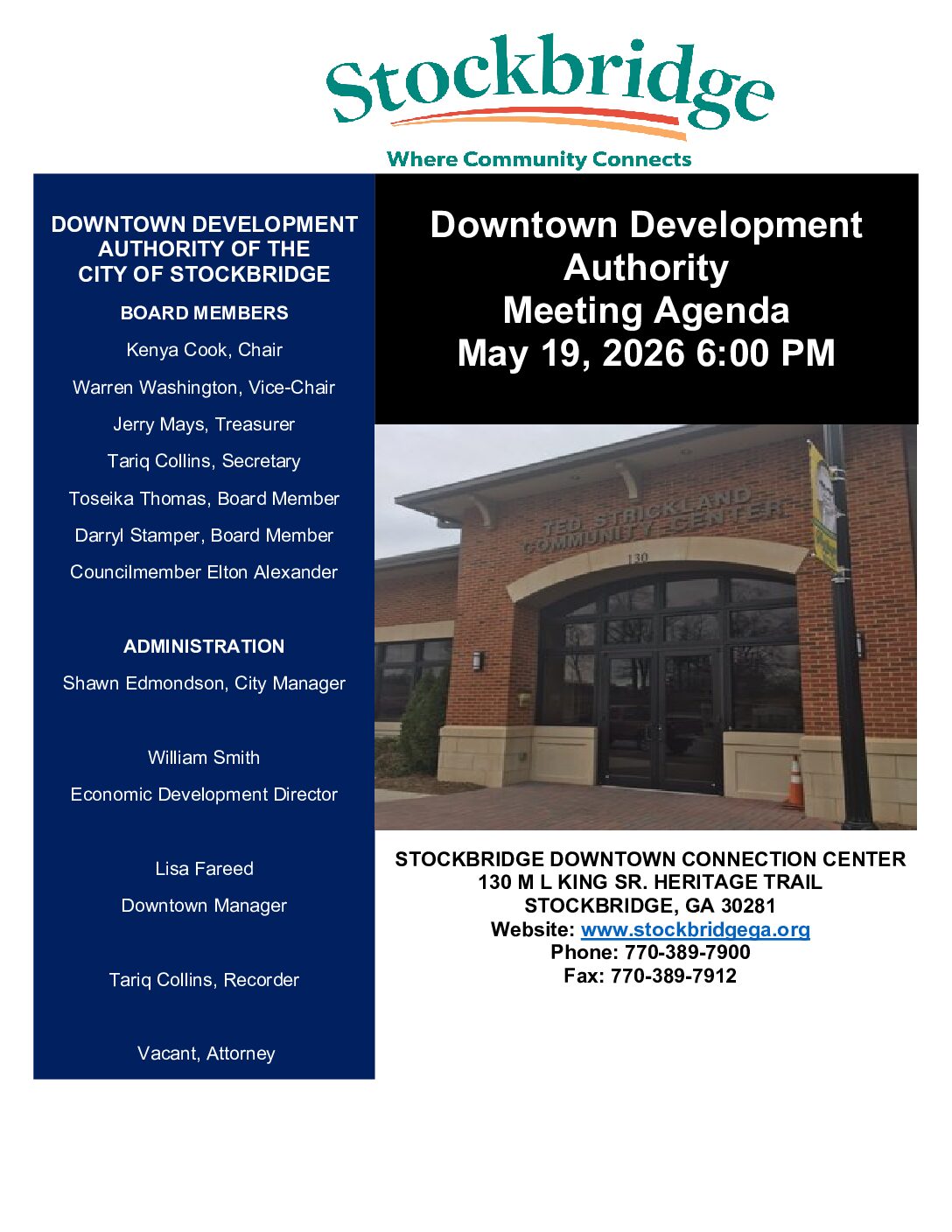
  • 2026-04-06 · Boards & Commissions · Agenda Packet · Youth Council – NO QUORUM · Agenda Packet

    2026-04-06 · Boards & Commissions · Agenda Packet · Youth Council – NO QUORUM · Agenda Packet

    2026-04-06 · Boards & Commissions · Agenda Packet · source: ccscrape-meetings · sha256 dac9555b · pages 5 · method: text

    Full text — searchable
    YOUTH COUNCIL Youth Mayor Laylah Simpson Youth Mayor Pro Tem Youth Council Meeting Agenda April 6, 2026 6:30 PM Mackenzy Edwards Youth City Clerk Ananya Augustine Youth City Manager Gavin Bradley Youth Parliamentarian Keyani Furtch MEMBERS-AT-LARGE Kaleb Acres Houleymatou Diallo Alivia Duck Addison Gaddis Selah Lewis Madison McCray Marcus McCray Reea Patel Aiden Zellars STOCKBRIDGE CITY HALL 4640 NORTH HENRY BLVD. STOCKBRIDGE, GA 30281 Website: www.stockbridgega.org STAFF LIAISON Cassandra Lester, Deputy City Clerk Phone: 770-389-7900 Fax: 770-389-7912 Page | 2 YOUTH COUNCIL MEETING AGENDA CITY OF STOCKBRIDGE MONDAY, APRIL 6, 2026 6:30 PM I. II. III. IV. Call to Order 1. Invocation Followed by Pledge 2. Roll Call 3. Approve Agenda 4. Approve March 2, 2026 Minutes Old Business 5. SYC GMA Recap 6. SYC Youth Expo After - Action New Business 7. Police Department Dinner 8. SYC Recruitment Tables 9. Senior Banquet 10. Social Media Engagement Adjourn The Youth Advisory Council Committee is to make recommendations to Council based on the following Terms of Reference; 1. To identify and advise on youth issues in the City of Stockbridge. 2. To advise Council on the development of policies that are responsive to the needs of youth. 3. To consult with local youth and feedback results of consultations to Council. 4. To assist in the ongoing development and delivery of youth-targeted projects and programs. 5. To create opportunities for youth leadership development by acting as a resource for youth activities. Note: This Committee meets monthly on selected dates. Stockbridge Youth Council Meeting Minutes March 2, 2026 I. Call to Order A. Quorum was met and the meeting was called to order at 18:49. B. Invocation: Led by Kaleb Acres. C. Pledge of allegiance: Recited in unison. D. Roll Call. Roll Call Member Absent: Guest: Houleymatou Diallo Marcus McCray Reea Patel Ms. Sharika Zellars Mackenzy Edwards Keyani Furtch Aiden Zellars Ms. Valerie Reese Ananya Augustine Alivia Duck Addison Gaddis Ms. Renee Gourdine Kaleb Acres Gavin Bradley Mayor Jayden L. Williams Laylah Simpson Selah Lewis Madison Mccray E. Approve February 2, 2026 Meeting Minutes Motion: Kaleb Acres Second: Alivia Duck. In Favor: Ananya Augustine, Houleymatou Diallo, Mackenzy Edwards, Keyani Furtch, Laylah Simpson, Selah Lewis, Gavin Bradley, Madison McCray, Marcus McCray. Oppose: None. Abstain: None. F. Approve March 2, 2026 Meeting Agenda Motion: Marcus McCray. Second: Alivia Duck. In Favor: Mackenzy Edwards, Houleymatou Diallo, Ananya Augustine, Kaleb Acres, Laylah Simpson, Selah Lewis, Madison McCray, Keyani Furtch, Alivia Duck, Gavin Bradley. Oppose: None. Abstain: None. II. Old Business A. SYC Leadership Retreat Recap - After Action Review completed by Gavin Bradley & Ananya Augustine. B. SYC Recruitment Ideas - - Recruitment ideas for the ‘26-’27 SYC cohort include: - SYC flyers at the library. - The SYAC showing up to college career festivals. - The SYC members promoting recruitment over their school announcements. - Word of mouth, with the careful consideration of seeking out prospective applicants that fit the SYC’s vision & purpose. - The SYC members setting up lunch tables at their schools for recruitment. - The SYAC going to middle schools for recruitment. Prospective change for the application: Put the option for “referred by a current member.” III. New Business A. Icebreaker - Led by Keyani Furtch. The icebreaker was “What is everyone’s favorite ice cream flavor?” B. SYC Youth Entrepreneurship Expo Promotion Ideas - SYC members set up lunch tables at their school with flyers. SYC members put flyers onto their schools bulletin boards. Correspond with Ms. Sharika Zellars for the amount of flyers needed per student. C. SYC Youth Entrepreneurship Expo Expectations - The SYC must be present at 10 A.M. to help set the event up. The SYC is expected to wear their new, red shirts. The event will be held indoors at the Merle Manders Conference Center. Prospective plans for different lighting to create a more appropriate ambiance is in the works. - Correspond with Gavin Bradley about his father’s business for lighting. D. Social Media Engagement - For the Wellness Wednesday videos, everyone must ensure that the background of their videos are appropriate. Previously mentioned methods of engagement in the minutes apply here as well. An intro could be created for the Wellness Wednesday videos. IV. Adjourn Motion: Marcus McCray. Second: Kaleb Acres. In Favor: Ananya Augustine, Houleymatou Diallo, Mackenzy Edwards, Laylah Simpson, Selah Lewis, Madison McCray, Alivia Duck, Keyani Furtch, Gavin Bradley. Oppose: None. Abstain: None. Adjourned at 21:03.
  • 2026-04-02 · Boards & Commissions · Agenda Packet · Citizens Police Advisory Council · Agenda Packet

    2026-04-02 · Boards & Commissions · Agenda Packet · Citizens Police Advisory Council · Agenda Packet

    2026-04-02 · Boards & Commissions · Agenda Packet · source: ccscrape-meetings · sha256 15988c3c · pages 6 · method: text

    Full text — searchable
    STOCKBRIDGE CITIZENS-POLICE ADVISORY COUNCIL At-Large – Rev. Dr. M. Lavell Sanders Citizens-Police Advisory Council Meeting Agenda April 2, 2026 6:00 PM District 1 – Carmen Reese District 2 – Thomas Smith, Chair District 3 – William Daniels District 4 – Paige Jones III District 5 – Mr. Raymond Martin Zone 1 – Neat Robinson Zone 2 – Nathan Banks, Sr. Zone 3 – Vacant Zone 4 – Judy Neal Business Community Representative Regonald Sylvain Faith-Based Community Representative Bishop LaRay Tillman Police Chief Vacant STOCKBRIDGE POLICE DEPARTMENT 4545 NORTH HENRY BLVD. STOCKBRIDGE, GA 30281 Website: www.stockbridgega.org Phone: 678-833-3334 After Hours: 770-957-9121 Vision Statement The vision of the Stockbridge Citizens Police Advisory Council is to serve as community of informed citizens, partnering with the Stockbridge Police Department to promote communication, community awareness, involvement and understanding of public safety policies and programs to enhance the quality of life for the citizens of Stockbridge, Georgia. Mission Statement The mission of the Stockbridge Citizens Police Advisory Council is to enhance the level of trust, understanding and involvement between the community and the SPD.by serving as an advisory and network resource for the Chief of Police in the formation of strategies, policy development and public awareness for the safety and quality of life for the citizens of Stockbridge, Georga. Mission Implementation The Mission of the Stockbridge Citizens Police Advisory Council, will be accomplished through monthly meetings, creating, and recommending policy strategies, enhancing policy discussions, and increasing public awareness regarding the concept of community policing. AGENDA CITIZENS-POLICE ADVISORY COUNCIL MEETING THURSDAY, APRIL 2, 2026 6:00 PM I. Call to Order 1. Invocation Followed by Pledge 2. Roll Call 3. Approve Agenda 4. Opening Remarks II. Officer Presentation III. Special Guests Presentation IV. Public Comments V. Approval of Minutes 5. CPAC Minutes - March 5, 2026 VI. Police Chief Report VII. Advisory Council Members Report VIII. Old Business 6. Faith and Blue Report 7. Citizens Police Academy IX. New Business X. Adjourn STOCKBRIDGE POLICE DEPARTMENT (SPD) Citizens Police Advisory Council (CPAC) MINUTES March 5, 2026 6:45pm - 8:00pm I. Call to Order 6:45pm .............................................................................. Dr. Thomas Smith, Chairman II. Invocation followed by Pledge.....................................................Nathan Banks, Sr./Dr. Thomas Smith III. Roll Call..........................................................................................................................William Daniels Present: Absent: Dr. Thomas Smith Captain Sherry Gilbert Bishop LaRay Tilman Judy Neal Code Supervisor Delina Lovell Neat Robinson William Daniels Carmen Reese Reggie Sylvain Nathan Banks, Sr. Paige Jones III Raymond Martin Pastor Dr. Lavell Sanders IV. Approve Agenda ………………….................................................................Dr. Thomas Smith, Chairman ● Motion - Carmen Reese ● Second - Judy Neal V. February 2025 Minutes…………………........................................................Dr. Thomas Smith, Chairman ● Motion - Judy Neal ● Second - Paige Jones III VI. Opening Remarks....................................................................................Dr. Thomas Smith, Chairman ● Advised all to encourage citizens to attend monthly CPAC meetings. ● No Officer presentation during this meeting. Page 1 of 4 VII. Advisory Council Member Reports ● Carmen Reese o Nothing to report. ● Paige Jones III o Nothing to report. ● Pastor Dr. Lavell Sanders o Teen driving event to be held at Stockbridge First United Methodist Church, 4863 N. Henry Blvd. on April 18th from 10:00am to 11:30am. The event will present the “safe driving initiative.” o Attended the Peace Officer luncheon at the Merrell Mander Center was well attended. ● William Daniels o Nothing to report. ● Dr. Thomas Smith ○ Confirmed no parking within 30 feet of a stop sign. ● Judy Neal ○ Planning the safe driving initiative event with Pastor Sanders on April 18th. ○ Provided crime stats to her HOA Board. ● Nathan Banks, Sr. o Nothing to report. VIII. Police Reports….…..……………………………………………………………..........................Captain Sherrie Gilbert • • • IX. Crime statistics were presented and Captain Gilbert noted they are below prior month/year-to-date in the analysis of each category line-by-line. Disclosed that the City Council is still reviewing the parking ordinance. Advised members that juvenile crime statistics can be obtained from the county. Old Business • CPAC members continued the discussion of 2026 initiatives and decided that each was particularly important to the CPAC mission, members, and SPD, therefore all 4 would be implemented for 2026. A motion to accept all 4 and move forward with planning. Motion - Nathan Banks, Sr. Page 2 of 4 Second - Bishop LeRay Tilman (a) The first of the initiative is a breakfast for SPD Patrol Officers which will occur on March 7, 2026, at 8:00 at the Golden Corral on North Henry Blouvard. The event will be like the previous breakfast at Golden Corral; members would sponsor an officer(s) breakfast. Dr Thomas Smith will contact the establishment manager to secure the larger private dining area. He also advised all members to arrive at 7:45 am and Pastor Dr. Lavell Sanders will deliver the prayer. (b) The Faith and Blue(F&B) softball games have been successful, and the members decided to include other events during the year because F&B is not a one-day event. The dates for F&B 2026 are October 9th - 12th. Other events aligned with F&B will be discussed, and the initiative will end with the softball game. Pastor Dr. Lavell Sanders will lead the event and planning of additional events. Motion - Pastor Dr. Lavell Sanders Second - Bishop LeRay Tilman - Securing Cochran Park for the softball game - Neat Robinson Date of the softball game TBD. Include all pasters in the public service announcement with the Chief and staff. (c) Coffee with a COP, at local establishments planning to be discussed along with a date. - Invite students and athletic directors - Neat Robinson - Hold the event on a Saturday - Dr. Thomas Smith (d) Zone/District community meetings to held virtually (combining two districts). - Further discussion required upon the selection of the new Chief. X. New Business 1. CPAC meetings will not start until a quorum is attained and is passed. Motion - Judy Neal Second - Carmen Reese 2. CPAC monthly meeting will be cancelled if a quorum is not met by 6:45pm and is passed. Motion - William Daniels Secon - Paige Jones III Page 3 of 4 3. Notification of a potential absence by a member to the Chairman preferably 24 hours in advance and a minimum of 8 hours, baring an emergency if a meeting will not be attended. 4. Assist Captain Gilbert with BridgeKidz Summer Camp with a location due to the limited space in the SPD community room. More discussion and planning to come. XI. Public Comments - None XII. Closing Motion - Dr. Thomas Smith Second - Judy Neal ● Meeting adjourned at 7:45 pm Page 4 of 4
  • 2026-03-31 · City Council · Agenda Packet · Work Session Meeting · Agenda Packet

    2026-03-31 · City Council · Agenda Packet · Work Session Meeting · Agenda Packet

    2026-03-31 · City Council · Agenda Packet · source: ccscrape-meetings · sha256 3f27e3db · pages 152 · method: text

    Full text — searchable
    STOCKBRIDGE CITY COUNCIL Mayor At–Large Work Session Meeting Agenda March 31, 2026 6:00 PM Jayden L. Williams Mayor Pro Tem Elton Alexander Council District 5 Councilmember LaKeisha Gantt Council District 1 Councilmember Antwan Cloud Council District 2 Councilmember Kyle D. Berry, Sr. Council District 3 Councilmember Yolanda Barber Council District 4 CITY MANAGER Stockbridge City Hall Shawn Edmondson 4640 N. Henry Blvd. INTERIM CITY CLERK Stockbridge, GA 30281 Cassandra Lester CITY TREASURER Frank Milazi CITY ATTORNEY Quinton G. Washington Website: www.stockbridgega.org Phone: 770-389-7900 Fax: 770-389-7912 Translation and Interpretation Services are available with (7) days prior notice. Please contact the City’s Human Resource Manager at 770-389-7908 for assistance. AGENDA WORK SESSION MEETING CITY OF STOCKBRIDGE TUESDAY, MARCH 31, 2026 6:00 PM CALL TO ORDER INVOCATION PLEDGE OF ALLEGIANCE ROLL CALL ADOPTION OF THE AGENDA ADOPTION OF THE MINUTES 1 Approval of the City Council Special Called Meeting Minutes February 12, 2026 2 Approval of the City Council Meeting Minutes March 09, 2026 PUBLIC COMMENTS - All persons wishing to speak for public comment must sign in with the City Clerk prior to the beginning of the meeting. You must sign your name, address, and phone number. You will be able to address the Mayor and Council for three (3) minutes. Speakers must respect all members of the elected body, officials, and staff. Defamation, unruliness and/or swearing will not be tolerated while meetings are in session. PRESENTATION 3 Henry County Schools City of Stockbridge Update Presentation - Presented by: Stefon Plummer CONSENT AGENDA 4 Confirmation of the Chief of Police with an official start date of April 13, 2026 OLD BUSINESS 5 STREET NAME CHANGES FOR NORTH LEE STREET AND SOUTH LEE STREET. (Council District 4) (Second Reading) Consideration of a resolution to change the names of both North Lee Street and South Lee Street to Martin Luther King, Jr. Way. This action is intended to honor the legacy of Dr. Martin Luther King, Jr. while Page | 3 aligning the corridor with a name that reflects the community's historical and cultural values. Applicant: City of Stockbridge. - Presented by: Ryan Anderson NEW BUSINESS 6 Council consideration to approve the increase in the City's paid Basic Life Insurance benefit from $10,000 to $50,000, effective April 1, 2026. - Presented by: Dwayne Pollock 7 Council consideration to approve Dianna Hunt & Associates, Inc. to provide acquisition services for approximately 43 parcels in connection with the Tye Street Muti-Use Path Project right-of-way acquisitions. First phase of acquisition service is estimated at $40,000.00. Funding source from TSPLOST. 33542200-541404. - Presented by: Decius Aaron 8 Council consideration to approve piggybacking of Macon-Bibb County RFP No. 24-022-LH Traffic Signal Repairs and Maintenance Services, issued April 5, 2024, with Riverside Traffic Solutions, LLC. Funding for this contract is available in the FY2026 operating budget under Account No. 100-42200-522224. - Presented by: Decius Aaron 9 Council consideration to approve the purchase of two vehicles for departmental use at a cost not to exceed $94,910. Funding for this purchase is available in the FY 2026 budget, General Ledger No. 100-74100-5422. - Presented by: Ryan Anderson MAYOR'S COMMENTS (Jayden L. Williams) EXECUTIVE SESSION (Exemptions to the Georgia Open Meetings Acts) ANNOUNCEMENTS OF UPCOMING MEETINGS & EVENTS Council meetings will be held in the City Council Chamber, while some Board and Committee meetings will take place via Zoom. Meeting dates and times may change, so please check the city's website at www.stockbridgega.org or contact City Hall at 770-389-7900 for updates. The City of Stockbridge complies with the Americans with Disabilities Act (ADA) and does not discriminate based on disability. Individuals requiring auxiliary services for meeting participation should contact City Hall at 770-389-7900 in advance. ADJOURNMENT March 31, 2026 6:00 PM 4640 N. Henry Stockbridge, GA 30281 Phone: (770) 389-7900 CITY COUNCIL SPECIAL CALLED MEETING SUMMARY MINUTES THURSDAY, FEBRUARY 12, 2026 6:00 P.M. Mayor & City Council Mayor Jayden L. Willams At-Large Mayor Pro Tem Elton Alexander – Council District 5 Councilmember LaKeisha Gantt – Council District 1 Councilmember Antwan Cloud – Council District 2 Councilmember Kyle D. Berry, Sr. – Council District 3 Councilmember Yolanda Barber – Council District 4 Administration Shawn Edmondson – City Manager Frank Milazi – City Treasurer Cassandra Lester – Interim City Clerk Quinton Washington – City Attorney Megan McCullough – Associate Attorney Mission: To provide visionary leadership and superior municipal services that enhance the quality of life for citizens while creating a welcoming business atmosphere focused on sustainability and expansion of tourism and cultural events. Mayor Jayden L. Williams called the Special Called Meeting to order at 6:03 PM. The Mayor led the invocation followed by the Pledge of Allegiance. Interim City Clerk Cassandra Lester conducted the roll call. Councilmember Kyle Berry was not present. With all other members present, a quorum was established. Motion to adopt the agenda made by Councilmember Cloud Seconded by: Councilmember Gantt Vote: Approved unanimously 4-0. EXECUTIVE SESSION (Exemptions to the Georgia Open Meetings Act O.C.G.A. § 50-14-1) Mayor Williams requested a motion to go into executive session for real estate, litigation, cybersecurity, and personnel matters. Councilmember Barber objected stated that the matter before them was a contract, which did not qualify for executive session under Georgia law. She noted that executive sessions are limited to personnel, litigation, real estate, or cybersecurity matters, and that this contract should be discussed in the open meeting. Mayor Williams inquired whether the city attorney was present. 1|Page City Manager Shawn Edmondson responded that their legal counsel had previously advised that since the matter dealt with personnel, initial discussions could occur in executive session, but a formal vote would need to take place in the public meeting. Councilmember Barber reiterated her concern about violating the Open Meetings Act. Stating the issue before the city council was a professional services agreement, and the Council had already approved the personnel matter when they voted to select the individual at the prior city council meeting. She emphasized again that what was before them was a professional services agreement that should be discussed in the open meeting, though she would defer to the consensus of the Council. Councilmember Gantt stated that the city council would be discussing a legal contract agreement that had not been finalized. She noted that as a legal matter, and any legal matters can be discussed behind closed doors, consistent with the Council's practice since at least 2014. She stated that once they finalized the legal agreement, they would return for the public vote. Motion to go into executive session for real estate, cyber security, personnel, and litigation made by Councilmember Gantt; Seconded by Mayor Pro Tem Alexander. Vote: Approved 3-1 (Barber opposed) Councilmember Barber stated for the record that she opposed because "this is a contract." The Council adjourned for executive session. Motion to end executive session and return to the regular scheduled meeting made by Councilmember Gantt; Seconded by Councilmember Cloud: Vote: Approved unanimously 4-0. Mayor Williams announced that there were two items to bring back to the public from executive session. The first item was presented with a motion to approve the contractual agreement with Sandra Poag in the amount of $140,000.00 (one hundred forty thousand dollars) as the General Manager for the Vystar Amphitheater made by Councilmember Gantt; Seconded by Mayor Pro Tem Alexander. Discussion: Councilmember Barber stated there were several questions she had asked via email and in executive session that should have been asked in the public meeting. Citing that all questions do not relate to the contract per se but wanted them for public knowledge. She requested the following be stated on the record: • The Council has not yet adopted or approved a rental policy for the amphitheater. • She had asked about assistance with finalizing the contract. • She requested a force majeure clause be added to all contracts. • She inquired about limited liability insurance for vendors and everyone else. 2|Page • She noted the amphitheater has historically not been in use from October to March and asked for creative ideas to generate revenue during that period. (The following questions were mentioned at the meeting and emailed to the clerk’s office during this meeting for the record) • Why was this contract advertised as a Job Announcement as opposed to a solicitation (RFQ)? • Why is limited liability insurance not required? Mayor Williams called for the vote as previously stated by Councilmember Gantt and seconded by Mayor Pro Tem Alexander for all those in favor of the contractual agreement with Sandra Poag in the amount of $140,000.00 (one hundred forty thousand dollars) as the General Manager for the Vystar Amphitheater. Vote: Approved 3-1 (Barber opposed) Councilmember Barber stated her opposition was because her questions had not been answered and there were still changes that needed to be made to the contract. The second item from Executive Session was presented with a motion to approve the Seay Firm LLC for entertainment legal services that was made by Councilmember Gantt Seconded by: Mayor Pro Tem Alexander. Vote: Approved 3-1 (Barber opposed) Councilmember Barber stated she opposed because the information was just provided to her in executive session, and she hadn't had an opportunity to review any information prior to the meeting. ADJOURNMENT Motion to adjourn made by Councilmember Gantt: Seconded by Councilmember Cloud: Motion approved unanimously 4-0. The meeting was adjourned at 7:22 PM. Respectfully submitted by: ______________________________ ______________________________ Cassandra Lester, Interim City Clerk Jayden L. Williams, Mayor 3|Page CITY COUNCIL WORK SESSION MEETING SUMMARY MINUTES MONDAY MARCH 9, 2026 6:00 P.M. Mayor & City Council Mayor Jayden L. Willams At-Large Mayor Pro Tem Elton Alexander – Council District 5 Councilmember LaKeisha Gantt – Council District 1 Councilmember Antwan Cloud – Council District 2 Councilmember Kyle D. Berry, Sr. – Council District 3 Councilmember Yolanda Barber – Council District 4 Administration Shawn Edmondson – City Manager Frank Milazi – City Treasurer Cassandra Lester – Interim City Clerk Quinton Washington – City Attorney Megan McCullough – Associate Attorney Mission: To provide visionary leadership and superior municipal services that enhance the quality of life for citizens while creating a welcoming business atmosphere focused on sustainability and expansion of tourism and cultural events. The meeting was called to order by Mayor Jayden L. Williams at 6:00 PM. Councilmember Kyle Berry led the invocation. Mayor Williams led the Pledge of Allegiance. Interim City Clerk Cassandra Lester proceeded with roll call. A quorum was established. Councilmember LaKeisha Gantt arrived at 6:03 p.m. Mayor Williams requested two amendments to the agenda: removing item number 4 (confirmation of the police chief) and adding to the consent agenda that the city is now a city of civility as discussed during the council retreat. Motion: Councilmember Cloud moved to amend the agenda as requested. Mayor Pro Tem Alexander seconded. The motion passed 4-0. Councilmember Barber then requested adding an item for the confirmation of the human resources director to the consent agenda, noting that the position wasn't included on the original agenda. 1|Page City Attorney Megan McCulloch clarified that since it was already discussed and approved by council, it could simply be an announcement, but it could be added to the agenda. Motion: Councilmember Barber moved to add the confirmation of the new HR director to the consent agenda. Councilmember Gantt seconded. The motion passed 5-0. With those amendments, Mayor Williams called for adoption of the agenda. Motion: Mayor Pro Tem Alexander moved to adopt the agenda as amended. Councilmember Gantt seconded. The motion passed 5-0. Adoption of the February 24th 2026 Work Session Meeting Minutes Motion: Mayor Pro Tem Alexander moved to approve the February 24, 2026 work session meeting minutes. Councilmember Gantt seconded. The motion passed 5-0. PUBLIC COMMENTS Six citizens signed up for public comments. Below is a summary of their comments: Judy Neal (174 East Club Drive) spoke against the Lee Street name change, sharing her personal history with the area and her sons' attendance at Stockbridge schools. She emphasized the happy memories associated with Lee Street and supported the business owners who had requested the council vote against the name change. She suggested the council respect constituents' concerns and vote no. Marvin Gross (115 North Lee Street) opposed any name change to his street, regardless of what new name might be chosen. He noted his family had lived there for over 80 years, his brick house was built in the early 1960s, and changing the name would cost both the city and residents money for new signs, driver's license changes, and potential address number changes. He questioned why the change was necessary and stated he didn't understand the reason behind it. Coren Randazzo (111 Bryant Street) argued that renaming Lee Street based on dishonesty about its origins undermines Dr. King's legacy. He contended that the street wasn't named after Robert E. Lee but rather a local Lee family, and that creating false narratives devalues both historical truth and Dr. King's memory. He referenced studies showing that MLK streets across America often become associated with declining neighborhoods rather than thriving communities, suggesting symbolic renaming without substance fails to honor what Dr. King stood for. Brandon Dubs (118 Lake Terrace) spoke on behalf of his family's business, Affairs by Pinehurst Catering, which has operated on South Lee Street for over 30 years. He emphasized that while he supports Stockbridge's growth, the name change would create practical difficulties for their business, requiring reprinting materials, updating advertisements, and ensuring GPS systems direct out-of-town wedding guests correctly. He asked the council to reconsider and vote no on the change. 2|Page Mary Broun (115 North Lee Street) became emotional while speaking about Lee Street's historical significance to the community and her personal connection to Stockbridge High School. She suggested that instead of changing the street name, the council consider installing beautiful bronze plaques at the entryways to honor Dr. King, which would be less financially burdensome for residents and businesses while still providing appropriate recognition. She asked the council to vote no on the name change. Chuck Dubs (108 South Lee Street) provided historical context about former Stockbridge mayor R.E. Lee and his wife Mildred, a longtime elementary school teacher. He read from official city council meeting minutes indicating Lee served as mayor for over two decades and was instrumental in bringing electricity, paved roads, and water systems to Stockbridge. He argued that renaming Lee Street would erase the historical value and honor bestowed upon the Lee family and their descendants and respectfully asked the council not to proceed with the name change. CEREMONIAL PRESENTATION OF THE ADOPT-A-ROAD SIGN AND PROCLAMATION FOR THE ZETA MU NU CHAPTER OF OMEGA PSI PHI FRATERNITY, INC. Mayor Williams presented a proclamation recognizing the Zeta Mu Nu Chapter of Omega Psi Phi Fraternity, Incorporated for their participation in the City's Adopt-A-Road Program. The proclamation commended the fraternity for their community service and civic engagement in helping to keep roadways clean and enhancing quality of life in the community. Randall Slaughter, representing the Henry County chapter with 106 brothers, expressed honor at being able to help keep the community beautiful. He noted that the fraternity also provides scholarships to high school seniors in the Henry County area and engages in various community activities, stating it was a delight to be a community partner. Mayor Williams expressed his look forward to the first invitation to their road cleanup activities. CONSENT AGENDA Confirmation of the Economic Development Director Mr. William Smith Confirmation of the Chief of Police (removed from agenda) Confirmation of HR Director Mr. Dwayne Pollock (added during agenda amendments) City of Civility Designation (added during agenda amendments) Motion: Councilmember Gantt moved to approve the consent agenda. Mayor Pro Tem Alexander seconded. The motion passed 5-0. OLD BUSINESS COUNCIL CONSIDERATION TO APPROVE THE NORFOLK SOUTHERN LEASE AGREEMENT City Attorney Megan McCulloch explained that as discussed at the planning retreat, the Norfolk Southern lease agreement for the parking lot was currently not in the city's best interest in her opinion. She indicated that staff would like to work on fixing the 3|Page agreement before council approval and noted that representatives from the city would be meeting with elected officials to help facilitate improvements to the agreement. Motion: Mayor Pro Tem Alexander moved to table the Norfolk Southern Lease Agreement. Councilmember Gantt seconded. The motion passed 5-0. PUBLIC HEARING CAPITAL IMPROVEMENTS ELEMENT (C.I.E.) FOR 2026 Community Development Director Ryan Anderson presented the Capital Improvement Element, explaining its purpose as guiding infrastructure planning and ensuring compliance with state laws. He detailed that the CIE enables strategic budgeting, maintains eligibility for state programs and grants, and coordinates planning across services like parks, safety, and utilities. Anderson explained that Georgia law requires local governments to adopt capital improvement elements for impact fee compliance and planning, with the Georgia Department of Community Affairs setting compliance standards. He noted that Stockbridge's current CIE was based on a 1993 joint document with Henry County and other jurisdictions, but since other jurisdictions had adopted their own CIEs and Henry County amended theirs to be standalone, Stockbridge needed its own CIE. The presentation outlined that Stockbridge's population is projected to increase 53.9 percent by 2050, driving demand for infrastructure improvements. The CIE would support the 2023 annexation impact, ensure development pays its fair share through impact fees, and fund projects like Rock Quarry Road improvements, expanded police facilities, and 33.5 new miles of trail system. Public Comments in Favor: Anthony Ford (47 Lily Glenn Lane) supported the CIE adoption, emphasizing Georgia's position as a top 10 growth state and Henry County as one of the fastest-growing counties in the country. He stressed the importance of properly preparing for inevitable growth and population increases. Councilmember Barber asked Anderson to highlight specific roadway projects affected by the CIE. Anderson mentioned improvements planned for Walt Stevens Road, Jodeco Road, Flippen Road, Highway 138, East Atlanta Road, and North Henry Boulevard, explaining that the CIE would allow the city to collect impact fees from developers to support these initiatives. Motion: Councilmember Barber moved to approve the capital improvement element for 2026. Mayor Pro Tem Alexander seconded. The motion passed 5-0. STREET NAME CHANGES FOR NORTH LEE STREET AND SOUTH LEE STREET Community Development Director Ryan Anderson presented the agenda item proposing the renaming of North and South Lee Street to Martin Luther King Jr. Way. He stated that the purpose of the change was to honor Dr. King’s legacy and provide a more familiar and unifying name for the high-visibility corridor near City Hall and the amphitheater. Anderson provided background research on Lee Street, noting that the earliest reference identified by staff appeared in City Council meeting minutes from 1949. He 4|Page explained that while some information suggests the street may have been named after General Robert E. Lee, staff research also indicated the possibility that it was named after former Stockbridge Mayor R.E. Lee. As part of the presentation, Anderson displayed a memorial resolution from the February 19, 1952 City Council meeting minutes commemorating former Mayor R.E. Lee following his passing. The resolution outlined his significant contributions to the city, including the introduction of electricity, paved roads, and water systems during his tenure from 1927 to 1952. During the presentation, questions arose regarding the validity of the information provided. Councilmember Gantt reviewed the materials and stated that she could not find specific evidence confirming that Lee Street was named after the former mayor. She emphasized that the memorial resolution did not explicitly reference the street being named in his honor. Veronica Green, Chief Planner for the Community Development Department, clarified that there is no definitive evidence establishing that Lee Street was named for R.E. Lee. She explained, “That is the oral history of the City of Stockbridge.” When asked about the source of this oral history, Green stated that references were found on several websites but could not be included in the presentation due to lack of verifiable citation. She added, “We have to present what we can prove,” referencing the February 19, 1952 City Council minutes as the closest documented connection. Mayor Williams asked for clarification, stating, “So you’re basically saying that Lee Street is not named after anybody?” Green responded that the information presented represents the closest historical reference and association available. Councilmember Berry asked when Lee Street first appeared in postal or official records, and Green reiterated that the first confirmed reference in City meeting minutes was in 1949. Mayor Pro Tem Alexander cautioned that, given the sensitivity of the issue, it is important to rely on verified facts. He stated, “In situations like this, emotions are high. We need to have facts. We cannot have definitive statements without supporting evidence.” He also referenced prior efforts by a former City Clerk to research Confederate-related names within the city. Councilmember Barber, who represents the district containing Lee Street, clarified that the initiative to rename the street did not originate from her but from Mayor Pro Tem Alexander. She stated that the issue was not a priority concern within her district and urged compassion for residents with longstanding ties to the area. Councilmember Barber expressed opposition to the proposed name change and called for a broader, more comprehensive discussion regarding downtown redevelopment. Councilmember Gantt stated that her support for renaming the street was not solely based on any perceived Confederate association, but rather a desire to honor Reverend Dr. Martin Luther King Jr. by naming a prominent street near the STEM school in his recognition. Councilmember Cloud asked whether the referenced mayor passed away after the earliest documented mention of Lee Street and whether all possible research avenues 5|Page had been exhausted. Anderson responded that significant public interest prompted staff to investigate the origin of the street name. He stated that staff were unable to find evidence confirming that the street was named after General Robert E. Lee and included all available findings in the presentation for transparency. He added that staff conducted thorough research to the best of their ability and presented the information to Council accordingly. Councilmember Cloud confirmed that all reasonable research efforts had been exhausted, and Anderson affirmed. Mayor Williams inquired whether Lee Street may have had a different name prior to its first documented appearance in 1949. Staff indicated that no evidence had been found to suggest a prior name. Councilmember Berry emphasized the importance of due diligence, stating that when historical matters are debated, the city has a responsibility to ensure accuracy. He noted discrepancies in the timeline, including that General Robert E. Lee died in 1870, the City was established in 1920, and Lee Street first appeared in records in 1949. He stated that these gaps highlight the need for further research and that a definitive conclusion could not be reached during the meeting. Mayor Williams then opened the floor for public comment. Public Comments in Favor: Anthony Ford expressed support for the name change, noting that many people are unaware that Stockbridge is considered the ancestral home of the King family. He described a vision of creating a Martin Luther King Sr. Heritage Trail on one side of downtown and Martin Luther King Jr. Way on the other, both connecting to Rock Quarry Road, where Dr. King Sr.’s father historically worked. Mayor Pro Tem Alexander provided additional context regarding the broader vision, explaining that the Downtown Development Authority has discussed replacing the Statue of Liberty in Municipal Park with a statue of Martin Luther King Sr. This would create a symbolic connection between the STEM school, the statue, and Floyd Chapel Baptist Church through a multi-use trail system. Public Comments in Opposition: Coren Randazzo presented historical documentation from Henry County Weekly archives dating back to the 1800s and early 1900s, indicating references to Lee families and Lee Street as early as 1918—prior to Mayor R.E. Lee’s death in 1952. Brandon Dubs expressed concerns regarding the potential impact on local businesses and recommended that additional research be conducted before any decision is made. Chuck Dubs stated that, based on his research and work conducted by former City Councilmember Steve Cash using official City records, the street was named after the mayor, describing it as “his street” and asserting confidence in that conclusion. Marvin Gross voiced opposition to the name change and questioned the need to alter what he considered an important part of Stockbridge’s history. 6|Page The discussion highlighted significant uncertainty regarding the origin of the street name, with multiple theories presented, including connections to local Lee families, pre1952 references, and the former mayor. Given the conflicting historical information and timeline discrepancies, Mayor Pro Tem Alexander made a motion to defer the item to allow additional time for staff research. Motion: Mayor Pro Tem Alexander moved to defer the street name change to a future meeting to allow for additional due diligence and research. Councilmember Cloud seconded the motion. Vote: The motion passed 4–1, with Councilmember Barber voting in opposition. Councilmember Barber explained her dissent, reiterating the need for a comprehensive downtown redevelopment plan and expressing concern about making decisions that impact constituents without sufficient planning and verified historical information. NEW BUSINESS Council moved the de-annexation cases to after executive session due to attorney-client privileged legal memorandums that needed to be discussed first. Motion: Councilmember Gantt moved to move executive session before new business to discuss the de-annexation items. Councilmember Cloud seconded. The motion passed 5-0. EXECUTIVE SESSION Motion: Councilmember Gantt moved to adjourn to executive session for real estate, personnel, litigation, and cyber security matters. Mayor Pro Tem Alexander seconded. The motion passed 5-0. [Executive session held] Motion: Mayor Pro Tem Alexander moved to adjourn executive session and reconvene regular session. Councilmember Berry seconded. The motion passed 50. DE-ANNEXATION CASE #DX-2026-01 FOR THE MANDERLEY SUBDIVISION, PHASE 9 Following executive session discussion of attorney-client privileged legal documents, Councilmember Gantt explained that council had received detailed legal authority based on state code regarding the legality of the de-annexation requests. Motion: Councilmember Gantt moved to deny de-annexation case DX-2026-01. Mayor Pro Tem Alexander seconded. The motion passed 4-0-1, with Councilmember Barber abstaining, stating she didn't have enough information to vote. 7|Page DE-ANNEXATION CASE #DX-2026-02 FOR THE MANDERLEY SUBDIVISION, PHASE 10 Motion: Councilmember Gantt moved to deny de-annexation case DX-2026-02 based on the legal explanation received in executive session. Mayor Pro Tem Alexander seconded. The motion passed 4-0-1, with Councilmember Barber abstaining for lack of sufficient information. Councilmember Gantt clarified for the record that council had received a detailed 4page attorney-client privileged legal document providing legal authority based on state code, which informed their decision-making on both de-annexation cases. MAYOR'S COMMENTS Mayor Williams welcomed the spring weather and expressed excitement about upcoming activities in the warmer weather. He announced that council would be producing initiatives and engagement opportunities, directing citizens with questions to contact Executive Assistant Roslyn Rawls at rrawls@stockbridgega.org. ADJOURNMENT Motion: Mayor Pro Tem Alexander moved to adjourn. Councilmember Berry seconded. The motion passed 5-0. The meeting adjourned at 8:47 PM. Respectfully submitted by: ______________________________ ______________________________ Cassandra Lester, Interim City Clerk Jayden L. Williams, Mayor 8|Page 9|Page Henry County Schools Stockbridge City Council District Update Dr. Cemond Robinzine Assistant Superintendent Dr. John Pace, III Superintendent District Profile • Enrollment of 42,000+ for 2025-2026 • 8th Largest District in Georgia • 53 District Schools, including Academy for Advanced Studies • Approximately 6,000 employees • Approximately 95 job families • Nearly 300 total bus routes • 2700+ students enrolled in HCS in Before & AfterSchool Enrichment (BASE) • Over 3.1 million meals (breakfast & lunch) served first semester SY 25-26 WHO IS HENRY? Updates to PSO Metrics HCS On The RISE! Stockbridge Elementary School Demonstrated Significant Academic Progress by Exiting Federal Improvement Designated Status (TSI) 24-25 SY GMAS Proficient+ Growth by School Austin Road Elementary 3rd Reading +22 5th Science +15 Cotton Indian Elementary Fairview Elementary 3rd Reading +16 4th Reading +8 4th Math +16 Red Oak Elementary 4th Reading +17 5th Reading +7 4th ELA +10 3rd Math +11 Pleasant Grove Elementary 3rd Reading +7 5th Reading +5 3rd ELA +12 4th ELA +19 5th ELA +10 4th Math +16 5th Science +15 4th Reading +25 4th ELA +17 4th Math +9 Woodland Elementary Smith-Barnes Elementary 4th ELA+7 5th ELA +5 5th Math +4 5th Science +15 Austin Road Middle 7th Reading +5 6th ELA +5 7th Math +12 8th Math +7 Algebra +28 3rd Reading +6 4th Reading +3 5th Reading +4 Pate’s Creek Elementary Woodland Middle 6th Math +5 3rd Reading +7 4th Reading +14​ 4th ELA +6 3rd Math +8 4th Math +9 Stockbridge Elementary 3rd Reading +4 Stockbridge Middle Woodland High Biology +6 History +4 6th Reading +6 7th Reading +11 6th ELA +8 7th ELA +5 6th Math +7 8th Science +5 Stockbridge High Reading +4 Algebra +5 Biology +18 2025 2025 2026 2026 2026 2026 Henry County, GA Overview Legend Parcels Roads 1,175 ft Parcel ID Property Address District S26-02027000 4640 NORTH HENRY BLVD City/Stockbridge TAD Class Exempt Owner STOCKBRIDGE PUBLIC Acreage 6.12 Address FACILITIES AUTHORITY 4640 NORTH HENRY BLVD STOCKBRIDGE, GA 30281 Land $765,000 Value: Building $5,774,000 Value: Misc $110,380 Value: Total $6,717,100 Value: Last 2 Sales Date Price Reason Qual 3/23/2021 $0 VH U 11/21/2005 $0 U U Parcel lines depicted on the maps do not re ect a true and exact representation of property boundaries and should not be relied upon for said purpose. Property boundary lines are depicted on recorded plats available at the Henry County courthouse or can be determined by employing the services of a licensed surveyor. Date created: 2/20/2026 Last Data Uploaded: 2/20/2026 1:13:03 AM Developed by Hi ll R µ Old Stagecoach Rd North Davis Dr Va lle y d k Oa Collier N Rd Cr S Cr k Oa Rd s vi Da g Bi Dr k Oa e dg Ri yer C on Old sR d Rn Landover Dr B Stapleton Dr ge rid C Ct rk Pa ub Cl t Taylor Dr Tr Cr nta East Atla w ie kv oc St Club Creek Cr Duvall Dr Ceresa Dr Miller Rd Rock Quarry Rd Nolan St First St Tahoe Trail Jackson Dr Chur Wy on k Yu Welch St Silent Ave Ra ilr oa d Main Street & DDA Districts Walker St Fairhaven Blvd Legend City of Stockbridge Childs St Breezy Hill Wk r Tramore Ps eD Creekview Ov nt mo r Tina Hely Ct Ct Misty Ridge Tl Main Street Boundary Moonlit Cresce Tram o re Addy Cv South Lee St St y sW Wilson Av Ro se nw g nin Jen Ra ilr oa d Wilson St Tr a Cr Second St Shefield Ct Glynn Addy Dr Spring St Berry S t ald C r Fairhaven Ct ch St Appleton Bv va No DDA District Railway Lane Dr State Route 42 Harrell Dr Tye St. Hillcrest St Mimosa Dr Bow Beacon St en S t McCain Creek Tl Ward St Love St Mann Blvd West Burke St Burke St Center St Club Dr Bryant St Lovejoy St North Lee St Turning Pt Parkwood Dr Rd Pl No Name Club PARCELS WITH ADDRESSES OF N LEE ST OR S LEE ST Parcel ID S26-01020000 S26-01021001 S26-01022000 S26-01023000 S26-01024000 S26-02002000 S26-02003000 S26-02004000 S26-02006000 S26-04007000 S26-04009000 S26-04010000 S26-04011000 S26-04012000 S27-01013000 S27-01014000 Address 109 NORTH LEE ST 111 NORTH LEE ST 113 NORTH LEE ST 115 NORTH LEE ST 117 NORTH LEE ST 110 NORTH LEE ST 112 NORTH LEE ST 114 NORTH LEE ST 118 NORTH LEE ST 109 S LEE ST 108 S LEE ST 106 S LEE ST 0 S LEE ST 102 S LEE ST 0 S LEE ST 500 S LEE ST Owner Names CARRABELLE REAL ESTATE LLC DUNBAR COREY DRILLOT KRISTIE BECK GROCE MARVIN F SANDERS JUNE T M STOCKBRIDGE PUBLIC FACILITIES AUTHORITY STOCKBRIDGE PUBLIC FACILITIES AUTHORITY STOCKBRIDGE PUBLIC FACILITIES AUTHORITY STOCKBRIDGE PUBLIC FACILITIES AUTHORITY STOCKBRIDGE ELEM SCHOOL HENRY COUNTY BD OF EDUCATION DUBBS CHARLES L JR & LYNDA A CITY OF STOCKBRIDGE CITY OF STOCKBRIDGE CITY OF STOCKBRIDGE READY MIX USA LLC READY MIX USA LLC RE-NAMING OF MARTIN LUTHER KING, JR. WAY: STREET RENAMING OF NORTH LEE STREET AND SOUTH LEE STREET Ryan Anderson, MPPA, CPM Director, Community Development Stockbridge City Work Session Meeting March 31, 2026 Genealogy of Street Naming Concept Common Sources of Street Names • Street names reflect a community’s history, land ownership, geography, and culture • Serve as a “genealogy” of how a town developed over time Provide insight into the people and features that shaped early growth How Street Names Developed • Often emerged organically through local use • Not always established through formal government action • Later adopted into maps, legal descriptions, and official records • Individuals & Leaders: Landowners, families, civic or national figures • Geographical Features: Hills, rivers, and natural landscape • Trades & Occupations: Reflect historical economic activity • Developers: Names assigned during subdivision and platting • Trees & Natural Elements: Common in residential areas • Historical & Cultural Landmarks: Churches, mills, community features Researching Street Name Origins • Local archives, newspapers, and historical societies • Historic maps (e.g., Sanborn maps, early atlases) • City directories and land ownership records • Tax assessor data and official municipal records • Supplemental sources (e.g., cemetery or genealogical records) Purpose And Rationale • PURPOSE: The City of Stockbridge proposes to rename North Lee Street and South Lee Street to Martin Luther King, Jr. Way to honor his legacy and contributions to the City, State of Georgia, and the nation. • REQUEST: City Council is requested to consider adoption of a resolution to rename the subject corridor. • RATIONALE: Recognize the legacy of Dr. Martin Luther King, Jr; Provide a unifying and recognizable name within the downtown area; Align with common municipal practices honoring nationally significant figures • PLANNING CONTEXT: Corridor located within historic downtown Stockbridge; Provides connectivity between residential, commercial, and civic uses; Functions as a key north–south route in the City’s street network • ADDITIONAL ANALYSIS: Due to community discussion regarding the origin of “Lee Street,” the City conducted additional historical research to provide a fact-based foundation for Council consideration. North Lee Street and South Lee Street Today LOCATION North Lee Street and South Lee Street are located in historic downtown Stockbridge and function as a key north–south connector across North Henry Boulevard (U.S. 23). CORRIDOR FUNCTION The corridor connects residential, commercial, and civic areas while serving as a central spine that provides access to key community destinations, extending from North Henry Boulevard north to Ceresea Drive and south to Rock Quarry Road. KEY DESTINATIONS Key destinations along the corridor include Stockbridge City Hall, the Stockbridge Amphitheater, First Baptist Church of Stockbridge, Stockbridge Elementary School, and Patrick Henry educational facilities. HISTORICAL CONTEXT The corridor developed in the late 1800s to early 1900s, influenced by railroad expansion and early town growth, with evidence confirming Lee Street as an established route by the early twentieth century. DEVELOPMENT PATTERN The corridor features a mix of residential and institutional uses, including an early structure at 108 South Lee Street (c. 1900), with irregular lot patterns reflecting historic land division practices. 4 PARCEL MAP FOR NORTH LEE STREET AND SOUTH LEE STREET 6 PARCEL SPREADSHEET FOR NORTH LEE STREET AND SOUTH LEE STREET 7 Historical Context Early Development of Stockbridge • Settlement began in 1826 with the establishment of Concord Methodist Church, forming the nucleus of the community • Early village development included homes, general stores, and essential services, supporting a growing rural population • Stockbridge functioned as a key crossroads along regional routes, including the corridor now known as U.S. Highway 23 • The arrival of the railroad in 1881–1882 shifted development southward and accelerated growth around the new town center • By the late 1800s, Stockbridge emerged as a local commercial and civic hub within Henry County • The town was incorporated in 1895 and later incorporated as a city in 1920 • Early street patterns developed organically, with roadways following land ownership and settlement patterns • By the early 20th century, Stockbridge was a small but established community with civic institutions, businesses, and approximately 400 residents • Historical maps and census data reflect steady, incremental growth centered around transportation corridors Early Cartographic References to Stockbridge • Stockbridge appears on 1863 and 1865 historical maps, confirming its presence as an established settlement prior to incorporation • Early maps identify Stockbridge as a recognized rural center and transportation node within Henry County • The community was positioned along key regional routes connecting Atlanta, McDonough, Jonesboro, and surrounding areas • Nineteenth-century maps typically documented active settlements, crossroads, and economic centers, reinforcing Stockbridge’s early significance • Early transportation routes developed organically, following travel patterns, property lines, and natural features • These routes formed the foundation for later street alignments and development patterns • Streets such as Lee Street likely originated from these early travel corridors and land divisions, rather than formal planning actions • Cartographic evidence shows that the framework for street development existed well before 1918, when Lee Street appears in documented records Early Lee Family References in Henry County • A 1879 public notice in The Henry County Weekly references the estate of Samuel Lee, including a property known as “Lee’s Mill” • The property was located within the 12th Land District of Henry County, an area tied to early settlement patterns • Mill properties were typically economic and community hubs, indicating the Lee family’s role in local commerce • This record confirms the Lee family’s presence in the region decades before Lee Street is documented (1918) • In rural communities, roads and corridors were often named after landowners, families, or landmarks such as mills • The reference to Lee’s Mill suggests an established geographic association with the Lee name • Estate documentation indicates significant land ownership, contributing to early parcel and roadway formation Census Documentation (1880–1950) •Federal census records confirm the long-term presence of the Lee family in Henry County and the Stockbridge area •1880 Census: Samuel Lee listed as head of household; Robert E. Lee recorded as a child •1910 Census: Robert E. Lee documented as an independent adult resident, showing continuity in the community •1920 Census: Lee family present at the time of Stockbridge’s incorporation as a city •1930 Census: Continued residency reflects long-term community establishment •1950 Census: Robert E. Lee remains a resident, demonstrating multi-decade continuity (approx. 70 years) Documented Existence of Lee Street (1918) The earliest confirmed reference to Lee Street appears in a 1918 legal notice published in The Henry County Weekly Notice dates: • October 11, 1918 • October 25, 1918 • November 8, 1918 Property description includes: • “…bounded north by J. T. Mays, east by Thurman Askew, south by Mrs. Sallie Lee, west by Lee Street.” Early Development Along Lee Street Key Evidence • Structure at 108 South Lee Street (c. 1900) confirms early development along the corridor • Property size (~3 acres) reflects significant early landholding • Development patterns indicate buildings were constructed along existing roadways • Suggests Lee Street was established by the early 1900s Lee Family Connection • Property and deed records link land ownership to the Lee family • Location aligns with 1918 legal references to adjacent Lee-owned parcels • Demonstrates a direct geographic relationship between the Lee family and the corridor • Deed and ownership records confirm Lee family land ownership, including William Jackson Lee Mayoral History Mayoral History • Joseph Mann served as mayor (1925–1926) during early municipal growth • R. E. Lee served as mayor in the late 1940s–early 1950s and was a long-time resident and community leader • His son, William Jackson “Dub” Lee, later served on City Council (1958) and as mayor in the early 1960s • Both were associated with the Southern Railway System and active in civic and community organizations Community Contributions • Expansion of electric service and utility systems • Improvements to road paving and transportation infrastructure • Development of the municipal water system • Supported Stockbridge’s transition to a modernized municipality Key Finding • Lee Street is documented as existing by 1918, prior to R. E. Lee’s mayoral service • Indicates the street predates mid-20th century leadership • Suggests the name was not derived from a commemorative naming action Municipal Records and Mapping Municipal Records and Mapping • 1948 City Council minutes note that Stockbridge did not have an official municipal map • City Clerk was directed to coordinate with the U.S. Census Bureau to provide mapping at a later date Planning Context • Early streets and layouts were often not formally documented in small municipalities • Roadways developed through customary use, property boundaries, and travel routes • Street names were commonly based on local landowners, families, or landmarks Key Implication • The absence of a formal record does not indicate a lack of origin • Instead, it reflects limited recordkeeping practices during early development • Helps explain why no official naming record for Lee Street exists Later Documentation of Lee Street Planning & Mapping Records • 1962 Zoning Map identifies Lee Street as part of the City’s established urban framework • 1978 Real Estate Atlas confirms roadway location through mapped and aerial data • 2004 aerial imagery and parcel maps show continued development along the corridor Key Findings • Lee Street is consistently documented across multiple decades of mapping • The roadway maintained its alignment, name, and function over time • Recognized in both public planning documents and private mapping resources • Demonstrates Lee Street as a stable and integrated component of the City’s network Historical Timeline of Stockbridge & Lee Street Development Concord Methodist Church established Civil War activity in Stockbridge 1863 1826 Johnson’s Georgia and Alabama Map (A.J. Johnson); Stockbridge identified as a recognized settlement The Henry County Weekly publishes notice of estate sale for Samuel Lee, referencing Lee’s Mill in the 12th Land District 1865 1864 Lindenkohl Map (U.S. Government) (Stockbridge shown within regional transportation network) Southern Railroad constructed 1880 1879 1895 1881–1882 U.S. Census documents Samuel Lee household (Robert E. Lee listed as a child) Stockbridge incorporated as a town Historical Timeline of Stockbridge & Lee Street Development Early residence established along Lee Street, confirming corridor development Stockbridge Baptist Church established 1910 ~1900 Stockbridge not listed as separate municipality (Census); Reflects preincorporation rural status Stockbridge incorporated as a city; Population ~386 residents (U.S. Census) 1918 1917 Lee Street documented in legal notices; Established roadway used in property descriptions Population ~392 residents (Henry County District 775) 1927 1920 Robert E. Lee begins service as Mayor 1939 1930 Henry County Highway Planning Map; Population ~443 residents; Development centered on transportation routes Historical Timeline of Stockbridge & Lee Street Development U.S. Census confirms continued residency of Robert E. Lee William Jackson “Dub” Lee serves as Mayor 1952 ~1950 1962 1958–1960s Death of R.E.Lee Stockbridge Urban Area Zoning District Map (Lee Street formally recognized in zoning framework) Established Early • Lee Street existed by at least 1918, confirmed by legal notices • Referenced as a defined boundary, indicating active use Consistent Documentation • Appears in legal records, property data, and mapping over time • Maintained name, alignment, and function for decades Lee Family Connection • Lee family owned land along or near the corridor Summary of Findings • Records confirm presence of individuals such as William Jackson Lee • Establishes a direct geographic and historical link Not Named After Mayors • Street predates R. E. Lee and William “Dub” Lee • Name existed decades before their public service Historical Naming Pattern • Streets commonly named after landowners or local families • Naming often occurred informally, not by ordinance Early Origin & Development • Lee Street likely originated during early town development (late 1800s–early 1900s) • Established through organic growth patterns, not formal designation Land Ownership Connection • Lee family owned property along or near the corridor • Records reference individuals such as Sallie Lee and Martin Parks Lee • Strong evidence linking the street name to local landholding patterns Analysis Common Historical Practice • Streets were typically named after: • Adjacent landowners • Local families • Recognizable landmarks (mills, churches, etc.) • Naming was often informal and community-based Limitations in Documentation • Early records (maps, ordinances) were not consistently preserved • No definitive record identifying who the street was named after Key Determination • Lee Street predates mid-20th century civic leaders • Unlikely named for R. E. Lee or William “Dub” Lee Contact the U.S. Postal Service to notify the Addressing Office of the new street name so that it can update its addressing system. United States Postal Service Notification Requirements Notify the property owners of the sixteen (16) properties along North Lee Street and South Lee Street so that they can change their home and business addresses. Residents may also report their new addresses to the Stockbridge Post Office, or they may submit “Growth Management Assistance Request Forms.” BACKGROUND INFORMATION ON THE M.L.K. FAMILY MARTIN LUTHER KING, SENIOR Life in Stockbridge He was born and raised in Stockbridge, and he preached at the historic Floyd Chapel Baptist Church at 104 First Street. Commemorative Street Plaque Placed at Floyd Baptist Church in his honor. Street Named in His Honor The City of Stockbridge renamed three streets in his honor in Downtown Stockbridge, located along the railroad tracks (North Berry Street, South Berry Street, and Railroad Street) to “Martin Luther King, Sr. Heritage Trail” on September 14, 2025. Commemorative Statue Proposed by the Downtown Development Authority to be located in a City-owned park at 102 South Lee Street, adjacent to the Stockbridge police headquarters. BACKGROUND INFORMATION ON THE M.L.K. FAMILY MARTIN LUTHER KING, JUNIOR: ~ Led the Montgomery Bus Boycott in 1955--This was a pivotal event in the civil rights movement in the U.S. ~ Co-Founded the Southern Christian Leadership Conference in 1957—This organization played a significant role in the civil rights movement. ~ Delivered the “I Have a Dream” Speech in 1963—This speech during the March on Washington advocated for civil rights. ~ Was Instrumental in the Civil Rights Act of 1964—His efforts contributed to the passage of this landmark legislation to outlaw discrimination based on race, color, religion, sex, or national origin. ~ Received the Nobel Peace Prize in 1964—He was honored for his non-violent struggle for civil rights for the African American population. Policy Consideration • Council is requested to review the historical findings and analysis • Provide policy direction on the proposed renaming Key Context Staff Recommendation • Lee Street originated from early development patterns • Likely tied to local land ownership—not formal naming action • Name predates later civic leaders associated with the Lee family Important Distinction • Proposed renaming is a policy decision • Not a correction of the historical record Council Consideration • Alignment with: • Community identity • Historical recognition • Cultural significance Recommended Action (If Approved) • Approve resolution to rename: North & South Lee Street → Martin Luther King, Jr. Way • Direct staff to proceed with: • Interagency coordination (County, USPS, emergency services) • Property owner notification • Updates to City records, GIS, and mapping systems • Installation of new signage Thank You Ryan Anderson, MPPA, CPM Director, Community Development Randerson@stockbridg ega.org STAFF REPORT: PROPOSED STREET NAME CHANGE – NORTH LEE STREET AND SOUTH LEE STREET TO MARTIN LUTHER KING, JR. WAY Community Development Department Planning & Zoning Division Contents Request..................................................................................................................... 2 Location ................................................................................................................... 2 Purpose of Historical Research ................................................................................... 6 Common Sources of Street Names ........................................................................... 7 Researching the Origin of Street Names .................................................................. 7 Historical Context ..................................................................................................... 8 Early Development of Stockbridge.............................................................................. 8 Early Cartographic References to Stockbridge .......................................................... 10 Early Lee Family References in Henry County .......................................................... 13 Census Documentation (1880–1950) .......................................................................... 14 Documented Existence of Lee Street (1918) ............................................................... 16 Early Development Along Lee Street ......................................................................... 18 Mayoral History ...................................................................................................... 20 Municipal Records and Mapping .............................................................................. 21 Later Documentation of Lee Street ........................................................................... 24 Summary of Findings .............................................................................................. 28 Analysis .................................................................................................................. 29 Proposed Action ...................................................................................................... 30 Staff Recommendation............................................................................................. 31 Historical Timeline .................................................................................................. 32 Historical Timeline (cont.) ........................................................................................ 33 Historical Timeline (cont.) ........................................................................................ 34 Page 1 of 34 Request The City Council is requested to consider adoption of a resolution to rename North Lee Street and South Lee Street to Martin Luther King, Jr. Way. The proposed name change is intended to recognize and honor the legacy of Dr. Martin Luther King Jr., whose leadership during the Civil Rights Movement had a profound and lasting impact on communities throughout the United States and the State of Georgia. Designation of a roadway in his honor represents a commemorative action consistent with practices adopted by many municipalities to acknowledge individuals of national and historical significance. The subject corridor is located within the historic downtown area of the City of Stockbridge and serves as an important local street providing connectivity between residential neighborhoods, commercial properties, and key civic destinations. As a continuous north-south route, the corridor functions as part of the City’s established street network and contributes to both local access and community identity. Due to community discussion and varying perspectives regarding the origin and historical significance of the existing street name, the City initiated additional research to better understand the background of Lee Street. This effort was intended to provide an objective, fact-based foundation to inform the City Council’s consideration of the proposed renaming. Accordingly, this report compiles and evaluates available historical documentation, including newspaper archives, property records, census data, and municipal history, to identify the earliest known references to Lee Street and assess its likely origin. The findings are presented to assist the City Council in making an informed policy decision that considers both historical context and community values. Location North Lee Street and South Lee Street are located within the historic downtown area of the City of Stockbridge and run generally north–south through the community, forming a continuous local corridor. As illustrated in the map below, the corridor extends across North Henry Boulevard (U.S. Highway 23), which serves as a major regional transportation route connecting Stockbridge to the broader Atlanta metropolitan area. This intersection represents a key node within the city, linking local circulation routes with a principal arterial roadway. The Lee Street corridor lies within an area that historically developed during the late nineteenth and early twentieth centuries, following the expansion of rail transportation and associated commercial activity in Henry County. Development patterns in this area were heavily influenced by proximity to transportation infrastructure, with streets such as Lee Street serving as connectors between residential areas, local businesses, and civic destinations. Page 2 of 34 As shown in the aerial imagery, Lee Street functions as a key connector across North Henry Boulevard (U.S. Highway 23), which is a major regional arterial linking Stockbridge to the Atlanta metropolitan area. The corridor provides direct access to several important civic and community destinations, including: • • • • • Stockbridge City Hall Stockbridge Amphitheater First Baptist Church of Stockbridge Stockbridge Elementary School Patrick Henry educational facilities This concentration of civic, institutional, and community-serving uses highlights the corridor’s role as a central spine within the historic downtown area. Notably, historical records indicate that the first building associated with First Baptist Church of Stockbridge was dedicated in 1920 and was located across Lee Street, further confirming that the roadway was already established and recognized within the community by the early twentieth century. This provides additional historical context demonstrating that Lee Street functioned as a defined and important corridor during the period of early civic and institutional development in Stockbridge. South of North Henry Boulevard, the corridor transitions into a mix of residential and quasiinstitutional development patterns, including multifamily housing and neighborhood-scale streets. North of the corridor, development reflects earlier residential patterns and smaller-scale land divisions typical of early town growth. A particularly significant property along the corridor is located at 108 South Lee Street, currently operating as Pinehurst Catering & Events Facility. Based on available tax assessor data, this structure dates to approximately circa 1900, making it one of the earliest documented developed properties along Lee Street. The presence of this structure is important from both a historical and planning perspective: • • • It demonstrates that development was already occurring along Lee Street by the turn of the twentieth century; It reinforces that the roadway was functioning as an established access route prior to modern subdivision and zoning practices; and It reflects a traditional development pattern, where structures were constructed along existing roadways that served as primary corridors for movement and access. The surrounding parcel configuration further supports this pattern, with properties fronting directly onto Lee Street and exhibiting irregular lot shapes consistent with early land division practices rather than later planned subdivisions. Because of its location within the historic core of the city, Lee Street has long been an integral component of Stockbridge’s transportation network and community identity. The corridor reflects Page 3 of 34 the City’s early development pattern, linking historic residential areas, civic institutions, and later commercial growth along North Henry Boulevard. Taken together, the physical layout, surrounding land uses, and presence of early structures such as 108 South Lee Street, along with documented institutional development such as the 1920 church site, provide strong evidence that Lee Street developed organically as part of the City’s initial growth framework and has remained a continuous and significant corridor within the community over time. Page 4 of 34 Page 5 of 34 Purpose of Historical Research During discussions regarding the proposed renaming of North Lee Street and South Lee Street, members of the community expressed differing perspectives regarding the origin and historical significance of the name “Lee Street.” These differing viewpoints prompted the need for additional research to ensure that the City Council’s consideration of the proposed name change is informed by accurate and objective historical context. Two primary interpretations have been suggested: 1. The street may have been named for Robert E. Lee, the Confederate military leader, reflecting a broader historical pattern in which streets and public spaces across the southern United States were named after prominent figures associated with the Civil War era. 2. The street may have been named for R. E. Lee, a local civic leader who served as mayor of the City of Stockbridge during the mid-twentieth century and who is associated with infrastructure improvements and municipal development within the community. In addition to these interpretations, preliminary findings suggested the possibility that the name could also be associated with local Lee family land ownership, which was common in early town development patterns where streets were informally named after adjacent property owners or prominent local families. Because of these differing interpretations—and the potential historical, cultural, and community implications associated with each—staff conducted a focused historical investigation to identify the earliest documented reference to Lee Street and to better understand its likely origin. This research effort included a review of multiple historical sources, including: • • • • • Archived issues of The Henry County Weekly and other historical newspapers; Property records, tax assessor data, and deed references; Census records and draft registration documents identifying local residents; Municipal records, including City Council minutes and infrastructure-related documentation; and Historical maps and aerial imagery, where available. The primary objective of this research was to establish a reliable historical timeline for the existence of Lee Street and to determine whether sufficient evidence exists to attribute the street name to a specific individual or historical figure. This analysis is intended to provide the City Council with a fact-based foundation for decisionmaking by distinguishing between documented historical evidence and community interpretation. The findings do not advocate for a particular outcome but instead clarify the historical context to support an informed and transparent policy decision regarding the proposed street renaming. Page 6 of 34 Genealogy of Street Naming Street names often function as a form of “genealogy” for a community, reflecting its historical development, land ownership patterns, geography, and cultural influences. In many cases, street names provide insight into the individuals, features, and activities that shaped a town’s early growth and identity. Historically, particularly in small towns and rural communities, street naming was not always the result of formal governmental action. Instead, names frequently emerged organically based on local usage and recognition. As communities expanded, these informal names were often adopted into official records, maps, and legal descriptions. Common Sources of Street Names Street names are typically derived from several widely recognized sources: • • • • • • Individuals and Community Leaders: Streets may be named after local landowners, prominent families, civic leaders, or nationally recognized figures (e.g., Washington, Lincoln). Geographical Features: Names often reflect natural features such as topography, waterways, or landscape characteristics (e.g., Hill Street, River Road, Water Street). Trades and Occupations: Some street names originate from historical economic activities or trades associated with the area (e.g., Dyer, Vintner, or similar occupational references). Developers and Subdivision Planning: In more formally planned developments, particularly during the twentieth century, developers often proposed street names during the subdivision and platting process. Vegetation and Natural Elements: Residential areas frequently include names based on trees, plants, or natural features (e.g., Oak, Elm, Pine). Historical and Cultural References: Certain street names reflect historic structures, institutions, or cultural landmarks (e.g., Church Street, Mill Road), preserving elements of local heritage. Researching the Origin of Street Names Determining the origin of a street name typically requires a multi-source research approach. Common resources include: • • • • Local Historical Archives: Libraries, historical societies, and newspaper archives provide valuable contextual information. Historic Maps and Atlases: Sanborn Fire Insurance Maps and early municipal or county maps can help establish when a street first appeared. City Directories and Land Records: These sources can identify early landowners and development patterns associated with a street. Government and Official Records: Tax assessor data, deed records, and municipal documents often provide evidence of land ownership and street references. Page 7 of 34 • Supplemental Records: Additional sources, such as cemetery records or genealogical data, may provide supporting context regarding individuals associated with a location. Historical Context Early Development of Stockbridge The origins of the community now known as Stockbridge date to the early nineteenth century. In 1826, a small group of settlers established one of the area’s first organized institutions, Concord Methodist Church, which became the nucleus of early settlement in northern Henry County. Among the founding members of the congregation were P. Z. Ward, Thomas A. Ward, James W. Wilkerson, D. L. Coleman, and James Coker. The church was located near the present-day intersection of East Atlanta Road and Stagecoach Road and served as a focal point for community life in the surrounding rural area. Over time, a small village developed around the church. Early residents constructed modest log cabins and homesteads, including pioneers such as Sam Skelton, Lewis Coleman, Mrs. Harriet Brannan, and John Friddle. Recognizing the potential for growth in the area, J. T. Bond purchased approximately forty acres of nearby land and established several essential services for the developing settlement, including a general store, shoe shop, and post office. As the community expanded, the village also welcomed its first medical practitioners, Dr. Hightower and Dr. Hambrick, who provided much-needed healthcare to residents. During the Civil War, Henry County and the surrounding region experienced military activity due to its strategic location along key transportation routes. In late October 1864, the Kentucky “Orphan Brigade,” a Confederate unit led by former Vice President John C. Breckinridge, established its headquarters in Stockbridge while scouting roads southeast of Atlanta. At the time, Stockbridge served as an important crossroads along the main road from Atlanta to Macon, now known as U.S. Highway 23, with additional roads connecting the community to nearby settlements such as Buckhead and Decatur. Following the Civil War, development in the area remained relatively limited until the 1880s. A significant turning point occurred in 1881 when representatives of the Southern Railroad Company explored the possibility of constructing a rail line through the village. Negotiations with local landowners were initially unsuccessful; however, later that year John W. Grant and George W. Adair acquired land located approximately one to two miles south of the original village site and facilitated the construction of the railroad. The arrival of the railroad dramatically reshaped the community. Because the original village location was no longer practical in relation to the new rail alignment, residents began relocating closer to the new train station. Construction activity accelerated, and by 1882 the first houses within what would become the city center were constructed, including homes built by J. T. Bond and W. W. Ward. The railroad quickly stimulated economic activity and encouraged further development of homes, businesses, and civic institutions. Page 8 of 34 By the late nineteenth century, Stockbridge had begun to emerge as a small but active commercial center within Henry County. In 1890, the Harmony Masonic Lodge relocated to the growing town, reflecting the increasing importance of the community as a gathering place for civic and social organizations. The community of Stockbridge continued to develop during the nineteenth century as part of the agricultural and transportation network of Henry County. The expansion of railroad infrastructure and regional commerce contributed to the gradual development of a town center. Stockbridge was officially incorporated as a town in 1895 and later incorporated as a city on August 6, 1920. During this early period of development, streets were often established as settlement expanded around privately owned land parcels. Street names were commonly derived from local landowners, prominent families, geographic features, or early civic leaders associated with the area. Because many early municipal records and maps were not preserved, it is not uncommon for the precise origin of street names in small communities to remain uncertain. By the time of its incorporation as a city in 1920, Stockbridge had grown into a modest but thriving community. Contemporary accounts describe a town of approximately 400 residents with five churches, two schools, a bank, a telephone exchange, a steam ginnery, several retail stores, an electric light plant, two cotton warehouses, a hotel, a lumber yard, two garages, and a substantial brick school building with an auditorium and multiple classrooms. The town was served by two physicians, a lawyer, and a local police officer, reflecting the emergence of essential civic and professional services. By the early twentieth century, available census data further illustrates the scale and character of Stockbridge’s development. The Town of Stockbridge does not appear as a separately listed municipality in the 1910 U.S. Census, indicating that it had not yet been formally recognized as an incorporated town at that time. However, by 1920, the town is recorded with a population of approximately 386 residents, and by 1930, the population had modestly increased to approximately 392 residents, as documented within Henry County’s District 775. This limited population growth over the decade reflects a small but stable community that had transitioned from its rural origins into an incorporated municipality. The relatively modest size of the town suggests a close-knit, locally oriented community, where development patterns and street naming practices were likely influenced by local landowners, civic leaders, and longstanding families rather than formalized planning processes. Additional historical mapping further illustrates the gradual growth of Stockbridge during the early twentieth century. A 1939 Henry County highway planning map, prepared by the Georgia Division of Highway Planning, identifies Stockbridge with a reported population of approximately 443 residents. This increase from the 1920 and 1930 census figures reflects steady but modest growth during this period. The map also depicts the town’s development pattern centered around key transportation routes, reinforcing the importance of roadway and rail infrastructure in shaping the community’s layout. The relatively compact footprint shown on the map further supports the characterization of Stockbridge as a small, close-knit town where development occurred incrementally around existing roads and locally owned land. Page 9 of 34 Together, these developments illustrate how Stockbridge evolved from a small rural settlement centered around a church into a growing municipal community and commercial hub within Henry County. Early Cartographic References to Stockbridge Historical maps provide important contextual evidence of the early presence and development of the Stockbridge community within Henry County during the nineteenth century and help illustrate the foundational conditions under which its street network later emerged. One of the earliest known cartographic references appears in Johnson’s Georgia and Alabama Map (1863), created by Alvin Jewett Johnson and published by Johnson and Ward in New York. This map identifies Stockbridge as a recognized settlement within Henry County during the midnineteenth century, indicating that the community had already achieved a level of regional significance prior to the Civil War. Additional cartographic documentation appears in the map titled “Southern Georgia and Part of South Carolina” (1865), prepared by Adolph Lindenkohl and published by the United States Government Printing Office. This map also depicts Stockbridge and illustrates its geographic position in relation to early transportation routes connecting nearby communities such as Atlanta, Jonesboro, Fayetteville, and McDonough. From a planning and historical geography perspective, the inclusion of Stockbridge on these maps is significant. Nineteenth-century maps typically identified locations that functioned as established settlements, crossroads, or nodes of economic and transportation activity. The presence of Stockbridge on both the 1863 and 1865 maps indicates that the community was already functioning as a recognized rural center within the regional network of roads and agricultural landholdings. These maps also provide insight into early transportation patterns that influenced the development of the town. During this period, roadways were not formally planned or engineered in the modern sense, but instead evolved organically based on travel routes between farms, mills, churches, and neighboring towns. As a result, early roads often followed property lines, natural topography, and existing paths of movement, forming the basis for later street alignments. This pattern of organic development is particularly relevant when considering the origin of streets such as Lee Street. In small nineteenth-century communities, streets were frequently established along existing travel routes or property boundaries and were often named informally based on nearby landowners, prominent families, or recognizable landmarks. Over time, these informal routes became fixed as part of the town’s permanent street network. The cartographic evidence therefore demonstrates that the spatial framework necessary for street development—including travel corridors, land division, and settlement clustering—was already in place decades before Lee Street appears in documented legal records in 1918. This reinforces the conclusion that Lee Street likely originated during this earlier period of gradual community formation rather than as part of a later, formally documented naming action. Page 10 of 34 Additionally, the maps highlight Stockbridge’s role as a connecting point between larger regional destinations, particularly along routes leading toward Atlanta and Macon. This positioning would have increased the importance of local roads and corridors within the town, further supporting the early establishment of streets that facilitated movement, access, and property development. Taken together, these cartographic sources provide critical historical context for understanding the early development of Stockbridge and the evolution of its street network. They illustrate that the community’s physical and transportation framework was established well before formal incorporation and support the broader conclusion that street naming and alignment, including Lee Street, likely developed organically as part of the town’s early growth pattern. Figure 1: Johnson’s Georgia and Alabama Map (1863) showing the location of Stockbridge within Henry County. Map by Alvin J. Johnson, published by Johnson and Ward, New York. Page 11 of 34 Figure 2: Southern Georgia and Part of South Carolina,” 1865. Map by Adolph Lindenkohl, published by the United States Government Printing Office. The map identifies Stockbridge within Henry County and illustrates early transportation routes connecting the community with Atlanta and surrounding towns Page 12 of 34 Early Lee Family References in Henry County One of the earliest documented references to the Lee family in the region appears in The Henry County Weekly dated February 21, 1879. A public notice published in the newspaper referenced the proposed sale of property belonging to the estate of Samuel Lee, which included a mill property commonly referred to as Lee’s Mill. The property was located within the original 12th Land District of Henry County. The notice stated in part: “Application will be made to the Court of Ordinary of Henry County for leave to sell certain mill property… belonging to the estate of Samuel Lee.” From a historical and economic perspective, this reference is significant. Mill properties during the nineteenth century were typically located along key transportation routes and waterways and served as important centers of local commerce and agricultural processing. Ownership of such a facility suggests that members of the Lee family were not only landowners, but also active participants in the local economy and community structure. The identification of Lee’s Mill within the 12th Land District further indicates that the Lee family held land within the broader geographic area that would later influence the development of nearby settlements, including the Town of Stockbridge. During this period, land districts formed the foundational framework for property ownership, settlement patterns, and the eventual establishment of roads and community infrastructure. Although this record does not directly reference Lee Street, it establishes the presence of the Lee surname in Henry County several decades prior to the documented existence of Lee Street in 1918. This temporal gap is important, as it demonstrates that the Lee family was already associated with land ownership and economic activity in the region during the formative years of community development. In early rural communities, it was common for roads, landmarks, and emerging corridors to be informally named after nearby landowners, prominent families, or recognizable local features such as mills, churches, or stores. The presence of a property known as Lee’s Mill suggests that the Lee name was already geographically associated with a specific location, which could have influenced later naming conventions as the area developed. Additionally, the reference to an estate sale indicates that the Lee family’s landholdings were of sufficient size or value to require formal probate proceedings, further reinforcing their role as established landowners within the county. Such properties were often subdivided, transferred, or inherited over time, contributing to the gradual formation of roads and parcels that defined early town layouts. Taken together, this record provides important contextual evidence that the Lee family was present in Henry County well before the early twentieth century and was engaged in land ownership and economic activity. While not conclusive on its own, this early reference supports the broader Page 13 of 34 pattern observed in later records, suggesting that the name “Lee” was locally established and associated with land and development in the region prior to the formal recognition of Lee Street. Figure 3: Public notice published in The Henry County Weekly on February 21, 1879 referencing the proposed sale of Lee’s Mill property belonging to the estate of Samuel Lee in the 12th Land District of Henry County. Census Documentation (1880–1950) Federal census records provide critical primary source documentation confirming the long-term and continuous presence of individuals bearing the Lee surname within Henry County and the Stockbridge area from the late nineteenth century through the mid-twentieth century. These records offer detailed information regarding household composition, occupation, and residency, and are widely regarded as reliable historical sources due to their standardized, governmentadministered data collection. The 1880 United States Federal Census provides one of the earliest documented references to the Lee family in the area. The record identifies Samuel Lee as head of household, with Robert E. Lee listed as a child residing within the household. This establishes the presence of the Lee family in Henry County during the late nineteenth century and confirms that Robert E. Lee was raised in the local area. Page 14 of 34 By the time of the 1910 United States Federal Census, Robert E. Lee is documented as an independent adult resident within Henry County. This transition from a dependent household member to an established adult resident reflects continuity of presence within the community and suggests long-term ties to the area. The 1910 census further confirms that the Lee family remained in the region during a period of early town development and prior to the formal documentation of Lee Street. The 1920 United States Federal Census, conducted in the same year that Stockbridge was incorporated as a city, again records Robert E. Lee as a resident of the area. This record situates the Lee family within the community at a pivotal moment in its municipal development and reinforces their continued presence during a period of population growth and infrastructure expansion. The 1930 United States Federal Census continues to document Robert E. Lee as a resident of the Stockbridge area, reflecting a sustained presence into later adulthood. By this time, his long-term residency indicates that he was an established and recognized member of the community during a period of continued development and stabilization within the city. Further extending this timeline, the 1950 United States Federal Census confirms that Robert E. Lee remained a resident of Stockbridge into the mid-twentieth century. This record represents the culmination of a documented residency spanning approximately seventy years, from childhood through later adulthood. When viewed collectively, these census records establish a continuous and uninterrupted timeline of residency: • • • • • 1880 – Robert E. Lee resides in the Samuel Lee household (youth) 1910 – Robert E. Lee is documented as an adult resident in Henry County 1920 – Robert E. Lee remains a resident at the time of city incorporation 1930 – Robert E. Lee continues residence in the Stockbridge area 1950 – Robert E. Lee remains a resident of the community This sequence of federal records provides compelling evidence that the Lee family maintained a long-standing and continuous presence within the Stockbridge area across multiple decades. The duration and consistency of this residency demonstrate that the Lee family was deeply rooted in the local community during key periods of land development, infrastructure expansion, and the establishment of the city’s street network. From a historical and planning perspective, this continuity is significant. Long-term residency and generational land association are commonly observed factors in early street naming practices, particularly in small towns where roads were often informally identified by reference to nearby landowners or prominent local families. Accordingly, the census documentation supports the broader pattern observed in land records and legal notices, reinforcing the conclusion that the Lee surname was firmly established within the local area prior to the documented existence of Lee Street in 1918. Page 15 of 34 Documented Existence of Lee Street (1918) The earliest confirmed reference to Lee Street within the Town of Stockbridge appears in a series of legal notices published in 1918. A notice titled “Executors’ Sale” was filed on October 9, 1918 and subsequently published in The Henry County Weekly on the following dates: • • • October 11, 1918 October 25, 1918 November 8, 1918 The notice described the sale of property located within the Town of Stockbridge and provided the following legal description: “…one house and lot in the town of Stockbridge… bounded north by lot of J. T. Mays, east by Thurman Askew, south by Mrs. Sallie Lee lot, west by Lee Street.” The notice also referenced additional property described as being bounded in part by land owned by M. P. Lee, indicating that members of the Lee family owned property in the immediate vicinity of the street. Genealogical and historical records reviewed as part of this study indicate that M. P. Lee refers to Martin Parks Lee (1874–1939), a documented resident of Henry County and a member of the Lee family associated with Samuel James Lee and Sarah Ann Williams Lee. Census records and family documentation confirm that Martin Parks Lee was part of a multi-generational family with established roots in the Stockbridge area during the late nineteenth and early twentieth centuries. From a historical and land use perspective, the use of Lee Street as a boundary descriptor in a formal legal notice is significant. During the early twentieth century, legal property descriptions relied on widely recognized and established physical features—such as roads, property lines, and adjacent landowners—to define parcel boundaries. The inclusion of Lee Street in this context indicates that the roadway was not only in existence, but sufficiently established and commonly understood within the community to serve as a reliable point of reference in legal transactions. Furthermore, the repeated publication of the notice over multiple weeks reinforces the legitimacy and consistency of the description. The absence of clarification or correction in subsequent publications suggests that the referenced street name was well known and unambiguous to both local residents and legal authorities at the time. The notice also provides important insight into the spatial relationship between Lee Street and surrounding land ownership. The direct reference to adjacent parcels owned by Mrs. Sallie Lee and Martin Parks Lee (M. P. Lee) indicates that members of the Lee family held property immediately adjoining or near the roadway. This proximity is notable, as it reflects a pattern commonly observed in early town development, where streets were often informally named after nearby landowners or families whose property defined the corridor. Page 16 of 34 The identification of Martin Parks Lee as a neighboring landowner strengthens the documented connection between the Lee family and the physical corridor of Lee Street. Rather than representing a symbolic or commemorative naming, the available evidence demonstrates a direct geographic relationship between the Lee family’s landholdings and the roadway itself. The combination of these factors confirms several key historical findings: 1. Lee Street was an established and recognized roadway within the Town of Stockbridge by October 1918. 2. The street name was sufficiently known to be used as a legal boundary reference in formal property transactions. 3. Members of the Lee family, including Mrs. Sallie Lee and Martin Parks Lee, owned land directly adjacent to or in close proximity to the street during this time period. 4. The street’s existence and naming likely predate 1918, as it would have required time to become commonly recognized within the community. Taken together, this evidence strongly suggests that Lee Street originated during the late nineteenth or early twentieth century as part of the town’s early development pattern. This period coincides with the expansion of Stockbridge following the arrival of the railroad and the gradual transition from a rural crossroads settlement to a more defined town center with organized streets and property boundaries. From a planning and historical context, the documentation supports the conclusion that Lee Street was not the result of a later commemorative naming action, but rather emerged organically as part of the community’s growth, likely influenced by adjacent land ownership and early settlement patterns associated with the Lee family. Page 17 of 34 Figure 4: 1918 property notice from The Henry County Weekly referencing a property boundary along Lee Street in the Town of Stockbridge. This record confirms the documented existence of Lee Street in the community by October 1918. Early Development Along Lee Street Property records provide additional evidence of early development patterns along Lee Street and further contextualize the street’s historical origin. According to Henry County tax assessor and parcel data, a structure located at 108 South Lee Street was constructed circa 1900. The property, currently operating as Pinehurst Catering and Events Facility, is situated directly along the Lee Street corridor and occupies approximately 3.03 acres, indicating a relatively substantial landholding for the time period. The existence of a developed structure at this location by 1900 suggests that Lee Street was already functioning as an established corridor by the turn of the twentieth century. In small, early railroad communities such as Stockbridge, residential and agricultural structures were typically constructed along existing access routes rather than in isolation, indicating that the roadway likely predated or developed concurrently with the structure. Historical deed and ownership records associated with this property further reinforce the presence of the Lee family in the immediate vicinity. Recorded transactions reference individuals bearing the Lee surname, including William Jackson Lee, as well as estate-related transfers involving Lee family members. Page 18 of 34 Additional documentation further confirms the presence of William Jackson Lee in the community during the mid-twentieth century. A World War II draft registration record dated October 16, 1940 identifies him as a resident of Stockbridge, Henry County, Georgia, at age 31, with a birth date of April 10, 1909. This record demonstrates that members of the Lee family continued to reside in the area well after the initial establishment of Lee Street, reinforcing a pattern of long-term community presence. Property records from 1960 further reference ownership associated with “Lee W. J. Mrs.”, which corresponds to the wife of William Jackson Lee. This designation reflects a common historical naming convention in which married women were identified in legal and property records by their husband’s name. The alignment between the draft registration record and property ownership documentation confirms continuity between residency and landholding associated with his household. Subsequent deed records, including conveyances recorded in 1995 referencing earlier ownership lineage, indicate a continuity of land ownership tied to the Lee family over time. This pattern of sustained ownership is consistent with historical landholding practices in rural and small-town Georgia, where family-owned tracts were often retained, subdivided, or transferred through estates over extended periods. The spatial relationship of this property to Lee Street is particularly significant. The parcel fronts directly onto South Lee Street and is located within the same general area described in the 1918 legal notices referencing adjacent Lee family land ownership, including properties associated with Sallie Lee and Martin Parks Lee. This geographic alignment strengthens the likelihood that Lee Street derived its name from local landowners rather than from a later municipal naming decision. When considered alongside the 1918 Executors’ Sale notice, which references Lee Street as an established boundary, the presence of a circa 1900 structure on land associated with the Lee family provides both physical and documentary evidence of early settlement and land use patterns along the corridor. From a planning and historical development perspective, this pattern is consistent with common street-naming conventions in late nineteenth and early twentieth century communities, where roadways were frequently named after prominent or adjacent landowners whose properties defined the corridor. Taken together, the existence of early development along Lee Street, the documented presence of Lee family land ownership, and the formal recognition of the street in early twentieth-century legal records collectively support the conclusion that Lee Street originated as part of the town’s early growth pattern and was likely associated with local land ownership rather than a later commemorative naming. Page 19 of 34 Mayoral History Historical records indicate that Joseph Mann served as mayor of the City of Stockbridge from 1925 to 1926, during a period of early municipal growth following the city’s incorporation in 1920. Community members have suggested that Lee Street may have been named in honor of R. E. Lee, who served as mayor during the late 1940s and early 1950s. Available historical records, including City Council meeting minutes and newspaper accounts from the period, confirm that R. E. Lee held a leadership role within the municipal government and was an active and respected figure within the local community. In addition to his service as mayor, R. E. Lee was a long-time resident of Stockbridge and was associated with the Southern Railway System, where he worked for several decades prior to his retirement. His professional career, combined with his civic involvement, positioned him as a wellknown and influential member of the community. He was also affiliated with local civic and fraternal organizations, including Masonic and community service groups, which were common centers of leadership and social organization in small towns during the mid-twentieth century. R. E. Lee’s son, William Jackson “Dub” Lee (1909–1965), continued the family’s civic involvement and leadership within the City. Historical records indicate that William Jackson Lee was elected to the Stockbridge City Council in 1958 and later served as mayor during the early 1960s. Like his father, he was employed by the Southern Railway System and was actively involved in the First Baptist Church of Stockbridge and the Stockbridge Masonic Lodge. During this period of leadership spanning two generations, the City undertook several important infrastructure improvements that contributed to the modernization of the community. One of the most notable areas of advancement was the expansion of electric service within the city. Earlier council records from the 1920s and 1930s reflect ongoing challenges related to local electric generation and distribution, including maintenance of the municipal light plant and extension of service to residents. By the mid-twentieth century, efforts to improve and expand electric service helped transition the community toward more reliable and widespread access, supporting both residential growth and emerging commercial activity. In addition, the City undertook improvements to road paving and transportation infrastructure, which were critical during a time when many small municipalities were transitioning from unpaved or minimally maintained roadways to more durable, all-weather surfaces. These improvements enhanced internal circulation within the city and strengthened connections to regional corridors, including U.S. Highway 23 (North Henry Boulevard), which served as a key route linking Stockbridge to Atlanta and surrounding communities. Mayor R. E. Lee’s tenure, along with the continued leadership of William Jackson “Dub” Lee, is also associated with the development and expansion of the municipal water system, representing a significant milestone in the City’s evolution from a rural settlement to a more fully serviced municipality. Council records from the late 1940s reference discussions related to waterworks infrastructure and financing mechanisms, including efforts to secure funding through water revenue certificates. The expansion of the water system improved public health conditions, Page 20 of 34 enhanced fire protection capabilities, and supported more consistent residential and commercial development. Collectively, these improvements reflect a broader period of post-World War II municipal investment in essential infrastructure systems. During this time, many small cities across Georgia were focused on modernizing utilities, improving transportation networks, and expanding public services to accommodate population growth and economic stability. While these contributions represent an important chapter in the development of Stockbridge, the available historical record indicates that Lee Street was already established prior to Mayor R. E. Lee’s tenure. Legal notices published in The Henry County Weekly in 1918 clearly reference Lee Street as an existing roadway within the Town of Stockbridge. This documented evidence places the existence of Lee Street at least several decades before the public service of both R. E. Lee and William Jackson “Dub” Lee. As such, from a historical and chronological standpoint, it is unlikely that the street was originally named in recognition of either individual. Additionally, early municipal records suggest that formal street naming processes were not consistently documented during the late nineteenth and early twentieth centuries. As a result, many street names within the city likely developed organically based on land ownership patterns, local families, or commonly recognized geographic identifiers, rather than through formal legislative action. Taken together, while R. E. Lee and William Jackson “Dub” Lee played significant roles in advancing infrastructure and modernizing the City of Stockbridge during the mid-twentieth century, the available evidence indicates that Lee Street predates their tenure and was likely established during an earlier phase of the community’s development. Municipal Records and Mapping City Council minutes dated February 3, 1948 provide additional historical insight into the development of municipal recordkeeping within the City of Stockbridge. During this meeting, the Council discussed the absence of an official municipal map, and the minutes indicate that the City Clerk was instructed to contact the United States Census Bureau to advise that the City did not currently have a map but would provide one once available. From a planning and administrative perspective, this record is significant. The absence of a municipal map as late as 1948 suggests that the City’s early physical layout—including streets, parcels, and development patterns—had not yet been formally documented through standardized mapping practices. In many small municipalities during the early twentieth century, mapping and recordkeeping evolved gradually and were often secondary to immediate infrastructure and service needs. As a result, early street alignments and names were frequently established through informal or customary use rather than through formally adopted ordinances, plats, or official naming Page 21 of 34 resolutions. Streets often emerged along property boundaries, access routes, or paths of travel and became known by names associated with adjacent landowners, families, or local landmarks. Over time, these names became widely accepted and were incorporated into legal descriptions, deeds, and community usage without necessarily being recorded through formal municipal action. The lack of an official map also has implications for the preservation of historical records. Without a centralized mapping system or consistent documentation practices, it is less likely that early decisions regarding street naming were formally recorded or retained. This condition helps explain why a definitive municipal record identifying the origin of Lee Street has not been located. This context is particularly important when evaluating the historical origin of Lee Street. The absence of formal documentation should not be interpreted as evidence that the street lacked a clear origin, but rather as an indication that its naming likely occurred during a period when recordkeeping practices were limited or decentralized. Accordingly, the historical analysis relies on a combination of available sources—including newspaper publications, property records, cartographic evidence, and council minutes—to reconstruct the development of the street. This multi-source approach is consistent with standard practices in historical and planning research when primary municipal documentation is incomplete or unavailable. Taken together, the 1948 council minutes provide critical context for understanding why the specific origin of Lee Street cannot be definitively documented within City records, while also supporting the broader conclusion that the street likely developed organically as part of the community’s early growth pattern. Page 22 of 34 Figure 5: Minutes from the February 3, 1948 City Council meeting in Stockbridge showing R. E. Lee serving as mayor and documenting that the City Clerk was instructed to inform the U.S. Census Bureau that the town did not have an official municipal map. Page 23 of 34 Later Documentation of Lee Street Lee Street is further documented in a series of mid- to late-twentieth century planning maps, aerial imagery, and property-based reference materials, all of which confirm its continued presence, alignment, and functional role within the City of Stockbridge street network. One of the earliest such references appears on the 1962 Stockbridge Urban Area Zoning District Map (see Figure 6). This official planning document depicts Lee Street as part of the established urban framework of the city. Its inclusion indicates that by the early 1960s, Lee Street was not only physically present but also formally recognized within the City’s land use and regulatory structure. Zoning maps serve as foundational planning tools used to guide development patterns, designate land use districts, and regulate property development. The presence of Lee Street on this map demonstrates its integration into the City’s planned growth and municipal governance framework. Figure 6: 1962 Stockbridge Urban Area Zoning District Map (Lee Street highlighted) Page 24 of 34 Additional confirmation is provided through the 1978 Real Estate Atlas of Henry County, which includes both mapped roadway outlines and aerial imagery identifying Lee Street (see Figures 7 and 8). Real estate atlases are typically compiled using parcel data, ownership records, and roadway information, and are widely used for property identification, taxation, and land valuation purposes. The consistent depiction of Lee Street within these materials indicates that the roadway was well established and recognized across both public planning documents and private-sector mapping resources by the late twentieth century. Figure 7: 1978 Real Estate Atlas of Henry County – Aerial Imagery of Lee Street Page 25 of 34 Figure 8: 1978 Real Estate Atlas – Road Outline Map of Lee Street Page 26 of 34 Further supporting documentation is found in aerial imagery and parcel overlay maps from 2004 (see Figure 9 ), which illustrate the continued development and subdivision of land along Lee Street. These materials show that the roadway not only retained its original alignment but also became increasingly integrated into the surrounding residential and commercial fabric. Parcel overlays provide additional evidence of property ownership patterns and development intensity, reinforcing the role of Lee Street as a stable and functional component of the local street network. Figure 9: 2004 Realty Atlas of Henry County – Aerial Imagery with Parcel Overlay (Lee Street) From a planning perspective, the appearance of Lee Street across multiple decades of mapping and documentation is significant because it demonstrates both continuity and permanence within the City’s infrastructure system. By the mid- to late-twentieth century, Lee Street had transitioned from an informally established roadway—likely originating from early land use patterns and property boundaries—to a fixed and recognized component of the municipal transportation network. Importantly, these records also indicate that Lee Street has maintained its name, alignment, and general function over time, with no evidence of renaming or reclassification in the available historical documentation. This level of consistency suggests that the street name became firmly Page 27 of 34 embedded within the community and was consistently used across planning, mapping, and administrative platforms. When considered alongside earlier evidence—including 1918 legal notices referencing Lee Street as a boundary and early twentieth-century property records indicating development along the corridor—these later documents confirm that Lee Street has functioned as a longstanding and stable element of the City’s transportation and land use framework. Taken together, the 1962 zoning map, the 1978 real estate atlas, and the 2004 aerial and parcel mapping provide clear and consistent verification that Lee Street has been an enduring component of the City of Stockbridge for decades. These materials reinforce the conclusion that the street originated during an earlier phase of development and has remained continuously recognized and utilized within the community. Summary of Findings Based on a comprehensive review of available historical documentation, including newspaper archives, property records, draft registration records, and municipal history, the following findings are presented: • • • • • • Lee Street was established in the Town of Stockbridge by at least 1918, as evidenced by its appearance in contemporaneous legal notices published in The Henry County Weekly. These notices reference Lee Street as a defined boundary within property descriptions, indicating that the roadway was already recognized and in use at that time. The street name is consistently documented in early legal and property-related records, demonstrating that Lee Street functioned as an established and identifiable corridor within the community during the early twentieth century. The use of the street name in formal legal descriptions further confirms its significance within the town’s spatial framework. Members of the Lee family owned property in the immediate vicinity during this same period, including land referenced in early twentieth-century transactions and estate-related notices. This proximity establishes a clear geographic connection between the Lee family and the corridor along which Lee Street is located. Additional supporting documentation, including draft registration records and property ownership data, confirms the presence of individuals such as William Jackson Lee in Stockbridge during the early twentieth century, reinforcing the historical presence of the Lee family within the community at or near the time the street was established. The existence of Lee Street predates the mayoral service of R. E. Lee (late 1940s–early 1950s) and William Jackson “Dub” Lee (early 1960s), demonstrating that the street name was already in use several decades prior to their tenure in public office. This establishes a clear chronological distinction between the origin of the street name and later civic leadership associated with the Lee family. During the late nineteenth and early twentieth centuries, it was a common and welldocumented practice for streets—particularly in small towns and rural communities—to be informally named after adjacent landowners, prominent local families, or commonly recognized geographic features. In many cases, these names emerged organically over time Page 28 of 34 • • • based on local usage rather than through formal governmental action or recorded ordinances. In early communities such as Stockbridge, development patterns typically followed existing access routes, with homes, farms, and small commercial uses established along roadways that connected key destinations such as rail lines, churches, and town centers. As a result, streets often took on the names of the families whose land defined or bordered those corridors. Early municipal mapping, recordkeeping, and formal street-naming procedures were limited or inconsistently documented, particularly prior to the mid-twentieth century. As a result, no definitive legislative record has been identified that attributes the naming of Lee Street to a specific individual or official action. Taken together, the convergence of early documented use, geographic proximity of Lee family land ownership, and common historical naming practices supports the conclusion that Lee Street most likely derived its name from local land ownership patterns rather than from a later commemorative naming decision. Analysis The available historical and documentary evidence indicates that Lee Street most likely originated during the early development of the Town of Stockbridge, emerging as part of the community’s organic growth pattern in the late nineteenth or early twentieth century. The consistent appearance of Lee Street in legal notices by 1918, combined with the documented presence of Lee family land ownership in the immediate vicinity, supports the conclusion that the street name is closely associated with local landholding patterns during this formative period. From a planning and historical development perspective, early communities such as Stockbridge did not typically follow formalized street naming procedures. Instead, roads and corridors often developed along property lines, travel routes, and connections between key destinations such as rail lines, churches, mills, and town centers. As these routes became more established, they were commonly identified by the names of adjacent landowners, prominent local families, or recognizable landmarks. This informal naming convention was widely observed throughout rural Georgia and similar small-town contexts during the late nineteenth and early twentieth centuries. The proximity of Lee family landholdings to the Lee Street corridor—documented through property records, census data, and legal notices referencing individuals such as Sallie Lee and Martin Parks Lee—provides a strong geographic and contextual basis for associating the street name with local family ownership. Additionally, the continuity of Lee family presence in the area across multiple decades further reinforces the likelihood that the name was derived from longstanding community recognition rather than a later formal designation. However, despite this strong circumstantial and contextual evidence, the precise origin of the name cannot be definitively verified. Early municipal records, including official maps, ordinances, and naming resolutions, were either not consistently created or have not been preserved. As a result, there is no surviving documentation that explicitly identifies the individual for whom Lee Street was named. Page 29 of 34 Accordingly, the historical record does not conclusively establish whether the street name was intended to commemorate a specific individual or simply reflect common local usage. Based on the available evidence, several plausible interpretations remain: • • • A local Lee family associated with adjacent land ownership, whose property defined or bordered the corridor that became Lee Street; A prominent individual bearing the surname Lee, whose identity may have been locally understood at the time but not formally recorded; or Another individual or reference that has not been preserved in existing records, due to gaps in early documentation and recordkeeping practices. It is also important to note that, although later civic leaders such as R. E. Lee and William Jackson “Dub” Lee played significant roles in the development of Stockbridge during the mid-twentieth century, the documented existence of Lee Street prior to 1918 establishes that the street name predates their public service. Therefore, it is unlikely that the street was originally named in recognition of their tenure. In summary, while the available evidence strongly supports an origin tied to early land ownership and community development patterns, the absence of definitive documentation prevents a conclusive identification of the specific individual for whom Lee Street was named. Proposed Action The City Council is requested to consider adoption of a resolution to rename North Lee Street and South Lee Street to Martin Luther King, Jr. Way. If approved, the proposed name change would recognize the legacy and historical significance of Dr. Martin Luther King Jr., whose leadership in the Civil Rights Movement represents a defining chapter in American history. The renaming would serve as a commemorative action that aligns with broader national and local efforts to honor Dr. King’s contributions to civil rights, equality, and social justice. From a community and planning perspective, the designation of a major roadway as Martin Luther King, Jr. Way would establish a unified corridor identity that reflects the values, cultural heritage, and historical awareness of the City of Stockbridge. Such designations are commonly used in municipalities across the United States to recognize significant historical figures while also reinforcing civic identity and community pride. The proposed renaming would also provide an opportunity to enhance wayfinding, placemaking, and community recognition along the corridor. As a continuous north-south route, the consolidation of North and South Lee Street under a single commemorative name would create a more cohesive identity and improve clarity for residents, visitors, and emergency services. If approved, implementation of the name change would require coordination across multiple departments and agencies, including: Page 30 of 34 • • • • • Updating official City records, maps, and GIS databases to reflect the new street name; Coordination with Henry County, the United States Postal Service, and emergency service providers to ensure continuity of addressing and response systems; Notification of affected property owners and businesses, including guidance regarding address updates and transition timelines; Replacement and installation of street signage, including potential gateway or commemorative signage along the corridor; and Public communication and outreach, to ensure a clear and coordinated transition process. Consideration of this proposed action involves both historical context and community values, as it balances the documented origins of the existing street name with the opportunity to recognize a nationally significant figure whose legacy continues to shape communities today. Staff Recommendation Staff recommends that the City Council review the historical findings and analysis presented in this report and provide policy direction regarding the proposed renaming of North Lee Street and South Lee Street. The historical research indicates that Lee Street originated during the early development of the Town of Stockbridge and was likely associated with local land ownership patterns rather than a formally documented naming action. While the exact individual for whom the street was named cannot be definitively identified, the evidence demonstrates that the street name predates later civic leaders associated with the Lee family. Given this context, the proposed renaming represents a policy decision rather than a correction of the historical record. As such, the City Council may consider whether the proposed name change aligns with the City’s goals related to community identity, historical recognition, and cultural significance. Should the City Council determine that the renaming is appropriate, staff recommends approval of a resolution to rename North Lee Street and South Lee Street to Martin Luther King, Jr. Way, along with direction to proceed with implementation, including coordination with relevant agencies, notification of affected property owners, and updates to official City records and mapping systems. . Page 31 of 34 Historical Timeline Concord Methodist Church established Civil War activity in Stockbridge 1863 1826 Johnson’s Georgia and Alabama Map (A.J. Johnson); Stockbridge identified as a recognized settlement Page 32 of 34 The Henry County Weekly publishes notice of estate sale for Samuel Lee, referencing Lee’s Mill in the 12th Land District 1865 1864 Lindenkohl Map (U.S. Government) (Stockbridge shown within regional transportation network) Southern Railroad constructed 1880 1879 1895 1881–1882 U.S. Census documents Samuel Lee household (Robert E. Lee listed as a child) Stockbridge incorporated as a town Historical Timeline (cont.) Early residence established along Lee Street, confirming corridor development Stockbridge Baptist Church established 1910 ~1900 Stockbridge not listed as separate municipality (Census); Reflects preincorporation rural status Page 33 of 34 Stockbridge incorporated as a city; Population ~386 residents (U.S. Census) 1918 1917 Population ~392 residents (Henry County District 775) 1927 1920 Lee Street documented in legal notices; Established roadway used in property descriptions Robert E. Lee begins service as Mayor 1939 1930 Henry County Highway Planning Map; Population ~443 residents; Development centered on transportation routes Historical Timeline (cont.) U.S. Census confirms continued residency of Robert E. Lee William Jackson “Dub” Lee serves as Mayor 1952 ~1950 Death of R.E.Lee Page 34 of 34 1962 1958–1960s Stockbridge Urban Area Zoning District Map (Lee Street formally recognized in zoning framework) City-Paid Basic Life Insurance Change Request DWAYNE POLLOCK, HUMAN RESOURCES DIRECTOR Proposal: Increase City-Paid Basic Life & AD&D Insurance Recommend increasing the Basic Life/AD&D benefit from $10,000 to $50,000 for all FT employees, including elected officials (no minimum benefit amount). Purpose of the Proposal - EPAS Enhance Enhance the City’s employee benefits package Provide Align Provide meaningful financial protection to employees and their families Align benefits with common public-sector employer practices Strengthen Strengthen recruitment and retention of quality employees 3 Benefit Structure PROPOSED CURRENT • • • • • 4 Basic Life and AD&D coverage currently provided: $10,000 per employee Coverage applies to all FT employees Carrier: Lincoln Financial Group Current rate: $0.216 per $1,000 of coverage Average monthly cost per employee: $2.65 • • • • • Increase Basic Life/AD&D coverage to $50,000 Coverage applies to all FT employees and elected officials No minimum benefit amount Coverage remains with Lincoln Financial Group Average monthly cost per employee: $11.20 • Current total insured volume: $1,801,800 Financial Overview • Proposed insured volume: $9,132,500 • Average monthly cost per employee increases from $2.65 to $11.20 • Total annual cost increase to the City: $19,009 Demonstrates commitment to employee wellbeing Strategic Value to the City Provides stronger financial protection for employees and their families Improves competitiveness with peer municipalities Supports the City’s ability to attract and retain talent Recommendation Motion: Authorize the increase of the City of Stockbridge’s Basic Life and AD&D benefit from $10,000 to $50,000 effective April 1, 2026. Funding source: Employee Group Life Insurance 7 Any Questions? Thank you for your consideration. City-Paid Basic Life Insurance Change Request DWAYNE POLLOCK, HUMAN RESOURCES DIRECTOR Proposal: Increase City-Paid Basic Life & AD&D Insurance Recommend increasing the Basic Life/AD&D benefit from $10,000 to $50,000 for all FT employees, including elected officials (no minimum benefit amount). Purpose of the Proposal - EPAS Enhance Enhance the City’s employee benefits package Provide Align Provide meaningful financial protection to employees and their families Align benefits with common public-sector employer practices Strengthen Strengthen recruitment and retention of quality employees 3 Benefit Structure PROPOSED CURRENT • • • • • 4 Basic Life and AD&D coverage currently provided: $10,000 per employee Coverage applies to all FT employees Carrier: Lincoln Financial Group Current rate: $0.216 per $1,000 of coverage Average monthly cost per employee: $2.65 • • • • • Increase Basic Life/AD&D coverage to $50,000 Coverage applies to all FT employees and elected officials No minimum benefit amount Coverage remains with Lincoln Financial Group Average monthly cost per employee: $11.20 • Current total insured volume: $1,801,800 Financial Overview • Proposed insured volume: $9,132,500 • Average monthly cost per employee increases from $2.65 to $11.20 • Total annual cost increase to the City: $19,009 Demonstrates commitment to employee wellbeing Strategic Value to the City Provides stronger financial protection for employees and their families Improves competitiveness with peer municipalities Supports the City’s ability to attract and retain talent Recommendation Motion: Authorize the increase of the City of Stockbridge’s Basic Life and AD&D benefit from $10,000 to $50,000 effective April 1, 2026. Any Questions? Thank you for your consideration. Funding source: Employee Group Life Insurance 7 SERVICE AGREEMENT BETWEEN THE CITY OF STOCKBRIDGE AND RIVERSIDE TRAFFIC SOLUTIONS, LLC. This Service Agreement ("Agreement”) is made and entered into by The City of Stockbridge ("City"), a political subdivision of the State of Georgia, and Riverside Traffic Solutions, LLC ("Contractor"), a domestic limited liability company, with a principal office address of 18473 US Hwy 27, Roopville, GA 30170, collectively the "Parties." NOW THEREFORE, for good and valuable consideration, the sufficiency of which is hereby acknowledged, City and Contractor agree as follows: 1. Scope of Services Contractor shall commence, diligently pursue, and complete the services designated under "Traffic Signal Repair and Maintenance Services" (the "Services") in the attached Exhibit A – Macon-Bibb County RFP No. 24-022-LH, Traffic Signal Repair and Maintenance Services, issued April 5, 2024, which is incorporated herein by reference. Contractor shall perform regular and ordinary preventive maintenance once per quarter, respond onsite to non-emergency requests for service within 24 hours on a 24-7, as needed basis, and respond on-site to emergency service calls within a 2-hour or 4-hour window, depending on the severity of the emergency as determined by the Public Works Director, or his designee. Contractor shall designate primary and secondary points of contact for emergency and after-hours service requests and provide direct contact information for such points of contact to the Public Works Director, or his or her designee. All Services shall be performed in accordance with all Federal, State, and Local laws, regulations, and ordinances. Contractor warrants that it has or will obtain and will maintain all certifications, licenses, and permits necessary to provide the Services to the City. Contractor warrants that it and its principals, employees, agents, and any subcontractors hired or contracted to complete work described herein have the skills and technical training to complete the Services in a workman-like manner and in accordance with current industry standards, Contractor shall not be obligated to perform any services beyond those contemplated by this Agreement. Any changes to the Scope of Services shall be mutually agreed upon and made in writing, signed by both Parties hereto. 2. Compensation Contractor shall be compensated for work done in accordance with the attached Exhibit B - Contractor’s Traffic Signal Services Cost Proposals ("Exhibit B"), attached hereto and incorporated by reference. For the purposes of this Agreement, the use of the acronym "BU" shall refer to the use of a Bucket Truck, and the use of the acronym "PU" shall refer to the use of a Pickup Truck in the performance of services hereunder. All materials utilized in the performance of Services at any City-owned facility may be invoiced to City at a TWENTY -FIVE (25%) percent mark-up over Contractor's cost in obtaining the materials. City will not pay any interest, penalties, or other amount claimed beyond the amount authorized by this Agreement. Any amount charged to City in excess of the amount stated in this Agreement must be approved by City in writing in the form of a Change Order prior to performance of services. Payment of all amounts due is to be made upon presentation of an invoice and will be considered past due thirty (30) days from City's receipt of invoice. City is tax exempt and cannot agree to pay State or Federal taxes. Prior to the issuance of final payment from City, Contractor shall certify in a form satisfactory to City that all subcontractors, staff, materialmen, suppliers, and other persons engaged by Contractor in connection to this Agreement have been paid in full or will be paid in full utilizing the funds constituting final payment to Contractor. 3. Term This Agreement shall be effective as of the date fully executed and shall remain in effect through December 31, 2026. Upon mutual written consent of the Parties, this Agreement may be renewed for up to four (4) additional one-year terms, not to extend beyond June 30, 2029. In no event shall this Agreement extend beyond the expiration of the originating MaconBibb County contract, including any valid renewals thereof. 4. Termination Either Party may terminate this Agreement, or any part of this Agreement, upon thirty (30) days written notice, with or without cause, and with no penalty or additional cost beyond the rates stated in this Agreement. In the event of such termination, Contractor shall be entitled to receive payment for work completed up to and including the date of termination. 5. Fiscal Non-Appropriation Clause Financial obligations of City payable after the current fiscal year are contingent upon funds for that purpose being appropriated, budgeted, and otherwise made available in accordance with the rules, regulations, and resolutions of City, and other applicable laws. In the event that there ceases to be appropriated funds available to pay any obligation under this Agreement, this Agreement shall be terminated. 6. Performance Standards Contractor shall perform the Services using that degree of care, skill, and professionalism ordinarily exercised under similar circumstances by members of the same profession practicing or performing the substantially same or similar services. Contractor warrants that all of Contractor's employees, agents, and subcontractors have all necessary skills, training, certifications, and expertise to complete the work in a professional and workmanlike manner. Contractor further warrants that work will be completed in accordance with Georgia Department of Transportation (GDOT) regulations, National Highway Traffic Safety Administration (NHTSA) regulations, and the Manual on Uniform Traffic Control Devices (MUTCD). 7. Independent Contractor Contractor is an independent Contractor and not an agent, partner, joint venture, or employee of City. Neither Contractor, nor any employee or agent thereof, shall be deemed for any reason to be an employee or agent of City. City shall not have any liability or responsibility for any direct payments of any salaries, wages, payroll taxes, or any and all other forms or types of compensation or benefits to any personnel performing services for City under this Agreement. Contractor will be responsible for, and compensation paid under this Agreement shall include the cost of obtaining, maintaining, and complying with, and paying all fees and taxes associated with all applicable licenses, authorizations, consents, approvals, and permits required of Contractor in performing services and complying with this Agreement. Contractor will not make any representations, warranties, or commitments binding the City without the City's written consent. The compensation set forth in this Agreement shall be the sole payment for services rendered. Contractor shall provide City with a W-9 form for each contract term for which services are performed. Contractor and City agree that Contractor will be free to contract for similar services to be performed for other employers while under Contract with City. Contractor acknowledges and agrees that Contractor is not entitled to receive Unemployment Insurance Benefits or Worker's Compensation Coverage. Further, Contractor is obligated to pay Federal and State Income Tax on any moneys received from City for services provided under this Agreement. 8. Subcontracting and Assignment Contractor shall not assign or subcontract the whole or any part of this Agreement without City's prior written consent. Should Contractor subcontract any services, Contractor shall remain responsible for the performance of the subcontractors, remain City's sole point of contact for the services, and be responsible for the payment of any subcontractors. Subject to the foregoing, the terms, covenants, and conditions of this Agreement shall be binding on the successors and assigns of either party. Notwithstanding the terms of any subcontractor's agreement, in no circumstances shall any subcontractor have any greater rights as against the City than the Contractor has under this Agreement; and in no circumstances shall the City's responsibilities towards subcontractor be greater than City's responsibilities to Contractor under this Agreement. 9. Conflicts of Interest Contractor and all subcontractors thereof shall immediately notify City in writing, specifically disclosing any and all potential or actual conflicts of interest, which arise or may arise during the execution of its work in the fulfillment of the requirements of this Agreement. City shall make a written determination as to whether a conflict of interest actually exists and the actions to be taken to resolve the conflict of interest. Failure to properly disclose any conflicts of interest may result in immediate termination of this Agreement. Upon termination, Contractor shall be entitled to compensation of services performed prior to the date of termination, on a pro rata basis, provided such services are reasonably satisfactory to the City. 10. Indemnification To the fullest extent permitted by law, Contractor shall defend, indemnify, and hold harmless City, its elected and appointed officials, employees and volunteers, and others working on behalf of City, from and against any and all third-party claims, demands, suits, costs (including reasonable legal costs), expenses, and liabilities ("Claims") alleging personal injury, including bodily injury or death, and/or property damage, but only to the extent that any such Claims are caused by the negligence of Contractor or any Officer, employee, representative, or agent of Contractor. Contractor shall have no obligations under this Section to the extent that any Claim arises as a result of Contractor's compliance with City law, ordinances, rules, regulations, resolution, executive orders, or other instructions received from City. 11. Insurance (a) Contractor shall procure and maintain and shall cause any subcontractor of Contractor to procure and maintain, the minimum insurance coverages listed below throughout the term of this Agreement. Such coverages shall be procured and maintained with forms and insurers acceptable to City. In the case of any claims-made policy, the necessary retroactive dates and extended reporting periods shall be procured to maintain such continuous coverage. (b) Contractor shall procure and maintain Worker's Compensation Insurance in an amount not less than that statutory minimum as established by the General Assembly of the State of Georgia. Contractor shall require all Trade Contractors /Subcontractors performing work under this Agreement to obtain an insurance certificate showing proof of Worker's Compensation coverage. (c) Contractor agrees to procure and maintain General Commercial Liability Insurance (2001 ISO Occurrence Form or Equivalent) with minimum combined single limits of one million dollars ($1,000,000) per occurrence and two million dollars ($2,000,000) general aggregate per Project, covering all premises and operations. The policy shall include coverage for bodily injury, broad form property damage, personal injury (including coverage for contractual and employee acts), blanket contractual, Independent Contractors, products and completed operations, explosion and/or collapse of building, and underground damage. The policy shall contain a severability of interest provision and shall be endorsed to include City and City's officers, employees, and contractors as additional insureds. A company authorized to conduct business in the State of Georgia must issue this policy. Excess liability coverage may be used in combination with the base policy to obtain the required limits. (d) Contractor agrees to procure and maintain Business Automobile Liability Insurance ("BAP") with liability limits of not less than $1,000,000.00, covering any owned, non-owned, or hired motor vehicles. Excess liability coverage may be used in combination with the base policy to obtain these limits. This policy shall name the City and its officers and employees as additional insured. (e) Prior to the commencement of Services, Contractor shall submit certificates of insurance acceptable to City. Each insurance policy required above shall be issued by a company licensed by the Insurance Commissioner of the State of Georgia to transact the business of insurance in the State of Georgia for the applicable line of insurance and, except otherwise stated in this Agreement, shall be an insurer with a Best Policyholders Rating of "A" or better and with a financial size rating of Class V or larger. One original certificate of insurance with all endorsements attached must be deposited with City for each insurance policy required. Contractor is responsible for any delay resulting from the failure of its insurance carriers to furnish proof of proper coverage in the prescribed form. (f) All deductibles shall be paid by Contractor. All liability policies obtained by Contractor in satisfaction of this Agreement shall be primary and noncontributory, shall list the City of Stockbridge and all elected officials, officers, agents, and employees thereof as additional insureds, and all such policies shall apply separately to each insured against whom any claim is made, or suit is brought, except with respect to limits of insurance provided. All coverage shall be provided on a "pay on behalf' basis, with defense costs paid in addition to policy limits and there shall be no cross liability performed by Contractor. Contractor shall provide current certificates of insurance for all insurance types required under this Agreement and shall provide updated certificates of insurance no later than thirty (30) days prior to the renewal or amendment of any required insurance policy. Contractor shall provide complete copies of any or all insurance policies upon written demand. No policy shall be cancelled, non-renewed, or have policy limits reduced outside of this Agreement unless City is given thirty (30) days advance notice from Contractor. Contractor shall further require that no insurer shall cancel, non-renew, or reduce the policy limits of any policy required under this Agreement without first giving thirty (30) days written notice to City. (g) The City shall be under no obligation to ensure that Contractor, or any subcontractor, complies with the insurance requirements of this Agreement, and Contractor assumes all liability arising from its, or its subcontractor's failure, to acquire and/or maintain adequate insurance to cover its operations and business. Contractor further agrees to indemnify and hold harmless the City for any claims arising from Contractor's, or any subcontractor's, failure to acquire and/or maintain adequate insurance. Contractor shall be solely responsible for any delay resulting from the failure of his insurance carriers to furnish proof of proper coverage in the above-described forms. 12. Confidential Information and Open Records The Parties acknowledge that both Contractor and City are required to comply with the Georgia Open Records Act, O.C.G.A. § 50-18-70, et seq. See, Milliron v. Antonakakis, S24G0198, Supreme Court of Georgia, decided August 13, 2024. As a result, Contractor acknowledges and agrees that City may make such disclosures as are authorized or required under the Georgia Open Records Act, notwithstanding any claims of confidentiality asserted by Contractor as to any records or data in the City's possession. Upon execution of this Agreement, Contractor shall designate in writing that one or more of its officers shall be the open records officer for Contractor in accordance with the Open Records Act. In the event that Contractor receives a request for records under the Open Records Act, Contractor shall notify City within two business days by sending an email, return receipt requested, to cityclerk@cityofstockbridgega.gov. Contractor shall provide City with copies of all records proposed for production prior to responding to such request. Contractor shall assert all exemptions and exceptions available to the fullest extent of the law and shall not produce any records which are subject to withholding under the Open Records Act or any other state or federal law. Contractor shall have a duty to consult with independent legal counsel concerning which records are or are not subject to production prior to making any production, and shall certify to City at the time the proposed production is provided to City that the records contained therein have been reviewed by counsel for responsiveness and that all information that is protected or protectable from release under the law has been redacted therefrom. Contractor shall be responsible for calculating response costs and billing requestors for all requests sent in accordance with the Open Records Act, and Contractor's complete compliance with the provisions of this section shall be performed at no cost to City. Contractor assumes all civil and criminal liability for its own compliance with the Open Records Act. In the event that Contractor produces material records that are subject to withholding under the Open Records Act, and it would be impossible or very difficult to accurately estimate the damages and harm caused to City by such production, then 6 Contractor shall pay City the sum of$10,000.00 per request as liquidated damages. The Parties intend that these liquidated damages shall constitute compensation, and not a penalty, and that the liquidated damages are a reasonable estimate of the anticipated or actual harm that might arise from a breach by Contractor. Where actual damages are calculable, then City shall reserve the right to seek actual damages for the harm caused by such production instead of liquidated damages. Nothing herein shall be construed as limiting in any way the City's right to seek injunctive, declaratory, or other relief to prevent the release of protected information prior to any such production being made. 13. Audit Clause City or its authorized agent shall have the right to audit and inspect financial records pertaining to services offered under this Agreement from time to time during the contract term, upon reasonable notice to Contractor and during Contractor's ordinary business hours. 14. Publicity Contractor shall not release without prior written approval from City, any publicity regarding services provided, including but not limited to, notices, information pamphlets, press releases, research, reports, signs and similar public notices prepared by or for Contractor, identifying City as receiving goods or services under this Agreement. 15. Discrimination and ADA Compliance Contractor will not discriminate against any employee or applicant for employment because of race, color, religion, age, sex, disability, national origin, or any other category protected by applicable federal or state law. Such action shall include but not be limited to the following: employment, upgrading, demotion or transfer, recruitment or recruitment advertising, layoff or termination, rates of pay or other forms of compensation, and selection for training, including apprenticeship. Contractor agrees to post in conspicuous places, available to employees and applicants for employment, notice to be provided by an agency of the federal government, setting forth the provisions of Equal Opportunity laws. Contractor shall comply with the appropriate provisions of the Americans with Disabilities Act (the "ADA"), as enacted and as from time to time amended, and any other applicable federal regulations. A signed certificate confirming compliance with the ADA may be requested by City at any time during the term of this Agreement. 16. Drug Free Workplace Contractor and any subcontractors shall not be in possession of or use a controlled substance or marijuana during the performance of this Agreement, except for those controlled substances prescribed by a licensed medical provider. City has a no tolerance policy for violation of this rule. 17. Prohibition Against Employing Illegal Aliens 7 Contractor is registered with and is authorized to use and uses the federal work authorization program commonly known as E-Verify. Contractor shall not knowingly employ or contract with an illegal alien to perform work under this Agreement and will verify immigration status to confirm employment eligibility. Contractor shall not enter into an agreement with a subcontractor that fails to certify to Contractor that the subcontractor shall not knowingly employ or contract with an illegal alien to perform work under this Agreement. Contractor is prohibited from using the E-Verify program procedures to undertake pre-employment screening of job applicants while this Agreement is being performed. 18. Notices All notices required or permitted to be given under this Agreement shall be in writing (the "Notice") and deemed given when (a) hand delivered by the sender and properly receipted for by a responsible person of the receiving party, (b) deposited in the United States Mail, properly addressed, with sufficient postage affixed, via first class mail, return receipt requested, (c) via Federal Express, UPS or similar national overnight courier service with delivery charges prepaid; or (d) via facsimile with a copy sent that same day via (a), (b), or (c). All Notices shall be addressed as follows: For City: City of Stockbridge Attn: City Manager 4640 North Henry Blvd Stockbridge, GA 30281 For Contractor: Riverside Traffic Solutions, LLC Attn: Brandon Oravetz 18473 US Hwy27 Roopville, GA30170 Either party has the right to designate in writing, as provided above, a different address to which any notice, demand or communication is to be mailed. 19. Force Majeure Any delay or non-performance of any provision of this Agreement by either Party (with the exception of payment obligations) which is caused by events beyond the reasonable control of such party, shall not constitute a breach of this Agreement, and the time for performance of such provision, if any, shall be deemed to be extended for a period equal to the duration of the conditions preventing such performance. 20. Dispute Resolution and Jury Trial In the event a dispute arises out of or relates to this Agreement, or the breach thereof, and if said dispute cannot be settled through negotiation, Parties may try in good faith to settle the dispute by mediation before resorting to some other dispute resolution procedure or litigation; however, mediation is not a required pre-condition to litigation. Disputes arising under this Agreement shall be governed by and interpreted in accordance with the laws of the State of Georgia. Exclusive jurisdiction and venue for any legal proceeding related to this Agreement shall lie in Henry County, Georgia or the Federal District Court for the Northern District of Georgia. City does not agree to arbitration nor waive its right to a jury trial. Nothing in this Agreement shall be construed as waiving any immunity held by the City under the Eleventh Amendment of the United States Constitution. In the event of dispute resolution or litigation to enforce any of the terms herein, each Party shall pay all its own costs and attorney's fees. 21. Non-Exclusivity. Nothing herein shall prevent or be construed as preventing City from utilizing its own personnel or a third-party Vendor to complete any work that may or may not fall under the scope of work herein contemplated. No set amounts of work are guaranteed by this agreement or any provision herein. The Parties hereto agree and acknowledge that each has their own separate business interests and that each is permitted to engage with in the same or similar work as contemplated herein. 22. Authority to Execute The person or persons executing this Agreement represent and warrant that they are fully authorized to sign and so execute this Agreement and to bind their respective entities to the performance of its obligations hereunder. 23. Counterparts This Agreement may be executed in two or more counterparts, each of which taken together shall constitute one and the same instrument. This Agreement shall be fully executed when each Party whose signature is required has signed at least one counterpart, even though no one counterpart contains all of the signatures of all the Parties to this Agreement. Reproduced or electronic signatures shall be considered the same as an original signature. Delivery of a copy of this Agreement bearing an original signature by facsimile transmission, by electronic mail or by any other electronic means will have the same effect as physical delivery of the paper document bearing the original signature. 24. Electronic Representations and Records Parties hereby agree to regard electronic representations of original signatures as legally sufficient for executing this Agreement and scanned signatures emailed by PDF or otherwise shall be as valid as the original. Parties agree not to deny the legal effect or enforceability of the Agreement solely because it is in electronic form or because an electronic record was used in its formation. Parties agree not to object to the admissibility of the Agreement in the form of an electronic record, or a paper copy of an electronic document, or a paper copy of a document bearing an electronic signature, on the ground that it is an electronic record or electronic signature or that it is not in its original form or is not an original. 25. Waiver Failure to enforce any provision of this Agreement shall not be deemed a waiver of that provision. Waiver of any right or power arising out of this Agreement shall not be deemed waiver of any other right or power. 26. Severability In the event that any provision of this Agreement is declared invalid, unenforceable, or unlawful, such provision shall be deemed omitted and shall not affect the validity of other provisions of this Agreement. 27. Survival Any provision of this Agreement which contemplates performance or observance subsequent to any termination or expiration of this Agreement or which must survive in order to give effect to its meaning, shall survive the expiration or termination of this Agreement. 28. Entire Agreement The Parties acknowledge that this Agreement sets forth the entire agreement and understanding between the Parties and fully supersedes all previous communications, representations or agreements, oral or written, between the Parties pertaining to the same subject matter. This Agreement may only be amended or modified in writing by consent of both Parties. Contractor may not unilaterally amend or modify this Agreement by including provisions in its invoices, or other business forms, which shall be deemed objected to by City and of no force or effect. This Agreement is executed pursuant to the City’s authority to utilize cooperative and piggyback contracts under applicable Georgia law IN WITNESS WHEREOF, the parties have executed this Agreement to be effective as of the date executed by both parties. By: Date Attested: RIVERSIDE TRAFFIC SOLUTIONS, LLC: By: Date (Name/Title) Attested: Date (SEAL) Q:\At1y\AEB\Contracts\FY 2025 Contracts\2024-022 - 1,-affic Signal Services - Riverside Traffic Solutions Inc - FM.doc EXHIBIT A III. SCOPE OF SERVICES. 1. Preventive Maintenance (quarterly) 2. Troubleshooting and repairing signal malfunctions 3. Repair damaged, destroyed, broken, etc. signal, poles, cabinets and all other items in signal systems, flashers, school flashers, RFBs, HA WK systems, etc. 4. All types of vehicle detection repair/replacement as needed. 5. All work shall comply with GDOT, MUTCD, and NHTSA standards and specs. 6. Provide References 7. Number of Employees to perform duties Traffic Signs: Installation, Maintenance and Repair of all Stockbridge owned traffic signs on Citymaintained roadways and properties 2. Installation, Maintenance and Repair of all types of traffic calming devices/signs on City-maintained roadways. 3. All work shall comply with GDOT, MUTCD, and NHTSA standards and specs. 1. General Contractors Requirements 1. The Contractor shall provide routine scheduled preventative maintenance/operation services to all locations during the hours of operations. Preventative maintenance tasks shall include, but not limited to, furnishing all equipment, materials, and labor necessary to perform assigned activities described in this Scope of Work. 2. The Contractor shall provide an assigned manager/supervisor for the City of Stockbridge Public Works Department to ensure services are delivered consistent with the scope of services described herein. Management services shall include supervising, evaluating service delivery methods, and submitting improvements/enhancement opportunities to improve quality. 3. Contractor shall provide monthly, quarterly, and year-to-date operational reporting services that highlight operational issues/conditions and summarize the preventive maintenance, remedial work requests and facility management. In addition, Contractor shall prepare an invoice listing the expenses to be paid and submit each invoice to The City of Stockbridge Public Works Department for payment in a lump sum. 4. For on-call Services, the Contractor shall perform emergency services on an "as-needed basis" for maintenance services. If an emergency arises, City designated personnel may contact the contractors on the City's on-call emergency services list to obtain contractor's availability. Upon notification by the City of the scope of a given project, Contractor shall later follow up with an invoice for on-call emergency service that shall consist of a narrative description of the task assigned, detailed scope of work to complete the task and cost for completion and any supporting information for work performed. The City reserves the right to request supporting documentation for the contractor's original cost on parts and materials. All invoices for on-call emergency and non-emergency services must include a breakdown of the number of hours for all fixed rates charged and the original cost and markup price for all parts and materials charged. 5. The Contractor shall provide on-call emergency and non-emergency repairs on a time and material basis. 6. The Contractor shall comply with all applicable local, state, and federal laws, and all code regulation, and safety regulations recommendations in relation to all work accomplished. 7. As an agent of Stockbridge Facilities Management permits will not be required for routine maintenance. For larger projects and new construction applicable permits are required with no permitting fee. MACON-BIBB COUNTY, GEORGIA Request for Proposals (RFP) FOR Traffic Signal Repair and Maintenance Services 24-022-LH 95890 96877 MACON-BIBB COUNTY ISSUE DATE: 4/5/24 DUE DATE: 5/16/24 MBE/WBE/DBE Participation: Minority, Women Owned, and other Disadvantaged Business Enterprises are encouraged to participate in the solicitation process. Additionally, respondents are encouraged to use M/W/DBE sub-consultants where possible. Small and other disadvantaged businesses requiring assistance with the competitive process can contact Cherise Stephens, Small Business Affairs at (478) 300-2297 or cstephens@maconbibb.us 1 1. GENERAL A. Invitation Notice is hereby given that Macon-Bibb County will receive responses to the Request for Professional Services (original plus 3 copies and Flash Drive) in the Procurement Department, 700 Poplar Street, Suite 308, Macon, Georgia 31201, until 12:00 o’clock NOON at the time legally prevailing in Macon, Georgia on Thursday, May 16, 2024, for Traffic Signal Repair and Maintenance Services for Macon- Bibb County. NO LATE RESPONSES WILL BE CONSIDERED The names of responding firms will be publicly read on Thursday, May 16, 2024, at 2:00 P.M. in the MaconBibb County Procurement Department Conference Room, located at 700 Poplar Street, Suite 308, Macon, Ga 31201. The deadline to submit questions is Friday, April 26, 2024, by 3:00 p.m. Questions must be emailed to lhardwick@maconbibb.us B. Definitions Wherever the term “Owner”, “County”, or “Macon-Bibb County” occur in this document, it shall mean MaconBibb County, a political subdivision of the State of Georgia acting through the Macon-Bibb County Board of Commissioners. C. Solicitation Documents Announcement of this Request for Professional Services may also be posted on the Macon-Bibb County website at www.maconbibb.us/purchasing and on the Georgia Procurement Registry website https://ssl.doas.state.ga.us/PRSapp/PR_index.jsp D. Insurance Requirements Insurance coverage shall be carried with an insurance company licensed to do business in the State of Georgia. All coverage should be written with insurance company with a Best Rating of A or better. Insurance shall be obtained prior to commencement of work and shall remain in force throughout the period of the contract. Macon-Bibb County shall be named as additional insured on the policy. Workers’ Compensation: Statutory Errors and Omission: $1,000,000 General Liability: $1,000,000 E. Submittals Responses must be sealed and identified on the outside of the package as and delivered to 24-022-LH, Traffic Signal Maintenance Services Facilities Maintenance Services for Macon-Bibb County Macon-Bibb County Procurement Department 700 Poplar Street Suite 308 Macon, Georgia 31201 Telephone: (478) 803-0550 Submissions may not be withdrawn for a period of one hundred and twenty (120) days after the deadline on date of closing. Macon- Bibb reserves the right to reject any and all submissions and to waive technicalities and 2 formalities. Respondents shall carefully read the information contained herein and submit a complete response to all requirements and questions as directed. Submittals and any other information submitted by in response to the RFP shall become the property of Macon-Bibb County. F. Responsiveness In order to be considered “responsive” the submission must include completed copies of the following documents: • Price Proposal Form • Proposer Qualification Form • List of Sub-Consultants • Minority Participation Goal • Financial & Legal Stability Statement • Georgia Security and Immigration Compliance Act (E-Verify) Affidavit G. Responsibility In order to be considered “responsible” the submitting firm must meet the following minimum qualifications: • Three (3) years of experience providing the services included herein • Licensed to do business in the State of Georgia • Financially and legally responsible to perform the services included herein H. Reservations Macon-Bibb County will not provide compensation to Respondents for any expenses incurred by the Respondent(s) for submittal preparation or for any demonstrations that may be made, unless otherwise expressly stated or required by law. Each submission should be prepared simply and economically, providing a straightforward, concise description of your firm’s ability to meet the requirements of this RFP. Emphasis should be on completeness, clarity of content, responsiveness to the requirements, and an understanding of the Owner’s needs. Macon-Bibb County makes no guarantee that an award will be made as a result of this RFP and reserves the right to accept or reject any or all submittals, with or without cause, waive any formalities or minor technical inconsistencies, or delete any item/requirement from this RFP or contract when deemed to be in the Owner’s best interest. Macon-Bibb County will consider only representations made within the submission in response to this RFP. Owner will not be bound to act by any previous knowledge, communication, or submission by the firms other than this RFP. Failure to comply with the requirements contained herein may result in the submission being deemed “nonresponsive” or “non-responsible”. Nonresponsive submissions will not be reviewed for potential award. II. BACKGROUND Macon Bibb County government has a legislative branch which composes of ten Commissioners and employs approximately 1,708 individuals. The County provides a variety of services, that include facility maintenance, public works, engineering services, building and fire safety, and a host of other essential services to maintain the development of the community and the County’s infrastructure. 3 III. SCOPE OF SERVICES. Macon-Bibb County Facility Maintenance Department is soliciting requests for proposals from highly skilled contractors to perform traffic signal repair and maintenance services. The Contractors must be certified in his/her trade and licensed in the State of Georgia. The services required include both preventive maintenance, routine maintenance, and on-call emergency repairs. The Scope of Work for this Request for Proposal will include the following services to provide all equipment, materials, (Macon Bibb reserves the option to purchase and provide equipment and materials on a situational case by case basis) and labor required to perform the listed services: Traffic Signal: 1. 2. 3. 4. 5. 6. 7. 8. 9. Traffic Signs: 1. 2. 3. Preventive Maintenance (quarterly) Troubleshooting and repairing signal malfunctions Repair damaged, destroyed, broken, etc. signal, poles, cabinets and all other items in signal systems, flashers, school flashers, RFBs, HAWK systems, etc. All types of vehicle detection repair/replacement as needed. All work to GDOT, MUTCD, and NHSA standards and specs. Provide References Provide examples of Signal work preformed in Macon-Bibb Area Number of Employees to perform duties. Are you approved Vendor for Macon-Bibb Installation, Maintenance and Repair of all MBC owned traffic signs on countymaintained roadways and properties Installation, Maintenance and Repair of all types of traffic calming devices/signs on county-maintained roadways. All work to GDOT, MUTCD, and NHSA standards and specs. General Contractors Requirements 1. The Contractor shall provide routine scheduled preventative maintenance/operation services to all locations in Macon-Bibb County government facilities during the hours of operations. Preventative maintenance tasks shall include, but not limited to, furnishing all equipment, materials, and labor necessary to perform assigned activities described in this Scope of Work. 2. The Contractor shall provide an assigned manager/supervisor for Macon-Bibb County to ensure services are delivered consistent with the scope of services described herein. Management services shall include supervising, evaluating service delivery methods, and submitting improvements/enhancement opportunities to improve quality. 3. Contractor shall provide monthly, quarterly, and year to-date operational reporting services that highlight operational issues/conditions and summarize the preventive maintenance, remedial work requests and facility management. In addition, Contractor shall prepare an invoice listing the expenses to be paid and submit each invoice to Macon-Bibb County Government for payment in a lump sum. 4. For on-call Services, the Contractor shall perform emergency services on an “as-needed basis” for maintenance services. If an emergency arises, Macon-Bibb County designated personnel may contact the contractors on the County’s on-call emergency services list to obtain contractor’s availability. Upon notification by the County of the scope of a given project, Contractor shall later follow-up with an invoice for on-call emergency service that shall consist of a narrative description of the task assigned, detailed scope of work to complete the task and cost for completion and any supporting information for work performed. The County reserves the right to request supporting documentation for the contractor’s original cost on parts and materials. All invoices for on-call emergency and non-emergency services must include a 4 breakdown of the number of hours for all fixed rates charged and the original cost and mark up price for all parts and materials charged. 5. The Contractor shall provide on-call emergency and non-emergency repairs on a time and material basis. 6.The Contractor shall comply with all applicable local, state, and federal laws, and all code regulation, and safety regulations recommendations in relation to all work accomplished. 7.As an agent of Macon Bibb Facilities Management permits will not be required for routine maintenance. For larger projects and new construction applicable permits are required with no permitting fee. 5 The successful contractors Key Dates: • RFP Release Date: 4/5/2024 • Questions Due: 4/26/2024 • Proposal Due Date: 5/16/2024 IV. SUBMITTAL FORMAT AND REQUIREMENTS Along with the included required submittal documents, bidders shall provide the following: • • • A Statement of Qualifications on the company’s history with similar project A cost proposal A timeline for completion. Proposals shall be submitted by mail or hand delivery by 12:00 noon on May 16th, 2024. The address for submittals is: Macon-Bibb County Procurement Department 700 Poplar Street Suite 308 Macon, Georgia 31201 Questions: Any questions regarding this RFP shall be submitted to Laura Hardwick, Procurement Director in via email at Lhardwick@maconbibb.us. All questions will be aggregated, and answers shared with all interested bidders via addendum Letter of Interest: V. SCORING (total possible number of points = 100) Expérience/Qualifications – Maximum 40 points Capacity /Resources - 40 Points Price – Maximum 15 Points Local Approach – Maximum 5 Points VI. AWARD BASIS Award will be recommended to the respondent with the highest number of points. 6 TRAFFIC SIGNAL COST PROPOSAL DO YOU PROVIDE 24 HOURS, 7 DAYS PER WEEK SERVICE ______YES______NO Labor Rates – Per Hour Enter Hourly Rates for labor services used in performing all work which may be required. Labor rates shall be paid on the basis of Time on the Job Site. Labor rates shall include all direct and indirect costs such as transportation, G&A, contractor supervision, and profit, etc. Labor Rate - Regular time – 8:00 a.m. to 5:30 p.m., Monday - Friday 1. Annual Preventative Maintenance 2. On-Call Hourly Labor Rate (24-hour response) Annual $ $725.00 per signal HR $ $135.00 Tech + PU $195.00 Tech + BU Labor Rate - Overtime 5:30 p.m. to 8:00 a.m., Mon. - Fri., Weekends & Holidays 1 On-Call Hourly Labor Rate, Overtime (24-hour response) HR Emergency Service Rate charge for work performed during regular or overtime hours. 1 Emergency Service - Regular Time 2 Emergency Service – Overtime, weekends, holidays Mark Up Over Cost (markup not to exceed 25%) Tech + PU $235.00 Tech + BU 2 Hour Response Time 4 Hour Response Time HR $ $265.00 $ $235.00 HR $ $300.00 $ $275.00 ***4 hour minimum mobilization Parts and Materials 1 $ $150.00 EA % 25% 7 Allan Vigil Ford Lincoln 6790 Mt Zion Blvd MORROW, GA (678) 364-3673 Date: Address DEAL WORKSHEET 03/06/2026 Purchaser's Name CITY OF STOCKBRIDGE Phone Res: 4640 NORTH HENRY BOULEVARD STOCKBRIDGE GA 30281 STREET CITY STATE QUANTITY XL 4x4 Sup Body Type NEW USED CARBONIZED GRAY Color 2025 Ford F-150 MAKE MODEL/SERIES Interior Tag# Serial# 1FTEX1LP1SKF54607 Miles FILL OUT THIS SECTION IF USED CAR IS TO BE TRADED IN #1 MAKE/MODEL OF TRADE-IN / BODY TYPE MILEAGE 21 SUGGESTED RETAIL PRICE OVER DISCOUNT SERIAL# TOTAL SALES PRICE #2 MAKE/MODEL OF TRADE-IN / BODY TYPE MILEAGE OVER SERIAL# SALES WORKSHEET $49,348.00 1. TOTAL SALES PRICE 2. LESS TRADE-IN 3. NET DIFFERENCE 4. ADMINISTRATIVE CHARGES $799.00 .00 5. GA TAVT $3.00 6. WARRANTY RIGHTS ACT 7. ETR $ 20.00 8. Tag Fee $20.00 9. Other Fees 10. LIEN ON TRADE-IN $50,190 11. SUB TOTAL $4,250.00 12. REBATE 13. LESS CASH $45,940 14. UNPAID BALANCE 15. EXTENDED SERVICE CONTRACT $45,940 16. BALANCE BUYER'S SIGNATURE X SALESMAN (1) Decal // Date of Birth SKF54607 YR HENRY COUNTY YEAR Driver's License# YR (470) 651-6069 ZIP CODE I agree to buy Stock# E-mail Add. Zpearson@stockbridgega.org Phone Bus: (770) 771-3348 Phone Cell: (678) 216-6516 Jonathan Simmons SALESMAN (2) Approved By Over $48,850.00 $500.00 49,348.00 Allan Vigil Ford Lincoln 6790 Mt Zion Blvd MORROW, GA (678) 364-3673 DEAL WORKSHEET Purchaser's Name CITY OF STOCKBRIDGE E-mail Add. zpearson@stockbridgega.org Phone Bus: Phone Cell: (678) 345-2272 Date: 03/06/2026 Address 4545 N HENRY BLVD STOCKBRIDGE GA 30281 HENRY STREET CITY STATE ZIP CODE COUNTY I agree to buy QUANTITY Body Type XL 4x4 Sup NEW Color USED 2025 Ford F-150 MAKE MODEL/SERIES OXFORD WHITE Interior Tag# Serial# 1FTFX1L54SKF61540 Miles FILL OUT THIS SECTION IF USED CAR IS TO BE TRADED IN #1 MAKE/MODEL OF TRADE-IN / BODY TYPE MILEAGE OVER SERIAL# #2 MAKE/MODEL OF TRADE-IN YR 21 // MILEAGE $51,730.00 DISCOUNT $1,200.00 TOTAL SALES PRICE 51,128.00 OVER SERIAL# SALES WORKSHEET $51,128.00 1. TOTAL SALES PRICE 2. LESS TRADE-IN 3. NET DIFFERENCE 4. ADMINISTRATIVE CHARGES $799.00 .00 5. GA TAVT $3.00 6. WARRANTY RIGHTS ACT 7. ETR $ 20.00 8. Tag Fee $20.00 9. Other Fees 10. LIEN ON TRADE-IN $51,970 11. SUB TOTAL $3,000.00 12. REBATE 13. LESS CASH $48,970 14. UNPAID BALANCE 15. EXTENDED SERVICE CONTRACT $48,970 16. BALANCE BUYER'S SIGNATURE X Jonathan Simmons SALESMAN (2) Approved By Over SUGGESTED RETAIL PRICE / BODY TYPE SALESMAN (1) Decal Date of Birth SKF61540 YR (678) 345-2272 YEAR Driver's License# Stock# Phone Res: GA 867 4-REBILL,NB,101574,SJ261 VEHICLE DESCRIPTION ULC U W GA C CERTCERTCERT TRD RAMPBUMPCAMPBOOKEXFLROTABATT SK F-150 F54607 EXTERIOR CARBONIZED GRAY METALLIC INTERIOR DARK SLATE CLOTH 40/20/40 2025 F-150 4X4 SUPER CAB 145" WHEELBASE 2.7L V6 ECOBOOST ELEC TEN-SPEED AUTO TRANS INCLUDED ON THIS VEHICLE INTERIOR Ÿ CRUISE CONTROL Ÿ DOOR LOCKS - POWER Ÿ DUAL SUNVISORS Ÿ ILLUMINATED ENTRY Ÿ MESSAGE CTR: OUTSIDE TEMP, COMPASS, TRIP COMPUTER Ÿ TILT/TELESCOPE STR COLUMN FUNCTIONAL Ÿ AM/FM STEREO Ÿ AUTO HOLD Ÿ BLIS W/CROSS-TRAFFIC ALERT Ÿ CLASS IV TRAILER HITCH W/ SMART TRLR TOW CONNECTOR Ÿ CURVE CONTROL Ÿ FORDPASS™ CONNECT 5GWI-FI HOTSPOT TELEMATICS MODEM Ÿ LANE-KEEPING SYSTEM Ÿ POST-COLLISION BRAKING Ÿ PRE-COLLISION ASSIST W/AEB Ÿ REVERSE SENSING AND REAR VIEW CAMERA Ÿ SELECTABLE DRIVE MODES Ÿ SYNC®4 W/EVR & 12" SCREEN OPTIONAL EQUIPMENT/OTHER .17" SILVER STEEL WHEELS .265/70R 17 BSW ALL-TERRAIN 3.55 RATIO REGULAR AXLE 6550# GVWR PACKAGE FRONT LICENSE PLATE BRACKET BLACK PLATFORM RUNNING BOARDS 50 STATE EMISSIONS EXTENDED RANGE 36GAL FUEL TANK FLEET DRL - REPLACE STD DRL SOLD TO Allan Vigil Ford P.O. BOX 100001 Morrow SHIP TO (IF OTHER THAN SOLD TO) (MSRP) $45,560.00 295.00 TOTAL VEHICLE & OPTIONS/OTHER DESTINATION & DELIVERY ____________ 20 combined city/hwy 5.0 MPG 18 city Standard Pickup Trucks range from 12 to 87 MPG. The best vehicle rates 140 MPGe. 23 highway Annual fuel cost $2,600 CH7Z KANSAS CITY METHOD OF TRANSP. CONVOY RAMP TWO 21-1406 O/T 5B TOTAL MSRP Scan The QR Code to get more details about this vehicle ĀÂÞÞށÐñ’åè崛þ›ò償ŒÝþĀÂÞÞÞÂĀ NB spend $3,500 more in fuel costs over 5 years Smog Rating (tailpipe only) This vehicle emits 444 grams CO2 per mile. The best emits 0 grams per mile (tailpipe only). Producing and distributing fuel also create emissions; learn more at fueleconomy.gov. Actual results will vary for many reasons, including driving conditions and how you drive and maintain your vehicle. The average new vehicle gets 28 MPG and costs $9,500 to fuel over 5 years. Cost estimates are based on 15,000 miles per year at $3.50 per gallon. MPGe is miles per gasoline gallon equivalent. Vehicle emissions are a significant cause of climate change and smog. fueleconomy.gov Calculate personalized estimates and compare vehicles 45,855.00 2,195.00 $48,050.00 You Fuel Economy & Greenhouse Gas Rating (tailpipe only) 45.00 FINAL ASSEMBLY PLANT SKF54607 compared to the average new vehicle. gallons per 100 miles NO CHARGE 250.00 NO CHARGE RAMP ONE 1FTEX1LP1 Fuel Economy and Environment NO CHARGE ITEM #: SHIP THROUGH WARRANTY Ÿ 3YR/36,000 BUMPER / BUMPER Ÿ 5YR/60,000 POWERTRAIN Ÿ 5YR/60,000 ROADSIDE ASSIST Ÿ 8YR/100,000 HYBRID BATTERY PRICE INFORMATION BASE PRICE TOTAL OPTIONS/OTHER 21B 122 GA 30260 SAFETY/SECURITY Ÿ ADVANCETRAC™ WITH RSC® Ÿ AIRBAGS - FRONT SEAT MOUNTED SIDE IMPACT Ÿ AIRBAGS - SAFETY CANOPY® Ÿ CTR HIGH MOUNT STOP LAMP Ÿ PERIMETER ALARM Ÿ SECURE PKG 1 YR INCLUDED Ÿ SOS POST-CRASH ALERT SYS™ Ÿ TIRE PRESSURE MONIT SYS (MSRP) EQUIPMENT GROUP 101A ŸXL SERIES ƬŗƈijƔĽƧŗƣıƃőƧŊƚŤƪœŸœŸĵƒķŮŗ ƬŕŋŒŒŽƬƉŮŝijŭƖŐŖĭţĵƚľƂūōńłƂ ƬŊıōűƦŽƔůŊƀŪƢƝƋƒńƝƌųƌōōŤĸŗ ƩšƁƉřƉƁũŁıőƉšőıũũƩƑơőŁƉűƑƁ Fuel Economy STANDARD EQUIPMENT INCLUDED AT NO EXTRA CHARGE EXTERIOR Ÿ DAYTIME RUNNING LAMPS Ÿ EASY FUEL® CAPLESS FILLER Ÿ FULLY BOXED STEEL FRAME Ÿ HEADLAMPS - AUTO HIGH BEAM Ÿ HEADLAMPS - AUTOLAMP (ON/OFF) Ÿ LED REFLECTOR HEADLAMPS Ÿ LOCKING REMOVABLE TAILGATE Ÿ MANUAL FOLD POWER MIRRORS Ÿ PICKUP BOX TIE DOWN HOOKS Ÿ POWER TAILGATE LOCK Ÿ TRAILER SWAY CONTROL Ÿ WIPERS- INTERMITTENT 032056 867/2300 1FTEX1LP1SKF54607 ĬēĂĐĞďĢĂĖĚĂĝĕĐĆąćāĈĬ µ•´–«£ú£Ä®Í¯Ú½¯ÑŠÂÞñçúâ§§²£¼’ £ ÿ”–ç£ìÖ²‘›£ÙƒŒØè½ç̷̔ÕÎÇà¶Á²þ‰Ñ„ ÌËÓãËˬ©—‡æåû¦¾Œæµ³ò”ÝÊñ ©»‰ üåø† ý õõõ ýÅõ ¥™Å™Í½¥¥±½Á‰ÍÁõÙõÝ¡á SPECIAL ORDER SJ261 R RB X 565 001574 09 26 25 2202509262052 Smartphone QR Code™ KAN-001574 220250926 BLEND 2052 €B^^^B€j!H[dMvG<€B^^^B€ 69%(+)X7tI7rcdR2' *6 e"wm&V+-Ae*A/9LXq8R(>FPyA @!///!@w#h2bM )oe€ *~hOrG AAAAAAAAAAAAAAA GU13 GA 10973 9-NORMAL,NB,001346,SK061 VEHICLE DESCRIPTION W CERTCERTCERT TRD RAMPBUMPCAMPBOOKEXFLROTABATT SK F-150 F61540 EXTERIOR OXFORD WHITE INTERIOR DARK SLATE VINYL 40/20/40 2025 F-150 4X4 SUPER CAB 145" WHEELBASE 5.0L V8 ENGINE ELEC TEN-SPEED AUTO TRANS INCLUDED ON THIS VEHICLE INTERIOR Ÿ CRUISE CONTROL Ÿ DOOR LOCKS - POWER Ÿ DUAL SUNVISORS Ÿ ILLUMINATED ENTRY Ÿ MESSAGE CTR: OUTSIDE TEMP, COMPASS, TRIP COMPUTER Ÿ TILT/TELESCOPE STR COLUMN FUNCTIONAL Ÿ AM/FM STEREO Ÿ AUTO HOLD Ÿ BLIS W/CROSS-TRAFFIC ALERT Ÿ CLASS IV TRAILER HITCH W/ SMART TRLR TOW CONNECTOR Ÿ CURVE CONTROL Ÿ FORDPASS™ CONNECT 5GWI-FI HOTSPOT TELEMATICS MODEM Ÿ LANE-KEEPING SYSTEM Ÿ POST-COLLISION BRAKING Ÿ PRE-COLLISION ASSIST W/AEB Ÿ REVERSE SENSING AND REAR VIEW CAMERA Ÿ SELECTABLE DRIVE MODES Ÿ SYNC®4 W/EVR & 12" SCREEN OPTIONAL EQUIPMENT/OTHER 1018-101S08/26/24GAQQ497 .17" SILVER STEEL WHEELS 5.0L V8 ENGINE .265/70R 17 BSW ALL-TERRAIN 3.31 ELECTRONIC LOCK RR AXLE 7100# GVWR PACKAGE FRONT LICENSE PLATE BRACKET BLACK PLATFORM RUNNING BOARDS 50 STATE EMISSIONS EXTENDED RANGE 36GAL FUEL TANK VINYL 40/20/40 FRONT SEAT LED WARNING BEACONS-AMBER*ACCY BEDLINER-TOUGHBED SPRAYIN*ACCY SOLD TO Allan Vigil Ford P.O. BOX 100001 Morrow SHIP TO (IF OTHER THAN SOLD TO) Allan Vigil Ford P.O. BOX 100001 Morrow (MSRP) GA 30260 SHIP THROUGH KANSAS CITY VPC 8250 NE UNGD P163 KANSAS CITY MO $45,360.00 3,575.00 TOTAL VEHICLE & OPTIONS/OTHER DESTINATION & DELIVERY ____________ 19 combined city/hwy 5.3 MPG 16 city Standard Pickup Trucks range from 12 to 87 MPG. The best vehicle rates 140 MPGe. 24 highway Annual fuel cost $2,750 CH7Z METHOD OF TRANSP. CONVOY ITEM #: 21-1391 O/T 5B TOTAL MSRP Scan The QR Code to get more details about this vehicle ĀÂÞÞÞÂĀÐ™†ë¶å´›Î›ò償ŒÝþĀÂÞÞÞÂĀ spend $4,250 more in fuel costs over 5 years Actual results will vary for many reasons, including driving conditions and how you drive and maintain your vehicle. The average new vehicle gets 28 MPG and costs $9,500 to fuel over 5 years. Cost estimates are based on 15,000 miles per year at $3.50 per gallon. MPGe is miles per gasoline gallon equivalent. Vehicle emissions are a significant cause of climate change and smog. fueleconomy.gov Calculate personalized estimates and compare vehicles 48,935.00 1,995.00 $50,930.00 NB Smog Rating (tailpipe only) This vehicle emits 474 grams CO2 per mile. The best emits 0 grams per mile (tailpipe only). Producing and distributing fuel also create emissions; learn more at fueleconomy.gov. NO CHARGE 650.00 595.00 KANSAS CITY You Fuel Economy & Greenhouse Gas Rating (tailpipe only) NO CHARGE 250.00 NO CHARGE FINAL ASSEMBLY PLANT SKF61540 compared to the average new vehicle. gallons per 100 miles 420.00 RAMP ONE 1FTFX1L54 Fuel Economy and Environment 1,660.00 RAMP TWO 21B 122 WARRANTY Ÿ 3YR/36,000 BUMPER / BUMPER Ÿ 5YR/60,000 POWERTRAIN Ÿ 5YR/60,000 ROADSIDE ASSIST Ÿ 8YR/100,000 HYBRID BATTERY PRICE INFORMATION BASE PRICE TOTAL OPTIONS/OTHER 21B 122 GA 30260 SAFETY/SECURITY Ÿ ADVANCETRAC™ WITH RSC® Ÿ AIRBAGS - FRONT SEAT MOUNTED SIDE IMPACT Ÿ AIRBAGS - SAFETY CANOPY® Ÿ CTR HIGH MOUNT STOP LAMP Ÿ PERIMETER ALARM Ÿ SECURE PKG 1 YR INCLUDED Ÿ SOS POST-CRASH ALERT SYS™ Ÿ TIRE PRESSURE MONIT SYS (MSRP) EQUIPMENT GROUP 101A ŸXL SERIES ƬŏƀţƔŞƧŔƝıƃőƫņƖŤƪœŸijƘĹŷŧƎŗ ƬŕŋŒƊŽŀŁƆŝijŭĵşŎŶŎĿƈƫŚƟťƌĺƂ ƬņŁşŹƞŽƓŮŀŌŷūźųƍĽőŇŒũķũŜĸŗ ƩĹƉƁőűőũũšũƩŁơıƙƩơƑơƑŁũƁƙƁ Fuel Economy STANDARD EQUIPMENT INCLUDED AT NO EXTRA CHARGE EXTERIOR Ÿ DAYTIME RUNNING LAMPS Ÿ EASY FUEL® CAPLESS FILLER Ÿ FULLY BOXED STEEL FRAME Ÿ HEADLAMPS - AUTO HIGH BEAM Ÿ HEADLAMPS - AUTOLAMP (ON/OFF) Ÿ LED REFLECTOR HEADLAMPS Ÿ LOCKING REMOVABLE TAILGATE Ÿ MANUAL FOLD POWER MIRRORS Ÿ PICKUP BOX TIE DOWN HOOKS Ÿ POWER TAILGATE LOCK Ÿ TRAILER SWAY CONTROL Ÿ WIPERS- INTERMITTENT 032205 78/249 1FTFX1L54SKF61540 ĬēĂĐĞĐĢĂĖĆąĝĕĐćĂĆąāĬ ¢ „°«°ùæ“Äÿ°Ú½£ÑŠÂÞñçúâ§§²£»’§ †üÀ’ÜÖ¬¸šá•úÃðµç̷̔ÕÎÇà¶Á²¾‰Ñ„ ÌË£»Û㬩Ÿç§¿—¥âŒæ•£ò”ÝÊñ ©»¹ÀÜÅø† ý õõõ ýÅ‘±å••™Í½¥¥±½Á‰ÍÁõÙõý¡á SPECIAL ORDER SK061 N RB 2X 515 001346 10 06 25 2202510146861 Smartphone QR Code™ KAN-001346 220251014 BLEND 6861 €B^^^B€jGddMvG<€B^^^B€ =(1!+=KqY)W7rcdR2' *6 5*SR6V<m`z[I*A/9LXq8R(>FPyA @!///!@wMRbO )oe€ *~hOrG AAAAAAAAAAAAAAAAAA GU13 STATE OF GEORGIA HENRY COUNTY CITY OF STOCKBRIDGE, GEORGIA RESOLUTION NO. ___________ A RESOLUTION AUTHORIZING THE PURCHASE OF TWO (2) FORD F-150 TRUCKS FOR THE COMMUNITY DEVELOPMENT DEPARTMENT, INSPECTIONS DIVISION; APPROVING EXPENDITURES FOR SAID PURCHASES; AND FOR OTHER PURPOSES. WHEREAS, the City Council of the City of Stockbridge desires to facilitate responsible community growth and economic vitality to meet the needs of residents; and WHEREAS, Article IX, Section II, Paragraph IV of the Georgia Constitution empowers the governing authority of each county and of each municipality to adopt plans and exercise the power of zoning; and WHEREAS, the City of Stockbridge is a municipal corporation duly organized and existing under the laws of the State of Georgia; and WHEREAS, the Community Development Department’s Inspections Division requires dependable and properly equipped vehicles to conduct daily field inspections and support ongoing departmental operations; and WHEREAS, the vehicles currently in use have reached the end of their useful service life, resulting in increased maintenance costs and reduced operational efficiency; and WHEREAS, the City has obtained purchase information for two (2) new 2025 Ford F-150 XL 4x4 SuperCab trucks from Allan Vigil Ford Lincoln, with the following specifications and pricing: 2025 Ford F-150 XL 4x4 SuperCab – Oxford White Stock No.: SKF61540 VIN: 1FTFX1L54SKF61540 Total Sales Price After Rebate: $48,970 2025 Ford F-150 XL 4x4 SuperCab – Carbonized Gray Stock No.: SKF54607 VIN: 1FTEX1LP1SKF54607 Total Sales Price After Rebate: $45,940 WHEREAS, the combined total for both vehicles is Ninety-Four Thousand Nine Hundred Ten Dollars ($94,910), inclusive of administrative charges, applicable fees, and manufacturer rebates; and WHEREAS, funding for these purchases is available and allocated for fleet replacements within the approved FY 2026 City Budget; and WHEREAS, the acquisition of these vehicles will enhance the Inspections Division’s operational reliability, efficiency, and capacity to support community development throughout the City of Stockbridge. NOW, THEREFORE, BE IT RESOLVED by the Mayor and Council of the City of Stockbridge, Georgia, as follows: Section 1. The Mayor and Council hereby approve the purchase of two (2) 2025 Ford F150 XL 4x4 SuperCab trucks from Allan Vigil Ford Lincoln at a combined cost not to exceed $94,910. SECTION 2. Intention of the Governing Body. It is the intention of the governing body, and it is hereby ordained that the provisions of this Ordinance shall become and be made a part of the Code of Ordinances, City of Stockbridge, Georgia, and the sections of the Resolution may be renumbered to accomplish such intention. SECTION 3. Severability. In the event that any section, subsection, sentence, clause, or phrase of this Resolution is declared or adjudged to be invalid or unconstitutional, such adjudication shall in no manner affect the remaining portions of this Resolution, which shall remain in full force and effect as if the invalid or unconstitutional section, subsection, sentence, clause, or phrase was not originally a part of this Resolution. SECTION 4. Approval of Execution. The Mayor is hereby authorized to sign all documents necessary to effectuate this Resolution. SECTION 5. Attestation. The City Clerk is authorized to execute, attest to, and seal any documents which may be necessary to effectuate this Resolution, subject to approval as to form by the City Attorney. SECTION 6. Repeal of Conflicting Provision. Except as otherwise provided herein, all Resolutions or parts of Resolutions in conflict with this Resolution are hereby repealed. SECTION 7. Authority to Amend. The City Attorney is granted the authority to amend or correct this Resolution, with the express consent of the City Council, to reflect the intent of the Council and to ensure compliance with applicable laws. Section 8. This Resolution shall become effective immediately upon its adoption. RESOLVED AND ADOPTED, this ___ day of ______________, 2026. Jayden Williams, Mayor ATTEST: (SEAL) Cassandra Lester, Interim City Clerk APPROVED S TO FORM: Quinton G Washington, City Attorney
  • 2026-03-19 · Boards & Commissions · Agenda Packet · Youth Council Advisory Committee · Agenda Packet

    2026-03-19 · Boards & Commissions · Agenda Packet · Youth Council Advisory Committee · Agenda Packet

    2026-03-19 · Boards & Commissions · Agenda Packet · source: ccscrape-meetings · sha256 43c7c0ee · pages 2 · method: text

    Full text — searchable
    STOCKBRIDGE YOUTH COUNCIL ADVISORY COMMITTEE Dr. Alfreda Renee Gourdine, Chair Ayesha Gambles, Vice-Chair Youth Council Advisory Committee Meeting Agenda March 19, 2026 6:30 PM Joc’Quelyn Carter, Treasurer Sharika Zellars, Student Liaison Vacant, Secretary Valerie Richmond-Reese, Parliamentarian MEMBERS-AT-LARGE Tykera Goins Gernita Johnson Candis Jones Georgia McIntyre Denita Webb Dr. Thomas Smith STAFF LIAISON Cassandra Lester STOCKBRIDGE CITY HALL 4640 NORTH HENRY BLVD. STOCKBRIDGE, GA 30281 Website: www.stockbridgega.org Phone: 770-389-7900 Fax: 770-389-7912 AGENDA YOUTH COUNCIL ADVISORY COMMITTEE MEETING THURSDAY, MARCH 19, 2026 6:30 PM I. II. III. IV. Call to Order 1. Invocation Followed by Pledge 2. Roll Call 3. Approve Agenda 4. Approve February 19, 2026 Meeting Minutes Old Business 5. Welcome New Advisory Committee Member 6. Track it Forward 7. SYC Recruitment 8. SPD/SYC Dinner and Discussion 9. SYC Entrepreneur Expo Update 10. Calendar Report End of Year/Upcoming Year 11. Budget Report New Business 12. Senior Banquet 13. SYC Wellness Videos/Anti-Bullying Videos Adjourn The Youth Advisory Council Committee is to make recommendations to Council based on the following Terms of Reference. 1. To identify and advise on youth issues in the City of Stockbridge. 2. To advise Council on the development of policies that are responsive to the needs of youth. 3. To consult with local youth and feedback results of consultations to Council. 4. To assist in the ongoing development and delivery of youth-targeted projects and programs. 5. To create opportunities for youth leadership development by acting as a resource for youth activities. Note: This Committee meets monthly on selected dates.