Author: H Ermes

  • 2026-07-16 · Boards & Commissions · Agenda Packet · Youth Council Advisory Committee · Agenda Packet

    2026-07-16 · Boards & Commissions · Agenda Packet · Youth Council Advisory Committee · Agenda Packet

    2026-07-16 · Boards & Commissions · Agenda Packet · source: ccscrape-meetings · sha256 805bb44e · pages 8 · method: text

    Full text — searchable
    STOCKBRIDGE YOUTH COUNCIL ADVISORY COMMITTEE Dr. Alfreda Renee Gourdine, Chair Ayesha Gambles, Vice-Chair Youth Council Advisory Committee Meeting Agenda July 16, 2026 6:30 PM Joc’Quelyn Carter, Treasurer Sharika Zellars, Student Liaison Denita Webb, Secretary Valerie Richmond-Reese, Parliamentarian MEMBERS-AT-LARGE Gernita Johnson Candis Jones Georgia McIntyre Dr. Thomas Smith Vacant STOCKBRIDGE CITY HALL STAFF LIAISON Cassandra Lester 4640 NORTH HENRY BLVD. STOCKBRIDGE, GA 30281 Website: www.stockbridgega.org Phone: 770-389-7900 Fax: 770-389-7912 AGENDA YOUTH COUNCIL ADVISORY COMMITTEE MEETING THURSDAY, JULY 16, 2026 6:30 PM I. II. III. IV. Call to Order 1. Invocation Followed by Pledge 2. Roll Call 3. Approve May 27th and June 2nd Agenda Old Business 4. AC Retreat AAR 5. Fill The Bus 6. City of Stockbridge Back to School Drive New Business 7. Area Beautification 8. SYC Recruitment 9. SYC Interviews 10. SYC Interviews 11. SYC Retreat - Sep/Oct 12. Upcoming Calendar Year Preparation 13. Budget Adjournment The Youth Advisory Council Committee is to make recommendations to Council based on the following Terms of Reference. 1. To identify and advise on youth issues in the City of Stockbridge. 2. To advise Council on the development of policies that are responsive to the needs of youth. 3. To consult with local youth and feedback results of consultations to Council. 4. To assist in the ongoing development and delivery of youth-targeted projects and programs. 5. To create opportunities for youth leadership development by acting as a resource for youth activities. Note: This Committee meets monthly on selected dates. Stockbridge Youth Council Advisory Committee Special Call Meeting Minutes May 27, 2026 I. Call to Order a) Quorum was met, and the meeting was called to order at _6:34pm_ 1. • Invocation led by _Dr. Thomas Smith__ Pledge of Allegiance: Recited in unison 2. Roll Call Roll Call Dr. Renee Gourdine Ayesha Gambles Sharika Zellars Tykera Goins Dr. Thomas Smith Joc’Quelyn Carter Georgia McIntyre Denita Webb Gernita Johnson Members Absent: Valerie Richmond-Reese Candis Jones 3. Approve Agenda Joc’quelyn Carter: Motion to approve the agenda, with the changes to add two events to New Business-Summer Months Calendar: Stockbridge Methodist Church-Teen Summer Safety; and Steve Harvey Golf Event. a. Motion: Joc’quelyn Carter b. Second: Ayesha Gambles c. In Favor: All present d. Oppose: None e. Abstain: None f. Motion: Carries 4. Approve March 19, 2026 Minutes a. Motion: Georgia McIntyre b. Second: Tykera Goins c. In Favor: All present d. Oppose: None e. Abstain: None f. Motion: Carries II. Old Business 5. Advisory Council Retreat 1 • • • • The retreat will be held at an off-site location-TBD but will be in the general Stockbridge area, on Saturday July 11, 2026, with a start time of 8:30am. Breakfast and Lunch will be provided. There will be a review of the by-laws, leadership positions responsibilities, position nominations opening, and some team building activities. Budget for this event was proposed to be set at $1,000.00. a. Motion: Ayesha Gambles b. Second: Joc’Quelyn Carter c. In Favor: All present d. Oppose: None e. Abstain: None f. Motion: Carries 6. Track It Forward • Gernita Johnson explained that Track it Forward is a tool used to track attendance and participation. • Two separate sheets will have QR codes that each member will scan at every event and the sheets will be laminated. • One sheet will have the sign-in QR code and the other sheet will have the sign-out QR code. Time will be recorded accordingly. • Gernita asked that members bring their laptops or tablets with them to the retreat to make it easier to follow along as she covers Track it Forward. 7. SYC Recruitment • Ayesha Gambles mentioned we currently have 8-12 pending applications that will need to be reviewed after following up with the city which is where the applications flow. • Sharika Zellars reiterated we plan to target the schools where we do not already have SYC students attending. She explained that our calendar runs alongside the school calendar. • That we do Tasty Tuesdays in the summer and Back to School Drive/Giveaways in July or August. • We need a total of twelve SYC candidates to fill the new positions and fill the position from the six graduating seniors. • Denita Webb reported that two different teachers who lead the Chess Club and one who leads the Junior Beta Club at Stockbridge Middle School and they wouldn’t mind inviting us to their meetings. • Denita Webb sent the contact information to Sharika to reach out to them. Recruitment is ongoing, but we want to start in January. • The committee agreed that recruitment will start again actively in August. 8. Closet Maintenance • Ayesha Gambles asked for volunteers to complete inventory and organizational clean-up of the SYC closet on a Friday in the month of June. • The following members volunteered to assist; Denita, Georgia, Sharika, Gernita and Chair Gourdine. • Ayesha will communicate a definite date as soon as possible. 9. Paraphernalia Re-Order 2 Ayesha Gambles suggested we get new cardigans and Sharika Zellars agreed to place the order and requested that all members send her their sizes. Budget for the apparel order was proposed to be set at $1,500.00. a. Motion: Sharika Zellars b. Second: Joc’Quelyn Carter c. In Favor: All present d. Oppose: None e. Abstain: None f. Motion: Carries 10. Area Beautification • Chair Gourdine reiterated that it is important that everyone attends beautification as it is something we all voted for but not everyone is showing up. • Suggest using A&B Teams in the past and she suggested we go back to that. • Sharika Zellars agreed we should go back to the Teams option and just communicate with each other if calendar conflicts occur. • She also suggested we transition to doing every other month. Many members agreed with the commitment to making area beautification a priority. • Joc’Quelyn Carter suggested also inviting the parents of SYC for additional support. • Tykera Goins suggested that the members pick which team does odd months and the other team does even months. • The members agreed that the two teams will be built and discussed at the AC Retreat and will revisit the Friday option for the fall season. • Sharika Zellars mentioned she will also request a public safety officer accompanies us for every area beautification. III. New Business 11. SYC Interview • Chair Gourdine stated that it is usually in July or August. • Sharika Zellars requested that we do it late August, so we have time to get feedback from the schools. • Tentatively the date for interviews is set for Thursday, August 20, 2026. • Sharika Zellars explained that interviews are done via panel and we typically include the SYC Youth Mayor and Mayor Pro Tem to engage with the prospective applicants. • Every person who submits a completed application and recommendations will get an opportunity to interview. • Her suggestion this year is that we do a better job scheduling the applicants for a specific time slot to keep the flow of interviews consistent and orderly. • Chair Gourdine mentioned that volunteers will be requested to join the panel at the AC Retreat. The interview questions will be pre-selected, and each panel member will receive them ahead of time to become familiar and review them in advance. 12. Summer Months Calendar • The Back to School “Fill the Bus” event that is held at Tasty Tuesday in Clark Park where people can donate money and/or school supplies. • Chairman Gourdine stated that any member who can attend should attend this event on July 14, 2026. We usually donate $500 to this event. • Proposed donation to the city for the back-to-school event was proposed to be set at $500.00. 3 a. b. c. d. e. f. Motion: Joc’Quelyn Carter Second: Gernita Johnson In Favor: All present Oppose: None Abstain: None Motion: Carries 13. SYC/AC Calendar (July-September) • Dr. Smith stated the Stockbridge Police Department would like to invite the SYC and as many teens as possible to attend their “Safe Summer Driving” event Saturday June 6, 2026 from 10:00am to 12:00pm at the First United Methodist Church. • The SYC student retreat will be held in September, date, location, and times TBD. • Chair Gourdine shared that Ms. Lewis has requested a representative to assist at their table for the Stockbridge Development Authority’s Steve Harvey Golf Tournament on Tuesday, June 2, 2026. • Dr. Smith mentioned the General Assembly at the state capital is scheduled for January 2027. • Joc’Quelyn Carter suggested that our SYC students do more impactful events this year regarding legislative issues and initiatives. • Ayesha shared that the National League of Cities is set for November in Nashville, TN. She also mentioned that the Youth Symposium will be in July in Savannah, GA this year. 14. Budget Report Joc’Quelyn reported our current balance as of May 18, 2026 is $20,381.51. IV. Executive Session (if needed) a. Not Required V. Adjourn a. Joc’quelyn Carter made a motion to adjourn at 8:38pm a. Motion: Gernita Johnson b. Second: Georgia McIntyre c. In Favor: All present d. Oppose: None e. Abstain: None a. Motion: Carries 4 Stockbridge Youth Council Advisory Committee Special Call Meeting Minutes June 2, 2026 I. Call to Order a) Quorum was met, and the meeting was called to order at _6:30pm_ 1. • Invocation led by _Joc’Quelyn Carter__ Pledge of Allegiance: Recited in unison 2. Roll Call Roll Call Dr. Renee Gourdine Ayesha Gambles Joc’Quelyn Carter Valerie Richmond-Reese Georgia McIntyre Denita Webb Members Absent: Gernita Johnson Dr. Thomas Smith Sharika Zellars – Candis Jones 6:37pm called in and joined in person at 6:45pm Tykera Goins 3. Approve Agenda Joc’quelyn Carter: Motion to approve the agenda. a. Motion: Joc’quelyn Carter b. Second: Ayesha Gambles c. In Favor: All present d. Oppose: None e. Abstain: None f. Motion: Carries II. New Business 4. Approved Budget for National League of Cities (NLC) • Chair Gourdine provided overview of NLC. Date: November 18-19, 2026; leaving on Tuesday, November 17 after school and returning Friday, November 20, 2026. • Attendees: 4 SYC; 2 AC to attend. Chair Gourdine and Sharika Zellars volunteered to chaperone as the AC but will leave it open if others wanted to volunteer to chaperone closer to the NLC date. • Chair Gourdine recommendation is 2 young ladies and 2 young men in order to have a diverse group attending with two SYC members being the student mayor and mayor pro tem. 1 • • • Joc’Quelyn Carter suggest traveling by airplane to minimize liability. It was agreed that the travel mode should be city van to account for flexibility, ease of traveling and cost efficiency. Budget proposed: $10,000 to cover registration, hotel, per diem, travel. a. Motion: Ayesha Gambles b. Second: Georgia McIntyre c. In Favor: All present d. Oppose: None e. Abstain: None f. Motion: Carries 5. Accept Tykera Goins Letter of Intent to Resign from Advisory Committee • Chair Gourdine read Tykera Goins resignation letter with a resignation date effective June 1, 2026. • Asked for someone to make a motion to accept the letter of resignation. a. Motion: Joc’Quelyn Carter b. Second: Valerie Richmond-Reese c. In Favor: All present d. Oppose: None e. Abstain: None f. Motion: Carries III. Executive Session (if needed) a. Not Required IV. Adjourn Chair Gourdine asked someone to make a motion to adjourn at 6:53pm a. Motion: Sharika Zellars b. Second: Joc’Quelyn Carter c. In Favor: All present d. Oppose: None e. Abstain: None a. Motion: Carries 2
  • 2026-07-16 · Boards & Commissions · Agenda · Planning Commission · Agenda

    2026-07-16 · Boards & Commissions · Agenda · Planning Commission · Agenda

    2026-07-16 · Boards & Commissions · Agenda · source: ccscrape-meetings · sha256 5d0e81c2 · pages 4 · method: text

    Full text — searchable
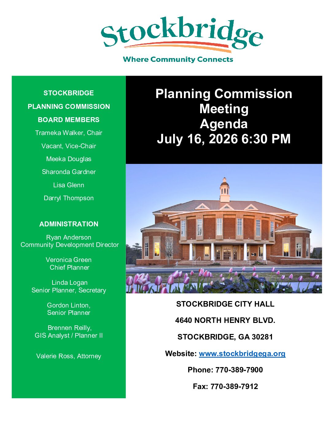
    STOCKBRIDGE PLANNING COMMISSION BOARD MEMBERS Trameka Walker, Chair Vacant, Vice-Chair Planning Commission Meeting Agenda July 16, 2026 6:30 PM Meeka Douglas Sharonda Gardner Lisa Glenn Darryl Thompson ADMINISTRATION Ryan Anderson Community Development Director Veronica Green Chief Planner Linda Logan Senior Planner, Secretary Gordon Linton, Senior Planner Brennen Reilly, GIS Analyst / Planner II Valerie Ross, Attorney STOCKBRIDGE CITY HALL 4640 NORTH HENRY BLVD. STOCKBRIDGE, GA 30281 Website: www.stockbridgega.org Phone: 770-389-7900 Fax: 770-389-7912 AGENDA PLANNING COMMISSION MEETING CITY OF STOCKBRIDGE THURSDAY, JULY 16, 2026 6:30 PM I. Call to Order II. Invocation III. Pledge of Allegiance IV. Roll Call V. Adoption of the Agenda Approval of March 19, 2026 Summary Minutes Item # 1 - March 19, 2026 Summary Minutes Presented by: VII. Public Hearing Item # 1 - ZONING MODIFICATION CASE #ZM-2026-01. (Council District 4.) Consideration of a major zoning modification request for the property at 111 Old Conyers Road to provide for changes to the previously-approved site plan for a mixed-use development, which included 160 apartment units plus ground-floor commercial space within a four-story mid-rise building, plus an underground parking garage. The development was approved via three cases by City Council on July 8, 2024. The cases included: 1) Comprehensive Plan Amendment Case #CP-2024-02, which changed the property’s future land use designation from Low-Density Residential to Special Purpose; 2) Rezoning Case #RZ-2024-02, which rezoned the property from SR (Suburban Residential) to PUD (Planned Unit Development); and 3) Variance Case #RZ-2024-01, which allowed the approvals of three variances, as are listed below. The previous applicant for CP2024-02, RZ-2024-02, and VR-2024-01 was Charlie Hightower, on behalf of First National Land Trust, LLC. The previously-approved development was not built, and now, a new applicant wishes to build a revised development. • Previously-Approved Variance Request #1—Variance to reduce the parking requirements according to the number of bedrooms per apartment unit, whereby studio and one-bedroom apartment units would have only 1.00 parking spaces instead of the required 1.25 parking spaces per unit, and two-bedroom units would have only 1.25 parking spaces per unit instead of the required 1.75 parking spaces per unit. Page | 3 • Previously-Approved Variance Request #2--Variance to modify the ground-floor retail square footage requirement by changing the residential-to-retail space ratio from the required ratio of 75%/25% to a proposed ratio of 87.5%/12.5%. • Previously-Approved Variance Request #3--Variance to increase the project density from twenty-four (24) units per acre to twenty-nine (29) units per acre. The current applicant for ZM-2026-01 is Marlon Burton of Morgan, Jackson & Powell, Inc., who proposes to build a mixed-use development with 200 apartment units and 15,000 square feet of retail/commercial space within a six-story building, plus a parking garage. For such purpose, he requests the following two zoning modifications: • Zoning Modification Request #1--An increase in the maximum number of residential units from 160 units to 200 units; and • Zoning Modification Request #2--An increase in the maximum building height from four (4) stories to six (6) stories. The zoning and future land use designation of the property would not change. The front portion of the property is located within the Parkway Mixed-Use (PMU) Overlay District. The current property owner is Solutions Development, LLC. The property is located in Land Lot 68, District 12, and it contains 6.71 +/- acres within the Stockbridge City Limits. Presented by: Gordon Linton Item # 2 - REZONING CASE #RZ-2026-01. (Council District 4.) Consideration of a rezoning application for the property at 112 Old Conyers Road to rezone the property from the C-3 (Heavy Commercial) District to the RR (Rural Residential) District to better align the zoning of the property with the existing bed-and-breakfast operations, and to access residential resources. There are no plans to change the current operations or property footprint of the bed-and-breakfast inn that was established in 2018. Applicant: Anita Johnson. Property Owner: Marvin Johnson. Property Location: District 12, Land Lot 68, within the Stockbridge City Limits. Property Size: 3.734 +/- acres. Presented by: Gordon Linton Item # 3 - SPECIAL USE PERMIT CASE #SP-2026-01. (Council District 4.) Consideration of a special use permit application for the property at 112 Old Conyers Road to allow a special use permit for a bed-and-breakfast inn within the RR (Rural Residential) District. There are no plans to change the current operations or property footprint of the bed-and-breakfast inn that was established in 2018. Applicant: Anita Johnson. Property Owner: Marvin Johnson. Property Location: District 12, Land Lot 68, within the Stockbridge City Limits. July 16, 2026 6:30 PM 4640 N. Henry Stockbridge, GA 30281 Phone: (770) 389-7900 Page | 4 Property Size: 3.734 +/- acres. Presented by: Gordon Linton Item # 4 - COMPREHENSIVE PLAN AMENDMENT CASE #CP-2026-01. (Council District 4.) Consideration of a Comprehensive Plan amendment application to change the future land use designation of the property at 4231 North Henry Boulevard from Low-Density Mixed-Use to Heavy Industrial to allow for the further development of natural resources that are associated with the existing surrounding rock quarry, pursuant to Section 3.2.25 of the Stockbridge Unified Development Code (UDC). Applicant: Vulcan Lands, Inc., c/o Vulcan Materials Company. Agent: Jack Nichols of James, Bates, Brannan, Groover, LLP. Property Owner: Ekstedt Properties, LLC. Property Location: District 12, Land Lot 62. Property Size: 1.377 +/- acres. Presented by: Gordon Linton Item # 5 - REZONING CASE #RZ-2026-02. (Council District 4.) Consideration of a rezoning application to rezone the property at 4231 North Henry Boulevard from the C-2 (General Commercial) District to the HI (Heavy Industrial) District to allow for the further development of natural resources that are associated with the existing surrounding rock quarry, pursuant to Section 3.2.25 of the Stockbridge Unified Development Code (UDC). Applicant: Vulcan Lands, Inc., c/o Vulcan Materials Company. Agent: Jack Nichols of James, Bates, Brannan, Groover, LLP. Property Owner: Ekstedt Properties, LLC. Property Location: District 12, Land Lot 62. Property Size: 1.377 +/- acres. Presented by: Gordon Linton Item # 6 - SPECIAL USE PERMIT CASE #SP-2026-02. (Council District 4.) Consideration of a special use permit application for the property at 4231 North Henry Boulevard to allow for the development of natural resources, including the removal of minerals (such as rock quarries) and natural materials, together with necessary buildings and machinery, within the HI (Heavy Industrial) District. Applicant: Vulcan Lands, Inc., c/o Vulcan Materials Company. Agent: Jack Nichols of James, Bates, Brannan, Groover, LLP. Property Owner: Ekstedt Properties, LLC. Property Location: District 12, Land Lot 62. Property Size: 1.377 +/- acres. Presented by: Gordon Linton VIII. Project Updates IX. Staff Comments X. Board Comments XI. Adjournment July 16, 2026 6:30 PM 4640 N. Henry Stockbridge, GA 30281 Phone: (770) 389-7900
  • 2026-07-16 · Boards & Commissions · Agenda Packet · Planning Commission · Agenda Packet

    2026-07-16 · Boards & Commissions · Agenda Packet · Planning Commission · Agenda Packet

    2026-07-16 · Boards & Commissions · Agenda Packet · source: ccscrape-meetings · sha256 019a3961 · pages 270 · method: text

    Full text — searchable
    STOCKBRIDGE PLANNING COMMISSION BOARD MEMBERS Trameka Walker, Chair Vacant, Vice-Chair Planning Commission Meeting Agenda July 16, 2026 6:30 PM Meeka Douglas Sharonda Gardner Lisa Glenn Darryl Thompson ADMINISTRATION Ryan Anderson Community Development Director Veronica Green Chief Planner Linda Logan Senior Planner, Secretary Gordon Linton, Senior Planner Brennen Reilly, GIS Analyst / Planner II Valerie Ross, Attorney STOCKBRIDGE CITY HALL 4640 NORTH HENRY BLVD. STOCKBRIDGE, GA 30281 Website: www.stockbridgega.org Phone: 770-389-7900 Fax: 770-389-7912 AGENDA PLANNING COMMISSION MEETING CITY OF STOCKBRIDGE THURSDAY, JULY 16, 2026 6:30 PM I. Call to Order II. Invocation III. Pledge of Allegiance IV. Roll Call V. Adoption of the Agenda Approval of March 19, 2026 Summary Minutes Item # 1 - March 19, 2026 Summary Minutes Presented by: VII. Public Hearing Item # 1 - ZONING MODIFICATION CASE #ZM-2026-01. (Council District 4.) Consideration of a major zoning modification request for the property at 111 Old Conyers Road to provide for changes to the previously-approved site plan for a mixed-use development, which included 160 apartment units plus ground-floor commercial space within a four-story mid-rise building, plus an underground parking garage. The development was approved via three cases by City Council on July 8, 2024. The cases included: 1) Comprehensive Plan Amendment Case #CP-2024-02, which changed the property’s future land use designation from Low-Density Residential to Special Purpose; 2) Rezoning Case #RZ-2024-02, which rezoned the property from SR (Suburban Residential) to PUD (Planned Unit Development); and 3) Variance Case #RZ-2024-01, which allowed the approvals of three variances, as are listed below. The previous applicant for CP2024-02, RZ-2024-02, and VR-2024-01 was Charlie Hightower, on behalf of First National Land Trust, LLC. The previously-approved development was not built, and now, a new applicant wishes to build a revised development. • Previously-Approved Variance Request #1—Variance to reduce the parking requirements according to the number of bedrooms per apartment unit, whereby studio and one-bedroom apartment units would have only 1.00 parking spaces instead of the required 1.25 parking spaces per unit, and two-bedroom units would have only 1.25 parking spaces per unit instead of the required 1.75 parking spaces per unit. Page | 3 • Previously-Approved Variance Request #2--Variance to modify the ground-floor retail square footage requirement by changing the residential-to-retail space ratio from the required ratio of 75%/25% to a proposed ratio of 87.5%/12.5%. • Previously-Approved Variance Request #3--Variance to increase the project density from twenty-four (24) units per acre to twenty-nine (29) units per acre. The current applicant for ZM-2026-01 is Marlon Burton of Morgan, Jackson & Powell, Inc., who proposes to build a mixed-use development with 200 apartment units and 15,000 square feet of retail/commercial space within a six-story building, plus a parking garage. For such purpose, he requests the following two zoning modifications: • Zoning Modification Request #1--An increase in the maximum number of residential units from 160 units to 200 units; and • Zoning Modification Request #2--An increase in the maximum building height from four (4) stories to six (6) stories. The zoning and future land use designation of the property would not change. The front portion of the property is located within the Parkway Mixed-Use (PMU) Overlay District. The current property owner is Solutions Development, LLC. The property is located in Land Lot 68, District 12, and it contains 6.71 +/- acres within the Stockbridge City Limits. Presented by: Gordon Linton Item # 2 - REZONING CASE #RZ-2026-01. (Council District 4.) Consideration of a rezoning application for the property at 112 Old Conyers Road to rezone the property from the C-3 (Heavy Commercial) District to the RR (Rural Residential) District to better align the zoning of the property with the existing bed-and-breakfast operations, and to access residential resources. There are no plans to change the current operations or property footprint of the bed-and-breakfast inn that was established in 2018. Applicant: Anita Johnson. Property Owner: Marvin Johnson. Property Location: District 12, Land Lot 68, within the Stockbridge City Limits. Property Size: 3.734 +/- acres. Presented by: Gordon Linton Item # 3 - SPECIAL USE PERMIT CASE #SP-2026-01. (Council District 4.) Consideration of a special use permit application for the property at 112 Old Conyers Road to allow a special use permit for a bed-and-breakfast inn within the RR (Rural Residential) District. There are no plans to change the current operations or property footprint of the bed-and-breakfast inn that was established in 2018. Applicant: Anita Johnson. Property Owner: Marvin Johnson. Property Location: District 12, Land Lot 68, within the Stockbridge City Limits. July 16, 2026 6:30 PM 4640 N. Henry Stockbridge, GA 30281 Phone: (770) 389-7900 Page | 4 Property Size: 3.734 +/- acres. Presented by: Gordon Linton Item # 4 - COMPREHENSIVE PLAN AMENDMENT CASE #CP-2026-01. (Council District 4.) Consideration of a Comprehensive Plan amendment application to change the future land use designation of the property at 4231 North Henry Boulevard from Low-Density Mixed-Use to Heavy Industrial to allow for the further development of natural resources that are associated with the existing surrounding rock quarry, pursuant to Section 3.2.25 of the Stockbridge Unified Development Code (UDC). Applicant: Vulcan Lands, Inc., c/o Vulcan Materials Company. Agent: Jack Nichols of James, Bates, Brannan, Groover, LLP. Property Owner: Ekstedt Properties, LLC. Property Location: District 12, Land Lot 62. Property Size: 1.377 +/- acres. Presented by: Gordon Linton Item # 5 - REZONING CASE #RZ-2026-02. (Council District 4.) Consideration of a rezoning application to rezone the property at 4231 North Henry Boulevard from the C-2 (General Commercial) District to the HI (Heavy Industrial) District to allow for the further development of natural resources that are associated with the existing surrounding rock quarry, pursuant to Section 3.2.25 of the Stockbridge Unified Development Code (UDC). Applicant: Vulcan Lands, Inc., c/o Vulcan Materials Company. Agent: Jack Nichols of James, Bates, Brannan, Groover, LLP. Property Owner: Ekstedt Properties, LLC. Property Location: District 12, Land Lot 62. Property Size: 1.377 +/- acres. Presented by: Gordon Linton Item # 6 - SPECIAL USE PERMIT CASE #SP-2026-02. (Council District 4.) Consideration of a special use permit application for the property at 4231 North Henry Boulevard to allow for the development of natural resources, including the removal of minerals (such as rock quarries) and natural materials, together with necessary buildings and machinery, within the HI (Heavy Industrial) District. Applicant: Vulcan Lands, Inc., c/o Vulcan Materials Company. Agent: Jack Nichols of James, Bates, Brannan, Groover, LLP. Property Owner: Ekstedt Properties, LLC. Property Location: District 12, Land Lot 62. Property Size: 1.377 +/- acres. Presented by: Gordon Linton VIII. Project Updates IX. Staff Comments X. Board Comments XI. Adjournment July 16, 2026 6:30 PM 4640 N. Henry Stockbridge, GA 30281 Phone: (770) 389-7900 1 City of Stockbridge Mission: To provide visionary leadership and superior municipal services that enhance the quality of life for citizens while creating a welcoming business atmosphere focused on sustainability and expansion of tourism and cultural events. SUMMARY MINUTES PLANNING COMMISSION THURSDAY, MARCH 19, 2026 AT 6:30 p.m. ___________________________________________________________________________________ BOARD MEMBERS: Trameka Walker, Chairperson (District 5) Sharonda Gardner (District 2) Lisa Glenn (At Large) Meeka Douglas (District 4) Darryl Thompson (District 3) ADMINISTRATION: Ryan Anderson, Community Dev. Director Valerie Ross, City Zoning Attorney Veronica Green, Chief Planner Linda Logan, Senior Planner / PC Secretary Gordon Linton, Senior Planner Jarvis Richardson, Planning Intern ------------------------------------------------------------------------------------------------------------------------------------------------------------------------------- I. CALL TO ORDER – Made by Trameka Walker, Chairperson. II. INVOCATION – Made by Elder. III. PLEDGE OF ALLEGIANCE—Done in unison. IV. ROLL CALL: Present: Absent: ~ Trameka Walker ____ X_____ __________ ~ Meeka Douglas ____ X_____ __________ ~ Sharonda Gardner _____X_____ __________ ~ Lisa Glenn ___ _X_____ __________ ~ Darryl Thompson ____ X_____ __________ A quorum of board members was present at the meeting. City of Stockbridge, GA Planning Commission Summary Minutes for March 19, 2026 2 V. WELCOME TO NEW BOARD MEMBERS AND STAFF INTRODUCTIONS Chairperson Trameka Walker introduced all of the new Planning Commission board members, and the staff members were also introduced. VI. ADOPTION OF THE AGENDA Valerie Ross, the City Zoning Attorney, stated that the Planning Commission training that was listed on the agenda could not happen during a Planning Commission meeting, but that it must take place at a separate meeting. Darryl Thompson therefore motioned to amend the Agenda to remove the Planning Commission Training, and Meeka Douglas seconded the motion. A vote was taken, and the motion was unanimously approved. VII. APPROVAL OF MINUTES – December 2, 2025 Summary Minutes. Lisa Glenn motioned to approve the December 2, 2025 Summary Minutes, and Meeka Douglas seconded the motion. A vote was taken, and the Summary Minutes were unanimously adopted. VIII. ELECTION OF OFFICERS Darryl Thompson motioned to nominate Trameka Walker as the Planning Commission Chairperson for the year 2026, and Lisa Glenn seconded the motion. A vote was taken, and the motion was unanimously approved. Trameka Walker then made a motion to nominate Darryl Thompson as the Vice Chairperson. A vote was taken, and the motion was unanimously approved. IX. TRAINING FOR PLANNING COMMISSION BOARD MEMBERS: PART 1—THE PLANNING COMMISSION To be presented by the Community Development Staff. No action is required. Upon the advice of Valerie Ross, City Zoning Attorney, the training did not take place during the Planning Commission meeting, but it was to be scheduled for a separate meeting. X. TRAINING FOR PLANNING COMMISSION BOARD MEMBERS: PART 2—MEETING PROCEDURES To be presented by the Community Development Staff. No action is required. City of Stockbridge, GA Planning Commission Summary Minutes for March 19, 2026 3 Upon the advice of Valerie Ross, City Zoning Attorney, the training did not take place during a Planning Commission meeting, but it was to be scheduled for a separate meeting. XI. TRAINING FOR PLANNING COMMISSION BOARD MEMBERS: PART 3—ITEM RECOMMENDATIONS: COMPREHENSIVE PLAN, UNIFIED DEVELOPMENT CODE, AND ZONING PROCESSES To be presented by the Community Development Staff. No action is required. Upon the advice of Valerie Ross, City Zoning Attorney, the training did not take place during a Planning Commission meeting, but it was to be scheduled for a separate meeting. XII. VARIANCE CASE #VR-2026-01. (Property is located in Council District 2.) Consideration of a variance application for the request of two variances, as are listed below, for Parcel #S20-03003000 on Wilson Avenue to allow for the construction of a new single-family detached dwelling. Property Owners: Laura Bernal Gopar and Luis A. Gopar-Carmona. Applicant: Jerry Robinson. The property is located in Land Lot 36 of District 12, and it contains 0.613 +/- acres. ~ Variance Request #1: Reduce the front yard setback from the required 50 feet to 25 feet within the SR (Suburban Residential) zoning district. ~ Variance Request #2: Reduce the rear yard setback from the required 40 feet to 20 feet within the SR (Suburban Residential) zoning district. To be presented by the Community Development Staff. Staff Presentation -- Linda Logan gave a PowerPoint presentation of the case. She explained that the narrow and irregular shape of the subject property presented a hardship for the applicant in meeting the setback requirements of the SR (Suburban Residential) district, which are 50 feet in the front and 40 feet in the rear. The applicant had therefore requested two variances to allow for reductions in the required setbacks. In addition, the applicant proposed to build a two-story house to allow for a reduced footprint (first floor) to prevent it from encroaching into the required setbacks, while still meeting the minimum required floor area of 1,500 square feet. Ms. Logan stated that the proposed site plan met those requirements, so the Staff recommended the approval of VR-2026-01. Public Hearing—Ms. Diane D. Miller of 804 Rum Hill Court stated that she wanted to see sidewalks installed along Wilson Avenue. She said that the area has significant historical significance. There is no City historic preservation ordinance. She was not sure that the home would be compatible with other homes in the area City of Stockbridge, GA Planning Commission Summary Minutes for March 19, 2026 4 because there are not many two-story homes, and the proposed first floor would be larger than that of most other homes in the area. Ryan Anderson stated that the Staff is working on a historic preservation ordinance. Board Action—Sharonda Gardner motioned to approve VR-2026-01, and Meeka Douglas seconded the motion. A vote was taken, and VR-2026-01 was unanimously recommended for approval. XIII. PROJECT UPDATES To be presented by the Community Development Staff. No action is required. Ryan Anderson welcomed the new board members. He stated that the Planning Commission Training was being rescheduled to a Zoom meeting, to take place on April 9, 2026 at 11:00 a.m. XIV. STAFF COMMENTS To be presented by the Community Development Staff. No action is required. There were no staff comments. XV. BOARD COMMENTS Chairperson Trameka Walker expressed her thanks to the other board members for selecting her as Chairperson for 2026. XVI. ADJOURNMENT Lisa Glenn motioned to adjourn the meeting, and Meeka Douglas seconded the motion. A vote was taken, and the motion was unanimously approved. The meeting was adjourned at 7:12 p.m. City of Stockbridge, GA Planning Commission Summary Minutes for March 19, 2026 Project/Case # ZMOD-2026.04.0941 Address: Parcel Number(s): 111 OLD CONYERS RD, STOCKBRIDGE, GA 30281 S24-01017000 City of Stockbridge APPLICATION FOR ADMINISTRATIVE OR ZONING MODIFICATIONS Zoning Case Number: Ordinance Case Number: The undersigned, having an interest in the property herein described respectfully request: Property Owner Authorization Form please click here SECTION I A. Administrative Modification: Minor changes are those which implement only slight alterations to the approved site design layout; which are made necessary by actual field conditions at the time of development; or which do not alter the impact of the development on nearby properties, nor the intent or integrity of the conditions as they were originally imposed. Any request for a minor change of the master development plan shall be made in written form to the Director. Furthermore, the request for a minor change shall be accompanied by copies of the revised master development plan. This does not require a public hearing, but an administrative decision by the Director of Community Development. Section 9.2.3 B. Zoning Modification (Major): Major modifications to zoning conditions include any changes to allowable uses, maximum density, maximum intensity, or compatibility requirements attached to the zoning approval as conditions of approval. This requires a public hearing by the City of Stockbridge. Section 9.2.4 List previous case number: #M SECTION II 1. Planner to be assigned during review cycle. 2. Identify the specific condition(s) being modified. State the condition number(s) and letter(s) (e.g. 2-b, 2-e) INCREASE MAXIMUM NUMBER OF RESIDENTIAL UNITS FROM 160 UNITS TO 200 UNITS. REDUCE REQUIRED PARKING TO 1 SPACE FOR EACH ONE-BEDROOM AND STUDIO APARTMENT AND 1.25 SPACES FOR EACH TWO-BEDROOM APARTMENT, TO INCREASE THE MAXIMUM NUMBER OF FLOORS TO NINE 3. Petition number of the Zoning or Use Permit to which this application applies RZ-2024-02 - CP-2024-02 VR2024-01 4. Attach a copy of Legal Description [must be metes and bounds], or complete the following information if the property is within a recorded subdivision. Is the property within a recorded subdivision? Subdivision Name: Lot Number: Yes No N/A Block Designation: Land Lot(s): District: District 4 Recorded in Plat Book: Page: Please refer to the SagesGov Council District Finder. Road Name: 111 Old Conyers Road SECTION III: Owner states under oath that he/she is the owner of the property described in the attached legal description, which is made part of this application for a Modification. First Last Primary Owner Name: SOLUTIONS DEVELOPMENT LLC Mailing Address: 131 PINE DR STOCKBRIDGE, GA 30281 City: stockbridge State: Georgia Zip: Phone #: 678-791-6260 Email: solutions13117@yahoo.com Owner Signature First Last Name of Secondary Owner Mailing Address: City: State Zip: Phone #: Email: Secondary Owner Signature SECTION IV: Applicant, if different from the owner, states under oath that: 1. The applicant is the executor or attorney-in-fact under a Power-of-Attorney for the Owner. Attach a copy of Power-of-Attorney and type name of Owner as indicated in Section III; or 2. The applicant has an option to purchase said property conditioned upon the property being granted a modification. Attach a copy of the contract and type of name of Owner as indicated in Section III; or 3. The applicant has an estate for years which permits the applicant to apply for a modification. Attach a copy of the lease and type name of the Owner as indicated in Section III. First Last Marlon Burton Morgan Jackson & Powell, Inc. Name of Applicant: Applicant's Address: 5944 Waggoner Court City: Rex State: Georgia Zip: 30273 Phone: 404-693-1739 Email: morganjacksonpowell@gmail.com Applicant Signature SECTION V: Attorney or Agent, if different from the applicant and/or owner First Last Steve Moore Attorney/Agent Name: Check One: Address: 1350 Keys Ferry Court City: McDonough State: Georgia Phone #: (770) 914-9394 Attorney Zip: 30253 Agent Email: atlpermitting@moorebass.com 2025 PLANNING & ZONING SCHEDULE (Revised on 04/23/25) CZIM & City Council meetings begin at 6:00 p.m. Planning Commission meetings begin at 6:30 p.m. All meetings are held in the Council Chamber at City Hall. “Notice of such hearing shall be provided at least 30 days prior to the quasi-judicial hearing . . . “(State Zoning Procedures Law, Revised; Sec. 36-66-4(g).) Each row across the table below represents an Application Cycle. Application Filing Deadline Planning Commission (Beginning of Application Cycle) Public Notification/ Community Zoning & Information Sign Posting Deadline (C.Z.I.M) Meeting (3rd Thursday of the Month) (2nd Monday of the Month) 1 January 5, 2026 February 4, 2026 February 11, 2026 February 19, 2026 March 9, 2026 2 February 2, 2026 March 4, 2026 March 11, 2026 March 19, 2026 April 13, 2026 3 March 2, 2026 April 1, 2026 April 8, 2026 April 16, 2026 May 11, 2026 4 April 6, 2026 May 6, 2026 May 13, 2026 May 21, 2026 June 8, 2026 5 May 4, 2026 June 3, 2026 June 10, 2026 June 18, 2026 July 13, 2026 6 June 1, 2026 July 1, 2026 July 8, 2026 July 16, 2026 August 10, 2026 7 July 6, 2026 August 5, 2026 August 12, 2026 August 20, 2026 September 14, 2026 8 August 3, 2026 September 2, 2026 September 9, 2026 September 17, 2026 October 12, 2026 9 September 8, 2026 October 7, 2026 October 14, 2026 October 22, 2026 November 9, 2026 10 October 5, 2026 November 4, 2026 November 10, 2026 November 19, 2026 December 14, 2026 11 November 2, 2026 December 2, 2026 December 9, 2026 December 17, 2026 January 11, 2027 12 December 7, 2026 January 6, 2027 January 13, 2027 January 21, 2027 February 8, 2027 Application Cycle Mayor & City Council Meeting Henry County, GA Overview Legend Parcels Roads 294 ft Parcel ID Property Address District S24-01017000 111 OLD CONYERS RD TAD combo City/Stockbridge SSD-TAD combo Class Residential Owner Acreage 6.71 Address SOLUTIONS DEVELOPMENT LLC 131 PINE DR STOCKBRIDGE, GA 30281 Land $88,300 Value: Building $35,400 Value: Misc $0 Value: Total $123,700 Value: Last 2 Sales Date Price Reason Qual 3/14/2019 $0 VM U 12/26/2018 $62,000 XZ U Parcel lines depicted on the maps do not re ect a true and exact representation of property boundaries and should not be relied upon for said purpose. Property boundary lines are depicted on recorded plats available at the Henry County courthouse or can be determined by employing the services of a licensed surveyor. Date created: 5/29/2026 Last Data Uploaded: 5/29/2026 3:16:30 AM Developed by SITE DATA REQUESTED MODIFICATION TO PRIOR APPROVALS EXISTING SITE INFORMATION PROJECT NAME 111 OLD CONYERS ROAD PARCEL NO(S). S24-01017000 SITE AREA 1 EXISTING POND REQUEST TO INCREASE MAXIMUM NUMBER OF RESIDENTIAL UNITS FROM 160 UNITS TO 200 UNITS 6.71 AC. +/PUD CURRENT ZONING 2 PROPOSED SITE INFORMATION REQUEST TO INCREASE MAXIMUM BUILDING HEIGHT TO 110 FEET MIXED USE (RETAIL / MULTI-FAMILY) PROPOSED USE X LI 9 PROPOSED NUMBER OF FLOORS: TR 15,000 SF (40% OF GROUND FLOOR AREA) PROPOSED RETAIL / COMMERCIAL AREA: TWO BEDROOM UNITS: 50 TOTAL PROPOSED UNITS: 200 MAXIMUM PROPOSED BUILDING HEIGHT 110' www.moorebass.com ATLANTA WV 1350 Keys Ferry Court McDonough, GA 30253 770.914.9394 CE 150 · Civil Engineering · Land Surveying · Development Consulting · Landscape Architecture · Environmental Permitting TALLAHASSEE /W R EX. AN ONE BEDROOM / STUDIO UNITS: REQUEST TO DECREASE PARKING REQUIREMENTS FOR RESIDENTIAL USE TO 1 SPACE PER 1 BEDROOM OR STUDIO UNIT AND 1.25 SPACES PER 2 BEDROOM UNIT. EN 37,000 SF X 9 STORIES = 333,000 SF TOTAL BUILDING AREA: 3 B PU 37,000 SF PROPOSED BUILDING FOOTPRINT AREA Moore Bass Consulting, Inc. WV PROPOSED PARKING CALCULATION WV 1.25 SPACE PER UNIT X 150 UNITS = 188 SPACES WV EX. WV R/W MORGAN JACKSON & POWELL, INC. ONE BED / STUDIOS: D 1.75 SPACES PER UNIT X 50 UNITS = 88 SPACES RETAIL 5 SPACES PER 1000 SF KIN = 75 SPACES FIR TOTAL PARKING REQUIRED 351 SPACES LESS PARKING REDUCTION PER VR-2024-01 - 30 SPACES CC EA ESS /N AR OP G 111 OLD CONYERS ROAD STOCKBRIDGE, GA TWO BED: OUTDOOR DINING AREA WV D 75 SPACES RESIDENTIAL PARKING PROVIDED 273 SPACES 343 SPACES WV S /W X. R E SS OLD RS E Y N CO AD RO OLD S YER CON MIXED USE BUILDING GROUND FLOOR RETAIL = 15,000 SF MULTI-FAMILY ) "E 0'41 1 ° 9 N6 00' 674. 93.26' TOTAL PARKING PROVIDED R/W 0' D (8 ROA 145' 3 12 5 W V 90' SS 10 CLIENT NAME NON-RESIDENTIAL PARKING PROVIDED PROJECT NAME 321 SPACES 20' ADJUSTED PARKING REQUIRED 10 GATED RESIDENT ENTRY 8 4 SS 8 RETAIL USE DUMPSTER PAD 7 S N11°51'29"W 103.83' SS RESIDENTIAL AMENITY AREA 6 25' LANDSCAPE STRIP 3 7 42.0' N38°02'21"W 120.97' N/F GOD FIRST BREAKTHROUGH MINISTRIES INC D.B. 10485 PG. 147 TAX ID. S24-01015000 ZONED: SR ROOF-TOP POOL 10 8 SS 6 242.16' 4 6 6 S08°45'08"E 644.19' EAST A 5 5 N3 N52°24'36"W 28.90' 30 90' 45. 34"W 7' 1°2 TLANT N61°42'45"W 11.77' SS 30 'S 'S .S . 9 9 E. 8 5 .S .E . A4034.0001 - BASE7 50' 75' UN DIS IMP ER V TUR BED D 25' UN DIS TUR BED N58°02'49"W 21.12' EX. R/W N43°39'13"W 25.60' IOU SS ETB STR EAM N58°02'28"W 19.04' ITY ) TAT E) U 11 SS R N48°55'19"W 26.20' CL OF BRUSH CREEK IS BOUNDARY LINE SEAL EE SS 47.2 6 TO P KN65°10'57 ' OF "W TO PO FB N5 AN SS BA NK 48. 7°0 29' 3'2 6"W SS 30' S.S.E. S K SS S N58°39'01"W 12.08' S N64 PL 20' S .S.E. 335.39' N85°08'05"W 46.8 °36 9' '14" W N89°37'59"W 23.76' 64.67' 0"W S80°01'0 N68°37'29"W 21.07' S77°33'22"W 19.23' 48.66' N86°08'36"W N86°56'35"W 27.96' S84°06'07"W 14.37' N72°36'53"W 18.71' 43.0 0' N68 °40' 53"W S63°34'28"W 23.31' SHEET TITLE S86°07'29"W 13.31' N60°07'06"W 21.23' 26.7' N30°23'12"W 26.33' C Moore Bass Consulting SS SS SS 30' S.S.E. SS N/F AS BUSINESS USA INC D.B. 19325 PG. 304 TAX ID. S25-01001004 1350 KEYS FERRY COURT McDONOUGH, GA 30253 LSF #1179 PROPSOED SWMF 355 8°2 .35' 1'0 7"W C SDM 170.9' BOUNDARY TIE LINE PER P.B. 64 PG. 164 N5 SH N62°13'26"W 27.95' DRAWN BY The Drawings, Specifications and other documents prepared by Moore Bass Consulting, Inc. (MB) for this Project are instruments of MB for use solely with respect to this Project and, unless otherwise provided, MB shall be deemed the author of these documents and shall retain all common law, statutory and other reserved rights, including the copyright. RESIDENTIAL USE DUMPSTER PAD R (S R 150 K R (C 04-01-2026 CONTRACT # 4 AC DATE BU FFE STR SS EAM BU FFE 44.95' N76°1 6'2B 5"W PARKING STRUCTURE 150 SPACES 8 76' ' .61 W 52 '55" 54 8° N3 A ROA SS 7 S EX. R/W S:\A4034.0001 - 111 CONYERS ROAD\Engineering\Planning\A4034.0001 - BASE7.dwg, SITE PLAN, btaylor, Jun 12, 2026 - 8:07:38am SS CONCEPTUAL SITE PLAN GRAPHIC SCALE 40 0 20 80 40 160 2022.03.10 S REVISIONS S SS 1. REVISED BUILDING LOCATION PER CITY 06/11/2026 MULTI-FAMILY BUILDING 2 SHEET ( IN FEET ) 1 inch = 40 ft. 1 April 28, 2026 City of Stockbridge, Planning & Zoning, Community Development 4640 North Henry Boulevard Stockbridge, GA 30281 RE: 111 Old Conyers Road – Henry County Parcel ID# S24-01017000 Letter of Intent - Request for Major Modification To whom it may concern, On behalf of the property owner, this letter is submitted in support of a Major Modification Application for the property located at 111 Old Conyers Road (Parcel No. S24-01017000), consisting of approximately 6.71 acres and currently zoned PUD. The applicant is proposing a mixed-use development consisting of a multi-family residential component integrated with ground-floor retail. The proposed development includes a six-story building with approximately 15,000 square feet of retail/commercial space and approximately 201,000 square feet of residential area, totaling 200 dwelling units. The site plan also incorporates structured and surface parking, as well as associated amenities including open space, a rooftop pool, dog park, playground, and passive recreation areas. As part of this Major Modification request, the following revisions to the previously approved plan are being requested: • • • An increase in the maximum number of residential units from 160 units to 200 units An increase in the maximum building height from four (4) stories to six (6) stories A modification to the parking requirements to allow 1 space per one-bedroom/studio unit and 1.25 spaces per two-bedroom unit The proposed plan maintains the overall intent of the previously approved PUD while enhancing the site with a vertically integrated mixed-use product that promotes efficient land use, walkability, and a higher-quality development pattern along the corridor. The inclusion of structured parking and consolidated building footprint allows for the preservation of open space and the incorporation of meaningful amenity areas for residents. If you have any questions concerning the above or if any additional information is required, please do not hesitate to call me at (770) 914-9394. Sincerely, Stephen D. Moore Moore Bass Consulting, Inc. 1350 Keys Ferry Court • McDonough, GA 30253 G A E n g i n e e r i n g C e r t . o f A u t h o r i z a t i o n N o . 4 8 6 6 1 • G A S u r v e y i n g C e r t . o f A u t h o r i z a t i o n N o . L S F 0 0 11 7 9 April 28, 2026 Revised June 10, 2026 City of Stockbridge, Planning & Zoning, Community Development 4640 North Henry Boulevard Stockbridge, GA 30281 RE: 111 Old Conyers Road – Henry County Parcel ID# S24-01017000 Letter of Intent - Request for Major Modification To whom it may concern, On behalf of the property owner, this letter is submitted in support of a Major Modification Application for the property located at 111 Old Conyers Road (Parcel No. S24-01017000), consisting of approximately 6.71 acres and currently zoned PUD. The applicant is proposing a mixed-use development consisting of a multi-family residential component integrated with ground-floor retail. The proposed development includes a six-story building with approximately 15,000 square feet of retail/commercial space and approximately 201,000 square feet of residential area, totaling 200 dwelling units. The site plan also incorporates structured and surface parking, as well as associated amenities including open space, a rooftop pool, dog park, playground, and passive recreation areas. As part of this Major Modification request, the following revisions to the previously approved plan are requested: • • • An increase in the maximum number of residential units from 160 units to 200 units An increase in the maximum building height from four (4) stories to nine (9) stories or 110’ feet, whichever is greater. A modification to the parking requirements to allow 1 space per one-bedroom/studio unit and 1.25 spaces per two-bedroom unit The proposed plan maintains the overall intent of the previously approved PUD while enhancing the site with a vertically integrated mixed-use product that promotes efficient land use, walkability, and a higher-quality development pattern along the corridor. The inclusion of structured parking and consolidated building footprint allows for the preservation of open space and the incorporation of meaningful amenity areas for residents. If you have any questions concerning the above or if any additional information is required, please do not hesitate to call me at (770) 914-9394. Sincerely, Stephen D. Moore Moore Bass Consulting, Inc. 1350 Keys Ferry Court • McDonough, GA 30253 G A E n g i n e e r i n g C e r t . o f A u t h o r i z a t i o n N o . 4 8 6 6 1 • G A S u r v e y i n g C e r t . o f A u t h o r i z a t i o n N o . L S F 0 0 11 7 9 SITE DATA EXISTING SITE INFORMATION PROJECT NAME 111 OLD CONYERS ROAD PARCEL NO(S). S24-01017000 SITE AREA CURRENT ZONING REQUESTED MODIFICATION TO PRIOR APPROVALS EXISTING POND 1 6.71 AC. +/PUD VARIANCE REQUESTED TO INCREASE MAXIMUM NUMBER OF RESIDENTIAL UNITS FROM 160 UNITS TO 200 UNITS PROPOSED SITE INFORMATION PROPOSED USE PROPOSED RETAIL / COMMERCIAL AREA: 36,000 SF X 6 STORIES = 216,000 SF 15,000 SF (42% OF GROUND FLOOR AREA) PROPOSED RESIDENTIAL AREA: 201,000 SF ONE BEDROOM / STUDIO UNITS: 150 TWO BEDROOM UNITS: 50 TOTAL PROPOSED UNITS: 200 VARIANCE REQUESTED TO REDUCE REQUIRED PARKING TO 1 SPACE FOR EACH ONE-BEDROOM AND STUDIO APARTMENT AND 1.25 SPACES FOR EACH TWO-BEDROOM APARTMENT. · Civil Engineering · Land Surveying · Development Consulting · Landscape Architecture · Environmental Permitting www.moorebass.com CE AN TR EN TOTAL BUILDING AREA: 6 X LI PROPOSED NUMBER OF FLOORS: 36,000 SF 2 B PU PROPOSED BUILDING FOOTPRINT AREA MIXED USE (RETAIL / MULTI-FAMILY) Moore Bass Consulting, Inc. 3 VARIANCE REQUESTED TO INCREASE THE MAXIMUM NUMBER OF FLOORS FROM FOUR TO SIX. TALLAHASSEE ATLANTA 1350 Keys Ferry Court McDonough, GA 30253 770.914.9394 1 TWO BED: 1.25 SPACES PER UNIT X 50 UNITS = 63 SPACES RETAIL 5 SPACES PER 1000 SF 2 KIN = 75 SPACES TOTAL PARKING REQUIRED 288 SPACES TOTAL PARKING PROVIDED RETAIL 75 SPACES FIR CC EA ESS /N AR OP G OUTDOOR DINING AREA RESIDENTIAL 221 SPACES 10' 20' 160' D 90' OLD RS E Y N A RO 76 SPACES ALLOCATED FOR RETAIL 12 CO MIXED USE BUILDING 6 STORIES TOTAL GROUND FLOOR RETAIL = 15,000 SF 5 STORIES MULTI-FAMILY 3 PROJECT NAME TOTAL 296 SPACES 5 90' 11 3 CLIENT NAME 1 SPACE PER UNIT X 150 UNITS = 150 SPACES 111 OLD CONYERS ROAD STOCKBRIDGE, GA ONE BED / STUDIOS: MORGAN JACKSON & POWELL, INC. PROPOSED PARKING CALCULATION 7 11 10 GATED RESIDENT ENTRY RETAIL USE DUMPSTER PAD OPEN SPACE GATED EMERGENCY ENTRY 7 9 MULTI-FAMILY BUILDING 6 STORIES TOTAL 5 240' 5 8 ROOF-TOP POOL 4 AMENITY AREA THERAPY GARDEN DOG PARK PLAYGROUND PERGOLA / SITTING AREA OPEN SPACE 4 5 8 REVISIONS EAST A 12 6 TLANT 10 A4034.0001 - BASE4 RESIDENTIAL USE DUMPSTER PAD D 75' 50' U B R U ND IMP ER IST UR VIO US 213 SPACES ALLOCATED FOR RESIDENTIAL (63 SURFACE PARKING, 150 DECK PARKING SET 150 PARKING STRUCTURE 5 STORIES 30 SPACES PER FLOOR 150 SPACES DATE 65' A ROA CONTRACT # DRAWN BY 160' K STR E AM BU FFE R SDM The Drawings, Specifications and other documents prepared by Moore Bass Consulting, Inc. (MB) for this Project are instruments of MB for use solely with respect to this Project and, unless otherwise provided, MB shall be deemed the author of these documents and shall retain all common law, statutory and other reserved rights, including the copyright. BAC BED 04-01-2026 1350 KEYS FERRY COURT McDONOUGH, GA 30253 LSF #1179 PROPSOED SWMF SH SEAL C R EE K OPEN SPACE SHEET TITLE CONCEPTUAL SITE PLAN GRAPHIC SCALE 40 0 20 80 40 160 2022.03.10 S:\A4034.0001 - 111 CONYERS ROAD\Engineering\Planning\A4034.0001 - BASE4.dwg, SITE PLAN, smoore, Apr 22, 2026 - 12:01:53pm 4 SHEET C Moore Bass Consulting ( IN FEET ) 1 inch = 40 ft. 1 TO: Planning Commission; Mayor and Council FROM: Gordon Linton, Senior Planner CC: R. Ryan Anderson, Community Development Director DATE: June 18th 2026 (Planning Commission) July 13th 2026 (Mayor and Council) Subject: #ZM-2026-01 for 111 Old Conyers Road Summary of Request: The applicant, Marlon Burton of Morgan Jackson & Powell, Inc., on behalf of Solutions Development, LLC, requests approval of a major zoning modification to the previously approved Planned Unit Development (PUD) for the property located at 111 Old Conyers Road (Parcel #S24-01017000). The subject property contains approximately 6.71 acres, is currently zoned PUD (Planned Unit Development), and has a Special Purpose Future Land Use designation. Approximately 3.87 acres of the property are located within the Parkway Mixed-Use (PMU) Overlay District. The previously approved development consisted of a mixed-use project containing 160 residential dwelling units and approximately 15,000 square feet of ground-floor retail/commercial space within a four-story building. The applicant proposes to modify the approved development by increasing the maximum number of residential units from 160 units to 200 units and increasing the maximum building height from four (4) stories to nine (9) stories (110 feet). The proposed development will continue to provide approximately 15,000 square feet of ground-floor retail/commercial space while maintaining the mixed-use character established under the prior approvals. The revised site plan incorporates a structured parking facility containing approximately 150 parking spaces, resulting in a total parking supply of 343 spaces, which exceeds the adjusted parking requirement established under Variance VR-2024-01. Additional site improvements include a rooftop pool, centralized Residential Amenity Area, outdoor dining space, gated residential and emergency access points, enhanced pedestrian connectivity, preservation of open space and stream buffers associated with Brush Creek, and a twenty-five (25) foot landscape strip along the eastern property boundary adjacent to God First Breakthrough Ministries. The property's zoning classification and Future Land Use designation will remain unchanged. The purpose of the requested zoning modification is to allow increased residential density and building height while implementing a more compact, vertically integrated mixed-use development pattern that emphasizes structured parking, pedestrian-oriented design, and efficient land utilization. I. PURPOSE Consideration of a request for a major zoning modification to amend the previously approved Planned Unit Development (PUD) under Rezoning Case RZ-2024-02 for property located at 111 Old Conyers Road. The request proposes to increase the maximum number of residential 1|Pa ge dwelling units from 160 units to 200 units, increase the maximum building height from four (4) stories to nine (9) stories (110 feet), and revise the approved site plan to incorporate structured parking, a centralized Residential Amenity Area, enhanced pedestrian connectivity, and a more compact, vertically integrated mixed-use development pattern. The proposed development will continue to provide approximately 15,000 square feet of ground-floor retail/commercial space while maintaining the mixed-use character established through the original approval. II. III. PROPERTY INFORMATION Proposed Development Mixed-use development with 200 residential units that will include commercial spaces on the ground floor Site Address 111 Old Conyers Road Parcel Identification S24-01017000 Parcel Acreage 6.71 +/- acres Applicant Marlon Burton Owner Solutions Development, LLC. Current Zoning of Property PUD (Planned Unit Development) Current Future Land Use Designation of Property Special Purpose Proposed Number of Units Per Acre 29.80 units per acre Current Use of Property Vacant, undeveloped property characterized by wooded vegetation and natural features, including an intermittent stream (Brush Creek) and associated buffer areas that constrain portions of the developable area. LAND USE ANALYSIS The table below identifies the zoning classifications and existing land uses of adjacent properties surrounding the subject site. 2|Pa ge SURROUNDING ZONING PROPERTY INFORMATION Location Property to the North Existing Zoning Existing Land Use C-2 (General Commercial District) C-3 Vacant; Publix Shopping Center Stockbridge (Heavy Commercial District) Lakes Bed & Breakfast Property to the South C-2 (General Commercial District) Downtown Food Mart (Convenience Store) Korner Store (Convenience Store) City of Stockbridge Public Works Facility Property to the East OI (Office Institutional District) God First Breakthrough Ministries Property to the West DT (Downtown District) Cochran Park The surrounding area consists of a mix of commercial, institutional, and recreational uses, with proximity to downtown Stockbridge. The subject property is located within a transitional area that supports a mix of land uses and development intensities. SURROUNDING FUTURE LAND USE DESIGNATIONS Location Existing Land Use Future Land Use Designation Property to the North Vacant; Publix Shopping Center Stockbridge Lakes Bed & Breakfast Low Density Mixed Use Property to the South Downtown Food Mart (Convenience Store) Korner Store (Convenience Store) City of Stockbridge Public Works Facility Low Density Residential Property to the East God First Breakthrough Ministries Public Institutional Property to the West Cochran Park Park/Recreation/Conservation The Future Land Use Map (FLUM) identifies the subject property as Special Purpose, with surrounding areas consisting of a mix of Low Density Mixed Use, Low Density Residential, Public/Institutional, and Park/Recreation/Conservation designations. SURROUNDING LAND USE DENSITIES (SUBDIVISION) Name of Subdivision/Development Number of Units Estimated Density (Units per Acre) Spanish Village Subdivision HH Duvall Subdivision 28 16 1.5 units/acre 1.0 units/acre 3|Pa ge Name of Subdivision/Development Number of Units Estimated Density (Units per Acre) Diamante Townhomes 200 7.0 units/acre 135 East Townhomes 27 16.36 units/acre Pine Grove 270 4.0 units/acre Pineview 77 2.49 units/acre 111 Old Conyers Road (Subject Property) 200 29.80 units/acre The table above summarizes the existing land uses and corresponding future land use designations for adjacent properties. The proposed development’s residential density has been evaluated in relation to nearby subdivisions to determine its compatibility with the surrounding built environment. The table below provides a comparison of the total number of dwelling units and the overall density of existing residential developments within the immediate area. As shown in the table, surrounding residential developments generally range in density from approximately 1.0 to 16.36 units per acre, with the majority of developments characterized by lowto moderate-density residential patterns. The proposed development at 29.80 units per acre represents a higher-density development compared to surrounding subdivisions. However, the subject property’s location near downtown Stockbridge, its adjacency to commercial and institutional uses, and its designation as Special Purpose on the Future Land Use Map support a higher-density, mixed-use development pattern at this location. Additionally, the proposed vertical design and incorporation of structured parking allow for increased density while minimizing land disturbance and enhancing open space, further supporting compatibility with the surrounding area. IV. FINDING OF FACTS 1. The subject property is currently zoned PUD (Planned Unit Development) and has a Special Purpose future land use designation. 2. The surrounding area consists of a mix of zoning classifications, including C-2 (General Commercial), C-3 (Heavy Commercial), OI (Office Institutional), DT (Downtown), and SR (Suburban Residential). 3. The surrounding land uses include commercial, institutional, recreational, and residential developments, indicating that the subject property is located within a transitional area near downtown Stockbridge. 4. The subject property contains an intermittent stream (Brush Creek) and associated environmental buffers, which constrain portions of the developable area. 5. The proposed modification introduces a more vertically integrated development design, incorporating structured parking and reducing the overall development footprint. 6. The property is located within proximity to downtown Stockbridge, Cochran Park, and nearby commercial centers, supporting the viability of a mixed-use development pattern. 7. Approximately 3.87 acres of the subject property are located within the Parkway Mixed-Use (PMU) Overlay District. While portions of the site, including parking areas, landscaping, and open space, are located within the overlay district, the proposed mixed-use building and parking structure are located primarily outside of the PMU Overlay boundary. 4|Pa ge 8. The subject property is located within the Tax Allocation District (TAD), which is intended to encourage quality development and redevelopment within underutilized or distressed areas of the City. 9. In accordance with the requirements of the City of Stockbridge Unified Development Code, a public notice sign was posted on the subject property on June 3, 2026, notifying the public of the proposed zoning modification request. 10. A legal advertisement for the public hearing was published on June 3, 2026, in accordance with the public notice requirements of the City of Stockbridge Unified Development Code and applicable state law. 11. The applicant submitted documentation demonstrating that notice letters were mailed via certified mail to surrounding property owners. The applicant also provided a mailing list identifying the parcels and property owners notified of the proposed zoning modification request. Certified mail receipts indicate that the notices were mailed on June 2, 2026. 12. The mailing list provided by the applicant included adjacent and nearby property owners within the notification area, including residential, commercial, institutional, and governmental properties surrounding the subject property. 13. The subject property is located within an area that was evaluated as part of the 2012 Livable Centers Initiative (LCI) Update. The LCI planning effort identified opportunities for redevelopment, mixed-use development, improved walkability, and higher-intensity development patterns in proximity to Downtown Stockbridge. The proposed mixed-use development is generally consistent with several of the redevelopment and land use objectives identified through that planning process. V. MAPS, SITE PLAN, AND RENDERINGS The following exhibits are included as part of the review of the requested zoning modification: • • • • • • • • • • • • • • Vicinity Map of 111 Old Conyers Road Aerial Photograph of the Subject Property and Surrounding Area Acreage Map of 111 Old Conyers Road Zoning Map of 111 Old Conyers Road Surrounding Residential Developments Map Residential Density Comparison Map Future Land Use Map of 111 Old Conyers Road Parkway Mixed-Use (PMU) Overlay District Map Proposed Site Plan Aerial Photograph with Proposed Site Plan Overlay Development Data Summary for Proposed Development Applicant's Conceptual Rendering of Proposed Nine-Story Mixed-Use Development Applicant's Conceptual Rendering of Proposed Residential Amenity Area and Parking Structure Applicant's Conceptual Rendering of Proposed Mixed-Use Building (Southwest Perspective) These exhibits illustrate the location of the subject property, surrounding land uses, zoning classifications, future land use designations, overlay district boundaries, nearby residential developments, and comparative residential densities within the surrounding area. The exhibits also depict the proposed site layout, parking configuration, open space and amenity areas, environmental features, and conceptual architectural design of the proposed nine-story mixeduse development. 5|Pa ge The PMU Overlay District Map further demonstrates that a portion of the subject property is located within the Parkway Mixed-Use Overlay District, while the principal mixed-use building and structured parking facility are located primarily outside of the overlay boundary. Collectively, these exhibits assist in evaluating the relationship of the proposed development to surrounding properties and the modifications requested under ZM-2026-01. 6|Pa ge Vicinity Map of 111 Old Conyers Road 7|Pa ge Aerial Photograph of 111 Old Conyers Road 8|Pa ge Acreage Map of 111 Old Conyers Road 9|Pa ge Zoning Map – 111 Old Conyers Road 10 | P a g e Surrounding Residential Developments Map 11 | P a g e Residential Density Comparison Map 12 | P a g e Future Land Use Map – 111 Old Conyers Road 13 | P a g e Overlay District Map of 111 Old Conyers Road 14 | P a g e Proposed Site Plan Proposed Site Plan for 111 Old Conyers Road (ZM-2026-01) 15 | P a g e Development Data Summary – Proposed Development Development Data Summary for Proposed Mixed-Use Development at 111 Old Conyers Road 16 | P a g e Aerial Photograph with Proposed Site Plan Overlay – 111 Old Conyers Road 17 | P a g e Architectural Rendering of Proposed Nine-Story Mixed-Use Development Conceptual rendering depicting the proposed nine-story mixed-use development consisting of approximately 200 residential units, 15,000 square feet of ground-floor retail/commercial space, and structured parking as submitted by the applicant. 18 | P a g e Applicant's Conceptual Rendering of Proposed Residential Amenity Area and Parking Structure Conceptual rendering depicting the proposed nine-story mixed-use development, including the centralized Residential Amenity Area, structured parking facility, internal open space, pedestrian gathering areas, and upper-story residential units. 19 | P a g e Applicant's Conceptual Rendering of Proposed Mixed-Use Building (Southwest Perspective) Conceptual rendering depicting the proposed nine-story mixed-use development consisting of approximately 200 residential dwelling units, 15,000 square feet of ground-floor retail/commercial space, structured parking, and associated residential amenities. 20 | P a g e VI. ZONING HISTORY The subject property consists of approximately 6.71 acres located along Old Conyers Road, identified as Parcel #S24-01017000. The property was previously zoned SR (Suburban Residential District), which does not permit mixed-use developments. Under Rezoning Case RZ-2024-02, the applicant, Charlie Hightower of First National Land Trust, requested to rezone the property from SR (Suburban Residential District) to PUD (Planned Unit Development) to allow for the development of a mixed-use project consisting of 200 residential units and approximately 15,000 square feet of ground-floor retail space. The proposed development included a five-story building, surface parking, and associated amenities such as open space areas, pedestrian connections, and recreational features. The rezoning was accompanied by Comprehensive Plan Amendment CP-2024-02, which amended the Future Land Use Map designation from Low-Density Residential to Special Purpose to support a higher-density, mixed-use development pattern consistent with the City’s vision for redevelopment in proximity to downtown Stockbridge. Additionally, under Variance VR-2024-01, the applicant received approval to modify development standards, including: • Reducing required parking ratios based on unit type • Modifying the residential-to-retail ratio • Increasing the allowable residential density from 24 units per acre to 29 units per acre These approvals collectively established the development framework for a 200-unit mixed-use development on the subject property. Conditions of Approval As part of the rezoning approval, the Mayor and City Council imposed the following conditions governing development of the property: 1. The number of residential units shall be limited to 160 units (23.84 units per acre) in accordance with the maximum density permitted under the Special Purpose future land use designation. 2. Flock cameras shall be installed at the entrance of the development. 3. On the eastern side of the property, the 25-foot buffer area shall be extended beyond the pool area shown on the conceptual site plan. 4. The front façade of the residential building shall consist of not less than 50% primary materials, including brick, stone, or stucco, with the remaining materials consisting of stucco, shake, and/or cement fiberboard siding. 5. The side and rear façades shall consist of a combination of primary and secondary materials, with secondary materials not exceeding 30% of the entire building. 6. Building colors shall consist of a cohesive and complementary palette, with limited use of accent colors that are not bright or fluorescent. 7. The development shall not exceed four (4) stories in height. 8. All parking spaces shall be located to the rear of the building in accordance with Section 2.5.2(H)(1) of the Unified Development Code. 9. Decorative streetlights shall be installed throughout the development. 21 | P a g e 10. Electric vehicle (EV) charging stations shall be provided on-site. 11. A ten-foot-wide multi-use path shall be constructed along the frontage of East Atlanta Road and Old Conyers Road. 12. A centralized bus stop shall be provided for residents. 13. The unit mix shall consist of fewer studio units and a greater proportion of two- and three-bedroom units. Transition to Current Request Collectively, these approvals and conditions established the original development framework for the subject property. The current request for a major zoning modification seeks to amend the previously approved site plan and modify certain conditions of approval, including building height, density, and site design, while maintaining the overall mixed-use character of the development. 22 | P a g e Previously Approved Site Plan for 111 Old Conyers Road 23 | P a g e Aerial Photograph with Previous Approved Site Plan Overlay – 111 Old Conyers Road 24 | P a g e Development Site Data of Previously Approved Site Plan for 111 Old Conyers Road 25 | P a g e Exterior Elevations of Proposed Mixed Use Development 26 | P a g e First Floor Plan of Proposed Mixed-Use Development 27 | P a g e Ordinance for RZ-2024-02 that was Approved by Mayor and Council on July 8, 2024 28 | P a g e Ordinance for RZ-2024-02 that was Approved by Mayor and Council on July 8, 2024 (cont.) 29 | P a g e Ordinance for RZ-2024-02 that was Approved by Mayor and Council on July 8, 2024 (cont.) 30 | P a g e VII. DEVELOPMENT INFORMATION A. Overview of Development The proposed development consists of a nine (9) story mixed-use project containing approximately 200 residential units and 15,000 square feet of ground-floor retail/commercial space. The residential component includes a mix of studio, one-bedroom, and two-bedroom units, consisting of approximately 150 studio and one-bedroom units and 50 two-bedroom units. The proposed development is designed to provide a variety of housing options while maintaining the mixed-use character previously approved for the site. The proposed building has a footprint of approximately 37,000 square feet and a total building area of approximately 333,000 square feet. The building includes approximately 15,000 square feet of retail/commercial space on the ground floor, representing approximately 40 percent of the ground-floor area, with the remaining floor area dedicated to residential uses. The proposed building height is approximately 110 feet. The revised site plan incorporates a combination of structured and surface parking. The development includes a parking structure providing approximately 150 parking spaces, supplemented by surface parking throughout the site. Based on the applicant's parking calculations, the development requires 351 parking spaces under the standard provisions of the Unified Development Code. Pursuant to the previously approved parking reduction granted under Variance VR-2024-01, the adjusted parking requirement is 321 spaces. The proposed development provides a total of 343 parking spaces, including approximately 273 residential parking spaces and 75 retail parking spaces. The development includes a variety of amenity features designed to serve future residents, including a rooftop pool and a centralized Residential Amenity Area. The amenity area incorporates landscaped open space, pedestrian gathering areas, seating opportunities, and recreational features intended to enhance the residential experience and promote community interaction within the development. Vehicular access to the site is provided from Old Conyers Road through a clearly defined internal circulation system. The development includes a gated residential entrance to provide controlled access for residents, as well as a separate gated emergency access point to ensure adequate emergency vehicle access while maintaining site security. The revised site layout also improves internal circulation and organizes parking areas more efficiently than the previously approved development plan. Pedestrian connectivity is enhanced through the inclusion of internal walkways, landscaped open spaces, and active frontage elements. The proposed site plan replaces the previously approved bicycle parking area located adjacent to the building frontage with an outdoor dining area associated with the ground-floor retail uses, creating a more active and pedestrian-oriented environment. The revised site plan preserves substantial open space and environmentally sensitive areas associated with Brush Creek and its required stream buffers. In addition, the plan incorporates a twenty-five (25) foot landscape strip along the eastern property boundary adjacent to God First Breakthrough Ministries to provide visual screening and separation from adjoining properties. By concentrating development vertically and incorporating structured parking, the proposal reduces the overall development footprint and allows for greater preservation of open space, buffering, and environmentally sensitive areas than would otherwise be possible under a more conventional development pattern. 31 | P a g e Overall, the proposed development reflects a more compact and vertically integrated mixed-use design that incorporates structured parking, enhanced pedestrian amenities, centralized open space, improved buffering, and efficient site organization while maintaining the overall mixed-use character of the previously approved development. B. Architectural Renderings Summary The architectural renderings submitted by the applicant depict a contemporary mixed-use development consisting of a nine (9) story building containing approximately 200 residential dwelling units and 15,000 square feet of ground-floor retail/commercial space. The renderings illustrate a vertically integrated development pattern that combines residential, commercial, parking, and amenity components within a cohesive architectural design. The proposed building incorporates a variety of architectural elements intended to reduce the perceived mass and scale of the structure, including changes in building materials, façade articulation, recessed balconies, vertical design features, extensive glazing, and variations in building plane. The ground floor is designed to accommodate commercial uses and pedestrian activity, while upper floors are dedicated to residential uses. The renderings also depict a structured parking facility integrated into the overall building design, reducing the visual prominence of parking areas and supporting a more urban development pattern. The submitted renderings illustrate several pedestrian-oriented design features, including groundfloor storefronts, outdoor dining areas, landscaped open spaces, internal walkways, and a centralized Residential Amenity Area. These features are intended to enhance walkability, encourage resident interaction, and create an active mixed-use environment. The renderings further depict the relationship between the residential building, parking structure, amenity areas, and open space network, demonstrating how the proposed development concentrates density vertically while preserving portions of the site for landscaping, recreation, and environmental protection. The renderings also highlight the proposed rooftop pool and amenity areas, which provide recreational opportunities for residents while reducing the need for additional ground-level development. By incorporating structured parking, centralized amenities, and vertically integrated building design, the proposal seeks to maximize site efficiency while preserving open space and required environmental buffers associated with Brush Creek. Overall, the architectural renderings depict a development that is more urban in character than the previously approved four-story mixed-use project. The renderings illustrate a compact, pedestrian-oriented mixed-use environment that emphasizes structured parking, enhanced amenities, active ground-floor commercial uses, and improved site organization. While the proposed nine-story building represents a significant increase in height and visual prominence, the renderings demonstrate the applicant's intent to create a cohesive mixed-use development that supports redevelopment and investment objectives within the Downtown Stockbridge area. C. Site Design and Layout The proposed site plan reflects a compact, vertically integrated development pattern, representing a departure from the previously approved layout, which relied primarily on surface parking and a more horizontally oriented design. The development is centered around a nine (9) story mixed-use building containing ground-floor retail/commercial space and upper-story residential units. The building is strategically positioned to 32 | P a g e maximize site efficiency while maintaining appropriate setbacks, buffering, and pedestrian connections throughout the site. The proposed building footprint allows for the concentration of development within the most suitable portion of the property while preserving substantial open space and environmentally sensitive areas. A defining feature of the proposed layout is the incorporation of a structured parking facility providing approximately 150 parking spaces. The parking structure significantly reduces the need for extensive surface parking and allows for a more efficient allocation of land. Surface parking is strategically located throughout the site to support both residential and retail uses, resulting in a more balanced and organized development pattern. The site design incorporates a centralized Residential Amenity Area intended to serve future residents of the development. The amenity area includes landscaped open space, pedestrian gathering areas, seating opportunities, and recreational features that enhance the overall residential environment. In addition, the development includes a rooftop pool that provides recreational opportunities while reducing the need for additional ground-level amenity space. The proposed layout preserves and integrates environmentally sensitive areas associated with Brush Creek, including required state and local stream buffers, setbacks, and open space areas. A stormwater management facility is located along the southern portion of the site and is incorporated into the overall landscape design. The plan also includes a twenty-five (25) foot landscape strip along the eastern property boundary adjacent to God First Breakthrough Ministries, providing visual screening and separation between the development and adjoining properties. Vehicular circulation is improved through a more organized internal drive system with clearly defined access points from Old Conyers Road. The development includes a gated residential entrance that provides controlled access for residents, as well as a separate gated emergency access point to ensure adequate emergency vehicle access. Internal drive aisles are designed to accommodate safe and efficient traffic circulation while supporting both residential and commercial operations. Pedestrian connectivity is enhanced through the inclusion of internal walkways, landscaped open spaces, and active frontage elements. The proposed site plan replaces the previously approved bicycle parking area located adjacent to the building frontage with an outdoor dining area associated with the ground-floor retail uses. This modification creates a more active and engaging pedestrian environment while strengthening the relationship between the retail component and public spaces within the development. Overall, the proposed site design represents a transition from a parking-dominated, suburban-style layout to a more organized, efficient, and pedestrian-oriented mixed-use development pattern. The incorporation of structured parking, centralized amenities, enhanced buffering, preservation of environmentally sensitive areas, and improved pedestrian connectivity contributes to a more compact and integrated development while maintaining the overall intent of the previously approved mixed-use project. D. Letter of Intent The applicant submitted a Letter of Intent dated April 28, 2026, and revised June 10, 2026, describing the proposed major zoning modification and the rationale supporting the request. According to the Letter of Intent, the proposed development consists of a vertically integrated mixed-use project containing approximately 200 residential dwelling units and 15,000 square feet of ground-floor retail/commercial space on the 6.71-acre subject property. The applicant states that the development will provide a combination of multifamily residential and commercial uses 33 | P a g e within a single building while incorporating structured parking, open space, and resident amenities. The applicant requests approval of the following modifications to the previously approved Planned Unit Development: (1) an increase in the maximum number of residential units from 160 units to 200 units; (2) an increase in the maximum building height from four (4) stories to nine (9) stories or 110 feet, whichever is greater; and (3) continuation of the previously approved parking reduction allowing one (1) parking space per studio and one-bedroom unit and 1.25 parking spaces per two-bedroom unit. The applicant asserts that the proposed modifications maintain the overall intent of the previously approved Planned Unit Development while creating a more efficient and walkable mixed-use environment. The Letter of Intent states that the inclusion of structured parking and a consolidated building footprint allows for the preservation of open space, enhanced pedestrian connectivity, and the incorporation of resident amenities, including a rooftop pool, open space areas, and recreational facilities. According to the applicant, the revised development pattern promotes efficient land utilization and a higher-quality development along the Old Conyers Road corridor. Table 1. Summary of Requested Modifications Reason # From (Approved RZ-2024-02) 1 Maximum of 160 residential units (23.84 units per acre) Increase to 200 residential units (29.80 units per acre) 2 Maximum building height of four (4) stories Increase to nine (9) stories (110 feet) 3 Surface parkingoriented site design Structured parking facility and revised site layout 4 Dispersed amenity areas and groundlevel pool Centralized Residential Amenity Area and rooftop pool 5 Bicycle parking area along building frontage Outdoor dining area associated with ground-floor retail uses To (Proposed Modification) Reason / Explanation To increase residential density, expand housing opportunities, and support a more compact mixed-use development pattern within proximity to Downtown Stockbridge. To accommodate additional residential units while concentrating development vertically, reducing the overall building footprint, and preserving open space and environmentally sensitive areas. To improve site efficiency, reduce reliance on surface parking, preserve open space, and support a more organized and pedestrian-oriented development pattern. To improve accessibility to resident amenities, enhance recreational opportunities, and make more efficient use of developable land. To create a more active streetscape, strengthen pedestrian activity, and enhance the interaction between commercial uses and public spaces. 34 | P a g e 6 7 E. Previously approved parking reduction under VR-2024-01 Continuation of parking reduction and revised parking layout providing 343 spaces To maintain the previously approved parking ratios while incorporating structured parking and providing sufficient parking to support both residential and retail uses. Previously approved site layout Revised site layout with gated residential entry, gated emergency access, structured parking, and enhanced pedestrian connectivity To improve site circulation, resident security, emergency access, and overall site functionality. Site Plan Comparison The proposed site plan reflects several notable changes from the previously approved development plan under Rezoning Case RZ-2024-02. These changes primarily relate to building height, residential density, parking configuration, site layout, open space preservation, and the overall design of the development. The previously approved site plan consisted of a four (4) story mixed-use building containing 160 residential units and approximately 15,000 square feet of ground-floor retail/commercial space. The approved development relied primarily on surface parking and a more horizontally oriented site layout. In contrast, the proposed site plan introduces a nine (9) story mixed-use building containing 200 residential units and approximately 15,000 square feet of ground-floor retail/commercial space, resulting in a more compact and vertically integrated development pattern. One of the most significant changes is the increase in residential density from 160 units to 200 units, as well as the increase in building height from four (4) stories to nine (9) stories. These modifications allow for a greater concentration of development within the buildable portion of the site while maintaining the overall mixed-use character established through the original approval. The proposed plan replaces the previously approved parking-dominated layout with a structured parking facility and a more efficient parking configuration. The revised development provides a total of 343 parking spaces, including approximately 273 residential spaces and 75 retail spaces, and incorporates a structured parking facility containing approximately 150 parking spaces. The inclusion of structured parking reduces the need for extensive surface parking and allows for a more organized site layout. The revised site design also includes a centralized Residential Amenity Area, rooftop pool, enhanced pedestrian connections, outdoor dining space associated with the retail component, and improved internal circulation. These features provide a more cohesive amenity network and create a more active and pedestrian-oriented environment than the previously approved plan. In addition, the previously approved bicycle parking area located adjacent to the building frontage has been replaced with an outdoor dining area intended to support the retail component and enhance streetscape activity. 35 | P a g e The proposed development incorporates a gated residential entrance and a separate gated emergency access point, improving site security, emergency accessibility, and overall circulation. Internal drive aisles have been refined to provide more efficient traffic flow and better organization of residential and retail parking areas. The revised site plan also places a greater emphasis on open space preservation and environmental protection. Development is concentrated within the eastern portion of the property, allowing for the preservation of substantial open space, required stream buffers, and environmentally sensitive areas associated with Brush Creek. Additionally, the plan incorporates a twenty-five (25) foot landscape strip along the eastern property boundary adjacent to God First Breakthrough Ministries to provide visual screening and separation from adjoining properties. Overall, the proposed site plan reflects a transition from a more suburban-style, surface parkingoriented development pattern to a compact, vertically integrated mixed-use development that emphasizes structured parking, pedestrian connectivity, open space preservation, and efficient land utilization while increasing the overall intensity of development on the site. Comparison of Approved vs. Proposed Site Plan Category Approved (RZ-2024-02) Proposed (ZM-2026-01) Change / Impact Residential Units 160 units 200 units Density 23.84 units/acre 29.80 units/acre Building Height 4 stories (maximum) 9 stories (110 feet) Building Design Horizontally oriented mixed-use building Building Area Smaller building footprint and floor area Parking Type Primarily surface parking Total Parking Approximately 336 spaces Compact, vertically integrated mixed-use building Approximately 37,000 SF footprint and 333,000 SF total building area Structured parking facility and surface parking 343 spaces Increase in density (+40 units) Higher development intensity Significant increase in vertical scale and building mass More efficient land utilization and reduced building footprint Increased development intensity and floor area Parking Layout Surface parking distributed throughout site Previously approved parking reduction under VR-2024-01 Parking Requirement Amenity Layout Dispersed amenity areas Structured parking with organized residential and retail parking areas Continues approved parking reduction and provides parking in excess of adjusted requirement Centralized Residential Amenity Area and rooftop pool Reduced reliance on surface parking Increased parking supply and improved organization Improved site efficiency and circulation Improved parking performance compared to prior concept Improved accessibility and amenity organization 36 | P a g e Pool Location Ground-level pool Rooftop pool Open Space More fragmented open space areas Centralized open space and amenity areas Environmental Features Preservation of Brush Creek corridor Eastern Buffer 25-foot landscape strip required by condition Frontage Design Bicycle parking area along building frontage Pedestrian Design Secondary to vehicular circulation Site Access Standard site access Internal Circulation Parking-oriented circulation pattern Open Space Preservation Limited preservation through horizontal layout Development Pattern Suburban-style mixeduse development Preservation of Brush Creek corridor, stream buffers, and integrated stormwater management 25-foot landscape strip maintained along eastern property boundary Outdoor dining area associated with retail component Enhanced pedestrian connectivity, walkways, and active frontage elements Gated residential entrance and gated emergency access Organized internal circulation system with improved traffic flow Greater preservation of open space through vertical development and structured parking Urban-style, vertically integrated mixed-use development V. Frees ground-level space and supports compact site design Improved functionality and usability Enhanced environmental stewardship Maintains compatibility and visual screening Increased pedestrian activity and streetscape activation Improved walkability and pedestrian experience Improved security and emergency access Enhanced site functionality Reduced development footprint and improved environmental protection Significant shift in overall development character STAFF ANALYSIS 1. Reasonableness of Applicant’s Request. The applicant is requesting a major zoning modification to the previously approved Planned Unit Development (PUD) for the property located at 111 Old Conyers Road. Specifically, the request seeks to increase the maximum number of residential units from 160 units to 200 units and increase the maximum building height from four (4) stories to nine (9) stories, while maintaining the previously approved mixed-use development pattern and reduced parking ratios approved under Variance VR-2024-01. These modifications represent a significant increase in development intensity when compared to the development plan approved under Rezoning Case RZ-2024-02. In evaluating the reasonableness of the request, staff considered the location of the subject property, surrounding land uses, the Future Land Use Map designation, prior approvals, and the proposed site design modifications. The subject property is located within a mixed-use environment near Downtown Stockbridge and is surrounded by a variety of commercial, institutional, recreational, and residential uses, including Cochran Park, the Publix Shopping 37 | P a g e Center, Stockbridge Public Works, God First Breakthrough Ministries, and other commercial and residential developments. The property is also located within the City's Tax Allocation District (TAD) and within an area identified for redevelopment and investment through previous planning efforts, including the 2012 Livable Centers Initiative (LCI) planning process. The property is designated Special Purpose on the Future Land Use Map. The Special Purpose designation is intended to accommodate innovative development projects and mixed-use developments that may not fit within traditional land use categories. The proposed development continues the mixed-use concept previously approved by the City and incorporates residential and commercial uses within a single integrated development. The revised site plan includes structured parking, a centralized Residential Amenity Area, a rooftop pool, enhanced pedestrian connectivity, outdoor dining areas, preservation of environmentally sensitive areas associated with Brush Creek, and improved site circulation. Staff finds that several aspects of the proposed development represent improvements over the previously approved site plan. The proposal utilizes a structured parking facility in lieu of a parkingdominated site layout, allowing for more efficient land utilization and greater preservation of open space. The development also incorporates a rooftop pool, centralized resident amenities, pedestrian-oriented design features, improved internal circulation, and enhanced streetscape elements that contribute to the overall quality of the project. Additionally, the increase in residential units may contribute to the City's housing inventory while supporting nearby commercial businesses and redevelopment objectives within the Downtown area. The revised site plan also preserves substantial open space and environmentally sensitive areas associated with Brush Creek and its required stream buffers. Furthermore, the plan maintains a twenty-five (25) foot landscape strip along the eastern property boundary adjacent to God First Breakthrough Ministries, providing visual screening and separation from adjoining properties while supporting compatibility with surrounding land uses. However, the request also raises several concerns. The increase from 160 units to 200 units represents a twenty-five percent (25%) increase in residential density. Additionally, the increase in building height from four (4) stories to nine (9) stories represents a substantial increase in the vertical scale and visual intensity of the development. The proposed density of approximately 29.80 units per acre exceeds the density range typically associated with the Special Purpose Future Land Use designation, which identifies a range of approximately 16.01 to 24 units per acre. Parking remains an important consideration. The proposed development provides 343 parking spaces and exceeds the adjusted parking requirement established under the previously approved variance. While the parking supply has been substantially improved from earlier iterations of the project, staff recognizes that the increased residential density and building intensity may generate additional parking demand and should be considered as part of the overall evaluation of the request. Overall, staff finds that the applicant's request is reasonable based on the property's location, mixed-use character, redevelopment context, Tax Allocation District designation, and Special Purpose Future Land Use designation. The proposed development incorporates several site design improvements, enhanced amenities, structured parking, improved pedestrian connectivity, and greater preservation of open space than the previously approved development. However, the proposed increase in density and building height represent substantial modifications to the original approval and warrant careful consideration by the Planning Commission and Mayor and Council. 38 | P a g e 2. Suitability for the Proposed Development The subject property is generally suitable for the proposed mixed-use development based on its location, surrounding land use pattern, existing zoning classification, and Future Land Use Map designation. The property consists of approximately 6.71 acres located along Old Conyers Road and is situated within an area characterized by a mixture of commercial, institutional, recreational, and residential uses. Adjacent properties include commercial businesses, the Stockbridge Public Works Department, God First Breakthrough Ministries, Cochran Park, and other developed and undeveloped properties. The diverse land use pattern surrounding the site supports consideration of a mixed-use development at this location. The property is currently zoned Planned Unit Development (PUD), and the proposed modification does not alter the overall mixed-use character of the development approved under Rezoning Case RZ-2024-02. Rather, the request seeks to increase the development intensity through additional residential units and increased building height while maintaining the previously approved combination of residential and commercial uses. As such, the proposed use remains consistent with the overall development concept previously approved by the City. The subject property is designated as Special Purpose on the Future Land Use Map. The Special Purpose designation is intended to accommodate innovative development projects, mixed-use developments, and redevelopment opportunities that may not fit within conventional land use categories. The proposed development's integration of residential units, ground-floor retail space, structured parking, and pedestrian-oriented amenities reflects the type of flexible and innovative development envisioned by this designation. The inclusion of approximately 15,000 square feet of retail/commercial space and 200 residential units promotes a mixed-use environment that encourages both residential occupancy and commercial activity within a single development. The revised site plan incorporates several design elements that improve the overall functionality and organization of the site. These improvements include a structured parking facility, centralized amenity area, rooftop pool, therapy garden, playground, dog park, outdoor dining area, improved pedestrian circulation, and gated residential and emergency access points. Collectively, these features contribute to a more efficient use of land and support a development pattern that is more urban in character than the previously approved site plan. The property's proximity to Downtown Stockbridge, commercial services, employment opportunities, public facilities, Cochran Park, and other community amenities further supports mixed-use residential development at this location. The proposed development may provide opportunities for residents to access goods and services within walking distance, thereby promoting a more connected and pedestrian-oriented environment. Additionally, the property is located within the City's Tax Allocation District (TAD) and within an area that was identified for redevelopment and investment through the 2012 Livable Centers Initiative (LCI) planning process, further supporting consideration of a higher-intensity mixed-use development pattern. However, while the proposed use is generally suitable for the property, the scale and intensity of the development warrant careful consideration. The proposed density of approximately 29.80 units per acre exceeds the density range typically associated with the Special Purpose Future Land Use designation. Furthermore, the increase in building height from four (4) stories to nine (9) stories represents a substantial increase in the vertical scale and visual prominence of the development. While the site's location within a mixed-use area near Downtown Stockbridge supports a more intensive form of development, the proposed height may create compatibility 39 | P a g e considerations related to building mass, visual impacts, buffering, and the relationship of the development to surrounding properties. These modifications also have the potential to increase demands on parking, transportation infrastructure, utilities, and public services. Despite these concerns, staff finds that the property's location, mixed-use character, existing PUD zoning designation, Special Purpose Future Land Use designation, inclusion within the Parkway Mixed-Use Overlay District, and proximity to Downtown Stockbridge support consideration of the proposed development. The overall mixed-use concept remains appropriate for the site; however, the increased density, substantial increase in building height, parking considerations, and buffering modifications should be carefully evaluated to ensure compatibility with surrounding properties and consistency with the intent of prior approvals and long-range planning objectives. 3. Effects on Surrounding Properties and Infrastructure The proposed major zoning modification has the potential to generate both positive and adverse effects on surrounding properties and public infrastructure. Staff evaluated the request based on the proposed increase in residential density, building height, parking supply, site design, environmental considerations, and compatibility with adjacent land uses. The proposed development would increase the number of residential units from 160 units to 200 units and increase the maximum building height from four (4) stories to nine (9) stories. These modifications will increase the overall intensity of development on the site and may result in greater activity levels, increased traffic generation, and additional demand on public infrastructure when compared to the previously approved development plan. However, the increased density may also contribute additional housing opportunities within proximity to Downtown Stockbridge, commercial services, employment centers, parks, and public facilities. From a land use compatibility standpoint, the subject property is surrounded by a mixture of commercial, institutional, recreational, and residential uses. Properties to the north and south are primarily commercial in nature, while Cochran Park is located to the west and God First Breakthrough Ministries is located to the east. The property is also located within the City's Tax Allocation District (TAD), within an area identified for redevelopment through the 2012 Livable Centers Initiative (LCI) planning process, and partially within the Parkway Mixed-Use Overlay District. Due to the mixed-use character of the surrounding area and the property's Special Purpose Future Land Use designation, the proposed development is generally compatible with the broader redevelopment pattern envisioned for this portion of the City. The revised site plan incorporates several design features that may positively impact surrounding properties. The inclusion of structured parking reduces the amount of land devoted to surface parking and allows for a more efficient site layout. The proposal also includes a centralized Residential Amenity Area, rooftop pool, outdoor dining area, enhanced pedestrian connectivity, gated residential access, and improved internal circulation. These elements contribute to a more organized, walkable, and pedestrian-oriented development pattern than the previously approved site plan. The proposed development may also generate positive economic impacts through increased residential population, support for nearby businesses, additional commercial activity, and expansion of the City's tax base. The continued inclusion of approximately 15,000 square feet of ground-floor retail/commercial space further supports a mixed-use environment that encourages 40 | P a g e both residential occupancy and commercial investment within close proximity to Downtown Stockbridge. The revised site plan preserves substantial open space and environmentally sensitive areas associated with Brush Creek and its required stream buffers. Development is concentrated within the developable portion of the site, allowing for greater preservation of open space than would otherwise be possible under a more conventional development pattern. The plan also maintains a twenty-five (25) foot landscape strip along the eastern property boundary adjacent to God First Breakthrough Ministries, providing visual screening and separation between the development and adjoining properties. Parking impacts have been improved through the revised site design. The proposed development provides a total of 343 parking spaces, including approximately 273 residential spaces and 75 retail spaces. While the development continues to utilize the parking reduction previously approved through Variance VR-2024-01, the proposed parking supply exceeds the adjusted parking requirement associated with that approval. Staff finds that the revised parking configuration substantially improves upon previous iterations of the development and better accommodates anticipated residential and commercial parking demand. Notwithstanding these improvements, the proposed increase in building height from four (4) stories to nine (9) stories remains a significant consideration. The proposed height and density increase the visual prominence and overall scale of the development and may affect views, building massing, and perceived compatibility with surrounding properties. Additionally, the proposed density of approximately 29.80 units per acre exceeds the density range typically associated with the Special Purpose Future Land Use designation. With respect to infrastructure, the subject property is located within an urbanized area of the City and has access to existing public roadways, water service, sanitary sewer service, and other municipal utilities. The proposed development is expected to utilize existing infrastructure systems; however, the increased intensity of development may result in additional demands on transportation, utility, and public service infrastructure. Engineering, Public Works, and other reviewing departments should continue to evaluate infrastructure capacity and operational impacts during the development review process. Overall, the proposed development is expected to have both positive and negative effects on surrounding properties and infrastructure. Positive effects include additional housing opportunities, support for redevelopment objectives, increased economic activity, preservation of open space and environmental resources, enhanced pedestrian amenities, improved site organization, and a more efficient mixed-use development pattern. Potential adverse effects include increased traffic generation, increased building mass and height, visual impacts associated with a nine-story structure, and the increased density proposed for the site. These impacts should be carefully considered when evaluating the requested zoning modification. 41 | P a g e Parking Requirement Comparison UDC Required Spaces Approved Variance Ratio (Spaces per Unit) Adjusted Required Spaces Residential Unit Type Number of Units UDC Requirement (Spaces per Unit) Studio / 1 Bedroom 150 1.25 188 1.00 150 2 Bedroom 50 1.75 88 1.25 63 Residential Subtotal 200 — 276 — 213 Retail (15,000 SF) — 5 spaces / 1,000 SF 75 5 spaces / 1,000 SF 75 Total Required Parking — — 351 Spaces — 288 Spaces Previously Approved Parking Reduction (VR-2024-01) — — (30 Spaces Reduction) — — Adjusted Required Parking — — — — 321 Spaces — — — — 343 Spaces — — 8 Space Deficit — — — — — — 22 Space Surplus Total Parking Provided Difference from Standard UDC Requirement Difference from Adjusted Requirement (VR-2024-01) Parking Summary Category Required Under UDC Required Under Approved Variance (VR-2024-01) Parking Provided Difference Residential 276 Spaces 213 Spaces 273 Spaces +60 (Variance Standard) / -3 (UDC Standard) Retail 75 Spaces 75 Spaces 75 Spaces 0 Total 351 Spaces 321 Spaces 343 Spaces +22 (Variance Standard) / -8 (UDC Standard) The proposed development provides 273 residential parking spaces, consisting of approximately 150 structured parking spaces within the parking deck and 123 surface parking spaces distributed throughout the site. 42 | P a g e The proposed development provides a total of 343 parking spaces, including 273 residential parking spaces and 75 retail parking spaces. Under the standard provisions of the Unified Development Code, the development would require 351 parking spaces. Pursuant to the previously approved parking reduction granted under Variance VR-2024-01, the adjusted parking requirement is 321 spaces. As proposed, the development exceeds the adjusted parking requirement by 22 spaces while remaining 8 spaces below the standard UDC parking requirement. Staff finds that the revised parking plan substantially improves parking availability compared to previous iterations of the development and adequately supports the proposed mixeduse development pattern. VI. STAFF RECOMMENDATION Based upon the findings contained herein, staff recommends APPROVAL WITH CONDITIONS of ZM-2026-01, a request to amend the previously approved Planned Unit Development (PUD) for the property located at 111 Old Conyers Road (Parcel #S24-01017000). Staff finds that the proposed mixed-use development remains generally consistent with the overall vision established through Comprehensive Plan Amendment CP-2024-02 and Rezoning Case RZ-2024-02. The proposed development maintains the previously approved mixed-use character of the site while incorporating several site design improvements, including a structured parking facility, centralized Residential Amenity Area, rooftop pool, enhanced pedestrian connectivity, outdoor dining areas, improved internal circulation, and preservation of environmentally sensitive areas associated with Brush Creek. The subject property is designated Special Purpose on the Future Land Use Map and is partially located within the Parkway Mixed-Use Overlay District. The property is also located within the City's Tax Allocation District (TAD) and within an area identified for redevelopment and investment through the 2012 Livable Centers Initiative (LCI) planning process. Staff finds that the proposed development supports redevelopment objectives by introducing additional residential opportunities, commercial activity, and investment within proximity to Downtown Stockbridge. The revised site plan provides several improvements over the previously approved development plan. The incorporation of structured parking reduces reliance on surface parking, allows for greater preservation of open space, and creates a more efficient site layout. The plan preserves required stream buffers associated with Brush Creek, incorporates a twenty-five (25) foot landscape strip along the eastern property boundary adjacent to God First Breakthrough Ministries, and provides a total of 343 parking spaces, which exceeds the adjusted parking requirement established under Variance VR-2024-01. Notwithstanding these improvements, staff recognizes that the proposed increase from 160 residential units to 200 residential units and the increase in building height from four (4) stories to nine (9) stories represent substantial modifications to the original approval. Staff further notes that the proposed density of approximately 29.80 units per acre exceeds the density range typically associated with the Special Purpose Future Land Use designation. These factors should be carefully considered by the Planning Commission and Mayor and Council when evaluating the request. Subject to the conditions listed below, staff finds that the proposed development may contribute positively to the continued redevelopment and investment objectives of the City while maintaining 43 | P a g e compatibility with the surrounding area and advancing the mixed-use development vision previously established for the property. 1. The subject property shall be developed in substantial conformance with the revised site plan entitled "111 Old Conyers Road," prepared by Moore Bass Consulting, Inc., revised June 10, 2026, unless otherwise modified by the conditions of approval herein. 2. The number of residential dwelling units shall not exceed 200 units as depicted on the approved site plan. 3. The development shall not exceed nine (9) stories or one hundred ten (110) feet in height as depicted on the approved site plan. 4. Flock cameras shall be installed and maintained at all vehicular entrances to the development. 5. A minimum twenty-five (25) foot landscape strip shall be maintained along the eastern property boundary adjacent to God First Breakthrough Ministries. Said landscape strip shall be landscaped in substantial conformance with the approved site plan. 6. All four (4) façades of the mixed-use building shall comply with Section 4.4.4 of the Unified Development Code, as amended. A minimum of seventy-five percent (75%) of each façade shall consist of brick or stone, with the remaining façade materials limited to those materials permitted by the Unified Development Code. Vinyl siding shall be prohibited. 7. Architectural elevations submitted at the time of permitting shall demonstrate compliance with the façade material requirements established herein and shall be subject to review and approval by the Community Development Director. 8. The side and rear façades shall consist of a combination of primary and secondary materials, with secondary materials not exceeding thirty percent (30%) of the total exterior façade area. 9. Building colors shall consist of a cohesive and complementary palette. Accent colors may be utilized provided they are not bright, fluorescent, or otherwise incompatible with the overall architectural design of the development. 10. The development shall be constructed substantially in accordance with the architectural elevations and renderings submitted with ZM-2026-01. 11. Decorative streetlights shall be installed throughout the development and maintained by the property owner or property owners' association. 12. A minimum ten-foot (10') multi-use path shall be installed along the property's frontage on Old Conyers Road, subject to approval by the City Engineer. 13. The proposed development shall provide and maintain a minimum of 343 parking spaces as depicted on the approved site plan unless otherwise approved by the Mayor and Council. 14. The rooftop pool and rooftop amenity areas shall be limited to use by residents and their guests and shall not be utilized for public events, commercial events, or special-event rentals. 15. Ground-floor retail/commercial space shall not be reduced below 15,000 square feet without approval of a major zoning modification by the Mayor and Council. 16. All stormwater management facilities, stream buffers, and environmental protection measures shown on the approved site plan shall be maintained in accordance with applicable local, state, and federal regulations. 17. All other conditions of approval associated with CP-2024-02, RZ-2024-02, and VR-202401 shall remain in full force and effect unless specifically modified herein. 18. A centralized transit stop, transit shelter, or designated rideshare/transit pickup area shall be provided for residents at a location approved by the Community Development Director. 44 | P a g e 19. The development shall provide electric vehicle charging stations in accordance with the requirements of the Unified Development Code and all applicable building and electrical codes. 20. The approved unit mix shall remain substantially consistent with the unit mix depicted on the approved site plan unless otherwise approved by the Mayor and Council. 45 | P a g e Henry County, GA Overview Legend Parcels Roads 294 ft Parcel ID Property Address District S24-01002000 112 OLD CONYERS RD City/Stockbridge SSD Class Commercial Owner Acreage 3.73 Address JOHNSON MARVIN 112 OLD CONYERS RD STOCKBRIDGE, GA 30281 Land Value: Building Value: Misc Value: Total Value: $167,800 $387,000 Last 2 Sales Date Price Reason Qual $11,500 4/17/2015 $225,000 FM Q 9/1/1985 $0 U U $566,300 Parcel lines depicted on the maps do not re ect a true and exact representation of property boundaries and should not be relied upon for said purpose. Property boundary lines are depicted on recorded plats available at the Henry County courthouse or can be determined by employing the services of a licensed surveyor. Date created: 6/3/2026 Last Data Uploaded: 6/3/2026 3:11:41 AM Developed by Project/Case # REZ-2026.05.1127 Address: Parcel Number(s): 112 OLD CONYERS RD, STOCKBRIDGE, GA 30281 S24-01002000 City of Stockbridge Planning and Zoning Division, Community Development Department Rezoning Request Application Zoning Case Num Ordinance Num First: Last: Name of Applicant Anita Johnson Applicants Address: 112 Old Conyers Rd City State: Zip: Email: Georgia 30281 Stockbridgelakesbb@gmail.com Phone: Stockbridge (404) 376-4336 First Last Name of Owner: Marvin Johnson Phone: Owner's Address City: Stockbridge 112 Old Conyers Rd 4043763830 State: Zip: Email: Georgia 30281 Mdjohnson226@gmail.com First Last Name of Second Owner: Second Property Owner's Phone: Address: City: State: Zip: Email: First Last Name of Third Owner: Third Property Owner's Phone: Address: City: State: Zip: Email: First Last Name of Agent: Anita Johnson Agent's Address: 112 Old Conyers Rd City: State: Zip: Email: Stockbridge Georgia 30281 Stockbridgelakesbb@gmail.com Phone: 4043764336 THE APPLICANT NAMED ABOVE AFFIRMS THAT THEY ARE THE OWNER OR AGENT OF THE OWNER OF THE PROPERTY DESCRIBED BELOW AND REQUESTS Request from C-3 (Heavy Commercial District) to The property will be POSTED with a City of Stockbridge Planning and Zoning Sign. The sign must remain on the s fifteen days prior to either Planning Commission or City Council meeting(s). The applicant or property owner sh reason. (Current Zoning) RR (Rural Residential District) (Requested Zoning District) For the Purpose of: To better align zoning with the existing B&B operations and access residential resources. (Type of Development) Case Name: Stockbridge Lakes Bed & Breakfast Is Development of Regional Impact (DRI)? Size of Tract: 4 Yes Nearest intersection to the property: East Atlanta Rd No acres Land Lot Number(s): District: District 4 Please refer to the TO: Planning Commission; Mayor and Council FROM: Brennen Reilly, GIS Analyst/Planner II CC: R. Ryan Anderson, Community Development Director Veronica Green, Chief Planner DATE: Thursday, July 16, 2026 (Planning Commission) Monday, August 10, 2026 (Mayor and Council) Subject: I. #RZ-2026-01 for 112 Old Conyers Road PURPOSE Consider a rezoning request by Anita Johnson of Stockbridge Lakes Bed & Breakfast to rezone 112 Old Conyers Road from ‘C-3’ (Heavy Commercial’) to ‘RR’ (Rural Residential) to allow for better alignment with operations of the existing Bed & Breakfast and access to residential resources. II. BACKGROUND Proposed Development Rezone from C-3 (Heavy Commercial) to RR (Rural Residential) to better align zoning with the existing operations of Stockbridge Lakes Bed & Breakfast and to access residential resources. Site Address 112 Old Conyers Rd S24-01002000 Parcel Identification Parcel Acreage 3.73 acres Anita Johnson Applicant Owner: Marvin Johnson #RZ-2026-01 For 112 Old Conyers Road Current Zoning C-3 (Heavy Commercial District) Current Use This property currently operates as a Bed & Breakfast, built in 1995. The property partially encompasses a lake to the West of the Bed & Breakfast. Low-Density Residential Current Future Land Use Designation SURROUNDING LAND USE AND ZONING Existing Land Use Location Existing Zoning Vacant C-3 (Heavy Commercial District) Berean Christian Church; Residences RR (Rural Residential District) Residences SR (Suburban Residential) Stockbridge Public Works Department C-2 (General Commercial District) Property to the North Property to the South God First Breakthrough Ministries Vacant Property to the East Residences OI (Office Institutional District) C-3 (Heavy Commercial District) RR (Rural Residential District) Vacant Property to the West Domino’s Pizza; Great Clips; Public Super Market; Vacant III. C-2 (General Commercial District) FINDINGS OF FACTS 1. The applicant submitted a rezoning application (RZ-2026-01) from a Heavy Commercial District (C-3) to a Rural Residential District (RR). 2. The vicinity of the area is mostly Heavy Commercial (C-3). 3. Surrounding Zoning Districts include General Commercial (C-2) & Rural Residential (RR). 4. The applicant submitted a Special Use Permit which complies with Section 3.2.6 (F) of the Unified Development Code (UDC) to operate in the Rural Residential District. 5. The current Future Land Use Map designates the listed property as Low-Density Residential. 2|Page #RZ-2026-01 For 112 Old Conyers Road IV. ZONING HISTORY OF THE PROPERTY The subject property lies in Land Lot 68 of the 12th District, Henry County, and was historically part of a larger roughly 10.98-acre tract along with 118 and 124 Old Conyers Road, tracked under Parcel IDs S24-01-002-000, S24-01003000, and S24-01002002, respectively (the 112 Old Conyers Road parcel corresponds to Tax ID R054-01-002-000 in later City records). On December 9, 1985, a portion of this tract was rezoned from RA-200 (Residential Agricultural) to R-125 (Single-Family Residence) under County file 85-10, and on November 10, 1986, the City Council considered an exemption from the minimum road frontage requirement for the 118 Old Conyers Road portion of the tract, which was landlocked. On January 8, 2007, the property was rezoned from RA (Residential Agricultural) to C-2 (General Commercial), subject to a development agreement contemplating combined development of all three parcels as an event center known as "Touch of Elegance," per a site plan prepared by TJM and Associates dated August 2006. That agreement limited use of the property to a defined list of social, business, religious, military/government, educational, and club or organizational functions—including weddings, banquets, family reunions, corporate meetings, religious retreats, military formals, graduations, and charity events—and imposed ten development conditions: residential-appearing building materials (brick, stone, stucco, wood siding, or glass); a monumentstyle ground sign no taller than eight feet; a fully enclosed, concrete-pad dumpster area matching the site's architecture; a moderate-brightness, downcast exterior lighting plan; a six-to-eight-foot decorative brick or stone privacy fence along residentially abutting property lines; construction of acceleration/deceleration lanes at each entrance and exit to Henry County DOT standards; minimum intersection sight distance at every entrance, exit, and driveway along Old Conyers Road and Collier Road; a requirement that site entrances be located at least 250 feet from Collier Road and 125 feet from Stapleton Drive (with one entrance permitted to align with Stapleton Drive); installation of five-foot-wide sidewalks along the site's Old Conyers Road and Collier Road frontages; and dedication of right-of-way sufficient to achieve an 80-foot right-of-way on Old Conyers Road and a 60-foot right-of-way on Collier Road. The contemplated development included up to 8,000 square feet of banquet kitchen, ballroom, and banquet room space accommodating 600 seated or 800 total guests, a new wedding chapel, gazebos, a pavilion, a softball field, and renovation of the existing house on Old Conyers Road into an office center. The City of Stockbridge's Official Zoning Map, adopted December 10, 2012, continued to reflect all three parcels as C-2 (General Commercial). By 2016, no progress had been made toward combining the three parcels or constructing the event center envisioned by the 2007 development agreement. The City accordingly initiated reversion proceedings under Section 3-7-318 of the City Code, docketed as RZ-16-20-S, to revert 112, 118, and 124 Old Conyers Road from C-2 back to RA (Residential Agricultural). At the same time, the 112 Old Conyers Road parcel had separately been brought forward for rezoning to C-3 (Heavy Commercial) to allow development of a bed and breakfast, characterized in the evaluation as "a type of hotel," consistent with the Future Land Use Map's Commercial designation for the western portion of that parcel (the remainder being designated Low-Density Residential). Because the proposed bed and breakfast parcel remained bound to the same development agreement as the other two parcels—and the remaining two parcels alone could not satisfy that agreement— staff determined that reversion of 112 Old Conyers Road should be declined only if the City Council chose to approve its rezoning to C-3. A rezoning sign was posted on the property July 12, 2016, and site photographs were taken the same day showing the residence at 112 Old Conyers 3|Page #RZ-2026-01 For 112 Old Conyers Road Road and the driveways serving 118 and 124 Old Conyers Road. The Henry County Zoning Advisory Board reviewed the matter at its July 28, 2016 meeting, based on a report prepared by Planner II Stacey Jordan-Rudeseal for City ZAB member Quaneisha Robinson-Green. That evaluation noted the property's adjacent zoning and land uses as C-2/single-family residential to the north and east, OI and R-2 (church and single-family residential) to the south, and C2/shopping center to the west, and found the proposed use generally consistent with RA district development standards for minimum lot area, lot width, and front, side, and rear yard setbacks, with the exception of minimum frontage, which 118 Old Conyers Road could not meet due to being landlocked; the report also flagged ambiguity as to whether 124 Old Conyers Road's front yard setback would comply depending on whether Old Conyers Road or Collier Road was treated as the parcel's front. Staff ultimately recommended reversion of 118 and 124 Old Conyers Road from C-2 to RA, and recommended that 112 Old Conyers Road be reverted to RA as well unless the City Council elected to rezone it to C-3 for the bed and breakfast use, in which case reversion of that parcel specifically should be declined. The City Council subsequently acted on the 112 Old Conyers Road parcel through Ordinance No. OR16-415 (Case RZ-16-20-S), ordained September 12, 2016, and presented to and received by the Mayor on September 19, 2016, signed by Mayor Pro Tem Anthony S. Ford, City Clerk Vanessa Holiday, and City Attorney Michael Williams. Consistent with the staff recommendation, the Council rezoned 112 Old Conyers Road to C-3 (Heavy Commercial), declining reversion of that parcel, subject to seven new conditions specific to bed and breakfast use: the only allowable use of the property is a bed and breakfast; the number of bedrooms is limited to six; social events and weddings are permitted on-site; sixty feet of right-of-way from the centerline of Old Conyers Road must be preserved along the site's frontage, with any new facilities set back accordingly; any new site development requires improving or replacing the existing driveway, with new or relocated curb cuts meeting buffer and intersection sight-distance standards in coordination with the City and Henry County DOT; any commercial development beyond the bed and breakfast use may trigger additional access requirements from the City or County; and all events require a Special Event Permit. The record reviewed does not confirm whether 118 and 124 Old Conyers Road were formally reverted to RA as separately recommended by staff, as that action would fall outside the ordinance addressing 112 Old Conyers Road. Nearly a decade later, on January 13, 2025, the City Council adopted Ordinance No. OR25-584 (Text Amendment TX-2024-09), following a Planning Commission recommendation of approval on December 19, 2024, and signed by Mayor Anthony S. Ford, City Clerk Vanessa Holiday, and City Attorney Quinton G. Washington. This citywide amendment to UDC Section 3.2.6 added Subsections F through L governing bed and breakfast accessory structures and operations generally, including Special Use Permit review for bed and breakfast facilities in the RR zoning district, non-transferability of such permits to new owners without a fresh application and hearing, permitted residential use of an existing contiguous accessory structure by the owner, a 50-person cap on weddings and similar small gatherings, a prohibition on renting the accessory structure commercially or to tenants, grandfathered status for facilities operating prior to 2022, and mandatory annual, non-transferable business licensing. Because this amendment's Special Use Permit trigger applies to properties zoned RR, and 112 Old Conyers Road remains zoned C-3 under the site-specific conditions of RZ-16-20-S, the property's bed and breakfast operation continues to be governed primarily by its 2016 rezoning conditions, with the citywide UDC standards providing general baseline context. No subsequent site-specific rezoning action affecting the parcel has been identified in the records reviewed. 4|Page #RZ-2026-01 For 112 Old Conyers Road V. MAPS, SITE PLAN, AND RENDERINGS Vicinity Map 5|Page #RZ-2026-01 For 112 Old Conyers Road Aerial Photo with Survey of 112 Old Conyers Road 6|Page #RZ-2026-01 For 112 Old Conyers Road Zoning Map of 112 Old Conyers Road 7|Page #RZ-2026-01 For 112 Old Conyers Road Future Land Use Map of 112 Old Conyers Rd 8|Page #RZ-2026-01 For 112 Old Conyers Road Location of 112 Old Conyers Rd Relative to the Parkway Mixed-Use Overlay District 9|Page #RZ-2026-01 For 112 Old Conyers Road Site Plan of 112 Old Conyers Road 10 | P a g e #RZ-2026-01 For 112 Old Conyers Road VI. ANALYSIS Project Description The applicant, proposes to rezone the property located at 112 Old Conyers Road from C-3 (Heavy Commercial District) to RR (Rural Residential) in order to better align the zoning designation with the existing operations of the Stockbridge Lakes Bed & Breakfast and to access residential resources. The subject property, owned by Marvin Johnson, is identified by Parcel #S24-01002000 and contains approximately 3.73 acres of land. The property currently operates as a Bed & Breakfast, which was built in 1995. The site partially encompasses a lake located to the west of the Bed & Breakfast structure. The property's Current Future Land Use Designation is Low-Density Residential, which is more consistent with a Rural Residential zoning classification than the existing C-3 (Heavy Commercial District) designation. As the current C-3 zoning district is intended to accommodate heavy commercial uses, it does not align with the property's long-standing residential and hospitality operations or its future land use designation. Therefore, the applicant is requesting the rezoning of the parcel from C-3 (Heavy Commercial District) to RR (Rural Residential). Section 2.4.1. of the Stockbridge Unified Development Code states that the purpose of the RR zoning district is to "preserve the mixed agricultural and residential character of land which presently serves as a transition between rural land and land which may become urban in character." The table below shows the development requirements for the RR zoning district. Such standards include a minimum lot size of 1, 1.25, or 3 acres depending on prospective utility use; a minimum lot width of 150 feet; and a minimum house size of either 1,000 square feet for lots with a minimum size of 1.25 acres or 1,200 square feet lots smaller than 1.25 acres. In addition, the yard setback requirements of the RR zoning district are as follows: 75 feet in the front, 20 feet at the side, and 40 feet in the rear. Minimum Lot Size Minimum Lot Width Minimum Lot Frontage Minimum Front Yard Setback Minimum Side Yard Setback Minimum Rear Yard Setback Maximum Lot Coverage Minimum Heated Floor Area RR Zoning District Requirements 1 acre on public water/sewer and/or septic 1.25 acres on private well and septic 3 acres for agricultural use 150 feet 100 percent of the lot width 75 feet 20 feet 40 feet 30 percent 1,000 square feet on lot having 1.25-acre lot or larger 1,200 square feet on lot smaller than 1.25 acres 11 | P a g e #RZ-2026-01 For 112 Old Conyers Road Staff Analysis The applicant requests a Rezoning under the City of Stockbridge Unified Development Code Section (Sec. 9.2.1 C): The Planning Commission and the City Council shall consider the following standards in considering any proposal that would result in a change to the text or map of this UDC, giving due weight or priority to those factors that are appropriate to the circumstances of each proposal. ANALYSIS OF REQUEST 1. Consistency with the Comprehensive Plan. The City of Stockbridge 2024 Comprehensive Plan, at page 44, identifies the following Future Land Use goals: (1) "To ensure that new developments promote a better sense of place and preserve valued elements of community character;" and (2) "To establish land use designations that meet the needs of the City and are consistent with the new UDC." The requested rezoning of the subject property located at 112 Old Conyers Road to the Rural Residential (RR) District is consistent with the aforementioned Future Land Use goals as set forth in the City of Stockbridge 2024 Comprehensive Plan. Furthermore, the proposed RR District designation is consistent with the following Future Land Use policy identified on page 44 of the City of Stockbridge 2024 Comprehensive Plan: “Encourage development of a rational network of commercial nodes to meet the service needs of citizens while avoiding unattractive and inefficient strip development along major roadways.” The request is further consistent with the purpose and intent of the RR zoning district, which is designed to preserve the mixed agricultural and residential character of land serving as a transition between rural and urban development patterns. The subject property measures approximately 3.73 acres, thereby exceeding the minimum lot size requirements of the RR district and is of an appropriate size to accommodate the low-intensity residential and hospitality use currently operating on the site. The existing C-3 zoning designation is intended to accommodate higher-intensity commercial uses that generate substantial traffic volumes and are typically located along major arterial roadways. The subject property is currently improved with a single-family residential structure operating as the Stockbridge Lakes Bed & Breakfast, a use more compatible with the character and intent of the RR district than the commercial activities permitted within the C-3 district. Accordingly, the proposed rezoning would bring the property's zoning classification into closer alignment with its existing use and the long-term vision established by the Comprehensive Plan. The Stockbridge Unified Development Code recognizes bed and breakfast facilities as a residentially compatible lodging option when operated in a manner consistent with the preservation of neighborhood character. Subject to approval of the required Special Use Permit, the proposed rezoning would permit the continued operation of the Stockbridge Lakes Bed & Breakfast within a zoning district specifically designed to accommodate residential uses while maintaining the established character of the surrounding area. Therefore, the proposed rezoning is consistent with the Comprehensive Plan and Future Land Use Map and would advance the City's goals of orderly growth, land use compatibility, preservation of community character, and implementation of the Unified Development Code. 12 | P a g e #RZ-2026-01 For 112 Old Conyers Road 2. The relation that the proposed rezoning amendment bears to the purpose of the overall zoning scheme with due consideration given to whether the proposed change will help carry out the purposes of the City of Stockbridge Zoning Code. The proposed rezoning of the subject property from C-3 (Heavy Commercial) to RR (Rural Residential) is consistent with the purpose and intent of the Stockbridge Unified Development Code. Section 1.4 of the Unified Development Code identifies the following objectives: A. Promote the health, safety, aesthetics, convenience, order, prosperity, and general welfare of the present and future residents of the City of Stockbridge. B. Encourage the most appropriate and best use of land, buildings, and other structures throughout the City. The proposed rezoning is further consistent with the purpose and intent of the RR zoning district. Section 2.4.1 of the Stockbridge Unified Development Code provides that the RR district is intended to preserve the mixed agricultural and residential character of land which presently serves as a transition between rural land and land which may become urban in character. At approximately 3.73 acres, the subject property exceeds the minimum lot size requirement of one (1) acre within the RR district and is appropriately scaled to accommodate the low-intensity residential and hospitality use currently operating on the property. The existing C-3 zoning designation, as set forth in Section 2.4.10 of the Stockbridge Unified Development Code, is intended to provide distinct areas for commercial activities that require locations along major arterial roads, highway intersections, and freeway interchange areas due to their generation of heavy traffic or their need to transport and display heavy bulk materials, and which provide services not appropriately located in areas designated for neighborhood or other commercial retail and service activities. Uses within the C-3 district are required to be located on roads carrying a minimum classification of major arterial. The intensity and character of uses permitted within the C-3 district are inconsistent with the existing single-family residential structure and small-scale hospitality operation currently on the property. Accordingly, rezoning to RR would more appropriately align the property's zoning classification with its existing use and the services currently provided by the Bed & Breakfast. Section 3.2.6 of the Stockbridge Unified Development Code establishes supplemental use regulations for bed and breakfast facilities not located within a subdivision. These regulations are intended to allow for a more efficient use of large (over three thousand five hundred (3,500) square feet), older homes in residential areas where neighborhood character is preserved, so as to maintain both the residential neighborhood experience and the bed and breakfast experience. The regulations further enable property owners to maintain large residential structures in primarily residential use while providing an alternative form of lodging for visitors who prefer a residential setting. The proposed rezoning to RR is consistent with the purpose and intent of the Unified Development Code's supplemental regulations governing bed and breakfast facilities, provided the applicant obtains an approved Special Use Permit, as required for bed and breakfast operations within the RR zoning district pursuant to Sections 3.2.6(A) and 3.2.6(F) of the Unified Development Code. Rezoning to RR would afford the applicant access to the residential resources available under that designation and not otherwise accessible under the current C-3 zoning classification. 13 | P a g e #RZ-2026-01 For 112 Old Conyers Road 3. Potential positive effects of the rezoning amendment on the character of the proposed zoning district, a particular piece of property, neighborhood, a particular area, or community. The proposed rezoning of 112 Old Conyers Road from C-3 (General Commercial) to RR (Rural Residential) is consistent with the City's Future Land Use Map and Comprehensive Plan and supports the long-term vision for the area. The rezoning would reduce the intensity of development permitted on the property by transitioning from a commercial zoning classification to a low-density residential classification, thereby limiting potential traffic, noise, lighting, and other impacts commonly associated with commercial uses. The amendment would promote development that is more compatible with surrounding residential properties and help preserve the area's existing residential and rural character. Additionally, the rezoning would provide an appropriate transition between nearby land uses, reduce the potential for land-use conflicts, and discourage commercial encroachment into established residential areas. Development under the RR district would encourage a larger lot of residential uses and the preservation of open space, contributing to neighborhood stability and maintaining the visual character of the community. Overall, the proposed rezoning would support orderly growth, enhance compatibility among surrounding properties, and further the goals and policies established in the City's Comprehensive Plan. 4. The physical conditions of the site relative to its capability to be developed as requested, including topography, drainage, access, and size and shape of the property. The site’s physical conditions are suitable for the proposed use (the continued operation of the Stockbridge Lakes Bed & Breakfast). The property consists of 3.73 acres, which exceeds the minimum lot size required in the RR (Rural Residential) zoning district and provides sufficient area to accommodate the existing structures and operations associated with the Bed and Breakfast use. The attached site plan, approved by the Henry County Fire Department in 2017, indicates front setbacks of 50 feet and rear setbacks of 20 feet for the existing structures on the subject property. The RR zoning district requires a minimum front yard setback of 75 feet and a minimum side yard setback of 20 feet, and a minimum rear yard setback of 40 feet under Section 2.4.1 of the Stockbridge Unified Development Code. The existing setbacks of the subject property render the existing structures legally non-conforming with respect to minimum setback standards. Because no new construction is proposed, the non-conforming setbacks do not prevent approval of the Special Use Permit. However, any future expansion of the structures towards Old Conyers Road would be subject to the minimum setback requirements identified under Section 2.4.1 of the Stockbridge Unified Development Code. A small lake is located on the western portion of the subject property and has been classified as a wetland. The existing structures are located at a sufficient distance from the wetland area, and no disturbance of the wetland is proposed. The property is not located within a FEMA-designated Special Flood Hazard Area. Overall, the physical conditions of the site are well-suited to support the proposed special use and the low-intensity nature of the Bed and Breakfast operation. 5. The impact upon adjacent property owners should the request be granted. The impact of the proposed rezoning upon adjacent property owners, should the request be approved, is anticipated to be minimal and, in relevant respects, beneficial. The subject property 14 | P a g e #RZ-2026-01 For 112 Old Conyers Road is surrounded by a mixture of commercial, institutional, vacant, and residential uses. Properties to the north include vacant land zoned C-3 (Heavy Commercial District), Berean Christian Church, and residential properties zoned RR (Rural Residential District). Properties to the south include residences zoned SR (Suburban Residential District), the Stockbridge Public Works Department zoned C-2 (General Commercial District), and God First Breakthrough Ministries zoned OI (OfficeInstitutional District). Properties to the east consist of vacant land zoned C-3 and residential properties zoned RR. Properties to the west include vacant land and commercially developed parcels zoned C-2 and C-3, including establishments such as a pizza restaurant, a hair salon, and a grocery store. The proposed rezoning from C-3 (Heavy Commercial) to RR (Rural Residential) would reduce the maximum intensity of development otherwise permissible on the subject property under its current zoning classification. Consequently, adjacent property owners would be less likely to experience impacts typically associated with heavy commercial development, including increased traffic volumes, outdoor lighting, noise, signage, and related commercial activities. The proposed rezoning would instead establish a lower-intensity land use pattern more compatible with the residential properties located to the north, south, and east of the subject property. The subject property is currently improved with a single-family residential structure operating as the Stockbridge Lakes Bed & Breakfast. The proposed rezoning would align the property's zoning classification with its existing character and use while preserving the residential appearance of the site. The continued operation of the Bed & Breakfast, subject to approval of a Special Use Permit, is not anticipated to adversely affect neighboring properties given its small scale, residential setting, and compatibility with the surrounding land use pattern. Given the surrounding mix of commercial, institutional, vacant, and residential uses, the proposed rezoning is not expected to produce adverse impacts upon adjacent property owners. To the contrary, the request may serve as a beneficial transitional designation between existing commercial and residential uses, reduce the potential for future land use conflicts, and support the preservation of neighborhood character consistent with the goals of the City of Stockbridge 2024 Comprehensive Plan and Unified Development Code. 6. The potential impact of the rezoning on City infrastructure including water and sewage system. The rezoning of the subject property from C-3 to RR is not anticipated to have a negative impact on City infrastructure, including the water and sewage system. The proposed rezoning does not include plans for new construction or an increase in the intensity of water use on the subject property. Because the Stockbridge Lakes Bed & Breakfast is an existing operation, water and sewage services are already being provided on the subject property. The rezoning from C-3 to RR would not increase the number of dwelling units or guest rooms on the property and therefore would not generate additional demand for the City’s water and sewage system beyond what is currently being consumed. No letter from the Henry County Water Authority is on file with this application. Staff recommends that the applicant confirm with the Water Authority that the existing water and sewage infrastructure on the subject property is properly permitted, in good standing, and sufficient to support the continued operation of the Bed & Breakfast under the RR zoning designation. 7. The impact of the proposed amendment on adjacent thoroughfares and pedestrian and vehicular circulation and traffic volumes. 15 | P a g e #RZ-2026-01 For 112 Old Conyers Road The proposed amendment does not include plans that will modify the infrastructural design of adjacent thoroughfares, as well as the circulation and volume of pedestrian and vehicular traffic locally. Furthermore, the proposed amendment does not modify existing site access and parking spaces of the location. As such, the amendment will not impact the surrounding human-geographic landscape and thus satisfies the listed condition. 8. The merits of the requested change in zoning relative to any other guidelines and policies for development, which the Planning Commission and City Council may use in furthering the objective of the comprehensive plan. No other relevant guidelines and policies for development have been identified. 9. The ability of the subject land to be developed as it is presently zoned. The applicant has requested that 112 Old Conyers Rd, identified by Parcel #S24-01002000, be rezoned. Although the parcel is currently zoned ‘C-3’ (Heavy Commercial), it is highly unlikely that the property will be developed for commercial uses due to the existence of a residential building occupying a significant portion of the site. Furthermore, the applicant intends to continue to use the property as a “bed and breakfast” location, a use permitted conditionally in the RR district but prohibited in the C-3 district. Also, since there are other surrounding RR zoning districts in the vicinity of the area, the most appropriate use for the subject property is rural residential. 16 | P a g e #RZ-2026-01 For 112 Old Conyers Road IV. STAFF RECOMMENDATION Based on the Planning & Zoning Staff’s findings, analyses, and conclusions, the Staff recommends that Rezoning Case #RZ-2026-01 for the property at 112 Old Conyers Road be APPROVED. 17 | P a g e Note: Will verify on site inspection HENRY COUNTY FIRE DEPARTMENT APPROVED PLANS bcochran 09/28/2017 Henry County, GA Overview Legend Parcels Roads 294 ft Parcel ID Property Address District S24-01002000 112 OLD CONYERS RD City/Stockbridge SSD Class Commercial Owner Acreage 3.73 Address JOHNSON MARVIN 112 OLD CONYERS RD STOCKBRIDGE, GA 30281 Land Value: Building Value: Misc Value: Total Value: $167,800 $387,000 Last 2 Sales Date Price Reason Qual $11,500 4/17/2015 $225,000 FM Q 9/1/1985 $0 U U $566,300 Parcel lines depicted on the maps do not re ect a true and exact representation of property boundaries and should not be relied upon for said purpose. Property boundary lines are depicted on recorded plats available at the Henry County courthouse or can be determined by employing the services of a licensed surveyor. Date created: 6/3/2026 Last Data Uploaded: 6/3/2026 3:11:41 AM Developed by Project/Case # REZ-2026.05.1127 Address: Parcel Number(s): 112 OLD CONYERS RD, STOCKBRIDGE, GA 30281 S24-01002000 City of Stockbridge Planning and Zoning Division, Community Development Department Rezoning Request Application Zoning Case Num Ordinance Num First: Last: Name of Applicant Anita Johnson Applicants Address: 112 Old Conyers Rd City State: Zip: Email: Georgia 30281 Stockbridgelakesbb@gmail.com Phone: Stockbridge (404) 376-4336 First Last Name of Owner: Marvin Johnson Phone: Owner's Address City: Stockbridge 112 Old Conyers Rd 4043763830 State: Zip: Email: Georgia 30281 Mdjohnson226@gmail.com First Last Name of Second Owner: Second Property Owner's Phone: Address: City: State: Zip: Email: First Last Name of Third Owner: Third Property Owner's Phone: Address: City: State: Zip: Email: First Last Name of Agent: Anita Johnson Agent's Address: 112 Old Conyers Rd City: State: Zip: Email: Stockbridge Georgia 30281 Stockbridgelakesbb@gmail.com Phone: 4043764336 THE APPLICANT NAMED ABOVE AFFIRMS THAT THEY ARE THE OWNER OR AGENT OF THE OWNER OF THE PROPERTY DESCRIBED BELOW AND REQUESTS Request from C-3 (Heavy Commercial District) to The property will be POSTED with a City of Stockbridge Planning and Zoning Sign. The sign must remain on the s fifteen days prior to either Planning Commission or City Council meeting(s). The applicant or property owner sh reason. (Current Zoning) RR (Rural Residential District) (Requested Zoning District) For the Purpose of: To better align zoning with the existing B&B operations and access residential resources. (Type of Development) Case Name: Stockbridge Lakes Bed & Breakfast Is Development of Regional Impact (DRI)? Size of Tract: 4 Yes Nearest intersection to the property: East Atlanta Rd No acres Land Lot Number(s): District: District 4 Please refer to the Note: Will verify on site inspection HENRY COUNTY FIRE DEPARTMENT APPROVED PLANS bcochran 09/28/2017 TO: Planning Commission; Mayor and Council FROM: Brennen Reilly, GIS Analyst/Planner II CC: R. Ryan Anderson, Community Development Director Veronica Green, Chief Planner DATE: Thursday, July 16, 2026 (Planning Commission) Monday, August 10, 2026 (Mayor and Council) Subject: I. #SP-2026-01 For 112 Old Conyers Rd PURPOSE The applicant, Stockbridge Lakes Bed & Breakfast (represented by Anita Johnson), is requesting a special use permit for 112 Old Conyers Road to allow for better alignment with operations of the existing Bed & Breakfast and access to residential resources. II. PROJECT INFORMATION Proposed Development Rezone from C-3 (Heavy Commercial) to RR (Rural Residential) to better align zoning with the existing operations of Stockbridge Lakes Bed & Breakfast and to access residential resources. Site Address 112 Old Conyers Rd S24-01002000 Parcel Identification Parcel Acreage 3.73 acres Anita Johnson Applicant #SP-2026-01 For 112 Old Conyers Road Owner: Marvin Johnson Current Zoning C-3 (Heavy Commercial District) Current Use This property currently operates as a Bed & Breakfast, built in 1995. The property partially encompasses a lake to the West of the Bed & Breakfast. Current Future Land Use Designation Low-Density Residential SURROUNDING ZONING DISTRICTS Location Property to the North Property to the South Current Zoning Vacant C3 (Heavy Commercial District) Berean Christian Church; Residences RR (Rural Residential District) Residences SR (Suburban Residential) Stockbridge Public Works Department C2 (General Commercial District) God First Breakthrough Ministries Property to the East Property to the West Existing Land Use OI (Office Institutional District) Vacant C3 (Heavy Commercial District) Residences RR (Rural Residential District) Vacant C2 (General Commercial District) Domino’s Pizza; Great Clips; Public Super Market; Vacant 2|Pa ge #SP-2026-01 For 112 Old Conyers Road SURROUNDING FUTURE LAND USE DESIGNATIONS Location Existing Land Use Vacant Low-Density Residential Berean Christian Church; Residences Low-Density Residential Residences Low-Density Residential Stockbridge Public Works Department Public/Institutional Property to the North Property to the South God First Breakthrough Ministries Public/Institutional Vacant Low-Density Residential Residences Low-Density Residential Vacant Low-Density Mixed Use Domino’s Pizza; Great Clips; Public Super Market; Vacant Low-Density Mixed Use Property to the East Property to the West III. Current Future Land Use Designation FINDING OF FACTS 1. The subject property is surrounded by the following zoning districts: C-3 (Heavy Commercial), C-2 (General Commercial), and SR (Suburban Residential). 2. The subject property is surrounded by the following current future land use designations: Low Density Mixed Use and Medium Density Mixed Use. 3. The subject property has frontage on North Henry Boulevard, which is classified by the Georgia Department of Transportation as a principal arterial road. 4. The subject property is part of the Parkway Mixed-Use Overlay District. 3|Pa ge #SP-2026-01 For 112 Old Conyers Road IV. ZONING HISTORY OF THE PROPERTY The subject property lies in Land Lot 68 of the 12th District, Henry County, and was historically part of a larger roughly 10.98-acre tract along with 118 and 124 Old Conyers Road, tracked under Parcel IDs S24-01-002-000, S24-01003000, and S24-01002002, respectively (the 112 Old Conyers Road parcel corresponds to Tax ID R054-01-002-000 in later City records). On December 9, 1985, a portion of this tract was rezoned from RA-200 (Residential Agricultural) to R-125 (Single-Family Residence) under County file 85-10, and on November 10, 1986, the City Council considered an exemption from the minimum road frontage requirement for the 118 Old Conyers Road portion of the tract, which was landlocked. On January 8, 2007, the property was rezoned from RA (Residential Agricultural) to C-2 (General Commercial), subject to a development agreement contemplating combined development of all three parcels as an event center known as "Touch of Elegance," per a site plan prepared by TJM and Associates dated August 2006. That agreement limited use of the property to a defined list of social, business, religious, military/government, educational, and club or organizational functions—including weddings, banquets, family reunions, corporate meetings, religious retreats, military formals, graduations, and charity events—and imposed ten development conditions: residential-appearing building materials (brick, stone, stucco, wood siding, or glass); a monumentstyle ground sign no taller than eight feet; a fully enclosed, concrete-pad dumpster area matching the site's architecture; a moderate-brightness, downcast exterior lighting plan; a six-to-eight-foot decorative brick or stone privacy fence along residentially abutting property lines; construction of acceleration/deceleration lanes at each entrance and exit to Henry County DOT standards; minimum intersection sight distance at every entrance, exit, and driveway along Old Conyers Road and Collier Road; a requirement that site entrances be located at least 250 feet from Collier Road and 125 feet from Stapleton Drive (with one entrance permitted to align with Stapleton Drive); installation of five-foot-wide sidewalks along the site's Old Conyers Road and Collier Road frontages; and dedication of right-of-way sufficient to achieve an 80-foot right-of-way on Old Conyers Road and a 60-foot right-of-way on Collier Road. The contemplated development included up to 8,000 square feet of banquet kitchen, ballroom, and banquet room space accommodating 600 seated or 800 total guests, a new wedding chapel, gazebos, a pavilion, a softball field, and renovation of the existing house on Old Conyers Road into an office center. The City of Stockbridge's Official Zoning Map, adopted December 10, 2012, continued to reflect all three parcels as C-2 (General Commercial). By 2016, no progress had been made toward combining the three parcels or constructing the event center envisioned by the 2007 development agreement. The City accordingly initiated reversion proceedings under Section 3-7-318 of the City Code, docketed as RZ-16-20-S, to revert 112, 118, and 124 Old Conyers Road from C-2 back to RA (Residential Agricultural). At the same time, the 112 Old Conyers Road parcel had separately been brought forward for rezoning to C-3 (Heavy Commercial) to allow development of a bed and breakfast, characterized in the evaluation as "a type of hotel," consistent with the Future Land Use Map's Commercial designation for the western portion of that parcel (the remainder being designated Low-Density Residential). Because the proposed bed and breakfast parcel remained bound to the same development agreement as the other two parcels—and the remaining two parcels alone could not satisfy that agreement— staff determined that reversion of 112 Old Conyers Road should be declined only if the City Council chose to approve its rezoning to C-3. A rezoning sign was posted on the property July 12, 2016, and site photographs were taken the same day showing the residence at 112 Old Conyers 4|Pa ge #SP-2026-01 For 112 Old Conyers Road Road and the driveways serving 118 and 124 Old Conyers Road. The Henry County Zoning Advisory Board reviewed the matter at its July 28, 2016 meeting, based on a report prepared by Planner II Stacey Jordan-Rudeseal for City ZAB member Quaneisha Robinson-Green. That evaluation noted the property's adjacent zoning and land uses as C-2/single-family residential to the north and east, OI and R-2 (church and single-family residential) to the south, and C2/shopping center to the west, and found the proposed use generally consistent with RA district development standards for minimum lot area, lot width, and front, side, and rear yard setbacks, with the exception of minimum frontage, which 118 Old Conyers Road could not meet due to being landlocked; the report also flagged ambiguity as to whether 124 Old Conyers Road's front yard setback would comply depending on whether Old Conyers Road or Collier Road was treated as the parcel's front. Staff ultimately recommended reversion of 118 and 124 Old Conyers Road from C-2 to RA, and recommended that 112 Old Conyers Road be reverted to RA as well unless the City Council elected to rezone it to C-3 for the bed and breakfast use, in which case reversion of that parcel specifically should be declined. The City Council subsequently acted on the 112 Old Conyers Road parcel through Ordinance No. OR16-415 (Case RZ-16-20-S), ordained September 12, 2016, and presented to and received by the Mayor on September 19, 2016, signed by Mayor Pro Tem Anthony S. Ford, City Clerk Vanessa Holiday, and City Attorney Michael Williams. Consistent with the staff recommendation, the Council rezoned 112 Old Conyers Road to C-3 (Heavy Commercial), declining reversion of that parcel, subject to seven new conditions specific to bed and breakfast use: the only allowable use of the property is a bed and breakfast; the number of bedrooms is limited to six; social events and weddings are permitted on-site; sixty feet of right-of-way from the centerline of Old Conyers Road must be preserved along the site's frontage, with any new facilities set back accordingly; any new site development requires improving or replacing the existing driveway, with new or relocated curb cuts meeting buffer and intersection sight-distance standards in coordination with the City and Henry County DOT; any commercial development beyond the bed and breakfast use may trigger additional access requirements from the City or County; and all events require a Special Event Permit. The record reviewed does not confirm whether 118 and 124 Old Conyers Road were formally reverted to RA as separately recommended by staff, as that action would fall outside the ordinance addressing 112 Old Conyers Road. Nearly a decade later, on January 13, 2025, the City Council adopted Ordinance No. OR25-584 (Text Amendment TX-2024-09), following a Planning Commission recommendation of approval on December 19, 2024, and signed by Mayor Anthony S. Ford, City Clerk Vanessa Holiday, and City Attorney Quinton G. Washington. This citywide amendment to UDC Section 3.2.6 added Subsections F through L governing bed and breakfast accessory structures and operations generally, including Special Use Permit review for bed and breakfast facilities in the RR zoning district, non-transferability of such permits to new owners without a fresh application and hearing, permitted residential use of an existing contiguous accessory structure by the owner, a 50-person cap on weddings and similar small gatherings, a prohibition on renting the accessory structure commercially or to tenants, grandfathered status for facilities operating prior to 2022, and mandatory annual, non-transferable business licensing. Because this amendment's Special Use Permit trigger applies to properties zoned RR, and 112 Old Conyers Road remains zoned C-3 under the site-specific conditions of RZ-16-20-S, the property's bed and breakfast operation continues to be governed primarily by its 2016 rezoning conditions, with the citywide UDC standards providing general baseline context. No subsequent site-specific rezoning action affecting the parcel has been identified in the records reviewed. 5|Pa ge #SP-2026-01 For 112 Old Conyers Road V. MAPS, SITE PLAN, AND RENDERINGS Vicinity Map of 112 Old Conyers Rd 6|Pa ge #SP-2026-01 For 112 Old Conyers Road Zoning Map of 112 Old Conyers Rd 7|Pa ge #SP-2026-01 For 112 Old Conyers Road Future Land Use Map of 112 Old Conyers Rd 8|Pa ge #SP-2026-01 For 112 Old Conyers Road Location of 112 Old Conyers Rd Relative to the Parkway MixedUse Overlay District w 9|Pa ge #SP-2026-01 For 112 Old Conyers Road Site Plan of 112 Old Conyers Rd 10 | P a g e #SP-2026-01 For 112 Old Conyers Road Aerial Photo with Survey of 112 Old Conyers Rd 11 | P a g e #SP-2026-01 For 112 Old Conyers Road VI. ANALYSIS Project Description The applicant, Anita Johnson, is requesting a Special Use Permit to allow the continued operation of the existing Stockbridge Lakes Bed & Breakfast located at 112 Old Conyers Road (Parcel ID S24-01002000). The subject property consists of approximately 3.73 acres and is currently developed with a Bed & Breakfast facility that was originally constructed in 1995. The property includes the principal lodging structure, associated parking areas, and a lake located on a portion of the site. The Bed & Breakfast has operated as a low-intensity lodging use and maintains a residential appearance that is compatible with surrounding residential, institutional, and commercial uses. No expansion of the existing structures, additional guest accommodations, or substantial site modifications are proposed as part of this request. The purpose of the Special Use Permit is to allow the continued operation of the Bed & Breakfast in accordance with the requirements of the Stockbridge Unified Development Code. The property is served by existing public infrastructure, including public water service and an existing septic system, and has established access from Old Conyers Road. The continued operation of the Bed & Breakfast is not expected to adversely affect surrounding properties due to its limited scale, residential character, and long-standing presence within the community. The request supports the productive use of an existing property while maintaining compatibility with the surrounding area. UDC Development Regulations Relevant to Request: • • • Section 3.2.6 – Bed and Breakfast Section 9.2.5 – Requirements for Special Use Permits Section 9.2.6 – Use Permit Considerations 12 | P a g e #SP-2026-01 For 112 Old Conyers Road Staff Analysis ANALYSIS OF REQUEST 9.2.5 Requirements for special use permits. 1. The proposed use shall not cause traffic congestion or conditions that will adversely affect nearby properties. The proposed use (continued operation of an existing Bed and Breakfast facility) is not expected to cause traffic congestion or create conditions that adversely affect nearby properties. The Stockbridge Lakes Bed & Breakfast is an already-operating establishment and offers a limited number of guest rooms subject to the maximum of 6 bedrooms established by Section 3.2.6 of the Stockbridge Unified Development Code. The Henry County Fire Department reviewed and approved the site plan for the subject property on September 28, 2017, confirming the adequacy of the site’s access points and internal circulation. No new construction or changes to the existing access points or circulation systems are proposed as part of this application. Given the low-intensity nature of the use and the site’s existing access infrastructure, the proposed special use of the facility is not anticipated to generate traffic congestion or adversely affect nearby properties. 2. The physical conditions of the site, including topography, drainage and size and shape, are suitable for the proposed development. The site’s physical conditions are suitable for the proposed use (the continued operation of the Stockbridge Lakes Bed & Breakfast). The property consists of 3.73 acres, which exceeds the minimum lot size required in the RR (Rural Residential) zoning district and provides sufficient area to accommodate the existing structures and operations associated with the Bed and Breakfast use. The attached site plan, approved by the Henry County Fire Department in 2017, indicates front setbacks of 50 feet and rear setbacks of 20 feet for the existing structures on the subject property. The RR zoning district requires a minimum front yard setback of 75 feet and a minimum side yard setback of 20 feet, and a minimum rear yard setback of 40 feet under Section 2.4.1 of the Stockbridge Unified Development Code. The existing setbacks of the subject property render the existing structures legally non-conforming with respect to minimum setback standards. Because no new construction is proposed, the non-conforming setbacks do not prevent approval of the Special Use Permit. However, any future expansion of the structures towards Old Conyers Road would be subject to the minimum setback requirements identified under Section 2.4.1 of the Stockbridge Unified Development Code. A small lake is located on the western portion of the subject property and has been classified as a wetland. The existing structures are located at a sufficient distance from the wetland area, and no disturbance of the wetland is proposed. The property is not located within a FEMA-designated Special Flood Hazard Area. Overall, the physical conditions of the site are well-suited to support the proposed special use and the low-intensity nature of the Bed and Breakfast operation. 3. Adequate public facilities are available to serve the proposed use. 13 | P a g e #SP-2026-01 For 112 Old Conyers Road As shown in the approved site plan, the subject property is served by public water via an 8-inch water main running along Old Conyers Road, as well as an existing fire hydrant located on the property. A 1995 Henry County Board of Health Inspection Report confirms the installation and approval of a 1,000-gallon septic tank with a 900-square-foot drain field. A Henry County Environmental Health Septic System Information Form completed in June 2016 confirms that an existing septic system is present on the property. However, the form notes that the system is designed for a 3-bedroom residence and does not confirm that the existing system will support the proposed Bed and Breakfast use. The applicant will be required to obtain an updated evaluation confirming that the existing septic system has adequate capacity to support the Bed and Breakfast operation. If the existing system is found to be inadequate, the applicant will be required to upgrade or expand the septic system in accordance with applicable state and county health regulations. 4. The applicant has made a binding agreement for any specific limitations or conditions necessary to protect the public interest and assure the continued beneficial use and enjoyment of nearby properties or that no special limitations are necessary to protect the public. No special binding agreements have been proposed by the applicant beyond compliance with applicable City codes and standards. Staff find that no additional limitations are necessary to protect the public interest at this time. 5. The special use with specific limitations and design features as may have been required will further the aims of the comprehensive plan and will not be unduly detrimental to nearby properties. The proposed special use is consistent with and furthers the aims of the “Low-Density Residential” designation identified for the property in the City’s Comprehensive Plan. The Stockbridge Lakes Bed & Breakfast operates primarily as a residential use with limited small-scale hospitality accommodations, and its continued operation is consistent with the low-intensity, residential character envisioned by the Comprehensive Plan for this area. The proposed special use will not be unduly detrimental to nearby properties. The limitations detailed in Section 3.2.6 of the Unified Development Code ensure that the Bed and Breakfast will continue to maintain the residential character of the neighborhood and will not introduce commercial activity at a scale inconsistent with the surrounding low-density residential areas. 9.2.6 Use permit considerations 1. Whether the proposed use is consistent with the comprehensive land use plan adopted by the city council Economic Development Goal: To attract and retain high-quality and diverse employers with quality of life, education, culture, housing, healthcare, retail, and recreation facilities. Economic Development Policy: Support programs for the retention, expansion, and creation of businesses that complement our vision for our community and local economy 14 | P a g e #SP-2026-01 For 112 Old Conyers Road Economic Development Policy: Target reinvestment opportunities for declining, vacant or underutilized sites or buildings Community Goals and Policies Economic Development Policy: Market the City as a great place to do business Future Land Use Goal: To ensure that new developments promote a better sense of place and preserve valued elements of community character (page 42-44) Future Land Use Policy: Encourage development of a rational network of commercial nodes to meet the service needs of citizens while avoiding unattractive and inefficient strip development along major roadways. Future Land Use Policy: Create a “sense of place” for our community along our major commercial corridors Future Land Use Policy: Work with business owners/ developers to improve conditions of property and require a consistent look of quality among commercial developments The subject property is designated Low-Density Residential on the Future Land Use Map. The continued operation of the Stockbridge Lakes Bed & Breakfast is consistent with the intent of the Low-Density Residential designation, as the use maintains the residential character of the property while providing limited lodging accommodations. The Bed & Breakfast operates at a scale that is compatible with surrounding residential and institutional uses and supports the continued productive use of an existing property. The proposed Special Use Permit is consistent with the goals and policies of the Comprehensive Plan by preserving community character and encouraging appropriate reinvestment in existing development. 2. Compatibility with land uses and zoning districts in the vicinity of the property for which the use permit is proposed The subject property is currently surrounded by a mixture of commercial uses, vacant land, and public spaces with several zoning districts that support the compatibility of the proposed use. To the north of the subject property lies a combination of C-3 (Heavy Commercial), RR (Rural Residential), and C-2 (General Commercial) with uses including a church and local residences. Such uses, along with the nearby properties in the RR zoning district, bolsters the compatibility of the proposed use with the surrounding landscape. Located to the south of the property there are various uses, including another church, single-family residences, vacant land, and a municipal office building and worksite. Zoning districts to the south of the property include OI (Office Institutional), C-2 (General Commercial), and SR (Suburban Residential). To the east, 15 | P a g e #SP-2026-01 For 112 Old Conyers Road the proposed site is adjacent to more vacant land and single-family residences in the C-3 (Heavy Commercial) and RR (Rural Residential) zoning districts, respectively. On the western side of the property, the site abuts properties in the C-2 (General Commercial) district, which includes a grocery store, restaurants, offices, and personal service establishments. Therefore, given the prevalence of surrounding properties in the RR (Rural Residential) district, the proposed bed and breakfast facility would be compatible with the surrounding zoning districts in the vicinity of the area. In addition, the subject property, currently zoned as C-3 (Heavy Commercial) is permitted to have a bed and breakfast facility under Section 2.4.1 of the Stockbridge Unified Development Code. 3. Whether the proposed use may violate local, State and/or Federal statutes, ordinances or regulations governing land development. The proposed use is not anticipated to violate any local, state, or federal statutes, ordinances, or regulations governing land development. The continued operation of the Bed & Breakfast shall remain subject to all applicable provisions of the Stockbridge Unified Development Code, building regulations, fire safety requirements, health department requirements, and all other applicable governmental regulations. Compliance with these regulations will be required as a condition of continued operation. 4. The effect of the proposed use on traffic flow, vehicular and pedestrian, along adjoining streets The proposed amendment does not include plans that will modify the infrastructural design of adjacent thoroughfares, as well as the circulation and volume of pedestrian and vehicular traffic locally. Furthermore, the proposed amendment does not modify existing site access and parking spaces of the location. As such, the amendment will not impact the surrounding humangeographic landscape and thus satisfies the listed condition. 5. The location and number of off-street parking spaces The subject property contains existing off-street parking areas that have historically served the operation of the Stockbridge Lakes Bed & Breakfast. The existing parking configuration has adequately accommodated guests, residents, and service vehicles without creating parking shortages or spillovers onto adjacent properties. No changes to the existing parking layout are proposed as part of this request. Given the limited scale of the Bed & Breakfast use and the existing parking available on the 3.73-acre site, staff finds that adequate off-street parking is available to serve the proposed use. The continued operation of the Bed & Breakfast is not anticipated to create adverse parking impacts on neighboring properties or public rights-of-way. 6. The amount and location of open space 16 | P a g e #SP-2026-01 For 112 Old Conyers Road The proposed amendment does not include plans to adjust the amount and location of open space existing on the property. The proposed development has a total site area of approximately 3.73 acres of which at least 70% (that is, at least 2.61 acres) is designated as open space. This open space consists of pervious landscape area located at the eastern and central portions of the property, along with the northern, eastern, and southern perimeter of the site. The property also has two 40-foot buffers and two building lines—one of which is 50 feet from street frontage of the property, and the other is 20 feet from the rear. At most 30% of the site is impervious, consisting of singlefamily residence, a paved concrete driveway, and pedestrian footpaths. 7. Protective screening The subject property contains existing landscaping, mature vegetation, and natural features that provide visual buffering between the Bed & Breakfast and surrounding properties. Additionally, the property's size and configuration help maintain separation from adjacent uses and contribute to preserving the residential character of the area. No new development or site expansion is proposed as part of this request; therefore, no additional screening is necessary currently. The existing natural buffers and site conditions provide adequate protection for neighboring properties. Any future site improvements or expansions shall be required to comply with the screening and buffering standards of the Stockbridge Unified Development Code. 8. Hours and manner of operation The proposed use operates every day from 11:00 a.m. to 7:00 p.m. 9. Outdoor lighting Existing outdoor lighting on the property provides adequate visibility and security for guests, visitors, and emergency personnel. The lighting is designed to support the operation of the Bed & Breakfast while maintaining compatibility with the surrounding area. No significant modifications to the existing lighting system are proposed as part of this request. Any future lighting improvements shall comply with the requirements of the Stockbridge Unified Development Code and shall be designed to minimize glare and light trespass onto adjacent properties while ensuring safe access throughout the site. 10. Ingress and egress to the property. Ingress and egress to the proposed bread and breakfast use is provided via a single access point along Old Conyers Road as shown on the site plan. The internal circulation design includes a wide driveway allowing the vehicles to enter and exit efficiently back to Old Conyers Road. 17 | P a g e #SP-2026-01 For 112 Old Conyers Road VII. STAFF RECOMMENDATION This Staff Report has demonstrated that the requested Special Use Permit via SP-2026-01 is consistent with the regulations found in OR24-563, Section 9.2.5, and Section 9.2.6 of the Stockbridge Unified Development Code. Therefore, the Planning and Zoning staff recommends APPROVAL. 18 | P a g e Henry County, GA Overview Legend Parcels Roads 147 ft Parcel ID Property Address District S33-01052000 4231 NORTH HENRY BLVD City/Stockbridge SSD Class Commercial Owner Acreage 1.4 Address EKSTEDT PROPERTIES LLC 508 GUINEVERE CT MCDONOUGH, GA 30252 Land $167,700 Value: Building $473,400 Value: Misc $11,440 Value: Total $652,540 Value: Last 2 Sales Date Price Reason Qual 9/29/2005 $502,000 FM Q 9/26/2002 $0 U U Parcel lines depicted on the maps do not re ect a true and exact representation of property boundaries and should not be relied upon for said purpose. Property boundary lines are depicted on recorded plats available at the Henry County courthouse or can be determined by employing the services of a licensed surveyor. Date created: 6/29/2026 Last Data Uploaded: 6/29/2026 1:13:22 AM Developed by Henry County, GA Overview Legend Parcels Roads 294 ft Parcel ID Property Address District S33-01052000 4231 NORTH HENRY BLVD City/Stockbridge SSD Class Commercial Owner Acreage 1.4 Address EKSTEDT PROPERTIES LLC 508 GUINEVERE CT MCDONOUGH, GA 30252 Land $167,700 Value: Building $473,400 Value: Misc $11,440 Value: Total $652,540 Value: Last 2 Sales Date Price Reason Qual 9/29/2005 $502,000 FM Q 9/26/2002 $0 U U Parcel lines depicted on the maps do not re ect a true and exact representation of property boundaries and should not be relied upon for said purpose. Property boundary lines are depicted on recorded plats available at the Henry County courthouse or can be determined by employing the services of a licensed surveyor. Date created: 6/29/2026 Last Data Uploaded: 6/29/2026 1:13:22 AM Developed by Applicant Campaign Disclosure Form (Must be completed by the applicant, the property owner, and the agent. Use as many forms as needed.) Has the applicant made, within two (2) years immediately preceding the filing of this application for a conditional use permit, campaign contributions aggregating $250 or more, or made gifts having in the aggregate a value of $250 or more to a member of the City of Stockbridge Planning Commission or Stockbridge City Council who will consider the application? Yes No If Yes, the applicant and the attorney representing the applicant must file the following information with the City of Stockbridge Planning and Zoning Division within ten (10) days after this application is first filed: Planning Commissioner and/or City Council Member Name Dollar Amount of / Campaign Contribution We certify that the foregoing information is true and correct, this I Description of Gift $250 or greater, which was given to Board Member day of~ — Applicant’s Name - Printed Signature of Applicant/Property Owner/Agent Applicant’s Attorney, if applicable - Printed Sign0(ire of Applicant’s Attorney, if applicable Sworn to and subscribed before me this J IA iN 'day of _________ _________________ lotary Public NOTARY PUBLIC GEORGIA MARSHA L. GILLESPIE MONROE COUNTY * Applicant means any individual or business entity (corporation, partnership, limited partnership, firm enterprise, franchise, association, or trust) applying for a variance. Citv of Stockbridoe Community Develooment Deoartment-4602 North Henry Blvd : Sfockbridoe. GA 302S1 770-389-7900 4231 North Henry Blvd Stockbridge, GA Parcel No. S33-01052000 1.4 Acres COMP-2026.06.1145 Address: 4231 NORTH HENRY BLVD, STOCKBRIDGE, GA 30281 Web Form City of Stockbridge Planning a Community Development Dep Application for an Amendment to the Comprehensiv Name of Applicant: First Vulcan Lands, Inc. Applicant's Address: 1200 Urban Center Drive City: Birmingham State: Alabama Name of Agent: First Jack Agent's Address: 231 Riverside Drive City: Macon Last c/o Vulcan Materials C Last Nichols State: Georgia THE APPLICANT NAMED ABOVE AFFIRMS THAT HE OR SHE IS THE OWNER, OR AGENT OF THE OWNER, OF THE PROPERTY DESCRIBED BELOW, AND REQUESTS THAT THE FOLLOWING AMENDMENT TO THE COMPREHENSIVE PLAN BE GRANTED: From: Low Density Mixed Use To: Heavy Industrial Project Name: 4231 North Henry Boulevard Purpose of ProjectFurther development of natural resources associated with the existing quarry pursuant to S Industrial rather than Low Density Mixed Use. Nearest intersection to the property: North Henry Boulevard and Pinehurst Drive Size of Tract: 1.4 acres Landlot/ District62 / 12 Applicant Signature: Vulcan Lands, Inc. Property Owner Authorization Form please click here TO: Planning Commission; Mayor/Council FROM: Gordon Linton, Senior Planner CC: R. Ryan Anderson, Community Development Director DATE: July 16, 2026 (Planning Commission) August 10, 2026 (Mayor and Council) Subject: CP-2026-01 for 4231 North Henry Boulevard Summary of Request: The applicant, Vulcan Lands, Inc., is requesting a Comprehensive Plan Amendment for approximately 1.4 acres located at 4231 North Henry Boulevard to amend the Future Land Use designation from Low Density Mixed-Use to Heavy Industrial. The purpose of the request is to facilitate the incorporation of the subject property into the existing Stockbridge Quarry operation. According to the applicant, the majority of the subject property will be utilized for the construction of a proposed berm along the northern boundary of the quarry, while a limited portion of the site may ultimately be incorporated into the edge of the quarry pit as quarry operations progress. The proposed berm is intended to provide additional visual screening and buffering between quarry operations and adjacent residential, commercial, institutional, and public properties. The requested Future Land Use amendment is accompanied by a Rezoning request from C-2 (General Commercial District) to HI (Heavy Industrial District) and a Special Use Permit pursuant to Section 3.2.25 of the Unified Development Code to allow for the development of natural resources and quarry-related activities. The subject property is currently developed with a commercial building occupied by a mailing and printing services business; however, it is immediately adjacent to and surrounded on multiple sides by the existing Stockbridge Quarry. Approval of the requested Comprehensive Plan Amendment would establish a Future Land Use designation that is consistent with the proposed heavy industrial use and the surrounding quarry operation. I. PURPOSE Consideration of a request to amend the Future Land Use Map for property located at 4231 North Henry Boulevard from Low Density Mixed-Use to Heavy Industrial to allow for the expansion of the existing Stockbridge Quarry, including the construction of a proposed berm. 1 CP-2026-01 for 4231 North Henry Boulevard II. PROPERTY INFORMATION Proposed Use Expansion of the existing Stockbridge Quarry operation, including the construction of a berm and associated quarry-related activities Site Address 4231 North Henry Boulevard Parcel Identification S33-01052000 Parcel Acreage 1.4 Acres Applicant Vulcan Lands, Inc. c/o Vulcan Materials Company Agent: Jack Nichols, Brannan Groover, LLP Owner: Current Future Land Use Designation Ekstedt Properties, LLC Low Density Mixed-Use Proposed Future Land Use Designation Heavy Industrial Current Use of Property: The subject property is developed with a commercial building occupied by a mailing, printing, and direct mail services business. The site includes associated parking and access improvements and fronts North Henry Boulevard. Page 2 of 21 CP-2026-01 for 4231 North Henry Boulevard SURROUNDING LAND USE DESIGNATIONS Location Existing Land Use Existing Future Land Use Designation Property to the North Ultimate Auto Body Shop, Commercial Vehicle Storage Area, and Single-Family Residences Low-Density Mixed Use Property to the South Stockbridge Quarry Heavy Industrial Property to the East Stockbridge Quarry; City of Stockbridge Well Site Transportation/Communication/Utilities; Low-Density Mixed Use Property to the West Abundant Life of Jesus Church, Vacant Commercial Building, Car on Demand USA, and Single-Family Residences Low-Density Mixed Use The surrounding Future Land Use pattern consists primarily of Low-Density Mixed Use designations to the north and west, Heavy Industrial to the south, and a combination of Heavy Industrial and Transportation/Communication/Utilities to the east. The subject property is situated at the transition between the existing Stockbridge Quarry and the North Henry Boulevard corridor. The requested Comprehensive Plan Amendment would change the Future Land Use designation of the subject property from Low-Density Mixed Use to Heavy Industrial to better align with the existing quarry operation and the proposed expansion. III. FINDINGS OF FACTS 1. The subject property is located at 4231 North Henry Boulevard and consists of approximately 1.4 acres. 2. The request is associated with concurrent applications for a Rezoning from C-2 (General Commercial District) to HI (Heavy Industrial District) and a Special Use Permit pursuant to Section 3.2.25 of the Unified Development Code for the development of natural resources and quarry-related activities. 3. The subject property is currently developed with a commercial building occupied by a mailing and printing services business. 4. The property is immediately adjacent to the existing Stockbridge Quarry and is surrounded on multiple sides by quarry-related property. 5. The subject property fronts North Henry Boulevard, a Principal Arterial roadway that provides regional access to the site. 6. Surrounding land uses include the existing Stockbridge Quarry to the south and east, the Page 3 of 21 CP-2026-01 for 4231 North Henry Boulevard City of Stockbridge municipal well site to the east, commercial and institutional uses along North Henry Boulevard, and single-family residential properties to the west. 7. Existing Future Land Use designations surrounding the property include Heavy Industrial to the south, Heavy Industrial and Transportation/Communication/Utilities to the east, and Low-Density Mixed Use to the north and west. Page 4 of 21 CP-2026-01 for 4231 North Henry Boulevard IV. MAPS, SITE PLAN, AND SUPPORTING EXHIBITS The following exhibits are included as part of the review of the requested rezoning, Comprehensive Plan Amendment, and Special Use Permit: • • • • • • • Vicinity Map of 4231 North Henry Boulevard Aerial Photograph of the Subject Property and Surrounding Area Parcel Acreage Map of 4231 North Henry Boulevard Existing Zoning Map of 4231 North Henry Boulevard Future Land Use Map of 4231 North Henry Boulevard Proposed Site Plan Aerial Photograph with Proposed Site Plan Overlay These exhibits illustrate the location of the subject property, surrounding land uses, zoning classifications, future land use designations, transportation network, and proximity to nearby residential, commercial, institutional, industrial, and quarry-related uses. The exhibits also depict the proposed incorporation of the subject property into the existing Stockbridge Quarry operation, including the construction of a proposed berm and associated quarry-related activities. Additionally, the exhibits illustrate the relationship of the subject property to the existing Stockbridge Quarry, nearby residential neighborhoods, and the City of Stockbridge well site. Page 5 of 21 CP-2026-01 for 4231 North Henry Boulevard Page 6 of 21 CP-2026-01 for 4231 North Henry Boulevard Page 7 of 21 CP-2026-01 for 4231 North Henry Boulevard Page 8 of 21 CP-2026-01 for 4231 North Henry Boulevard Page 9 of 21 CP-2026-01 for 4231 North Henry Boulevard Page 10 of 21 CP-2026-01 for 4231 North Henry Boulevard ALTA/NSPS Land Title Survey of the Subject Property. Page 11 of 21 CP-2026-01 for 4231 North Henry Boulevard Applicant's Conceptual Site Plan Showing the Proposed Berm and Ultimate Pit Boundary. Page 12 of 21 CP-2026-01 for 4231 North Henry Boulevard Applicant's Conceptual Aerial Rendering of the Proposed Quarry Expansion and Berm Page 13 of 21 CP-2026-01 for 4231 North Henry Boulevard Applicant's Conceptual Street-Level Rendering of the Proposed Berm Page 14 of 21 CP-2026-01 for 4231 North Henry Boulevard V. DEVELOPMENT INFORMATION The applicant proposes to incorporate the approximately 1.4-acre subject property into the existing Stockbridge Quarry operation through the expansion of quarry-related activities. The request includes a Rezoning from C-2 (General Commercial District) to HI (Heavy Industrial District), a Comprehensive Plan Amendment to change the Future Land Use designation from Low Density Mixed-Use to Heavy Industrial, and a Special Use Permit pursuant to Section 3.2.25 of the Unified Development Code to allow for the development of natural resources and quarryrelated activities. The subject property is currently developed with a commercial building occupied by a mailing and printing services business. Although commercially zoned, the parcel is uniquely situated because it is immediately adjacent to the existing Stockbridge Quarry and surrounded on multiple sides by quarry-related property. If approved, the property would transition from a commercial use into an integrated component of the existing quarry operation, resulting in a more cohesive land use pattern and zoning classification. Proposed Berm According to the submitted site plan, the majority of the subject property will be utilized for the construction of a proposed berm along the northern boundary of the quarry adjacent to North Henry Boulevard. A berm is an engineered earthen embankment constructed from compacted soil, rock, and other approved fill materials. Berms are commonly incorporated into quarry, mining, transportation, and industrial developments to provide physical separation between differing land uses while supplementing existing buffering and screening measures. Purpose of the Berm The proposed berm is intended to serve as a permanent buffering feature between the existing Stockbridge Quarry and surrounding development. According to the applicant, the berm is designed to: • • • • • Provide additional visual screening along North Henry Boulevard. Supplement the existing wooded buffer surrounding the quarry. Create additional separation between quarry operations and nearby residential, commercial, institutional, and public properties. Improve compatibility between the quarry operation and surrounding development. Establish a long-term transition between industrial activities and adjacent land uses. Ultimate Pit Boundary The submitted site plan indicates that the ultimate quarry pit boundary will remain south of the proposed berm. The ultimate pit boundary represents the maximum anticipated extent of quarry excavation based on the proposed mining plan. Locating the berm north of this boundary allows it to function as a permanent screening and buffering feature between the active quarry operation and surrounding properties. Page 15 of 21 CP-2026-01 for 4231 North Henry Boulevard Relationship to Surrounding Development The proposed development does not include the construction of new commercial buildings, residential units, or other vertical development. Instead, the application facilitates the expansion of an existing quarry by incorporating the subject property into the overall operation. The proposal is intended to support the continued extraction and management of natural resources while improving the overall development pattern through the elimination of an isolated commercial parcel within a predominantly heavy industrial area. The subject property fronts North Henry Boulevard, a Principal Arterial roadway that provides regional access to the quarry. Surrounding land uses include the existing Stockbridge Quarry to the south and east, the City of Stockbridge municipal well site to the east, commercial businesses along North Henry Boulevard, Abundant Life of Jesus Church to the west, and nearby singlefamily residential neighborhoods along Lake Terrace, Spring Street, and North Henry Boulevard. Existing mature vegetation currently provides a natural buffer between the quarry and many surrounding properties. The proposed berm is intended to supplement this existing vegetation by providing an additional layer of visual screening and separation. As part of its review, Staff evaluated the residential, commercial, institutional, and public properties located nearest to the proposed berm. The analysis identified nearby residential neighborhoods within the City of Stockbridge, commercial properties located in both Stockbridge and unincorporated Henry County, the City of Stockbridge municipal well site, and Abundant Life of Jesus Church. The proposed berm is intended to strengthen the existing buffer and improve the visual transition between the quarry operation and surrounding development. Regulatory Requirements If approved, the proposed Comprehensive Plan Amendment, Rezoning, and Special Use Permit would allow the subject property to become part of the existing Stockbridge Quarry operation. Development of the site would remain subject to all applicable local, state, and federal permitting requirements, including those governing quarry operations, environmental protection, stormwater management, erosion and sedimentation control, and any other required regulatory approvals. VI. STAFF ANALYSIS The applicant requests a Comprehensive Plan Amendment under the City of Stockbridge Unified Development Code Section (Sec. 9.2.7): 1. Consistency with the Comprehensive Plan. The applicant is requesting a Comprehensive Plan Amendment to change the Future Land Use designation of the subject property from Low Density Mixed-Use to Heavy Industrial. The purpose of the amendment is to facilitate the incorporation of the approximately 1.4-acre parcel into the existing Stockbridge Quarry operation through concurrent applications for a Rezoning and Special Use Permit. The City of Stockbridge Comprehensive Plan serves as the City's long-range policy document for guiding future growth, land use, economic development, transportation, infrastructure, environmental stewardship, and community development. The Future Land Use Map establishes Page 16 of 21 CP-2026-01 for 4231 North Henry Boulevard the City's long-term vision for future growth and provides the policy framework for evaluating requests to amend land use designations. The subject property is currently designated Low Density Mixed-Use, a land use category intended to support a compatible mixture of residential, commercial, office, institutional, civic, and complementary uses along major transportation corridors. This designation reflects the City's long-term vision of promoting coordinated development patterns that encourage compatibility among adjoining land uses and reinforce the character of the North Henry Boulevard corridor. Staff acknowledges that the subject property is immediately adjacent to the existing Stockbridge Quarry and is bordered by Heavy Industrial land to the south and a combination of Heavy Industrial and Transportation/Communication/Utilities designations to the east. Approval of the requested amendment would establish consistency between the proposed Heavy Industrial Future Land Use designation and the applicant's concurrent request to rezone the property to HI (Heavy Industrial District) while incorporating an isolated commercially developed parcel into the existing quarry operation. However, Staff finds that the requested amendment is inconsistent with the City's adopted longterm planning vision for the North Henry Boulevard corridor. The subject property is located within the Parkway Mixed Use (PMU) Overlay District, which was established to promote a coordinated pattern of mixed-use, commercial, office, residential, civic, entertainment, and cultural development through high-quality site design, landscaping, gateway aesthetics, pedestrian connectivity, and compatible land uses. The requested amendment from Low Density Mixed-Use to Heavy Industrial is not consistent with the purpose and intent of the PMU Overlay District and would alter the development pattern envisioned for this portion of the corridor. While the proposed amendment would establish consistency between the Future Land Use Map and the requested HI zoning classification, Staff finds that it does not further the Comprehensive Plan's broader objectives of promoting compatible land use patterns, protecting community character, encouraging high-quality mixed-use development along major transportation corridors, and guiding orderly long-term growth. Accordingly, Staff finds that the requested Future Land Use Map Amendment is inconsistent with the Comprehensive Plan and the adopted planning objectives of the Parkway Mixed Use (PMU) Overlay District. Therefore, Staff does not support approval of the requested Comprehensive Plan Amendment. Existing Future Land Use Proposed Future Land Use Low Density Mixed-Use To incorporate the property into the existing Stockbridge Heavy Industrial Quarry operation and align the Future Land Use designation with the surrounding development pattern. Reason for Amendment Lastly, the proposed Future Land Use Map Amendment from Low Density Mixed-Use to Heavy Industrial is consistent with the policy goals of the 2024 Comprehensive Plan (pages 42–44), as outlined below: Page 17 of 21 CP-2026-01 for 4231 North Henry Boulevard Community Goals and Policies (Pages 42–44) Staff Analysis Although the applicant proposes a landscaped berm intended to improve visual screening, Staff finds that changing the Future Land Use designation from Low Density Mixed-Use to Heavy Future Land Use Goal #1: To ensure that new Industrial would alter the long-term character envisioned for this developments promote a better sense of place and portion of the North Henry Boulevard corridor. The proposed preserve valued elements of community character. amendment is not consistent with the purpose and intent of the Parkway Mixed Use (PMU) Overlay District, which promotes a coordinated pattern of mixed-use and commercial development supported by high-quality site design and compatible land uses. While the proposed amendment would align the Future Land Use designation with the requested HI (Heavy Industrial District) zoning classification, Staff finds that it does not support the City's Future Land Use Goal #2: To establish land use adopted long-term land use objectives for the North Henry designations that meet the needs of the City and Boulevard corridor. The proposed amendment would convert are consistent with the Unified Development Code. property planned for Low Density Mixed-Use development to Heavy Industrial, which is inconsistent with the planning objectives of the PMU Overlay District. Staff recognizes that the proposal would incorporate an existing commercial parcel into the adjacent quarry operation. However, Future Land Use Goal #3: To identify available Staff finds that maintaining opportunities for redevelopment land for redevelopment and work with the consistent with the existing Low Density Mixed-Use designation development community on desirable development. better supports the Comprehensive Plan and the City's vision for mixed-use and commercial development along the North Henry Boulevard corridor. Staff acknowledges that the proposal would facilitate the continued operation of an existing quarry. However, Staff finds Natural, Cultural, and Historic Resources Goal that the primary planning consideration is whether the requested #1: To promote the efficient use of natural Future Land Use Map Amendment is appropriate within the resources and identify and protect environmentally context of the City's adopted land use policies. Staff concludes sensitive and culturally/historically significant areas. that expanding the Heavy Industrial Future Land Use designation into the PMU Overlay District is inconsistent with the City's longterm planning vision for the corridor. The proposed landscaped berm and existing wooded vegetation would provide additional visual screening along North Henry Boulevard. While these improvements may enhance the site's Natural, Cultural, and Historic Resources Policy: appearance, Staff finds that they do not alter the fundamental Reduce the impact of new development through the land use issue presented by the application. The requested preservation of greenspace. amendment remains inconsistent with the adopted planning objectives of the Parkway Mixed Use (PMU) Overlay District, which emphasize compatible mixed-use development and corridor character. Page 18 of 21 CP-2026-01 for 4231 North Henry Boulevard 2. Relation to the Zoning of the Property. The subject property is currently zoned C-2 (General Commercial District) and is developed with a commercial building occupied by a mailing and printing services business. The applicant has submitted a concurrent request to rezone the property to HI (Heavy Industrial District) in order to incorporate the parcel into the existing Stockbridge Quarry operation. The current Low Density Mixed-Use Future Land Use designation supports a mixture of residential, commercial, office, institutional, and civic uses and is generally consistent with the existing C-2 (General Commercial District) zoning classification. As such, the existing Future Land Use designation and zoning classification are compatible with one another. Staff recognizes that approval of the requested Future Land Use Map Amendment would establish consistency between the Comprehensive Plan and the applicant's concurrent request to rezone the property to HI (Heavy Industrial District). The proposed Heavy Industrial designation would also more closely reflect the existing quarry operation located immediately south and east of the subject property. However, the purpose of a Comprehensive Plan Amendment is not solely to establish consistency between a proposed zoning classification and the Future Land Use Map, but to determine whether the proposed long-term land use designation is appropriate based upon the City's adopted planning policies. Staff finds that changing the Future Land Use designation from Low Density Mixed-Use to Heavy Industrial would be inconsistent with the long-term planning vision established for the North Henry Boulevard corridor and the development objectives of the Parkway Mixed Use (PMU) Overlay District, which promotes mixed-use, commercial, office, residential, civic, and cultural development supported by compatible land uses and high-quality site design. Accordingly, Staff finds that maintaining the existing Low Density Mixed-Use Future Land Use designation and C-2 (General Commercial District) zoning classification is more consistent with the City's adopted planning framework and long-term vision than the requested amendment. 3. Suitability of the Site’s Location. The subject property possesses several physical characteristics that distinguish it within the North Henry Boulevard corridor. The approximately 1.4-acre parcel is immediately adjacent to the existing Stockbridge Quarry and is bordered by quarry-related property to the south and east. The property also fronts North Henry Boulevard, a Principal Arterial roadway that provides regional access. Staff acknowledges that the site's proximity to the existing quarry distinguishes it from many other properties designated Low Density Mixed-Use. From a purely operational perspective, the requested Heavy Industrial Future Land Use designation would align more closely with the adjacent quarry operation. However, suitability for a Future Land Use designation must also be evaluated in relation to the City's adopted planning policies. The subject property is located within the Parkway Mixed Use (PMU) Overlay District, which was established to encourage mixed-use, commercial, office, residential, civic, entertainment, and cultural development along the North Henry Boulevard corridor. The requested amendment would expand the Heavy Industrial Future Land Use designation into an area where the City's adopted planning policies encourage a coordinated mixed-use development pattern. Page 19 of 21 CP-2026-01 for 4231 North Henry Boulevard The applicant proposes to construct a landscaped berm to supplement the existing wooded buffer and improve visual screening along North Henry Boulevard. While Staff recognizes that the berm may enhance the visual transition between the quarry and surrounding properties, Staff finds that it does not alter the fundamental land use issue presented by the application. The requested amendment remains inconsistent with the long-term planning objectives established for the PMU Overlay District. Accordingly, although the subject property's location adjacent to the existing quarry supports consideration of the request, Staff finds that the site is not suitable for the proposed Heavy Industrial Future Land Use designation because it is inconsistent with the City's adopted planning vision for the North Henry Boulevard corridor. 4. Maintaining the Current Land Use Designation. The subject property is currently designated Low Density Mixed-Use on the City of Stockbridge Future Land Use Map. This designation is intended to encourage a compatible mixture of residential, commercial, office, institutional, and civic uses that promote connectivity, economic development, and a cohesive development pattern along major transportation corridors. The subject property is presently developed with a commercial building occupied by a mailing and printing services business, which is consistent with the existing Future Land Use designation. Accordingly, the property is capable of continuing to function under its current designation or being redeveloped with uses that are compatible with the Low Density Mixed-Use classification. Staff recognizes that the property's physical context differs from many other properties designated Low Density Mixed-Use because it is immediately adjacent to the existing Stockbridge Quarry and bordered on multiple sides by quarry-related heavy industrial property. This relationship provides the basis for the applicant's request to amend the Future Land Use designation to Heavy Industrial. However, Staff finds that the existing Low Density Mixed-Use designation remains appropriate because it is consistent with the City's adopted Comprehensive Plan and the planning objectives established for the Parkway Mixed Use (PMU) Overlay District. The existing designation continues to support viable commercial and mixed-use redevelopment opportunities that reinforce the longterm vision for the North Henry Boulevard corridor. While the requested amendment would facilitate the incorporation of the property into the existing quarry operation, it would also convert property planned for mixed-use development to Heavy Industrial, thereby altering the adopted land use vision for the corridor. Staff finds that the proposed landscaped berm does not change this fundamental planning consideration. Accordingly, Staff finds that maintaining the existing Low Density Mixed-Use Future Land Use designation better supports the City's adopted Comprehensive Plan, preserves future redevelopment opportunities consistent with the long-term vision for the North Henry Boulevard corridor, and advances the planning objectives of the Parkway Mixed Use (PMU) Overlay District. Therefore, Staff does not find sufficient justification to amend the Future Land Use designation to Heavy Industrial. Page 20 of 21 CP-2026-01 for 4231 North Henry Boulevard IV. STAFF RECOMMENDATION Staff recommends DENIAL of CP-2026-01, a request to amend the City of Stockbridge Future Land Use Map for approximately 1.4 acres located at 4231 North Henry Boulevard from Low Density Mixed-Use to Heavy Industrial. Staff acknowledges that the subject property is immediately adjacent to the existing Stockbridge Quarry and that approval of the requested amendment would establish consistency between the proposed Heavy Industrial Future Land Use designation and the applicant's concurrent request to rezone the property to HI (Heavy Industrial District). Staff also recognizes that the applicant proposes to incorporate the property into the existing quarry operation through the construction of a landscaped berm intended to supplement the existing wooded buffer and provide additional visual screening along North Henry Boulevard. However, Staff finds that the requested amendment is inconsistent with the City's adopted longterm planning vision for the North Henry Boulevard corridor. The subject property is located within the Parkway Mixed Use (PMU) Overlay District, which was established to promote a coordinated pattern of mixed-use, commercial, office, residential, civic, entertainment, and cultural development through high-quality site design, landscaping, gateway aesthetics, pedestrian connectivity, and compatible land uses. Changing the Future Land Use designation from Low Density Mixed-Use to Heavy Industrial would be inconsistent with the purpose and intent of the PMU Overlay District and would alter the development pattern envisioned for this portion of the corridor. While the proposed amendment would establish consistency between the Future Land Use Map and the requested HI (Heavy Industrial District) zoning classification, Staff finds that it does not further the Comprehensive Plan's broader objectives of promoting compatible land use patterns, protecting community character, encouraging high-quality development along major transportation corridors, and reinforcing the City's long-term vision for the North Henry Boulevard corridor. Based upon the findings contained within this report, Staff concludes that the applicant has not demonstrated sufficient justification to amend the Future Land Use designation from Low Density Mixed-Use to Heavy Industrial. Accordingly, Staff finds that the requested Comprehensive Plan Amendment is inconsistent with the Comprehensive Plan and the planning objectives of the Parkway Mixed Use (PMU) Overlay District and recommends DENIAL of CP-2026-01. Page 21 of 21 TITLE LEGAL DESCRIPTION ALL THAT TRACT OR PARCEL OF LAND LYING AND BEING IN LAND LOT 62 OF THE 12th DISTRICT OF HENRY COUNTY, GEORGIA, IN THE CITY OF STOCKBRIDGE, CONTAINING 1.40 ACRES AS SHOWN ON PLAT OF SURVEY FOR JUDY B. MILLER PREPARED BY MATHIS-MILLIGAN SURVEYORS, INC. CERTIFIED BY DONALD R. MILLIGAN, GEORGIA REGISTERED LAND SURVEYOR NUMBER 2472 DATED MAR. 17, 1997, AND BEING MORE PARTICULARLY DESCRIBED AS FOLLOWS: TO FIND THE POINT OF BEGINNING, COMMENCE AT A POINT ON THE SOUTH SIDE OF THE RIGHT OF WAY OF U.S. HIGHWAY 23 (WHICH IS GEORGIA HIGHWAY 42 AND HAVING A VARIABLE RIGHT OF WAY) A DISTANCE OF 1,375.6 FEET EASTERLY, AS MEASURED ALONG THE SOUTH SIDE OF THE RIGHT OF WAY OF SAID U.S. HIGHWAY 23, FROM ITS INTERSECTION WITH THE EAST SIDE OF LAMBERT DRIVE (30 FEET RIGHT OF WAY); THENCE SOUTH 29 DEGREES 39 MINUTES 26 SECONDS WEST A DISTANCE OF 38.38 FEET TO AN IRON PIN SET ON THE SOUTH SIDE OF SAID RIGHT OF WAY OF U.S. HIGHWAY 23 AND THE POINT OF BEGINNING; FROM THE SAID POINT OF BEGINNING THUS ESTABLISHED, THENCE EASTERLY, ALONG THE SOUTH SIDE OF THE RIGHT OF WAY OF SAID U.S. HIGHWAY 23, ALONG THE ARC OF A CURVE TO THE RIGHT, WHICH HAS A RADIUS OF 1,829.86 FEET, A DISTANCE OF 139.65 FEET TO AN IRON PIN SET [SAID ARC BEING SUBTENDED BY A CHORD OF 139.62 FEET AS MEASURED ALONG A BEARING OF SOUTH 81 DEGREES 48 MINUTES 39 SECONDS EAST]; THENCE SOUTH 29 DEGREES 38 MINUTES 10 SECONDS WEST A DISTANCE OF 493.86 FEET TO AN IRON PIN SET; THENCE NORTH 60 DEGREES 21 MINUTES 43 SECONDS WEST A DISTANCE OF 130.11 FEET TO A FLAT IRON PIN FOUND; THENCE NORTH 29 DEGREES 39 MINUTES 26 SECONDS EAST A DISTANCE OF 422.81 FEET TO AN IRON PIN LOCATED ON THE SOUTH SIDE OF U.S. HIGHWAY 23 AND THE POINT OF BEGINNING. JAMES BATES BRANNAN GROOVER 231 Riverside Drive Suite 100 Macon, Georgia 31201 O 478.742.4280 F 478.742.8720 Jack Nichols Direct Line: (478)749-9982 Email: jnichols@jamesbatesllp.com - Please Reply to the Macon Office - July 10, 2026 Ryan Anderson Community Development Director Stockbridge, Georgia randerson@stockbridgega.org Veronica Green Chief Planner Stockbridge, Georgia vgreen@stockbridgega.org Re: Addendum to Letter of Intent for 4231 North Henry Boulevard, Stockbridge, GA 30281 Parcel No. S33-01052000 (the “Subject Parcel”) Dear Mr. Anderson and Ms. Green: Please accept this letter as an addendum to the initial Letter of Intent that was submitted with the application packets for Vulcan Lands, Inc. c/o Vulcan Materials Company’s (“Applicant”) three zoning-related requests, which are: 1. Rezoning of the Subject Parcel from C2 (general commercial district) to HI (heavy industrial district); 2. Special Use Permit for the Subject Parcel to allow the development of natural resources including the removal of minerals (such as rock quarries) and natural materials, together with necessary buildings and machinery; and 3. Comprehensive Plan Amendment to change the Subject Parcel’s designation on the City’s Future Land Use Map from Low Density Mixed-Use to Heavy Industrial. At the Community Zoning & Information Meeting (CZIM) held on July 8, 2026, two items were raised relating to the above requests that I want to clarify. First, the Applicant’s plan for the Subject Parcel does not involve parking or the use of trucks to turn around on the Subject Parcel. The Applicant’s intent, if the rezoning is approved, is to use the Subject Parcel for a continuation of its berm that surrounds the quarry. The Applicant would build a berm on the Subject Parcel and would plant trees to match the tree buffer that already exists on either side of the Subject Parcel. ATLANTA ATHENS MACON jamesbatesllp.com Ryan Anderson, Community Development Director Veronica Green, Chief Planner July 10, 2026 Second, there was a question raised about whether blasting would happen on the Subject Parcel. There will not be blasting on the Subject Parcel. The Applicant’s plan is to use the Subject Parcel as additional berm, which will allow further mining work to be done on other parcels at the quarry that are already owned by the Applicant. To clarify any concerns about this, I am attaching to this letter an updated image showing where additional berm is planned to be built (between the red lines) and where additional mining and blasting would occur (yellow area). Please note this is slightly different from the initial site plan that was submitted with the application packets as that initial site plan showed a small portion of the Subject Parcel being used as the edge of the expanded pit. The attached image is the Applicant’s updated plan for the Subject Parcel, which should alleviate any concerns that blasting might happen on the Subject Parcel. If you have any questions, or if any other information is needed in support of the requests, please do not hesitate to contact me. Respectfully, JAMES BATES BRA’ By: .N GROOVER LLP A Jack Nichols Enclosure cc: Vulcan Materials Company 51748.0012 Page 2 of 2 231 Riverside Drive Suite 100 Macon, Georgia 31201 0 478.742.4280 BRANNAN GROOVER F 478.742.8720 Jack Nichols Direct Line: (478)749-9982 Email: jnichols@jamesbatesllp.com - Please Reply to the Macon Office - June 1,2026 Ryan Anderson Community Development Director Stockbridge, Georgia randerson@stockbridgega.org Veronia Green Chief Planner Stockbridge, Georgia vgreen @st ockb ridgega. or g Re: Letter of Intent for 4231 North Henry Boulevard, Stockbridge, GA 30281 Parcel No. S33-01052000 (the “Subject Parcel”) Dear Mr. Anderson and Ms. Green: I represent Vulcan Lands, Inc. c/o Vulcan Materials Company (“Applicant” or “Vulcan”), and I am submitting this letter of intent along with Vulcan’s Application to the City of Stockbridge (the “City”) relating to three zoning related requests for the above-referenced Subject Parcel. The three requests are for: 1. Rezoning of the Subject Parcel from C2 (general commercial district) to HI (heavy industrial district); 2. Special Use Permit for the Subject Parcel to allow the development of natural resources including the removal of minerals (such as rock quarries) and natural materials, together with necessary buildings and machinery; and 3. Comprehensive Plan Amendment to change the Subject Parcel’s designation on the City’s Future Land Use Map from Low Density Mixed-Use to Heavy Industrial. The Subject Parcel is 1.4 acres currently zoned C2 that is owned by Ekstedt Properties, LLC (“Ekstedt”). There is one building on the property that is used in Ekstedt’s business. Ekstedt is fully aware of the Applicant’s requests to the City and supports the Applicant’s requests for the Subject Parcel. The Subject Parcel has approximately 140 feet of frontage along North Henry Boulevard. All remaining sides of the Subject Parcel are surrounded by property owned by the Applicant and currently used in the Applicant’s Stockbridge Quarry. The Subject Parcel juts into the Applicant’s property (parcel no. S33-01053000), creating a rectangular incision into the 30+ ATLANTA ATHENS MACON jamesbatesllp.com Ryan Anderson, Community Development Director Veronica Green, Chief Planner June 1,2026 acres of property owned by the Applicant that surrounds the Subject Parcel. All the Applicant’s property surrounding the Subject Parcel is already zoned HI and used as part of Applicant’s quarry. In total the Applicant owns over 787 acres of property associated with the Stockbridge Quarry. The Applicant requests that the Subject Parcel be rezoned to HI in order to allow the Applicant to utilize the 1.4 acres as part of its quarry operations. If rezoning is approved, the large majority of the Subject Parcel would be utilized as a berm with a small portion of the 1.4 acres being used as an edge of the Applicant’s mining pit as shown on the Site Plan submitted with this Application. Pursuant to the City’s Unified Development Code (“UDC”) at § 3.2.25, mines and quarries are allowed in the HI zoning district. That section states, “The development of natural resources, including removal of minerals and other natural materials, together with necessary buildings and machinery, is allowed in the HI zoning district. . . .” Section 3.1 of the UDC states that mines and quarries are Permitted Uses in the HI district, but it also says that the “[d]evelopment of natural resources, including the removal of minerals (such as rock quarries) and natural materials, together with necessary buildings and machinery” requires a Special Use in the HI district. Thus, to try and fully satisfy any discrepancies in the UDC, the Applicant is also requesting that it be granted a Special Use Permit pursuant to § 3.1 of the UDC to allow the Applicant to build a berm and conduct mining operations on the Subject Parcel. Finally, the Applicant is also asking that the City’s Comprehensive Plan be amended to the extent that the Subject Parcel is currently designated as Low Density Mixed-Use on the Future Land Use Map. The Applicant asks that the Subject Parcel’s designation on the Future Land Use Map be changed to Heavy Industrial to conform to what the Subject Parcel would actually be used for if rezoning is approved. This change would also make sense so as to correspond to what all the property surrounding the Subject Parcel is currently used as, which is the Applicant’s Stockbridge Quarry. If you have any questions about the above requests, or if any other information is needed in support of the requests, please do not hesitate to contact me. Respectfully, Jack Nichols cc: Vulcan Materials Company 51748.0012 Page 2 of 2 Parcel S33-01052000 (City of Stockbridge) Legend Stockbridge Quarry Boundary Quarry 100 ft Buffer Berm Ultimate Pit Boundary Parcel To Be Rezoned ± Stockbridge Quarry Pre-Application Meeting Notes: 1. Feature Representation: All features shown are conditional and for representation purposes only. 2. Latest Revision: December 10, 2025. Microsoft, Vantor 0 140 280 Feet A B D C E F H G I K J L M N P O Q ZONING REFERENCES: SURVEYORS COMMENTS ON B-II TITLE EXCEPTIONS AS SHOWN IN THAT COMMITMENT FOR TITLE INSURANCE ISSUED BY FIRST AMERICAN TITLE INSURANCE COMPANY, SAID COMMITMENT HAVING A COMMITMENT NUMBER: NCS-1274709-ORL AND AN EFFECTIVE DATE OF AUGUST 25, 2025, SAID COMMITMENT BEING ISSUED BY FIRST AMERICAN TITLE INSURANCE COMPANY NATIONAL COMMERCIAL SERVICES. OHE LVD DR S IT E SC OT TB PIN EH U RS T NEAL AVE ACCORDING TO THE FLOOD INSURANCE RATE MAP (FIRM) FOR CITY OF STOCKBRIDGE, HENRY COUNTY, GEORGIA, (COMMUNITY-PANEL NUMBER 13151C0086D, DATED OCTOBER 06, 2016), ALL OF THE SUBJECT PROPERTY LIES WITHIN ZONE X, DEFINED AS "AREAS DETERMINED TO BE OUTSIDE THE 0.2% ANNUAL CHANCE FLOODPLAIN." OH OH E C/L DITC X DRIVE CONST WAY .E D.B. 1 115, PSMT. X G. 196 GAT E OHE DENIE (DB 1 D ACCESS 115 P G 196 ) IPS THE FIELD DATA UPON WHICH THIS PLAT IS BASED WAS GATHERED USING BASE AND ROVER USING MULTIPLE SETUPS AND DUPLICATE OBSERVATIONS ON CORNERS. THE PROCESSED DATA HAS A HORIZONTAL POSITION OF LESS THAN 0.093. THE SCALE FACTOR USED TO ADJUST THE POINTS TO GROUND DISTANCES: 1.00013545994269. 7. THIS PLAT HAS BEEN CALCULATED FOR CLOSURE AND IS FOUND TO BE ACCURATE WITHIN ONE FOOT IN 798,544 FEET. X X X CH AIN X LIN KF E X 8. EQUIPMENT USED FOR MEASUREMENT: GPS: TRIMBLE R12I GPS BASE & RECEIVER X O OH HE E X ENC X X 10. STATE, COUNTY, AND LOCAL BUFFERS AND SETBACKS MIGHT EXIST ON THE SUBJECT PROPERTY THAT ARE NOT SHOWN HEREON. OVERHANG X OOHH EE 13. LJA SURVEYING DOES NOT WARRANT THE EXISTENCE OR NONEXISTENCE OF ANY WETLANDS OR HAZARDOUS WASTES LOCATED ON THE SUBJECT PROPERTY. X PVC STUB OH OHE E KF 14. CURRENT PROPERTY OWNER: EKSTEDT PROPERTIES LLC CURRENT SITE ADDRESS: 4231 NORTH HENRY BLVD CURRENT PID #:S33-01052000 FENCE 1.2' OVER P/L X ING OH E OH E BU ILD RIPRAP WATER METER W WATER MARKER/ MONUMENT X X O OHHE E IRRIGATION CONTROL VALVE WATER VAULT IPS OHE GUY WIRE A/C UNIT /L X X 'B ELECTRIC METER X X GAS METER IRON PIN FOUND X X PVC STUB COMPUTED POINT IPS X LIN KF X CE (M) (R) R/W MARKER X X 80' PROJECT #: LJAS3940-2516 RECORD DISTANCE SURVEYOR CERTIFICATION THIS PLAT IS A RETRACEMENT OF AN EXISTING PARCEL OR PARCELS OF LAND AND DOES NOT SUBDIVIDE OR CREATE A NEW PARCEL OR MAKE ANY CHANGES TO ANY REAL PROPERTY BOUNDARIES. THE RECORDING INFORMATION OF THE DOCUMENTS, MAPS, PLATS, OR OTHER INSTRUMENTS WHICH CREATED THE PARCEL OR PARCELS ARE STATED HEREON. RECORDATION OF THIS PLAT DOES NOT IMPLY APPROVAL OF ANY LOCAL JURISDICTION, AVAILABILITY OF PERMITS, COMPLIANCE WITH LOCAL REGULATIONS OR REQUIREMENTS, OR SUITABILITY FOR ANY USE OR PURPOSE OF THE LAND. FURTHERMORE, THE UNDERSIGNED LAND SURVEYOR CERTIFIES THAT THIS PLAT COMPLIES WITH THE MINIMUM TECHNICAL STANDARDS FOR PROPERTY SURVEYS IN GEORGIA AS SET FORTH IN THE RULES AND REGULATIONS OF THE GEORGIA BOARD OF REGISTRATION FOR PROFESSIONAL ENGINEERS AND LAND SURVEYORS AND AS SET FORTH IN O.C.G.A. SECTION 15-6-67. 120' M. Chayce Bell, GA P.L.S. #3465 Date Know what's below. Call before you dig. THE LOCATIONS OF EXISTING UNDERGROUND UTILITIES ARE SHOWN IN AN APPROXIMATE WAY ONLY AND HAVE NOT BEEN INDEPENDENTLY VERIFIED BY THE OWNER OR ITS REPRESENTATIVE. THE CONTRACTOR SHALL DETERMINE THE EXACT LOCATION OF ALL EXISTING UTILITIES BEFORE COMMENCING WORK, AND AGREES TO BE FULLY RESPONSIBLE FOR ANY AND ALL DAMAGES WHICH MIGHT BE OCCASIONED BY THE CONTRACTOR'S FAILURE TO EXACTLY LOCATE AND PRESERVE ANY AND ALL UNDERGROUND UTILITIES. 12 40' AKC MCB MCB MEASURED DISTANCE 10/24/2025 0' DRAFTED BY: MAP CHECKED BY: REVIEWED BY: SET 5/8" CAPPED REBAR X N/F VULCAN LANDS INC DB 3613 PG 192 PID#S33-01053000 Date M. Chayce Bell, GA P.L.S. #3465 11 EN FOUND 1/2" REBAR X CH AIN 10/24/2025 SINGLE WING CATCH BASIN MAILBOX SURVEY LEGAL DESCRIPTION STORM SEWER LINE OVERHEAD ELECTRIC PROPERTY LINE ADJACENT PROPERTY LINE FENCE 10 20 GRAVEL STORM SEWER MANHOLE CLEANOUT UTILITY POLE X X FENCE 0.6' WEST FROM P/L INITIAL: X WATER VALVE ~GRAVEL~ THIS IS TO CERTIFY THAT THIS MAP OR PLAT AND THE SURVEY ON WHICH IT IS BASED WERE MADE IN ACCORDANCE WITH THE 2021 MINIMUM STANDARD DETAIL REQUIREMENTS FOR ALTA/NSPS LAND TITLE SURVEYS, JOINTLY ESTABLISHED AND ADOPTED BY ALTA AND NSPS, AND INCLUDES ITEMS 1, 2, 3, 4, 8, 13, 16, 17 AND 19 OF TABLE A THEREOF. THE FIELD WORK WAS COMPLETED DURING THE MONTH OF OCTOBER OF 2025. 9 X SIGN ISSUE: DATE X E OH OH E X TO: VULCAN MATERIALS & FIRST AMERICAN TITLE INSURANCE COMPANY COPYRIGHT 2026 LJA SURVEYING INC NO REPRODUCTION SHALL BE MADE WITHOUT THE PRIOR WRITTEN CONSENT OF LJA SURVEYING INC SHEET NO: 1 INCH = 40 FEET REV. 7: SURVEYOR CERTIFICATION REV. 6: INK CH X AIN L DESCRIPTION FE X NC E E OH OH E 10 10 'B /L 'B /L X ALL THAT TRACT OR PARCEL OF LAND LYING AND BEING IN LAND LOT 62 OF THE 12TH DISTRICT OF HENRY COUNTY, GEORGIA, IN THE CITY OF STOCKBRIDGE, CONTAINING 1.40 ACRES AS SHOWN ON PLAT OF SURVEY FOR JUDY B. MILLER PREPARED BY MATHIS-MILLIGAN SURVEYORS, INC., CERTIFIED BY DONALD R. MILLIGAN, GEORGIA REGISTERED LAND SURVEYOR NUMBER 2472, DATED MAR 17, 1997, AND BEING MORE PARTICULARLY DESCRIBED AS FOLLOWS: N/F VULCAN LANDS INC DB 3613 PG 192 PID#S33-01053000 REV. 5: X TITLE LEGAL DESCRIPTION REV. 4: 8 EX X IST ING X 15. Matters as would be disclosed by a current and accurate survey and inspection of the Land. 15. ACCESS BETWEEN THE SUBJECT PROPERTY AND THE RIGHT-OF-WAY OF U.S. HIGHWAY #23 HAS BEEN RELINQUISHED PER DB 1115 PG 196 EXCEPT WITHIN THE DRIVEWAY EASEMENT AS SHOWN HEREON. 10/24/2025 CH ELL BO ANEO X US X 14. Terms and provisions of an unrecorded Lease by and between Ekstedt Properties, LLC and Better Letter Mailing Services, Inc., dated September 13, 2005, as evidenced by Lessee's Assignment of Lease and Subordination among Ekstedt Properties, LLC and Wachovia SBA Lending, Inc. and Better Letter Mailing Services, Inc., filed October 20, 2005, and recorded in Deed Book 8582, Page 168, aforesaid records. LEASE INCLUDES THE SUBJECT PROPERTY. SC X AIN LIN MI 12. THERE WAS NO OBSERVABLE EVIDENCE OF HUMAN BURIALS OR CEMETERIES ON SUBJECT PROPERTY AT THE TIME OF THE FIELD SURVEY. 7 13. Easements and conveyance of access rights granted in Right of Way Deed from Skateland Atlanta, Inc. to Department of Transportation, dated October 17, 1989, filed for record October 21, 1989, and recorded in Deed Book 1115, Page 196, aforesaid records. DRIVEWAY CONSTRUCTION EASEMENT SHOWN HEREON. REMAINING RIGHTS OF ACCESS BETWEEN THE SUBJECT PROPERTY AND THE RIGHT-OF-WAY OF U.S. HIGHWAY #23 HAS BEEN RELINQUISHED. X OVERHANG POST X ENC E 11. THIS SURVEY IS NOT VALID WITHOUT THE ORIGINAL SIGNATURE AND SEAL OF A GEORGIA LICENSED SURVEYOR. REV. 3: X OVERHANG GA POST TE THIS PLAT WAS PREPARED FOR THE EXCLUSIVE USE OF THE PERSON, PERSONS, OR ENTITY NAMED HEREON. THIS PLAT DOES NOT EXTEND TO ANY UNNAMED PERSON, PERSONS, OR ENTITY WITHOUT EXPRESS WRITTEN CERTIFICATION BY THE SURVEYOR NAMING SAID PERSON, PERSONS, OR ENTITY. 6 9. ~ASPHALT~ FENCE 7.7' OVER P/L N/F VULCAN LANDS INC DB 3613 PG 192 PID#S33-01053000 6. H W 50' B/L 12. Terms and provisions of easements granted in Warranty Deed from Stockbridge Property Development Company, Inc., a corporation of the County of Henry to Roller Way Rink, Inc., a corporation of the County of Henry, dated December 9, 1969, filed for record December 12, 1969, and recorded in Deed Book 107, Page 511, Henry County, Georgia records. DRIVEWAY EASEMENT SHOWN HEREON NORTH ARROW AND BEARINGS SHOWN HEREON ARE BASED ON GA WEST ZONE NAD83 ADJUSTED 2011. USING GLOBAL POSITIONAL SYSTEM (GPS) AND OBTAINED BY RTK OBSERVATIONS ON 10-15-2025 USING THE LEICA SMARTNET SYSTEM. ALL DISTANCES ARE HORIZONTAL GROUND MEASUREMENTS EXPRESSED IN U.S. SURVEY FEET (1-FOOT = 1200/3937 METERS). IF CONVERSION TO INTERNATIONAL FEET (1-FOOT = 0.3048 METERS) IS REQUIRED APPLY A SCALE FACTOR OF 1.000002 TO DISTANCES SHOWN. 5 DENIE (DB 11 D ACCESS 15 PG 196) ASPHALT 4.5' OVER P/L 5. REV. 2: K FENCE X REV. 1: 01/22/2026 ADDRESS ATTORNEY COMMENTS. CHAINLIN INV:840.19 DRIVEWAY EASEMENT (DB 107 PG 511) OH E X SECURITY POLE E " RC P 11. Rights of tenants in possession, as tenants only, under unrecorded occupancy agreements. File Location:s:\sectors\survey\projects\ljas3940 (vulcan materials)\2516 (stockbridge quarry)\06 survey cad\stockbridge quarry 3. OH 18 10. Rights of upper and lower riparian owners in and to the waters of any creek or stream that bounds or traverses the Land, free from increase, decrease or pollution. Said parcel contains 59,992 square feet, or 1.377 acres. THE PROPERTY SHOWN HEREON IS SUBJECT TO ALL EASEMENTS AND RESTRICTIONS OF RECORD BOTH WRITTEN AND UNWRITTEN. 4 FOUND RWM 9. No insurance is afforded as to the amount of acreage or square footage contained in the Land. Said point lying on a curve to the right, said curve having a radius of 1,813.62 feet, a central angle of 04 degrees 23 minutes 17 seconds, a chord bearing of South 79 degrees 20 minutes 47 seconds East, and a chord length of 138.86 feet; thence run along the arc of said curve and said right-of-way for a distance of 138.90 feet to a set 5/8” capped rebar (L.S.F. #1390); thence leaving said right-of-way run South 31 degrees 17 minutes 33 seconds West for a distance of 484.91 feet to a found 1/2” rebar; thence run North 58 degrees 42 minutes 20 seconds West for a distance of 130.11 feet to a set 5/8” capped rebar (L.S.F. #1390); thence run North 31 degrees 18 minutes 49 seconds East for a distance of 435.96 feet to the POINT OF BEGINNING. 2. 4. UNDERGROUND UTILITIES WERE NOT LOCATED AS PART OF THIS SURVEY. PRIOR TO ANY PLANNING, EXCAVATION, OR CONSTRUCTION ACTIVITIES, THE APPROPRIATE UTILITY LOCATING SERVICES (E.G., 811) MUST BE CONTACTED TO IDENTIFY THE PRESENCE AND LOCATION OF UNDERGROUND UTILITIES. FAILURE TO DO SO MAY RESULT IN DAMAGE, SERVICE DISRUPTION, OR SAFETY HAZARDS. OHE FOUND RWM ASPHALT 18.2' INSIDE R/W 24" RC P 8. Any lien or right to a lien for services, labor, material or equipment, unless such lien is shown by the Public Records at Date of Policy and not otherwise excepted from coverage herein. Commence at a point being the centerline intersection between U.S. Highway 23 (Variable R/W) and Stephens Ave (50' R/W); thence leaving said centerline run South 40 degrees 44 minutes 26 seconds East for a distance of 61.73 feet to a found right-of-way monument on the Southerly right-of-way of the aforementioned U.S. Highway 23; thence run South 87 degrees 32 minutes 44 seconds East along said right-of-way for a distance of 7.03 feet to a point, said point lying on a curve to the right, said curve having a radius of 1,864.71 feet, a central angle of 06 degrees 25 minutes 31 seconds, a chord bearing of South 84 degrees 19 minutes 59 seconds East, and a chord length of 209.00 feet; thence run along the arc of said curve and said right-of-way for a distance of 209.11 feet to a point; thence run South 27 degrees 32 minutes 44 seconds West along said right-of-way for a distance of 37.01 feet to a found right-of-way monument, said point being the POINT OF BEGINNING of the parcel herein described. ALL EASEMENTS AND RIGHTS OF WAY OF WHICH THE SURVEYOR HAS KNOWLEDGE ARE SHOWN HEREON; OTHERS MAY EXIST OF WHICH THE SURVEYOR HAS NO KNOWLEDGE AND OF WHICH THERE IS NO OBSERVABLE EVIDENCE. OHE JB TOP:842.19 INV IN:835.99 INV OUT:835.89 FOUND RWM 7. Defects, liens, encumbrances, adverse claims or other matters, if any, created, first appearing in the Public Records or attaching subsequent to the effective date hereof but prior to the date the proposed Insured acquires for value of record the estate or interest covered by this Commitment. A parcel of land lying in Land Lot 62, of the 12th/ District, City of Stockbridge, Henry County, Georgia, and being more particularly described as follows: 1. E OHE FOUND RWM The 2024 City of Stockbridge, State and Henry County, Georgia personal property taxes, assessed to Better Letter Mailing SVC Inc., were paid in the amount of $397.67 for Tax Account Reference Number 16913. TO FIND THE POINT OF BEGINNING, COMMENCE AT A POINT ON THE SOUTH SIDE OF THE RIGHT OF WAY OF U.S. HIGHWAY 23 (WHICH IS GEORGIA HIGHWAY 42 AND HAVING A VARIABLE RIGHT OF WAY) A DISTANCE OF 1,375.6 FEET EASTERLY, AS MEASURED ALONG THE SOUTH SIDE OF THE RIGHT OF WAY OF SAID U.S. HIGHWAY 23, FROM ITS INTERSECTION WITH THE EAST SIDE OF LAMBERT DRIVE (30 FOOT RIGHT OF WAY); THENCE SOUTH 29 DEGREES 39 MINUTES 26 SECONDS WEST A DISTANCE OF 38.38 FEET TO AN IRON PIN SET ON THE SOUTH SIDE OF SAID RIGHT OF WAY OF U.S. HIGHWAY 23 AND THE POINT OF BEGINNING; FROM THE SAID POINT OF BEGINNING THUS ESTABLISHED, THENCE EASTERLY, ALONG THE SOUTH SIDE OF THE RIGHT OF WAY OF SAID U.S. HIGHWAY 23, ALONG THE ARC OF A CURVE TO THE RIGHT, WHICH HAS A RADIUS OF 1829.86 FEET, A DISTANCE OF 139.65 FEET TO AN IRON PIN SET [SAID ARC BEING SUBTENDED BY A CHORD OF 139.62 FEET AS MEASURED ALONG A BEARING OF SOUTH 81 DEGREES 48 MINUTES 39 SECONDS EAST]; THENCE SOUTH 29 DEGREES 38 MINUTES 10 SECONDS WEST A DISTANCE OF 493.86 FEET TO AN IRON PIN SET; THENCE NORTH 60 DEGREES 21 MINUTES 43 SECONDS WEST A DISTANCE OF 130.11 FEET TO A FLAT IRON PIN FOUND; THENCE NORTH 29 DEGREES 39 MINUTES 26 SECONDS EAST A DISTANCE OF 442.81 FEET TO AN IRON PIN LOCATED ON THE SOUTH SIDE OF U.S. HIGHWAY 23 AND THE POINT OF BEGINNING. SURVEY NOTES OHE LAND LOT 62 12TH DISTRICT, CITY OF STOCKBRIDGE HENRY COUNTY, GEORGIA OHE 4231 NORTH HENRY BLVD FOR VULCAN MATERIALS OHE ALTA/NSPS LAND TITLE SURVEY OHE SWCB TOP:839.40 INV IN:832.9 0 INV OUT:932 .50 Any minerals or mineral rights leased, granted or retained by current or prior owners. The 2024 City of Stockbridge, State and Henry County, Georgia taxes were paid in the amount of $10,225.04 for Tax Map Reference Number S33-01052000. (base amount due was $10,061.77) The 2024 City of Stockbridge, State and Henry County, Georgia personal property taxes, assessed to Pitney Bowes Global Fin SVCS, were paid in the amount of $58.18 for Tax Account Reference Number 79663. D LOCATED IN: OHE 3. Easements, liens or encumbrances, or claims thereof, not shown by the Public Records. 6. Taxes and assessments for the year 2025 and subsequent years, not yet due and payable, and taxes for prior years arising from reassessments or digest disputes. LV 3 OHE 2. Any facts, rights, interest or claims that are not shown by the Public Records but that could be ascertained by an inspection of the Land or that may be asserted by persons in possession of the Land. 5. EB VICINITY MAP - NOT TO SCALE 1. (a) Taxes or assessments that are not shown as existing liens by the records of any taxing authority that levies taxes or assessments on real property or by the Public Records; (b) proceedings by a public agency that may result in taxes or assessments, or notices of such proceedings, whether or not shown by the records of such agency or by the Public Records. 4. Any encroachments, encumbrances, violations, variations, or adverse circumstances affecting Title that would be disclosed by an accurate and complete land survey of the Land or that could be ascertained by an inspection of the Land. LO TT 4525 SOUTH LEEP ShT oR neE 7 ET 13.953.5200 BUFORD G,A 3LS 0F N 5 1.1 o 3 8 90 TITLE COMMITMENT AR 2 THIS BLOCK RESERVED FOR THE CLERK OF THE SUPERIOR COURT. SPRING ST NORTH HENRY BLVD (A.K.A. U.S. HWY 23) CH LAMBERT DR ANY SETBACKS AND BUFFERS SHOWN ARE GOVERNED BY THE LOCAL JURISDICTION AND SHOULD BE CONFIRMED IN WRITING PRIOR TO LAND PLANNING OR ANY CONSTRUCTION ACTIVITIES. ROCK QUARRY RD GRID NORTH GEORGIA WEST STATE PLANE NAD 83 (2011) FRONT: 50 FEET SIDE: 10 FEET REAR: 20 FEET MAXIMUM BUILDING HEIGHT: 35 FEET LANE DR THE SETBACKS FOR ZONE C-2 GENERAL COMMERCIAL DISTRICT PER CITY OF STOCKBRIDGE MUNICODE ACCESSED ON 10/24/2025 ARE AS FOLLOWS: STEPHENS AVE DEED BOOK 1115 PAGE 196 DEED BOOK 107 PAGE 511 MANN BLVD 1. 2. 1 THE SUBJECT PROPERTY IS ZONED C-2 PER CITY OF STOCKBRIDGE ZONING MAP ACCESSED ON OCTOBER 24, 2025. 1 OF 1 Henry County, GA Overview Legend Parcels Roads 147 ft Parcel ID Property Address District S33-01052000 4231 NORTH HENRY BLVD City/Stockbridge SSD Class Commercial Owner Acreage 1.4 Address EKSTEDT PROPERTIES LLC 508 GUINEVERE CT MCDONOUGH, GA 30252 Land $167,700 Value: Building $473,400 Value: Misc $11,440 Value: Total $652,540 Value: Last 2 Sales Date Price Reason Qual 9/29/2005 $502,000 FM Q 9/26/2002 $0 U U Parcel lines depicted on the maps do not re ect a true and exact representation of property boundaries and should not be relied upon for said purpose. Property boundary lines are depicted on recorded plats available at the Henry County courthouse or can be determined by employing the services of a licensed surveyor. Date created: 6/29/2026 Last Data Uploaded: 6/29/2026 1:13:22 AM Developed by Henry County, GA Overview Legend Parcels Roads 294 ft Parcel ID Property Address District S33-01052000 4231 NORTH HENRY BLVD City/Stockbridge SSD Class Commercial Owner Acreage 1.4 Address EKSTEDT PROPERTIES LLC 508 GUINEVERE CT MCDONOUGH, GA 30252 Land $167,700 Value: Building $473,400 Value: Misc $11,440 Value: Total $652,540 Value: Last 2 Sales Date Price Reason Qual 9/29/2005 $502,000 FM Q 9/26/2002 $0 U U Parcel lines depicted on the maps do not re ect a true and exact representation of property boundaries and should not be relied upon for said purpose. Property boundary lines are depicted on recorded plats available at the Henry County courthouse or can be determined by employing the services of a licensed surveyor. Date created: 6/29/2026 Last Data Uploaded: 6/29/2026 1:13:22 AM Developed by Applicant Campaign Disclosure Form (Must be completed by the applicant, the property owner, and the agent. Use as many forms as needed.) Has the applicant made, within two (2) years immediately preceding the filing of this application for a conditional use permit, campaign contributions aggregating $250 or more, or made gifts having in the aggregate a value of $250 or more to a member of the City of Stockbridge Planning Commission or Stockbridge City Council who will consider the application? Yes No If Yes, the applicant and the attorney representing the applicant must file the following information with the City of Stockbridge Planning and Zoning Division within ten (10) days after this application is first filed: Planning Commissioner and/or City Council Member Name Dollar Amount of / Campaign Contribution We certify that the foregoing information is true and correct, this I Description of Gift $250 or greater, which was given to Board Member day of~ — Applicant’s Name - Printed Signature of Applicant/Property Owner/Agent Applicant’s Attorney, if applicable - Printed Sign0(ire of Applicant’s Attorney, if applicable Sworn to and subscribed before me this J IA iN 'day of _________ _________________ lotary Public NOTARY PUBLIC GEORGIA MARSHA L. GILLESPIE MONROE COUNTY * Applicant means any individual or business entity (corporation, partnership, limited partnership, firm enterprise, franchise, association, or trust) applying for a variance. Citv of Stockbridoe Community Develooment Deoartment-4602 North Henry Blvd : Sfockbridoe. GA 302S1 770-389-7900 4231 North Henry Blvd Stockbridge, GA Parcel No. S33-01052000 1.4 Acres TITLE LEGAL DESCRIPTION ALL THAT TRACT OR PARCEL OF LAND LYING AND BEING IN LAND LOT 62 OF THE 12th DISTRICT OF HENRY COUNTY, GEORGIA, IN THE CITY OF STOCKBRIDGE, CONTAINING 1.40 ACRES AS SHOWN ON PLAT OF SURVEY FOR JUDY B. MILLER PREPARED BY MATHIS-MILLIGAN SURVEYORS, INC. CERTIFIED BY DONALD R. MILLIGAN, GEORGIA REGISTERED LAND SURVEYOR NUMBER 2472 DATED MAR. 17, 1997, AND BEING MORE PARTICULARLY DESCRIBED AS FOLLOWS: TO FIND THE POINT OF BEGINNING, COMMENCE AT A POINT ON THE SOUTH SIDE OF THE RIGHT OF WAY OF U.S. HIGHWAY 23 (WHICH IS GEORGIA HIGHWAY 42 AND HAVING A VARIABLE RIGHT OF WAY) A DISTANCE OF 1,375.6 FEET EASTERLY, AS MEASURED ALONG THE SOUTH SIDE OF THE RIGHT OF WAY OF SAID U.S. HIGHWAY 23, FROM ITS INTERSECTION WITH THE EAST SIDE OF LAMBERT DRIVE (30 FEET RIGHT OF WAY); THENCE SOUTH 29 DEGREES 39 MINUTES 26 SECONDS WEST A DISTANCE OF 38.38 FEET TO AN IRON PIN SET ON THE SOUTH SIDE OF SAID RIGHT OF WAY OF U.S. HIGHWAY 23 AND THE POINT OF BEGINNING; FROM THE SAID POINT OF BEGINNING THUS ESTABLISHED, THENCE EASTERLY, ALONG THE SOUTH SIDE OF THE RIGHT OF WAY OF SAID U.S. HIGHWAY 23, ALONG THE ARC OF A CURVE TO THE RIGHT, WHICH HAS A RADIUS OF 1,829.86 FEET, A DISTANCE OF 139.65 FEET TO AN IRON PIN SET [SAID ARC BEING SUBTENDED BY A CHORD OF 139.62 FEET AS MEASURED ALONG A BEARING OF SOUTH 81 DEGREES 48 MINUTES 39 SECONDS EAST]; THENCE SOUTH 29 DEGREES 38 MINUTES 10 SECONDS WEST A DISTANCE OF 493.86 FEET TO AN IRON PIN SET; THENCE NORTH 60 DEGREES 21 MINUTES 43 SECONDS WEST A DISTANCE OF 130.11 FEET TO A FLAT IRON PIN FOUND; THENCE NORTH 29 DEGREES 39 MINUTES 26 SECONDS EAST A DISTANCE OF 422.81 FEET TO AN IRON PIN LOCATED ON THE SOUTH SIDE OF U.S. HIGHWAY 23 AND THE POINT OF BEGINNING. JAMES BATES BRANNAN GROOVER 231 Riverside Drive Suite 100 Macon, Georgia 31201 O 478.742.4280 F 478.742.8720 Jack Nichols Direct Line: (478)749-9982 Email: jnichols@jamesbatesllp.com - Please Reply to the Macon Office - July 10, 2026 Ryan Anderson Community Development Director Stockbridge, Georgia randerson@stockbridgega.org Veronica Green Chief Planner Stockbridge, Georgia vgreen@stockbridgega.org Re: Addendum to Letter of Intent for 4231 North Henry Boulevard, Stockbridge, GA 30281 Parcel No. S33-01052000 (the “Subject Parcel”) Dear Mr. Anderson and Ms. Green: Please accept this letter as an addendum to the initial Letter of Intent that was submitted with the application packets for Vulcan Lands, Inc. c/o Vulcan Materials Company’s (“Applicant”) three zoning-related requests, which are: 1. Rezoning of the Subject Parcel from C2 (general commercial district) to HI (heavy industrial district); 2. Special Use Permit for the Subject Parcel to allow the development of natural resources including the removal of minerals (such as rock quarries) and natural materials, together with necessary buildings and machinery; and 3. Comprehensive Plan Amendment to change the Subject Parcel’s designation on the City’s Future Land Use Map from Low Density Mixed-Use to Heavy Industrial. At the Community Zoning & Information Meeting (CZIM) held on July 8, 2026, two items were raised relating to the above requests that I want to clarify. First, the Applicant’s plan for the Subject Parcel does not involve parking or the use of trucks to turn around on the Subject Parcel. The Applicant’s intent, if the rezoning is approved, is to use the Subject Parcel for a continuation of its berm that surrounds the quarry. The Applicant would build a berm on the Subject Parcel and would plant trees to match the tree buffer that already exists on either side of the Subject Parcel. ATLANTA ATHENS MACON jamesbatesllp.com Ryan Anderson, Community Development Director Veronica Green, Chief Planner July 10, 2026 Second, there was a question raised about whether blasting would happen on the Subject Parcel. There will not be blasting on the Subject Parcel. The Applicant’s plan is to use the Subject Parcel as additional berm, which will allow further mining work to be done on other parcels at the quarry that are already owned by the Applicant. To clarify any concerns about this, I am attaching to this letter an updated image showing where additional berm is planned to be built (between the red lines) and where additional mining and blasting would occur (yellow area). Please note this is slightly different from the initial site plan that was submitted with the application packets as that initial site plan showed a small portion of the Subject Parcel being used as the edge of the expanded pit. The attached image is the Applicant’s updated plan for the Subject Parcel, which should alleviate any concerns that blasting might happen on the Subject Parcel. If you have any questions, or if any other information is needed in support of the requests, please do not hesitate to contact me. Respectfully, JAMES BATES BRA’ By: .N GROOVER LLP A Jack Nichols Enclosure cc: Vulcan Materials Company 51748.0012 Page 2 of 2 231 Riverside Drive Suite 100 Macon, Georgia 31201 0 478.742.4280 BRANNAN GROOVER F 478.742.8720 Jack Nichols Direct Line: (478)749-9982 Email: jnichols@jamesbatesllp.com - Please Reply to the Macon Office - June 1,2026 Ryan Anderson Community Development Director Stockbridge, Georgia randerson@stockbridgega.org Veronia Green Chief Planner Stockbridge, Georgia vgreen @st ockb ridgega. or g Re: Letter of Intent for 4231 North Henry Boulevard, Stockbridge, GA 30281 Parcel No. S33-01052000 (the “Subject Parcel”) Dear Mr. Anderson and Ms. Green: I represent Vulcan Lands, Inc. c/o Vulcan Materials Company (“Applicant” or “Vulcan”), and I am submitting this letter of intent along with Vulcan’s Application to the City of Stockbridge (the “City”) relating to three zoning related requests for the above-referenced Subject Parcel. The three requests are for: 1. Rezoning of the Subject Parcel from C2 (general commercial district) to HI (heavy industrial district); 2. Special Use Permit for the Subject Parcel to allow the development of natural resources including the removal of minerals (such as rock quarries) and natural materials, together with necessary buildings and machinery; and 3. Comprehensive Plan Amendment to change the Subject Parcel’s designation on the City’s Future Land Use Map from Low Density Mixed-Use to Heavy Industrial. The Subject Parcel is 1.4 acres currently zoned C2 that is owned by Ekstedt Properties, LLC (“Ekstedt”). There is one building on the property that is used in Ekstedt’s business. Ekstedt is fully aware of the Applicant’s requests to the City and supports the Applicant’s requests for the Subject Parcel. The Subject Parcel has approximately 140 feet of frontage along North Henry Boulevard. All remaining sides of the Subject Parcel are surrounded by property owned by the Applicant and currently used in the Applicant’s Stockbridge Quarry. The Subject Parcel juts into the Applicant’s property (parcel no. S33-01053000), creating a rectangular incision into the 30+ ATLANTA ATHENS MACON jamesbatesllp.com Ryan Anderson, Community Development Director Veronica Green, Chief Planner June 1,2026 acres of property owned by the Applicant that surrounds the Subject Parcel. All the Applicant’s property surrounding the Subject Parcel is already zoned HI and used as part of Applicant’s quarry. In total the Applicant owns over 787 acres of property associated with the Stockbridge Quarry. The Applicant requests that the Subject Parcel be rezoned to HI in order to allow the Applicant to utilize the 1.4 acres as part of its quarry operations. If rezoning is approved, the large majority of the Subject Parcel would be utilized as a berm with a small portion of the 1.4 acres being used as an edge of the Applicant’s mining pit as shown on the Site Plan submitted with this Application. Pursuant to the City’s Unified Development Code (“UDC”) at § 3.2.25, mines and quarries are allowed in the HI zoning district. That section states, “The development of natural resources, including removal of minerals and other natural materials, together with necessary buildings and machinery, is allowed in the HI zoning district. . . .” Section 3.1 of the UDC states that mines and quarries are Permitted Uses in the HI district, but it also says that the “[d]evelopment of natural resources, including the removal of minerals (such as rock quarries) and natural materials, together with necessary buildings and machinery” requires a Special Use in the HI district. Thus, to try and fully satisfy any discrepancies in the UDC, the Applicant is also requesting that it be granted a Special Use Permit pursuant to § 3.1 of the UDC to allow the Applicant to build a berm and conduct mining operations on the Subject Parcel. Finally, the Applicant is also asking that the City’s Comprehensive Plan be amended to the extent that the Subject Parcel is currently designated as Low Density Mixed-Use on the Future Land Use Map. The Applicant asks that the Subject Parcel’s designation on the Future Land Use Map be changed to Heavy Industrial to conform to what the Subject Parcel would actually be used for if rezoning is approved. This change would also make sense so as to correspond to what all the property surrounding the Subject Parcel is currently used as, which is the Applicant’s Stockbridge Quarry. If you have any questions about the above requests, or if any other information is needed in support of the requests, please do not hesitate to contact me. Respectfully, Jack Nichols cc: Vulcan Materials Company 51748.0012 Page 2 of 2 REZ-2026.06.1186 Address: 4231 NORTH HENRY BLVD, STOCKBRIDGE, GA 30281 Web Form City of Stockbridge Plannin Community Development D Rezoning Request Application Name of Applicant First: Vulcan Lands, Inc. Applicants Address: 1200 Urban Center Drive City Birmingha m State: Alabama Name of Owner: First Ekstedt Properties, LLC Owner's Address 4231 North Henry Boulevard City: Stockbridge State: Georgia Zip: 35242 Zip:30281 Name of Second Owner: First Second Property Owner's Address: City: State: Name of Third Owner: First Zip: Third Property Owner's Address: City: Name of Agent: State: Zip: First Jack Agent's Address: 231 Riverside Drive City: Macon State: Georgia Zip: 31201 THE APPLICANT NAMED ABOVE AFFIRMS THAT THEY ARE THE OWNER OR AGENT OF THE OWNER OF THE PROPERTY DESCRIBED BELOW AND REQUESTS The property will be P Request from C-2 (General Commercial District) to property owner shall n (Current Zoning) property for no less th HI (Heavy Industrial District) (Requested Zoning District) For the Purpose of: Further development of natural resources in conjunction with the existing quarry pursuant to Section 3.2.25 o (Type of Development) Case Name: Rezoning Application for 4231 North Henry Boulevard Is Development of Regional Impact (DRI)? Size of Tract: 1.4 acres Yes No Nearest intersection to t Land Lot Number(s): 62 Gross Density: units per acre Net Density: units per Vulcan Lands, Inc. Applicant Signature Property Owner Authorization Form please click here TO: Planning Commission; Mayor and Council FROM: Gordon Linton, Senior Planner CC: R. Ryan Anderson, Community Development Director DATE: July 16, 2026 (Planning Commission) August 10, 2026 (Mayor and Council) Subject: RZ-2026-02 For 4231 North Henry Boulevard Summary of Request: The applicant, Vulcan Lands, Inc., is requesting to rezone approximately 1.4 acres located at 4231 North Henry Boulevard from C-2 (General Commercial District) to HI (Heavy Industrial District). The purpose of the request is to incorporate the subject property into the existing Stockbridge Quarry operation. According to the applicant, the majority of the site will be utilized for the construction of a berm, while a small portion of the property may be used as the edge of the quarry pit. The request is accompanied by a Comprehensive Plan Amendment to change the Future Land Use designation from Low Density Mixed-Use to Heavy Industrial and a Special Use Permit pursuant to Section 3.2.25 of the Unified Development Code to allow for the development of natural resources and quarry-related activities. I. PURPOSE Consideration of a request to rezone property located at 4231 North Henry Boulevard from C-2 (General Commercial District) to HI (Heavy Industrial District) to allow for the expansion of the existing Stockbridge Quarry, including the construction of a proposed berm. II. PROPERTY INFORMATION Proposed Use Expansion of the existing Stockbridge Quarry operation, including the construction of a berm and associated quarry-related activities Site Address 4231 North Henry Boulevard Parcel Identification S33-01052000 # RZ-2026-02 For 4231 North Henry Boulevard Parcel Acreage 1.4 Acres Applicant Vulcan Lands, Inc. c/o Vulcan Materials Company Agent: Jack Nichols, Brannan Groover, LLP Ekstedt Properties, LLC Owner: Current Zoning of Property C-2 (General Commercial District) Proposed Zoning of Property HI (Heavy Industrial District) Current Use of Property: The subject property is developed with a commercial building occupied by a mailing, printing, and direct mail services business. The site includes associated parking and access improvements and fronts North Henry Boulevard. SURROUNDING ZONING PROPERTY INFORMATION Location Existing Zoning Existing Land Use Property to the North C-3 (Heavy Commercial District), C-2 (General Commercial District), and SR (Suburban Residential District) Ultimate Auto Body Shop, Commercial Vehicle Storage Area, and Single-Family Residences Property to the South HI (Heavy Industrial District) Stockbridge Quarry Property to the East HI (Heavy Industrial District); LI (Light Industrial District) Stockbridge Quarry; City of Stockbridge Well Site Property to the West C-2 (General Commercial District); C-3 (Heavy Commercial District); SR (Suburban Residential District) Abundant Life of Jesus Church, Vacant Commercial Building, Car on Demand USA, and Single-Family Residences 2|Pa ge # RZ-2026-02 For 4231 North Henry Boulevard The surrounding area consists of a mix of industrial, commercial, institutional, and residential uses. The subject property is located adjacent to the existing Stockbridge Quarry and is surrounded on multiple sides by quarry-related property. Commercial and institutional uses are located along North Henry Boulevard to the north, while single-family residential properties are located to the west. A City of Stockbridge well site is located to the east. The proposed rezoning would incorporate the subject property into the existing Stockbridge Quarry operation and establish zoning consistency with adjacent heavy industrial properties. III. FINDINGS OF FACTS 1. The subject property consists of approximately 1.4 acres located at 4231 North Henry Boulevard and is currently zoned C-2 (General Commercial District). 2. The request is accompanied by a Comprehensive Plan Amendment to change the Future Land Use designation from Low Density Mixed-Use to Heavy Industrial and a Special Use Permit pursuant to Section 3.2.25 of the Unified Development Code. 3. The subject property is surrounded on multiple sides by land associated with the existing Stockbridge Quarry operation and is located adjacent to property zoned HI (Heavy Industrial District). 4. Surrounding land uses include quarry operations, commercial businesses, institutional uses, a municipal well site, and single-family residential properties. 5. The subject property fronts North Henry Boulevard, which is classified as a Principal Arterial roadway and serves as a major transportation corridor within the City of Stockbridge and the surrounding region. 3|Pa ge # RZ-2026-02 For 4231 North Henry Boulevard IV. MAPS, SITE PLAN, AND SUPPORTING EXHIBITS The following exhibits are included as part of the review of the requested rezoning, Comprehensive Plan Amendment, and Special Use Permit: • • • • • • • Vicinity Map of 4231 North Henry Boulevard Aerial Photograph of the Subject Property and Surrounding Area Parcel Acreage Map of 4231 North Henry Boulevard Existing Zoning Map of 4231 North Henry Boulevard Future Land Use Map of 4231 North Henry Boulevard Proposed Site Plan Aerial Photograph with Proposed Site Plan Overlay These exhibits illustrate the location of the subject property, surrounding land uses, zoning classifications, future land use designations, transportation network, and proximity to nearby residential, commercial, institutional, industrial, and quarry-related uses. The exhibits also depict the proposed incorporation of the subject property into the existing Stockbridge Quarry operation, including the construction of a proposed berm and associated quarry-related activities. Additionally, the exhibits illustrate the relationship of the subject property to the existing Stockbridge Quarry, nearby residential neighborhoods, and the City of Stockbridge well site. 4|Pa ge # RZ-2026-02 For 4231 North Henry Boulevard 5|Pa ge # RZ-2026-02 For 4231 North Henry Boulevard 6|Pa ge # RZ-2026-02 For 4231 North Henry Boulevard 7|Pa ge # RZ-2026-02 For 4231 North Henry Boulevard 8|Pa ge # RZ-2026-02 For 4231 North Henry Boulevard 9|Pa ge # RZ-2026-02 For 4231 North Henry Boulevard 10 | P a g e # RZ-2026-02 For 4231 North Henry Boulevard ALTA/NSPS Land Title Survey of the Subject Property. 11 | P a g e # RZ-2026-02 For 4231 North Henry Boulevard Applicant's Conceptual Site Plan Showing the Proposed Berm and Ultimate Pit Boundary. 12 | P a g e # RZ-2026-02 For 4231 North Henry Boulevard Applicant's Conceptual Aerial Rendering of the Proposed Quarry Expansion and Berm 13 | P a g e # RZ-2026-02 For 4231 North Henry Boulevard Applicant's Conceptual Street-Level Rendering of the Proposed Berm 14 | P a g e # RZ-2026-02 For 4231 North Henry Boulevard V. DEVELOPMENT INFORMATION The applicant proposes to incorporate the approximately 1.4-acre subject property into the existing Stockbridge Quarry operation through the expansion of quarry-related activities. The request includes a Rezoning from C-2 (General Commercial District) to HI (Heavy Industrial District), a Comprehensive Plan Amendment to change the Future Land Use designation from Low Density Mixed-Use to Heavy Industrial, and a Special Use Permit pursuant to Section 3.2.25 of the Unified Development Code to allow the development of natural resources and quarryrelated activities. The subject property is currently developed with a commercial building occupied by a mailing and printing services business. Although commercially zoned, the parcel is uniquely situated because it is immediately adjacent to the existing Stockbridge Quarry and is surrounded on multiple sides by quarry-related property. If approved, the property would transition from a commercial use to become part of the overall quarry operation, thereby creating a more cohesive development pattern and establishing zoning consistency with the surrounding HI-zoned properties. According to the submitted site plan, the majority of the subject property will be utilized for the construction of a proposed berm located along the northern boundary of the existing quarry adjacent to North Henry Boulevard. A berm is an engineered earthen embankment typically constructed from compacted soil, rock, and other approved fill materials. Berms are commonly incorporated into quarry, mining, transportation, and industrial developments to provide physical separation between differing land uses and to supplement existing buffering and screening measures. The proposed berm is intended to serve as a permanent buffering feature between the existing quarry operation and surrounding development. The applicant's conceptual rendering depicts the proposed berm as a landscaped earthen embankment designed to complement the existing tree canopy while providing additional visual screening along the North Henry Boulevard corridor." According to the applicant, the berm is designed to provide additional visual screening along the North Henry Boulevard corridor, supplement existing wooded vegetation, improve separation between quarry activities and adjacent residential, commercial, institutional, and public properties, and enhance compatibility between the quarry operation and surrounding land uses. The site plan also indicates that the ultimate quarry pit boundary will remain south of the proposed berm, allowing the berm to function as a transitional area between active quarry operations and adjacent development. The proposed development does not include the construction of new commercial buildings, residential units, or other vertical development. Instead, the application facilitates the expansion of an existing heavy industrial use through the incorporation of the subject property into the existing quarry operation. The proposal is intended to support the continued extraction and management of natural resources while improving the overall development pattern by eliminating an isolated commercial parcel within a predominantly heavy industrial area. The subject property fronts North Henry Boulevard, a Principal Arterial roadway that provides regional access to the quarry and serves as a major transportation corridor within the City of Stockbridge. The surrounding area consists of a mixture of heavy industrial, commercial, institutional, and residential land uses, including the existing Stockbridge Quarry to the south and east, the City of Stockbridge municipal well site to the east, commercial businesses along North Henry Boulevard, Abundant Life of Jesus Church to the west, and nearby single-family residential neighborhoods along Lake Terrace, Spring Street, and North Henry Boulevard. Existing mature 15 | P a g e # RZ-2026-02 For 4231 North Henry Boulevard vegetation currently provides a natural buffer between the quarry and many surrounding properties. The proposed berm is intended to supplement these existing conditions by providing an additional layer of screening and separation along the northern edge of the quarry. As part of its review, Staff evaluated the properties located nearest to the proposed berm to better understand the relationship between the proposed quarry expansion and surrounding development. The analysis identified adjacent residential, commercial, institutional, and public utility uses within both the City of Stockbridge and unincorporated Henry County. The proposed berm is intended to enhance compatibility between these surrounding land uses and the existing quarry by strengthening the existing buffer and improving the visual transition along the North Henry Boulevard corridor. If approved, the proposed rezoning, Comprehensive Plan Amendment, and Special Use Permit would allow the subject property to become an integrated component of the existing Stockbridge Quarry while remaining subject to all applicable local, state, and federal permitting requirements governing quarry operations, environmental protection, stormwater management, and erosion and sedimentation control. A. What is a Berm? A berm is a raised earthen embankment constructed from compacted soil, rock, or other approved fill material. Berms are commonly used in quarry, mining, transportation, and industrial developments to provide a physical and visual buffer between operational areas and adjacent properties. In quarry operations, berms are designed to create separation between active extraction areas and surrounding land uses. They may support landscaping and vegetation, improve visual screening, define property boundaries, and provide a transition between industrial operations and neighboring residential, commercial, institutional, or public properties. Berms are often incorporated into site design as a long-term buffering feature and may be used in conjunction with existing natural vegetation to enhance compatibility with surrounding development. For this application, the applicant proposes to construct a berm along the northern boundary of the existing Stockbridge Quarry adjacent to North Henry Boulevard. According to the submitted site plan, the berm is intended to supplement the existing wooded buffer by providing additional visual screening and separation between quarry operations and nearby residential, commercial, institutional, and public properties while supporting the continued operation of the existing quarry. B. Purpose of the Berm The purpose of the proposed berm is to provide additional buffering and visual screening between the existing Stockbridge Quarry operation and surrounding properties. The berm is intended to supplement the existing wooded vegetation along the northern edge of the quarry and create a more defined transition between heavy industrial quarry activities and nearby residential, commercial, institutional, and public uses. The berm would also help establish physical separation between the quarry operation and the North Henry Boulevard corridor. As shown on the submitted site plan, the berm is located between the quarry operations and adjacent development, allowing it to function as a long-term site design feature that supports compatibility between the existing quarry and surrounding land uses. 16 | P a g e # RZ-2026-02 For 4231 North Henry Boulevard The berm should be understood as a buffering and screening measure. It does not eliminate quarry operations or replace applicable local, state, and federal regulations governing quarry activities, including extraction, blasting, dust control, stormwater management, and public safety. C. Ultimate Pit Boundary The ultimate pit boundary represents the maximum planned extent of excavation within the approved quarry operation at the completion of mining activities. It identifies the outer limit to which quarry extraction is anticipated to occur, based on the approved mine plan and applicable regulatory requirements. According to the submitted site plan, the ultimate pit boundary is located south of the proposed berm, allowing the berm to remain between the active quarry operations and North Henry Boulevard. As a result, the berm is intended to function as a permanent buffering and screening feature while separating the ultimate limits of quarry excavation from adjacent residential, commercial, institutional, and public properties. The location of the ultimate pit boundary demonstrates that the proposed berm is designed to remain outside the anticipated excavation area and serve as part of the long-term transition between the existing quarry operation and surrounding development. D. Potential Operational Impacts Quarry operations are generally associated with operational activities such as rock extraction, blasting, crushing, material processing, truck traffic, equipment operation, and the transportation of aggregate materials. These activities have the potential to generate operational impacts including noise, vibration, dust, and increased truck movements. The proposed application does not establish a new quarry operation but rather facilitates the expansion of the existing Stockbridge Quarry through the incorporation of the subject property into the overall quarry site. According to the submitted site plan, the primary improvement consists of the construction of a berm intended to provide additional visual screening and buffering between quarry operations and adjacent residential, commercial, institutional, and public properties. Quarry operations, including blasting activities where permitted, remain subject to applicable federal, state, and local regulations governing public safety, environmental protection, air quality, stormwater management, erosion and sedimentation control, and other operational requirements. Any quarry-related activities conducted on the subject property shall comply with all applicable permits and regulatory approvals. The proposed berm does not eliminate quarry operations or their associated activities. Rather, it is intended to supplement the existing wooded buffer by providing additional visual separation and improving compatibility between the existing quarry operation and surrounding development. E. Permit Requirements Approval of the requested Comprehensive Plan Amendment, Rezoning, and Special Use Permit does not, by itself, authorize quarry operations or site development. The applicant will be required to obtain all applicable local, state, and federal permits and approvals prior to commencing any site improvements or quarry-related activities. 17 | P a g e # RZ-2026-02 For 4231 North Henry Boulevard Depending on the scope of the proposed development, permits and approvals may include, but are not limited to: • • • • • • • • Special Use Permit pursuant to Section 3.2.25 of the City of Stockbridge Unified Development Code for the development of natural resources. Land Disturbance Permit (LDP) from the City of Stockbridge for grading, earthwork, and berm construction. Erosion, Sedimentation, and Pollution Control (ES&PC) Plan approval, as required by state and local regulations. Stormwater Management review and approval, as applicable. Georgia Environmental Protection Division (GA EPD) permits or approvals applicable to quarry and mining operations, including any required modifications to existing permits. Compliance with all applicable Georgia Surface Mining Act requirements and any associated reclamation obligations. Any required approvals from the City Engineer, Public Works Department, or other reviewing agencies for grading, drainage, access, utilities, and related site improvements. Any additional permits or approvals required by local, state, or federal regulatory agencies prior to construction or operation. The applicant shall be responsible for obtaining and maintaining all required permits and complying with all applicable federal, state, and local laws, regulations, and permit conditions throughout the development and operation of the site. VI. STAFF ANALYSIS The applicant requests a Rezoning under the City of Stockbridge Unified Development Code Section (Sec. 9.2.1 C): The Planning Commission and the City Council shall consider the following standards in considering any proposal that would result in a change to the text or map of this UDC, giving due weight or priority to those factors that are appropriate to the circumstances of each proposal.4 1. Consistency with the Comprehensive Plan. The subject property is currently designated Low Density Mixed-Use on the City of Stockbridge Future Land Use Map. The applicant has submitted a concurrent Comprehensive Plan Amendment requesting to change the Future Land Use designation to Heavy Industrial, which is being evaluated in conjunction with the requested HI (Heavy Industrial District) rezoning. The Comprehensive Plan recognizes that when a proposed development is inconsistent with the adopted Future Land Use Map, a Comprehensive Plan Amendment should be considered prior to or concurrently with a rezoning request. The proposed Heavy Industrial Future Land Use designation is intended to accommodate largescale industrial operations, including mining, quarrying, manufacturing, and similar uses. The applicant proposes to incorporate the subject property into the existing Stockbridge Quarry operation through the construction of a landscaped berm as part of the overall quarry expansion. Staff acknowledges that the subject property is immediately adjacent to the existing Stockbridge 18 | P a g e # RZ-2026-02 For 4231 North Henry Boulevard Quarry and that approval of the requested Comprehensive Plan Amendment and Rezoning would establish consistency between the Future Land Use Map and the requested HI (Heavy Industrial District) zoning classification. The proposal would also incorporate an isolated commercially developed parcel into the existing quarry operation. However, Staff finds that the proposed amendment is inconsistent with the City's adopted longterm planning vision for the North Henry Boulevard corridor. The subject property is located within the Parkway Mixed Use (PMU) Overlay District, which was established to encourage a coordinated pattern of mixed-use, commercial, office, residential, civic, entertainment, and cultural development supported by high-quality site design, pedestrian connectivity, gateway aesthetics, landscaping, and compatible land uses. The proposed Heavy Industrial Future Land Use designation is not consistent with the purpose and intent of the PMU Overlay District, which does not contemplate the expansion of heavy industrial land uses within the corridor. While the proposed amendment would establish consistency between the Future Land Use Map and the requested HI zoning classification, Staff finds that redesignating the property from Low Density Mixed-Use to Heavy Industrial would alter the adopted land use vision for this portion of the North Henry Boulevard corridor and would not further the Comprehensive Plan's objectives of promoting compatible development patterns and reinforcing the character of the Parkway Mixed Use corridor. Accordingly, Staff finds that the requested Comprehensive Plan Amendment is not consistent with the City's adopted Comprehensive Plan or the planning objectives established for the Parkway Mixed Use (PMU) Overlay District. Therefore, Staff does not support approval of the requested Comprehensive Plan Amendment. Accordingly, Staff finds that the requested rezoning is not consistent with the Comprehensive Plan and does not support approval of the requested zoning amendment. 2. The relation that the proposed rezoning amendment bears to the purpose of the overall zoning scheme with due consideration given to whether or not the proposed change will help carry out the purposes of the City of Stockbridge Zoning Code. Section 1.4 of the Unified Development Code states that the purpose and intent of the Zoning Code is to promote the public health, safety, aesthetics, convenience, order, prosperity, and general welfare of the City; encourage the most appropriate and best use of land; facilitate the efficient provision of public infrastructure; protect property values; and preserve natural resources. The applicant is requesting to rezone the subject property from C-2 (General Commercial District) to HI (Heavy Industrial District) in order to incorporate the property into the existing Stockbridge Quarry operation. The subject property is currently developed with a commercial building but is surrounded on multiple sides by property associated with the existing quarry. Section 2.4.12 of the Unified Development Code states that the intent of the HI (Heavy Industrial District) is to provide for the broadest range of industrial operations permitted within the City, including industries that may generate nuisance factors, provided they are appropriately located. The ordinance further provides that these uses should be located along an arterial or major collector street or have access to such thoroughfares. Staff acknowledges that the proposed rezoning is generally consistent with the operational intent of the HI (Heavy Industrial District) because the request is associated with the expansion of an 19 | P a g e # RZ-2026-02 For 4231 North Henry Boulevard existing quarry operation and the subject property fronts North Henry Boulevard, a Principal Arterial roadway. The applicant also proposes the construction of a landscaped berm intended to provide visual screening and buffering between quarry operations and adjacent properties. However, Staff finds that the requested rezoning is not consistent with the overall purpose and intent of the City's zoning scheme when considered in conjunction with the adopted planning policies governing the North Henry Boulevard corridor. The subject property is located within the Parkway Mixed Use (PMU) Overlay District, which was established to promote a coordinated pattern of mixed-use, commercial, office, residential, civic, entertainment, and cultural development through high-quality site design, landscaping, pedestrian connectivity, gateway aesthetics, and compatible land uses. The PMU Overlay does not contemplate the expansion of heavy industrial land uses within the corridor. Although the proposed rezoning would establish zoning consistency with the adjacent HI-zoned quarry properties, Staff finds that expanding the HI zoning district into the PMU Overlay District would be inconsistent with the City's adopted development objectives for the corridor and would not further the broader purposes of Section 1.4 of the Unified Development Code related to promoting compatible land use patterns, protecting community character, encouraging the most appropriate use of land, and advancing the general welfare of the City. Accordingly, Staff finds that the requested rezoning does not adequately carry out the overall purposes and intent of the City of Stockbridge Unified Development Code and is inconsistent with the planning objectives established for the Parkway Mixed Use (PMU) Overlay District. Therefore, Staff does not support approval of the requested zoning amendment. 3. Potential positive effects of the rezoning amendment on the character of the proposed zoning district, a particular piece of property, neighborhood, a particular area, or community. he proposed rezoning has the potential to create certain positive effects by incorporating the approximately 1.4-acre subject property into the existing Stockbridge Quarry operation. The request would eliminate an isolated C-2 (General Commercial District) parcel that is surrounded on multiple sides by quarry-related heavy industrial property and establish zoning consistency with the adjacent HI (Heavy Industrial District) properties. From a land use perspective, the proposal would consolidate an existing industrial operation rather than establish a new quarry at another location within the City. According to the applicant's revised proposal, the subject property is intended to be developed as a landscaped berm that will provide additional visual screening and buffering between the existing quarry and surrounding development. The applicant has also clarified that the subject property will not be used for mining, blasting, truck parking, or truck turnaround activities. Staff acknowledges that the proposed berm and associated landscaping have the potential to improve the visual transition along the North Henry Boulevard corridor and supplement the existing wooded vegetation. However, Staff finds that the primary planning consideration is not the construction of the berm, but the proposed expansion of the HI (Heavy Industrial District) into the Parkway Mixed Use (PMU) Overlay District. The PMU Overlay was established to promote a coordinated pattern of mixeduse, commercial, office, residential, civic, entertainment, and cultural development through highquality site design, landscaping, gateway aesthetics, pedestrian connectivity, and compatible land uses. While the proposal may improve visual screening along the quarry frontage, the requested 20 | P a g e # RZ-2026-02 For 4231 North Henry Boulevard rezoning would introduce a Heavy Industrial zoning classification into an area where the City's adopted planning policies envision mixed-use and commercial development. Staff finds that this expansion is inconsistent with the purpose and intent of the PMU Overlay District and would not positively contribute to the long-term character of the North Henry Boulevard corridor. Accordingly, while the proposed rezoning presents certain positive site-specific considerations, including the consolidation of an existing industrial operation and the construction of a landscaped berm, Staff finds that these benefits are outweighed by the inconsistency of the requested rezoning with the City's adopted planning objectives for the Parkway Mixed Use (PMU) Overlay District. Therefore, Staff does not find that the proposed rezoning would result in an overall positive effect on the surrounding neighborhood, corridor, or community sufficient to support approval. Analysis of Nearby Properties Staff identified the properties located nearest to the proposed berm to evaluate the relationship between the proposed quarry expansion and surrounding land uses. The analysis includes residential, commercial, institutional, and public properties located within the City of Stockbridge and unincorporated Henry County. The proposed berm is intended to supplement the existing wooded buffer by providing additional visual screening and separation between quarry operations and adjacent development. Table 1. Nearby Residential Properties Parcel ID Address Jurisdiction Existing Use Relative Location S33-01050000 4297 North Henry Blvd Stockbridge Residential West S33-01048000 125 Spring Street Stockbridge Residential West S33-01046000 S33-01046001 110 Lake Terrace 112 Lake Terrace Stockbridge Stockbridge Residential Residential Southwest Southwest S33-01045001 116 Lake Terrace Stockbridge Residential Southwest S33-01045000 118 Lake Terrace Stockbridge Residential Southwest Table 2. Nearby Commercial Properties Parcel ID S33-01051000 Address 4275 North Henry Blvd Jurisdiction Stockbridge Existing Use Relative Location Commercial Northwest 049A02029000 4198 North Henry Blvd Stockbridge Commercial North 049A02030000 4168 North Henry Blvd Henry County Commercial Northeast 049A02032000 049A01037000 4150 North Henry Blvd 4248 North Henry Blvd Henry County Henry County Commercial Commercial Northeast Northeast Table 3. Institutional and Public Facilities Property Abundant Life of Jesus Church Jurisdiction Stockbridge Existing Use Religious Institution Relative Location West 21 | P a g e # RZ-2026-02 For 4231 North Henry Boulevard Property Jurisdiction Existing Use Relative Location City of Stockbridge Well Site Stockbridge Municipal Utility East The proposed berm is intended to serve as a permanent buffering feature between the existing Stockbridge Quarry and surrounding development. Staff acknowledges that the berm has the potential to improve visual screening along the North Henry Boulevard corridor and supplement the existing wooded vegetation located between the quarry and adjacent properties. However, Staff's analysis also identified the close proximity of multiple residential properties, commercial businesses, Abundant Life of Jesus Church, and the City of Stockbridge municipal well site. While the proposed berm may enhance the visual transition between the quarry and these surrounding land uses, Staff finds that the primary planning consideration is the requested expansion of the HI (Heavy Industrial District) into the Parkway Mixed Use (PMU) Overlay District. The PMU Overlay was established to promote a coordinated pattern of mixed-use, commercial, office, residential, civic, entertainment, and cultural development supported by high-quality site design, gateway aesthetics, landscaping, pedestrian connectivity, and compatible land uses. Staff finds that expanding heavy industrial zoning within the PMU Overlay District is inconsistent with these adopted planning objectives and would not further the long-term vision established for the North Henry Boulevard corridor. Although the proposed rezoning would incorporate an isolated C-2 (General Commercial District) parcel into the surrounding HI (Heavy Industrial District) quarry operation, Staff concludes that the inconsistency of the requested rezoning with the adopted purpose and intent of the Parkway Mixed Use (PMU) Overlay District outweighs the land use benefits associated with establishing a more cohesive zoning pattern. 22 | P a g e # RZ-2026-02 For 4231 North Henry Boulevard Radius Map Identifying Nearby Residential and Non-Residential Properties. 23 | P a g e # RZ-2026-02 For 4231 North Henry Boulevard 4. The physical conditions of the site are relative to its capability to be developed as requested, including topography, drainage, access, and size and shape of the property. The subject property consists of approximately 1.4 acres located at 4231 North Henry Boulevard and is currently developed with a commercial building and associated parking area. The parcel is adjacent to the existing Stockbridge Quarry and is surrounded on multiple sides by quarry-related property, making it physically situated for incorporation into the existing quarry operation. • Topography: The property is located adjacent to an active quarry and exhibits topographic characteristics compatible with the proposed expansion. According to the submitted site plan, the majority of the parcel will be utilized for the construction of a berm along the northern edge of the quarry. The site's existing terrain and proximity to the quarry support the proposed grading and berm construction as part of the overall quarry operation. • Drainage: The applicant will be required to comply with all applicable local, state, and federal stormwater management and erosion and sedimentation control requirements during site development. Any grading or earthwork associated with the proposed berm will be subject to review and approval through the applicable permitting process to ensure that drainage patterns are appropriately managed. • Access: The property fronts North Henry Boulevard, a Principal Arterial roadway that provides direct access to the existing quarry operation and serves as a major transportation corridor within the City of Stockbridge. The site's location along an arterial roadway is consistent with the intent of the HI (Heavy Industrial District), which encourages heavy industrial uses to be located on or have access to arterial or major collector roadways. • Size and Shape: Although the subject property is relatively small at approximately 1.4 acres, its size and configuration are appropriate for the proposed use because it is intended to become part of the larger Stockbridge Quarry operation rather than function as an independent development site. The parcel's location adjacent to the existing quarry allows it to be integrated into the overall operation, with the proposed berm serving as a transition and buffering feature between quarry activities and surrounding land uses. Based on the site's physical characteristics, existing access, and relationship to the surrounding quarry property, the subject property appears capable of accommodating the proposed development as requested, subject to compliance with all applicable engineering, environmental, and regulatory requirements. 5. The potential impact of the rezoning on City infrastructure including water and sewage system. The proposed rezoning is not anticipated to generate a significant increase in demand for municipal water or sanitary sewer services because the subject property is proposed to be incorporated into the existing Stockbridge Quarry operation rather than redeveloped for residential, commercial, institutional, or mixed-use purposes. The proposal does not include the construction of new residential units, commercial buildings, or other vertical development that would substantially increase utility demands. 24 | P a g e # RZ-2026-02 For 4231 North Henry Boulevard The subject property is currently developed with a commercial building that is served by existing public infrastructure. If approved, the property would transition from commercial use to heavy industrial use as part of the existing Stockbridge Quarry operation. The proposed development primarily consists of the construction of a berm and the incorporation of the property into the existing quarry site. The Henry County Water Authority (HCWA) has issued a Water Service Availability Letter dated June 29, 2026, indicating that water service is available to the subject property. The letter further states that the available fire flow exceeds the Authority's minimum adopted standards for commercial development, with a static pressure of 105 psi, residual pressure of 95 psi, available flow of 1,350 gallons per minute (gpm), and a calculated flow of 4,288 gpm at 20 psi. HCWA also notes that public sanitary sewer service is not currently available to the property and that utility availability will be reevaluated upon the submission of future development plans. Staff also notes that the City of Stockbridge municipal well site is located immediately east of the subject property. Due to the proximity of this public utility infrastructure, continued coordination with the City's Public Works Department, the Henry County Water Authority, and any applicable state or regulatory agencies is recommended to ensure that the proposed quarry expansion complies with all applicable requirements intended to protect public water resources and utility infrastructure. Because the proposal represents the expansion of an existing quarry operation rather than the establishment of a new industrial facility, significant improvements or extensions to the City's water or sanitary sewer infrastructure are not anticipated. Any future site improvements associated with the quarry operation shall comply with all applicable engineering, environmental, utility, and permitting requirements, including those established by the Henry County Water Authority. 6. The impact of the proposed amendment on adjacent thoroughfares and pedestrian and vehicular circulation and traffic volumes. The subject property fronts North Henry Boulevard, a Principal Arterial roadway that serves as a major transportation corridor within the City of Stockbridge and the surrounding region. According to the Georgia Department of Transportation (GDOT) Traffic Analysis and Data Application (TADA), North Henry Boulevard carries an Annual Average Daily Traffic (AADT) volume of approximately 24,000 vehicles per day in the vicinity of the subject property. Nearby local streets, including those serving adjacent residential neighborhoods, experience substantially lower traffic volumes, reflecting their function as local residential roadways. The proposed rezoning would incorporate the approximately 1.4-acre subject property into the existing Stockbridge Quarry operation. The proposal does not include new residential, commercial, or mixed-use development that would generate significant new daily vehicular trips. Rather, the request facilitates the expansion of an existing industrial operation through the incorporation of the subject property into the overall quarry site. According to the submitted site plan, the primary improvement consists of the construction of a berm along the northern edge of the quarry adjacent to North Henry Boulevard. The proposal does not identify new public street connections or modifications to the existing roadway network. Access associated with the quarry operation is expected to continue utilizing the existing roadway system. Pedestrian activity in the immediate vicinity of the subject property is limited due to the surrounding industrial and commercial land use pattern. Consequently, the proposed rezoning is not anticipated to substantially alter existing pedestrian circulation within the area. 25 | P a g e # RZ-2026-02 For 4231 North Henry Boulevard Although quarry operations generate truck traffic associated with the transportation of materials, the proposed amendment represents the expansion of an existing quarry operation rather than the establishment of a new industrial use. Based on the nature of the request and the function of North Henry Boulevard as a Principal Arterial roadway, the proposed rezoning is not anticipated to significantly affect the operational function of adjacent thoroughfares. Any future access modifications or transportation improvements associated with the quarry operation shall be subject to review and approval by the appropriate local and state agencies. 7. The merits of the requested change in zoning relative to any other guidelines and policies for development, which the Planning Commission and City Council may use in furthering the objective of the comprehensive plan. The Planning Commission and Mayor and City Council should consider the requested rezoning in relation to the City's adopted planning policies, including the Comprehensive Plan, the Unified Development Code, and other applicable development regulations. The subject property is currently located within the Parkway Mixed Use (PMU) Overlay District, which was established to promote high-quality development along major transportation corridors through a balanced mix of commercial, office, residential, civic, entertainment, and cultural uses. The PMU Overlay encourages coordinated site design, landscaping, gateway aesthetics, pedestrian connectivity, and compatibility among adjoining land uses to create an attractive and cohesive development pattern along the North Henry Boulevard corridor. The expansion of heavy industrial land uses is not consistent with the purpose and intent of the PMU Overlay District. Staff acknowledges that the subject property possesses unique physical characteristics because it is immediately adjacent to the existing Stockbridge Quarry and bordered by quarry-related heavy industrial property to the south and east. The applicant proposes to incorporate the property into the existing quarry operation through the construction of a landscaped berm intended to supplement the existing wooded buffer and enhance visual screening along North Henry Boulevard. The applicant has also clarified that the subject property will not be used for mining, blasting, truck parking, or truck turnaround activities, but instead will function as a landscaped buffer for the existing quarry. While the proposed berm may improve the visual transition between the quarry and surrounding development, Staff finds that the primary planning consideration is the requested expansion of the HI (Heavy Industrial District) into the Parkway Mixed Use (PMU) Overlay District. Approval of the requested rezoning would introduce a Heavy Industrial zoning classification into an area where the City's adopted planning policies encourage mixed-use, commercial, office, residential, civic, and cultural development. Staff finds that the requested rezoning is inconsistent with the long-term planning objectives established for the North Henry Boulevard corridor and does not further the purpose and intent of the PMU Overlay District. Accordingly, Staff finds that the requested rezoning does not further the objectives of the Comprehensive Plan, the Unified Development Code, or the Parkway Mixed Use (PMU) Overlay District. Therefore, Staff does not support approval of the requested zoning amendment. 26 | P a g e # RZ-2026-02 For 4231 North Henry Boulevard 8. The ability of the subject land to be developed as it is presently zoned. The subject property is currently zoned C-2 (General Commercial District) and is developed with a commercial building occupied by a mailing and printing services business. The existing commercial use demonstrates that the property is capable of being developed and utilized in accordance with the current zoning classification. Under the current C-2 zoning designation, the property may continue to be used for commercial purposes or be redeveloped with other uses permitted within the district, subject to the applicable provisions of the Unified Development Code. Although the applicant is requesting to rezone the property to HI (Heavy Industrial District) in order to incorporate the parcel into the existing Stockbridge Quarry operation, Staff finds that the subject property is not rendered undevelopable under its existing zoning classification. Rather, the request is intended to facilitate the expansion of an existing heavy industrial use onto property that is currently designated and zoned for commercial development. Staff acknowledges that the subject property's location immediately adjacent to the existing Stockbridge Quarry distinguishes it from many other commercially zoned properties within the City. However, the property also remains within the Parkway Mixed Use (PMU) Overlay District, which was established to encourage mixed-use, commercial, office, residential, civic, entertainment, and cultural development along the North Henry Boulevard corridor. The existing C-2 zoning classification is more consistent with the purpose and intent of the PMU Overlay District than the proposed HI zoning classification. Accordingly, Staff finds that the subject property is capable of being developed and utilized under its existing C-2 (General Commercial District) zoning designation. Because the property retains reasonable development potential under the current zoning and the requested HI (Heavy Industrial District) classification is inconsistent with the adopted planning objectives of the Parkway Mixed Use (PMU) Overlay District, Staff does not find sufficient justification to support the requested rezoning. 27 | P a g e # RZ-2026-02 For 4231 North Henry Boulevard VII. STAFF RECOMMENDATION Staff recommends DENIAL of RZ-2026-02, a request to rezone approximately 1.4 acres located at 4231 North Henry Boulevard from C-2 (General Commercial District) to HI (Heavy Industrial District). Staff acknowledges that the subject property is immediately adjacent to the existing Stockbridge Quarry and that the requested rezoning would establish zoning consistency with the surrounding Heavy Industrial properties. Staff also acknowledges the applicant's proposal to incorporate the property into the existing quarry operation through the construction of a landscaped berm intended to supplement the existing wooded buffer and provide additional visual screening along North Henry Boulevard. However, Staff finds that the requested rezoning does not adequately satisfy the review criteria contained in Section 9.2.4 of the Unified Development Code. Specifically, Staff finds that the proposed expansion of the HI (Heavy Industrial District) into the Parkway Mixed Use (PMU) Overlay District is inconsistent with the adopted purpose and intent of the overlay, which was established to promote a coordinated pattern of mixed-use, commercial, office, residential, civic, entertainment, and cultural development through high-quality site design, landscaping, gateway aesthetics, pedestrian connectivity, and compatible land uses along the North Henry Boulevard corridor. Staff further finds that, while the proposed berm may improve visual screening between the quarry and surrounding development, it does not alter the fundamental land use issue presented by the application. Approval of the requested rezoning would expand Heavy Industrial zoning into an area where the City's adopted planning policies envision mixed-use and commercial development, thereby altering the long-term development pattern established for the corridor. Based upon the findings contained within this report, Staff concludes that the requested rezoning is inconsistent with the Comprehensive Plan, the Unified Development Code, and the planning objectives of the Parkway Mixed Use (PMU) Overlay District. Accordingly, Staff recommends DENIAL of RZ-2026-02. 28 | P a g e Parcel S33-01052000 (City of Stockbridge) Legend Stockbridge Quarry Boundary Quarry 100 ft Buffer Berm Ultimate Pit Boundary Parcel To Be Rezoned ± Stockbridge Quarry Pre-Application Meeting Notes: 1. Feature Representation: All features shown are conditional and for representation purposes only. 2. Latest Revision: December 10, 2025. Microsoft, Vantor 0 140 280 Feet A B D C E F H G I K J L M N P O Q ZONING REFERENCES: SURVEYORS COMMENTS ON B-II TITLE EXCEPTIONS AS SHOWN IN THAT COMMITMENT FOR TITLE INSURANCE ISSUED BY FIRST AMERICAN TITLE INSURANCE COMPANY, SAID COMMITMENT HAVING A COMMITMENT NUMBER: NCS-1274709-ORL AND AN EFFECTIVE DATE OF AUGUST 25, 2025, SAID COMMITMENT BEING ISSUED BY FIRST AMERICAN TITLE INSURANCE COMPANY NATIONAL COMMERCIAL SERVICES. OHE LVD DR S IT E SC OT TB PIN EH U RS T NEAL AVE ACCORDING TO THE FLOOD INSURANCE RATE MAP (FIRM) FOR CITY OF STOCKBRIDGE, HENRY COUNTY, GEORGIA, (COMMUNITY-PANEL NUMBER 13151C0086D, DATED OCTOBER 06, 2016), ALL OF THE SUBJECT PROPERTY LIES WITHIN ZONE X, DEFINED AS "AREAS DETERMINED TO BE OUTSIDE THE 0.2% ANNUAL CHANCE FLOODPLAIN." OH OH E C/L DITC X DRIVE CONST WAY .E D.B. 1 115, PSMT. X G. 196 GAT E OHE DENIE (DB 1 D ACCESS 115 P G 196 ) IPS THE FIELD DATA UPON WHICH THIS PLAT IS BASED WAS GATHERED USING BASE AND ROVER USING MULTIPLE SETUPS AND DUPLICATE OBSERVATIONS ON CORNERS. THE PROCESSED DATA HAS A HORIZONTAL POSITION OF LESS THAN 0.093. THE SCALE FACTOR USED TO ADJUST THE POINTS TO GROUND DISTANCES: 1.00013545994269. 7. THIS PLAT HAS BEEN CALCULATED FOR CLOSURE AND IS FOUND TO BE ACCURATE WITHIN ONE FOOT IN 798,544 FEET. X X X CH AIN X LIN KF E X 8. EQUIPMENT USED FOR MEASUREMENT: GPS: TRIMBLE R12I GPS BASE & RECEIVER X O OH HE E X ENC X X 10. STATE, COUNTY, AND LOCAL BUFFERS AND SETBACKS MIGHT EXIST ON THE SUBJECT PROPERTY THAT ARE NOT SHOWN HEREON. OVERHANG X OOHH EE 13. LJA SURVEYING DOES NOT WARRANT THE EXISTENCE OR NONEXISTENCE OF ANY WETLANDS OR HAZARDOUS WASTES LOCATED ON THE SUBJECT PROPERTY. X PVC STUB OH OHE E KF 14. CURRENT PROPERTY OWNER: EKSTEDT PROPERTIES LLC CURRENT SITE ADDRESS: 4231 NORTH HENRY BLVD CURRENT PID #:S33-01052000 FENCE 1.2' OVER P/L X ING OH E OH E BU ILD RIPRAP WATER METER W WATER MARKER/ MONUMENT X X O OHHE E IRRIGATION CONTROL VALVE WATER VAULT IPS OHE GUY WIRE A/C UNIT /L X X 'B ELECTRIC METER X X GAS METER IRON PIN FOUND X X PVC STUB COMPUTED POINT IPS X LIN KF X CE (M) (R) R/W MARKER X X 80' PROJECT #: LJAS3940-2516 RECORD DISTANCE SURVEYOR CERTIFICATION THIS PLAT IS A RETRACEMENT OF AN EXISTING PARCEL OR PARCELS OF LAND AND DOES NOT SUBDIVIDE OR CREATE A NEW PARCEL OR MAKE ANY CHANGES TO ANY REAL PROPERTY BOUNDARIES. THE RECORDING INFORMATION OF THE DOCUMENTS, MAPS, PLATS, OR OTHER INSTRUMENTS WHICH CREATED THE PARCEL OR PARCELS ARE STATED HEREON. RECORDATION OF THIS PLAT DOES NOT IMPLY APPROVAL OF ANY LOCAL JURISDICTION, AVAILABILITY OF PERMITS, COMPLIANCE WITH LOCAL REGULATIONS OR REQUIREMENTS, OR SUITABILITY FOR ANY USE OR PURPOSE OF THE LAND. FURTHERMORE, THE UNDERSIGNED LAND SURVEYOR CERTIFIES THAT THIS PLAT COMPLIES WITH THE MINIMUM TECHNICAL STANDARDS FOR PROPERTY SURVEYS IN GEORGIA AS SET FORTH IN THE RULES AND REGULATIONS OF THE GEORGIA BOARD OF REGISTRATION FOR PROFESSIONAL ENGINEERS AND LAND SURVEYORS AND AS SET FORTH IN O.C.G.A. SECTION 15-6-67. 120' M. Chayce Bell, GA P.L.S. #3465 Date Know what's below. Call before you dig. THE LOCATIONS OF EXISTING UNDERGROUND UTILITIES ARE SHOWN IN AN APPROXIMATE WAY ONLY AND HAVE NOT BEEN INDEPENDENTLY VERIFIED BY THE OWNER OR ITS REPRESENTATIVE. THE CONTRACTOR SHALL DETERMINE THE EXACT LOCATION OF ALL EXISTING UTILITIES BEFORE COMMENCING WORK, AND AGREES TO BE FULLY RESPONSIBLE FOR ANY AND ALL DAMAGES WHICH MIGHT BE OCCASIONED BY THE CONTRACTOR'S FAILURE TO EXACTLY LOCATE AND PRESERVE ANY AND ALL UNDERGROUND UTILITIES. 12 40' AKC MCB MCB MEASURED DISTANCE 10/24/2025 0' DRAFTED BY: MAP CHECKED BY: REVIEWED BY: SET 5/8" CAPPED REBAR X N/F VULCAN LANDS INC DB 3613 PG 192 PID#S33-01053000 Date M. Chayce Bell, GA P.L.S. #3465 11 EN FOUND 1/2" REBAR X CH AIN 10/24/2025 SINGLE WING CATCH BASIN MAILBOX SURVEY LEGAL DESCRIPTION STORM SEWER LINE OVERHEAD ELECTRIC PROPERTY LINE ADJACENT PROPERTY LINE FENCE 10 20 GRAVEL STORM SEWER MANHOLE CLEANOUT UTILITY POLE X X FENCE 0.6' WEST FROM P/L INITIAL: X WATER VALVE ~GRAVEL~ THIS IS TO CERTIFY THAT THIS MAP OR PLAT AND THE SURVEY ON WHICH IT IS BASED WERE MADE IN ACCORDANCE WITH THE 2021 MINIMUM STANDARD DETAIL REQUIREMENTS FOR ALTA/NSPS LAND TITLE SURVEYS, JOINTLY ESTABLISHED AND ADOPTED BY ALTA AND NSPS, AND INCLUDES ITEMS 1, 2, 3, 4, 8, 13, 16, 17 AND 19 OF TABLE A THEREOF. THE FIELD WORK WAS COMPLETED DURING THE MONTH OF OCTOBER OF 2025. 9 X SIGN ISSUE: DATE X E OH OH E X TO: VULCAN MATERIALS & FIRST AMERICAN TITLE INSURANCE COMPANY COPYRIGHT 2026 LJA SURVEYING INC NO REPRODUCTION SHALL BE MADE WITHOUT THE PRIOR WRITTEN CONSENT OF LJA SURVEYING INC SHEET NO: 1 INCH = 40 FEET REV. 7: SURVEYOR CERTIFICATION REV. 6: INK CH X AIN L DESCRIPTION FE X NC E E OH OH E 10 10 'B /L 'B /L X ALL THAT TRACT OR PARCEL OF LAND LYING AND BEING IN LAND LOT 62 OF THE 12TH DISTRICT OF HENRY COUNTY, GEORGIA, IN THE CITY OF STOCKBRIDGE, CONTAINING 1.40 ACRES AS SHOWN ON PLAT OF SURVEY FOR JUDY B. MILLER PREPARED BY MATHIS-MILLIGAN SURVEYORS, INC., CERTIFIED BY DONALD R. MILLIGAN, GEORGIA REGISTERED LAND SURVEYOR NUMBER 2472, DATED MAR 17, 1997, AND BEING MORE PARTICULARLY DESCRIBED AS FOLLOWS: N/F VULCAN LANDS INC DB 3613 PG 192 PID#S33-01053000 REV. 5: X TITLE LEGAL DESCRIPTION REV. 4: 8 EX X IST ING X 15. Matters as would be disclosed by a current and accurate survey and inspection of the Land. 15. ACCESS BETWEEN THE SUBJECT PROPERTY AND THE RIGHT-OF-WAY OF U.S. HIGHWAY #23 HAS BEEN RELINQUISHED PER DB 1115 PG 196 EXCEPT WITHIN THE DRIVEWAY EASEMENT AS SHOWN HEREON. 10/24/2025 CH ELL BO ANEO X US X 14. Terms and provisions of an unrecorded Lease by and between Ekstedt Properties, LLC and Better Letter Mailing Services, Inc., dated September 13, 2005, as evidenced by Lessee's Assignment of Lease and Subordination among Ekstedt Properties, LLC and Wachovia SBA Lending, Inc. and Better Letter Mailing Services, Inc., filed October 20, 2005, and recorded in Deed Book 8582, Page 168, aforesaid records. LEASE INCLUDES THE SUBJECT PROPERTY. SC X AIN LIN MI 12. THERE WAS NO OBSERVABLE EVIDENCE OF HUMAN BURIALS OR CEMETERIES ON SUBJECT PROPERTY AT THE TIME OF THE FIELD SURVEY. 7 13. Easements and conveyance of access rights granted in Right of Way Deed from Skateland Atlanta, Inc. to Department of Transportation, dated October 17, 1989, filed for record October 21, 1989, and recorded in Deed Book 1115, Page 196, aforesaid records. DRIVEWAY CONSTRUCTION EASEMENT SHOWN HEREON. REMAINING RIGHTS OF ACCESS BETWEEN THE SUBJECT PROPERTY AND THE RIGHT-OF-WAY OF U.S. HIGHWAY #23 HAS BEEN RELINQUISHED. X OVERHANG POST X ENC E 11. THIS SURVEY IS NOT VALID WITHOUT THE ORIGINAL SIGNATURE AND SEAL OF A GEORGIA LICENSED SURVEYOR. REV. 3: X OVERHANG GA POST TE THIS PLAT WAS PREPARED FOR THE EXCLUSIVE USE OF THE PERSON, PERSONS, OR ENTITY NAMED HEREON. THIS PLAT DOES NOT EXTEND TO ANY UNNAMED PERSON, PERSONS, OR ENTITY WITHOUT EXPRESS WRITTEN CERTIFICATION BY THE SURVEYOR NAMING SAID PERSON, PERSONS, OR ENTITY. 6 9. ~ASPHALT~ FENCE 7.7' OVER P/L N/F VULCAN LANDS INC DB 3613 PG 192 PID#S33-01053000 6. H W 50' B/L 12. Terms and provisions of easements granted in Warranty Deed from Stockbridge Property Development Company, Inc., a corporation of the County of Henry to Roller Way Rink, Inc., a corporation of the County of Henry, dated December 9, 1969, filed for record December 12, 1969, and recorded in Deed Book 107, Page 511, Henry County, Georgia records. DRIVEWAY EASEMENT SHOWN HEREON NORTH ARROW AND BEARINGS SHOWN HEREON ARE BASED ON GA WEST ZONE NAD83 ADJUSTED 2011. USING GLOBAL POSITIONAL SYSTEM (GPS) AND OBTAINED BY RTK OBSERVATIONS ON 10-15-2025 USING THE LEICA SMARTNET SYSTEM. ALL DISTANCES ARE HORIZONTAL GROUND MEASUREMENTS EXPRESSED IN U.S. SURVEY FEET (1-FOOT = 1200/3937 METERS). IF CONVERSION TO INTERNATIONAL FEET (1-FOOT = 0.3048 METERS) IS REQUIRED APPLY A SCALE FACTOR OF 1.000002 TO DISTANCES SHOWN. 5 DENIE (DB 11 D ACCESS 15 PG 196) ASPHALT 4.5' OVER P/L 5. REV. 2: K FENCE X REV. 1: 01/22/2026 ADDRESS ATTORNEY COMMENTS. CHAINLIN INV:840.19 DRIVEWAY EASEMENT (DB 107 PG 511) OH E X SECURITY POLE E " RC P 11. Rights of tenants in possession, as tenants only, under unrecorded occupancy agreements. File Location:s:\sectors\survey\projects\ljas3940 (vulcan materials)\2516 (stockbridge quarry)\06 survey cad\stockbridge quarry 3. OH 18 10. Rights of upper and lower riparian owners in and to the waters of any creek or stream that bounds or traverses the Land, free from increase, decrease or pollution. Said parcel contains 59,992 square feet, or 1.377 acres. THE PROPERTY SHOWN HEREON IS SUBJECT TO ALL EASEMENTS AND RESTRICTIONS OF RECORD BOTH WRITTEN AND UNWRITTEN. 4 FOUND RWM 9. No insurance is afforded as to the amount of acreage or square footage contained in the Land. Said point lying on a curve to the right, said curve having a radius of 1,813.62 feet, a central angle of 04 degrees 23 minutes 17 seconds, a chord bearing of South 79 degrees 20 minutes 47 seconds East, and a chord length of 138.86 feet; thence run along the arc of said curve and said right-of-way for a distance of 138.90 feet to a set 5/8” capped rebar (L.S.F. #1390); thence leaving said right-of-way run South 31 degrees 17 minutes 33 seconds West for a distance of 484.91 feet to a found 1/2” rebar; thence run North 58 degrees 42 minutes 20 seconds West for a distance of 130.11 feet to a set 5/8” capped rebar (L.S.F. #1390); thence run North 31 degrees 18 minutes 49 seconds East for a distance of 435.96 feet to the POINT OF BEGINNING. 2. 4. UNDERGROUND UTILITIES WERE NOT LOCATED AS PART OF THIS SURVEY. PRIOR TO ANY PLANNING, EXCAVATION, OR CONSTRUCTION ACTIVITIES, THE APPROPRIATE UTILITY LOCATING SERVICES (E.G., 811) MUST BE CONTACTED TO IDENTIFY THE PRESENCE AND LOCATION OF UNDERGROUND UTILITIES. FAILURE TO DO SO MAY RESULT IN DAMAGE, SERVICE DISRUPTION, OR SAFETY HAZARDS. OHE FOUND RWM ASPHALT 18.2' INSIDE R/W 24" RC P 8. Any lien or right to a lien for services, labor, material or equipment, unless such lien is shown by the Public Records at Date of Policy and not otherwise excepted from coverage herein. Commence at a point being the centerline intersection between U.S. Highway 23 (Variable R/W) and Stephens Ave (50' R/W); thence leaving said centerline run South 40 degrees 44 minutes 26 seconds East for a distance of 61.73 feet to a found right-of-way monument on the Southerly right-of-way of the aforementioned U.S. Highway 23; thence run South 87 degrees 32 minutes 44 seconds East along said right-of-way for a distance of 7.03 feet to a point, said point lying on a curve to the right, said curve having a radius of 1,864.71 feet, a central angle of 06 degrees 25 minutes 31 seconds, a chord bearing of South 84 degrees 19 minutes 59 seconds East, and a chord length of 209.00 feet; thence run along the arc of said curve and said right-of-way for a distance of 209.11 feet to a point; thence run South 27 degrees 32 minutes 44 seconds West along said right-of-way for a distance of 37.01 feet to a found right-of-way monument, said point being the POINT OF BEGINNING of the parcel herein described. ALL EASEMENTS AND RIGHTS OF WAY OF WHICH THE SURVEYOR HAS KNOWLEDGE ARE SHOWN HEREON; OTHERS MAY EXIST OF WHICH THE SURVEYOR HAS NO KNOWLEDGE AND OF WHICH THERE IS NO OBSERVABLE EVIDENCE. OHE JB TOP:842.19 INV IN:835.99 INV OUT:835.89 FOUND RWM 7. Defects, liens, encumbrances, adverse claims or other matters, if any, created, first appearing in the Public Records or attaching subsequent to the effective date hereof but prior to the date the proposed Insured acquires for value of record the estate or interest covered by this Commitment. A parcel of land lying in Land Lot 62, of the 12th/ District, City of Stockbridge, Henry County, Georgia, and being more particularly described as follows: 1. E OHE FOUND RWM The 2024 City of Stockbridge, State and Henry County, Georgia personal property taxes, assessed to Better Letter Mailing SVC Inc., were paid in the amount of $397.67 for Tax Account Reference Number 16913. TO FIND THE POINT OF BEGINNING, COMMENCE AT A POINT ON THE SOUTH SIDE OF THE RIGHT OF WAY OF U.S. HIGHWAY 23 (WHICH IS GEORGIA HIGHWAY 42 AND HAVING A VARIABLE RIGHT OF WAY) A DISTANCE OF 1,375.6 FEET EASTERLY, AS MEASURED ALONG THE SOUTH SIDE OF THE RIGHT OF WAY OF SAID U.S. HIGHWAY 23, FROM ITS INTERSECTION WITH THE EAST SIDE OF LAMBERT DRIVE (30 FOOT RIGHT OF WAY); THENCE SOUTH 29 DEGREES 39 MINUTES 26 SECONDS WEST A DISTANCE OF 38.38 FEET TO AN IRON PIN SET ON THE SOUTH SIDE OF SAID RIGHT OF WAY OF U.S. HIGHWAY 23 AND THE POINT OF BEGINNING; FROM THE SAID POINT OF BEGINNING THUS ESTABLISHED, THENCE EASTERLY, ALONG THE SOUTH SIDE OF THE RIGHT OF WAY OF SAID U.S. HIGHWAY 23, ALONG THE ARC OF A CURVE TO THE RIGHT, WHICH HAS A RADIUS OF 1829.86 FEET, A DISTANCE OF 139.65 FEET TO AN IRON PIN SET [SAID ARC BEING SUBTENDED BY A CHORD OF 139.62 FEET AS MEASURED ALONG A BEARING OF SOUTH 81 DEGREES 48 MINUTES 39 SECONDS EAST]; THENCE SOUTH 29 DEGREES 38 MINUTES 10 SECONDS WEST A DISTANCE OF 493.86 FEET TO AN IRON PIN SET; THENCE NORTH 60 DEGREES 21 MINUTES 43 SECONDS WEST A DISTANCE OF 130.11 FEET TO A FLAT IRON PIN FOUND; THENCE NORTH 29 DEGREES 39 MINUTES 26 SECONDS EAST A DISTANCE OF 442.81 FEET TO AN IRON PIN LOCATED ON THE SOUTH SIDE OF U.S. HIGHWAY 23 AND THE POINT OF BEGINNING. SURVEY NOTES OHE LAND LOT 62 12TH DISTRICT, CITY OF STOCKBRIDGE HENRY COUNTY, GEORGIA OHE 4231 NORTH HENRY BLVD FOR VULCAN MATERIALS OHE ALTA/NSPS LAND TITLE SURVEY OHE SWCB TOP:839.40 INV IN:832.9 0 INV OUT:932 .50 Any minerals or mineral rights leased, granted or retained by current or prior owners. The 2024 City of Stockbridge, State and Henry County, Georgia taxes were paid in the amount of $10,225.04 for Tax Map Reference Number S33-01052000. (base amount due was $10,061.77) The 2024 City of Stockbridge, State and Henry County, Georgia personal property taxes, assessed to Pitney Bowes Global Fin SVCS, were paid in the amount of $58.18 for Tax Account Reference Number 79663. D LOCATED IN: OHE 3. Easements, liens or encumbrances, or claims thereof, not shown by the Public Records. 6. Taxes and assessments for the year 2025 and subsequent years, not yet due and payable, and taxes for prior years arising from reassessments or digest disputes. LV 3 OHE 2. Any facts, rights, interest or claims that are not shown by the Public Records but that could be ascertained by an inspection of the Land or that may be asserted by persons in possession of the Land. 5. EB VICINITY MAP - NOT TO SCALE 1. (a) Taxes or assessments that are not shown as existing liens by the records of any taxing authority that levies taxes or assessments on real property or by the Public Records; (b) proceedings by a public agency that may result in taxes or assessments, or notices of such proceedings, whether or not shown by the records of such agency or by the Public Records. 4. Any encroachments, encumbrances, violations, variations, or adverse circumstances affecting Title that would be disclosed by an accurate and complete land survey of the Land or that could be ascertained by an inspection of the Land. LO TT 4525 SOUTH LEEP ShT oR neE 7 ET 13.953.5200 BUFORD G,A 3LS 0F N 5 1.1 o 3 8 90 TITLE COMMITMENT AR 2 THIS BLOCK RESERVED FOR THE CLERK OF THE SUPERIOR COURT. SPRING ST NORTH HENRY BLVD (A.K.A. U.S. HWY 23) CH LAMBERT DR ANY SETBACKS AND BUFFERS SHOWN ARE GOVERNED BY THE LOCAL JURISDICTION AND SHOULD BE CONFIRMED IN WRITING PRIOR TO LAND PLANNING OR ANY CONSTRUCTION ACTIVITIES. ROCK QUARRY RD GRID NORTH GEORGIA WEST STATE PLANE NAD 83 (2011) FRONT: 50 FEET SIDE: 10 FEET REAR: 20 FEET MAXIMUM BUILDING HEIGHT: 35 FEET LANE DR THE SETBACKS FOR ZONE C-2 GENERAL COMMERCIAL DISTRICT PER CITY OF STOCKBRIDGE MUNICODE ACCESSED ON 10/24/2025 ARE AS FOLLOWS: STEPHENS AVE DEED BOOK 1115 PAGE 196 DEED BOOK 107 PAGE 511 MANN BLVD 1. 2. 1 THE SUBJECT PROPERTY IS ZONED C-2 PER CITY OF STOCKBRIDGE ZONING MAP ACCESSED ON OCTOBER 24, 2025. 1 OF 1 Henry County, GA Overview Legend Parcels Roads 147 ft Parcel ID Property Address District S33-01052000 4231 NORTH HENRY BLVD City/Stockbridge SSD Class Commercial Owner Acreage 1.4 Address EKSTEDT PROPERTIES LLC 508 GUINEVERE CT MCDONOUGH, GA 30252 Land $167,700 Value: Building $473,400 Value: Misc $11,440 Value: Total $652,540 Value: Last 2 Sales Date Price Reason Qual 9/29/2005 $502,000 FM Q 9/26/2002 $0 U U Parcel lines depicted on the maps do not re ect a true and exact representation of property boundaries and should not be relied upon for said purpose. Property boundary lines are depicted on recorded plats available at the Henry County courthouse or can be determined by employing the services of a licensed surveyor. Date created: 6/29/2026 Last Data Uploaded: 6/29/2026 1:13:22 AM Developed by Henry County, GA Overview Legend Parcels Roads 294 ft Parcel ID Property Address District S33-01052000 4231 NORTH HENRY BLVD City/Stockbridge SSD Class Commercial Owner Acreage 1.4 Address EKSTEDT PROPERTIES LLC 508 GUINEVERE CT MCDONOUGH, GA 30252 Land $167,700 Value: Building $473,400 Value: Misc $11,440 Value: Total $652,540 Value: Last 2 Sales Date Price Reason Qual 9/29/2005 $502,000 FM Q 9/26/2002 $0 U U Parcel lines depicted on the maps do not re ect a true and exact representation of property boundaries and should not be relied upon for said purpose. Property boundary lines are depicted on recorded plats available at the Henry County courthouse or can be determined by employing the services of a licensed surveyor. Date created: 6/29/2026 Last Data Uploaded: 6/29/2026 1:13:22 AM Developed by Applicant Campaign Disclosure Form (Must be completed by the applicant, the property owner, and the agent. Use as many forms as needed.) Has the applicant made, within two (2) years immediately preceding the filing of this application for a conditional use permit, campaign contributions aggregating $250 or more, or made gifts having in the aggregate a value of $250 or more to a member of the City of Stockbridge Planning Commission or Stockbridge City Council who will consider the application? Yes No If Yes, the applicant and the attorney representing the applicant must file the following information with the City of Stockbridge Planning and Zoning Division within ten (10) days after this application is first filed: Planning Commissioner and/or City Council Member Name Dollar Amount of / Campaign Contribution We certify that the foregoing information is true and correct, this I Description of Gift $250 or greater, which was given to Board Member day of~ — Applicant’s Name - Printed Signature of Applicant/Property Owner/Agent Applicant’s Attorney, if applicable - Printed Sign0(ire of Applicant’s Attorney, if applicable Sworn to and subscribed before me this J IA iN 'day of _________ _________________ lotary Public NOTARY PUBLIC GEORGIA MARSHA L. GILLESPIE MONROE COUNTY * Applicant means any individual or business entity (corporation, partnership, limited partnership, firm enterprise, franchise, association, or trust) applying for a variance. Citv of Stockbridoe Community Develooment Deoartment-4602 North Henry Blvd : Sfockbridoe. GA 302S1 770-389-7900 4231 North Henry Blvd Stockbridge, GA Parcel No. S33-01052000 1.4 Acres TITLE LEGAL DESCRIPTION ALL THAT TRACT OR PARCEL OF LAND LYING AND BEING IN LAND LOT 62 OF THE 12th DISTRICT OF HENRY COUNTY, GEORGIA, IN THE CITY OF STOCKBRIDGE, CONTAINING 1.40 ACRES AS SHOWN ON PLAT OF SURVEY FOR JUDY B. MILLER PREPARED BY MATHIS-MILLIGAN SURVEYORS, INC. CERTIFIED BY DONALD R. MILLIGAN, GEORGIA REGISTERED LAND SURVEYOR NUMBER 2472 DATED MAR. 17, 1997, AND BEING MORE PARTICULARLY DESCRIBED AS FOLLOWS: TO FIND THE POINT OF BEGINNING, COMMENCE AT A POINT ON THE SOUTH SIDE OF THE RIGHT OF WAY OF U.S. HIGHWAY 23 (WHICH IS GEORGIA HIGHWAY 42 AND HAVING A VARIABLE RIGHT OF WAY) A DISTANCE OF 1,375.6 FEET EASTERLY, AS MEASURED ALONG THE SOUTH SIDE OF THE RIGHT OF WAY OF SAID U.S. HIGHWAY 23, FROM ITS INTERSECTION WITH THE EAST SIDE OF LAMBERT DRIVE (30 FEET RIGHT OF WAY); THENCE SOUTH 29 DEGREES 39 MINUTES 26 SECONDS WEST A DISTANCE OF 38.38 FEET TO AN IRON PIN SET ON THE SOUTH SIDE OF SAID RIGHT OF WAY OF U.S. HIGHWAY 23 AND THE POINT OF BEGINNING; FROM THE SAID POINT OF BEGINNING THUS ESTABLISHED, THENCE EASTERLY, ALONG THE SOUTH SIDE OF THE RIGHT OF WAY OF SAID U.S. HIGHWAY 23, ALONG THE ARC OF A CURVE TO THE RIGHT, WHICH HAS A RADIUS OF 1,829.86 FEET, A DISTANCE OF 139.65 FEET TO AN IRON PIN SET [SAID ARC BEING SUBTENDED BY A CHORD OF 139.62 FEET AS MEASURED ALONG A BEARING OF SOUTH 81 DEGREES 48 MINUTES 39 SECONDS EAST]; THENCE SOUTH 29 DEGREES 38 MINUTES 10 SECONDS WEST A DISTANCE OF 493.86 FEET TO AN IRON PIN SET; THENCE NORTH 60 DEGREES 21 MINUTES 43 SECONDS WEST A DISTANCE OF 130.11 FEET TO A FLAT IRON PIN FOUND; THENCE NORTH 29 DEGREES 39 MINUTES 26 SECONDS EAST A DISTANCE OF 422.81 FEET TO AN IRON PIN LOCATED ON THE SOUTH SIDE OF U.S. HIGHWAY 23 AND THE POINT OF BEGINNING. JAMES BATES BRANNAN GROOVER 231 Riverside Drive Suite 100 Macon, Georgia 31201 O 478.742.4280 F 478.742.8720 Jack Nichols Direct Line: (478)749-9982 Email: jnichols@jamesbatesllp.com - Please Reply to the Macon Office - July 10, 2026 Ryan Anderson Community Development Director Stockbridge, Georgia randerson@stockbridgega.org Veronica Green Chief Planner Stockbridge, Georgia vgreen@stockbridgega.org Re: Addendum to Letter of Intent for 4231 North Henry Boulevard, Stockbridge, GA 30281 Parcel No. S33-01052000 (the “Subject Parcel”) Dear Mr. Anderson and Ms. Green: Please accept this letter as an addendum to the initial Letter of Intent that was submitted with the application packets for Vulcan Lands, Inc. c/o Vulcan Materials Company’s (“Applicant”) three zoning-related requests, which are: 1. Rezoning of the Subject Parcel from C2 (general commercial district) to HI (heavy industrial district); 2. Special Use Permit for the Subject Parcel to allow the development of natural resources including the removal of minerals (such as rock quarries) and natural materials, together with necessary buildings and machinery; and 3. Comprehensive Plan Amendment to change the Subject Parcel’s designation on the City’s Future Land Use Map from Low Density Mixed-Use to Heavy Industrial. At the Community Zoning & Information Meeting (CZIM) held on July 8, 2026, two items were raised relating to the above requests that I want to clarify. First, the Applicant’s plan for the Subject Parcel does not involve parking or the use of trucks to turn around on the Subject Parcel. The Applicant’s intent, if the rezoning is approved, is to use the Subject Parcel for a continuation of its berm that surrounds the quarry. The Applicant would build a berm on the Subject Parcel and would plant trees to match the tree buffer that already exists on either side of the Subject Parcel. ATLANTA ATHENS MACON jamesbatesllp.com Ryan Anderson, Community Development Director Veronica Green, Chief Planner July 10, 2026 Second, there was a question raised about whether blasting would happen on the Subject Parcel. There will not be blasting on the Subject Parcel. The Applicant’s plan is to use the Subject Parcel as additional berm, which will allow further mining work to be done on other parcels at the quarry that are already owned by the Applicant. To clarify any concerns about this, I am attaching to this letter an updated image showing where additional berm is planned to be built (between the red lines) and where additional mining and blasting would occur (yellow area). Please note this is slightly different from the initial site plan that was submitted with the application packets as that initial site plan showed a small portion of the Subject Parcel being used as the edge of the expanded pit. The attached image is the Applicant’s updated plan for the Subject Parcel, which should alleviate any concerns that blasting might happen on the Subject Parcel. If you have any questions, or if any other information is needed in support of the requests, please do not hesitate to contact me. Respectfully, JAMES BATES BRA’ By: .N GROOVER LLP A Jack Nichols Enclosure cc: Vulcan Materials Company 51748.0012 Page 2 of 2 231 Riverside Drive Suite 100 Macon, Georgia 31201 0 478.742.4280 BRANNAN GROOVER F 478.742.8720 Jack Nichols Direct Line: (478)749-9982 Email: jnichols@jamesbatesllp.com - Please Reply to the Macon Office - June 1,2026 Ryan Anderson Community Development Director Stockbridge, Georgia randerson@stockbridgega.org Veronia Green Chief Planner Stockbridge, Georgia vgreen @st ockb ridgega. or g Re: Letter of Intent for 4231 North Henry Boulevard, Stockbridge, GA 30281 Parcel No. S33-01052000 (the “Subject Parcel”) Dear Mr. Anderson and Ms. Green: I represent Vulcan Lands, Inc. c/o Vulcan Materials Company (“Applicant” or “Vulcan”), and I am submitting this letter of intent along with Vulcan’s Application to the City of Stockbridge (the “City”) relating to three zoning related requests for the above-referenced Subject Parcel. The three requests are for: 1. Rezoning of the Subject Parcel from C2 (general commercial district) to HI (heavy industrial district); 2. Special Use Permit for the Subject Parcel to allow the development of natural resources including the removal of minerals (such as rock quarries) and natural materials, together with necessary buildings and machinery; and 3. Comprehensive Plan Amendment to change the Subject Parcel’s designation on the City’s Future Land Use Map from Low Density Mixed-Use to Heavy Industrial. The Subject Parcel is 1.4 acres currently zoned C2 that is owned by Ekstedt Properties, LLC (“Ekstedt”). There is one building on the property that is used in Ekstedt’s business. Ekstedt is fully aware of the Applicant’s requests to the City and supports the Applicant’s requests for the Subject Parcel. The Subject Parcel has approximately 140 feet of frontage along North Henry Boulevard. All remaining sides of the Subject Parcel are surrounded by property owned by the Applicant and currently used in the Applicant’s Stockbridge Quarry. The Subject Parcel juts into the Applicant’s property (parcel no. S33-01053000), creating a rectangular incision into the 30+ ATLANTA ATHENS MACON jamesbatesllp.com Ryan Anderson, Community Development Director Veronica Green, Chief Planner June 1,2026 acres of property owned by the Applicant that surrounds the Subject Parcel. All the Applicant’s property surrounding the Subject Parcel is already zoned HI and used as part of Applicant’s quarry. In total the Applicant owns over 787 acres of property associated with the Stockbridge Quarry. The Applicant requests that the Subject Parcel be rezoned to HI in order to allow the Applicant to utilize the 1.4 acres as part of its quarry operations. If rezoning is approved, the large majority of the Subject Parcel would be utilized as a berm with a small portion of the 1.4 acres being used as an edge of the Applicant’s mining pit as shown on the Site Plan submitted with this Application. Pursuant to the City’s Unified Development Code (“UDC”) at § 3.2.25, mines and quarries are allowed in the HI zoning district. That section states, “The development of natural resources, including removal of minerals and other natural materials, together with necessary buildings and machinery, is allowed in the HI zoning district. . . .” Section 3.1 of the UDC states that mines and quarries are Permitted Uses in the HI district, but it also says that the “[d]evelopment of natural resources, including the removal of minerals (such as rock quarries) and natural materials, together with necessary buildings and machinery” requires a Special Use in the HI district. Thus, to try and fully satisfy any discrepancies in the UDC, the Applicant is also requesting that it be granted a Special Use Permit pursuant to § 3.1 of the UDC to allow the Applicant to build a berm and conduct mining operations on the Subject Parcel. Finally, the Applicant is also asking that the City’s Comprehensive Plan be amended to the extent that the Subject Parcel is currently designated as Low Density Mixed-Use on the Future Land Use Map. The Applicant asks that the Subject Parcel’s designation on the Future Land Use Map be changed to Heavy Industrial to conform to what the Subject Parcel would actually be used for if rezoning is approved. This change would also make sense so as to correspond to what all the property surrounding the Subject Parcel is currently used as, which is the Applicant’s Stockbridge Quarry. If you have any questions about the above requests, or if any other information is needed in support of the requests, please do not hesitate to contact me. Respectfully, Jack Nichols cc: Vulcan Materials Company 51748.0012 Page 2 of 2 Parcel S33-01052000 (City of Stockbridge) Legend Stockbridge Quarry Boundary Quarry 100 ft Buffer Berm Ultimate Pit Boundary Parcel To Be Rezoned ± Stockbridge Quarry Pre-Application Meeting Notes: 1. Feature Representation: All features shown are conditional and for representation purposes only. 2. Latest Revision: December 10, 2025. Microsoft, Vantor 0 140 280 Feet SPEC-2026.06.1187 Address: 4231 NORTH HENRY BLVD, STOCKBRIDGE, GA 30281 Web Form City of Stockbridge Planning and Community Development Departm Special Use Permit Application Name of Applicant: First Vulcan Lands, Inc. Applicant's Address: 1200 Urban Center Drive City: Birmingham Last c/o Vulcan State: Alabama Name of Agent: First Jack Agent's Address: 231 Riverside Drive City: Macon Last Nichols State: Georgia THE APPLICANT NAMED ABOVE AFFIRMS THAT HE OR SHE IS THE OWNER, OR AGENT OF THE OWNER, OF THE PROPERTY DESCRIBED BELOW, AND IS REQUESTING A SPECIAL USE PERMIT. Special Use Permit(s) being requested: Conditional use in the HI district to allow the development of natural resources pursuant to Section 3.1 of the Unified Development Code. Nearest intersection to the property: North Henry Boulevard and Pinehurst Drive Size of Tract: 1.4 acres Land Lot Number(s): 62 Property Owner Authorization Form please click here TO: Planning Commission; Mayor and Council FROM: Gordon Linton, Senior Planner CC: R. Ryan Anderson, Community Development Director Veronica Green, Chief Planner DATE: July 16, 2026 (Planning Commission) August 10, 2026 (Mayor and Council) SUBJECT: SP-2026-02 for 4231 North Henry Boulevard (To be located in Council District 4) Summary of Request: The applicant, Vulcan Lands, Inc., is requesting a Special Use Permit pursuant to Section 3.2.25 of the City of Stockbridge Unified Development Code to allow for the development of natural resources and quarry-related activities on approximately 1.4 acres located at 4231 North Henry Boulevard. The purpose of the request is to incorporate the subject property into the existing Stockbridge Quarry operation. According to the applicant, the majority of the property will be utilized for the construction of a proposed berm along the northern boundary of the quarry adjacent to North Henry Boulevard, while a limited portion of the site may ultimately be incorporated into the edge of the quarry pit as quarry operations progress. The proposed berm is intended to provide additional visual screening and buffering between the quarry operation and surrounding residential, commercial, institutional, and public properties. The subject property is currently zoned C-2 (General Commercial District) and developed with a commercial building occupied by a mailing and printing services business. The applicant has submitted concurrent applications for a Comprehensive Plan Amendment to change the Future Land Use designation from Low Density Mixed-Use to Heavy Industrial and a Rezoning from C2 (General Commercial District) to HI (Heavy Industrial District). Approval of the requested Special Use Permit is contingent upon approval of the companion Comprehensive Plan Amendment and Rezoning applications. I. PURPOSE Consideration of a request for a Special Use Permit for property located at 4231 North Henry Boulevard to allow for the development of natural resources and quarry-related activities in conjunction with the existing Stockbridge Quarry, including the construction of a proposed berm, pursuant to Section 3.2.25 of the Unified Development Code. # SP-2026-02 for 4231 North Henry Boulevard II. PROJECT INFORMATION Proposed Use Expansion of the existing Stockbridge Quarry operation, including the construction of a berm and associated quarry-related activities Site Address 4231 North Henry Boulevard Parcel Identification S33-01052000 Parcel Acreage 1.4 Acres Applicant Vulcan Lands, Inc. c/o Vulcan Materials Company Agent: Jack Nichols, Brannan Groover, LLP Owner: Current Use of Property: Ekstedt Properties, LLC The subject property is developed with a commercial building occupied by a mailing, printing, and direct mail services business. The site includes associated parking and access improvements and fronts North Henry Boulevard. 2|Pa ge # SP-2026-02 for 4231 North Henry Boulevard III. LAND USE ANALYSIS The table below identifies the zoning classifications and existing land uses of adjacent properties surrounding the subject site. SURROUNDING ZONING PROPERTY INFORMATION Location Existing Zoning Existing Land Use Property to the North C-3 (Heavy Commercial District), C-2 (General Commercial District), and SR (Suburban Residential District) Ultimate Auto Body Shop, Commercial Vehicle Storage Area, and Single-Family Residences Property to the South HI (Heavy Industrial District) Stockbridge Quarry Property to the East HI (Heavy Industrial District); LI (Light Industrial District) Stockbridge Quarry; City of Stockbridge Well Site Property to the West C-2 (General Commercial District); C-3 (Heavy Commercial District); SR (Suburban Residential District) Abundant Life of Jesus Church, Vacant Commercial Building, Car on Demand USA, and Single-Family Residences The surrounding area consists of a mix of industrial, commercial, institutional, and residential uses. The subject property is located adjacent to the existing Stockbridge Quarry and is surrounded on multiple sides by quarry-related property. Commercial and institutional uses are located along North Henry Boulevard to the north, while single-family residential properties are located to the west. A City of Stockbridge well site is located to the east. The proposed rezoning would incorporate the subject property into the existing Stockbridge Quarry operation and establish zoning consistency with adjacent heavy industrial properties. SURROUNDING FUTURE LAND USE DESIGNATIONS Location Existing Zoning Existing Land Use Property to the North C-3 (Heavy Commercial District), C-2 (General Commercial District), and SR (Suburban Residential District) Ultimate Auto Body Shop, Commercial Vehicle Storage Area, and Single-Family Residences Property to the South HI (Heavy Industrial District) Stockbridge Quarry Property to the East HI (Heavy Industrial District); LI (Light Industrial District) Stockbridge Quarry; City of Stockbridge Well Site Property to the West C-2 (General Commercial District); C-3 (Heavy Commercial District); SR (Suburban Residential District) Abundant Life of Jesus Church, Vacant Commercial Building, Car on Demand USA, and Single-Family Residences The surrounding Future Land Use pattern consists primarily of Low-Density Mixed Use designations 3|Pa ge # SP-2026-02 for 4231 North Henry Boulevard to the north and west, Heavy Industrial to the south, and a combination of Heavy Industrial and Transportation/Communication/Utilities to the east. The subject property is situated at the transition between the existing Stockbridge Quarry and the North Henry Boulevard corridor. The requested Comprehensive Plan Amendment would change the Future Land Use designation of the subject property from Low-Density Mixed Use to Heavy Industrial to better align with the existing quarry operation and the proposed expansion. IV. FINDING OF FACTS 1. The subject property is located at 4231 North Henry Boulevard and consists of approximately 1.4 acres. 2. The request is associated with concurrent applications for a Rezoning from C-2 (General Commercial District) to HI (Heavy Industrial District) and a Special Use Permit pursuant to Section 3.2.25 of the Unified Development Code for the development of natural resources and quarry-related activities. 3. The subject property is currently developed with a commercial building occupied by a mailing and printing services business. 4. The property is immediately adjacent to the existing Stockbridge Quarry and is surrounded on multiple sides by quarry-related property. 5. The subject property fronts North Henry Boulevard, a Principal Arterial roadway that provides regional access to the site. 6. Surrounding land uses include the existing Stockbridge Quarry to the south and east, the City of Stockbridge municipal well site to the east, commercial and institutional uses along North Henry Boulevard, and single-family residential properties to the west. 7. Existing Future Land Use designations surrounding the property include Heavy Industrial to the south, Heavy Industrial and Transportation/Communication/Utilities to the east, and Low-Density Mixed Use to the north and west. 4|Pa ge # SP-2026-02 for 4231 North Henry Boulevard V. MAPS, SITE PLAN, RENDERINGS The following exhibits are included as part of the review of the requested rezoning, Comprehensive Plan Amendment, and Special Use Permit: • • • • • • • Vicinity Map of 4231 North Henry Boulevard Aerial Photograph of the Subject Property and Surrounding Area Parcel Acreage Map of 4231 North Henry Boulevard Existing Zoning Map of 4231 North Henry Boulevard Future Land Use Map of 4231 North Henry Boulevard Proposed Site Plan Aerial Photograph with Proposed Site Plan Overlay These exhibits illustrate the location of the subject property, surrounding land uses, zoning classifications, future land use designations, transportation network, and proximity to nearby residential, commercial, institutional, industrial, and quarry-related uses. The exhibits also depict the proposed incorporation of the subject property into the existing Stockbridge Quarry operation, including the construction of a proposed berm and associated quarry-related activities. Additionally, the exhibits illustrate the relationship of the subject property to the existing Stockbridge Quarry, nearby residential neighborhoods, and the City of Stockbridge well site. 5|Pa ge # SP-2026-02 for 4231 North Henry Boulevard 6|Pa ge # SP-2026-02 for 4231 North Henry Boulevard 7|Pa ge # SP-2026-02 for 4231 North Henry Boulevard 8|Pa ge # SP-2026-02 for 4231 North Henry Boulevard 9|Pa ge # SP-2026-02 for 4231 North Henry Boulevard 10 | P a g e # SP-2026-02 for 4231 North Henry Boulevard ALTA/NSPS Land Title Survey of the Subject Property. 11 | P a g e # SP-2026-02 for 4231 North Henry Boulevard Applicant's Conceptual Site Plan Showing the Proposed Berm and Ultimate Pit Boundary. 12 | P a g e # SP-2026-02 for 4231 North Henry Boulevard Applicant's Conceptual Aerial Rendering of the Proposed Quarry Expansion and Berm 13 | P a g e # SP-2026-02 for 4231 North Henry Boulevard Applicant's Conceptual Street-Level Rendering of the Proposed Berm 14 | P a g e # SP-2026-02 for 4231 North Henry Boulevard VI. DEVELOPMENT INFORMATION The applicant proposes to incorporate the approximately 1.4-acre subject property into the existing Stockbridge Quarry operation through the expansion of quarry-related activities. The request includes a Rezoning from C-2 (General Commercial District) to HI (Heavy Industrial District), a Comprehensive Plan Amendment to change the Future Land Use designation from Low Density Mixed-Use to Heavy Industrial, and a Special Use Permit pursuant to Section 3.2.25 of the Unified Development Code to allow for the development of natural resources and quarryrelated activities. The subject property is currently developed with a commercial building occupied by a mailing and printing services business. Although commercially zoned, the parcel is uniquely situated because it is immediately adjacent to the existing Stockbridge Quarry and surrounded on multiple sides by quarry-related property. If approved, the property would transition from a commercial use into an integrated component of the existing quarry operation, resulting in a more cohesive land use pattern and zoning classification. Proposed Berm According to the submitted site plan, the majority of the subject property will be utilized for the construction of a proposed berm along the northern boundary of the quarry adjacent to North Henry Boulevard. A berm is an engineered earthen embankment constructed from compacted soil, rock, and other approved fill materials. Berms are commonly incorporated into quarry, mining, transportation, and industrial developments to provide physical separation between differing land uses while supplementing existing buffering and screening measures. Purpose of the Berm The proposed berm is intended to serve as a permanent buffering feature between the existing Stockbridge Quarry and surrounding development. According to the applicant, the berm is designed to: • • • • • Provide additional visual screening along North Henry Boulevard. Supplement the existing wooded buffer surrounding the quarry. Create additional separation between quarry operations and nearby residential, commercial, institutional, and public properties. Improve compatibility between the quarry operation and surrounding development. Establish a long-term transition between industrial activities and adjacent land uses. Ultimate Pit Boundary The submitted site plan indicates that the ultimate quarry pit boundary will remain south of the proposed berm. The ultimate pit boundary represents the maximum anticipated extent of quarry excavation based on the proposed mining plan. Locating the berm north of this boundary allows it to function as a permanent screening and buffering feature between the active quarry operation and surrounding properties. 15 | P a g e # SP-2026-02 for 4231 North Henry Boulevard Relationship to Surrounding Development The proposed development does not include the construction of new commercial buildings, residential units, or other vertical development. Instead, the application facilitates the expansion of an existing quarry by incorporating the subject property into the overall operation. The proposal is intended to support the continued extraction and management of natural resources while improving the overall development pattern through the elimination of an isolated commercial parcel within a predominantly heavy industrial area. The subject property fronts North Henry Boulevard, a Principal Arterial roadway that provides regional access to the quarry. Surrounding land uses include the existing Stockbridge Quarry to the south and east, the City of Stockbridge municipal well site to the east, commercial businesses along North Henry Boulevard, Abundant Life of Jesus Church to the west, and nearby singlefamily residential neighborhoods along Lake Terrace, Spring Street, and North Henry Boulevard. Existing mature vegetation currently provides a natural buffer between the quarry and many surrounding properties. The proposed berm is intended to supplement this existing vegetation by providing an additional layer of visual screening and separation. As part of its review, Staff evaluated the residential, commercial, institutional, and public properties located nearest to the proposed berm. The analysis identified nearby residential neighborhoods within the City of Stockbridge, commercial properties located in both Stockbridge and unincorporated Henry County, the City of Stockbridge municipal well site, and Abundant Life of Jesus Church. The proposed berm is intended to strengthen the existing buffer and improve the visual transition between the quarry operation and surrounding development. Regulatory Requirements If approved, the proposed Comprehensive Plan Amendment, Rezoning, and Special Use Permit would allow the subject property to become part of the existing Stockbridge Quarry operation. Development of the site would remain subject to all applicable local, state, and federal permitting requirements, including those governing quarry operations, environmental protection, stormwater management, erosion and sedimentation control, and any other required regulatory approvals. VII. STAFF ANALYSIS The following provisions of the City of Stockbridge Unified Development Code (UDC) were reviewed and analyzed in evaluating the applicant's request for a Special Use Permit to allow for the development of natural resources and quarry-related activities pursuant to Section 3.2.25. These provisions establish the applicable review criteria, development standards, and operational requirements associated with the proposed use. UDC Development Regulations Relevant to this Request UDC Section Section 3.2.25 Title Development of Natural Resources Staff Analysis Discuss how the quarry expansion meets the purpose and standards. 16 | P a g e # SP-2026-02 for 4231 North Henry Boulevard UDC Section Section 9.2. 5 (if applicable) Section 9.2.6 (if applicable) Title Special Use Permit Procedures Use permit Staff Analysis Explain the review process and approval authority. Explain the review process and approval authority. 9.2.5 Requirements for special use permits. 1. The proposed use shall not cause traffic congestion or conditions that will adversely affect nearby properties. The subject property fronts North Henry Boulevard, a Principal Arterial roadway that provides direct access to the existing Stockbridge Quarry. According to the Georgia Department of Transportation (GDOT), North Henry Boulevard carries approximately 24,000 vehicles per day, demonstrating that the roadway is designed to accommodate regional traffic volumes. The proposed Special Use Permit does not establish a new quarry operation but facilitates the continued operation and expansion of the existing Stockbridge Quarry through the incorporation of the subject property into the overall quarry site. According to the applicant's revised proposal, the subject property will be developed as a landscaped berm and will not be utilized for truck parking, truck turnaround activities, mining, or blasting. Because the proposal does not introduce new access points, loading areas, operational facilities, or truck staging areas, Staff does not anticipate that the requested expansion will result in a measurable increase in traffic volumes beyond those associated with the existing quarry operation. The proposal does not include new commercial buildings, residential development, or modifications to the existing roadway network. Existing quarry traffic is expected to continue utilizing the established transportation system, with primary access provided from North Henry Boulevard. Staff also considered the proximity of nearby residential, commercial, institutional, and public properties. The applicant proposes to construct a landscaped berm along the North Henry Boulevard frontage to supplement the existing wooded vegetation and provide additional visual screening and buffering between quarry operations and surrounding development. Based on the nature of the proposal and the applicant's revised site plan, Staff does not anticipate that the requested Special Use Permit will create traffic congestion or adversely affect the operational function of adjacent roadways beyond existing quarry traffic conditions. 2. The physical conditions of the site, including topography, drainage and size and shape, are suitable for the proposed development. The subject property consists of approximately 1.4 acres and is immediately adjacent to the existing Stockbridge Quarry. The parcel's location, configuration, and relationship to the existing quarry make it suitable for incorporation into the overall quarry operation. According to the applicant's revised site plan and Letter of Intent Addendum, the subject property will be utilized for the construction of a landscaped berm that will serve as a continuation of the existing quarry buffer. The applicant has stated that the property will not be used for mining, blasting, truck parking, or truck turnaround activities. The proposed berm is intended to supplement 17 | P a g e # SP-2026-02 for 4231 North Henry Boulevard the existing wooded buffer by providing additional physical and visual screening between quarry operations and adjacent residential, commercial, institutional, and public properties. In addition, the berm is intended to function as a noise attenuation feature, helping to reduce the transmission of sound from quarry activities to surrounding properties while enhancing the visual character of the North Henry Boulevard corridor. Any grading, drainage, erosion and sedimentation control, stormwater management improvements, and berm construction associated with the project shall be subject to review and approval through the City's development review process and all applicable local, state, and federal regulatory requirements. 3. Adequate public facilities are available to serve the proposed use. The proposal represents the expansion of an existing quarry operation and is not anticipated to generate a substantial increase in demand for municipal infrastructure. According to the applicant's revised proposal, the subject property will be developed as a landscaped berm and buffer and will not include new buildings, mining activities, blasting, truck parking, or truck turnaround operations. As such, the proposed use is not expected to require additional public facilities beyond those currently serving the existing quarry operation. The Henry County Water Authority has confirmed that public water service is available to the property and that available fire flow exceeds the Authority's minimum standards. Public sanitary sewer service is not currently available; however, because the proposal does not include new residential, commercial, or industrial buildings, significant sanitary sewer capacity is not required. Staff also recognizes that the City of Stockbridge municipal well site is located immediately east of the subject property. Continued coordination with the City of Stockbridge, the Henry County Water Authority, and all applicable local, state, and federal regulatory agencies will be necessary to ensure the continued protection of public infrastructure and water resources. Any future grading, drainage, stormwater management, erosion and sedimentation control, and berm construction shall be subject to review and approval through the City's development review process and all applicable regulatory requirements. Based on the information submitted, Staff finds that adequate public facilities are available to serve the proposed use, subject to compliance with all applicable permitting and engineering requirements. 4. The applicant has made a binding agreement for any specific limitations or conditions necessary to protect the public interest and assure the continued beneficial use and enjoyment of nearby properties or that no special limitations are necessary to protect the public. The applicant has submitted a site plan and conceptual renderings illustrating the proposed incorporation of the property into the existing Stockbridge Quarry, including construction of a landscaped berm along the North Henry Boulevard frontage. The proposed berm is intended to provide additional visual screening and buffering between quarry operations and surrounding development. Should the Special Use Permit be approved, Staff recommends that development be substantially 18 | P a g e # SP-2026-02 for 4231 North Henry Boulevard consistent with the approved site plan and that the berm be installed and maintained in accordance with the approved engineering and landscape plans. The project shall also remain subject to all applicable local, state, and federal permitting requirements governing quarry operations. 5. The special use with specific limitations and design features as may have been required will further the aims of the comprehensive plan and will not be unduly detrimental to nearby properties. The proposed Special Use Permit is associated with concurrent applications for a Comprehensive Plan Amendment and Rezoning to facilitate the expansion of the existing Stockbridge Quarry. The proposal is intended to incorporate an isolated commercial parcel into an established heavy industrial operation rather than establish a new quarry at a different location. The proposed berm, existing wooded vegetation, and applicable regulatory requirements are intended to improve compatibility between the quarry and surrounding residential, commercial, institutional, and public properties. Staff finds that, when considered together with the companion Comprehensive Plan Amendment and Rezoning applications, the proposed Special Use Permit supports the continued management of natural resources while incorporating buffering measures intended to minimize impacts on adjacent properties. 9.2.6 Use permit considerations 1. Whether the proposed use is consistent with the comprehensive land use plan adopted by the city council The applicant has submitted a concurrent Comprehensive Plan Amendment requesting to change the Future Land Use designation from Low Density Mixed-Use to Heavy Industrial. The proposed Special Use Permit is dependent upon the approval of the requested Comprehensive Plan Amendment and the associated Rezoning. The City of Stockbridge Comprehensive Plan establishes the City's long-term vision for growth and development through the Future Land Use Map and supporting goals and policies. While the subject property is immediately adjacent to the existing Stockbridge Quarry, Staff finds that the proposed Special Use Permit should also be evaluated in relation to the City's adopted planning objectives for the North Henry Boulevard corridor. The subject property is located within the Parkway Mixed Use (PMU) Overlay District, which was established to encourage a coordinated pattern of mixed-use, commercial, office, residential, civic, entertainment, and cultural development through high-quality site design, landscaping, gateway aesthetics, pedestrian connectivity, and compatible land uses. Although the applicant proposes to develop the subject property as a landscaped berm that will provide additional visual screening and buffering, the requested Special Use Permit is intended to facilitate the expansion of a heavy industrial use within an area where the City's adopted planning policies encourage mixed-use and commercial development. Staff finds that the proposed Special Use Permit is not consistent with the City's adopted Comprehensive Plan because it would facilitate a land use pattern that is inconsistent with the long-term vision established for the Parkway Mixed Use (PMU) Overlay District. While the proposed berm may improve the visual transition between the quarry and surrounding development, it does not alter the fundamental land use issue presented by the application. 19 | P a g e # SP-2026-02 for 4231 North Henry Boulevard Accordingly, Staff finds that the proposed Special Use Permit is not consistent with the Comprehensive Plan or the adopted planning objectives of the Parkway Mixed Use (PMU) Overlay District. Community Goals and Policies (pages 42–44) Community Goals and Policies (Pages 42–44) Staff Analysis Although the applicant proposes a landscaped berm intended to improve visual screening, Staff finds that facilitating a heavy Future Land Use Goal #1: To ensure that new industrial use through the requested Special Use Permit is developments promote a better sense of place and inconsistent with the long-term character envisioned for the North preserve valued elements of community character. Henry Boulevard corridor and the planning objectives of the Parkway Mixed Use (PMU) Overlay District. While the proposal would support the requested HI zoning Future Land Use Goal #2: To establish land use classification, Staff finds that it does not further the City's adopted designations that meet the needs of the City and land use objectives for the corridor. The proposal would facilitate are consistent with the Unified Development Code. Heavy Industrial development within an area planned for Low Density Mixed-Use development. Staff recognizes that the proposal would incorporate an existing Future Land Use Goal #3: To identify available commercial parcel into the adjacent quarry operation. However, land for redevelopment and work with the maintaining redevelopment opportunities consistent with the development community on desirable development. existing Low Density Mixed-Use designation better supports the Comprehensive Plan's long-term vision for the corridor. Staff acknowledges that the proposal would support the Natural, Cultural, and Historic Resources Goal continued operation of an existing quarry. However, Staff finds #1: To promote the efficient use of natural that the primary planning consideration is the appropriateness of resources and identify and protect environmentally expanding heavy industrial land use within the Parkway Mixed sensitive and culturally/historically significant areas. Use (PMU) Overlay District, which is inconsistent with the City's adopted land use policies. The proposed landscaped berm and existing wooded vegetation would provide additional visual screening along North Henry Natural, Cultural, and Historic Resources Policy: Boulevard. While these improvements are beneficial, Staff finds Reduce the impact of new development through the that they do not change the underlying inconsistency between preservation of greenspace. the proposed Special Use Permit and the City's adopted planning objectives for the Parkway Mixed Use (PMU) Overlay District. 2. Compatibility with land uses and zoning districts in the vicinity of the property for which the use permit is proposed The subject property is immediately adjacent to the existing Stockbridge Quarry and is bordered by Heavy Industrial properties to the south and east. The surrounding area also includes commercial businesses along North Henry Boulevard, Abundant Life of Jesus Church, the City of Stockbridge municipal well site, and nearby single-family residential neighborhoods. The applicant proposes to construct a landscaped berm intended to supplement the existing wooded vegetation by providing additional visual screening and buffering between the quarry operation and surrounding development. 20 | P a g e # SP-2026-02 for 4231 North Henry Boulevard Staff acknowledges that the subject property's proximity to the existing quarry provides a basis for considering the requested Special Use Permit. However, Staff also finds that compatibility must be evaluated within the context of the City's adopted planning policies. The subject property is located within the Parkway Mixed Use (PMU) Overlay District, which was established to encourage a coordinated pattern of mixed-use, commercial, office, residential, civic, entertainment, and cultural development through high-quality site design, landscaping, gateway aesthetics, pedestrian connectivity, and compatible land uses. While the proposed berm may improve the visual transition between the quarry and surrounding properties, Staff finds that the requested Special Use Permit would facilitate the expansion of a heavy industrial use within an area where the City's adopted planning policies encourage mixed-use and commercial development. As a result, Staff finds that the proposed use is not compatible with the long-term planning objectives established for the Parkway Mixed Use (PMU) Overlay District. Accordingly, Staff finds that the proposed Special Use Permit is not compatible with the surrounding land use pattern and the adopted planning vision for the North Henry Boulevard corridor and, therefore, does not satisfy this review criterion. 3. Whether the proposed use may violate local, State and/or Federal statutes, ordinances or regulations governing land development. The proposed Special Use Permit does not, in itself, violate any applicable local, state, or federal statutes, ordinances, or regulations governing land development. Approval of the Special Use Permit would not exempt the applicant from compliance with all applicable provisions of the City of Stockbridge Unified Development Code, nor from obtaining all required permits and approvals from the appropriate local, state, and federal regulatory agencies. Quarry operations and associated site improvements shall remain subject to all applicable permitting requirements, including erosion and sedimentation control, stormwater management, engineering review, environmental protection requirements, and any permits required by the Georgia Environmental Protection Division (EPD), the U.S. Army Corps of Engineers, and other agencies having jurisdiction, as applicable. Staff notes, however, that the requested Special Use Permit is proposed in conjunction with a Comprehensive Plan Amendment and Rezoning that Staff has determined are inconsistent with the City's adopted Comprehensive Plan and the planning objectives of the Parkway Mixed Use (PMU) Overlay District. While the proposed use is capable of complying with applicable regulatory requirements, Staff finds that it is not consistent with the City's adopted land use policies. 4. The effect of the proposed use on traffic flow, vehicular and pedestrian, along adjoining streets The subject property fronts North Henry Boulevard, a Principal Arterial roadway designed to accommodate regional traffic. According to the applicant's revised proposal, the subject property will be developed as a landscaped berm and will not be utilized for mining, blasting, truck parking, or truck turnaround activities. The proposal does not include new commercial or residential 21 | P a g e # SP-2026-02 for 4231 North Henry Boulevard development, new access points, or operational facilities that would generate additional traffic. Existing quarry traffic is anticipated to continue utilizing the established roadway network. Pedestrian activity within the immediate vicinity is limited because of the surrounding industrial and commercial land use pattern. Accordingly, Staff does not anticipate that the proposed Special Use Permit will significantly affect vehicular or pedestrian circulation along adjoining streets. 5. The location and number of off-street parking spaces The proposal does not include new buildings or employee parking facilities. The existing parking area associated with the commercial building is anticipated to be removed as the property is incorporated into the proposed landscaped berm. The applicant has indicated that the parking area shown on the conceptual rendering is included solely to identify the subject property and will ultimately be replaced with grass, trees, and other landscaping consistent with the proposed berm design. Because no new parking demand is created by the proposal, Staff finds that additional offstreet parking is not required. 6. The amount and location of open space The proposal does not include active recreational open space. However, the proposed landscaped berm, together with the existing wooded vegetation, will establish a substantial buffer between North Henry Boulevard and the existing quarry operation. The berm is intended to provide physical separation, visual screening, and additional landscaped open space along the corridor, thereby improving the transition between the quarry and adjacent development. 7. Protective screening Protective screening is a significant component of the proposed development. The applicant proposes to construct a landscaped earthen berm along the northern boundary of the quarry adjacent to North Henry Boulevard. The berm is intended to supplement the existing wooded vegetation by providing additional physical separation, visual screening, and noise attenuation between quarry operations and adjacent residential, commercial, institutional, and public properties. The applicant has submitted conceptual renderings illustrating the intended appearance of the berm upon completion. Staff acknowledges that the proposed berm represents an enhancement to the existing buffer along the corridor. 8. Hours and manner of operation The application does not propose modifications to the existing hours or manner of operation of the Stockbridge Quarry beyond incorporating the subject property into the overall quarry operation. According to the applicant's revised proposal, the subject property will function as a landscaped berm and will not be utilized for mining, blasting, truck parking, or truck turnaround activities. Quarry operations shall continue to be conducted in accordance with all applicable permit conditions, regulatory requirements, and any conditions imposed by the Mayor and City Council if the Special Use Permit is approved. 9. Outdoor lighting No new outdoor lighting is proposed as part of this application. Any future lighting associated with the quarry operation shall comply with the applicable provisions of the Unified Development Code and any conditions of approval established by the Mayor and City Council. 22 | P a g e # SP-2026-02 for 4231 North Henry Boulevard 10. Ingress and egress to the property. The proposal does not identify new access points to North Henry Boulevard. Access associated with the existing Stockbridge Quarry is anticipated to continue utilizing the established roadway network. Because the proposed berm will not function as an operational area for quarry activities, no changes to existing ingress or egress are proposed. Any future modifications to site access shall be subject to review and approval by the City of Stockbridge, the Georgia Department of Transportation, and other applicable agencies, as required. VIII. STAFF RECOMMENDATION Staff recommends DENIAL of SP-2026-02, a request for a Special Use Permit pursuant to Section 3.2.25 of the Unified Development Code to allow the expansion of the existing Stockbridge Quarry onto approximately 1.4 acres located at 4231 North Henry Boulevard. Staff acknowledges that the proposal represents the expansion of an existing quarry operation rather than the establishment of a new quarry. Staff also recognizes that the applicant proposes to develop the subject property as a landscaped berm intended to supplement the existing wooded buffer by providing additional physical separation, visual screening, and noise attenuation along North Henry Boulevard. In addition, Staff acknowledges that the proposal is not anticipated to significantly increase traffic volumes, create new access points, or require substantial additional public infrastructure. However, after evaluating the request against the Special Use Permit approval criteria contained in Sections 9.2.5 and 9.2.6 of the Unified Development Code, Staff finds that the proposed use is not consistent with the City's adopted Comprehensive Plan and the long-term planning objectives established for the North Henry Boulevard corridor. Specifically, Staff finds that the requested Special Use Permit would facilitate the expansion of a heavy industrial use within the Parkway Mixed Use (PMU) Overlay District, which was established to promote a coordinated pattern of mixed-use, commercial, office, residential, civic, entertainment, and cultural development through high-quality site design, landscaping, gateway aesthetics, pedestrian connectivity, and compatible land uses. While Staff recognizes that the proposed berm would improve visual screening between the existing quarry and surrounding development, Staff finds that the proposed screening does not alter the fundamental land use issue presented by the application. Approval of the requested Special Use Permit would facilitate a land use pattern that is inconsistent with the City's adopted planning vision for the North Henry Boulevard corridor and the development objectives of the Parkway Mixed Use (PMU) Overlay District. Based upon the findings contained within this report and the applicable review criteria of the Unified Development Code, Staff concludes that the applicant has not demonstrated that the requested Special Use Permit is consistent with the Comprehensive Plan or the adopted planning objectives of the Parkway Mixed Use (PMU) Overlay District. Accordingly, Staff recommends DENIAL of SP-2026-02. 23 | P a g e A B D C E F H G I K J L M N P O Q ZONING REFERENCES: SURVEYORS COMMENTS ON B-II TITLE EXCEPTIONS AS SHOWN IN THAT COMMITMENT FOR TITLE INSURANCE ISSUED BY FIRST AMERICAN TITLE INSURANCE COMPANY, SAID COMMITMENT HAVING A COMMITMENT NUMBER: NCS-1274709-ORL AND AN EFFECTIVE DATE OF AUGUST 25, 2025, SAID COMMITMENT BEING ISSUED BY FIRST AMERICAN TITLE INSURANCE COMPANY NATIONAL COMMERCIAL SERVICES. OHE LVD DR S IT E SC OT TB PIN EH U RS T NEAL AVE ACCORDING TO THE FLOOD INSURANCE RATE MAP (FIRM) FOR CITY OF STOCKBRIDGE, HENRY COUNTY, GEORGIA, (COMMUNITY-PANEL NUMBER 13151C0086D, DATED OCTOBER 06, 2016), ALL OF THE SUBJECT PROPERTY LIES WITHIN ZONE X, DEFINED AS "AREAS DETERMINED TO BE OUTSIDE THE 0.2% ANNUAL CHANCE FLOODPLAIN." OH OH E C/L DITC X DRIVE CONST WAY .E D.B. 1 115, PSMT. X G. 196 GAT E OHE DENIE (DB 1 D ACCESS 115 P G 196 ) IPS THE FIELD DATA UPON WHICH THIS PLAT IS BASED WAS GATHERED USING BASE AND ROVER USING MULTIPLE SETUPS AND DUPLICATE OBSERVATIONS ON CORNERS. THE PROCESSED DATA HAS A HORIZONTAL POSITION OF LESS THAN 0.093. THE SCALE FACTOR USED TO ADJUST THE POINTS TO GROUND DISTANCES: 1.00013545994269. 7. THIS PLAT HAS BEEN CALCULATED FOR CLOSURE AND IS FOUND TO BE ACCURATE WITHIN ONE FOOT IN 798,544 FEET. X X X CH AIN X LIN KF E X 8. EQUIPMENT USED FOR MEASUREMENT: GPS: TRIMBLE R12I GPS BASE & RECEIVER X O OH HE E X ENC X X 10. STATE, COUNTY, AND LOCAL BUFFERS AND SETBACKS MIGHT EXIST ON THE SUBJECT PROPERTY THAT ARE NOT SHOWN HEREON. OVERHANG X OOHH EE 13. LJA SURVEYING DOES NOT WARRANT THE EXISTENCE OR NONEXISTENCE OF ANY WETLANDS OR HAZARDOUS WASTES LOCATED ON THE SUBJECT PROPERTY. X PVC STUB OH OHE E KF 14. CURRENT PROPERTY OWNER: EKSTEDT PROPERTIES LLC CURRENT SITE ADDRESS: 4231 NORTH HENRY BLVD CURRENT PID #:S33-01052000 FENCE 1.2' OVER P/L X ING OH E OH E BU ILD RIPRAP WATER METER W WATER MARKER/ MONUMENT X X O OHHE E IRRIGATION CONTROL VALVE WATER VAULT IPS OHE GUY WIRE A/C UNIT /L X X 'B ELECTRIC METER X X GAS METER IRON PIN FOUND X X PVC STUB COMPUTED POINT IPS X LIN KF X CE (M) (R) R/W MARKER X X 80' PROJECT #: LJAS3940-2516 RECORD DISTANCE SURVEYOR CERTIFICATION THIS PLAT IS A RETRACEMENT OF AN EXISTING PARCEL OR PARCELS OF LAND AND DOES NOT SUBDIVIDE OR CREATE A NEW PARCEL OR MAKE ANY CHANGES TO ANY REAL PROPERTY BOUNDARIES. THE RECORDING INFORMATION OF THE DOCUMENTS, MAPS, PLATS, OR OTHER INSTRUMENTS WHICH CREATED THE PARCEL OR PARCELS ARE STATED HEREON. RECORDATION OF THIS PLAT DOES NOT IMPLY APPROVAL OF ANY LOCAL JURISDICTION, AVAILABILITY OF PERMITS, COMPLIANCE WITH LOCAL REGULATIONS OR REQUIREMENTS, OR SUITABILITY FOR ANY USE OR PURPOSE OF THE LAND. FURTHERMORE, THE UNDERSIGNED LAND SURVEYOR CERTIFIES THAT THIS PLAT COMPLIES WITH THE MINIMUM TECHNICAL STANDARDS FOR PROPERTY SURVEYS IN GEORGIA AS SET FORTH IN THE RULES AND REGULATIONS OF THE GEORGIA BOARD OF REGISTRATION FOR PROFESSIONAL ENGINEERS AND LAND SURVEYORS AND AS SET FORTH IN O.C.G.A. SECTION 15-6-67. 120' M. Chayce Bell, GA P.L.S. #3465 Date Know what's below. Call before you dig. THE LOCATIONS OF EXISTING UNDERGROUND UTILITIES ARE SHOWN IN AN APPROXIMATE WAY ONLY AND HAVE NOT BEEN INDEPENDENTLY VERIFIED BY THE OWNER OR ITS REPRESENTATIVE. THE CONTRACTOR SHALL DETERMINE THE EXACT LOCATION OF ALL EXISTING UTILITIES BEFORE COMMENCING WORK, AND AGREES TO BE FULLY RESPONSIBLE FOR ANY AND ALL DAMAGES WHICH MIGHT BE OCCASIONED BY THE CONTRACTOR'S FAILURE TO EXACTLY LOCATE AND PRESERVE ANY AND ALL UNDERGROUND UTILITIES. 12 40' AKC MCB MCB MEASURED DISTANCE 10/24/2025 0' DRAFTED BY: MAP CHECKED BY: REVIEWED BY: SET 5/8" CAPPED REBAR X N/F VULCAN LANDS INC DB 3613 PG 192 PID#S33-01053000 Date M. Chayce Bell, GA P.L.S. #3465 11 EN FOUND 1/2" REBAR X CH AIN 10/24/2025 SINGLE WING CATCH BASIN MAILBOX SURVEY LEGAL DESCRIPTION STORM SEWER LINE OVERHEAD ELECTRIC PROPERTY LINE ADJACENT PROPERTY LINE FENCE 10 20 GRAVEL STORM SEWER MANHOLE CLEANOUT UTILITY POLE X X FENCE 0.6' WEST FROM P/L INITIAL: X WATER VALVE ~GRAVEL~ THIS IS TO CERTIFY THAT THIS MAP OR PLAT AND THE SURVEY ON WHICH IT IS BASED WERE MADE IN ACCORDANCE WITH THE 2021 MINIMUM STANDARD DETAIL REQUIREMENTS FOR ALTA/NSPS LAND TITLE SURVEYS, JOINTLY ESTABLISHED AND ADOPTED BY ALTA AND NSPS, AND INCLUDES ITEMS 1, 2, 3, 4, 8, 13, 16, 17 AND 19 OF TABLE A THEREOF. THE FIELD WORK WAS COMPLETED DURING THE MONTH OF OCTOBER OF 2025. 9 X SIGN ISSUE: DATE X E OH OH E X TO: VULCAN MATERIALS & FIRST AMERICAN TITLE INSURANCE COMPANY COPYRIGHT 2026 LJA SURVEYING INC NO REPRODUCTION SHALL BE MADE WITHOUT THE PRIOR WRITTEN CONSENT OF LJA SURVEYING INC SHEET NO: 1 INCH = 40 FEET REV. 7: SURVEYOR CERTIFICATION REV. 6: INK CH X AIN L DESCRIPTION FE X NC E E OH OH E 10 10 'B /L 'B /L X ALL THAT TRACT OR PARCEL OF LAND LYING AND BEING IN LAND LOT 62 OF THE 12TH DISTRICT OF HENRY COUNTY, GEORGIA, IN THE CITY OF STOCKBRIDGE, CONTAINING 1.40 ACRES AS SHOWN ON PLAT OF SURVEY FOR JUDY B. MILLER PREPARED BY MATHIS-MILLIGAN SURVEYORS, INC., CERTIFIED BY DONALD R. MILLIGAN, GEORGIA REGISTERED LAND SURVEYOR NUMBER 2472, DATED MAR 17, 1997, AND BEING MORE PARTICULARLY DESCRIBED AS FOLLOWS: N/F VULCAN LANDS INC DB 3613 PG 192 PID#S33-01053000 REV. 5: X TITLE LEGAL DESCRIPTION REV. 4: 8 EX X IST ING X 15. Matters as would be disclosed by a current and accurate survey and inspection of the Land. 15. ACCESS BETWEEN THE SUBJECT PROPERTY AND THE RIGHT-OF-WAY OF U.S. HIGHWAY #23 HAS BEEN RELINQUISHED PER DB 1115 PG 196 EXCEPT WITHIN THE DRIVEWAY EASEMENT AS SHOWN HEREON. 10/24/2025 CH ELL BO ANEO X US X 14. Terms and provisions of an unrecorded Lease by and between Ekstedt Properties, LLC and Better Letter Mailing Services, Inc., dated September 13, 2005, as evidenced by Lessee's Assignment of Lease and Subordination among Ekstedt Properties, LLC and Wachovia SBA Lending, Inc. and Better Letter Mailing Services, Inc., filed October 20, 2005, and recorded in Deed Book 8582, Page 168, aforesaid records. LEASE INCLUDES THE SUBJECT PROPERTY. SC X AIN LIN MI 12. THERE WAS NO OBSERVABLE EVIDENCE OF HUMAN BURIALS OR CEMETERIES ON SUBJECT PROPERTY AT THE TIME OF THE FIELD SURVEY. 7 13. Easements and conveyance of access rights granted in Right of Way Deed from Skateland Atlanta, Inc. to Department of Transportation, dated October 17, 1989, filed for record October 21, 1989, and recorded in Deed Book 1115, Page 196, aforesaid records. DRIVEWAY CONSTRUCTION EASEMENT SHOWN HEREON. REMAINING RIGHTS OF ACCESS BETWEEN THE SUBJECT PROPERTY AND THE RIGHT-OF-WAY OF U.S. HIGHWAY #23 HAS BEEN RELINQUISHED. X OVERHANG POST X ENC E 11. THIS SURVEY IS NOT VALID WITHOUT THE ORIGINAL SIGNATURE AND SEAL OF A GEORGIA LICENSED SURVEYOR. REV. 3: X OVERHANG GA POST TE THIS PLAT WAS PREPARED FOR THE EXCLUSIVE USE OF THE PERSON, PERSONS, OR ENTITY NAMED HEREON. THIS PLAT DOES NOT EXTEND TO ANY UNNAMED PERSON, PERSONS, OR ENTITY WITHOUT EXPRESS WRITTEN CERTIFICATION BY THE SURVEYOR NAMING SAID PERSON, PERSONS, OR ENTITY. 6 9. ~ASPHALT~ FENCE 7.7' OVER P/L N/F VULCAN LANDS INC DB 3613 PG 192 PID#S33-01053000 6. H W 50' B/L 12. Terms and provisions of easements granted in Warranty Deed from Stockbridge Property Development Company, Inc., a corporation of the County of Henry to Roller Way Rink, Inc., a corporation of the County of Henry, dated December 9, 1969, filed for record December 12, 1969, and recorded in Deed Book 107, Page 511, Henry County, Georgia records. DRIVEWAY EASEMENT SHOWN HEREON NORTH ARROW AND BEARINGS SHOWN HEREON ARE BASED ON GA WEST ZONE NAD83 ADJUSTED 2011. USING GLOBAL POSITIONAL SYSTEM (GPS) AND OBTAINED BY RTK OBSERVATIONS ON 10-15-2025 USING THE LEICA SMARTNET SYSTEM. ALL DISTANCES ARE HORIZONTAL GROUND MEASUREMENTS EXPRESSED IN U.S. SURVEY FEET (1-FOOT = 1200/3937 METERS). IF CONVERSION TO INTERNATIONAL FEET (1-FOOT = 0.3048 METERS) IS REQUIRED APPLY A SCALE FACTOR OF 1.000002 TO DISTANCES SHOWN. 5 DENIE (DB 11 D ACCESS 15 PG 196) ASPHALT 4.5' OVER P/L 5. REV. 2: K FENCE X REV. 1: 01/22/2026 ADDRESS ATTORNEY COMMENTS. CHAINLIN INV:840.19 DRIVEWAY EASEMENT (DB 107 PG 511) OH E X SECURITY POLE E " RC P 11. Rights of tenants in possession, as tenants only, under unrecorded occupancy agreements. File Location:s:\sectors\survey\projects\ljas3940 (vulcan materials)\2516 (stockbridge quarry)\06 survey cad\stockbridge quarry 3. OH 18 10. Rights of upper and lower riparian owners in and to the waters of any creek or stream that bounds or traverses the Land, free from increase, decrease or pollution. Said parcel contains 59,992 square feet, or 1.377 acres. THE PROPERTY SHOWN HEREON IS SUBJECT TO ALL EASEMENTS AND RESTRICTIONS OF RECORD BOTH WRITTEN AND UNWRITTEN. 4 FOUND RWM 9. No insurance is afforded as to the amount of acreage or square footage contained in the Land. Said point lying on a curve to the right, said curve having a radius of 1,813.62 feet, a central angle of 04 degrees 23 minutes 17 seconds, a chord bearing of South 79 degrees 20 minutes 47 seconds East, and a chord length of 138.86 feet; thence run along the arc of said curve and said right-of-way for a distance of 138.90 feet to a set 5/8” capped rebar (L.S.F. #1390); thence leaving said right-of-way run South 31 degrees 17 minutes 33 seconds West for a distance of 484.91 feet to a found 1/2” rebar; thence run North 58 degrees 42 minutes 20 seconds West for a distance of 130.11 feet to a set 5/8” capped rebar (L.S.F. #1390); thence run North 31 degrees 18 minutes 49 seconds East for a distance of 435.96 feet to the POINT OF BEGINNING. 2. 4. UNDERGROUND UTILITIES WERE NOT LOCATED AS PART OF THIS SURVEY. PRIOR TO ANY PLANNING, EXCAVATION, OR CONSTRUCTION ACTIVITIES, THE APPROPRIATE UTILITY LOCATING SERVICES (E.G., 811) MUST BE CONTACTED TO IDENTIFY THE PRESENCE AND LOCATION OF UNDERGROUND UTILITIES. FAILURE TO DO SO MAY RESULT IN DAMAGE, SERVICE DISRUPTION, OR SAFETY HAZARDS. OHE FOUND RWM ASPHALT 18.2' INSIDE R/W 24" RC P 8. Any lien or right to a lien for services, labor, material or equipment, unless such lien is shown by the Public Records at Date of Policy and not otherwise excepted from coverage herein. Commence at a point being the centerline intersection between U.S. Highway 23 (Variable R/W) and Stephens Ave (50' R/W); thence leaving said centerline run South 40 degrees 44 minutes 26 seconds East for a distance of 61.73 feet to a found right-of-way monument on the Southerly right-of-way of the aforementioned U.S. Highway 23; thence run South 87 degrees 32 minutes 44 seconds East along said right-of-way for a distance of 7.03 feet to a point, said point lying on a curve to the right, said curve having a radius of 1,864.71 feet, a central angle of 06 degrees 25 minutes 31 seconds, a chord bearing of South 84 degrees 19 minutes 59 seconds East, and a chord length of 209.00 feet; thence run along the arc of said curve and said right-of-way for a distance of 209.11 feet to a point; thence run South 27 degrees 32 minutes 44 seconds West along said right-of-way for a distance of 37.01 feet to a found right-of-way monument, said point being the POINT OF BEGINNING of the parcel herein described. ALL EASEMENTS AND RIGHTS OF WAY OF WHICH THE SURVEYOR HAS KNOWLEDGE ARE SHOWN HEREON; OTHERS MAY EXIST OF WHICH THE SURVEYOR HAS NO KNOWLEDGE AND OF WHICH THERE IS NO OBSERVABLE EVIDENCE. OHE JB TOP:842.19 INV IN:835.99 INV OUT:835.89 FOUND RWM 7. Defects, liens, encumbrances, adverse claims or other matters, if any, created, first appearing in the Public Records or attaching subsequent to the effective date hereof but prior to the date the proposed Insured acquires for value of record the estate or interest covered by this Commitment. A parcel of land lying in Land Lot 62, of the 12th/ District, City of Stockbridge, Henry County, Georgia, and being more particularly described as follows: 1. E OHE FOUND RWM The 2024 City of Stockbridge, State and Henry County, Georgia personal property taxes, assessed to Better Letter Mailing SVC Inc., were paid in the amount of $397.67 for Tax Account Reference Number 16913. TO FIND THE POINT OF BEGINNING, COMMENCE AT A POINT ON THE SOUTH SIDE OF THE RIGHT OF WAY OF U.S. HIGHWAY 23 (WHICH IS GEORGIA HIGHWAY 42 AND HAVING A VARIABLE RIGHT OF WAY) A DISTANCE OF 1,375.6 FEET EASTERLY, AS MEASURED ALONG THE SOUTH SIDE OF THE RIGHT OF WAY OF SAID U.S. HIGHWAY 23, FROM ITS INTERSECTION WITH THE EAST SIDE OF LAMBERT DRIVE (30 FOOT RIGHT OF WAY); THENCE SOUTH 29 DEGREES 39 MINUTES 26 SECONDS WEST A DISTANCE OF 38.38 FEET TO AN IRON PIN SET ON THE SOUTH SIDE OF SAID RIGHT OF WAY OF U.S. HIGHWAY 23 AND THE POINT OF BEGINNING; FROM THE SAID POINT OF BEGINNING THUS ESTABLISHED, THENCE EASTERLY, ALONG THE SOUTH SIDE OF THE RIGHT OF WAY OF SAID U.S. HIGHWAY 23, ALONG THE ARC OF A CURVE TO THE RIGHT, WHICH HAS A RADIUS OF 1829.86 FEET, A DISTANCE OF 139.65 FEET TO AN IRON PIN SET [SAID ARC BEING SUBTENDED BY A CHORD OF 139.62 FEET AS MEASURED ALONG A BEARING OF SOUTH 81 DEGREES 48 MINUTES 39 SECONDS EAST]; THENCE SOUTH 29 DEGREES 38 MINUTES 10 SECONDS WEST A DISTANCE OF 493.86 FEET TO AN IRON PIN SET; THENCE NORTH 60 DEGREES 21 MINUTES 43 SECONDS WEST A DISTANCE OF 130.11 FEET TO A FLAT IRON PIN FOUND; THENCE NORTH 29 DEGREES 39 MINUTES 26 SECONDS EAST A DISTANCE OF 442.81 FEET TO AN IRON PIN LOCATED ON THE SOUTH SIDE OF U.S. HIGHWAY 23 AND THE POINT OF BEGINNING. SURVEY NOTES OHE LAND LOT 62 12TH DISTRICT, CITY OF STOCKBRIDGE HENRY COUNTY, GEORGIA OHE 4231 NORTH HENRY BLVD FOR VULCAN MATERIALS OHE ALTA/NSPS LAND TITLE SURVEY OHE SWCB TOP:839.40 INV IN:832.9 0 INV OUT:932 .50 Any minerals or mineral rights leased, granted or retained by current or prior owners. The 2024 City of Stockbridge, State and Henry County, Georgia taxes were paid in the amount of $10,225.04 for Tax Map Reference Number S33-01052000. (base amount due was $10,061.77) The 2024 City of Stockbridge, State and Henry County, Georgia personal property taxes, assessed to Pitney Bowes Global Fin SVCS, were paid in the amount of $58.18 for Tax Account Reference Number 79663. D LOCATED IN: OHE 3. Easements, liens or encumbrances, or claims thereof, not shown by the Public Records. 6. Taxes and assessments for the year 2025 and subsequent years, not yet due and payable, and taxes for prior years arising from reassessments or digest disputes. LV 3 OHE 2. Any facts, rights, interest or claims that are not shown by the Public Records but that could be ascertained by an inspection of the Land or that may be asserted by persons in possession of the Land. 5. EB VICINITY MAP - NOT TO SCALE 1. (a) Taxes or assessments that are not shown as existing liens by the records of any taxing authority that levies taxes or assessments on real property or by the Public Records; (b) proceedings by a public agency that may result in taxes or assessments, or notices of such proceedings, whether or not shown by the records of such agency or by the Public Records. 4. Any encroachments, encumbrances, violations, variations, or adverse circumstances affecting Title that would be disclosed by an accurate and complete land survey of the Land or that could be ascertained by an inspection of the Land. LO TT 4525 SOUTH LEEP ShT oR neE 7 ET 13.953.5200 BUFORD G,A 3LS 0F N 5 1.1 o 3 8 90 TITLE COMMITMENT AR 2 THIS BLOCK RESERVED FOR THE CLERK OF THE SUPERIOR COURT. SPRING ST NORTH HENRY BLVD (A.K.A. U.S. HWY 23) CH LAMBERT DR ANY SETBACKS AND BUFFERS SHOWN ARE GOVERNED BY THE LOCAL JURISDICTION AND SHOULD BE CONFIRMED IN WRITING PRIOR TO LAND PLANNING OR ANY CONSTRUCTION ACTIVITIES. ROCK QUARRY RD GRID NORTH GEORGIA WEST STATE PLANE NAD 83 (2011) FRONT: 50 FEET SIDE: 10 FEET REAR: 20 FEET MAXIMUM BUILDING HEIGHT: 35 FEET LANE DR THE SETBACKS FOR ZONE C-2 GENERAL COMMERCIAL DISTRICT PER CITY OF STOCKBRIDGE MUNICODE ACCESSED ON 10/24/2025 ARE AS FOLLOWS: STEPHENS AVE DEED BOOK 1115 PAGE 196 DEED BOOK 107 PAGE 511 MANN BLVD 1. 2. 1 THE SUBJECT PROPERTY IS ZONED C-2 PER CITY OF STOCKBRIDGE ZONING MAP ACCESSED ON OCTOBER 24, 2025. 1 OF 1
  • 2026-07-13 · City Council · Agenda · Regular Council Meetings · Agenda

    2026-07-13 · City Council · Agenda · Regular Council Meetings · Agenda

    2026-07-13 · City Council · Agenda · source: ccscrape-meetings · sha256 9f5bd991 · pages 3 · method: text

    Full text — searchable
    STOCKBRIDGE CITY COUNCIL Mayor Jayden L. Williams At-Large Council Meeting Agenda July 13, 2026 6:00 PM Mayor Pro Tem Elton Alexander Council District 5 Councilmember LaKeisha Gantt Council District 1 Councilmember Antwan Cloud Council District 2 Councilmember Kyle D. Berry, Sr. Council District 3 Councilmember Yolanda Barber Council District 4 CITY MANAGER STOCKBRIDGE CITY HALL Shawn Edmondson 4640 NORTH HENRY BLVD. INTERIM CITY CLERK Cassandra Lester CITY TREASURER Frank Milazi CITY ATTORNEY Quinton G. Washington Megan McCulloch STOCKBRIDGE, GA 30281 Website: www.stockbridgega.org Phone: 770-389-7900 Fax: 770-389-7912 Translation and Interpretation Services are available with (7) days prior notice. Please contact the City’s HR Manager at 770-389-7908 for assistance. AGENDA COUNCIL MEETING CITY OF STOCKBRIDGE MONDAY, JULY 13, 2026 6:00 PM CALL TO ORDER INVOCATION PLEDGE OF ALLEGIANCE ROLL CALL ADOPTION OF THE AGENDA ADOPTION OF THE MINUTES 1 Adopt the June 2, 2026 Henry County BOC Called Joint Meeting w Cities re TSPLOST2 2 Adopt the June 8th City Council Summary Minutes PUBLIC COMMENTS - All persons wishing to speak for public comment must sign in with the City Clerk prior to the beginning of the meeting. You must sign your name, address, and phone number. You will be able to address the Mayor and Council for three (3) minutes. Speakers must respect all members of the elected body, officials, and staff. Defamation, unruliness and/or swearing will not be tolerated while meetings are in session. CONSENT AGENDA 3 Council Consideration to appoint a member to the Planning Commission - Term to be assigned accordingly. OLD BUSINESS 4 SECOND READ of an ordinance establishing the City of Stockbridge Community Redevelopment Tax Incentive program for Blighted Properties pursuant to Article IX, Section II, Paragraph VII(d) of the Georgia Constitution and O.C.G.A. § 41-2-12, et. seq. - Presented by: Megan McCulloch NEW BUSINESS Page | 3 5 Scope Of Services Under Contract No. RFP 2024-0001 With Whitley Engineering, Inc - Presented by: Ryan Anderson MAYOR'S COMMENTS (Mayor Jayden L. Williams) EXECUTIVE SESSION (Exemptions to the Georgia Open Meetings Acts) ANNOUNCEMENTS OF UPCOMING MEETINGS & EVENTS City Council Meetings are held on the second Monday of each month, and Work Sessions are held the last Tuesday of the month at the Stockbridge City Hall - City Council Chamber. Meeting times and dates may change. Please visit www.stockbridgega.org for updates. The City of Stockbridge adheres to the Americans with Disabilities Act (ADA). If you need auxiliary services to participate in the meetings, please contact City Hall at 770-389-7900 in advance. ADJOURNMENT July 13, 2026 6:00 PM 4640 N. Henry Stockbridge, GA 30281 Phone: (770) 389-7900
  • 2026-07-13 · City Council · Agenda Packet · Regular Council Meetings · Agenda Packet

    2026-07-13 · City Council · Agenda Packet · Regular Council Meetings · Agenda Packet

    2026-07-13 · City Council · Agenda Packet · source: ccscrape-meetings · sha256 22d4a729 · pages 161 · method: text

    Full text — searchable
    STOCKBRIDGE CITY COUNCIL Mayor Jayden L. Williams At-Large Council Meeting Agenda July 13, 2026 6:00 PM Mayor Pro Tem Elton Alexander Council District 5 Councilmember LaKeisha Gantt Council District 1 Councilmember Antwan Cloud Council District 2 Councilmember Kyle D. Berry, Sr. Council District 3 Councilmember Yolanda Barber Council District 4 CITY MANAGER STOCKBRIDGE CITY HALL Shawn Edmondson 4640 NORTH HENRY BLVD. INTERIM CITY CLERK Cassandra Lester CITY TREASURER Frank Milazi CITY ATTORNEY Quinton G. Washington Megan McCulloch STOCKBRIDGE, GA 30281 Website: www.stockbridgega.org Phone: 770-389-7900 Fax: 770-389-7912 Translation and Interpretation Services are available with (7) days prior notice. Please contact the City’s HR Manager at 770-389-7908 for assistance. AGENDA COUNCIL MEETING CITY OF STOCKBRIDGE MONDAY, JULY 13, 2026 6:00 PM CALL TO ORDER INVOCATION PLEDGE OF ALLEGIANCE ROLL CALL ADOPTION OF THE AGENDA ADOPTION OF THE MINUTES 1 Adopt the June 2, 2026 Henry County BOC Called Joint Meeting w Cities re TSPLOST2 2 Adopt the June 8th City Council Summary Minutes PUBLIC COMMENTS - All persons wishing to speak for public comment must sign in with the City Clerk prior to the beginning of the meeting. You must sign your name, address, and phone number. You will be able to address the Mayor and Council for three (3) minutes. Speakers must respect all members of the elected body, officials, and staff. Defamation, unruliness and/or swearing will not be tolerated while meetings are in session. CONSENT AGENDA 3 Council Consideration to appoint a member to the Planning Commission - Term to be assigned accordingly. OLD BUSINESS 4 SECOND READ of an ordinance establishing the City of Stockbridge Community Redevelopment Tax Incentive program for Blighted Properties pursuant to Article IX, Section II, Paragraph VII(d) of the Georgia Constitution and O.C.G.A. § 41-2-12, et. seq. - Presented by: Megan McCulloch NEW BUSINESS Page | 3 5 Scope Of Services Under Contract No. RFP 2024-0001 With Whitley Engineering, Inc - Presented by: Ryan Anderson MAYOR'S COMMENTS (Mayor Jayden L. Williams) EXECUTIVE SESSION (Exemptions to the Georgia Open Meetings Acts) ANNOUNCEMENTS OF UPCOMING MEETINGS & EVENTS City Council Meetings are held on the second Monday of each month, and Work Sessions are held the last Tuesday of the month at the Stockbridge City Hall - City Council Chamber. Meeting times and dates may change. Please visit www.stockbridgega.org for updates. The City of Stockbridge adheres to the Americans with Disabilities Act (ADA). If you need auxiliary services to participate in the meetings, please contact City Hall at 770-389-7900 in advance. ADJOURNMENT July 13, 2026 6:00 PM 4640 N. Henry Stockbridge, GA 30281 Phone: (770) 389-7900 , 2026 Page 1 of 3 STATE OF GEORGIA COUNTY OF HENRY The Henry County Board of Commissioners held a Called Joint Public Meeting with the Cities (Hampton, Locust Grove, McDonough, and Stockbridge) regarding T-SPLOST 2 on Tuesday, June 2, 2026, at 10:30 a.m. at the Henry County Administration Building (Community Room), 140 Henry Parkway, McDonough GA. HenryTV also streamed this live online on its website, as well as Charter/Spectrum Channel 180 and Facebook Live. Carlotta Harrell, Chair Johnny Wilson, District 1 Commissioner Neat Robinson, District 2 Commissioner Dee Anglyn, III, Vice Chair/District 3 Commissioner Michael T. Price, District 4 Commissioner Kevin J. Lewis, District 5 Commissioner Staff Present: Kevin Johnson, Interim County Manager; Rachel Mack, County Attorney; Stephaine Braun, County Clerk; and Jasmin Head, Deputy County Clerk Municipalities Present: City of Stockbridge: Mayor Jayden L. Williams; Councilmembers Elton Alexander, Antwan Cloud and Yolanda Barber; City Manager Shawn Edmondson; and Interim City Clerk Cassandra Lester City of Hampton: Mayor Ann Tarpley; Councilmembers Marty Meeks, Pam Duchesne and Kesha White-Williams; and City Manager Jeff Baker City of Locust Grove: Mayor Carlos Greer and City Administrator Tim Young City of McDonough: Mayor Kamila “Kam” Varner; Councilmembers Darryl Payton, Vanessa Thomas and Xavier Johnson ; City Administrator, Keith Dickerson; and Deputy City Administrator Sylvia Smith Pledge of Allegiance The Pledge was recited. Call to Order Chair Harrell and each Mayor from the Cities of McDonough, Stockbridge, Locust Grove and Hampton called their respective meetings to order. The purpose of the meeting was to review the proposed renewal of Henry County’s Transportation SPLOST program, receive updates from county staff and municipal representatives, discuss potential transportation projects, and outline the process for an Intergovernmental Agreement (IGA) and a potential November 2026 referendum. , 2026 Page 2 of 3 County Presentation: T-SPLOST II Overview County staff presented an overview of T-SPLOST II, noting that voters approved the first T-SPLOST in November 2021. A six-year renewal is projected to generate approximately $340 million in transportation revenues. Staff reviewed eligible project categories, including road widening, resurfacing, intersection improvements, sidewalks, trails, and bridge work. Finance Director Joy Robinson reviewed estimated collections and population-based distribution projections. Staff highlighted accomplishments under T-SPLOST I, including the McDonough Parkway Extension, Rock Quarry Road Widening, Mill Road Widening, State Route 81 Widening, Jonesboro Road Widening, Bill Gardner Parkway Widening, and Fairview Road Widening. Public Outreach and Recommended County Projects Staff reported conducting seven public open houses and receiving more than 900 survey responses. Residents identified traffic congestion, intersection delays, road conditions, and road widening as top priorities. Recommended county projects included: Jonesboro Road Phase II, Fairview Road Phases II/IIIA, SR 81 Phase II (right of way grant match), Mill Road Phase II (design and right of way grant match), SR 42 improvements (design grant match), major intersection upgrades throughout the county, road resurfacing projects, trail investments, safety improvements, grant matching funds, and program management. Staff also identified Tier II projects that could advance if revenues exceed projections. Municipal Presentations Stockbridge representatives emphasized a data-driven project prioritization framework centered on public safety, asset preservation, congestion relief, connectivity, economic impact, and project readiness. The city highlighted the Patrick Henry Parkway widening project, signal modernization, stormwater improvements, resurfacing, trails, sidewalks, and grant matching opportunities. Hampton representatives expressed support for regional transportation planning, infrastructure investments that keep pace with growth, and continued collaboration on trail connectivity, including the Flint River Greenway. Locust Grove presented proposed investments in road resurfacing, strategic roadway connections, downtown grid streets, multiuse trails, and projects designed to improve mobility and economic development. City officials stressed the importance of maintaining existing infrastructure while expanding connectivity. McDonough representatives identified preliminary priorities including Industrial Boulevard, Avalon Parkway, Highway 155 North, Turner Church Road, Zack Hinton Parkway, King Mill Road, sidewalk connections, and multiuse trail projects. , 2026 Page 3 of 3 Intergovernmental Agreement (IGA) County Attorney Rachel Mack reviewed the Intergovernmental Agreement requirements. The IGA must be approved by the Board of Commissioners and participating municipalities before the referendum can proceed. Staff advised that municipal approval is requested by July 15, 2026, with Board consideration anticipated on July 21, 2026. Discussion included population figures used for revenue distribution. Chair Harrell stated the county’s willingness to utilize 2024 population figures to support collaboration and fairness among all jurisdictions. Comments Commissioners, mayors, council members, and staff expressed support for regional cooperation, transportation investment, trail connectivity, congestion relief, infrastructure preservation, and continued partnership among Henry County and its municipalities. Speakers emphasized the importance of public support for T-SPLOST II and the need to address future transportation demands. Upcoming Meetings and Events A. June 16, 2026 is a Regular BOC Meeting at 6:30 p.m. B. July 7, 2026 is a Regular BOC Meeting at 9:00 a.m. The meeting was adjourned at 11:39 a.m. Carlotta Harrell, Chair Henry County Board of Commissioners Stephanie Braun County Clerk Henry County SPLOST Department T-SPLOST 2 Public Outreach and Feedback Report June 2, 2026 To the Henry County Board of Commissioners, The SPLOST Department has held a series of events this spring to gather the community’s feedback ahead of the T-SPLOST 2 referendum in November 2026. Our public outreach efforts included the following: • • • The Department hosted seven public open houses held at county facilities throughout Henry County. During these events, an estimated 40-50 residents stopped by to learn more about the program and share their feedback. The online public survey had 907 respondents hearing directly from residents about the potential projects on the T-SPLOST 2 project list. Many of the most highly requested projects have been incorporated into the recommended projects list. The Department held three online training sessions and two in-person meetings with the T-SPLOST 2 Ambassadors Group, comprised of community members appointed by the Board, to discuss current and future transportation projects. The ambassadors offered valuable insights and feedback when finalizing the recommended project list. The SPLOST Department is pleased to present the T-SPLOST 2 Recommended Projects List, as recommended by county staff and the T-SPLOST 2 Ambassadors’ Group, and the T-SPLOST 2 Public Feedback Report. This report summarizes the public feedback received during our public outreach events and survey. An appendix which includes the written comments will be provided digitally as part of today’s meeting records. Following the Board’s adoption of a final project list in July, the department will update our outreach materials to include the final projects and to share the latest information with our community. We appreciate the community’s and Board’s continued interest in advancing Henry County SPLOST projects and enhancing our local infrastructure. Henry County T-SPLOST 2 Public Feedback Report - Countywide Number of Respondents: 907 What transportation issue affects your daily travel the most? (Select up to 2) Which transportation improvements should Henry County prioritize? (Select up to 3) Traffic congestion 781 Intersection delays 327 Safety concerns Road widening Intersection improvements 74 248 51 Expanded public transit 26 0 75 Bridge improvements 80 Other 196 Bicycle or trails 36 Limited transit options 463 Sidewalk projects 125 School zone traffic 537 Road resurfacing Road conditions/potholes Lack of sidewalks 716 141 Other 200 400 600 800 0 200 400 600 800 Please select the projects that would most improve your travel experience. Road widening projects (Select up to 5) East Atlanta Road Intersection improvement projects (Select up to 5) Airline at Kelleytown 115 East Lake Road 240 Hampton-Locust Grove Road 479 219 129 Noah's Ark at Pates Creek 127 North Ola at Snapping Shoals 131 Old Jackson at Leguin Mill 257 State Route 81, ph. II 122 Old Jackson at South Ola 300 145 Peeksville at Leguin Mill 300 200 107 McCullough at Pates Creek 350 100 129 McCullough at Mitchell McDonough Parkway (west) 0 280 East Atlanta at Thurman 312 Patrick Henry Pkwy 221 Chambers at Mt. Olive 427 Mill Road, ph. II 154 Chambers at McCullough Jodeco Road (west of I-75) Oak Grove Road 169 Airline at Turner Church 305 Jonesboro Road, ph. II 194 Airline at Lake Dow 400 154 State Route 155 at Crumbley 500 243 State Route 20 at Kelleytown How do you interact with Henry County transportation? Travel through here 2% Live and work here 43.1% 269 Other 73 0 In which commission district do you reside? Live here 47% Work here 7.9% 177 State Route 81 at Mt. Carmel Not Sure / Don't live here 11.4% District 5 10.5% District 1 23.7% District 2 12% District 4 18.3% District 3 24.1% 50 100 150 200 250 300 Henry County T-SPLOST 2 Public Feedback Report - District 1 Number of Respondents: 215 What transportation issue affects your daily travel the most? (Select up to 2) Which transportation improvements should Henry County prioritize? (Select up to 3) Traffic congestion 196 Intersection delays Road widening 85 Safety concerns Intersection improvements 10 54 Lack of sidewalks 3 21 Other 110 Sidewalk projects 24 Limited transit options 130 Road resurfacing Road conditions/potholes School zone traffic 181 35 Bicycle or trails 15 Bridge improvements 12 Expanded public transit 9 40 Other 0 50 100 150 200 0 50 100 150 200 Please select the projects that would most improve your travel experience. Road widening projects (Select up to 5) East Atlanta Road Intersection improvement projects (Select up to 5) Airline at Kelleytown 4 East Lake Road 36 Hampton-Locust Grove Road 139 Jodeco Road (west of I-75) 52 McDonough Parkway (west) 134 Mill Road, ph. II 50 East Atlanta at Thurman 11 McCullough at Mitchell 11 McCullough at Pates Creek 11 21 43 76 Old Jackson at South Ola State Route 81, ph. II 40 60 80 100 73 Peeksville at Leguin Mill 90 20 31 Old Jackson at Leguin Mill 28 0 Chambers at McCullough North Ola at Snapping Shoals 49 Patrick Henry Pkwy 30 Noah's Ark at Pates Creek 102 Oak Grove Road 37 Airline at Turner Church Chambers at Mt. Olive 69 Jonesboro Road, ph. II 36 Airline at Lake Dow 120 140 95 State Route 155 at Crumbley 38 State Route 20 at Kelleytown 26 State Route 81 at Mt. Carmel 68 Other 20 0 20 40 60 80 100 Henry County T-SPLOST 2 Public Feedback Report - District 2 Number of Respondents: 109 What transportation issue affects your daily travel the most? (Select up to 2) Traffic congestion Which transportation improvements should Henry County prioritize? (Select up to 3) 84 Intersection delays Road widening 34 Safety concerns Intersection improvements 7 42 27 Bicycle or trails School zone traffic 7 Bridge improvements Limited transit options 7 Expanded public transit 4 0 62 Sidewalk projects 17 Other 69 Road resurfacing Road conditions/potholes Lack of sidewalks 76 9 11 14 Other 20 40 60 80 100 0 20 40 60 80 Please select the projects that would most improve your travel experience. Road widening projects (Select up to 5) Intersection improvement projects (Select up to 5) East Atlanta Road Airline at Kelleytown 58 East Lake Road 14 Hampton-Locust Grove Road 13 Airline at Turner Church Jonesboro Road, ph. II McDonough Parkway (west) 45 65 McCullough at Mitchell 34 Mill Road, ph. II 41 East Atlanta at Thurman 37 22 McCullough at Pates Creek 30 Noah's Ark at Pates Creek 27 25 North Ola at Snapping Shoals 18 Patrick Henry Pkwy 50 5 Old Jackson at Leguin Mill 1 Old Jackson at South Ola 1 Peeksville at Leguin Mill 9 0 6 Chambers at Mt. Olive 72 State Route 81, ph. II 8 Chambers at McCullough Jodeco Road (west of I-75) Oak Grove Road 19 Airline at Lake Dow 20 40 60 80 4 State Route 155 at Crumbley 29 State Route 20 at Kelleytown 8 State Route 81 at Mt. Carmel 21 Other 9 0 10 20 30 40 50 60 70 Henry County T-SPLOST 2 Public Feedback Report - District 3 Number of Respondents: 219 What transportation issue affects your daily travel the most? (Select up to 2) Which transportation improvements should Henry County prioritize? (Select up to 3) Traffic congestion 178 Intersection delays Road widening 76 Safety concerns Intersection improvements 29 65 7 Limited transit options 19 Other 40 Bicycle or trails 13 Bridge improvements 15 Expanded public transit 9 0 116 Sidewalk projects 27 School zone traffic 137 Road resurfacing Road conditions/potholes Lack of sidewalks 175 21 Other 50 100 150 200 0 50 100 150 200 Please select the projects that would most improve your travel experience. Road widening projects (Select up to 5) East Atlanta Road Intersection improvement projects (Select up to 5) Airline at Kelleytown 16 East Lake Road 129 Hampton-Locust Grove Road 36 108 59 9 Noah's Ark at Pates Creek 11 57 19 Old Jackson at South Ola State Route 81, ph. II 60 80 100 120 38 Peeksville at Leguin Mill 113 40 McCullough at Pates Creek Old Jackson at Leguin Mill 45 20 5 North Ola at Snapping Shoals 38 0 29 12 McCullough at Mitchell McDonough Parkway (west) Mill Road, ph. II 15 East Atlanta at Thurman 52 Patrick Henry Pkwy 78 Chambers at Mt. Olive 76 Oak Grove Road 85 Airline at Turner Church Chambers at McCullough Jodeco Road (west of I-75) Jonesboro Road, ph. II 82 Airline at Lake Dow 140 23 State Route 155 at Crumbley 93 State Route 20 at Kelleytown 82 State Route 81 at Mt. Carmel 38 Other 7 0 20 40 60 80 100 Henry County T-SPLOST 2 Public Feedback Report - District 4 Number of Respondents: 166 What transportation issue affects your daily travel the most? (Select up to 2) Which transportation improvements should Henry County prioritize? (Select up to 3) Traffic congestion 140 Intersection delays 54 Safety concerns 40 51 Bicycle or trails 7 24 Bridge improvements 19 Other 70 Sidewalk projects 33 Limited transit options 79 Road resurfacing Road conditions/potholes School zone traffic 119 Intersection improvements 15 Lack of sidewalks Road widening 7 Expanded public transit 2 36 Other 0 20 40 60 80 100 120 140 0 20 40 60 80 100 120 Please select the projects that would most improve your travel experience. Road widening projects (Select up to 5) East Atlanta Road Intersection improvement projects (Select up to 5) Airline at Kelleytown 27 East Lake Road 35 Hampton-Locust Grove Road 32 Jonesboro Road, ph. II 91 26 30 North Ola at Snapping Shoals 14 Old Jackson at Leguin Mill 74 10 Old Jackson at South Ola 14 Peeksville at Leguin Mill 33 40 16 Noah's Ark at Pates Creek 64 Patrick Henry Pkwy 64 25 McCullough at Pates Creek 56 Oak Grove Road 46 McCullough at Mitchell McDonough Parkway (west) 20 25 East Atlanta at Thurman 63 0 Airline at Turner Church Chambers at Mt. Olive 101 State Route 81, ph. II 24 Chambers at McCullough Jodeco Road (west of I-75) Mill Road, ph. II 34 Airline at Lake Dow 60 80 100 120 10 State Route 155 at Crumbley 42 State Route 20 at Kelleytown 29 State Route 81 at Mt. Carmel 54 Other 16 0 10 20 30 40 50 60 70 Henry County T-SPLOST 2 Public Feedback Report - District 5 Number of Respondents: 95 What transportation issue affects your daily travel the most? (Select up to 2) Which transportation improvements should Henry County prioritize? (Select up to 3) Traffic congestion 86 Intersection delays Road widening 39 Safety concerns 75 Intersection improvements 3 56 Road resurfacing Road conditions/potholes 22 Sidewalk projects Lack of sidewalks 20 Bicycle or trails School zone traffic 6 Bridge improvements Limited transit options 7 Expanded public transit Other 48 26 9 2 16 Other 0 20 40 60 80 100 0 20 40 60 80 Please select the projects that would most improve your travel experience. Road widening projects (Select up to 5) East Atlanta Road Intersection improvement projects (Select up to 5) Airline at Kelleytown 2 East Lake Road 5 2 Airline at Turner Church Hampton-Locust Grove Road 43 Jodeco Road (west of I-75) 58 Jonesboro Road, ph. II McDonough Parkway (west) 61 Chambers at Mt. Olive 60 35 Noah's Ark at Pates Creek 22 North Ola at Snapping Shoals Oak Grove Road 29 Patrick Henry Pkwy 29 Old Jackson at South Ola 30 State Route 155 at Crumbley 3 Old Jackson at Leguin Mill 3 1 Peeksville at Leguin Mill 13 10 36 McCullough at Pates Creek 59 State Route 81, ph. II 3 McCullough at Mitchell 54 Mill Road, ph. II 4 Chambers at McCullough East Atlanta at Thurman 63 0 5 Airline at Lake Dow 20 40 50 60 70 6 19 State Route 20 at Kelleytown 8 State Route 81 at Mt. Carmel 46 Other 11 0 10 20 30 40 50 60 70 T-SPLOST 2 Public Feedback Report Appendix A (Comments) What transportation issue affects your daily travel the most? Other Responses 26 Big trucks driving on roads that are not made for them! Government over spending highway/road needs to be widen I can’t afgord to be on the road because of your stupid taxes Influenced drivers, "unruly" drivers (speed, exhaust, music) ... need more "traffic" dedicated officers. Interstate build up Lack of double lane/two lane road throughout the County Road (Ex. Highways 20, 42, 55, 81, & 138) Also over heads at some the railroad crossing lack of intersection control at Noah's Ark, Pates Creek & McCUllough Lack of traffic law enforcement Literally all of these options are major concerns No more building of warehouses Over development leading to too much traffic. Overpopulation and overdevelopment people blocking the box at red lights preventing cross traffic movements People that don’t follow the rules of the road. Policeable traffic infractions (speed, impared, irrational action) Quarry (dump truck) traffic off Hwy 42 Repave Hwy 3 can't see in heavy rain Roundabouts School buses providing door to door service is ridiculous. THE TRAIN CONSTANTLY BEING STOPPED!!!!!!!!!!!!!!!!!!!!!!!!!!!!!!!!! Too few lanes, can’t pass Too many construction projects in several locations at the same time! Tractor Trailers on roads they aren't supposed to be on, like Hampton Locust Grove Road. The bridge before Rocky Creek isn't strong enough to keep supporting these! Henry County needs to enforce the road signs that say no thru trucks! Traffic light does not hold long enough at Willow Drive to cross over to Industrial Pkwy trucks parked and lined up on both sides of the road leaving a small area in between to drive through. One direction only. P a g e | 1 of 19 T-SPLOST 2 Public Feedback Report Appendix A (Comments) Please select the projects that would most improve your travel experience: Intersections Other Responses 73 155 and Kings Mill 155 from Bill Gardener to I75 20 & Simpson Mill Rd / Oakland Ave, Willow Ln (near Walmart) from 20 to Roundabout, Road in front of Rufus Stewart Park needs sidewalk to Macon street, 81 at Florence McGarity A light, and intersection improvements, or a roundabout is needed at Mt. Carmel and 81. Traffic has been backing up to the cemetery on Mt. Carmel at the nearby church due to current traffic patterns. Additionally, it’s currently a safety hazard for the cars turning East onto 81 due to cars going above highway speeds. This has been a need for the area for many years. ADD ROUNDABOUTS AT HWY 155/INDUSTRIAL BLVD AND BUILD A BRIDGE OVER THE TRAIN TRACKS !!!!!!!!!!!! All the above Anywhere in Locust Grove Bandy Pkwy at Bill Gardner Pkwy Bill Gardner at Lester Mill Bill Gardner at Lester Mill Road and Hwy 155 at I75 Bill Gardner Parkway at Lester Mill Bill Gardner Parkway at Lester Mill Rd Bill Gardner Pkwy @ Lester Mill Rd Bill Gardner pkwy at Lester Mill Bill Gardner Road at Lester Mill Road Brannan Rd. @ State Hwy 42 Bridges road from willow to mt carmel East Atlanta Road and Orchard Road East Atlanta Road at Flat Rock Road Every intersection on GA. S.R. 81 East Fairview and 138 need widing. Fix the light at Racetrack and 42 and stop building warehouses and rental dwellings. Flippen at Hudson Bridge Rd and Flippen at Jodeco Rd Greenwood Industrial to I-75 Highway 20 at Lawrenceville Street/Turner Church Road HIGHWAY 42 FROM THE TRIANGLE TO LOCUST GROVE Holloway and Patrick Henry HWY 155 at Bill Gardner pkwy Hwy 155 at Valley Rd Hwy 155 Intersection by summit racing is nightmare 24/7 Hwy 20 at Oakland Road and Simpsons Mill Road Hwy 81 at Bethany Industrial Blvd & Hwy 155 Industrial Blvd/Kings Mill Rd at State Route 155 Jedeco Rd where it intersects both hudson bridge and flippen road.. always a backed up slow moving nightmare Jodeco & Meadowbrook P a g e | 2 of 19 T-SPLOST 2 Public Feedback Report Appendix A (Comments) Jodeco Rd and Chambers Rd Jodeco Rd and Dailey Mill Road Jodeco Rd near the Dollar General. Jonesboro near roundabout by the tracks Jonesboro rd and Willow lane Jonesboro rd at McCullough rd King Mill and HWY 155 King Mill Rd @155 Kings Mill Rd at 155 Kings Mill Road and Highway 155 McCullough Road at Jonesboro Road Mcdonough Parkway and Hwy 155 McDonough Pkwy at Bridges Rd Millers Mill and Hwy 138 Mitchell Rd at Jonesboro Rd More traffic circles they keep traffic moving which causes less congestion. Mt. Carmel Rd at South Mt. Carmel Rd. N ola at the schools need a light to exit Orleans place subdivision on HWY 81 WW Noah's Ark at Jodeco Rd None of the above North Bethany at 81 turn signal needed Oak Grove Road — Jonesboro Road to Jodeco Road Patrick Henry at Country Club Drive Problem is neighborhoods are not connected to main roads to ease conjestion Racetrack Road at Macon Street Railroad section at Peeksville/42 Reopen the Hwy 42/Old Atlanta Rf intersection near Davis Rd/Hwy 42 to exit the Wildwood Estates subdivision that was closed for unnecessary storage facility building Rex Rd & East Atlanta Simpsons Mill/Oakland at Hwy 20, Chambers at Hwy 81 State Route 155 (exit216) State Route 155 at Avalon Parkway State Route 155 at Hemphill Rd Stop with spending money on foolish projects Ward Rd at 155 Willow lane and Jonesboro td P a g e | 3 of 19 T-SPLOST 2 Public Feedback Report Appendix A (Comments) Are there any remaining comments or feedback you would like to share with the Henry County SPLOST Department? Responses 371 155 from 42 to75. King Mill Rd repaved from 155 to Sowell Rd. ASAP!!!! 20 year old roads are worn out and crumbling damaging cars, harming infrastructure and damaging home values 2026 ....There should be a railway to going and from the City of Atlanta and ATL Airport for people living in Henry County....You can only travel by car or Uber....not everyone have a car or know how to use Uber. The City needs to plan for all the new housing and warehouses being build...traffic will be a nightmare. The region is known for too much traffic...Folks might reconsider moving to Henry County and working in all these new warehouses.. 75 THROUGH HENRY COUNTY IS WELL KNOWN THRU/OUT THE US. ANYONE WHO COMES THROUGH HERE FROM ANYWHERE ALL HAVE THE SAME COMPLAINT, 75 IS CONGESTED EVERYDAY AT SOME TIME THROUGH THE DAY. WHY DO WE NOT OPEN UP THE PAY LANES AND MAKE THEM ALL USABLE AS PART OF HIGHWAY 75 TO RELIEVE CONGESTION ON THE HIGHWAY? a light is needed at Postmaster Drive and Highway 81. I was in a wreck there from a driver trying to play chicken to get across the road. I have also seen several accidents almost happen there while driving to and from McDonough Square. A lot of the problem with traffic congestion has to do with people driving very slow on major roads like Hwy 155 north and south, Hwy 42, and Hwy 20 going toward Conyers. If these roads can't be widened quickly, at least consider putting in passing lanes so people can go around slow drivers. A right turn lane is needed at the intersection of Campground Road and Hwy 155 (turning south onto Hwy 155 from Campground). A train system would alleviate a lot of congestion. Add or increase the library systems budget Add roundabouts to help traffic move faster. Add turn signals to Hwy 138 and 155. Stop the building of mega subdivisions. Tell the roads catch up. Stripping all the land of full grown trees doesn’t help our air pollution. Case in point. Flat rock Kelly town. Round abouts don’t help either. Adjust the property tax rate on the warehouses to equal what the homeowners are paying. The county is losing over $72,000,000.00 per year because of the CHEAP, CHEAP RATEs. Plus, make some of the projects in question to satr asap instead of 3 to 6 years from now. Almost all these proposals have had studies, reports, and reviews, and still the county delays them due to a lack of funds. Get some BONDS funding and stop procrastinating. These issues are not going away. All I can say is stop building in HC All of Henry county needs street lights. Although widening the roads will appease most people, it hasn’t worked. There needs to be alternative modes of transportation and bike lanes and trails around south henry county. Any improvements are appreciated Any road widening projects should consider multi modal transportation lanes as well. Having some sort of public transportation would be great. It takes me over 30 mins to travel from where i live in henry county to mcdonough where more food options are outside of chain restaurants and I ultimately decide to drive the 30mins to Atlanta where I can park and be more connected to options. At some point, a resurfacing of Laney between South Ola and New Hope would benefit the buses and other through traffic traversing every day. Before beginning detours and making them active, you need to take into account how the traffic lights at major intersections like the one at Hwy 155 and Industrial Blvd/Kings Mill Rd will effect the flow of traffic. The traffic lights need to be able to give all the opportunity to get through the light. Example: turning left from industrial onto Hwy 155. We have to wait for traffic to clear from kings mill to Industrial to go through and sometimes only a couple cars P a g e | 4 of 19 T-SPLOST 2 Public Feedback Report Appendix A (Comments) get through creating heavy traffic congestion, long line of cars past the Chevrolet dealership and impatience on the drivers who are sitting there for 10-15 minutes or more. Better signage to protect pedestrians. Cars are not paying enough attention. Better zoning, less apartments more single family homes. Bike/walking trails similar to belt line to decrease traffic and parking during leisure and entertainment is an idea Bill Gardner @ I-75 needs a long term plan. Bill Gardner traffic between I-75 & 42 needs to be re evaluated. Use eminent domain to get the traffic to flow. Bill Gardner at I75 is a real mess. Also the roundabout on Mill Road did nothing for the traffic congestion. Bill Gardner from 155 to 42 needs additional lanes, it also needs someone to use "Eminent domain" to properly get traffic moving thru the Tanger blvd/ wendy's & walmart entrances & exits. This state wants to control every aspect of traffic movement, use the right way. Who's idea was it to have the ingress & egress to the new Delta Community Credit union & clinic next door? It would work great if I'm entering from Tanger Blvd, or from the NORTH on hwy 42. There IS NO SIGNAGE directing traffic how to enter either place. PLEASE install some street lights in some of the intersections, it appears no one travels at night to see how bad the lighting is. Blacksville community needs more sidewalks, sidewalk connectivity, and paved streets where gravel exists. Some of these fixes can also be tied to improving 30 year old drainage issues in the community. Bridges Road has a terrible alignment. It is all over the place and inconsistent and poorly designed. It needs to connect through from 20 to jonesboro rd. It needs to be realigned at 20 in order for the 4 lane project on 20 which should tie into bridges at a roundabout at the intersection of 20/bridges, and then bridges should be reprofiled and realigned, 4laned, create an agreement with city to share work fundings and this way it will connect 20 to jonesboro road effectively and smoothly. Build a bridge over the train tracks in the king mill industrial park. It is stopped half the time the train rides through. Build DOT only lanes all over the county since we seem to permit every warehouse to be built within Henry County the doesn't seem to benefit the citizens whatsoever. They just hinder the citizens who are trying to get out of the county after multiple decades of living here. Buses! Where are the buses??? Can’t wait for the new intersection by Work Camp Road to finally be done! :) Cones on Kelly town go out and then come down and back up again but still no work seems like a waste of money so far Consideration for public transportation should be train, not more bus traffic which will need hundreds of thousands of dollars every three years for resurfacing the roads in which buses travel. Why can't the peach pass lane be expanded go both ways at the same time that will alleviate some of the hwy traffic. PLEASE change the bridge at exit 218 from that X shape which alleviates no traffic to widening such as the one at Hudson Bridge. Deal with the TRAFFIC Definitely prioritize intersections.. so many do not utilize traffic flow well and create additional congestion Delays because of railroad testing on both sides of King Mill Rd in McDonough (Hwy 155 & Hwy 42) - constantly causing delays with people commuting to work along King Mill Rd. Could use a light designating for left turns at Hwy 155 - King Mill Rd. as it is hard to turn at times because of traffic congestion on Hwy 155. Do not use anymore of SPLOST money on the aquatic center. Do something about 155. You constantly are allowing new housing and warehouses but have done NOTHING about the traffic congestion. Do you not look at consequences of these choices? Who is your urban planner? Do you have one? Do better for your people!! Don’t have simultaneous major projects in progress at same time messing up ALL routes in an area making things even worse than before. When reducing lanes, think about which ones are going to back up most & keep straight lanes free. The choice at Willow Drive & 20/81 with the left lane & straight lane sharing while right turn has its own is so dangerous. So many whip around into right lane to go straight making that intersection dangerous for straight traffic in the properly defined straight lane. P a g e | 5 of 19 T-SPLOST 2 Public Feedback Report Appendix A (Comments) Dual the state routes in Henry county and make sidewalks mandatory for upcoming divisions near major roads. Dumb idea wasting money on water park Dwelling growth is outpacing the roads. Henry needs a moratorium. Ellistown is the worse road in the county. Please get this road paved. It is use everyday as a cut through so there is a lot of traffic on it. Ellistown Road is horrible. It needs to be repaired. Extend Marta along 75 north and south for easy commute into the city. Fairview Road Project when will it begin? Finish one project before starting another. These work crews are the slowest I've ever seen Finish one road project before you begin another. But first and foremost, STOP ALL THE BUILDING OF UNNECESSARY HOMES AND APARTMENTS WHICH IS PUTTING TO MUCH PRESSURE ON THE QUALITY OF LIFE!!!!! Finish what you start before it is obsolete. Stop letting filming affect emergency vehicles and their response; communicate. Fix original roads before building new subdivisions/apartments. No to splost! Fix the pot holes Fix the potholes. Fix the roads Flippen Rd needs widening badly!! Flippen road needs to be on this list, from N Henry to Hudson Bridge and any parts in between. Widening, sidewalks,etc. Focus on Eagles Landing and Jonesboro Rd/Mill Rd athe traffic is beyond ridiculous Focus on North South roads to take pressure off i75 Get I-75 both North and South non-toll lanes added from I-675 to Locust Grove. I know it's an interstate, but it needed more than toll lanes. Get I-75 thru Henry County Widened from Eagles Landing Thru Locust Grove Widened to stop years of traffic back ups and surface street traffic will decrease some. Give attention to making intersections flow better.. sync lights to help flow of traffic instead of stop and go because they are not synced appropriately.. this only adds to traffic build up I see this constantly in Locust grove Bill Gardner at 75 and the diamond lanes on 20 Hampton mentioned needs of new pedestrian traffic bridge at the Feb 10 meeting would TSplost dollars be used for pedestrian safety? Hampton-Locust Grove road is an area that backs up badly because of one light that doesn't have a turn lane. This two lane section before the strong rock christian school is an immensely important connection between the two towns that thousands rely on daily and this section needs to be widened or have the intersections improved with turn lanes. Have a professional paving company fix Upchurch Rd near Turner Rd. I think they have tried 5 times and still is not smooth or fixed it keeps washing out. Henry County should live within their means and stop adding additional taxes when every commissioner campaigned on “NO NEW TAXES” and the fact that we already pay over inflated property taxes. STOP THE BUILDING!!!!! Hold meetings in the evenings where normal people are out of work and available to attend. Use constant contact to update those who have allowed for email, text, or other communication paths to keep updated on those meetings. How about reallocating funds generated from the high property taxes which is spent on lavish county spending. how many unfinished T-SPLOST projects are not started or finished. I am 43 years old, born and raised here. There are way too many roads around here, not to include state routes, that are the same as they were in the late 80's/early 90's. I'm aware state DOT is in charge of the State Routes however, it's ridiculous there has been minimal road IMPROVEMENT in this county. Lot of road work, not many improvements I am concerned about how emergency vehicles cannot get through the diverging diamond on 20 and 75. It’s bumper to bumper and they cannot get through at all. P a g e | 6 of 19 T-SPLOST 2 Public Feedback Report Appendix A (Comments) I am incredibly concerned with the number of motorists that run red lights. I am NOT voting for another Splost. Find the money elsewhere. You get enough of my mo ey I am voting NO I believe the N-S parallel connectors will significantly lessen congestion on I-75. Also a permanent two-direction toll lane, although I know this is GDOT responsibility. I believe widening the main roads in Henry County from County line to County line would greatly help. Also stop building so many town home in these subdivisions. houses should be on 1/2 to 3/4 of an acres. I can't view who my commissioner is, fix your website! :). I don't have any additional comments but do have a question. When will road widening on Bill Gardner Pkwy begin? Will Jonesboro Road from I-75 to Chambers Rd. ever be widened? The congestion is really bad and there are major concerns about that being exacerbated if the housing community proposed in Jonesboro Road is approved. I don't see anything about the traffic congestion in the Henry Town Center area. What can be done to improve this? I don't want another T-SPLOST. If the County cannot manage the millions it is currently taking in from the tax payers why would I approve millions more for them to mismanage. I dread driving anywhere in Henry county. Always worried the excessive reckless driving by most people will cause an accident and I'll be stuck somewhere for hours. Plus I'm fearful every morning walking my dog. Will the drivers driving 20 miles over the speed limit veer slightly and hit us? There are no sidewalks and even though I move off the road it's still dangerous. I feel that the diverging diamond at exit 218 was a completely missed opportunity, with its total utilitarian appearance. It looks unfinished and crude. I don’t understand why the same level of engineering and architectural design was not given to its overall design. The bridges and diverging diamonds on the Northside of Atlanta are beautiful, with light elements and attractive pedestrian walkways. Our’s looks like a truck stop. Aesthetics do matter! I have little to no faith in Henry County caring about the commuinity. I have lived at 125 Cotton Indian Trail for over 40 years. Many of my neighbors and I have called Henry County DOT concerning the condition of our street. Holes have been patched several times only to reopen shortly after. The condition of our street is listed as very poor on DOT List. Can we please get some needed support and asphalt replacement? Can we be placed on the needed replacement list? I learned about this survey from the I Love McDonough FB page even though I follow all the county pages. I wish it was easier for citizens to know what is going on/be informed. I live and work in Henry Co and it takes me 40 minutes one way. Crazy congestion and folks never do speed limit. I live in Lake Dow Estates and the traffic on 81 is the worst. Upchurch Rd and 81 needs a traffic light or the road needs widening. I lived in Henry for 17 years. We moved out because the traffic is horrible. We still work in Henry county & it takes less amount of time for us to get to where we work from another county than it did from where we lived in Henry County, and it’s double the miles!! I love round abouts I oppose SPLOST initiatives. I believe that our taxes should be spent more wisely so there would be no need for additional taxation. I really like having Roundabouts and Diverging Diamonds I see no improvements I could get home faster before y'all added all these other roads .... This is sad to see, I now have to sit in traffic now WHEN before it's was smooth and no traffic It's unbelievable really I thank you for you all's efforts in these matters. I think a transportation system (buses) would be wasted money. Put the money on road improvements. Also, why can't every red light have a censor that lets traffic continue to flow if no cars are coming from the opposite direction? Why sit at a red light without another car coming from the opposite direction? P a g e | 7 of 19 T-SPLOST 2 Public Feedback Report Appendix A (Comments) I think more operational improvements to traffic signals and lane management would provide more bang for your buck in increasing capacity and through put. If additional lanes are added but the operational issues are not addressed the travel times will not be significantly decreased I was told that I-75 was adding 2 lanes but these lanes are express lanes not free lanes. I think this might be a GADT issue but I-75 is what makes Henry County Special but when it is constantly backed up it puts the entire county to shame. Please ask for more "free" lanes ASAP and begin working on this before the local items in Henry County. Thanks for listening. I will be voting no on the SPLOST as this county has proven to be a poor steward of tax payer money. We are all over taxed and yet you want to tax us more. I will vote no on SPLOST. Most of these improvements should be funded by taxes already being collected especially from the major distribution centers and developers that have created the major need for these. I would like for the leaders to actually forecast what projects they plan on approving and to work on the roads before approving the project. I would like to see more affordable recreations options for lower to mid income families I would like to see more roundabout projects to improve the safety and efficiency at our intersections. I would like to see Willow Lane from Bridges Road to Highway 20 winding out I would really like to see Marta brought into Henry County. I’d like to see more pedestrian friendly streets I’d love for the country to focus heavily on side walks and trails I’m a huge fan of public infrastructure improvement, more active communication would be great. I'd really love more bike paths and sidewalks in Locust Grove. Thank you. Improve infrastructure (roads) before allowing more housing improve the speed it takes to get things done! Improving congestion and intersection. I drive from Stockbridge t McDonough to Hampton daily. McDonough is one of the most congested areas especially through Jonesboro rd area. Everyone is always driving crazy due to having wait so long. Multiple drivers do not understand to yield on a flashing yellow which almost causes wrecks daily! Increase roads ... increase patrols. High speeds... Loud exhaust... Loud music... DUI checkpoints... Start a "dashcam unit" ... use dash camera footage to prosecute vehicle owner ... don't care who's driving ... but they will. Increase sound barriers from I-75 Interchange SR81 at Bethany Roud needs turn arrows to allow transfer from Bethany to SR81 for both directions. Most of the time people run the yellow/red to get onto SR81 caused by the constant traffic traversing north and south on Bethany through the interchange It is vital that roadways in Henry County be improved to be safer/more accommodating for pedestrians. It takes forever to complete an actual project. It’s been over a year of infrequent work on Keys Ferry. Cones or pylons have been on that road forever. They don’t even widen the road at all. So many people bike and walk this roadway and it’s just not safe. It takes way too long to get anything done. We are not informed well enough when projects are happening. Projects you deem important are usually not that important. It would be great if we could begin being proactive rather than reactive while actively including needed projects that were not done to begin with. P a g e | 8 of 19 T-SPLOST 2 Public Feedback Report Appendix A (Comments) It would be nice if all traffic lights were sequenced so you would not stop at each intersection especially when going down Jonesboro Rd It’s plain awful trying to get anywhere around Henry County. I've stated before, the timing of the traffic signals needs improvement. What causes a lot of traffic at intersections is the timing of the lights only allows 3-5 vehicles though at certain intersections. Changing the timing to allow more vehicles to get through the intersection would greatly help with intersection congestion. Jonesboro road going West toward I-75 is horrible traffic. Jonesboro Road going East into the square and down Hwy 81 east is horrible. Too much traffic! Too much building! It needs to STOP!! Keep up the great work, without your team, we would be decades behind - oh wait...we are! But not because of SPLOST, there's only so much a penny can do! Kings Mill and International are in desperate need of repaving and have been for years. When will these streets/roads be paved? Lake Dow road and airline intersection four-way stop is very dangerous also McGarity and airline Lane widening i 75 from eaglesla ding through locust grove Lane widening will not solve the congestion issue. There needs to be other modes of transportation. Large problem is people blocking intersections. Look at 155& king mill/industrial. If you’re headed south on industrial trying to cross 155, the traffic turning left from king mill block it and you can’t go. Sit through 3-5 lights. Ridiculous. Leguin Mill Rd needs resurfacing from Peeksville to about Harris Less SpLost ... your building a special program for improper budgeting Less stop signs and roundabouts (nobody knows how to use either for some reason), and more traffic lights! On busier intersections, it takes forever to advance when there is no traffic light. For example, the Oak Grove/Jodeco Road traffic light addition has been a game changer. Also more streetlights for visibility at night would be incredibly beneficial. Let's get going on Jonrsboro Rd widening Mt Olive to N Mt Carmel!!! Lighting at 20/81 & Avalon Pky. Synchronization of traffic signals 20/81 from Nail road to Willow, and 155 from Greenwood Ind to King Rd. Just common sense. Offer more suggestions for T-splost South of I-75 Locust Grove Hwy 42, especially at Grove Rd Lose the planes for round about intersections. More and more people. Stop for no reason. Stop lights with turn signals and lanes or stop signs. Loss the round-about planes. Lower the speed limit coming into McDonough on Highway 20 East from Conyers. Tractor trailers are going too fast at Hwy 20 east and McGarity Rd-Lawrenceville Street-Fairview Dr. Maintain the current roads. No mass transit. Bike/walking trails for recreation. Make E. Atlanta Rd a parkway. Or atleast have turning lanes for each community. East Atlanta should look like Fairview rd. Install roundabout at Rex Rd and East Atlanta Rd. More roundabouts less traffic lights. PUT A SENSOR ON OLD CONYERS RD AND FLATROCK. The wait time is absolutely ridiculous especially when more times than not no one is coming. Need a turning light at and more turning lanes on SR 138 & 155 intersection, too much unnecessary traffic Making sure roadways are properly striped. There are many outlining roads where the centerline is not visible. Many of the items on this survey are not true problem areas. While a lot of our 'headache' areas are around state routes (specifically Highway 155 @ Industrial Blvd toward McDonough and I75) more effort should be put into getting the state to help with the road issues on this state highway P a g e | 9 of 19 T-SPLOST 2 Public Feedback Report Appendix A (Comments) McDonough Pkwy at Bridges Rd has had multiple very serious collisions, as I am sure has been documented. It gets very backed up and it's hard for pedestrians to cross safely as well. McDonough where 20 meets 75 is always soo traficky!! - i would like to see this improved and more trail and pedestrian improvements and public transportation so we can reduce cars rather than just aident roads. I’d also like to see more money put into remote workers who contribute to the community but do not contribute to traffic. Mill Rd\Mt Carmel roundabout was not an improvement. Bill Gardner/Lester Mill Rd traffic light was not an improvement. more bigger projects like Rock Quarry Rd and BillGardener More public transit options are needed in Henry County and the metro Atlanta area. More Roundabouts More round-a-bouts will help reduce traffic congestion throughout the county. Also, the use of traffic cameras to issue citations for violators who block intersections. More sidewalks along Austin Road and Hearn Road connecting to the rec center. Too many adolescents are walking close to the road towards the rec center without adequate spacing, especially along the lake. Honestly, sidewalks should be installed two miles in each direction from all rec centers to ensure safety for walkers. More sidewalks and walking accessibility. More streetlights for visibility, more traffic lights and less roundabouts(accidents), fix potholes More traffic circles More transit and more help for the homeless Need a stoplight BADLY at the intersection of Hwy 81 and Florence McGarity. Need additional options OVER RR tracks. Need developers to fund acel/decel. Fix intersection at Jonesboro Road and Starbucks near Olive Garden. Does not line up with Target exit, raised median sticks out too far, Starbucks traffic goes out into the road. need redlight at 155 and Crumbly road Need to improve the way traffic lights operate.. I am frequently in heavy traffic sitting at an intersection with zero traffic on the other road yet the light stays green for no traffic but holds the congested side. Or changes on a dime for the side with very little traffic causing more congestion. Need traffic lights at Brannan Road and Highway 42. Brannan Road intersect at Hwy 42. Nighttime lighting at exit 218 specifically 20/81/Avalon Pky. Very busy and darkest intersection in the county. Heavy heavy delays from Hampton to I75 on 20/81 and 155 are sad and disturbing. Very detrimental to lifestyle and safety for residents in District 1 and 5. Lack of management, overgrowth without thought of consequences. No Jack Braking signs on 75 North between Jodeco & Eagles Landing. New senior living center is very noisy whenever traffic starts backing up, which is around the clock. No more SPLoST No new taxes!!!!!! No Splost, stop building start repairing Noah's Ark Road needs repaving all the way to the Clayton County line and it needs the sign replaced to stop the Tractor Trailers from ruining the pavement. None at this kind North Henry is always left out of any improvements to our county. Yet we pay the same amount of taxes. I’ve lived in this county for 27 years. My husband has lived here for over 50. Our roads are primarily the same. Not sure how this is handled. But, prioritizing road improvements in the aging communities would help to increase visibilty on how SPLOT funds are used. People tend to connect better with initiatives that directly impact them. Oak grove rd widening would be detriment to the long standing residents/families along Oak grove. Already a speed danger and adding lanes would only make that more unsafe. Getting mail from boxes is a dangerous daily routine due to the speed of vehicles already. P a g e | 10 of 19 T-SPLOST 2 Public Feedback Report Appendix A (Comments) Old Hwy 3 needs to be resurfaced as well. Patrick Henry and Country Club is extremely dangerous every weekday afternoon. Road construction is making it much worse and even more congested. Is there anyway to change the times of lane closures? And add some type of intersection. Pave King Mill Rd.!!! Pavement markings along Hudson Bridge, Eagles landing, and East Lake need to be completed. I cannot understand how we are several months after the paving was completed and there are still missing crosswalks, balk lines and other traffic markings. Peeksville Rd and Hwy 42 have been much improved with the additional lane of travel starting at Bill Gardner but semi-trucks somehow still end up on Peeksville trying to turn back on 42. Please add Fairoaks subdivision Fairoaks circle for resurfacing. Please add lights on all these dark roads!! Please add some public transportation. I beg. Please consider the Lester Mill Rd and Bill Gardner intersection. There is traffic here do to the lack of a turning lane. Please develop roads before allowing new housing developments to begin or stop developments all together. Its too crowded in Henry County now. Please do more to promote cycling and walking, etc. Expanded trails, connectors, sidewalks that are wide and safe and not interrupted. Please do something to connect all of the unfinished sidewalks all over the county. It's very difficult to walk or bike anywhere due to all of the sidewalks that end in drainage ditches or un-walkable areas with dangerous traffic. Please evaluate and adjust the TIMING of lights at intersections so traffic is not sitting unnecessarily. #1 example: Hampton-Locust Grove Rd at Hwy 20. We have to sit at that light so long when no traffic is coming and we could have turned left from a stop sign so much easier and faster! Timing of lights would help a LOT of intersections in our county. Please fix the Carriage circle, east Atlanta, Thurman, old lantern drive area. It’s so dangerous. please fix traffic problems and resurface road / pave them Please focus on car alternatives instead of turning Henry county into large sprawling highways like Tara blvd. Spend the money on public transit options and encouraging other forms of transportation. Subsidize options instead of creating induced demand through yet more road widening, which never lasts. Please. Please for the sake of our AIR QUALITY have trees alongside the roads and shrubs at least in round about! Please get this traffic issue under control. These issues should have been planned & addressed years ago before allowing this unchecked growth. Please have better erosion and sediment controls on ALL road projects! Protect our Natural Waters! Please just finish one project before starting another- finish jonesboro road to clayton county line instead of starting another project PLEASE just finish the Jonesboro road widening. Why do half the project (phase 1) and leave it half done and move onto something else?? Just do phase 2 and yall can have the project completely done. Also the dutchtown school district and the majority of the subdivisions are in the phase 2 portion. The sidewalks are LONG overdue and at least 2 more subdivisions are being built on this end. Please look at the area in front of the McDonough library and senior center. There have been issues there for years and it’s so hard (and dangerous) turning left onto 81. Please no public transportation. Please pave and improve E Knight Rd! PLEASE pave Butlers Bridge rd. It has become dangerous Please pave Moss Drive!!! You spend more time and money patching it every few weeks than it would cost to really pave it! P a g e | 11 of 19 T-SPLOST 2 Public Feedback Report Appendix A (Comments) Please please help with the traffic congestion problems in Henry county and the horrible condition of our roads. We have potholes the size of planets!! Please please please fix Crumbly and 155, it is a nightmare to try and turn left out there!!! Please prioritize infrastructure building first and then growth. Please put a do not block the box/intersection sign on Jonesboro Rd at the I-75S exit ramp! Please put a traffic light at the intersection of Hwy 81 East and Florence McGarity Blvd, the entrance to the McDonough Library and Heritage Senior Center. Please put a traffic signal at Davis Road and Highway 42! Also, Bill Garnder needs to be widened going towards Hwy. 155. Please put roundabout at leguin mill and old Jackson because the bus has trouble turning left off leguin mill onto old Jackson northbound and as well other directions. Needed NOW for safety. Bus runs off roadway now. Please repave Jodeco Rd Please repave KING MILL and keep the railroad from stopping on the tracks and blocking the intersections. It happens frequently. Please resurface Snapping Shoals Road! Please resurface the entire street at Medline Place, McDonough Please stop asking me to tax myself with yet another iteration of these agendas. Manage and be good stewards of We The People money and all should work. Stop with the kickbacks and for once think about the constituents. Pretty please with sugar on top. Please STOP building apartments that only brings more congestion in a smaller space! Henry County has grown so big that it's no longer easy to get anywhere. We have family that live in Marietta and they HATE driving to see us, not because of ATL traffic but because of the traffic on 75 that is ALWAYS congested between 675 and Hwy 20. The switching lanes that we have to PAY to travel are rarely flowing in the right direction. Please stop building warehouses and housing developments. Reduce taxes for senior citizens/retirees. We can't afford to stay in our homes because you have taxed every last cent we have. Please take a look at the traffic at the intersection of Mitchell and Jonesboro Rd and McCullough Road and Jonesboro Road, these two intersections are very dangerous not to mention that the traffic is extremely heavy in those areas during school hours. People are still making left hand turns at McCullough and Jonesboro. The signs are NOT helping, please create a round about there or some kind of barrier that will prevent them from making a left. In addition, the residents of The Gates at Pates Creek are having a hard time making a left out of their neighborhood! Please widen the roads. It should not take 45mins to go 11 miles. I actually hate driving to and from work. The traffic is a nightmare. Potholes the size of your car. CRAZY Projects are taking longer than promised and crews aren’t working half the time in passing. Public transportation -electric buses rts on major thoroughfares and edges of communities would be great and SIDEWALKS SHOULD BE EVERYWHERE Public Works and Public Safety must be top concerns. We are focused so much on parks and rec. This needs to be at the bottom. If you don't feel safe and can't drive safely to the parks, they are useless. Purchase right of way for projected growth based on census data, DOT data, and ARC data. When bridges are replaced, ensure new bridges are wide enough to accommodate future growth, along with sidewalks on new bridges. Amend building codes and land zoning so that structures are further away from roadways and utilities to reduce costs associated with future road widenings. Enact a moratorium on new construction, increase impact fees QUALITY OF LIFE FOR RESIDENTS Quit approving developments until the roads can catch up. Quit putting the cart before the horse. Quit sending money on stupid stuff. Quit wasting my money on water parks and fountains! Fix the existing roads! Potholes and faded lines are NOT a feature. P a g e | 12 of 19 T-SPLOST 2 Public Feedback Report Appendix A (Comments) Rail service from ATL airport/downtown the GA/FL line. Repair, resurface,and make our smaller roads safer. You cannot fix the over build and its' affect on the infrastructure. Not everyone lives on a major road, but every day they are affected by them. Greed always ends in disaster! Repave Noah's Ark Road and put a stop to the tractor trailers on this road. Repave the roads that in dire need. The spot patching does not always suffice. Many times with a month it is needed again. Restore the buildings in Heritage Park as promised! resurface whole sections of roads instead of patch/fill holes in roads Rex Rd & East Atlanta Rd needs a roundabout Road work at night, not during the busy hours of the day or weekend Roads and other transportation issues need to be completed before continuing to approve housing and commercial building projects. Henry County citizens need a break from new construction congestion. Roundabout at McGarry and airline and Lake Dow road and airline Roundabouts ARE NOT the answer. Until the public is educated on how to function through them. Stop making them. Roundabouts aren’t the answer because the entitled and uneducated drivers do not know how to navigate a roundabouts. Roundabouts not lights keep us moving Safety and congestion relief should be the focus. There are several dangerous intersection that are extremely challenging to safely navigate with traffic. Safety over congestion. Extensive accident reviews should be completed with priority given to severity over number. For instance, congestion at Kelleytown and Airline is bad but I would bet the severity of accidents at Kelleytown and Hwy 20 are worse. Shared used paths improve efficiency and development- with Atlanta BeltLine leading an example of how much impact non-road development can have on an area. Nobody ever moved to any area because they have wide roads it’s because they have multiple ways they can get to places. Sidewalks are needed on Jonesboro Rd beginning from Crown Park Dr to McCullogh Rd to allow residents to safely commute to and from school, work, and home either by the use of walking, bicycles, scooters, etc. Also, a traffic light at the intersection of Jonesboro Rd and Town Centre Village Dr is needed to alleviate traffic congestion and to reduce the number of motor accidents. Sidewalks need to be put on the part of Flippen that is inside the Jodeco Heights subdivision. More wide bike lanes, wide enough for adult trikes, would add value to the area and keep some cars off the road. Slow down all the new “multi family” locations being built until AFTER the roads can be updated to handle at least the current traffic issues rather than adding even more traffic with no relief. Snapping Road has been on the books for widening really several years. I have been ran off this road 4 different times by large trucks etc. the road is too narrow and now 2 large rental subdivisions are emptying into it. A disaster waiting to happen. Snapping Shoals road is too narrow and is in dire need of resurfacing and repair- especially since adding huge build to rent subdivisions on that road. Snapping shoals road needs to be widened with all the extra homes that were approved to be built it is a dangerous road. Also lines need to be repainted on all the secondary roads. Snapping shoals road of north Ola is due for urgent resurfacing. Not only “fixing” potholes that just keep getting bigger after it rains. Something needs to be done on Kings Mill Toad from Highway 42 to SR155. The congestion caused by the 18 wheelers combined with the train tracks is too much. The reckless truck drivers (not all) make driving through there dangerous. Something needs to be done with snapping shoals Rd. It is about to be one big pot hole. Spend it where it needs to be spent. And quickly! Spend money on roads only! No parks, no pools! P a g e | 13 of 19 T-SPLOST 2 Public Feedback Report Appendix A (Comments) Start a new project after having current project 80 percent finished. Traffic circles or round about are great, but the one at hwy138 and moseley is ridiculous. This intersection should have a red light triggered only after someone is leaving moseley. Start using our taxes as intended. We are sick of all the building with outdated infrastructure. Traffic is already horrendous no matter where you go in this county! It shouldn't take an hour to go anywhere within the county when it's less than 30 miles! State Hwy 155 turn signal at Industrial Blvd in McDonough State road 155 needs widening now, it’s nearly impossible to use on week days. Stop all the overdevelopment. You are destroying what brought most people to the community. You will fix most of the traffic issues when you stop building warehouses and rental dwellings. Stop all this growth. Stop approving more housing until improvements are made Stop building Stop building all the homes adding more traffic than Henry County can handle. Stop building new homes/townhomes/apartments. We do not need more residents in the county. Stop building new residences until the roadway is able to handle additional traffic. Would be great to have an access road that would run parallel to the interstate from Locust Grove to Stockbridge. Stop building rent a homes and pave snapping shoals road. It is never in any plans I see. Potholes galore. Stop building roundabout they don’t help. And build a bridge over the train tracks on Jonesboro rd to avoid traffic congestion! Stop building shit. Too many people. STOP BUILDING STUFF = LESS TRAFFIC :) Stop building until the roads are widen. Also get the timing right for traffic lights. At each traffic light you get stoped Stop letting big trucks come downtown!! Make them go around Stop letting tractor trailers on roadways they don't belong on, The weight of their loads are damaging our roads. I drove a tractor trailer for 33 years in the city Start fining these drivers $600. Stop using our money for what they are destroying. stop over building!! Stop the warehouses. It is ruining our way of life Street lights are needed throughout the county Street lights are needed which are the basic safety hazards on the roads at night. Especially on hwy 20 going west Subdivisions are being severely neglected. Don't waste another dime on triple surface treatment. Thank you for paving the circle we live on Thank you for the improvements you are currently working on Thank you for your hard work! It's nice that we can share our input on the potential transportation projects before they begin. Several roads across the county need to be improved and we have to keep in mind that projects can take a while to complete. It would be great if you all could consider more intersection improvement projects to help alleviate some of the congestion while the major road work is under construction. I have noticed a significant difference after roundabouts were added to several intersections countywide. I appreciate all that you do! Thank you TEAM Henry SPLOST - You all are doing amazing work!! I know its challenging at times, but you continue to push through everyday!! Super Proud of the work that's being done. DPW Thanks for the good work. Progress is visible throughout the county The bicycle paths started over four years ago and we not see anything come to fruition. Where are we on this project? The biggest issue with the intersection congestion is the timing on the traffic signals. Only 4-5 vehicles are able to get through some of these heavily congested intersections because the traffic lights change way too quickly. Extending P a g e | 14 of 19 T-SPLOST 2 Public Feedback Report Appendix A (Comments) the time will allow more vehicles to get through, thus relieving some of the backup being caused at these traffic signals. The company you hired to do the roads (ersnell) are not doing a good job.The roads are uneven. No lines to tell the difference between the straight lane and turn lane. It’s causing confusion and people are using it like a passing lane. The consistent growth here in Henry County has increased traffic congestion. Growth is good and necessary, we need multiple forms of transportation to meet needs of our residents The county appears to do a good job with SPLOST. Is there a list of projects or a program tied to SPLOST? What are the projects life cycle? What is the 5 and 10 year projection for SPLOST projects? The County did an excellent job with engaging the community and keeping us informed on both completed and potential projects. The county is out building it's infrastructure. No matter how quickly you repair and expand the roads, the number of apartments here out pace the improvements. The county is so far behind with infrastructure improvements that I will be long gone before things get better. So much money wasted on unnecessary things. The county needs to remove stop the school zone camera ticketing until the timing and flashing lights are corrected. Revenue generation in this manner is unethical. The department needs to do better at communicating to people what work you are doing and when you are starting how long it will be going on for etc. There was NO Warning to residents about the digging up of E Atlanta Rd - no forward notice - nothing and no indication on what day work will be and how long it will be - also you need to detour people using Thurman and other roads except for locals. And consider other things like this. We live on E Atlanta rd and were stuck the other day for 20 min just trying to get back in our driveway. I have lived all over the world - and never ONCE has an area failed to notify me of roadwork affecting my road - and don’t say - oh attend meetings- first some people travel for work or work odd hours - not everyone can make a meeting - create a facebook page or a working website that provides useful information - the current website is not helpful at all - it is so high level it tells you nothing The intersection at Simpsons Mill/Oakland at Hwy 20 needs to be a light or roundabout (like on Jonesboro Road). The U-turn required is becoming more dangerous and the u-turn lane traffic backs up into Hwy 20 at peak times causing safety issues. The intersection of Industrial @ SR155 needs to be improved and traffic citations given to those who block the intersection and continually run the red light, impeding the flow of traffic. The intersection of SR 155 and Crumbley needs addressing and Crumbley Rd from SR 155 to Kellytown needs some speed control help The Knight Drive SPLOST project seems to be delayed. When will this work be completed. The light at Hwy 42 and Racetrack Road needs SERIOUS help. Between 6:30am and 7:15am, the light takes forever to change to green on Racetrack road then lets 2-3 cars through (no exaggeration) before it turns red again. Snapping Shoals needs to be widened and totally repaved due to the MASIVE rental community that is being built. The major issue for Henry County is our transportation woes....we have too much traffic and not enough roads to accommodate that amount of traffic The OLA area needs Keys Ferry Rd at 81 extended around to Eastlake or further north around to Eagles Landing to keep us from going into McDonough to access I75.. The phase 1 of Jonesboro road ends at North Mt Carmel road. Doesnt it make sense to do phase 2 now which will help traffic for the Dutchtown school district and surrounding subdivisions? The road conditions are terrible. The roads need resurfacing The roads need to be top priority. We, as an entire county, needed upgrades to infrastructure 20 years ago. There’s a joke, in true Henry county fashion everything is 15-20 years behind where it needs to be. Let’s stop the building of residential until we can bring our roads up to date. P a g e | 15 of 19 T-SPLOST 2 Public Feedback Report Appendix A (Comments) The roads that are already there and need paving and taking care of put money back into the infrastructure that is already there first and then focus on the ones that need improving and expanding. The round about on Mill Rd & Mt Carmel is not productive to Jonesboro road. Aggressive drivers not following the rules of each one get in concept. speeding through 5-6 cars at a time. These are the drivers who were running the stops signs before roundabout got here. frustrating. Try something else. The SR81 in McDonough need a light by the Library and entrance to Heritage Senior Center. In the past years many accidents occurred and some have been fatal. The traffic around highway 155, highway 20 close by HW 20 and HW75 - both ways is very bad. The traffic light relatively recently installed at the intersection of East Lake road and Elliot road is inefficient by only allowing one direction of travel at a time even at late hours at night when there are no other vehicles at the intersection. Ideally, there should be room for left turning lanes to allow for more than one direction of travel to flow at a time, but there should be at least some sort of other system in place than what it is now. The whole county need help from traffic congestion. Stop the growth until you can take care of the issues we already have. The widening of the streets should be a priority to reduce congestion on the main roads. The worst traffic issue that I am involved in almost daily I did not see listed. Where King Mill rd tries to merge onto 155 at the industrial blvd intersection with all the trucks is horrible. Please help!!! Thank you!!! There needs to be improved public transportation that connects people to a MARTA stop in neighboring Clayton County. Or just expand MARTA to Henry County There needs to be some improvements and safety issues done on Flippen Road. There should be sidewalks that connect the subdivision that are near parks. There's no amount of road widening that will solve congestion problems. There needs to be alternative modes of transportation, bike lines, public transportation. This county needs pedestrian friendly areas. It is unacceptable to be rapidly expanding and leaving out those that do not own cars in these expansions. With that being said, public transportation should go beyond the Henry shuttles. Widen these roads, add sidewalks and bike lanes and expand the public transportation system. It is not safe for pedestrians at all. Through most of the day it is extremely difficult to exit Nestle Court onto King's Mill Road. Once on you sit through multiple lights to turn left on Hwy 155. Hwy 155 backed up to Luxottica. Heavy congestion. Continued growth of Dist. Centers adding more trucks and traffic congestion. Too much outside traffic going through the Newberry 55+ Community Ryan Homes for senior citizens in Henry County! Too much tractor trailer traffic cutting through on Hwy 20 . It’s destroying the hwy, too many pot holes , constantly dodging, and it’s like driving down the road on a horse and buggy. Using the state hwy for interstate traffic rather than going around properly on the interstate is unacceptable . Night and day. Noisy . Causing numerous wrecks as county insists on building more subdivisions (another story) , always see visible long black skid marks where trucks avoid hitting someone. Moved here over 20 years ago and it was so peaceful. Now??? Too much traffic .. county is having a hard time keeping up with the growth. Not happy about all the growth.... Traffic is a huge problem in Henry County. Stop building !! Traffic light at Highway 81 and the library. Getting out of there to turn left not good. Also an arrow to turn left going to Walgreens and marathon gas station. Traffic lights seem to be poorly timed, with many intersections not having left turn arrows. Also, there seems to be never-ending construction, especially in McDonough traffic on 155 has tripled and getting worse. one lane each way which is not substantiable with all the new building and new housing development projects. who is responsible for approving these permits and new development projects making congestion a nightmare. Case in point new Kroger and car wash on 155 in overly congested area. person rubber stamping these projects without consideration of traffic infrastructure should be P a g e | 16 of 19 T-SPLOST 2 Public Feedback Report Appendix A (Comments) replaced . IJS Traffic signals in McDonough square need reviewed to lengthen the amount of time for traffic on Griffin and Macon street. Can take upwards of 5-10 minutes to proceed through the intersection during peak times. Need to increase police presence along 155 and enforce driving laws. Entirely too many speeders and people passing in non-passing zones (center lanes) through intersections and blind turns, people cutting off traffic and not abiding by laws and regulations. Traffic violations are rampant. Not sure if SPLOST money can be used to increase police presence but something needs to be done about the absolute disregard for the safety of others by a large number of drivers on our roads Turning lane lights should have longer timing, especially turning into Walmart on 20. There should be a red light leaving McDonough Walmart onto Willow Lane. Uneducated, aggressive and distracted drivers create many of our traffic issues. Drivers on their phones leaving excessive gaps in traffic, allows fewer cars through green lights. Aggressive drivers and tailgaters cause too many accidents, which creates more traffic. Unbelievable how many people still don’t know how to navigate a round-about. People who block intersections to try and get through a red light, create unnecessary backups. These are just a few examples of driver behavior that can’t be fixed with SPLOST dollars. Update the traffic light patterns. Use the property taxes on the road repairs.... As high as they are, there's really no reason to be asking for more money for ANY reason.... Vote no for t splost Way too many trucks and distribution centers in areas where the roads can’t support the trucks We can widen roads forever. With the growth we are having, we need reall mass transportation. We desparately need a roundabout at Noah's Ark, Crown Oaks and Pates Creek. There is entirely too much fast moving heavy traffic (including semi's which aren't even supposed to be on the road). It's blind hill and trying to turn onto Noah's Ark is very dangerous. We also need turn lanes at signals at Pates & Mccullough as it is impossible during school to get out. Also any time there is a problem on I75 it makes matters even worse for us. I live on Noah'sArk and sometimes it takes me 10 minutes just to get out of my driveway. We desperately need a dedicated left turn lane on Bill Gardner Pkwy at the Lester Mill intersection. Please consider this. We do need more sidewalks . We don’t need anymore buses or other forms of “public” transportation. Any form of Henry County Bussing/shuttle transit is unsafe for citizens due to the black crime in Henry County. Stop building warehouses and fix our roads! We don't need more chicken shacks or burger joints- we need roads. The roundabouts are great! We have lived here since 1981 and the traffic on 155 is always heavy now with no improvements to the road We have WAY too much traffic in locust grove on Bill Gardener, 42 and Peeksville. These should be widened We must stay in front of the growth. We need a new road from the intersection of Keys Kerry and Highway 81 over to Rt 155 to then turn onto Eagles Landing to get to I75 so the Ola community does not have to constantly go East-West into McDonough. This would easily reduce the pressure on Highway 81. The widening of Highway 81 will not improve traffic to I75, period. We need a red light at the intersection of Crumbley Road and Hwy 155. Traffic back up in all directions making it difficult to get out unless some kind soul lets you in. We need a roundabout on Noah's Ark, Crown Oaks & Pates Creek. It is a very dangerous sight limited intersection and heavily travelled. We also need more monitoring of speed on this road. We also need turn lanes to keep things moving at Pates & McCullough. McCUllough and Chambers is another very dangerous intersection and heavily traveled. We need alternate roads to two help us save time P a g e | 17 of 19 T-SPLOST 2 Public Feedback Report Appendix A (Comments) We need good leadership in this area. Make the hard decisions instead of the good ol boy network. We need Marta and bus transportation We need sidewalks and bike lanes, along with a limit on new construction before adequate infrastructure is in place. We need to focus on widening our current roads. We are decades behind in some areas. I know growth is going to continue, but so should adequate traffic improvements. We need to be building strong relationships with state and federal leaders, so we can secure the funding that we deserve. When a project is done by SPLOST, please ensure stop signs are placed appropriately and the correct distance from the roadway. Also please ensure appropriate signage is placed in the area (e.g., stop ahead, etc.). It’s crazy how many people don’t see and don’t stop for the newly placed stop signs for the McDonough Pkwy extension to Turner Church at White Mountain Pass. It’s been called in to SPLOST and DOT but no one does anything about it to address the signage and lack thereof. when are you going to widen jonesboro rd it took 45 minutes to go to homedepo i live on jodeco rd When will Snapping Shoals Road be resurfaced? Wherever you have road improvements, make sure there is proper lighting also. Why are approve TSPLOST approve and either zeroed out or not started. No new projects until you finished approved project. Airline connection to Old Jackson Why are we so far behind the growth improving / winding roads? Why does the County have a $13 million deficit? Where has the money gone. I want a forensic audit before agreeing to any additional taxes. Why is Henry county witholding splost funds from the HC cities. (recently filed lawsuit-HC cities vs HC) Why is Stockbridge allowed to use Tsplost for trails, not ROADS? Potholes everywhere in COS Widen 20/81 off of exit 218, and widen hwy 42 off of exit 216. It take 30-45 mins sometimes to get on the interstate when leaving work. It’s a 2 min drive with no traffic Widen Highway 155 from I-75 past the Publix at Hampton Locust Grove Road. Traffic on Highway 155 is a nightmare. For the love of God and all that his holy, please get whomever to fix I-75 through Henry County so it isn't a daily parking lot both ways. Whoever voted to do the changing "express" lanes needs to be fired. Every last one of them! I swear that made traffic through Henry County worse. Make tax payers pay for the nonsense and also make them pay to use it. Obvious money grab and all it accomplishes was make everyone mad and frustrated daily. Traffic and high property taxes are the biggest problem in Henry County. Fix it! Doubt anyone will, but sure would be nice. Widen roads faster and stop building homes until roads are set up first. Widen roads to deal with the volume of traffic that has been allowed to enter into Henry County. The road should have come first a long time ago so it is past due for them to be done to deal with all the amount of traffic. We now have in Henry County. Widening Flippen rd for overflow traffic from 75 south Widening of SR 155 in both directions from I-75. Nightmare with all the tractor trailers. The main reason I plan to sell my house and move. I have family that has already moved due to traffic and know several more people for the same reason. SR155 is always backed up. Absolutely no quality of life because you spend your time in traffic. Will Henry County consider a partnership with MARTA? Will the morons that run Henry county please stop adding more and more apartment complexes and subdivisions that squeeze too many houses on smaller and smaller lots? Will the senior center have a pool. We really need one Willow lane between bridges and 20. Bridges between willow and mt Carmel. Willow Lane from 20 to Bridges needs 4 laned ASAP before it becomes a bottleneck. Bridges Rd needs to connect from Willow to Mt Carmel. Old Jackson needs to continue and connect from 81 to Rodgers. A MAJOR issue that is GDOT, City, & County (maybe) is the intersection of 155 @ industrial. Traffic turning left off king mill onto 155 blocks the intersection and traffic going straight across from industrial cannot go and sits for 3 light cycles at times. Major issue. P a g e | 18 of 19 T-SPLOST 2 Public Feedback Report Appendix A (Comments) Also traffic on 155 going through the intersection block it at times as well. Another issue is Phillips Drive needs to be a roundabout because once the new road and roundabout at 20/mcdonough ppkwy lets loose you'll see a major bottle neck at phillips, and phillips traffic will not be able to move at all. It will also back traffic up to the new roundabout likely because the terminus of the 4 lane is not logical. It needs to have a roundabout at phillips and taper from 4 to 2 lane just past alpha auto. Worst idea ever. Our insurance and property value are not inline with what’s it really worth Would like sidewalk down Clark Dr in district 2, new subdivision, mobile homes down the road. Many kids are walking in the street becoming a dangerous situation. wow! No mention of Ga Hwy 138 and Ga Hwy 155 intersection signal improvements and widening. No mention of Ga Hwy 138 intersection with Old Conyers Road( How many wrecks make it justifiable). No mention of the HORRENDOUS ROUNDABOUT AT N Moseley Rd and Ga Hwy 138. Seems to be biased toward every where but Commission District 2. Poor communications about meetings. Y’all are YEARS behind. Good luck to you. Make friends with the GDOT. We don’t get our fair share of transportation dollars to help out like other counties because of previous assholes. Maybe you can do better if you’re nice. Yes Brown Ave. people use as cut thru from Hampton St to Griffin St. It has one speed bump but needs another closer up Brown. Ave to Griffin St. Drivers speed down Brown Ave one the go over first speed bump. Yes construction workers need to fix the entire road instead of patching spots. Construction workers should work at night when traffic isn’t as busy . Yes do not take these survey questions to dictate or allow the lack of responses from conservative side of the county to allow the future construction of sidewalks in this county they are not needed at all. Yes, put a signal light at Simpson Mill and Oakland Rds. You cant see with the turning lanes so there are to many accidents there! It is DANGEROUS!!! Should have been done a long time ago instead of what is there now! Yes....somehwre wishing the next decade you need to complete the Old Jackson to Airline Road connection. It is one of the original TSPLOST You need to implement turn lanes as part of adding any traffic lights to intersections that were previously 4-way stops. Using timed turning signals with no separate lanes doesn’t provide sufficient relief, it must be a package deal. Even just a 4-5 car deep temporary turn lane until a full road widening would provide far greater immediate improvement than just throwing in a light only. You people don’t have a clue! What have you been doing for the past 20 years? These road project should have been done a long time ago, quit taxing the Seniors that don’t drive on your stupid road system! You’re already 20 years behind. Get moving. P a g e | 19 of 19 How Projects Move Forward Project Categories Stockbridge WHERE COMMUNITY CONNECTS TSPLOST II candidate projects are screened through a practical, transparent prioritization approach designed to align public input, safety, infrastructure condition, congestion relief, and project readiness. Public input and safety needs Infrastructure condition and maintenance Congestion and operational efficiency Regional connectivity and funding leverage Project readiness within the 5-year window Patrick Henry Pkwy Widening joint county project. City share: Approx. 41% TSPLOST II Traffic Signal Upgrades Modernize intersections for safety, flow, and reliability. Stormwater Projects Drainage improvements to reduce risk and protect assets. Transportation Investments That Move Stockbridge Forward Focused on safety, preservation, congestion relief, connectivity, and responsible delivery. Street Resurfacing Preserve roadways through resurfacing or reconstruction. Priority Framework Trails and Sidewalks Install and maintain connections for pedestrians. 35 30 20 15 City of Stockbridge ARC Matching Funds Connects neighborhoods, improves safety, and strengthens mobility. Local match capacity to leverage outside funding. Community Brochure | City of Stockbridge, Georgia TSPLOST II Project Prioritization Stockbridge WHERE COMMUNITY CONNECTS Why TSPLOST II Matters Weighted Scoring Model Transportation infrastructure is one of the most visible and essential public services in a growing city. TSPLOST II provides a structured opportunity to invest in projects that improve safety, preserve assets, reduce congestion, and strengthen access across Stockbridge. Each eligible project category is reviewed against a 100-point framework. The weighting emphasizes public safety and infrastructure preservation while also accounting for connectivity, economic impact, strategic alignment, and leverage opportunities. Safety & Public Risk Responsible Delivery Focus Public Input Reflect community feedback, recent town halls, and observed transportation needs. Safety First Reduce collision risk, pedestrian exposure, flooding impacts, and emergency response constraints. Maintain What We Own 35 pts Leverage Funding Safety Signals, sidewalks, and risk reduction. Use street assessment data to guide preservation before minor issues become major failures. Asset Management & Preservation 30 pts Strengthen eligibility for GDOT, ARC, or federal matching funds to improve return on local investment. Execute Within the Window Engineer, permit, and deliver recommended projects within the TSPLOST II collection period. Reliability Connectivity & Economic Impact 20 pts Strategic Alignment & Leverage 15 pts Resurfacing and preservation. Connectivity Trails, sidewalks, and access. 100 TOTAL POINTS Bottom Line Fund needed, ready, defensible projects aligned with Stockbridge transportation priorities. Transportation Infrastructure: T-SPLOST II Road Resurfacing | Multiuse Trails | New Roads T-SPLOST 2: Building Better Communities Through Infrastructure What We Will Cover T-SPLOST 2 Road Resurfacing – Primary to Our T-SPLOST Methods, materials, and the case for maintaining our existing roads Listing of proposed roads within the City New Road Construction – Strategic Links to Benefit System Planning, building, and the economic ripple effects of new roadways Multiuse Trails – Important Emphasis of Mayor & Council Designing shared-use paths that boost health, connectivity, and local economies Funding & Future Outlook T-SPLOST 2, the infrastructure gap, and what comes next The State of U.S. Roads 2025 ASCE Report Card for America's Infrastructure D+ Roads Grade Up from D in 2021 39% of major roads in poor or mediocre condition $1,400 annual cost per driver from deterioration and congestion $3.7T infrastructure investment gap to reach good repair The 2025 Report Card marks the highest grade point average ASCE has ever awarded. Yet 9 of 18 categories still earned a D range grade. What Is Road Resurfacing? Road resurfacing is a maintenance process that adds a new top layer of asphalt or concrete over an existing road surface. It restores smoothness and safety without rebuilding the entire road structure from the base up. Key Indicators That Resurfacing Is Needed Visible potholes and cracks posing safety risks Rough surface textures suggesting underlying deterioration Poor drainage causing water pooling on the road Faded road markings impairing driver visibility Increased road noise indicating surface irregularities Resurfacing Methods Overlay Mill & Fill Micro-Surfacing Fresh 1.5–3" asphalt layer over existing surface. Best when the base is strong. Extends life 8–12 years. Removes damaged surface then replaces it. Structural fix lasting 11–17 years for heavily worn roads. Thin polymer-modified cold mix applied quickly. Roads reopen within 1 hour. 50% lower lifecycle cost. $1.50–$3.50/sq ft ~$15/sq yd ~$2–$4/sq yd The Resurfacing List $2.8 - $3 million 1. Lakeview Drive – Skyland Dr. West to Skyland Dam 2. Skyland Dr. East from 107 to Lakeview. 3. Highland Drive 4. Rockwood Lane 5. Wolf Creek 6. Roberts Trail (remainder) 7. Laughlin Drive 8. Elma Marie Court 9. Nadia Court 10. Happy Trail 11. Jubilee Blvd 12. McArthur Drive 13. Montefeltro Court 14. Invector Court 15. Citori Court 16. Werre Way 17. Lear Drive from Dunniston Dr. to Big Poplar Way 18. Elmstead Place 19. Brickfield Place 20. Tanger Boulevard (Grace Baptist to St. Augustine Parkway) 21. LG – Griffin from Shoal Creek to St. Augustine Parkway 22. Hosannah Road improvements (rough patching, other) Tanger/MLK Skyland Club Drive Commons New Road Construction Planning, Building, and Growing Communities Through New Roadways T-SPLOST 2: Building Better Communities Through Infrastructure Planning New Roads 1 Needs Assessment Traffic studies, growth projections, and community input identify where new connectivity is required. 2 Design & Engineering Route alignment, lane widths, drainage systems, and intersection design are finalized. 3 Right-of-Way Acquisition 4 Construction & QA Land is purchased or easements are secured. Public hearings ensure transparent engagement. Contractors build in phases. Inspectors verify materials and compaction meet specifications. Most new roads are built by developers. City seeks to link certain segments and to create new grid-streets downtown as part of the Heart of Locust Grove Plan. Economic Impact of New Roads 13,000+ jobs supported per $1B in highway investment The Multiplier Effect a $100M project flows 15–20% ofdirectly to local wages 7–12% 15–30% business productivity increase within 5 years of completion commercial property value appreciation near new exits value generated 30–40% additional through secondary spending 5–10% residential property value increase from new access The Road Segment List $3 million Grid Streets Heart of LG 1. Heart of LG network, Phase I (Smith/Carter/Ridge/Cleveland) 2. Palmetto Street to Indian Creek 3. Colvin Drive Extension (continuation of SPLOST VI) Palmetto Extension Colvin Drive Extension Multiuse Trails Shared-Use Paths for Pedestrians, Cyclists, and Communities T-SPLOST 2: Building Better Communities Through Infrastructure What Are Multiuse Trails? Dedicated off-road pathways serving pedestrians, cyclists, wheelchair users, joggers, skaters, and other non-motorized travelers. Also known as shared-use paths or greenways. Design Standards 10 ft 12–14 ft 8 ft Recommended High Traffic Minimum Standard width — adequate for moderate to heavy use Heavy use with high concentrations of multiple user types Minimum allowed — only for low traffic or short lengths Community Benefits of Trails Health & Wellness Environmental Economic Every $1 invested returns ~$3 in medical cost savings Reduces car trips, lowering greenhouse gas emissions Trails attract tourism and boost local business revenue 25–30% of adults are physically inactive — trails change that Protects natural habitats along trail corridors Increases property values in adjacent neighborhoods 2 hours outside per week improves mental health Prevents soil erosion and stormwater pollution Provides transportation savings for commuters Trail Impact by the Numbers $3 200+ #1 10 ft return per $1 studies amenity standard invested in trails (medical savings) documenting trail economic benefits trails are most desired community feature recommended path width for most use Multiuse Trail List $3 .4 million Hwy 42 S Connector 1. 2. 3. 4. Peeksville Connection (Design) $250,000 Palmetto Connector - $471,000 Price Road Ext - $715,000 Highway 42 South – Publix to Downtown - $2 million Palmetto, MLK And Indian Creek Connectors Price Road Extension The Funding Challenge Revenue Under Pressure Emerging Solutions Federal gas tax stuck at 18.4¢/gallon since 1993 Public-private partnerships (P3s) EV adoption eroding fuel tax revenue State infrastructure banks with low-interest loans State/local governments now fund 76% of roadway spending EV registration fees in 30+ states $118B General Fund transfer needed to sustain Highway Trust Fund Value capture from property appreciation Construction cost inflation reducing purchasing power BUILD America 250 Act — $580B proposed Looking Ahead T-SPLOST II Development Partners Continuation of the Penny Tax keeps local property taxes lower to go towards maintenance and new roads. Council seeks concessions from developers for additional rights-of-way as well as construction of segments wherever feasible. Complete Streets BUILD America 250 Road designs that integrate trails, bike lanes, and transit to serve all users — not just cars. FUNDING OPPORTUNITY! The proposed $580B successor to IIJA would fund highways, bridges, transit, and rail through 2031. Key Takeaways Road resurfacing extends pavement life 8–12 years at 30–60% less than full reconstruction — the most cost-effective maintenance strategy available. Multiuse trails deliver a 3:1 return on health savings alone, while boosting property values, reducing emissions, and connecting communities. New roads generate 13,000+ jobs per $1 billion invested and increase regional business productivity by 7–12% within five years. A $3.7 trillion infrastructure gap demands creative funding — from P3s and state loan programs to the proposed $580B BUILD America 250 Act. Thank You! T-SPLOST 2: Investing in Roads, Trails, and Communities Questions & Discussion T-SPLOST 2 Ambassador Recommended Projects June 2, 2026 The T-SPLOST 2 ambassadors have adopted the following recommended projects for T-SPLOST 2. We want to thank the Henry County community whose input and feedback helped to shape this proposed project list. Major Road Widening (ROW + Construction Costs) Cost (Millions) Jonesboro Road widening phase II (North Mt. Carmel Road to Moore's Church) $ 48.0 million Fairview Road widening phases II / IIIA (Home Depot to Hearn; Hearn to Austin Rd) $ 24.0 million State Route 81 phase II (ROW-Local Match) (Bethany Road to Keys Ferry Road) $ 2.0 million Mill Road phase II (PE in full + ROW-Local Match) (Flea Market to State Route 81) $ 2.75 million State Route 42 (PE-Local Match) (SR 155 to Locust Grove) (joint 61% county / 39% LG) $ 1.5 million Jodeco Road Major Intersections (Hudson Bridge-Flippen; Chambers Road) $ 18.0 million Oak Grove Road Major Intersections (Campground-Old Jodeco; Foster Drive) $ 14.0 million McDonough Parkway at Jonesboro Road / Bridges Rd (joint 50/50 project with McDonough) $ 8.0 million Airline Road at Kelleytown Road (re-alignment) $ 4.0 million East Lake Road at Elliott Road (multilane roundabout) $ 6.0 million Chambers Road at McCullough Road / Chambers Road at Mt. Olive Road (roundabouts) $ 8.0 million Panola Road at Flakes Mill Road (re-alignment) $ 6.0 million State Route 81 at Mt. Carmel Road (roundabout) $ 5.0 million Major Road Widening (Local Match for PE & ROW Costs) Major Intersections Intersection Improvements Other Categories (Lump Sum) Road Resurfacing $ 16.535 million County Arterials / Collectors Resurfacing (PCI <50)* (see reverse) $ 6.000 million Resurfacing Funds to be Divided by District $ 10.535 million Roadway Signs / Safety Improvements (e.g. signs and striping, rumble strips, guardrails, etc.) $ 6.0 million Trails (e.g. Camp Creek Greenway Trail, Flint River Greenway Trail, etc.) $ 4.0 million Federal / State Grant Matching Funds $ 11.0 million Program Management $ 11.0 million Contingency (15%) $ 33.7 million Total $ 229.485 million Revenue Projection (County Share) $ 224.9 million McDonough Contribution (joint project) $ 4.0 million Locust Grove Contribution (joint project) $ 0.585 million $ 229.485 million Total *Estimated cost for major county road resurfacing. Tier 2 Projects (if sales tax collections exceed 100%) on reverse. www.HenryTSPLOST.com Tier 2 Projects (if sales tax collections exceed 100%) Cost (Millions) Jodeco Road widening phase II (ROW) (Chambers to Pates Creek Elementary) $ 5.0 million East Lake Road widening (ROW) (SR 155 to Airline Road) $ 5.0 million Willow Ln / Industrial Blvd improvements (ROW) (Bridges Road to Old Industrial Blvd) $ 5.0 million State Route 42 widening (ROW-Local Match) (joint 61% county / 39% LG) $ 5.0 million Road Resurfacing (split by District) $ 20.55 million Program Management $ 2.0 million Contingency (10%) $ 4.5 million $ 47.05 million Revenue Projection (County Share) (Tier 2 - 100-120%) $ 45.0 million Locust Grove Contribution (joint project) $ 2.05 million Total County Arterials / Collectors Resurfacing (PCI <50)* Length (miles) District PCI Wynn Drive (Hampton City Limits to Dorsey Road) 0.8 5 27.20 Bond Drive (Fairview Rd to DeKalb County line) 0.7 2 35.00 Floyd Road (Old Griffin Rd to Hampton City Limits / Thompson Creek) 0.97 1 36.50 Rocky Creek Road (Hampton-Locust Grove Road to SR 20) 2.02 1 42.91 Snapping Shoals Road (River Road to SR 81) 2.34 3 45.07 King Mill Road (SR 155 to SR 42) 1.4 1/5 47.62 Gardner Road (Patillo Rd to Flat Shoals Church Rd) 1.73 2 48.91 *The above roads are classified as an arterial or collector according to Georgia DOT and they have a pavement condition score below 50. Staff is recommending these roads to be resurfaced in FY 2028 (beginning summer 2027). The remaining resurfacing funds would be divided by District. www.HenryTSPLOST.com June 2, 2026 HenryTSPLOST.com What is T-SPLOST 2? Henry County voters approved the county’s first Transportation SPLOST (T-SPLOST) in November 2021. The program began collections in April 2022 continuing through April 2027. The county is planning to ask voters in November to renew the T-SPLOST program for an additional six years. A 6-yr program can collect an estimated $340 million for transportation projects. Henry County and each city would then receive a portion for projects. What can T-SPLOST pay for? The Transportation SPLOST program can pay for a variety of transportation projects. Some types of projects include the following: road widening projects, road resurfacing, intersection improvements, new sidewalks and trails, and bridge repairs and replacements. *A T-SPLOST program can span six years with an approved Intergovernmental Agreement. This has been a change in state law since Henry County passed its first T-SPLOST in 2021. Estimated Collections Estimated Collections Economic Stability A 1% Local Sales Tax will collect an estimated $340 Million over 6 years Population-Based Distribution Population 2020 Percent Share of Collections Henry County (unincorporated) 158,638* 65.904% $224.9 M Hampton 8,381 3.482% $11.9 M Locust Grove 8,949 3.718% $12.7 M McDonough 29,058 12.072% $41.2 M Stockbridge 35,686** 14.825% $50.6 M *Unincorporated population only **Adjusted for 2022 legislative annexation Where We Are T-SPLOST 1 Approved in November 2021 Seven Major Projects: McDonough Parkway Extension — Construction in progress Rock Quarry Road Widening — Construction in progress Mill Road Widening — Construction in progress State Route 81 Widening — Construction awarded; work beginning this summer Jonesboro Road Widening — Construction awarded; work beginning this summer Bill Gardner Parkway Widening — Right of way acquisition in progress Fairview Road Widening — Right of way acquisition in progress McDonough Parkway Extension Estimated Completion Late 2026 Rock Quarry Road Widening Estimated Completion Early 2029 Where We Are 40+ Current & Upcoming Road Projects valued at over $6.6 Billion Twelve (12) Georgia DOT projects including the I-75 Commercial Vehicle Lanes, I-75 Express Lanes Expansion, I-75 at Bethlehem Road Interchange, the Western Parallel Connector and state highway widening projects Twenty-six (26) current County SPLOST projects including 12 new road / road widening projects, 9 intersection improvements and 4 dirt road improvements Fifteen (15) future County projects either in design or scheduled to start design this year Five (5) current resurfacing projects in progress repairing over 200 county roads Where We Are Sidewalks Transit 35 New Miles of Sidewalks / Shared Use Paths programmed as part of Major Projects 18 miles by Henry County & 17 miles by GDOT New Local Bus Route launching this summer between McDonough & Stockbridge Where We Are Going T-SPLOST 2 provides an opportunity to program the next group of transportation improvements in Henry County, building upon the existing projects planned by Georgia DOT and Henry County. What We Heard 77 Public Open Houses 40-50 Approx. Attendees 40-50 900+ Online Survey Responses 900+ What We Heard What transportation issue affects your daily travel the most? (Select up to 2) Traffic congestion 781 Intersection delays 327 Safety concerns 248 196 75 Bridge improvements 80 51 Expanded public transit 26 0 463 Bicycle or trails 36 Other 537 Sidewalk projects 125 Limited transit options 716 Road resurfacing Road conditions/potholes School zone traffic Road widening Intersection improvements 74 Lack of sidewalks Which transportation improvements should Henry County prioritize? (Select up to 3) 141 Other 200 400 600 800 0 200 400 600 800 What We Heard Please select the projects that would most improve your travel experience. Road widening projects East Atlanta Road 1. McDonough Parkway (west) 2. Jodeco Road (west of I-75) 3. Mill Road, phase II 4. Jonesboro Road, phase II 5. Hampton-Locust Grove Road 6. State Route 81, phase II 115 East Lake Road 240 Hampton-Locust Grove Road 305 Jodeco Road (west of I-75) 427 Jonesboro Road, ph. II 312 McDonough Parkway (west) 479 Mill Road, ph. II 350 Oak Grove Road 219 Patrick Henry Pkwy 257 State Route 81, ph. II 300 0 100 200 300 400 500 What We Heard Intersections Airline at Kelleytown 194 Airline at Lake Dow 169 Airline at Turner Church 154 Chambers at McCullough 221 Chambers at Mt. Olive 280 East Atlanta at Thurman 129 McCullough at Mitchell 107 McCullough at Pates Creek 129 Noah's Ark at Pates Creek 127 North Ola at Snapping Shoals 131 Old Jackson at Leguin Mill *Georgia DOT and Henry County SPLOST are collaborating to install a traffic signal at SR 155 and Crumbley. 122 Old Jackson at South Ola 145 Peeksville at Leguin Mill 154 State Route 155 at Crumbley 243 State Route 20 at Kelleytown 177 State Route 81 at Mt. Carmel 269 Other 73 0 50 100 150 1. Chambers at Mt. Olive Road 2. SR 81 at Mt. Carmel Road 3. SR 155 at Crumbley Road* 4. Chambers at McCullough Road 5. Airline at Kelleytown Road 6. SR 20 at Kelleytown Road 200 250 300 Recommended Projects Major Road Widening Projects N -> Jonesboro Road Fairview Road Phase II Phases II / IIIA Widen Jonesboro Road between North Mt. Carmel Road and Moore’s Church in preparation for upcoming subdivisions and to improve existing intersections Widen Fairview Road between Panola Road and Austin Road to improve connectivity and complete a trail connection between Fairview and Panola Mountain Federal Funds SR 81 Mill Road SR 42 Phase II Phase II SR 155 to Locust Grove (joint with Locust Grove) These projects have received federal funds to begin design work. The federal government covers 80% of costs with a 20% local match. The county can ask for federal funds in the future on these projects, using T-SPLOST 2 as the local match, to assist with full engineering and right of way costs. We expect the next federal funding application window to be in 2028. Major Intersections T-SPLOST 1 had a major focus on roadway widening projects. These projects are costing about $21 million per mile. Considering the long schedule to complete widening projects, high project costs and extensive network of already-planned road widening projects, staff looked instead at focusing on major intersection projects in T-SPLOST 2. Intersections are often a “pinch point” causing traffic congestion and high crash rates. By improving the major intersections, the county can provide meaningful benefit at a lower cost at more locations throughout the county. These projects will also be constructed so that future road widening projects can build upon them without reconstructing the intersections. What does that look like? SR 42 at Eagles Landing Pkwy State Route 42 is currently four lanes in the vicinity of Eagles Landing Parkway. When Georgia DOT widens SR 42 in the future, the project will connect into the existing intersection without the need for any major reconstruction. Major Intersections Jodeco Road Hudson Bridge, Flippen & Chambers Oak Grove Road Campground, Jodeco & Foster Drive McDonough Pkwy Jonesboro Rd & Bridges Rd (joint with McDonough) Other Intersections Airline Road at Kelleytown Road East Lake Road at Elliott Road Chambers at McCullough / Mt. Olive (dual roundabouts) Other Intersections <- N Panola Road at Flakes Mill Road State Route 81 at Mt. Carmel Rd Road Resurfacing Major Roads (to be bid out in 2027) County Arterials / Collectors scored below 50 on Pavement Condition Wynn Drive (Hampton City Limits to Dorsey Road) Bond Drive (Fairview Road to DeKalb County line) Floyd Road (Old Griffin Road to Hampton City Limits) Rocky Creek Road* (Hampton-Locust Grove Road to SR 20) Snapping Shoals Road* (River Road to SR 81) King Mill Road* (SR 155 to SR 42) Gardner Road (Patillo Rd to Flat Shoals Church Rd) Total: 10.16 miles at an estimated cost of $6 million Major Roads District Resurfacing $6 million $10.535 million Total $16.535 million All remaining funding after completing the major roads group would be allocated to repaving roads in each District. The roads selected for resurfacing would be based on the latest most current pavement condition scores at the time. *The county submitted several roads as part of grant applications in 2026 for federal funds. Schedule may shift based on possible award of federal funds. Other Categories Signs / Safety Improvements $6 Million Invest $1 million per year in the DOT Sign Shop to accelerate installation of low-cost safety enhancements such as flashing stop signs, rumble strips, guardrails, and lighting Trails $4 Million Advance trail projects in partnership with federal funding such as the Camp Creek Greenway Trail in McDonough and Flint River Greenway Trail in Hampton Grant Matching Funds $11 Million Provide the requisite local match when federal and state grant opportunities arise for transportation projects Program Management $11 Million Staff & office expenses to oversee project delivery Contingency (15%) $33.7 Million provide flexibility for unforeseen project needs or field conditions that may arise during right of way and construction Tier 2 Projects (if collections exceed estimate) Right of Way Acquisition $20 Million Advance right of way acquisition for future road widening projects: Jodeco Road widening (Pates Creek Elementary to Chambers) East Lake Road widening (SR 155 to Airline Road) Willow Ln / Industrial Blvd (Bridges Road to Old Industrial Blvd) State Route 42 widening (Local Match) (joint with Locust Grove) Road Resurfacing $20.55 Million Resurface roads based on the pavement condition index (funding divided by District) Program Management $2 Million Staff & office expenses to oversee project delivery Contingency (10%) $4.5 Million provide flexibility for unforeseen project needs or field conditions that may arise during right of way and construction Recommended Projects Major Road Projects $78.25 million Intersection Improvements $65 million Road Resurfacing $16.5 million Other Categories $21 million Program Management $11 million Contingency (15%) $33.7 million Henry County Total $224.9 million Intergovernmental Agreement The Intergovernmental Agreement must be approved by the Board of Commissioners and a majority of local City Councils representing at least 50% of the municipal population. The county’s goal is to have the participation of every city. Benefits of the IGA: The IGA allows the T-SPLOST program to operate for the full six-year period. The T-SPLOST program would remain in place for the full duration, providing greater certainty for the county and cities when planning projects, even if revenues reach projected levels earlier than expected due to strong economic activity. Every city receives a portion of collections to complete projects within their community. Next Steps Finalize the Intergovernmental Agreement with the BOC and City Councils Finalize the county project list and each city’s project list The county requests the city councils approve the IGA by July 15. The BOC plans to consider adopting the IGA and calling the referendum at the July 21 meeting. Election Day on November 3, 2026 HenryTSPLOST.com CITY COUNCIL MEETING SUMMARY MINUTES MONDAY JUNE 8, 2026 6:00 P.M. Mayor & City Council Mayor Jayden L. Willams At-Large Mayor Pro Tem Elton Alexander – Council District 5 Councilmember LaKeisha Gantt – Council District 1 Councilmember Antwan Cloud – Council District 2 Councilmember Kyle D. Berry, Sr. – Council District 3 Councilmember Yolanda Barber – Council District 4 Administration Shawn Edmondson – City Manager Frank Milazi – City Treasurer Cassandra Lester – Interim City Clerk Quinton Washington – City Attorney Megan McCullough – Associate Attorney Mission: To provide visionary leadership and superior municipal services that enhance the quality of life for citizens while creating a welcoming business atmosphere focused on sustainability and expansion of tourism and cultural events. CALL TO ORDER The City Council Meeting was called to order at 6:06 PM INVOCATION The invocation and The Pledge of Allegiance were led by Mayor Jayden L. Williams. ROLL CALL Roll was called and quorum was established. Councilmember Berry arrived at 6:15 pm. Councilmember Gantt arrived at 6:24 pm. ADOPTION OF THE AGENDA Motion to amend the agenda to add the approval of the renewals for Continued Participation In The Henry County Community Development Block Grant (CDBG) Program For Fiscal Years 2027-2029; to add Council consideration to approve a Resolution Encouraging Congressional Action On The 21st Century Road To Housing Act; and to adopt the agenda with the changes, was made by Mayor Pro Tem Alexander and seconded by Councilmember Cloud. The motion passed 3–0. 1|Page ADOPTION OF THE MINUTES Motion to approve the May 11, 2026 City Council Meeting Minutes and the May 26, 2026 Work Session Minutes made by Councilmember Cloud and seconded by Mayor Pro Tem Alexander. The motion passed 3-0. PUBLIC COMMENTS Three people presented Public Comments: Valerie Lambert of 7920 Christian Court; Charlene Woodruff of 7914 Christian Court; and Kathy Walker of 200 Hunting Court. All spoke regarding their concerns about the Tranquil Trail residential development adjacent to the Spivey Cove and Spivey Ridge subdivisions in Clayton County. CEREMONIAL REVIEW Mayor Jayden Williams provided a recap of the proclamations issued for the month of June, which included: - Municipal Court Clerk Week: June 8–12, 2026 - World Blood Donor Day: Sunday, June 14, 2026 - Juneteenth: Friday, June 19, 2026 - Father’s Day: Sunday, June 21, 2026 - Proclamation for the Steve and Marjorie Harvey Foundation - Caribbean American Heritage Month - Homeowners Month - Pride Month Mayor Williams also welcomed Stockbridge Municipal Court Judge Wanda Dallas, who took her oath of office prior to the council meeting. OLD BUSINESS Amphitheater Hours of Operation: Council consideration of an ordinance establishing an inclement weather policy at the VyStar Amphitheater. Any such ordinance would be limited in scope to allow a concert to continue, if delayed due to inclement weather, until midnight. Such ordinance will require an amendment to the City Noise Ordinance (Code of Ordinances § 11.26, et seq.) Motion to approve made by Mayor Pro Tem Alexander; Seconded by Councilmember Cloud. The motion passed 4-1-0. Councilmember Barber opposed Amphitheater Rental Policy: Council consideration to approve the 2026 Amphitheater Rental Policy. Motion to approve made by Mayor Pro Tem Alexander; Seconded by Councilmember Gantt. The motion passed 5-0. Variance Case #VR-2026-01. (Council District 2) Consideration of a variance application for two setback variances on Parcel #S20-03003000 on Wilson Avenue to allow for the construction of a new single-family detached dwelling. Applicant: Jerry Robinson of BAC Construction. Zoned: SR. Property size: 0.613 +/- acres. 2|Page Variance Request #1--Reduce the front yard setback from the required 50 feet to 25 feet. Variance Request #2--Reduce the rear yard setback from the required 40 feet to 20 feet. Conditional motion to approve made by Councilmember Cloud; seconded by Mayor Pro Tem Alexander. The motion passed 4-1-0. Councilmember Barber opposed. The conditional approval is based on the property owner’s approval of the future easement for installment of 5ft sidewalks during the neighborhood project currently under planning by Falcon Design. Appeal Case #AP-2026-01. (Council District 4) Consideration of an appeal of the completed Zoning Verification Letter (ZVL) for two parcels at the southwest corner of East Atlanta Road and Stagecoach Road, including Parcel #04701016001 with 2.64 acres and Parcel #028-02021005 with 10.88 acres. Applicant / Property Owner: Samir Patel. Agent: Newton Galloway, Attorney. The ZVL was completed on March 27, 2026, and the applicant filed the appeal on April 19, 2026. Motion to approve staff and legal recommendation of denial made by Councilmember Berry; Seconded by Councilmember Gantt. The motion passed 3-02. Mayor Pro Tem Alexander and Councilmember Cloud abstained. NEW BUSINESS City Of Stockbridge Bus Stop Location Map: Henry County Transit Department is introducing public transit service along a fixed route from McDonough to Stockbridge with defined stops for passengers to load and unload and requires an executed Memorandum of Understanding. Motion to approve made by Councilmember Gantt; Seconded by Councilmember Barber. The motion passed 5-0. Path Foundation Master Service Agreement with City of Stockbridge: Council consideration to approve the Master Services Agreement (MSA) for coordination between PATH and the City of Stockbridge. Motion to approve made by Councilmember Gantt; Seconded by Mayor Pro Tem Alexander. The motion passed 5-0. New Project Manager Classification: Council consideration approving a new Project Manager classification within the City Manager’s Office. Motion to table for executive session due to personnel matters made by Councilmember Gantt; Seconded by Councilmember Barber. The motion passed 50. Receipt of Fiscal Year 2026 Grant Awards: Council consideration to officially accept all grants awarded to the city in the 2026 fiscal year in order to be compliant with grant requirements. 3|Page Motion to approve made by Mayor Pro Tem Alexander; Seconded by Councilmember Berry. The motion passed 5-0. Council Consideration to Approve the Renewal for Continued Participation in the Henry County Community Development Block Grant (CDBG) Program for Fiscal Years 2027-2029 Motion to approve made by Councilmember Gantt; Seconded by Councilmember Berry. The motion passed 5-0. Council Consideration to Approve a Resolution Encouraging Congressional Action on the 21st Century Road to Housing Act: Motion to approve made by Mayor Pro Tem Alexander; Seconded by Councilmember Cloud. The motion passed 5-0. EXECUTIVE SESSION (Exemptions to the Georgia Open Meetings Act) Motion to adjourn to executive session for the purposes of litigation, personnel, real estate, and cybersecurity was made by Councilmember Gantt and seconded by Mayor Pro Tem Alexander. The motion passed 5–0. The council returned from executive session at approximately 10:03 PM. Motion to end the executive session and return to regular session was made by Councilmember Cloud; seconded by Councilmember Berry. The motion passed 5–0. Upon returning from executive session, a motion to approve the new Project Manager classification was made by Mayor Pro Tem Alexander and seconded by Councilmember Gantt. The motion passed 4-1-0. Councilmember Barber opposed ADJOURNMENT Motion to adjourn made by Councilmember Cloud; Seconded by councilmember Gantt The motion passed 5-0. The meeting adjourned at 10:07 p.m. Respectfully submitted by: ______________________________ Cassandra Lester, Interim City Clerk ______________________________ Jayden L. Williams, Mayor 4|Page STATE OF GEORGIA COUNTY OF HENRY CITY OF STOCKBRIDGE ORDINANCE NO. ______________________ AN ORDINANCE TO AMEND THE TEXT OF THE CITY OF STOCKBRIDGE (“CITY”) CODE OF ORDINANCES BY CREATING A NEW CHAPTER 3.10, ENTITLED " COMMUNITY REDEVELOPMENT TAX INCENTIVE PROGRAM"; TO ESTABLISH A COMMUNITY REDEVELOPMENT TAX INCENTIVE PROGRAM FOR BLIGHTED PROPERTIES PURSUANT TO ARTICLE IX, SECTION II, PARAGRAPH VII(D) OF THE GEORGIA CONSTITUTION AND O.C.G.A. § 41-2-12 ET SEQ.; TO PROVIDE FOR THE IDENTIFICATION OF BLIGHTED PROPERTY; TO IMPOSE AN INCREASED MUNICIPAL AD VALOREM TAX ON CERTAIN BLIGHTED PROPERTY; TO PROVIDE FOR NOTICE, HEARINGS, APPEALS, REMEDIATION, REMOVAL OF DESIGNATION, REDUCED TAXATION FOLLOWING REDEVELOPMENT, COORDINATION WITH HENRY COUNTY TAX OFFICIALS; ESTABLISHMENT OF A BLIGHTED PROPERTY REGISTRY; AND FOR OTHER PURPOSES. WHEREAS, the City of Stockbridge is a municipal corporation duly organized and existing under the laws of the State of Georgia is charged with providing public services to residents located within the corporate limits of the City; and WHEREAS, Article IX, Section II, Paragraph VII(d) of the Constitution of the State of Georgia and O.C.G.A. § 41-2-12 et seq. authorize municipalities to establish community redevelopment tax incentive programs to encourage the remediation and redevelopment of blighted property; and WHEREAS, the City Council finds that abandoned, neglected, unsafe, and blighted properties create substantial burdens on public safety, code enforcement, public infrastructure, neighborhood stability, and economic development; and WHEREAS, blighted properties discourage private investment, hinder economic development, impede neighborhood revitalization, reduce the City's tax base, and interfere with the orderly implementation of the City's Comprehensive Plan, Unified Development Code, Capital Improvements Program, Urban Redevelopment Plans, corridor studies, and other adopted planning and economic development initiatives; and WHEREAS, the Mayor and Council further find that the timely rehabilitation, redevelopment, stabilization, adaptive reuse, or removal of blighted properties serves a substantial public purpose by protecting property values, improving neighborhood character, encouraging private investment, expanding economic opportunity, eliminating unsafe conditions, and enhancing the overall quality of life within the City of Stockbridge; and Page 1 of 20 WHEREAS, the Mayor and Council desire to establish objective standards and fair administrative procedures for identifying blighted property, protecting the due process rights of property owners, encouraging voluntary compliance, promoting responsible property maintenance, and facilitating the productive reuse and long-term revitalization of underutilized properties throughout the City of Stockbridge. NOW, THEREFORE, BE IT ORDAINED BY THE MAYOR AND CITY COUNCIL OF THE CITY OF STOCKBRIDGE, GEORGIA AS FOLLOWS: SECTION 1. AMENDMENT TO THE CITY CODE OF ORDINANCES SECTION 5.16.070. Having considered the proposed amendment to the City of Stockbridge Code of Ordinances, the Mayor and Council hereby amend the Code by creating a new Chapter 3.10, which shall read as the attached and incorporated Exhibit A. SECTION 2. CODIFICATION. The provisions of this Ordinance shall be codified as Chapter 3.10 of the Code of Ordinances of the City of Stockbridge. SECTION 3. ADMINISTRATIVE IMPLEMENTATION. The City Manager, or their designee, is hereby authorized and directed to develop administrative procedures, coordinate public notice, and enforcement protocols, and to take all necessary steps to ensure consistent implementation and operation of this Ordinance. SECTION 4. REPEAL OF CONFLICTING PROVISIONS. All ordinances or parts of ordinances in conflict herewith are hereby repealed. SECTION 5. CITY ATTORNEY’S AUTHORITY. Pursuant to the City's charter and with explicit consent of the City Council, the City Attorney is duly authorized to make requisite amendments to all contracts, ordinances, resolutions, and documents, as may be necessary, in order to secure conformity with the express intent of the City Council and to ensure adherence to all pertinent laws and ordinances of the City. SECTION 6. SEVERABILITY. Should any section or provision of this Ordinance be declared invalid or unconstitutional by a court of competent jurisdiction, such decision shall not affect the validity of the remaining portions of this Ordinance. Page 2 of 20 SECTION 7. EFFECTIVE DATE. This Ordinance shall become effective immediately upon its adoption. SO ORDAINED THIS ___________ DAY OF __________, 2026. ______________________ Jayden Williams, Mayor ATTEST: APPROVED AS TO FORM: _______________________ Cassandra Lester, Interim City Clerk _______________________ Quinton G. Washington, City Attorney Page 3 of 20 EXHIBIT A FULL TEXT OF PROPOSED CHAPTER 3.10 CHAPTER 3.10: COMMUNITY REDEVELOPMENT TAX INCENTIVE PROGRAM 3.10.010 Purpose and Authority. A. This Chapter is adopted pursuant to the authority granted by Article IX, Section II, Paragraph VII(d) of the Constitution of the State of Georgia, O.C.G.A. § 41-2-12 et seq., the City's Charter, and all other applicable provisions of Georgia law. B. The purpose of this Chapter is to establish a Community Redevelopment Tax Incentive Program designed to encourage the rehabilitation, redevelopment, productive reuse, and long-term maintenance of blighted property located within the corporate limits of the City. C. The City recognizes that rehabilitation of blighted property decreases demands upon governmental services, improves neighborhood stability, encourages private investment, protects property values, and promotes economic development. D. This Chapter establishes administrative procedures for identifying qualifying blighted property, providing notice and an opportunity to cure, conducting hearings, imposing increased municipal ad valorem taxation where authorized by law, encouraging voluntary remediation, and providing reduced municipal taxation following successful redevelopment. E. This Chapter shall be administered in a manner consistent with the City of Stockbridge Unified Development Code, the City's Comprehensive Plan, Capital Improvements Program, adopted Urban Redevelopment Plans, Tax Allocation Districts, corridor studies, small area plans, and all other applicable planning, redevelopment, and economic development policies adopted by the Mayor and Council. F. Nothing contained in this Chapter shall limit or impair any authority otherwise possessed by the City under its Charter, Georgia law, or other provisions of this Code to enforce nuisance, zoning, building, housing, fire, life-safety, or property maintenance regulations. 3.10.020 Legislative Findings. The Mayor and Council specifically find and declare that: A. Blighted properties create conditions that are detrimental to the public health, safety, and welfare. B. Such properties increase demands upon police protection, fire protection, emergency response, code enforcement, sanitation, and other governmental services. C. Such properties discourage private investment, hinder economic development, impede neighborhood revitalization, reduce the City's tax base, and interfere with the orderly implementation of the City's Comprehensive Plan, Unified Development Code, Capital Improvements Program, Urban Redevelopment Plans, corridor studies, and other adopted planning and economic development initiatives. Page 4 of 20 D. The timely rehabilitation, redevelopment, stabilization, adaptive reuse, or removal of blighted properties serves a substantial public purpose by protecting property values, improving neighborhood character, encouraging private investment, expanding economic opportunity, eliminating unsafe conditions, and enhancing the overall quality of life within the City of Stockbridge. E. The public benefits resulting from rehabilitation and redevelopment substantially outweigh the temporary increased municipal tax burden imposed upon qualifying blighted properties. F. Article IX, Section II, Paragraph VII(d) of the Constitution of the State of Georgia authorizes municipalities to establish community redevelopment tax incentive programs and to levy an increased municipal ad valorem tax upon qualifying blighted property in order to encourage rehabilitation and redevelopment. G. Voluntary remediation should be encouraged whenever reasonably possible. H. Property owners should be afforded meaningful notice, an opportunity to correct violations, administrative review, and judicial review before any increased municipal taxation becomes effective. I. The procedures established by this Chapter are intended to be objective, transparent, uniformly administered, and consistent with constitutional principles of due process. J. This Chapter is enacted for the public purpose of eliminating blight, promoting redevelopment, encouraging investment, reducing governmental expenditures, and protecting the health, safety, and welfare of the citizens of the City. 3.10.030 Definitions. Unless the context clearly requires otherwise, the following words and phrases shall have the meanings ascribed below. A. Blighted Property means developed or urbanized real property meeting the definition established by Article IX, Section II, Paragraph VII(d) of the Constitution of the State of Georgia and O.C.G.A. § 41-2-12 et seq., and satisfying the eligibility requirements established by this Chapter. Property shall not be deemed blighted solely because of aesthetic conditions. Examples of blighted property include, but is not limited to the following: 1. An uninhabitable, unsafe, vacant, deteriorated, or abandoned building or structure; 2. Inadequate provisions for ventilation, light, air, sanitation, utilities, fire safety, or safe occupancy; 3. An imminent harm to life, safety, or other property caused by fire, flood, tornado, storm, structural failure, natural disaster, environmental hazard, or other dangerous condition, provided that the City or other appropriate public agency has given written notice to the property owner regarding the specific harm caused by the property and the owner has failed to take reasonable measures to remedy such harm; 4. A site identified by the United States Environmental Protection Agency, Georgia Environmental Protection Division, or other regulatory agency as a contaminated site or as requiring environmental remediation; Page 5 of 20 5. Repeated illegal or criminal activity occurring on the property of which the property owner knew or reasonably should have known; 6. Maintenance of the property below applicable state, county, or municipal codes for at least three (3) months after written notice of the violation has been provided to the owner; 7. Conditions conducive to ill health, transmission of disease, infestation, fire hazard, crime, nuisance activity, or danger to persons or property in the immediate vicinity; 8. Property that is subject to frequent property maintenance, building, fire, zoning, environmental, sanitation, stormwater, or other code citations; or 9. Vacant property last occupied by a commercial, industrial, office, institutional, or mixed-use activity where no visible lawful commercial, industrial, occupancy, redevelopment, construction, or maintenance activity has occurred for more than three (3) consecutive months. 10. Blighted property may also include property constituting an unsafe structure, dangerous building, nuisance property, dilapidated structure, or structure unfit for occupancy as defined elsewhere in the City Code. B. Building Inspector means the City's Chief Building Official, Building Inspector, Code Enforcement Officer, Fire Marshal, or any qualified inspector designated by the Public Officer. C. City means the City of Stockbridge, Georgia. D. Code Enforcement Division means the department responsible for enforcement of the City's nuisance, property maintenance, zoning, housing, and related ordinances. E. Community Redevelopment means any lawful activity undertaken to rehabilitate, repair, renovate, stabilize, restore, demolish, reconstruct, redevelop, improve, or otherwise return property to productive use consistent with applicable law. F. Final Determination means the written determination issued by the Public Officer following expiration of the applicable cure period or completion of all administrative proceedings. G. Owner means the individual or legal entity reflected upon the most recent Henry County tax digest or otherwise determined to hold legal title to the property. H. Person means any individual, partnership, corporation, limited liability company, trust, estate, association, governmental entity, or other legal entity responsible for payment of municipal ad valorem taxes. I. Preliminary Determination means the initial written determination issued by the Public Officer identifying property believed to qualify for designation as Blighted Property. J. Public Officer means the Community Development Director, or their designee, or such officer or employee designated by the City Manager to administer this Chapter. K. Remediation Agreement means a written agreement entered into between the City and a property owner establishing a schedule and requirements for correction of blighted conditions. Page 6 of 20 3.10.040 Construction and Intent. A. This Chapter shall be liberally construed to accomplish the public purposes authorized by Article IX, Section II, Paragraph VII(d) of the Constitution of the State of Georgia and O.C.G.A. § 41-2-12 et seq. B. Nothing contained herein shall be interpreted to diminish any constitutional or statutory rights afforded to property owners. C. This Chapter establishes minimum administrative procedures and shall not preclude the City from pursuing any additional remedies authorized by law. D. The increased municipal ad valorem taxation authorized by this Chapter is intended to function as a component of a Community Redevelopment Tax Incentive Program and shall not be construed as a criminal penalty, civil fine, special assessment, or code enforcement citation. E. In the event of any conflict between this Chapter and state law, state law shall control. F. This Chapter shall supplement and not replace the Unified Development Code, Property Maintenance Code, Building Code, Fire Code, Business Regulations, Stormwater Regulations, nuisance ordinances, unsafe structure regulations, environmental regulations, or any other applicable ordinance of the City of Stockbridge. G. Compliance with this Chapter shall not relieve any person from complying with any other applicable federal, state, or local law. H. Where provisions of this Chapter conflict with another ordinance of the City, the more restrictive provision shall apply unless otherwise prohibited by law. 3.10.050 Administration. A. Public Officer. The Community Development Director, or their designee, or such officer or employee designated by the City Manager shall serve as the Public Officer responsible for administration and enforcement of this Chapter. B. Delegation. The Public Officer may delegate inspection, investigation, and administrative functions to qualified City personnel but shall retain responsibility for issuance of all Preliminary Determinations and Final Determinations. C. Interdepartmental Cooperation. The Community Development Department, Code Enforcement Division, Fire Department, Police Department, Finance Department, and all other City departments shall cooperate with the Public Officer in administration of this Chapter. D. Administrative Rules. The Public Officer may develop administrative forms, inspection procedures, remediation agreement templates, internal operating procedures, and other documents necessary to administer this Chapter, provided such rules are consistent with this Chapter and applicable law. E. Administrative Record. The Public Officer shall maintain an administrative record for each property considered under this Chapter, including inspection reports, photographs, Page 7 of 20 notices, correspondence, code enforcement history, remediation agreements, hearing records, and final determinations. F. Coordination with Henry County. The City Manager is authorized to coordinate with the Henry County Tax Commissioner, Henry County Tax Assessor, and other appropriate county officials regarding implementation of this Chapter and may execute administrative memoranda of understanding or similar agreements, subject to approval as to form by the City Attorney, as necessary to facilitate administration of the Community Redevelopment Tax Incentive Program. 3.10.060 Qualification of Blighted Property. A. No property shall be eligible for designation as Blighted Property unless the Public Officer determines that: 1. The property satisfies the definition of "Blighted Property" established by Article IX, Section II, Paragraph VII(d) of the Constitution of the State of Georgia and O.C.G.A. § 41-2-12 et seq.; 2. The property has remained in violation of applicable federal, state, or local law for a period of not less than twelve (12) consecutive months following written notice of such violation; 3. The owner has been afforded a reasonable opportunity to correct the identified conditions; 4. The conditions continue to exist at the time of inspection; and 5. The property is not exempt from designation pursuant to this Chapter. B. In addition to subsection (A), the property shall satisfy at least one (1) of the following: 1. Three (3) or more unresolved code enforcement violations issued during the preceding twenty-four (24) months; 2. A final determination that a structure is unsafe pursuant to applicable City ordinance; 3. Repeated nuisance abatement actions by the City; 4. Abandonment or vacancy for a period exceeding twelve (12) consecutive months; 5. Identification by the United States Environmental Protection Agency, Georgia Environmental Protection Division, or other regulatory agency as a contaminated site or as requiring environmental remediation; 6. Inadequate provisions for ventilation, light, air, sanitation, utilities, fire safety, or safe occupancy; 7. Conditions conducive to ill health, transmission of disease, infestation, fire hazard, crime, nuisance activity, or danger to persons or property in the immediate vicinity; 8. Repeated criminal activity occurring upon the property of which the owner knew or reasonably should have known; 9. Subject to frequent property maintenance, building, fire, zoning, environmental, sanitation, stormwater, or other code citations; Page 8 of 20 10. Vacant property last occupied by a commercial, industrial, office, institutional, or mixed-use activity where no visible lawful commercial, industrial, occupancy, redevelopment, construction, or maintenance activity has occurred for more than three (3) consecutive months; 11. Any other objective evidence demonstrating that the property has become a continuing burden upon municipal resources. C. Property shall not be designated solely because: 1. The structure is aged; 2. Cosmetic deficiencies exist; 3. Landscaping is inadequate; 4. Market conditions have reduced property values; or 5. The property is vacant but otherwise maintained in compliance with applicable law. D. Nothing contained herein shall prohibit simultaneous enforcement of nuisance, zoning, building, housing, fire, life-safety, property maintenance, or other applicable regulations. 3.10.070 Exempt Property. The following property shall not be eligible for designation under this Chapter: A. Property receiving a valid homestead exemption and occupied as the owner's primary residence. B. Property actively undergoing construction pursuant to a valid building permit and demonstrating substantial progress. C. Property subject to an approved remediation agreement and remaining in compliance therewith. D. Property owned by the United States, the State of Georgia, Henry County, the City, or any governmental entity to the extent prohibited by law. E. Property temporarily damaged by fire, storm, flood, or other casualty, provided the owner is actively pursuing repairs in good faith. F. Property subject to an active bankruptcy stay to the extent prohibited by federal law. G. Notwithstanding the foregoing, real property upon which there is situated a dwelling occupied as the primary residence of one (1) or more persons shall not be eligible for designation as blighted property under this chapter and shall not be subject to the increased municipal ad valorem tax authorized herein. 3.10.080 Initiation of Proceedings. Proceedings under this Chapter may be initiated by: A. the Public Officer; B. the Community Development Department; C. the Code Enforcement Division; D. the Fire Marshal; E. the Police Department; F. Resolution of the Mayor and Council; Page 9 of 20 G. a community redevelopment study, neighborhood survey, corridor study, housing conditions survey, planning study, or other assessment conducted or adopted by the City; H. a proactive inspection initiated by the Public Officer based upon existing surveys, redevelopment studies, code enforcement records, housing condition assessments, or other official records prepared within the preceding five (5) years; I. a petition signed by at least five (5) residents of the City, not of the same household, identifying the property and alleged blighting conditions. A petition submitted by residents shall not require the Public Officer to designate property as blighted but shall require the Public Officer to conduct an investigation within a reasonable time. 3.10.090 Investigation and Inspection. A. Upon initiation of proceedings, the Public Officer shall cause the property to be inspected. B. Inspections may include review of: 1. prior code enforcement history; 2. police incident reports; 3. fire reports; 4. building permit history; 5. tax records; 6. ownership history; 7. utility service history where lawfully available; 8. photographs; 9. aerial imagery; 10. videos, inspection notes, reports, or other supporting documentation where reasonably available; 11. any other reliable evidence. C. The Public Officer may request assistance from any City department. D. When appropriate, inspections shall be conducted by certified personnel possessing qualifications relevant to the conditions under investigation. E. Entry upon private property shall occur only as authorized by law. F. Fire Safety Review. Where the Public Officer determines that a property presents a potential fire or life-safety hazard, the Fire Marshal or the Fire Marshal's designee shall review the property and may inspect the premises. The Fire Marshal's findings shall become part of the official Inspection Report and may be considered during any administrative or judicial proceeding conducted pursuant to this Chapter. The Fire Marshal may provide written findings regarding: 1. 2. 3. 4. 5. 6. Fire hazards; Hazardous materials; Structural conditions affecting life safety; Violations of the Fire Code; Unsafe occupancy conditions; and Recommended corrective actions. Page 10 of 20 G. Code Enforcement Review. The Public Officer may request a review by the Code Enforcement Division to determine whether the property has a documented history of repeated violations of the Property Maintenance Code, Unified Development Code, nuisance regulations, unsafe structure provisions, or any other applicable City ordinance. The Code Enforcement Division shall provide records of previous violations, notices, citations, administrative actions, or abatement efforts that may assist in determining whether the property is maintained in a blighted condition. H. Business Compliance Review. When the property contains or is associated with a commercial, industrial, office, institutional, or mixed-use business, the Public Officer may request a review by the Business Compliance Officer. The Business Compliance Officer may evaluate: 1. Business license compliance; 2. Occupancy status; 3. Operational compliance; 4. Vacant commercial or industrial buildings; 5. Prior business-related enforcement actions; and 6. Other matters relevant to determining whether the property is maintained in a blighted condition. 3.10.100 Inspection Report. A. Following inspection, the Public Officer shall prepare or cause to be prepared a written Inspection Report containing, at minimum: 1. parcel identification number; 2. property address; 3. ownership information; 4. existing zoning classification and current land use; 5. inspection dates; 6. photographs, videos, inspection notes, reports, or other supporting documentation where reasonably available; 7. applicable violations of the City Code, Unified Development Code, Property Maintenance Code, Building Code, Fire Code, Business Regulations, or other applicable federal, state, or local laws; 8. description of observed conditions; 9. history of prior enforcement actions; 10. determination whether constitutional and statutory blight criteria are satisfied; 11. recommendation concerning designation; 12. recommendations for corrective action; and 13. any additional information the Public Officer determines necessary. B. The Inspection Report shall become part of the administrative record. 3.10.110 Blighted Property Review Committee. A. There is hereby established a Blighted Property Review Committee. B. The Committee shall consist of: Page 11 of 20 1. Community Development Director (Chair); 2. Chief Building Official; 3. Code Enforcement Manager; 4. Fire Marshal; 5. Finance Director or designee; 6. The City Manager may appoint alternate members when necessary. C. The Committee shall review the Inspection Report and all supporting documentation. D. The Committee may request additional inspections or information. E. Within thirty (30) days following receipt of the Inspection Report, the Committee shall issue a written recommendation to: 1. proceed with designation; 2. defer pending additional investigation; 3. recommend voluntary remediation; or 4. close the matter. F. The Committee’s written determination shall identify the applicable provisions of this Chapter and other relevant City ordinances and specify the required corrective actions. G. The Committee's recommendation shall become part of the administrative record. H. The recommendation shall be advisory only and shall not constitute final agency action. 3.10.120 Preliminary Determination. A. Following receipt of the Committee's recommendation, the Public Officer shall determine whether sufficient evidence exists to support a Preliminary Determination. If the Public Officer issues a Preliminary Determination, the determination shall include: 1. findings of fact; 2. applicable code violations; 3. statutory basis for designation; 4. photographs or supporting documentation; 5. proposed corrective actions; 6. notice of the owner's rights under this Chapter; 7. a statement advising the owner of the right to request a hearing before the Municipal Court within thirty (30) calendar days after receipt of notice; 8. notice that failure to timely request a hearing shall constitute a waiver of the owner's right to contest the designation administratively. B. The Preliminary Determination shall not constitute a final designation. 3.10.130 Notice of Preliminary Determination. A. Within ten (10) business days after issuance of a Preliminary Determination, the Public Officer shall provide written notice to the owner. 1. However, where through the existence of reasonable diligence it becomes known to the public officer that real property has been sold or conveyed since publication Page 12 of 20 of the most recent tax digest, written notice shall be given to the person(s) known or reasonably believed to then own the property or be chargeable with the payment of ad valorem taxes thereon, at the best address available. Service in the manner set forth at O.C.G.A. § 41-2-12 shall constitute sufficient notice to the subject property owner or person chargeable with the payment of ad valorem taxes for purpose of this section, except that posting of the notice on the property will not be required. B. Notice shall be served by: 1. certified mail; 2. statutory overnight delivery; or 3. personal service as contemplated by O.C.G.A. § 9-11-4. C. Notice shall include: 1. a copy of the Preliminary Determination; 2. the Inspection Report; 3. photographs relied upon; 4. applicable code violations; 5. available administrative remedies; 6. procedures for voluntary remediation; 7. identification of outstanding municipal taxes, liens, demolition costs, code enforcement liens, court costs, administrative fees, and other municipal obligations; 8. right to inspect and copy the administrative record; 9. right to request an informal meeting with the Public Officer; and 10. right to appeal any Final Determination. D. The owner shall have forty-five (45) days from receipt of the notice to: 1. correct the violations; 2. submit a remediation plan; or 3. request an informal conference with the Public Officer. 3.10.140 Voluntary Remediation Agreement. A. Purpose. The purpose of a Voluntary Remediation Agreement is to encourage the prompt rehabilitation and productive reuse of property through cooperative compliance without the necessity of imposing the increased municipal ad valorem tax authorized by this Chapter. B. Submission. At any time prior to issuance of a Final Determination, the Owner may submit a written request to enter into a Voluntary Remediation Agreement. C. Contents. The proposed agreement shall include, at a minimum: 1. Description of existing conditions; 2. A detailed description of all corrective work to be completed; 3. A detailed scope of work and schedule for completion of each phase of work; 4. Estimated completion dates; 5. Proof of the Owner's legal authority to perform the work; Page 13 of 20 6. Copies of any required permits or applications, if available; 7. Evidence demonstrating the financial ability to complete the proposed remediation; 8. Identification of and payment due date for all outstanding municipal taxes, liens, demolition costs, code enforcement liens, court costs, administrative fees, and other municipal obligations be satisfied before eligibility for redevelopment incentives; 9. Such additional information as the Public Officer reasonably determines necessary. D. Approval. The Public Officer may approve, approve with conditions, or deny a proposed Voluntary Remediation Agreement after considering the recommendation of the Blighted Property Review Committee. E. Effect of Agreement. Upon approval, all proceedings under this Chapter shall be stayed for the duration of the agreement, provided the Owner remains in substantial compliance. F. Inspections. The Public Officer may conduct periodic inspections to verify compliance. G. Extensions. The Public Officer may grant one or more extensions for good cause shown, provided the Owner demonstrates substantial progress toward completion. H. Default. The Owner shall be deemed in default upon: 1. Failure to substantially perform the agreement; 2. Failure to obtain required permits; 3. Failure to maintain the property in a safe condition; 4. Failure to remit payment of outstanding municipal taxes, liens, demolition costs, code enforcement liens, court costs, administrative fees, and other municipal obligations be satisfied before eligibility for redevelopment incentives; 5. Submission of materially false information; or 6. Failure to permit reasonable inspections authorized by law. I. Effect of Default. Upon written notice of default, the stay shall automatically terminate and proceedings under this Chapter may resume from the point at which they were suspended. 3.10.150 Final Determination. A. Following expiration of the cure period established in Section 3.10.130, or upon default of a Voluntary Remediation Agreement, the Public Officer shall determine whether the property should be designated as Blighted Property. B. A Final Determination shall include: 1. Findings of fact; 2. Conclusions supporting designation under this Chapter; 3. Identification of the statutory authority; 4. Identification of required corrective actions completed or remaining; 5. Identification of all outstanding municipal taxes, liens, demolition costs, code enforcement liens, court costs, administrative fees, and other municipal obligations be satisfied before eligibility for redevelopment incentives; 6. The effective date of designation; Page 14 of 20 7. Notice that failure to timely request a hearing shall constitute a waiver of the owner's right to contest the designation administratively. 8. Notice of appeal rights. C. The Final Determination shall be served upon the Owner in the same manner as the Preliminary Determination. D. A copy of the Final Determination shall become part of the permanent administrative record. 3.10.160 Appeal to Municipal Court. A. Any Owner aggrieved by a Final Determination may appeal by filing a written Notice of Appeal with the Public Officer within thirty (30) calendar days following service of the Final Determination. B. Upon receipt of a timely Notice of Appeal, the Public Officer shall transmit the administrative record to the Municipal Court. C. The Municipal Court shall schedule the appeal for hearing not later than forty-five (45) days following receipt of the administrative record unless continued for good cause. D. Written notice of the date, time, and location of the hearing shall be provided to all parties not less than ten (10) business days before the hearing. E. Notice of the hearing shall also be published in the City's designated legal organ not fewer than five (5) days before the scheduled hearing. F. The hearing shall be conducted de novo. G. The Public Officer shall bear the burden of proving by a preponderance of the evidence that the property qualifies for designation under this Chapter and applicable Georgia law. H. The Owner shall have the right to: 1. Appear personally or through legal counsel; 2. Present witnesses; 3. Present documentary evidence; 4. Cross-examine witnesses; 5. Present rebuttal evidence. I. The Georgia Rules of Evidence shall apply except as otherwise permitted by law for administrative proceedings. J. The Municipal Court shall issue written Findings of Fact and Conclusions of Law within thirty (30) days after the conclusion of the hearing. 1. The Municipal Court may: 2. Affirm the Final Determination; 3. Reverse the Final Determination; 4. Modify the Final Determination; 5. Remand the matter to the Public Officer for additional proceedings. K. The decision of the Municipal Court shall constitute the City's final administrative action. Page 15 of 20 L. If the designation is affirmed, the Public Officer shall transmit a certified copy of the Court's decision to the Henry County Tax Commissioner for implementation of the increased municipal ad valorem tax in accordance with this Chapter. 3.10.170 Judicial Review. Any person aggrieved by the final administrative decision of the Municipal Court may seek judicial review in accordance with the laws of the State of Georgia. 3.10.180 Stay Pending Appeal. No increased municipal ad valorem tax authorized by this Chapter shall become due or payable during the pendency of any timely administrative or judicial appeal. If the designation is ultimately affirmed after exhaustion of all appeals, the increased municipal ad valorem tax shall become due in accordance with applicable law. 3.10.190 Community Redevelopment Tax Assessment. A. Property receiving a final designation as Blighted Property shall be subject to an increased municipal ad valorem tax calculated by applying a factor of twenty-five (25) to the City's annual operating millage rate. B. The increased tax authorized by this Chapter applies solely to the City's municipal operating millage and shall not affect county, school district, state, or other taxing authority millage rates. C. The increased tax shall become effective on January 1 of the calendar year following the date the designation becomes final, unless otherwise provided by Georgia law. D. If the designation is removed before January 1 of the applicable tax year, no increased municipal tax shall be imposed. E. Revenues generated pursuant to this Chapter shall be deposited into the City's General Fund and may be appropriated for code enforcement, demolition of unsafe structures, redevelopment initiatives, neighborhood revitalization, affordable housing initiatives, public safety, and other lawful municipal purposes. 3.10.200 Removal of Designation. A. The Owner may petition the Public Officer at any time for removal of a Blighted Property designation upon demonstrating compliance with one (1) or more of the following: 1. Completion of a Remedial Action Plan or Redevelopment Plan approved by the Public Officer that addresses all conditions of blight identified by the City and provides for compliance with all applicable federal, state, and local laws, including the City's Unified Development Code, Property Maintenance Code, Building Code, Fire Code, Business Regulations, and all other applicable ordinances; or 2. Completion of all work required by a final order of a court of competent jurisdiction, including proceedings brought pursuant to the City's nuisance, unsafe structures, or property maintenance ordinances. Page 16 of 20 B. Upon receipt of the petition, the Public Officer shall cause the property to be reinspected, pursuant to the procedures established in 3.10.090. C. If the Public Officer determines that all qualifying blighted conditions have been corrected and the property complies with applicable law, the Public Officer shall issue a written Removal of Designation. D. The Removal of Designation shall include a written Verification Report shall certify that: 1. All required corrective work has been completed in a good and workmanlike manner; 2. The property complies with all applicable codes and ordinances; 3. All unsafe conditions, nuisance conditions, and blight conditions have been eliminated; 4. Any redevelopment or remedial action has been completed substantially in accordance with the approved plan; 5. Any outstanding municipal taxes, liens, demolition costs, code enforcement liens, court costs, administrative fees, and other municipal obligations have been satisfied; and 6. Any required permits have received final approval; 7. Any required Certificate of Occupancy or Certificate of Completion has been issued, where applicable. E. Copies of the Removal of Designation shall be provided to: 1. Property owner of record; 2. Any person responsible for payment of ad valorem taxes; 3. The Henry County Tax Commissioner and Henry County Tax Assessor; and 4. Any other governmental agency deemed appropriate by the Public Officer. F. Removal shall become effective immediately upon issuance and the property shall become eligible for the reduced municipal ad valorem tax incentive established. G. The Public Officer shall notify the Henry County Tax Commissioner and Henry County Tax Assessor of the Removal of Designation within thirty (30) calendar days of the Removal of Designation. 3.10.210 Community Redevelopment Tax Incentive. A. Property for which a Blighted Property designation has been removed pursuant to Section 3.10.200 shall be eligible for a reduced City municipal operating millage equal to fifty percent (50%) of the City's operating millage. B. The reduced municipal operating millage shall remain in effect for two (2) consecutive tax years beginning January 1 following removal of the designation. C. To qualify, the Owner shall submit a notarized application with documentation demonstrating: 1. All conditions resulting in the property's designation as blighted have been fully corrected; Page 17 of 20 2. All required inspections have been successfully completed; 3. All applicable building permits, certificates of occupancy, and other development approvals have been obtained, where required; 4. The property complies with all applicable provisions of the City of Stockbridge Unified Development Code, Property Maintenance Code, Building Code, Fire Code, and other applicable federal, state, and local laws and regulations; 5. Any approved redevelopment plan or remedial action plan has been fully completed; 6. Receipts, invoices, contracts, cancelled checks, or other documentation establishing the actual cost of remediation or redevelopment; 7. Copies of all applicable permits, inspection approvals, and certificates of completion or occupancy, where applicable 8. All outstanding City ad valorem taxes, fees, assessments, fines, liens, and other municipal obligations related to the property have been satisfied or otherwise resolved in accordance with applicable law; and 9. Any additional information reasonably required by the Public Officer to verify eligibility. B. Upon receipt of a completed application, the Public Officer shall review the documentation and may conduct such additional inspections as deemed necessary to verify compliance with this Chapter. 1. If the Public Officer determines that the applicant has satisfied all requirements, the Public Officer shall issue a written determination approving the reduced municipal ad valorem tax rate and specifying the number of tax years for which the reduction shall apply. 2. If the Public Officer determines that the applicant has failed to satisfy the requirements of this Chapter, the application shall be denied in writing, stating the reasons for denial. C. If, during the period in which a reduced municipal ad valorem tax rate is in effect, the property is subsequently determined to have again become maintained in a blighted condition, or if the owner is found to have submitted materially false or misleading information in support of the application, the Public Officer may revoke the tax reduction following notice and an opportunity to be heard. Upon revocation, the property shall again be subject to the municipal ad valorem tax rate otherwise applicable under this Chapter. D. Upon approval or revocation of a reduced municipal ad valorem tax rate, the Public Officer shall provide written notice to the Henry County Tax Commissioner identifying the property by parcel number, street address, owner of record, and the applicable tax years for which the reduced municipal ad valorem tax rate shall apply. 3.10.220Blighted Property Registry. A. Establishment of Registry. The Community Development Department shall establish and maintain a Blighted Property Registry identifying all real property that has been officially designated as maintained in a blighted condition pursuant to this Chapter. B. Registration Required. Upon final designation as a blighted property, the owner of record shall register the property with the Community Development Department on forms prescribed by the Public Officer. Registration shall remain in effect until the Public Officer Page 18 of 20 issues a written determination removing the property's blight designation pursuant to Section 3.10.200 of this Chapter. C. Annual Regulatory Fee. To offset the City's costs associated with inspections, monitoring, code enforcement, hearings, recordkeeping, administration, and implementation of the Blighted Property Tax Incentive Program, each property listed on the Blighted Property Registry shall be assessed an annual regulatory fee of One Thousand Five Hundred Dollars ($1,500.00). i. The annual regulatory fee shall be due on January 31 of each calendar year, or within thirty (30) days following designation if the property is added to the Registry after January 1. ii. The annual regulatory fee shall remain payable until the property is removed from the Blighted Property Registry. D. Failure to Register or Pay Fee. Failure to register a designated property or to timely pay the annual regulatory fee shall constitute a violation of this Chapter and may result in enforcement action authorized by this Chapter or other applicable provisions of the City Code. E. Removal from Registry. Upon issuance of a written determination by the Public Officer removing the property's blight designation pursuant to Section 3.10.200 of this Chapter, the property shall be removed from the Blighted Property Registry, and no additional annual regulatory fee shall accrue after the effective date of removal. 3.10.230 Coordination with Henry County. A. Following any Final Determination or Removal of Designation, the Public Officer shall certify the action to the Henry County Tax Commissioner and Henry County Tax Assessor. B. The certification shall include: 1. Parcel identification number; 2. Property address; 3. Owner of record; 4. Effective date; 5. Applicable municipal ad valorem tax rate to be applied pursuant to this Chapter; and 6. Applicable tax year; and 7. Any additional information reasonably required by the Henry County Tax Commissioner to ensure proper administration of the City's municipal ad valorem tax program. B. The written notice provided pursuant to this section shall serve as the official authorization for the Henry County Tax Commissioner to implement the applicable municipal ad valorem tax rate in accordance with this Chapter and the Constitution of the State of Georgia. C. The City Manager may enter into administrative memoranda of understanding with Henry County necessary to facilitate implementation of this Chapter, subject to approval as to form by the City Attorney. Page 19 of 20 D. The Community Development Department shall maintain a permanent record of all notices transmitted pursuant to this section and shall retain copies of all correspondence, determinations, inspection reports, and related documentation in accordance with the City's records retention policies and applicable state law. 3.10.230 Annual Report. A. No later than March 31 of each calendar year, the Public Officer shall submit to the Mayor and Council an annual report summarizing administration of this Chapter during the preceding calendar year. B. The report shall include, at a minimum: 1. Number of properties investigated; 2. Number of Preliminary Determinations; 3. Number of Final Determinations; 4. Number of Voluntary Remediation Agreements executed; 5. Number of successful redevelopments; 6. Amount of additional municipal tax generated; 7. Number of pending appeals; 8. Annual accounting of revenues collected and expenditures made for redevelopment purposes; 9. Recommendations for improving administration of this Chapter. 3.10.240 Administrative Rules. The Public Officer may adopt written administrative policies, procedures, forms, and guidance documents necessary to administer this Chapter, provided such policies are consistent with this Chapter, the City Charter, and applicable law. Page 20 of 20 07/13/26 ✔ Megan McCulloch Legal SECOND READ of an ordiance establishing the City of Stockbridge Community Redevelopment Tax Inentive program for Blighted Properties pursuant to Article IX, SEction II, Paragraph VII(d) of the Georgia Constitution and O.C.G.A. § 41-2-12, et. seq. See second page of agenda sheet due to space constrictions. ✔ cannot be determined in advance Georgia law authorizes municipalities to establish a Community Redevelopment Tax Incentive Program to encourage the rehabilitation and redevelopment of qualifying blighted properties. The proposed ordinance establishes objective criteria and due process procedures for identifying qualifying properties, provides notice and appeal rights to affected property owners, and authorizes the imposition of an increased City ad valorem tax on properties that remain in a blighted condition. The ordinance also establishes procedures for removal of the designation upon remediation and provides a temporary reduced tax rate following successful redevelopment. Administration of the program would be coordinated with the Henry County Tax Commissioner and Tax Assessor. Approval. 07/13/2026 ✔ ✔ Ryan Anderson Community Development Consideration of a Request approval of an amendment to the Scope of Services under Contract No. RFP 2024-0001 with Whitley Engineering, Inc. to include review of Home Land Development Permit (HLDP) applications and associated engineering documents. The amendment authorizes payment of $100 from each HLDP review fee to Whitley Engineering for technical review services, with total annual compensation for HLDP reviews not to exceed $25,000 paid from GL100-72000-521203 The City entered into Contract No. RFP 2024-0001 with Whitley Engineering, Inc. in July 2024 to provide professional civil engineering services, plan reviews, consultation, and related engineering support for the Community Development Department. The contract has been successfully renewed, and the proposed amendment expands the existing scope of services to support implementation of the City's HLDP review process while providing qualified engineering review of permit applications ✔ 25000 ✔ Consideration of a Request approval of an amendment to the Scope of Services under Contract No. RFP 2024-0001 with Whitley Engineering, Inc. to include review of Home Land Development Permit (HLDP) applications and associated engineering documents. The amendment authorizes payment of $100 from each HLDP review fee to Whitley Engineering for technical review services, with total annual compensation for HLDP reviews not to exceed $25,000 paid from GL100-72000-521203 Approval COUNCIL MEETING ACTION MINUTES MONDAY, DECEMBER 8, 2025 6:00 P.M. Mayor & City Council Mayor Anthony S. Ford Mayor Pro Tem LaKeisha Gantt Dist. 1 Councilmember Alphonso Thomas Dist. 2 Councilmember Kyle D. Berry, Sr. Dist. 3 Councilmember Yolanda Barber Dist. 4 Councilmember Elton Alexander Dist. 5 Administration Shawn Edmondson, City Manager Frank Milazi, City Treasurer/CFO Vanessa Holiday, City Clerk Quinton Washington, City Attorney Megan McCulloch, Associate Attorney Mission: Is to provide visionary leadership and superior municipal services that enhance the quality of life for citizens while creating a welcoming business atmosphere focused on sustainability and expansion of tourism and cultural events. Call to Order – Mayor Ford called the meeting to order at 6:12 p.m. Invocation – Mr. Charles Marshall Pledge of Allegiance – Recited by all in attendance. Roll Call – All members were present except Councilmember Thomas. AMENDMENT OF THE AGENDA Motion to amend the Agenda to remove Item #7; Defer Item#10, 11 and 12 to the February 9, 2026 Council meeting; Add Item #24-Health Insurance Renewal; Add Item #25-Wayfinding Contract Renewal; and add a Soccer Field Resolution in place of Item #7 was made by Mayor Pro Tem Gantt; seconded by Councilmember Alexander. The motion passed unanimously 4-0. ADOPTION OF THE AGENDA Motion to adopt the Agenda was made by Mayor Pro Tem Gantt; seconded by Councilmember Alexander. The motion passed unanimously 4-0. CEREMONIAL REVIEW Mayor Ford reviewed the proclamations for Psi Alpha Omega’s 20th Year Anniversary. PUBLIC COMMENTS Mr. Charles Marshall spoke in support of the soccer fields to be developed in the new Eagles Landing park. APPROVAL OF THE MINUTES 1. Approval of the November 10, 2025 Council Meeting Minutes Approval of the November 18, 2025 Council Work Session Meeting Minutes Approval of the November 24, 2025 Hometown Connection Meeting Minutes Motion to approve the Minutes was made by Mayor Pro Tem Gantt; seconded by Councilmember Barber. The motion passed unanimously 4-0. 1|Page PRESENTATION 2. Tree Give Away Event - Grant ReLeaf Presented by: Rep. Regina Lewis-Ward Representative Lewis-Ward referenced Arbor Day on February 20, 2026, and referenced the site Arbor Day Event Brite.com where you can check to see if you are eligible for a free tree; and introduced Sustainability Scientist, Ms. Charlotte King, Ms. King gave an overview of the value of trees and noted that this initiative is important to Stockbridge noting the city is growing, and that growth brings increased stormwater runoff, infrastructure costs, energy costs, and public health impacts. Ms. King noted Urban trees are one of the highest returns, lowest-cost climate, and public health investments a city can make. CONSENT AGENDA 3. A. 2026 Event Calendars 2026 City Events 2026 Main Street Events 2026 Mayor/Council Initiatives B. Renewal of Board/Committee Appointments Main Street Advisory Board: Willie Hopkins, Anika Potts, Crystal Park, Camille Mason, and Vanessa Gibson Term Ends: December 31, 2027 Downtown Development Authority: Kenya Cook, Jerry Mays, and Toseika Thomas Term Ends: December 31, 2029 Youth Council Advisory Council: Dr. Alfreda Gourdine, Denita Minnis, Candis Jones, and Sharika Zellars Term Ends: December 31, 2029 Ethics Board: Mary Scott and Angela Jenkins Term Ends: December 31, 2029 Citizens Police Advisory Council District 1 - Carmen Reese District 2 - Thomas Smith District 3 - William Daniels District 4 - Paige Jones III District 5 - Raymond Martin At-Large (Mayor) - Pastor Lavell Sanders Bishop LaRay Tillman – Faith Based Community Representative Reggie Sylvain – Business Community Representative Neat Robinson, Zone 1 Nathan Banks, Zone 2 Judy Neal, Zone 4 Term Expires December 31, 2027 2|Page Councilmember Alexander requested Item A of the Consent Agenda be moved to New Business Item #27 on the Agenda. Motion to approve Item B of the Consent Agenda and to provide information for the city to share on its social media platforms was made by Councilmember Berry; seconded by Councilmember Alexander. The motion passed unanimously 3-0. (Mayor Pro Tem Gantt was not present on the dais for the vote). OLD BUSINESS 4. Council Consideration to approve Revised Copy of the SSD (Special Services District) Map. Presented by: Shawn Edmondson Motion to approve was made by Councilmember Alexander; seconded by Councilmember Berry. (Councilmember Barber Abstained, citing she had not been included in discussions). The motion failed. Item Revisited - Councilmember Alexander motioned to approve the Revised Copy of the SSD (Special Services District) Map; seconded by Councilmember Berry. The motion passed 3-1 (Barber Opposed). 5. SECOND READING - Council Consideration to approve FY2025 Budget Amendment Ordinance in the amount of $8,852,935.00. Presented by: Frank Milazi Motion to approve the FY2025 Budget Amendment in the amount of $8,842,935.00 was made by Councilmember Alexander; seconded by Councilmember Berry. The motion passed 3-1 (Barber Opposed citing the Council approved Amphitheater Operations during an Executive Session and noted those discussions should occur in a public meeting). Councilmember Alexander stated there is no voting in Executive Session, which is convened for privileged information, and that every municipality must have a balanced budget; and stated that without a public vote, the city would be in violation. 6. SECOND READING - Council Consideration to approve an ordinance to amend Title 3 of the Stockbridge Code of Ordinances regarding "Finance"; to amend Chapter 3.20 thereof entitled "Credit Card Payments"; to provide for Convenience Fees for certain transactions citywide effective January 1, 2026. Presented by: Frank Milazi Attorney McCulloch noted the item should be approved as a Resolution to reinstate credit card fees instead of an Ordinance. Motion to approve a Resolution to reinstate credit card fees was made by Councilmember Alexander; seconded by Councilmember Berry. The motion passed unanimously 4-0. Councilmember Berry noted the fees would only pertain to credit card transactions, and not the other forms of payment. 3|Page EXECUTIVE SESSION Attorney McCulloch noted Legal requested the Executive Session at this point on the Agenda relating to the Agenda Item #7 which has since been removed from the Agenda. By consensus, the Council agreed to convene Executive Session after Item #27. PUBLIC HEARING 7. APPEAL CASE #AP-2025-02. (Council District 4). Council Consideration of an appeal of the denial of an application for an alcohol license by Reynell Hay, per City of Stockbridge letter dated September 5, 2025. The applicant proposed locating a package store at 110 Rock Quarry Road (Parcel #S33-01011002). Applicant: Reynell Hay. Agent: Law Firm of Smith, Welch, Webb & White. This item was removed from the Agenda. Council Consideration to approve a Resolution of Support and partner with the Southern Crescent Soccer Foundation for Soccer Fields at the new Eagles Landing Park with $200,000 provided by the Southern Crescent Soccer Foundation. Presented by Shawn Edmondson, City Manager and Eric Morrison, President of the Southern Crescent Soccer Foundation. Motion to authorize a commitment to support the soccer fields, and approve funding up to $400,000 when construction begins, utilizing SPLOST VI funds toward the project, and to present a Plan, Schedule, and Timeline to implement the approved upgrades to Clark Park, Gardner Park and Memorial Park was made by Councilmember Berry; seconded by Councilmember Alexander. The motion passed 3-0. (Mayor Pro Tem Gantt was not present on the dais). 8. SPECIAL USE PERMIT CASE #SP-2025-04. (Council District 4.) Council Consideration of a request for a special use permit for a portion of the property at 4498 North Henry Boulevard to allow the development and operation of a quick-serve restaurant with drive-through windows and / or lanes. Property Owner: City of Stockbridge. Applicant: Royal TH, LLC. Agent: Battle Law, PC. Proposed Business: Tim Wharton’s, a coffee restaurant. Zoning District: C-2 (General Commercial). The property is located in Land Lot 61 of District 12 within the Stockbridge City Limits, and it contains 1.32 +/- acres. The applicant intends to develop only a 0.8-acre portion of the property. Presented by: Ryan Anderson, Community Development Director Mr. Anderson gave an overview of the request and presented Staff Recommended Conditions. Additional Conditions were made to include a minimum of 75% brick, decorative lighting and 8 – 10ft. sidewalks where feasible. Attorney Mahoney presented on behalf ot he Applicant who stated that because the site plan may need to be configured, he would need to confer with the Applicant regarding the Conditions presented. Public Hearing Opened. There were no comments. Public Hearing Closed. 4|Page Motion to approve Special Use Permit Case #SP-2025-04 with Staff Recommended Conditions; Additional Conditions were made to include a minimum of 75% brick, decorative lighting and 8 – 10ft. sidewalks where feasible and to address the safety concerns was made by Councilmember Barber; seconded by Councilmember Alexander. The motion passed unanimously 4-0. 9. ZONING MODIFICATION CASE #ZM-2025-03. (Council District 4.) Council Consideration of a request for a zoning modification to Rezoning Case #RZ-2023-02 for property at 258 and 264 Valley Hill Road, plus Parcel #S0801020000, for the purposes of 1) increasing the number of subdivisions lots from 16 to 28, and 2) changing the location and types of amenities to be included within the subdivision. Zoning District: SR (Suburban Residential). Property Owners: Claudia Perez Granados (for 258 Valley Hill Road) and Alejandro Granados Encinales (for 264 Valley Hill Road and Parcel #S08-01020000). Applicants: Claudia Perez Granados and Alejandro Granados Encinales. Agent: Jacqueline Funicello. The property is located in Land Lot 92 of District 12 within the Stockbridge City Limits, and it contains 17.062 +/- total acres within three parcels, as is described below. ~258 Valley Hill Road Parcel #S09-06010000)--Contains 2.2492 +/- acres. ~264 Valley Hill Road Parcel #S08-01010000)--Contains 6.5254 +/- acres. ~Unaddressed Parcel No. #S08-01020000)--Contains 8.2874 +/- acres. Presented by: Ryan Anderson, Community Development Director Mr. Anderson gave an overview of the request and presented Staff Recommended Conditions and a Condition was added whereas 25% of the homes would be larger homes with a minimum of 3,000 sq. feet and allow for shared amenities with the adjacent subdivision and fencing. Public Hearing Opened. No Speakers in Favor. Ms. Susan Grosvenor and Judy spoke in Opposition. Public Hearing Closed. Motion to approve Zoning Modification Case #ZM-2025-03 with Staff Conditions and Additional Conditions of 25% of homes at 3,000 sq. feet, allow for shared amenities with the adjacent subdivision and fencing was made by Councilmember Alexanders; seconded by Mayor Pro Tem Gantt. The motion passed 3-1 (Barber Opposed citing health and safety concerns and proper drainage issues). 10. ANNEXATION CASE #AX-2025-02. (Council District 5.) Council Consideration of a request for the annexation, using the 100 % Annexation Method of the property at 2220 Jodeco Road (off Feucht Drive), plus the adjacent Parcel #052-01020001, from unincorporated Henry County into the Stockbridge City Limits. Purpose: To allow for the construction of a multifamily (apartment) development. 5|Page Property Owner: Kenneth J. Butcher as representative for Glenn D. Cook, Carol J. Cook, Julia A. Cook, Bryan Cook, and Debra C. Butcher. Applicant: Emory Equity, LLC. Agent: Dennis J. Webb, Attorney with the law firm of Smith, Gambrell & Russell, LLP. The property is located in Land Lot 51 of District 6, and it contains two parcels, as are listed below, with 24.995 + / - total acres. ~ 2220 Jodeco Road -- Contains 21.494 +/- acres. ~ Parcel #052-01020001 – Contains 3.501 +/- acres. Presented by: Ryan Anderson, Community Development Director This item was deferred to the February 9, 2026 City Council meeting. 11. COMPREHENSIVE PLAN AMENDMENT CASE #CP-2025-03.(Council District 5.) Council Consideration of a request for a Comprehensive Plan Amendment for property at 2220 Jodeco Road (off Feucht Drive), plus the adjacent Parcel #05201020001, if and after the property is annexed into the Stockbridge City Limits. The property currently has the Henry County future land use designation of “High-Density Mixed-Use,” and the applicant requests that it be assigned the City of Stockbridge’s future land use designation of “High-Density Residential.” Purpose: To allow for the construction of a multifamily (apartment) development. Property Owner: Kenneth J. Butcher as representative for Glenn D. Cook, Carol J. Cook, Julia A. Cook, Bryan Cook, and Debra C. Butcher. Applicant: Emory Equity, LLC. Agent: Dennis J. Webb, Attorney with the law firm of Smith, Gambrell & Russell, LLP. The property is located in Land Lot 51 of District 6, and it contains two parcels, as are listed below, with 24.995 + / - total acres. ~ 2220 Jodeco Road -- Contains 21.494 +/- acres. ~ Parcel #052-01020001 – Contains 3.501 +/- acres. Presented by: Ryan Anderson, Community Development Director This item was deferred to the February 9, 2026 City Council meeting. 12. REZONING CASE #RZ-2025-04. (Council District 5.) Council Consideration of a request for the rezoning of the property at 2220 Jodeco Road (off Feucht Drive), plus the adjacent Parcel #052-01020001, if and after the property is annexed into the Stockbridge City Limits. The property’s current Henry County zoning district is ‘C-3’ (Heavy Commercial), and the applicant requests that the property be assigned the City of Stockbridge’s zoning district of ‘MFR’ (“Multiple Family Residential”). Purpose: To allow for the construction of a multifamily (apartment) development. Property Owner: Kenneth J. Butcher as representative for Glenn D. Cook, Carol J. Cook, Julia A. Cook, Bryan Cook, and Debra C. Butcher. Applicant: Emory Equity, LLC. Agent: Dennis J. Webb, Attorney with the law firm of Smith, Gambrell & Russell, LLP. The property is located in Land Lot 51 of District 6, and it contains two parcels, as are listed below, with 24.995 + / - total acres. ~ 2220 Jodeco Road -- Contains 21.494 +/- acres. ~ Parcel #052-01020001 – Contains 3.501 +/- acres. Presented by: Ryan Anderson, Community Development Director This item was deferred to the February 9, 2026 City Council meeting. 6|Page 13. FINAL READING & ADOPTION - FY2026 Operating Budget and Capital Improvements Plan. Presented by: Shawn Edmondson, City Manager and Frank Milazi, City Treasurer/CFO Mr. Edmondson refenced Section 2.21(5) of the Charter and read the required Budget Memo referencing the Proposed FY2026 Budget; noted the overall budget is $74.1 million dollars, noted a change of the proposed COLA (Cost of Living Adjustment) to 4%; recommended approval and thanked staff for their hard work and efforts during the budget process. Mr. Milazi noted this is the 3rd and final presentation, with the scheduled adoption of the FY2026 Budget going into effect January 1, 2026reviewed a 2026 Proposed Budget Summary Budget noting the Revenues and Expenditures are all estimates, with a proposed General Fund Operating Budget of $34,768,690, and increase of $5,529,379 or 19% over the 2025 approved budget of $29,239,311; and noted the total Proposed Balanced Budget (Revenues and Expenditures) for all Funds including General Fund is $73,302,280 for Fiscal Year 2026; noted the budget is a roadmap or fiscal plan for the City to continue providing various services across the city for the upcoming year; and noted some capital projects will take more than one year, however, the funding is approved annually. Mr. Milazi noted amendments to the budget cannot be made without revenues; noted Wayfinding was paid with ARPA funds, and that there were not obligated expenses in 2026; noted credit card fees are currently being absorbed by the city, and that an ordinance would be coming forward for Council approval to remove the waiver for credit card fees; noted the duties of the Governing Body and that the vision is executed through the City Manager. Mr. Milazi referenced the 2026 Budget Priorities as approved by the Governing Body: Community Center, T-SPLOST Projects, Downtown Development, Wayfinding, and City Municipal Buildings. Mr. Milazi referenced 2026 Budget Highlights: Road and Sidewalk Improvements to continue – LMIG/SPLOST VI Public Safety Enhancement No increase in Property Tax Millage Rate 3.77 mills since 2023 Community Development fee proposal to be submitted. 4% COLA for all City Employees Public Works new facility under construction Water receivables write off higher due to meters malfunction. Cemetery improvements Credit Card payment fees to be reimplemented. Pay off GEFA Loan 7|Page Mr. Milazi referenced Department Overviews, noting that approximately $4 million dollars is being transferred from the General Fund to fund the city’s CDA and DDA with the Downtown Development Authority to receive with $336,000, and the Citywide Development Authority to receive $68,000; and noted the balance for the Amphitheater; and noted there was an adjustment made in the Public Works Department budgets where funding was coming from Reserves, and was corrected. Mr. Milazi noted the budget is balanced and recommends approval of the proposed General Fund FY2026 Operating Budget in the $34,768,690. Councilmember Berry noted his concern of $3 million dollars for the Amphitheater considering $8.1 million was spent in 2024, and $4 million to date for 2025. Councilmember Alexander called Ms. Webster forward to state the number of paid concerts at the Amphitheater in 2025. Ms. Webster’s response was 10 concerts. Councilmember Alexander stated that it would be best to get ahead of the game and bring in the vendors, receive the reports two weeks after each show, noting the vendors will be vetted, stating the halo affect around the Amphitheater; noted ticket sales will be low in this economy, sales will be less; noted there needs to be an RFP put out; and recommended a minimum $4.5 million dollar budget set for the Amphitheater, noting the previous 3-year approach was not sustainable; noted the ticket vendor will change from FreshTix to Ticketmaster with tier ticketing, and that 40% of the ticket sales will cover costs, and the city will be intentional about the list of artists, and marketing efforts. Mr. Edmondson noted the intent is to bring in mor partnership and sponsorship; and referenced the breakdown of the 3,600 seats, opening up 250 additional seats by removing the blocked view area. Mayor Ford asked if the city needed to bring in HJ Russell, the Amphitheater’s Architects. Mr. Edmondson stated he didn’t believe that would be necessary, noting most of the equipment used is rented. Councilmember Alexander noted there needs to be an RFP for Sponsors, as sponsorships are currently not happening, and perhaps an IGA with Henry County similar to the IGA for marketing between the City of Jonesboro and Clayton County. Mr. Milazi stated the $3 million dollars for the Amphitheater is a combination of $2.1 million from Amphitheater revenues from ticket sales of $1.6 million, concession sales of $60,000, sponsorship (VyStar) of $300,000 and the shortfall of $840,000 will be transferred from the City’s General Fund; and recommended the Council approve the budget as is without an increase, and the revenue that comes in would offset the expenses; noting the Budget that has been presented 8|Page is balanced, and requesting a change to the Amphitheater budget up to $4.5 million would cause the Budget to be unbalanced, noting there are no additional projected revenues, and if the Council is insisting on $4.5 million dollars for the Amphitheater, there would need to be decreases throughout the current budget, or projects would need to be delayed. Councilmember Alexander noted there is money that will come in from Hotel/Motel tax. Mr. Milazi noted there is projected revenue of $900,000 and noted Hotel/Motel tax has restrictions of use; and stated the Finance Department will present a minimum of two budget amendments per year. Councilmember Barber stated that she could not wrap her head around the conversation to fund the Amphitheater up to $4.5 million dollars, when the priority should have been around the funding of the Soccer Fields where it was suggested that the city bond money for the soccer fields and other capital improvements; noting $4.5 million dollars should go toward park improvements, not the Amphitheater; noted she brought a major naming rights sponsor to the city in 2021 who agreed to pay all expenses including the artists fees, production and lighting costs, etc., and that not one dime would have come from the city, and not use taxpayer dollars, noting the city is not a nightclub, and that tax dollars should go toward the Master Trail Plan and infrastructure projects, and that the city has instead wasted millions of dollars on free events and the operations of the Amphitheater which is a gross mismanagement. Councilmember Barber noted her comments would all be for the record as follows, and noted she would send a copy of the letter to the governing body, City Manager, City Treasurer, City Attorney and City Clerk: I want to be clear about how I see my fiduciary responsibilities as an elected official and a member of the Governing Body. While I cannot and will not speak for the other members of Council, what I will say is that I take the budget adoption and adhering to the city’s approved Operating Budget very seriously. Equally, I take the City’s Charter seriously as well. Residents of our City are not looking for handouts. They’re looking for an equitable return on the investment of their tax dollars. The arrogance and the lack of care and concern that has been exhibited, as the Governing Body has made decisions that have benefited the very few, rather than the collective, is something that we all will have to answer for. That’s why I have been asking questions since I was sworn in and six years later, I have not stopped. I understand the weight of the responsibilities that my position carries. I understand that my role is to save money and to cut costs, NOT WASTE MONEY. As elected officials, we each took an oath to act in the best interest of our city, and to provide oversight of each and every taxpayer dollar that comes in and goes out. The Governing Body approved a Finance Policy and agreed to follow the processes and procedures in that policy, and we unanimously agreed to a 2 to 3 Year plan to 9|Page follow the recommendations by the City Treasurer and the City’s Financial Advisor to re-build the City’s Fund Balance (Savings Account). I hope that the Governing Body will fulfil its obligation and to not use the city’s Fund Balance and Contingency Fund except and only in case of an emergency. On October 28th of this year, the City Manager made a request to add new positions and reclassify current positions with new titles and pay grades. The City’s Charter Section 3.04.060 REQUIRES that when a new position is created, the Ordinance shall include the Job Description, a new Pay and Classification, and a new Organization Chart including the new and reclassified positions. On October 28th none of those documents were included and presented to the Governing Body as required. I opposed the vote to approve the new and reclassified positions. Not because I disagreed with the positions, but my opposition referenced the Charter which requires those documents and they had not been included. Members of the Governing Body should also question why the documents were not attached. Members of the Governing Body should also question why the city’s legal counsel did not advise on the requirement for those specific. This is not the first instance of when new positions or reclassified positions have been created, so there is history of adhering to the process and the Charter by doing this the right way. On November 10th, the City Manager presented the First Reading of the FY2026 Operating Budget and Capital Improvement Plan. The Mayor opened the Public Hearing portion of the meeting and members of the Council gave their input and responses to the budget that was presented. I read a statement into the record where I made it known that I had gone through every single line item of the proposed budget. What was missing from the First Reading of the Proposed Budget was funding for the Amphitheater, the Required Job Descriptions, Pay and Classification and a City Organizational Chart for the new and reclassified positions, making the budget (as presented) incomplete. I questioned several budget line items and various departmental budget amounts. I also recommended that the Council adopt an Ordinance regarding the use of Contingency Funds, which are only to be used in the event of an emergency such as a natural disaster. The Mayor and members of Council did not support moving forward with the approval of a Contingency Fund Ordinance that night and said that our City’s Legal Counsel needs to review and bring back an Ordinance. I forwarded my email to all members of the Governing Body, the City’s Legal Counsel, the City Manager, City Treasurer, and the City Clerk. To date, the city’s legal counsel has not prepared an Ordinance for Contingency Funds, nor have I received a response following their review. On November 17, 2025, City Staff submitted some, but not ALL, of the documents that I requested during the November 10th meeting. City Staff submitted some, but not ALL of the job descriptions for the newly created and the reclassified positions. City Staff submitted an incomplete Pay & Classification and responded to some, but not all of the questions and concerns that I raised regarding the FY2026 budget. 10 | P a g e During the Second Reading of the Proposed FY2026 on November 18, 2025 again, I requested that ALL Job Descriptions, the Pay & Classification and Organizational Chart to be attached to the Budget as REQUIRED by the Charter Section 3.04.60. I requested the Amphitheater Marketing Plan, the Sponsorship Plan to understand the necessary steps to offset costs associated with concerts and FREE City events as was discussed during the Retreat. I also requested the Building Maintenance Plan for the MMCC to understand the necessary steps to increase revenues (as discussed during the Budget Retreat). I asked for an update to the Assistant Public Works Director position as it relates to the Engineering Services as discussed during the Retreat, along with other documents and questions relating to the Proposed FY2026 Budget. I specifically asked during the November 18th meeting if the documents were attached as requested, and it was confirmed that they were included in the Governing Body’s Agenda Books/Agenda Binders. However, all of the requested documents and responses were not included and had not been submitted. When I stated that the information was not there, I was attacked by Councilmember Alexander for asking the City Manager to respond to the budget questions raised. And I was attacked by Mayor Pro Tem Gantt who insisted that the information had been submitted by staff and was included in the Agenda Books. Mayor Pro Tem Gantt accused me of not reading the information prior to the meetings. She also accused me of ‘gaslighting’ for asking questions of staff and she again violated the city’s Code of Conduct when she called me “crazy”, which can be clearly heard on mic during our public meeting. What is interesting is, whenever I bring up questions regarding the Amphitheater, funding of the Amphitheater, putting the Amphitheater services out for bid, or turning the Amphitheater over to a 3rd Party Management Company, these two councilmembers become argumentative and want to shut me down for simply asking questions. During the Budget Retreat in Macon, GA, Mayor Pro Tem Gantt also violated the City’s Code of Conduct when she called me a Bitch during the public meeting. Of course, the conversation was about Amphitheater funding…. During the Budget Retreat in September of this year, Mayor Pro Tem Gantt once again violated the Code of Conduct when the conversation centered around the Amphitheater funding and the operations, she called me a Bitch for the 2nd time during a public meeting. There were no consequences for any of these Code of Conduct violations. Attorney Washington, I am requesting an investigation of all three of these incidents where Mayor Pro Tem Gantt violated the Code of Conduct with name calling in a public meeting, with action to be taken by the Governing Body. The next day, after the last meeting of the Governing Body, on November 19, 2025, the Mayor & Council received a series of emails from City staff that included attachments and documents that two members of Council and the City Manager had just said the night before that the documents were in the Council Agenda Books/Binders. There were no explanations or apologies for their false accusations towards me during the last meeting of the Council. 11 | P a g e Following the 2nd Reading of the proposed budget, I asked for clarification on additional budget line items, and again requested ALL job descriptions, the Pay and Classification and the Organizational Chart as required. I sent an email to the entire Governing Body, City’s Legal Counsel, City Manager, City Treasurer and City Clerk. On Friday, December 5, 2025 at 10:48 P.M., some but not ALL of the information was emailed to the Governing Body with the final reading and adoption on Monday. This is exactly why I make my comments and requests publicly. Coincidentally, or not, the job description for the ‘new Events Director position was not submitted. Why is that? I have been publicly requesting monthly, quarterly, and semi-annual financials since 2022 because I knew the math wasn’t mathing. Two members of the Council and a former Councilmember directed the former City Manager (at the time)- via email NOT to release the financial information to me. It’s on record. I had to use my own personal monies to retain an attorney as a way to obtain information from our City, and I had to file a complaint with the Secretary of State for a violation of the Open Records Act when documents were not given to me as requested, as an elected official. The Operations of the Amphitheater went millions of dollars over budget in 2022, 2023, 2024 and 2025. I was sounding the alarm each of those years, and I’m sounding the alarm now. Our city spent nearly a million dollars on free events last year and is proposing the same in the 2026 budget. Again, I am sounding the alarm. There is no municipality that allows their city to repeatedly, year after year, go millions of dollars over budget, let alone overspend on FREE events and an Amphitheater. It is wasteful spending and irresponsible. The Governing Body approved a City tax, and the residents were told that the City tax would be used to cover expenses associated with Public Safety and Public Works to cover the additional areas as a result of the 2023 annexation of approximately 6,700 residents and businesses. However, we have been continuously spending millions of dollars OVER BUDGET on FREE CITY EVENTS AND THE AMPHITHEATER every year since 2022. Not thousands, but millions. I have pleaded with the Governing Body and the City Managers to outsource the Operations of the Amphitheater to a 3rd party Venue Management company who would bear all of the costs to run the shows, including booking the artists, etc. and the City would receive a portion of the profits for each show. My repeated recommendation has fallen on deaf ears with the Governing Body, who insist on having control of the Amphitheater by spending millions of taxpayer dollars to fund the Operations, even though we have in our face, four solid years of overspending and losses. In 2021 I brought a potential Naming Rights Sponsor to the table, but the Council did not want to proceed with the negotiations. During a separate public meeting, I made a motion to give a directive to staff to do the research on what Sponsorships would mean for our City. My motion failed, as the majority of the Council did not support the motion. 12 | P a g e In 2024, we exceeded the approved budget by $32.9 million dollars. City Staff decided that although there was an overall approved budget of $43 million dollars, a total of $76 million dollars was spent. City Staff didn’t come before the Governing Body to request an additional $32 million dollars (AS REQUIRED) during a public meeting where the full Governing Body would have been present, and a vote of approval was required. They just spent it. UNAUTHORIZED and UNAPPROVED. Without the proper oversight from the Governing Body. Nobody was listening to me on the bull horn as I was continuously sounding the alarm that something was not right with the finances. That $32.9 million dollars should still be available in the different accounts that it was pulled from and spent. But it’s no longer there. And that is why there was a $32.9 million budget amendment presented for 2024 expenses. I am trying to prevent that from happening to our city ever again. I had hoped that there would be a lesson learned and the members of the governing body, the leadership and the decision makers of our city will wake up and pay attention. There needs to be full oversight immediately. If not, we will be in the same dilemma with another budget amendment, and another, and another, until the well runs dry. There are those who said they didn’t know the city’s funds were being spent without their knowledge, even though I was sounding the alarm and asking for financial reporting too many times to count, and it has been suggested that I ask my questions and address my concerns behind the scenes. Well, the behind-thescenes conversations have cost us millions. The city has overspent over the approved budget for 4 consecutive years. This makes no sense! All discussions of funding sources such as SPLOST, TSPLOST, General Fund and other revenue streams should be discussed publicly, not behind closed doors in Executive Session and/or via text message or emails. When I continued to raise concerns and ask questions publicly, I was censored. I was admonished because I was raising red flags, asking for budget documents, contracts, and other financial records during the public meetings and emails. No one listened, I was ignored. And talked over with numerous attempts to drown me out so that you couldn’t hear what was really happening. The truth has since unfolded and been brought to the forefront, finally. However, the truth has not been accompanied by an apology and further review/discussions by the Governing Body. This is public money, and whenever we talk about city funds, those conversations need to take place in the open, for public knowledge. The Governing Body is fully aware of what happened as it relates to the 2024 $32.9 budget amendment, and the previous years of millions of dollars of overspending. Our city went over budget in 2022, 2023, 2024 and now in 2025. Our City’s Ethics Board recommended that an independent firm review the claims for dereliction of duties. Has the governing body acted on any of the Ethics Board recommendations? No. 13 | P a g e Tonight, this Council is being asked to approve the 2026 budget for $34 million dollars. City Staff asked the Council to approve the budget at this same time last year for $29 million – and tonight we have a 2025 budget amendment for $8.8 million dollars (so far). Staff has not provided ALL of the job descriptions and pay grades, or a complete city Organizational Chart. There have been three meetings in which I have asked for all of the job descriptions for new and reclassified positions including the and pay of the new position of Events Director, who will be responsible for overseeing the contractor who will manage all aspects of the Operations of the Amphitheater. It has not been submitted prior to this meeting tonight. Why is it been withheld? Members of Council should be asking that question too. My requests tonight are not complicated: • There needs to be proper reporting of spending, and oversight by the Governing Body frequently. • Turn the Amphitheater over to a 3rd Party Venue Management Company who has the capital to cover the costs of operations of the venue at 100% without relying on taxpayer dollars to subsidize the operations. • Reduce the budget for FREE City events. • Ensure sufficient funds are available to complete the Downtown Utility Relocation Project • Allocate adequate funding to the Rock Quarry Rd. Extension project. • Ensure sufficient funds are available to complete the Wayfinding project. • Ensure adequate funding is available to execute the Master Trail Plan. • Ensure adequate funding is available to execute the Parks Master Plan. Currently, the priorities of our city are not adequately reflected in the budget. Also, the Governing Body should pass an ordinance for the city’s Contingency Fund assuring those funds will only be used in an emergency as I mentioned on November 10th. The Governing Body should provide proper oversight and must fulfil our fiduciary responsibilities as we swore to when we took the oath of office. When the budget is approved and adopted, that amount is what staff should adhere to. Of course, there may need to be adjustments that happen, but never again should overspending be in excess of millions of dollars. Not on my watch. I will continue to do my due diligence. I will continue to ask questions. I will continue to ask for documents, as it is my right, and my responsibility. Members of the Governing Body must allow staff to do their jobs without interference, and without fear of losing their jobs simply because they are choosing to do what is right. And staff needs to do the job they have been hired to do. Our City will be better for it. Based on my GMA training, if the Council does not approve and adopt the budget tonight, it’s not a big deal. Our City operations would just continue using the 2025 budget until a new budget is adopted. 14 | P a g e I will support approving the FY2026 Balanced Budget in the amount of $34,768,690 dollars when all of the required documents are provided per the city’s Charter when adopting the budget. If there are any changes made to this budget, it should not exceed $34,768,690 dollars The bottom line is…the General Fund should remain at $34,768,690. All of the added positions requested by Mr. Edmondson are not included in this already balanced $34,768,690 budget. Are these are newly added positions after the budget has been balanced with no additional projected revenues? Soccer Field Project (new Park) I support the soccer field project; however, the City Council approved a Parks Master Plan. I think it’s a great idea considering the World Cup is coming to Atlanta. My only concern is, we made a financial commitment and entered into a contract to make upgrades to our current/existing park system (Clark, Gardiner and Memorial parks). The mismanagement of $32.9 in 2024 has set us back on completing various Capital Improvement projects. The overspending on the Amphitheater Operations and FREE City events in 2022, 2023, 2024 and 2025 are examples of misguided priorities and how Capital projects are delayed due to wasteful spending. The Parks Master Plan has been delayed, just as the roll-out of our Trail network. ➢ Mr. Aaron, I believe the execution of the Parks Master Plan as was approved is outlined in phases and was approved during the Council Retreat in March of this year. What’s the status? What phase are we in? ➢ Attorney Washington, what happens to our obligations under that contract agreement if we don’t move forward with those upgrades because there is no funding? ➢ Mr. Aaron, what is the status of the execution of the Master Trail Plan? Capital Improvement Projects List/LCI (Livable Cities Initiatives) • Updates are needed to dates, projects and amounts. Purchase of Vehicles The City Council agreed to purchase four vehicles which will replace the older vehicles (two Ford Explorers) and adding a Passenger Van and a large SUV to the Governing Body’s Fleet. It was said that we would transfer the vehicles that are being replaced to other departments, one being Main Street. I support moving the other vehicle to Events, but I don’t support purchasing another $60,000 vehicle when we already have a vehicle that can be transferred once the new vehicles are received. ➢ The Ford Explorer that the City Manager drives still doesn’t have city decals at all. Can it be transferred to Main Street and/or Events Department? 15 | P a g e Budget for Unhoused ➢ Mr. Edmondson, during the Hometown Connection meeting, you confirmed that there was funding in the budget to partner with agencies in support of the unhoused population in our city. What is that account number?____________________________________ DDA Budget Funding for the DDA Budget has increased in the FY2026 Budget from $45,000 to over $336,000. The full Governing Body is unaware of why the budget has increased to this amount. DDA Rep did not present their 2025 YTD expenditures during the Budget Retreat. I still have unanswered questions regarding several expenses and what appear to be discrepancies that were listed on the quarterly report that was provided over the summer. Job Descriptions/Pay and Classification and Org. Chart ➢ Did you have an opportunity to cross-check the job descriptions/pay and classification and Org. Chart? There are some positions on the Org Chart, but not on the Pay and Classification and vice versa. ➢ Mr. Edmondson can someone from the HR Department do a cross-check and provide make sure ALL the job descriptions are attached to the budget as required with a corrected Pay and Classification and Organizational Chart? ➢ Mr. Edmondson, the city advertised for a HR Manager to fill a vacancy; however, I see on the Organizational Chart a HR Director. Was a position of an HR Director advertised? Director positions are appointed by the City Manager and are confirmed by the City Council. Please send the applications and resumes of all Directors that you wish to appoint so the Council can review and consider confirmation in accordance with the Charter. Should the City Council approve this budget tonight without including all of the required documentation or a funding source of revenue for additional positions, this time, the governing body won’t be able to say they didn’t know. This time, just as been done in years past, you would have ignored all the tenants of Good Governance, and approving this budget without meeting the Charter requirements would be a violation and a dereliction of your duties. As part of the Amphitheater Plan to increase revenues, the Governing Body needs to adopt/approve a Rental Policy. Currently, there is no approved cost structure to determine projected revenues based on rentals. As I mentioned during our Budget Retreat in September 2025. What criteria has staff been using? During Councilmember Barber’s comments, there was a Motion to end comments being made by Councilmember Barber was made by Councilmember Alexander; seconded by Mayor Pro Tem Gantt. The motion failed. 16 | P a g e Point of Order was called by Councilmember Alexander, noting the length of the comments and that the comments were off-subject. Mayor Ford stated the comments and questions were budget related. Point of Order was made by Councilmember Alexander regarding comments made by Councilmember Barber with derogatory language. Councilmember Barber apologized, noting she was repeating the comments made toward her by Mayor Pro Tem Gantt. Councilmember Alexander called for a Point of Order for the length of time of Councilmember Barber’s comments. Councilmember Gantt called for a Point of Order for the length of time for Councilmember Barber’s comments. A Motion to end comments being made by Councilmember Barber was made by Councilmember Alexander; seconded by Mayor Pro Tem Gantt. The motion passed 3-1 (Barber Opposed, citing she remained quiet as other members of the governing body asked questions and had comments throughout the meeting, and is being shut down as she raises questions and makes comments that are budget related). Mayor Ford noted the motion was approved by members of the Council to end Councilmember Barber’s comments and questions relating to the budget. Motion to approve the FY2026 Operating Budget and Capital Improvement Plan and to seek additional funding for the operations of the Amphitheater as described by staff was made by Councilmember Alexander; seconded by Mayor Pro Tem Gantt. The motion passed 3-1 (Barber Opposed) Councilmember Alexander motioned to adjourn the meeting; seconded by Mayor Pro Tem Gantt. Mayor Ford noted there were several items remaining on the Agenda that have not been voted on; and noted the Public Hearing for the Budget has not taken place. Public Hearing Opened – No Comments in Favor Comments to Oppose: Ms. Alicia Moore stated residents are concerned about the operations and costs associated with the Amphitheater, and it seems to be personal perks for members of the governing body; stated the Amphitheater should be bid out for a Management Company to operate; stated it was inappropriate to shut down a member of the Governing Body who was asking questions and addressing concerns about the budget; and stated that she found the fact of the City Council being deadest on keeping the Amphitheater under its reign is very suspicious. Public Hearing Closed. 17 | P a g e 14. SECOND READING - TEXT AMENDMENT CASE #TX-2025-04 FOR FAÇADE BUILDING MATERIALS. (Citywide) Council Consideration of an ordinance to revise Section 4.4.4 of the Unified Development Code (UDC) to establish updated requirements for building façade materials for non-residential and multi-family structures. The proposed ordinance outlines material standards to promote architectural consistency, durability, and neighborhood compatibility. Presented by: Ryan Anderson, Community Development Director Mr. Anderson noted there were no changes from the First Reading. Motion to approve TX-2025-04 was made by Councilmember Alexander; seconded by Mayor Pro Tem Gantt. The motion passed unanimously 4-0. 15. SECOND READING - TEXT AMENDMENT CASE #TX-2025-05 FOR TWO-CAR GARAGES. (Citywide) Council Consideration of an ordinance to amend Section 4.4.2(F)(2) of the Unified Development Code (UDC) to require two-car garages for all single-family homes, townhomes, and each unit within duplexes. This amendment updates the architectural standards to promote adequate off-street parking and consistent residential design. Presented by: Ryan Anderson, Community Development Director Mr. Anderson noted there were no changes from the First Reading. Motion to approve TX-2025-05 was made by Mayor Pro Tem Gantt; seconded by Councilmember Berry. The motion passed unanimously 4-0. 16. SECOND READING - TEXT AMENDMENT CASE #TX-2025-06 FOR THE ENTERTAINMENT DISTRICT. (Council Districts 4 and 5) Council Consideration of an ordinance to adopt Title 9, Chapter 200 of the Municipal Code of Ordinance for the City of Stockbridge to establish regulations for Entertainment Districts within the City. The ordinance outlines operational standards, alcohol permitting, smoking establishment requirements, and enforcement provisions to support safe and vibrant public spaces. Presented by: Ryan Anderson, Community Development Director Mr. Anderson noted there were no changes from the First Reading. Councilmember Alexander asked if the additional areas of Patrick Henry Pkwy., Eagles Landing Pkwy., or Rock Quarry Rd. were included. Mr. Anderson noted the research is still in progress. Motion to approve TX-2025-06 was made by Councilmember Alexander; seconded by Mayor Pro Tem Gantt. The motion passed unanimously 4-0. 18 | P a g e 17. SECOND READING - TEXT AMENDMENT CASE #TX-2025-07 FOR OUTDOOR FESTIVALS. (Citywide) Council Consideration of an ordinance to revise Title 9, Chapter 28, Section 040 of the Municipal Code of Ordinances for the City of Stockbridge to establish updated permitting requirements for outdoor festivals and temporary special events within the City. The proposed ordinance outlines application procedures, public safety measures, and fee structures to ensure responsible event management. Presented by: Ryan Anderson, Community Development Director Mr. Anderson noted there were no changes from the First Reading Motion to approve TX-2025-07 was made by Mayor Pro Tem Gantt; seconded by Councilmember Berry. The motion passed unanimously 4-0. 18. SECOND READING - TEXT AMENDMENT CASE #TX-2025-08 FOR TEMPORARY ALCOHOL LICENSES. (Citywide) Council Consideration of an amendment to Chapter 9.04, Section 595.1 of the Municipal Code of Ordinances for the City of Stockbridge to establish a permitting process for temporary alcohol sales at outdoor events and special events within the City. The ordinance outlines application procedures, fee structures, and eligibility criteria for both nonprofit and commercial applicants. Presented by: Ryan Anderson, Community Development Director Mr. Anderson noted recommendations from the First Reading have been included in the ordinance, reducing the fee to $300 per event in the downtown district, and $500 per event outside of the downtown district, and allowing a OneYear Pass in the amount of $1,000.00 Citywide. Motion to approve TX-2025-08 was made by Mayor Pro Tem Gantt; seconded by Councilmember Berry. The motion passed unanimously 4-0. 19. SECOND READING - TEXT AMENDMENT CASE #TX-2025-10 FOR CONTAINER-BASED COMMERCIAL BUILDINGS. (District 4) Council Consideration of an ordinance to amend Sections 2.5.3(E) and 2.5.3(H) of the Stockbridge Unified Development Code (UDC) to allow container-based commercial buildings as a type of “Special Use” within the Downtown Village Overlay District. Mr. Anderson noted there were no changes from the First Reading. Motion to approve TX-2025-10 was made by Councilmember Barber; seconded by Councilmember Berry. The motion passed unanimously 4-0. NEW BUSINESS 20. Council Consideration to approve the Public Works Maintenance Shop – Phase 2 interior build-out with Prime Contractors, Inc. in the amount of $2,241,455.00. Funding source is from SPLOST VI. Presented by: Decius Aaron, Public Works Director 19 | P a g e Motion to approve Phase 2 of the Public Works Maintenance Shop was made by Mayor Pro Tem Gantt; seconded by Councilmember Berry. The motion passed unanimously 4-0. 21. Council Consideration to approve Change Order No. 2 for the 2025 LMIG Paving Project with Blount Construction Company in the amount of $109,689.20. Funding Source: TSPLOST. Presented by: Decius Aaron, Public Works Director Motion to approve Change Order No. 2 for the 2025 LMIG Paving Project was made by Mayor Pro Tem Gantt; seconded by Councilmember Berry. The motion passed unanimously 4-0. 22. Council Consideration to approve Change Order No. 3 for the Walter Way, Pine View and Memorial Park Lift Station and Force Main Rehabilitation Project with Sol Construction, LLC in the amount of $256,216.00. Funding Source is from SPLOST VI. Presented by: Decius Aaron, Public Works Director Motion to approve Change Order No. 3 for the Walter Way, Pine View and Memorial Park Lift Station and Force Main Rehabilitation Project was made by Mayor Pro Tem Gantt; seconded by Councilmember Alexander. The motion passed unanimously 4-0. Councilmember Alexander requested a listing of all funding expenses and balances for SPLOST, TSPLOST, ARPA and Contingency funds from 2025 to current. 23. Council Consideration to approve the award of the Governor's Office of Highway Safety H.E.A.T. Grant in the amount of $268,928.00. The effective date of the grant is December 1, 2025, through September 30, 2026. Allowed costs incurred within this period are reimbursable at a rate of 100% of the approved federal funds allocated above. Presented by: Asst. Chief Godfrey Motion to approve acceptance of the Governor’s Office of Highway Safety H.E.A.T. Grant in the amount of $268,928,00 was made by Mayor Pro Tem Gantt; seconded by Councilmember Berry. The motion passed unanimously 4-0. 24. Council Consideration to approve the renewal of the City’s Health Insurance Policy with Cigna the amount of $3,400,531. Funding Source: General Fund. Presented by: Frank Milazi, City Treasurer/CFO Motion to approve the City’s Health Insurance renewal with Cigna Insurance in the amount of $3,400,531 was made by Mayor Pro Tem Gantt; seconded by Councilmember Alexander. The motion passed unanimously 4-0. 20 | P a g e 25. Council Consideration to approve Phase II & Phase III of the Wayfinding Contract for DeNyse Company in the amount of $1.4 million dollars. Funding Source: ARPA Presented by: Shawn Edmondson, City Manager Motion to approve the DeNyse Co. contract renewal for Phase II of the Wayfinding Project was made by Councilmember Alexander; seconded by Mayor Pro Tem Gantt. The motion passed unanimously 4-0. 26. Council Consideration to approve the 2026 Event Calendars for Main Street, City Events and Council Initiatives. Motion to approve the 2026 Event Calendars for 2026 transferring the African American History Program, the Women’s History Month Program, and the Fall Festival Event to a City Event with staff determining the funding source for each event and revising the City’s Events and Mayor & Council Initiatives Calendar and Budget was made by Councilmember Berry; seconded by Councilmember Alexander. The motion passed unanimously 4-0. UPCOMING MEETINGS & ANNOUNCEMENTS: Council meetings will be held in the City Council Chamber. Meeting dates, locations, and times are subject to change or contact City Hall offices at 770-389-7900 or visit the website www.stockbridgega.org for updates. • • • • • • Citywide Development Authority Meeting, Second Tuesday of each month at 6:00 p.m. — City Hall Levi Meeting Room (Dec 9) Community Zoning and Information Meeting (CZIM) Wednesday, December 10th CANCELLED. Main Street Advisory Board Meeting, Second Friday of each Month, at 9:00 a.m. at the Downtown Connection Center 130 M L King Sr. Heritage Trail (Dec 12) Downtown Development Authority Board Meeting, Third Tuesday of each month, at 6:00 p.m. at the Downtown Connection Center, 130 M L King Sr. Heritage Trail (Dec 16) Planning Commission Meeting, Third Thursday of each month at 6:30 p.m. (Dec 18) CANCELLED Youth Council Advisory Committee Meeting, Third Thursday of each month, at 6:30 p.m. — City Hall Levi Meeting Room (Dec 18) UPCOMING CITY EVENTS / INITIATIVES • • Join the City of Stockbridge for the Swearing-In Ceremony for Mayor Jayden L. Williams, Councilwoman LaKeisha Gantt and Councilman Antwan Cloud on Friday, January 2, 2026, at 3pm at Home2 Suites 400 Speer Rd. Stockbridge, GA, This event is open to the public w/Free Shuttle Service from Kohls from 26pm. Join Councilman Alexander for a District 5 Town Hall Meeting on Thursday, December 11, 2025 at 7pm at the Winding Creek Community 254 Warbler Way, McDonough. 21 | P a g e • The Economic Development Department hosts a FREE Business Health Clinic on the 2nd Thursday of every month from 9am – 12pm at the Stockbridge Connection Center, 130 M L King Sr. Heritage Trail. Please contact Rosalynd Rawls to schedule an appointment for Meet the Mayor and for more information on Council Initiatives at 678-833-3348 or via email: rrawls@stockbridgega.org Mayor Ford wished everyone Happy Holidays, and encouraged everyone to get flu shots, and COVID boosters; noted it has been a wonderful twelve years serving the city of Stockbridge, where there has never been a dull moment; encouraged the governing body to continue moving things and doing great things, noting the public is watching; noted he is not moving, and will continue to be engaged, and he will help out where he can; noted he looks forward to a bright future for him, his family, and everyone. Stockbridge Where Community Connects. EXECUTIVE SESSION Motion to convene Executive Session for Real Estate, Personnel, Litigation and Cybersecurity matters was made by Mayor Pro Tem Gantt; seconded by Councilmember Alexander. The motion passed unanimously 4-0. Councilmember Barber exited the meeting following Executive Session. Motion to adjourn Executive Session and sign an Affidavit was made by Councilmember Berry; seconded by Mayor Pro Tem Gantt. The motion passed unanimously 3-0. Motion to reconvene the meeting was made by Mayor Pro Tem Gantt; seconded by Councilmember Alexander. The motion passed unanimously 3-0. Motion to approve a Conditional Settlement with GRP LLC litigation to place on the Agenda for January 12, 2026 was made by Councilmember Berry; seconded by Mayor Pro Tem Gantt. The motion passed unanimously 3-0. Motion to authorize the City Treasurer to open an account with Fund One, State of Georgia Fund was made by Councilmember Berry; seconded by Mayor Pro Tem Gantt. The motion passed unanimously 3-0. Motion to adjourn the meeting at 12:12 a.m. was made by Councilmember Berry; seconded by Mayor Pro Tem Gantt. The motion The motion passed unanimously 3-0. 22 | P a g e APPROVAL OF SCOPE CHANGE FOR WHITLEY ENGINEERING CONTRACT – HLDP REVIEWS Ryan Anderson, MPPA, CPM — 7/13/2026 Purpose and Scope Change Strategic Implications Primary Purpose of the Scope Change Request Summary: This is a request to change the scope of the Whitley Engineering contract to include additional revenue generated from the House Land Disturbance Permit fee adopted in the FY2026 fee schedule for Community Development. The permit fee is $300, of which Whitley Engineering will receive $100, for an amount not to exceed $25,000. Primary Purpose: To formalize and integrate technical engineering review for residential projects into the city’s standard permitting workflow. This ensures that house land disturbance is overseen by professional civil engineers to mitigate potential long-term impacts on city infrastructure. 2 Implications for the City of Stockbridge Enhanced Technical Standards: Provides the Community Development Department with dedicated engineering expertise specifically for residential land disturbance, ensuring compliance with environmental and city codes Fiscal Sustainability: Implements a selfsustaining fee model where the technical review cost ($100) is covered by the applicant’s permit fee($300), reducing the reliance on the General Fund for these specific professional services. Budgetary Safeguards: Includes a strict annual compensation cap of $25,000 for this scope of work, providing the City Council with clear oversight and predictability regarding departmental expenditures. Strategic Alignment: Directly fulfills the objectives of the 2026 Community Development fee proposal to modernize the city’s fee structures to better reflect the professional expertise required for modern municipal growth Background and Context Council Action Original Agreement: The City established a formal partnership for professional services for Civil Engineering Services Contract with RFP 2024-0001 Service Provider: The contract was awarded to Whitley Engineering, Inc. to support the operations and technical needs of the Community Development Department Official Codification: This agreement was formally adopted and codified by the Stockbridge City Council via Resolution No. R25-1831 Regulatory Context: This resolution serves as the legal and administrative basis for the current partnership, ensuring all engineering services are performed according to city standards and approved fee structures 3 R25-1831 Background and Context Original Whitley Engineering Contract Initial Authorization: The original civil engineering contract (RFP 2024-0001) with Whitley Engineering, Inc. was formally codified and authorized by the Stockbridge City Council through Resolution No. R25-1831 Purpose: This agreement was established to provide professional civil engineering services specifically for the Community Development Department Performance-Based Renewal: As part of the City's standard oversight, the contract is subject to formal performance reviews to ensure high-quality service and adherence to city standards Second Renewal Option: In August 2025, the City Council reviewed and approved the 2nd Renewal Option for Whitley Engineering, Inc., ensuring the ongoing availability of technical expertise for departmental projects Executed Evaluation: A formal Contract Renewal Evaluation Form was completed and executed, documenting the firm's successful performance and authorizing the extension of the partnership Current Standing: The proposed amendment regarding the land disturbance permit fee builds upon this established and successfully renewed contractual foundation. 4 RFP 2024-001 Proposed Scope Change Home Land Disturbance Permit Fee Modification to Scope: Update the existing professional services agreement (RFP 2024-0001) to formally include the review and processing requirements for House Land Disturbance Permits. Defined Fee Allocation: 1 Total Permit Fee: $300.00 per application. 2 Contractor Compensation: Whitley Engineering, Inc. shall receive $100.00 of the total fee for their technical portion of the work. 5 Annual Fiscal Cap: To ensure budgetary oversight and fiscal responsibility, the amendment stipulates that Whitley Engineering will not receive more than $25,000 annually for these specific permitrelated services. Strategic Alignment: This amendment directly supports the 2026 Community Development fee schedule presented during the budget process, aimed at ensuring the city's fee structures reflect the professional expertise required for current growth and development. Request for Council Approval A Clearly Defined, Necessary Amendment​ We ask the Council to approve amending the Whitley Engineering agreement to add HLDP engineering review services under clear, defined compensation terms.​ No New Cost to the City​ This amendment adds no burden to the city's budget; it is fully funded by existing permit fees and aligns with established fee schedules.​ Approval Protects Public Trust​ Approving this amendment reinforces transparency, accountability, and the consistent application of procurement and fiscal policy.​ Stronger, Faster Development Review​ Your approval streamlines permit reviews, protects public infrastructure, and guarantees evaluations by qualified engineers. 6 Ryan Anderson, MPPA, CPM Randerson@stockbridgega.org Thank YOu STATE OF GEORGIA HENRY COUNTY CITY OF STOCKBRIDGE RESOLUTION NO. R26-_____ A RESOLUTION OF THE MAYOR AND CITY COUNCIL OF THE CITY OF STOCKBRIDGE, GEORGIA, APPROVING AN AMENDMENT TO THE SCOPE OF SERVICES UNDER CONTRACT NO. RFP 2024-0001 WITH WHITLEY ENGINEERING, INC. TO PROVIDE HOME LAND DEVELOPMENT PERMIT (HLDP) REVIEW SERVICES; AUTHORIZING ASSOCIATED FEES; AND FOR OTHER PURPOSES. WHEREAS, the City of Stockbridge ("City") is a municipal corporation duly organized and existing under the laws of the State of Georgia and is charged with being fiscally responsible concerning the use and expenditure of all public funds; and WHEREAS, the City of Stockbridge entered into Contract No. RFP 2024-0001 with Whitley Engineering, Inc. for professional civil engineering services, plan reviews, consultation, and related engineering support services; WHEREAS, the City Council previously approved the renewal of Contract No. RFP 20240001 for continued civil engineering services provided by Whitley Engineering, Inc.; WHEREAS, the City has established the Home Land Development Permit (HLDP) process, and the Mayor and City Council have approved the fiscal year 2026 fee schedule for the Department of Community Development; and WHEREAS, the Department of Community Development desires to amend the Scope of Services under the Whitley Engineering Inc, contract to include review of Home Land Development Permit (HLDP) application submittals; and WHEREAS, the addition of HLDP review services will provide applicants with a streamlined review process and ensure professional engineering review of development proposals requiring HLDP approval; and WHEREAS, the Community Development Department desires to allocate One Hundred Dollars ($100.00) of each HLDP review fee to Whitley Engineering, Inc. as compensation for engineering review services, with the remaining portion of the fee retained by the City; and WHEREAS, expenditures associated with HLDP review services performed by Whitley Engineering, Inc. shall not exceed Twenty-Five Thousand Dollars ($25,000.00) annually under this amendment unless otherwise approved by the Mayor and City Council. NOW, THEREFORE, BE IT RESOLVED BY THE MAYOR AND CITY COUNCIL OF THE CITY OF STOCKBRIDGE, GEORGIA, AS FOLLOWS: SECTION 1. APPROVAL OF SCOPE AMENDMENT. The Mayor and City Council hereby approve an amendment to the Scope of Services under Contract No. RFP 2024-0001 with Whitley Engineering, Inc. to include the review of Home Land Development Permit (HLDP) applications, supporting plans, drainage studies, trafficrelated submittals, and associated engineering documents as requested by the City. SECTION 2. HLDP REVIEW FEE ALLOCATION. Consistent with the fiscal year 2026 fee schedule approved for the Department of Community Development, the total HLDP permit fee shall be Three Hundred Dollars ($300.00), of which One Hundred Dollars ($100.00) shall be paid to Whitley Engineering, Inc. for performance of HLDP review services, with the remaining Two Hundred Dollars ($200.00) retained by the City. SECTION 3. ANNUAL NOT-TO-EXCEED AMOUNT. Compensation paid to Whitley Engineering, Inc. for HLDP review services authorized by this amendment shall not exceed Twenty-Five Thousand Dollars ($25,000.00) annually. SECTION 4. AUTHORIZATION. The Mayor is authorized to execute any amendment or addendum necessary to implement this Resolution. SECTION 5. SEVERABILITY. If any portion of this Resolution is determined invalid, such determination shall not affect the remaining portions. SECTION 6. REPEAL OF CONFLICTING PROVISIONS. All conflicting resolutions or provisions are hereby repealed. SECTION 7. EFFECTIVE DATE. This Resolution shall become effective immediately upon adoption. SO RESOLVED this ____ day of __________, 2026. CITY OF STOCKBRIDGE, GEORGIA ______________________________ Jayden L. Williams, Mayor ATTEST: ______________________________ Cassandra Lester, Interim City Clerk APPROVED AS TO FORM: ______________________________ Quinton Washington, City Attorney
  • 2026-07-13 · City Council · Minutes · Regular Council Meetings · Minutes

    2026-07-13 · City Council · Minutes · Regular Council Meetings · Minutes

    2026-07-13 · City Council · Minutes · source: ccscrape-meetings · sha256 b4b263ac · pages 5 · method: ocr

    Full text — searchable
    --- page 1 --- StOCka’ l.éj ge Where Community Connects CITY COUNCIL MEETING SUMMARY MINUTES MONDAY JULY 13, 2026 6:00 P.M. Mayor & City Council Mayor Jayden L. Willams At-Large Mayor Pro Tem Elton Alexander — Council District 5 Councilmember LaKeisha Gantt — Council District 1 Councilmember Antwan Cloud — Council District 2 Councilmember Kyle D. Berry, Sr. — Council District 3 Councilmember Yolanda Barber — Council District 4 Administration Shawn Edmondson — City Manager Frank Milazi - City Treasurer Cassandra Lester — Interim City Clerk Quinton Washington - City Attorney Megan McCullough - Associate Attorney Mission: To provide visionary leadership and superior municipal services that enhance the quality of life for citizens while creating a welcoming business atmosphere focused on sustainability and expansion of tourism and cultural events. CALL TO ORDER The City Council Meeting was called to order at 6:04 PM INVOCATION The invocation led by Councilmember Kyle Berry and The Pledge of Allegiance was recited by all. ROLL CALL A quorum was established. Councilmember Gantt arrived at 6:24 pm ADOPTION OF THE AGENDA Motion to adopt the agenda was made by Mayor Pro Tem Alexander; Seconded by Councilmember Cloud. The motion passed 4-0. ADOPTION OF THE MINUTES June 2, 2026 Henry County BOC Called Joint Meeting with Cities regarding TSPLOST2 Motion to adopt made by Mayor Pro Tem Alexander; Seconded by Councilmember Berry. The motion passed 4-0. 1|Page --- page 2 --- June 8th City Council Summary Minutes Motion to adopt made by Mayor Pro Tem Alexander: Seconded Councilmember Berry. The motion passed 4-0. PUBLIC COMMENTS Kathy Walker (200 Hunting Court) raised concerns about the loss of a natural buffer, ongoing construction impacts, and a lack of transparency in city communications, including the unavailability of meeting audio and public access to meeting transcripts. Jontay Holmes (206 Hunting Court) described significant structural disturbance to homes from construction activity and expressed concern about a large mound of excavated dirt behind residences posing a mudslide risk, calling for an approved buffer. Following public comments, Councilmember Barber requested a status update on the Tranquil Trails development from City Attorney or the City Manager. The City Attorney stated she had no information to provide. City Manager Shawn Edmondson reported that the developer was in the process of applying for a permit and is still in the process of doing so. Councilmember Barber inquired whether it was proper for the developer to continue moving dirt without a building permit; the City Manager confirmed that activity was a separate process that they could proceed (moving dirt) prior to the issuance of a building permit. CONSENT AGENDA Council Consideration to appoint a member to the Planning Commission: Mills Johnson was nominated as the District 1 representative to the Planning Commission. Motion to appoint Mills Johnson as the District 1 representative to the Planning Commission was made by Mayor Pro Tem Alexander and seconded by Councilmember Berry. The motion passed 4-0. OLD BUSINESS Second read of an ordinance establishing the City of Stockbridge Community Redevelopment Tax Incentive program for Blighted Properties pursuant to Article IX, Section Il, Paragraph VIli(d) of the Georgia Constitution and 0.C.G.A. § 41-2-12, et. Seq. City Attorney Megan McCulloch presented the second reading of the Community Redevelopment Tax Incentive Program ordinance for blighted properties. The ordinance is designed as a redevelopment tool, applying only to properties meeting defined blight criteria — not broadly to any vacant property. The final version incorporated language from both the City Attorney's draft and staff's proposed version, the latter of which added a voluntary remediation agreement process. Mayor Pro Tem Alexander expressed a preference for a single compliance deadline rather than multiple, emphasizing the need to address long-standing blighted commercial properties along North Henry Boulevard. 2|Page --- page 3 --- Attorney McCulloch confirmed that a preliminary determination triggers a 45-day cure period through a voluntary remediation agreement, after which non-compliant properties proceed to a final determination and municipal court, where a judge holds authority to impose a tax rate of twenty-five (25) times the standard rate. The ordinance applies to non-owner-occupied residential and commercial properties; primary residences are excluded. Blight Determination Process and Procedures: Initiation of Action: « A determination that a property may be blighted can be initiated by: o Petition from more than five residents (not from the same household), o Resolution by the City Council, o Internal community development department findings. Preliminary Determination: « An inspection and preliminary determination phase occur when the property is assessed. Properties meeting blight criteria enter an initial phase allowing for voluntary remediation. Voluntary Remediation Agreement (Off Ramp): » Property owners may enter into a voluntary remediation agreement with the Community Development Department. This agreement allows property owners to remediate changes within an agreed timeframe. If remediation occurs timely, properties can remain eligible for tax incentives. This voluntary agreement acts as an off ramp early in the process to encourage quick resolution. Final Determination and Legal Enforcement: « If the property owner fails to comply with the remediation within the agreed period (approximately 45 days cure period), the process moves forward. This leads to a final formal determination of blight. The case can then proceed to municipal court for enforcement. The court can impose penalties such as a tax increase of up to twenty-five (25) times the regular tax on blighted properties (focused on non- owner-occupied residential and commercial properties; primary residences are excluded) Mayor Pro Tem Alexander expressed a preference for having only one off ramp in the process to avoid delays. It was recommended to set a date certain by which property owners must be 100% compliant to avoid penalties. Motion to adopt the ordinance as described, with one compliance off-ramp and final determination by a municipal court judge, was made by Mayor Pro Tem Alexander; Seconded by Councilmember Cloud. The motion passed 4-0. REQUEST TO AMEND THE AGENDA: Councilmember Barber requested an amendment to the agenda to include a discussion item. Barber moved to discuss the creation of a program similar to "Code Cares" called 3|Page --- page 4 --- "Bridge Cares.";Seconded by Councilmember Berry. The motion failed 2-0-2. Councilmember Cloud and Mayor Pro Tem Alexander abstained. NEW BUSINESS Scope Of Services Under Contract No. RFP 2024-0001 With Whitley Engineering, Inc. Community Development Director Ryan Anderson presented a proposed scope-of- service amendment to the existing Whitley Engineering contract to implement a Home Land Disturbance Permit (HLDP) review program. Under this program, each individual unit within a master civil plan would require its own land disturbance permit, in addition to the existing plan-level LDP review, to enhance oversight of erosion and stormwater control. The amendment carries no cost to the city; property owners/developers would pay a $300 fee per unit, of which $200 is retained by the city and $100 is paid to Whitley Engineering for the individual review, not to exceed $25,000 in fees to Whitley Engineering per calendar year. Mayor Pro Tem Alexander requested that the scope of the amendment include a requirement that surrounding property owners be formally notified — by mail, using the same distance requirements as the public hearing process — prior to the issuance of any land disturbance permit no matter how long the permitting process has taken. City Manager Edmondson acknowledged that notification requirements exist in the code, and Anderson confirmed this condition would be incorporated into Whitley Engineering's review process. Councilmember Barber sought clarification on the financial impact, confirming there is no cost to the city. Motion to approve the amended scope of services under Contract No. RFP 2024- 0001 with Whitley Engineering, Inc., including the requirement for surrounding-area notification prior to permit issuance, was made by Mayor Pro Tem Alexander,; Seconded by Councilmember Cloud. The motion passed 4-1. Councilmember Barber opposed. MAYOR'S COMMENTS There were no comments. EXECUTIVE SESSION (EXEMPTIONS TO THE GEORGIA OPEN MEETINGS ACT) Council convened to Executive Session for the purpose of discussing real estate, legal, personnel matters and cybersecurity matters. Motion to adjourn into Executive Session made by Mayor Pro Tem Alexander and seconded by Councilmember Berry. The motion passed 5-0. Motion to end Executive Session and return to the meeting was made by Mayor Pro Tem Alexander and seconded by Councilmember Cloud. The motion passed 5- 0. Mayor Williams was not present. 4|Page --- page 5 --- Action from Executive Session A motion to execute a Purchase and Sale Agreement with Phlanx Holdings LLC for property located at 101 and 102 Love Street, conditioned upon completion of due diligence and review of existing leases, was made by Councilmember Gantt and seconded by Councilmember Cloud. Discussion: Councilmember Barber asked if there was an appraisal for the property. Attorney McCulloch advised that the governing body will have an opportunity to review the appraisal during the due diligence period, which is about 75 days, and if within that time the city does not want to move forward, all the city is out is the earnest money. She further clarified that the rent rolls and the leases are a part of that due diligence period. Councilmember Barber asked: So, this is gonna have to come back to us once you receive the appraisal? Attorney McCulloch advised that “you will receive the appraisal and a summary of the rest of the due diligence items. And if you would like to see the due diligence items themselves, I'm sure that we can make those available to you.” The motion passed unanimously 5-0. ADJOURNMENT Motion to adjourn made by Councilmember Gantt; Seconded by Councilmember Berry The motion passed unanimously 5-0 The meeting adjourned at 9:53 pm. Respectfully submitted by: Cassandra Lester, Interim City Clerk illiams, Mayor 5|Page
  • 2026-07-10 · Boards & Commissions · Agenda · Main Street Advisory Board · Agenda

    2026-07-10 · Boards & Commissions · Agenda · Main Street Advisory Board · Agenda

    2026-07-10 · Boards & Commissions · Agenda · source: ccscrape-meetings · sha256 6022a59b · pages 2 · method: text

    Full text — searchable
    MAIN STREET ADVISORY BOARD MEMBERS Willie Hopkins, Chair Shomari Furtch, Vice-Chair Main Street Advisory Board Meeting Agenda July 10, 2026 9:00 AM Camille Reynoso Mason, Secretary Anika Potts Andrea Burnett Vanessa Gibson Linda P. Jones Crystal Park Vacant Kenya Cook (DDA Liaison) Antwan Cloud (City Council Liaison) ADMINISTRATION Lisa Fareed Main Street Program Manager Terezy Ochoa Main Street Program Coordinator William Smith Economic Development Director Downtown Connection Center 130 M L King, Sr. Heritage Trail Stockbridge , GA 30281 Website: www.stockbridgega.org Phone: 770-389-7900 Fax: 770-389-7912 AGENDA MAIN STREET ADVISORY BOARD MEETING CITY OF STOCKBRIDGE FRIDAY, JULY 10, 2026 9:00 AM I. II. Call to Order 1. Roll Call 2. Reading of the Mission Statement 3. Welcome - MSAB Members/City Staff/Guests Review and Approval of the Agenda 4. III. Review and Approval of Meeting Minutes 5. IV. VI. May 2026 Meeting Minutes Review and Approve Financial Statement 6. V. June 2026 Meeting Agenda May 2026 Financial Statement Main Street Managers Report/ Discussion 7. Staff Update — Ty Dozier, new Downtown Marketing Specialist 8. Downtown Updates 9. Landscape: Hedge removals, Yellowstone, committee 10. Program Updates 11. Recaps: Movie Night and Motorcycle Saftey Ride 12. Annual Work Plan Retreat planned for September 13. Training: Downtown Conference - Rome — Aug. 16th - 20th 14. Main Street Program By - Laws Discussion DDA Report 15. Presented by DDA Chair, Cook VII. Announcements/ Concerns VIII. Adjournment Mission: The Stockbridge Main Street Program's mission is to design and support an identifiable downtown historic district that promotes economic vitality, cultivates artistic expression, encourages cultural enrichment, and nurtures community spirit.
  • 2026-07-10 · Boards & Commissions · Agenda Packet · Main Street Advisory Board · Agenda Packet

    2026-07-10 · Boards & Commissions · Agenda Packet · Main Street Advisory Board · Agenda Packet

    2026-07-10 · Boards & Commissions · Agenda Packet · source: ccscrape-meetings · sha256 4d212509 · pages 6 · method: text

    Full text — searchable
    MAIN STREET ADVISORY BOARD MEMBERS Willie Hopkins, Chair Shomari Furtch, Vice-Chair Main Street Advisory Board Meeting Agenda July 10, 2026 9:00 AM Camille Reynoso Mason, Secretary Anika Potts Andrea Burnett Vanessa Gibson Linda P. Jones Crystal Park Vacant Kenya Cook (DDA Liaison) Antwan Cloud (City Council Liaison) ADMINISTRATION Lisa Fareed Main Street Program Manager Terezy Ochoa Main Street Program Coordinator William Smith Economic Development Director Downtown Connection Center 130 M L King, Sr. Heritage Trail Stockbridge , GA 30281 Website: www.stockbridgega.org Phone: 770-389-7900 Fax: 770-389-7912 AGENDA MAIN STREET ADVISORY BOARD MEETING CITY OF STOCKBRIDGE FRIDAY, JULY 10, 2026 9:00 AM I. II. Call to Order 1. Roll Call 2. Reading of the Mission Statement 3. Welcome - MSAB Members/City Staff/Guests Review and Approval of the Agenda 4. III. Review and Approval of Meeting Minutes 5. IV. VI. May 2026 Meeting Minutes Review and Approve Financial Statement 6. V. June 2026 Meeting Agenda May 2026 Financial Statement Main Street Managers Report/ Discussion 7. Staff Update — Ty Dozier, new Downtown Marketing Specialist 8. Downtown Updates 9. Landscape: Hedge removals, Yellowstone, committee 10. Program Updates 11. Recaps: Movie Night and Motorcycle Saftey Ride 12. Annual Work Plan Retreat planned for September 13. Training: Downtown Conference - Rome — Aug. 16th - 20th 14. Main Street Program By - Laws Discussion DDA Report 15. Presented by DDA Chair, Cook VII. Announcements/ Concerns VIII. Adjournment Mission: The Stockbridge Main Street Program's mission is to design and support an identifiable downtown historic district that promotes economic vitality, cultivates artistic expression, encourages cultural enrichment, and nurtures community spirit. Stockbridge Main Street Advisory Board Meeting – June 2026 Page 1 May 8, 2026 Mission: The Stockbridge Main Street Program's mission is to design an identifiable downtown historic district that promotes economic vitality, encourages cultural enrichment, and nurtures community spirit. On Friday, May 8, 2026, the Stockbridge Main Street Advisory Board (hereinafter the Board) meeting was held at the Main Street Program Office in the Stockbridge Downtown Connection Center Conference Room. The meeting was called to order with an official roll call at 9:12 a.m. by Mr. Willie Hopkins, Main Street Advisory Board Chairman. Mr. Shomari Furtch read the Main Street Mission. Board Members in Attendance: Andrea Burnett, Councilman Antwan Cloud, Kenya Cook, Shomari Furtch, Vanessa Gibson, Jaylan Holman, Willie Hopkins, Linda Jones, Camille Reynoso Mason, and Crystal Park. Board Members Absent: Anika Potts. City Staff in Attendance: Lisa Fareed, Main Street Program Manager and William Smith, Economic Development Director. Guests in Attendance: Toseika Thomas, DDA Board Member Review and Approval of the Meeting Agenda A motion to accept and approve the May 2026 Meeting Agenda. The motion properly approved. Motion: Second: Discussion: Vote: Shomari Furtch Camille Reynoso Mason None Unanimous Review and Approval of the Main Street Advisory Board Meeting Minutes A motion to accept and approve the April 2026 Meeting Minutes. The motion properly approved. Motion: Second: Discussion: Vote: Camille Reynoso Mason Linda Jones None Unanimous Office Address: 130 M.L.K., Sr. Heritage Trl. ∙ Stockbridge, GA 30281 ∙ 678-833-3306 Mailing Address: 4640 N. Henry Blvd. ∙ Stockbridge, GA Stockbridge Main Street Advisory Board Meeting – June 2026 Page 2 Review and Approval of the Monthly Financial Report. A motion to accept and approve the March 2026 Financial Report. The motion properly approved. Motion: Second: Discussion: Vote: Camille Reynoso Mason Shomari Furtch Ms. Fareed mentioned she would continue to follow up with Georgia Power. Unanimous Main Street Manager’s Report / Discussion Main Street Manager, Ms. Fareed, welcomed and thanked everyone for their attendance. New Business: o Nonprofit Status Discussion: Ms. Fareed discussed more about the possibility of creating a nonprofit structure for the Main Street program. The purpose would be to allow Main Street to receive sponsorships, donations, grants, and other funding sources outside of the City’s general fund structure. Discussion included: • Main Street currently operates as a department of the City of Stockbridge. • Board members discussed how funds generated through events, sponsorships, or donations are currently managed through the City's financial system. • A nonprofit structure was discussed as a way for Main Street to retain funds raised through sponsorships and fundraising efforts for future programming and initiatives. • Additional revenue opportunities could support expanded programming and potentially assist in efforts toward achieving GEMS status, the highest level of Georgia Main Street designation. • Ms. Fareed distributed information regarding the establishment of a Main Street nonprofit organization, including an overview of 501(c)(3) and 501(c)(6) structures and guidance on determining Main Street district boundaries. o Expanding the Main Street Model Citywide: Economic Development Director Will Williams discussed expanding Main Street program beyond downtown Stockbridge. The goal is to support small businesses throughout Stockbridge and avoid leaving local businesses behind as redevelopment occurs. o Motorcycle Safety Ride Proposal: Mr. Hopkins mentioned the motorcycle safety awareness ride in Stockbridge held on Saturday, June 6th. The proposed event would bring motorcycle riders downtown, promote motorcycle safety, and encourage participants to patronize downtown businesses. Office Address: 130 M.L.K., Sr. Heritage Trl. ∙ Stockbridge, GA 30281 ∙ 678-833-3306 Mailing Address: 4640 N. Henry Blvd. ∙ Stockbridge, GA Stockbridge Main Street Advisory Board Meeting – June 2026 Page 3 Program Updates: o Ferst Readers’ Luncheon: Ms. Fareed asked the Board about the First Readers Luncheon that was held on Thursday, April 16, 2026, at 11:30 a.m. at the Merle Manders Conference Center. The featured book is Mama, Do You Love Me? Board members had positive comments about the luncheon and the table decorations. o National Main Street Conference: Ms. Fareed and Mr. Kenya Cook talked briefly about the National Main Street Conference they attended in Tulsa, Oklahoma, April 12–16, 2026. Ms. Fareed mentioned Stockbridge should embrace an identify as the “Modern South.” o Annual Planning Retreat: Ms. Fareed proposed a new facilitator from the Georgia Department of Community Affairs, Eboni Simpson. The proposed facilitator is also a judge for Main Street annual assessment reporting at the end of the year. Eboni Simpson’s design would be a two-day retreat format. The cost would be approximately $700 compared to prior retreats costing around $2,500. The Board mentioned that it would be difficult to attend a two-day retreat during the week and asked if it would be possible to have an alternative schedule of Friday/Saturday. o Calendar of Events for Main Street and city wide was passed out. Downtown Projects Updates: Ms. Fareed updated the Board on the following projects. o New downtown business opening, We Live For Love Creative Assembly, located in the former vape shop space near Food Depot. Ribbon cutting on Friday, May 15th. o Pole Lights Downtown Décor : Ms. Fareed mentioned the poles lighting has been ordered. DDA Report: Mr. Cook provided a brief DDA update. Project under consideration: o A proposed statue honoring Martin Luther King Sr. Mr. Cook invited Board members to attend the next meeting to provide feedback on the proposed location. o Expanding the DDA downtown boundaries. o Interior business improvement grants. o Continue downtown redevelopment planning. Announcements / Concerns: o Mrs. Gibson announced her dance studio is having a recital that will be held on May 31, 2026 Office Address: 130 M.L.K., Sr. Heritage Trl. ∙ Stockbridge, GA 30281 ∙ 678-833-3306 Mailing Address: 4640 N. Henry Blvd. ∙ Stockbridge, GA Stockbridge Main Street Advisory Board Meeting – June 2026 o Next Meeting: Page 4 Friday, June 12, 2026 @ 9:00 a.m. Stockbridge Main Street Program Office at the Connection Center 130 M L King, Sr. Heritage Trail Stockbridge, GA 30281 There being no further business to address, a motion to adjourn the May 2026 meeting of the Stockbridge Main Street Advisory Board at 10:38 a.m. The motion properly approved. Motion: Second: Discussion: Vote: Linda Jones Vanessa Gibson None Unanimous Respectfully Submitted by: Camille Reynoso Mason Secretary Stockbridge Main Street Advisory Board Office Address: 130 M.L.K., Sr. Heritage Trl. ∙ Stockbridge, GA 30281 ∙ 678-833-3306 Mailing Address: 4640 N. Henry Blvd. ∙ Stockbridge, GA
  • 2026-07-08 · City Council · Agenda · Community Zoning Information Meeting · Agenda

    2026-07-08 · City Council · Agenda · Community Zoning Information Meeting · Agenda

    2026-07-08 · City Council · Agenda · source: ccscrape-meetings · sha256 0262c5a0 · pages 3 · method: text

    Full text — searchable
    STOCKBRIDGE COMMUNITY ZONING INFORMATION MEETING ADMINISTRATION Community Zoning Information Meeting Agenda July 8, 2026 6:00 PM Ryan Anderson Community Development Director Veronica Green Chief Planner Linda Logan Senior Planner Secretary Gordon Linton Senior Planner STOCKBRIDGE CITY HALL 4640 NORTH HENRY BLVD. STOCKBRIDGE, GA 30281 Website: www.stockbridgega.org Phone: 770-389-7900 Fax: 770-389-7912 AGENDA COMMUNITY ZONING INFORMATION MEETING CITY OF STOCKBRIDGE WEDNESDAY, JULY 8, 2026 6:00 PM I. Welcome II. Overview Of The Zoning Process Item # 1 - Overview of the Zoning Process: PowerPoint Presentation Presented by: Linda Logan III. Discussion Of Zoning Cases Item # 1 - REZONING CASE #RZ-2026-01. (Council District 4.) Consideration of a rezoning application for the property at 112 Old Conyers Road to rezone the property from the C-3 (Heavy Commercial) District to the RR (Rural Residential) District to better align the zoning of the property with the existing bed-and-breakfast operations, and to access residential resources. There are no plans to change the current operations or property footprint of the bed-and-breakfast inn that was established in 2018. Applicant: Anita Johnson. Property Owner: Marvin Johnson. Property Location: District 12, Land Lot 68, within the Stockbridge City Limits. Property Size: 3.734 +/- acres. Presented by: Linda Logan Item # 2 - SPECIAL USE PERMIT CASE #SP-2026-01. (Council District 4.) Consideration of a special use permit application for the property at 112 Old Conyers Road to allow a special use permit for a bed-and-breakfast inn within the RR (Rural Residential) District. There are no plans to change the current operations or property footprint of the bed-and-breakfast inn that was established in 2018. Applicant: Anita Johnson. Property Owner: Marvin Johnson. Property Location: District 12, Land Lot 68, within the Stockbridge City Limits. Property Size: 3.734 +/- acres. Presented by: Linda Logan Item # 3 - COMPREHENSIVE PLAN AMENDMENT CASE #CP-2026-01. (Council District 4.) Consideration of a Comprehensive Plan amendment application to change the future land use designation of the property at 4231 North Henry Boulevard from Low-Density Mixed-Use to Heavy Industrial to allow for the further development of natural resources that are associated with the existing surrounding rock quarry, pursuant to Section 3.2.25 of the Stockbridge Unified Development Code (UDC). Applicant: Vulcan Lands, Inc., c/o Vulcan Materials Company. Agent: Jack Nichols of James, Bates, Brannan, Groover, LLP. Property Owner: Ekstedt Properties, LLC. Property Location: District 12, Land Lot 62. Property Size: 1.377 Page | 3 +/- acres. Presented by: Linda Logan Item # 4 - REZONING CASE #RZ-2026-02. (Council District 4.) Consideration of a rezoning application to rezone the property at 4231 North Henry Boulevard from the C-2 (General Commercial) District to the HI (Heavy Industrial) District to allow for the further development of natural resources that are associated with the existing surrounding rock quarry, pursuant to Section 3.2.25 of the Stockbridge Unified Development Code (UDC). Applicant: Vulcan Lands, Inc., c/o Vulcan Materials Company. Agent: Jack Nichols of James, Bates, Brannan, Groover, LLP. Property Owner: Ekstedt Properties, LLC. Property Location: District 12, Land Lot 62. Property Size: 1.377 +/- acres. Presented by: Linda Logan Item # 5 - SPECIAL USE PERMIT CASE #SP-2026-02. (Council District 4.) Consideration of a special use permit application for the property at 4231 North Henry Boulevard to allow for the development of natural resources, including the removal of minerals (such as rock quarries) and natural materials, together with necessary buildings and machinery, within the HI (Heavy Industrial) District. Applicant: Vulcan Lands, Inc., c/o Vulcan Materials Company. Agent: Jack Nichols of James, Bates, Brannan, Groover, LLP. Property Owner: Ekstedt Properties, LLC. Property Location: District 12, Land Lot 62. Property Size: 1.377 +/- acres. Presented by: Linda Logan IV. Other Business V. Upcoming Meetings VI. Adjournment July 8, 2026 6:00 PM 4640 N. Henry Stockbridge, GA 30281 Phone: (770) 389-7900
  • 2026-07-08 · City Council · Agenda Packet · Community Zoning Information Meeting · Agenda Packet

    2026-07-08 · City Council · Agenda Packet · Community Zoning Information Meeting · Agenda Packet

    2026-07-08 · City Council · Agenda Packet · source: ccscrape-meetings · sha256 f077c194 · pages 81 · method: text

    Full text — searchable
    STOCKBRIDGE COMMUNITY ZONING INFORMATION MEETING ADMINISTRATION Community Zoning Information Meeting Agenda July 8, 2026 6:00 PM Ryan Anderson Community Development Director Veronica Green Chief Planner Linda Logan Senior Planner Secretary Gordon Linton Senior Planner STOCKBRIDGE CITY HALL 4640 NORTH HENRY BLVD. STOCKBRIDGE, GA 30281 Website: www.stockbridgega.org Phone: 770-389-7900 Fax: 770-389-7912 AGENDA COMMUNITY ZONING INFORMATION MEETING CITY OF STOCKBRIDGE WEDNESDAY, JULY 8, 2026 6:00 PM I. Welcome II. Overview Of The Zoning Process Item # 1 - Overview of the Zoning Process: PowerPoint Presentation Presented by: Linda Logan III. Discussion Of Zoning Cases Item # 1 - REZONING CASE #RZ-2026-01. (Council District 4.) Consideration of a rezoning application for the property at 112 Old Conyers Road to rezone the property from the C-3 (Heavy Commercial) District to the RR (Rural Residential) District to better align the zoning of the property with the existing bed-and-breakfast operations, and to access residential resources. There are no plans to change the current operations or property footprint of the bed-and-breakfast inn that was established in 2018. Applicant: Anita Johnson. Property Owner: Marvin Johnson. Property Location: District 12, Land Lot 68, within the Stockbridge City Limits. Property Size: 3.734 +/- acres. Presented by: Linda Logan Item # 2 - SPECIAL USE PERMIT CASE #SP-2026-01. (Council District 4.) Consideration of a special use permit application for the property at 112 Old Conyers Road to allow a special use permit for a bed-and-breakfast inn within the RR (Rural Residential) District. There are no plans to change the current operations or property footprint of the bed-and-breakfast inn that was established in 2018. Applicant: Anita Johnson. Property Owner: Marvin Johnson. Property Location: District 12, Land Lot 68, within the Stockbridge City Limits. Property Size: 3.734 +/- acres. Presented by: Linda Logan Item # 3 - COMPREHENSIVE PLAN AMENDMENT CASE #CP-2026-01. (Council District 4.) Consideration of a Comprehensive Plan amendment application to change the future land use designation of the property at 4231 North Henry Boulevard from Low-Density Mixed-Use to Heavy Industrial to allow for the further development of natural resources that are associated with the existing surrounding rock quarry, pursuant to Section 3.2.25 of the Stockbridge Unified Development Code (UDC). Applicant: Vulcan Lands, Inc., c/o Vulcan Materials Company. Agent: Jack Nichols of James, Bates, Brannan, Groover, LLP. Property Owner: Ekstedt Properties, LLC. Property Location: District 12, Land Lot 62. Property Size: 1.377 Page | 3 +/- acres. Presented by: Linda Logan Item # 4 - REZONING CASE #RZ-2026-02. (Council District 4.) Consideration of a rezoning application to rezone the property at 4231 North Henry Boulevard from the C-2 (General Commercial) District to the HI (Heavy Industrial) District to allow for the further development of natural resources that are associated with the existing surrounding rock quarry, pursuant to Section 3.2.25 of the Stockbridge Unified Development Code (UDC). Applicant: Vulcan Lands, Inc., c/o Vulcan Materials Company. Agent: Jack Nichols of James, Bates, Brannan, Groover, LLP. Property Owner: Ekstedt Properties, LLC. Property Location: District 12, Land Lot 62. Property Size: 1.377 +/- acres. Presented by: Linda Logan Item # 5 - SPECIAL USE PERMIT CASE #SP-2026-02. (Council District 4.) Consideration of a special use permit application for the property at 4231 North Henry Boulevard to allow for the development of natural resources, including the removal of minerals (such as rock quarries) and natural materials, together with necessary buildings and machinery, within the HI (Heavy Industrial) District. Applicant: Vulcan Lands, Inc., c/o Vulcan Materials Company. Agent: Jack Nichols of James, Bates, Brannan, Groover, LLP. Property Owner: Ekstedt Properties, LLC. Property Location: District 12, Land Lot 62. Property Size: 1.377 +/- acres. Presented by: Linda Logan IV. Other Business V. Upcoming Meetings VI. Adjournment July 8, 2026 6:00 PM 4640 N. Henry Stockbridge, GA 30281 Phone: (770) 389-7900 OVERVIEW OF THE ZONING PROCESS CITY OF STOCKBRIDGE Community Development Department OVERVIEW OF THE ZONING PROCESS—SLIDE #1 I. INITIAL ACTIONS BY THE PROPERTY OWNER OR DEVELOPER: A. Purchases a property or enters into a contract with the owner to purchase the property, pending zoning approval by the City of Stockbridge. B. Prepares a site plan for the proposed development project. C. Contacts the Planning & Zoning Staff to request a pre-application meeting, which is required before submitting zoning applications. The developer’s proposal is discussed. D. Submits zoning applications to the City (after a pre-application meeting is held) to request various zoning actions to allow the proposed development. ~ Applications include the application request, the survey of the property, the proposed site plan, various legal documents, a letter of intent, and a water/sewer availability letter. ~ The applicant is usually the property owner or the developer. ~ The applicant often hires an agent to handle the application process. ~ An attorney often acts as the applicant or agent to represent the owner or developer. OVERVIEW OF THE ZONING PROCESS—SLIDE #2 TYPES OF ZONING APPLICATIONS / CASES: ANNEXATION – Allows a property in unincorporated Henry County to be brought into the Stockbridge City Limits. COMPREHENSIVE PLAN AMENDMENT – Changes the “future land use designation” of the property from what the Future Land Use Map shows within the City’s Comprehensive Plan, to another future land use designation which 1) allows for the proposed types of use; 2) allows the requested zoning; and 3) allows the proposed residential density. REZONING – Changes the base zoning of the property to allow for the proposed types of uses, and to disallow the uses under the existing zoning. Any overlay zoning district would not change. VARIANCE – Allows the applicant to deviate from a required site design standard, such as a building setback requirement, or to be exempt from meeting a certain requirement. SPECIAL USE PERMIT – Is required for special types of uses that are identified as being possibly allowed in a zoning district. Examples: churches, liquor stores, personal care homes, and gas stations. ZONING MODIFICATION – Is required when a developer wants to deviate from what City Council approved for a rezoning case. Examples: building according to a completely different site plan (major modification) or seeking relief from a required zoning condition (minor zoning modification). OVERVIEW OF THE ZONING PROCESS—SLIDE #3 II. ACTIONS BY THE CITY OF STOCKBRIDGE’S COMMUNITY DEVELOPMENT DEPARTMENT: A. Conducts a pre-application meeting with the owner/applicant. ~ Includes the Planning & Zoning Staff, City Engineer, City Fire Marshall, and the City Building Official. ~ Purpose of meeting is to assess the merits of the proposed development and its compliance with applicable zoning and other regulations. B. Processes incoming zoning applications by assessing their completeness and assigning case numbers. C. Takes various actions to meet the legal advertising requirements. ~ Sends legal ads to the newspaper. ~ Lists zoning cases on agendas for upcoming public meetings. ~ Prepares a draft letter for applicants to mail to owners of neighboring properties within 500 feet. ~ For annexation cases, sends copies of all of the applications to Henry County officials for review. ~ Posts zoning signs on the property. OVERVIEW OF THE ZONING PROCESS—SLIDE #4 D. Prepares a Staff Report: ~ Assesses the merits of each zoning case. ~ Assesses the compliance with the Comprehensive Development Plan and Unified Development Code (UDC). ~ Makes recommendations, including zoning conditions of approval. E. Prepares a PowerPoint presentation for use in presenting each zoning case at public meetings. F. Prepares a Decision Letter to document the City Council’s action, and sends it to the applicant. G. Sends the Final Ordinances, which have been prepared by the City Clerk, to the applicant. OVERVIEW OF THE ZONING PROCESS—SLIDE #5 III. PUBLIC MEETINGS (All held in the Council Chamber at City Hall): A. C.Z.I.M. Meeting (Community Zoning and Information Meeting)—This is an informal meeting to allow the public a chance to hear an overview of proposed zoning cases and to ask questions of the applicant/developer. No actions are taken at this meeting. B. Planning Commission Meeting: ~ This is a public hearing that is conducted by the Stockbridge Planning Commission Board members. ~ Board members hear the staff’s presentation of cases, allow the applicant to speak, hold a public hearing for citizens to speak, ask questions of the staff and developer, have a discussion, and vote to approve, approve with conditions, deny, or defer each case to another meeting. ~ Board members’ votes become recommendations to City Council. C. City Council Meeting: ~ Follows a similar format as Planning Commission meetings. ~ Council members’ votes become final, and they become law. OVERVIEW OF THE ZONING PROCESS—SLIDE #6 IV. PERMITTING REVIEWS: A. Developer submits land disturbance and building permit applications to the Permitting Staff. B. Permit applications are reviewed by the Planning & Zoning Staff (and others) to ensure that all zoning requirements and all zoning conditions (if any) from approved zoning cases are met. C. When all requirements are met, permits are issued: ~ Land Disturbance Permit—Allows the developer to clear the land, install streets and sidewalks, install utilities, and build amenities. ~ Building Permit—Allows the developer to build each residential unit and each other type of building on the property. Henry County, GA Overview Legend Parcels Roads 294 ft Parcel ID Property Address District S24-01002000 112 OLD CONYERS RD City/Stockbridge SSD Class Commercial Owner Acreage 3.73 Address JOHNSON MARVIN 112 OLD CONYERS RD STOCKBRIDGE, GA 30281 Land Value: Building Value: Misc Value: Total Value: $167,800 $387,000 Last 2 Sales Date Price Reason Qual $11,500 4/17/2015 $225,000 FM Q 9/1/1985 $0 U U $566,300 Parcel lines depicted on the maps do not re ect a true and exact representation of property boundaries and should not be relied upon for said purpose. Property boundary lines are depicted on recorded plats available at the Henry County courthouse or can be determined by employing the services of a licensed surveyor. Date created: 6/3/2026 Last Data Uploaded: 6/3/2026 3:11:41 AM Developed by Project/Case # REZ-2026.05.1127 Address: Parcel Number(s): 112 OLD CONYERS RD, STOCKBRIDGE, GA 30281 S24-01002000 City of Stockbridge Planning and Zoning Division, Community Development Department Rezoning Request Application Zoning Case Num Ordinance Num First: Last: Name of Applicant Anita Johnson Applicants Address: 112 Old Conyers Rd City State: Zip: Email: Georgia 30281 Stockbridgelakesbb@gmail.com Phone: Stockbridge (404) 376-4336 First Last Name of Owner: Marvin Johnson Phone: Owner's Address City: Stockbridge 112 Old Conyers Rd 4043763830 State: Zip: Email: Georgia 30281 Mdjohnson226@gmail.com First Last Name of Second Owner: Second Property Owner's Phone: Address: City: State: Zip: Email: First Last Name of Third Owner: Third Property Owner's Phone: Address: City: State: Zip: Email: First Last Name of Agent: Anita Johnson Agent's Address: 112 Old Conyers Rd City: State: Zip: Email: Stockbridge Georgia 30281 Stockbridgelakesbb@gmail.com Phone: 4043764336 THE APPLICANT NAMED ABOVE AFFIRMS THAT THEY ARE THE OWNER OR AGENT OF THE OWNER OF THE PROPERTY DESCRIBED BELOW AND REQUESTS Request from C-3 (Heavy Commercial District) to The property will be POSTED with a City of Stockbridge Planning and Zoning Sign. The sign must remain on the s fifteen days prior to either Planning Commission or City Council meeting(s). The applicant or property owner sh reason. (Current Zoning) RR (Rural Residential District) (Requested Zoning District) For the Purpose of: To better align zoning with the existing B&B operations and access residential resources. (Type of Development) Case Name: Stockbridge Lakes Bed & Breakfast Is Development of Regional Impact (DRI)? Size of Tract: 4 Yes Nearest intersection to the property: East Atlanta Rd No acres Land Lot Number(s): District: District 4 Please refer to the Note: Will verify on site inspection HENRY COUNTY FIRE DEPARTMENT APPROVED PLANS bcochran 09/28/2017 Henry County, GA Overview Legend Parcels Roads 294 ft Parcel ID Property Address District S24-01002000 112 OLD CONYERS RD City/Stockbridge SSD Class Commercial Owner Acreage 3.73 Address JOHNSON MARVIN 112 OLD CONYERS RD STOCKBRIDGE, GA 30281 Land Value: Building Value: Misc Value: Total Value: $167,800 $387,000 Last 2 Sales Date Price Reason Qual $11,500 4/17/2015 $225,000 FM Q 9/1/1985 $0 U U $566,300 Parcel lines depicted on the maps do not re ect a true and exact representation of property boundaries and should not be relied upon for said purpose. Property boundary lines are depicted on recorded plats available at the Henry County courthouse or can be determined by employing the services of a licensed surveyor. Date created: 6/3/2026 Last Data Uploaded: 6/3/2026 3:11:41 AM Developed by Project/Case # REZ-2026.05.1127 Address: Parcel Number(s): 112 OLD CONYERS RD, STOCKBRIDGE, GA 30281 S24-01002000 City of Stockbridge Planning and Zoning Division, Community Development Department Rezoning Request Application Zoning Case Num Ordinance Num First: Last: Name of Applicant Anita Johnson Applicants Address: 112 Old Conyers Rd City State: Zip: Email: Georgia 30281 Stockbridgelakesbb@gmail.com Phone: Stockbridge (404) 376-4336 First Last Name of Owner: Marvin Johnson Phone: Owner's Address City: Stockbridge 112 Old Conyers Rd 4043763830 State: Zip: Email: Georgia 30281 Mdjohnson226@gmail.com First Last Name of Second Owner: Second Property Owner's Phone: Address: City: State: Zip: Email: First Last Name of Third Owner: Third Property Owner's Phone: Address: City: State: Zip: Email: First Last Name of Agent: Anita Johnson Agent's Address: 112 Old Conyers Rd City: State: Zip: Email: Stockbridge Georgia 30281 Stockbridgelakesbb@gmail.com Phone: 4043764336 THE APPLICANT NAMED ABOVE AFFIRMS THAT THEY ARE THE OWNER OR AGENT OF THE OWNER OF THE PROPERTY DESCRIBED BELOW AND REQUESTS Request from C-3 (Heavy Commercial District) to The property will be POSTED with a City of Stockbridge Planning and Zoning Sign. The sign must remain on the s fifteen days prior to either Planning Commission or City Council meeting(s). The applicant or property owner sh reason. (Current Zoning) RR (Rural Residential District) (Requested Zoning District) For the Purpose of: To better align zoning with the existing B&B operations and access residential resources. (Type of Development) Case Name: Stockbridge Lakes Bed & Breakfast Is Development of Regional Impact (DRI)? Size of Tract: 4 Yes Nearest intersection to the property: East Atlanta Rd No acres Land Lot Number(s): District: District 4 Please refer to the Note: Will verify on site inspection HENRY COUNTY FIRE DEPARTMENT APPROVED PLANS bcochran 09/28/2017 Henry County, GA Overview Legend Parcels Roads 147 ft Parcel ID Property Address District S33-01052000 4231 NORTH HENRY BLVD City/Stockbridge SSD Class Commercial Owner Acreage 1.4 Address EKSTEDT PROPERTIES LLC 508 GUINEVERE CT MCDONOUGH, GA 30252 Land $167,700 Value: Building $473,400 Value: Misc $11,440 Value: Total $652,540 Value: Last 2 Sales Date Price Reason Qual 9/29/2005 $502,000 FM Q 9/26/2002 $0 U U Parcel lines depicted on the maps do not re ect a true and exact representation of property boundaries and should not be relied upon for said purpose. Property boundary lines are depicted on recorded plats available at the Henry County courthouse or can be determined by employing the services of a licensed surveyor. Date created: 6/29/2026 Last Data Uploaded: 6/29/2026 1:13:22 AM Developed by Henry County, GA Overview Legend Parcels Roads 294 ft Parcel ID Property Address District S33-01052000 4231 NORTH HENRY BLVD City/Stockbridge SSD Class Commercial Owner Acreage 1.4 Address EKSTEDT PROPERTIES LLC 508 GUINEVERE CT MCDONOUGH, GA 30252 Land $167,700 Value: Building $473,400 Value: Misc $11,440 Value: Total $652,540 Value: Last 2 Sales Date Price Reason Qual 9/29/2005 $502,000 FM Q 9/26/2002 $0 U U Parcel lines depicted on the maps do not re ect a true and exact representation of property boundaries and should not be relied upon for said purpose. Property boundary lines are depicted on recorded plats available at the Henry County courthouse or can be determined by employing the services of a licensed surveyor. Date created: 6/29/2026 Last Data Uploaded: 6/29/2026 1:13:22 AM Developed by Applicant Campaign Disclosure Form (Must be completed by the applicant, the property owner, and the agent. Use as many forms as needed.) Has the applicant made, within two (2) years immediately preceding the filing of this application for a conditional use permit, campaign contributions aggregating $250 or more, or made gifts having in the aggregate a value of $250 or more to a member of the City of Stockbridge Planning Commission or Stockbridge City Council who will consider the application? Yes No If Yes, the applicant and the attorney representing the applicant must file the following information with the City of Stockbridge Planning and Zoning Division within ten (10) days after this application is first filed: Planning Commissioner and/or City Council Member Name Dollar Amount of / Campaign Contribution We certify that the foregoing information is true and correct, this I Description of Gift $250 or greater, which was given to Board Member day of~ — Applicant’s Name - Printed Signature of Applicant/Property Owner/Agent Applicant’s Attorney, if applicable - Printed Sign0(ire of Applicant’s Attorney, if applicable Sworn to and subscribed before me this J IA iN 'day of _________ _________________ lotary Public NOTARY PUBLIC GEORGIA MARSHA L. GILLESPIE MONROE COUNTY * Applicant means any individual or business entity (corporation, partnership, limited partnership, firm enterprise, franchise, association, or trust) applying for a variance. Citv of Stockbridoe Community Develooment Deoartment-4602 North Henry Blvd : Sfockbridoe. GA 302S1 770-389-7900 COMP-2026.06.1145 Address: 4231 NORTH HENRY BLVD, STOCKBRIDGE, GA 30281 Web Form City of Stockbridge Planning a Community Development Dep Application for an Amendment to the Comprehensiv Name of Applicant: First Vulcan Lands, Inc. Applicant's Address: 1200 Urban Center Drive City: Birmingham State: Alabama Name of Agent: First Jack Agent's Address: 231 Riverside Drive City: Macon Last c/o Vulcan Materials C Last Nichols State: Georgia THE APPLICANT NAMED ABOVE AFFIRMS THAT HE OR SHE IS THE OWNER, OR AGENT OF THE OWNER, OF THE PROPERTY DESCRIBED BELOW, AND REQUESTS THAT THE FOLLOWING AMENDMENT TO THE COMPREHENSIVE PLAN BE GRANTED: From: Low Density Mixed Use To: Heavy Industrial Project Name: 4231 North Henry Boulevard Purpose of ProjectFurther development of natural resources associated with the existing quarry pursuant to S Industrial rather than Low Density Mixed Use. Nearest intersection to the property: North Henry Boulevard and Pinehurst Drive Size of Tract: 1.4 acres Landlot/ District62 / 12 Applicant Signature: Vulcan Lands, Inc. Property Owner Authorization Form please click here TITLE LEGAL DESCRIPTION ALL THAT TRACT OR PARCEL OF LAND LYING AND BEING IN LAND LOT 62 OF THE 12th DISTRICT OF HENRY COUNTY, GEORGIA, IN THE CITY OF STOCKBRIDGE, CONTAINING 1.40 ACRES AS SHOWN ON PLAT OF SURVEY FOR JUDY B. MILLER PREPARED BY MATHIS-MILLIGAN SURVEYORS, INC. CERTIFIED BY DONALD R. MILLIGAN, GEORGIA REGISTERED LAND SURVEYOR NUMBER 2472 DATED MAR. 17, 1997, AND BEING MORE PARTICULARLY DESCRIBED AS FOLLOWS: TO FIND THE POINT OF BEGINNING, COMMENCE AT A POINT ON THE SOUTH SIDE OF THE RIGHT OF WAY OF U.S. HIGHWAY 23 (WHICH IS GEORGIA HIGHWAY 42 AND HAVING A VARIABLE RIGHT OF WAY) A DISTANCE OF 1,375.6 FEET EASTERLY, AS MEASURED ALONG THE SOUTH SIDE OF THE RIGHT OF WAY OF SAID U.S. HIGHWAY 23, FROM ITS INTERSECTION WITH THE EAST SIDE OF LAMBERT DRIVE (30 FEET RIGHT OF WAY); THENCE SOUTH 29 DEGREES 39 MINUTES 26 SECONDS WEST A DISTANCE OF 38.38 FEET TO AN IRON PIN SET ON THE SOUTH SIDE OF SAID RIGHT OF WAY OF U.S. HIGHWAY 23 AND THE POINT OF BEGINNING; FROM THE SAID POINT OF BEGINNING THUS ESTABLISHED, THENCE EASTERLY, ALONG THE SOUTH SIDE OF THE RIGHT OF WAY OF SAID U.S. HIGHWAY 23, ALONG THE ARC OF A CURVE TO THE RIGHT, WHICH HAS A RADIUS OF 1,829.86 FEET, A DISTANCE OF 139.65 FEET TO AN IRON PIN SET [SAID ARC BEING SUBTENDED BY A CHORD OF 139.62 FEET AS MEASURED ALONG A BEARING OF SOUTH 81 DEGREES 48 MINUTES 39 SECONDS EAST]; THENCE SOUTH 29 DEGREES 38 MINUTES 10 SECONDS WEST A DISTANCE OF 493.86 FEET TO AN IRON PIN SET; THENCE NORTH 60 DEGREES 21 MINUTES 43 SECONDS WEST A DISTANCE OF 130.11 FEET TO A FLAT IRON PIN FOUND; THENCE NORTH 29 DEGREES 39 MINUTES 26 SECONDS EAST A DISTANCE OF 422.81 FEET TO AN IRON PIN LOCATED ON THE SOUTH SIDE OF U.S. HIGHWAY 23 AND THE POINT OF BEGINNING. 231 Riverside Drive Suite 100 Macon, Georgia 31201 0 478.742.4280 BRANNAN GROOVER F 478.742.8720 Jack Nichols Direct Line: (478)749-9982 Email: jnichols@jamesbatesllp.com - Please Reply to the Macon Office - June 1,2026 Ryan Anderson Community Development Director Stockbridge, Georgia randerson@stockbridgega.org Veronia Green Chief Planner Stockbridge, Georgia vgreen @st ockb ridgega. or g Re: Letter of Intent for 4231 North Henry Boulevard, Stockbridge, GA 30281 Parcel No. S33-01052000 (the “Subject Parcel”) Dear Mr. Anderson and Ms. Green: I represent Vulcan Lands, Inc. c/o Vulcan Materials Company (“Applicant” or “Vulcan”), and I am submitting this letter of intent along with Vulcan’s Application to the City of Stockbridge (the “City”) relating to three zoning related requests for the above-referenced Subject Parcel. The three requests are for: 1. Rezoning of the Subject Parcel from C2 (general commercial district) to HI (heavy industrial district); 2. Special Use Permit for the Subject Parcel to allow the development of natural resources including the removal of minerals (such as rock quarries) and natural materials, together with necessary buildings and machinery; and 3. Comprehensive Plan Amendment to change the Subject Parcel’s designation on the City’s Future Land Use Map from Low Density Mixed-Use to Heavy Industrial. The Subject Parcel is 1.4 acres currently zoned C2 that is owned by Ekstedt Properties, LLC (“Ekstedt”). There is one building on the property that is used in Ekstedt’s business. Ekstedt is fully aware of the Applicant’s requests to the City and supports the Applicant’s requests for the Subject Parcel. The Subject Parcel has approximately 140 feet of frontage along North Henry Boulevard. All remaining sides of the Subject Parcel are surrounded by property owned by the Applicant and currently used in the Applicant’s Stockbridge Quarry. The Subject Parcel juts into the Applicant’s property (parcel no. S33-01053000), creating a rectangular incision into the 30+ ATLANTA ATHENS MACON jamesbatesllp.com Ryan Anderson, Community Development Director Veronica Green, Chief Planner June 1,2026 acres of property owned by the Applicant that surrounds the Subject Parcel. All the Applicant’s property surrounding the Subject Parcel is already zoned HI and used as part of Applicant’s quarry. In total the Applicant owns over 787 acres of property associated with the Stockbridge Quarry. The Applicant requests that the Subject Parcel be rezoned to HI in order to allow the Applicant to utilize the 1.4 acres as part of its quarry operations. If rezoning is approved, the large majority of the Subject Parcel would be utilized as a berm with a small portion of the 1.4 acres being used as an edge of the Applicant’s mining pit as shown on the Site Plan submitted with this Application. Pursuant to the City’s Unified Development Code (“UDC”) at § 3.2.25, mines and quarries are allowed in the HI zoning district. That section states, “The development of natural resources, including removal of minerals and other natural materials, together with necessary buildings and machinery, is allowed in the HI zoning district. . . .” Section 3.1 of the UDC states that mines and quarries are Permitted Uses in the HI district, but it also says that the “[d]evelopment of natural resources, including the removal of minerals (such as rock quarries) and natural materials, together with necessary buildings and machinery” requires a Special Use in the HI district. Thus, to try and fully satisfy any discrepancies in the UDC, the Applicant is also requesting that it be granted a Special Use Permit pursuant to § 3.1 of the UDC to allow the Applicant to build a berm and conduct mining operations on the Subject Parcel. Finally, the Applicant is also asking that the City’s Comprehensive Plan be amended to the extent that the Subject Parcel is currently designated as Low Density Mixed-Use on the Future Land Use Map. The Applicant asks that the Subject Parcel’s designation on the Future Land Use Map be changed to Heavy Industrial to conform to what the Subject Parcel would actually be used for if rezoning is approved. This change would also make sense so as to correspond to what all the property surrounding the Subject Parcel is currently used as, which is the Applicant’s Stockbridge Quarry. If you have any questions about the above requests, or if any other information is needed in support of the requests, please do not hesitate to contact me. Respectfully, Jack Nichols cc: Vulcan Materials Company 51748.0012 Page 2 of 2 Parcel S33-01052000 (City of Stockbridge) Legend Stockbridge Quarry Boundary Quarry 100 ft Buffer Berm Ultimate Pit Boundary Parcel To Be Rezoned ± Stockbridge Quarry Pre-Application Meeting Notes: 1. Feature Representation: All features shown are conditional and for representation purposes only. 2. Latest Revision: December 10, 2025. Microsoft, Vantor 0 140 280 Feet A B D C E F H G I K J L M N P O Q ZONING REFERENCES: SURVEYORS COMMENTS ON B-II TITLE EXCEPTIONS AS SHOWN IN THAT COMMITMENT FOR TITLE INSURANCE ISSUED BY FIRST AMERICAN TITLE INSURANCE COMPANY, SAID COMMITMENT HAVING A COMMITMENT NUMBER: NCS-1274709-ORL AND AN EFFECTIVE DATE OF AUGUST 25, 2025, SAID COMMITMENT BEING ISSUED BY FIRST AMERICAN TITLE INSURANCE COMPANY NATIONAL COMMERCIAL SERVICES. OHE LVD DR S IT E SC OT TB PIN EH U RS T NEAL AVE ACCORDING TO THE FLOOD INSURANCE RATE MAP (FIRM) FOR CITY OF STOCKBRIDGE, HENRY COUNTY, GEORGIA, (COMMUNITY-PANEL NUMBER 13151C0086D, DATED OCTOBER 06, 2016), ALL OF THE SUBJECT PROPERTY LIES WITHIN ZONE X, DEFINED AS "AREAS DETERMINED TO BE OUTSIDE THE 0.2% ANNUAL CHANCE FLOODPLAIN." OH OH E C/L DITC X DRIVE CONST WAY .E D.B. 1 115, PSMT. X G. 196 GAT E OHE DENIE (DB 1 D ACCESS 115 P G 196 ) IPS THE FIELD DATA UPON WHICH THIS PLAT IS BASED WAS GATHERED USING BASE AND ROVER USING MULTIPLE SETUPS AND DUPLICATE OBSERVATIONS ON CORNERS. THE PROCESSED DATA HAS A HORIZONTAL POSITION OF LESS THAN 0.093. THE SCALE FACTOR USED TO ADJUST THE POINTS TO GROUND DISTANCES: 1.00013545994269. 7. THIS PLAT HAS BEEN CALCULATED FOR CLOSURE AND IS FOUND TO BE ACCURATE WITHIN ONE FOOT IN 798,544 FEET. X X X CH AIN X LIN KF E X 8. EQUIPMENT USED FOR MEASUREMENT: GPS: TRIMBLE R12I GPS BASE & RECEIVER X O OH HE E X ENC X X 10. STATE, COUNTY, AND LOCAL BUFFERS AND SETBACKS MIGHT EXIST ON THE SUBJECT PROPERTY THAT ARE NOT SHOWN HEREON. OVERHANG X OOHH EE 13. LJA SURVEYING DOES NOT WARRANT THE EXISTENCE OR NONEXISTENCE OF ANY WETLANDS OR HAZARDOUS WASTES LOCATED ON THE SUBJECT PROPERTY. X PVC STUB OH OHE E KF 14. CURRENT PROPERTY OWNER: EKSTEDT PROPERTIES LLC CURRENT SITE ADDRESS: 4231 NORTH HENRY BLVD CURRENT PID #:S33-01052000 FENCE 1.2' OVER P/L X ING OH E OH E BU ILD RIPRAP WATER METER W WATER MARKER/ MONUMENT X X O OHHE E IRRIGATION CONTROL VALVE WATER VAULT IPS OHE GUY WIRE A/C UNIT /L X X 'B ELECTRIC METER X X GAS METER IRON PIN FOUND X X PVC STUB COMPUTED POINT IPS X LIN KF X CE (M) (R) R/W MARKER X X 80' PROJECT #: LJAS3940-2516 RECORD DISTANCE SURVEYOR CERTIFICATION THIS PLAT IS A RETRACEMENT OF AN EXISTING PARCEL OR PARCELS OF LAND AND DOES NOT SUBDIVIDE OR CREATE A NEW PARCEL OR MAKE ANY CHANGES TO ANY REAL PROPERTY BOUNDARIES. THE RECORDING INFORMATION OF THE DOCUMENTS, MAPS, PLATS, OR OTHER INSTRUMENTS WHICH CREATED THE PARCEL OR PARCELS ARE STATED HEREON. RECORDATION OF THIS PLAT DOES NOT IMPLY APPROVAL OF ANY LOCAL JURISDICTION, AVAILABILITY OF PERMITS, COMPLIANCE WITH LOCAL REGULATIONS OR REQUIREMENTS, OR SUITABILITY FOR ANY USE OR PURPOSE OF THE LAND. FURTHERMORE, THE UNDERSIGNED LAND SURVEYOR CERTIFIES THAT THIS PLAT COMPLIES WITH THE MINIMUM TECHNICAL STANDARDS FOR PROPERTY SURVEYS IN GEORGIA AS SET FORTH IN THE RULES AND REGULATIONS OF THE GEORGIA BOARD OF REGISTRATION FOR PROFESSIONAL ENGINEERS AND LAND SURVEYORS AND AS SET FORTH IN O.C.G.A. SECTION 15-6-67. 120' M. Chayce Bell, GA P.L.S. #3465 Date Know what's below. Call before you dig. THE LOCATIONS OF EXISTING UNDERGROUND UTILITIES ARE SHOWN IN AN APPROXIMATE WAY ONLY AND HAVE NOT BEEN INDEPENDENTLY VERIFIED BY THE OWNER OR ITS REPRESENTATIVE. THE CONTRACTOR SHALL DETERMINE THE EXACT LOCATION OF ALL EXISTING UTILITIES BEFORE COMMENCING WORK, AND AGREES TO BE FULLY RESPONSIBLE FOR ANY AND ALL DAMAGES WHICH MIGHT BE OCCASIONED BY THE CONTRACTOR'S FAILURE TO EXACTLY LOCATE AND PRESERVE ANY AND ALL UNDERGROUND UTILITIES. 12 40' AKC MCB MCB MEASURED DISTANCE 10/24/2025 0' DRAFTED BY: MAP CHECKED BY: REVIEWED BY: SET 5/8" CAPPED REBAR X N/F VULCAN LANDS INC DB 3613 PG 192 PID#S33-01053000 Date M. Chayce Bell, GA P.L.S. #3465 11 EN FOUND 1/2" REBAR X CH AIN 10/24/2025 SINGLE WING CATCH BASIN MAILBOX SURVEY LEGAL DESCRIPTION STORM SEWER LINE OVERHEAD ELECTRIC PROPERTY LINE ADJACENT PROPERTY LINE FENCE 10 20 GRAVEL STORM SEWER MANHOLE CLEANOUT UTILITY POLE X X FENCE 0.6' WEST FROM P/L INITIAL: X WATER VALVE ~GRAVEL~ THIS IS TO CERTIFY THAT THIS MAP OR PLAT AND THE SURVEY ON WHICH IT IS BASED WERE MADE IN ACCORDANCE WITH THE 2021 MINIMUM STANDARD DETAIL REQUIREMENTS FOR ALTA/NSPS LAND TITLE SURVEYS, JOINTLY ESTABLISHED AND ADOPTED BY ALTA AND NSPS, AND INCLUDES ITEMS 1, 2, 3, 4, 8, 13, 16, 17 AND 19 OF TABLE A THEREOF. THE FIELD WORK WAS COMPLETED DURING THE MONTH OF OCTOBER OF 2025. 9 X SIGN ISSUE: DATE X E OH OH E X TO: VULCAN MATERIALS & FIRST AMERICAN TITLE INSURANCE COMPANY COPYRIGHT 2026 LJA SURVEYING INC NO REPRODUCTION SHALL BE MADE WITHOUT THE PRIOR WRITTEN CONSENT OF LJA SURVEYING INC SHEET NO: 1 INCH = 40 FEET REV. 7: SURVEYOR CERTIFICATION REV. 6: INK CH X AIN L DESCRIPTION FE X NC E E OH OH E 10 10 'B /L 'B /L X ALL THAT TRACT OR PARCEL OF LAND LYING AND BEING IN LAND LOT 62 OF THE 12TH DISTRICT OF HENRY COUNTY, GEORGIA, IN THE CITY OF STOCKBRIDGE, CONTAINING 1.40 ACRES AS SHOWN ON PLAT OF SURVEY FOR JUDY B. MILLER PREPARED BY MATHIS-MILLIGAN SURVEYORS, INC., CERTIFIED BY DONALD R. MILLIGAN, GEORGIA REGISTERED LAND SURVEYOR NUMBER 2472, DATED MAR 17, 1997, AND BEING MORE PARTICULARLY DESCRIBED AS FOLLOWS: N/F VULCAN LANDS INC DB 3613 PG 192 PID#S33-01053000 REV. 5: X TITLE LEGAL DESCRIPTION REV. 4: 8 EX X IST ING X 15. Matters as would be disclosed by a current and accurate survey and inspection of the Land. 15. ACCESS BETWEEN THE SUBJECT PROPERTY AND THE RIGHT-OF-WAY OF U.S. HIGHWAY #23 HAS BEEN RELINQUISHED PER DB 1115 PG 196 EXCEPT WITHIN THE DRIVEWAY EASEMENT AS SHOWN HEREON. 10/24/2025 CH ELL BO ANEO X US X 14. Terms and provisions of an unrecorded Lease by and between Ekstedt Properties, LLC and Better Letter Mailing Services, Inc., dated September 13, 2005, as evidenced by Lessee's Assignment of Lease and Subordination among Ekstedt Properties, LLC and Wachovia SBA Lending, Inc. and Better Letter Mailing Services, Inc., filed October 20, 2005, and recorded in Deed Book 8582, Page 168, aforesaid records. LEASE INCLUDES THE SUBJECT PROPERTY. SC X AIN LIN MI 12. THERE WAS NO OBSERVABLE EVIDENCE OF HUMAN BURIALS OR CEMETERIES ON SUBJECT PROPERTY AT THE TIME OF THE FIELD SURVEY. 7 13. Easements and conveyance of access rights granted in Right of Way Deed from Skateland Atlanta, Inc. to Department of Transportation, dated October 17, 1989, filed for record October 21, 1989, and recorded in Deed Book 1115, Page 196, aforesaid records. DRIVEWAY CONSTRUCTION EASEMENT SHOWN HEREON. REMAINING RIGHTS OF ACCESS BETWEEN THE SUBJECT PROPERTY AND THE RIGHT-OF-WAY OF U.S. HIGHWAY #23 HAS BEEN RELINQUISHED. X OVERHANG POST X ENC E 11. THIS SURVEY IS NOT VALID WITHOUT THE ORIGINAL SIGNATURE AND SEAL OF A GEORGIA LICENSED SURVEYOR. REV. 3: X OVERHANG GA POST TE THIS PLAT WAS PREPARED FOR THE EXCLUSIVE USE OF THE PERSON, PERSONS, OR ENTITY NAMED HEREON. THIS PLAT DOES NOT EXTEND TO ANY UNNAMED PERSON, PERSONS, OR ENTITY WITHOUT EXPRESS WRITTEN CERTIFICATION BY THE SURVEYOR NAMING SAID PERSON, PERSONS, OR ENTITY. 6 9. ~ASPHALT~ FENCE 7.7' OVER P/L N/F VULCAN LANDS INC DB 3613 PG 192 PID#S33-01053000 6. H W 50' B/L 12. Terms and provisions of easements granted in Warranty Deed from Stockbridge Property Development Company, Inc., a corporation of the County of Henry to Roller Way Rink, Inc., a corporation of the County of Henry, dated December 9, 1969, filed for record December 12, 1969, and recorded in Deed Book 107, Page 511, Henry County, Georgia records. DRIVEWAY EASEMENT SHOWN HEREON NORTH ARROW AND BEARINGS SHOWN HEREON ARE BASED ON GA WEST ZONE NAD83 ADJUSTED 2011. USING GLOBAL POSITIONAL SYSTEM (GPS) AND OBTAINED BY RTK OBSERVATIONS ON 10-15-2025 USING THE LEICA SMARTNET SYSTEM. ALL DISTANCES ARE HORIZONTAL GROUND MEASUREMENTS EXPRESSED IN U.S. SURVEY FEET (1-FOOT = 1200/3937 METERS). IF CONVERSION TO INTERNATIONAL FEET (1-FOOT = 0.3048 METERS) IS REQUIRED APPLY A SCALE FACTOR OF 1.000002 TO DISTANCES SHOWN. 5 DENIE (DB 11 D ACCESS 15 PG 196) ASPHALT 4.5' OVER P/L 5. REV. 2: K FENCE X REV. 1: 01/22/2026 ADDRESS ATTORNEY COMMENTS. CHAINLIN INV:840.19 DRIVEWAY EASEMENT (DB 107 PG 511) OH E X SECURITY POLE E " RC P 11. Rights of tenants in possession, as tenants only, under unrecorded occupancy agreements. File Location:s:\sectors\survey\projects\ljas3940 (vulcan materials)\2516 (stockbridge quarry)\06 survey cad\stockbridge quarry 3. OH 18 10. Rights of upper and lower riparian owners in and to the waters of any creek or stream that bounds or traverses the Land, free from increase, decrease or pollution. Said parcel contains 59,992 square feet, or 1.377 acres. THE PROPERTY SHOWN HEREON IS SUBJECT TO ALL EASEMENTS AND RESTRICTIONS OF RECORD BOTH WRITTEN AND UNWRITTEN. 4 FOUND RWM 9. No insurance is afforded as to the amount of acreage or square footage contained in the Land. Said point lying on a curve to the right, said curve having a radius of 1,813.62 feet, a central angle of 04 degrees 23 minutes 17 seconds, a chord bearing of South 79 degrees 20 minutes 47 seconds East, and a chord length of 138.86 feet; thence run along the arc of said curve and said right-of-way for a distance of 138.90 feet to a set 5/8” capped rebar (L.S.F. #1390); thence leaving said right-of-way run South 31 degrees 17 minutes 33 seconds West for a distance of 484.91 feet to a found 1/2” rebar; thence run North 58 degrees 42 minutes 20 seconds West for a distance of 130.11 feet to a set 5/8” capped rebar (L.S.F. #1390); thence run North 31 degrees 18 minutes 49 seconds East for a distance of 435.96 feet to the POINT OF BEGINNING. 2. 4. UNDERGROUND UTILITIES WERE NOT LOCATED AS PART OF THIS SURVEY. PRIOR TO ANY PLANNING, EXCAVATION, OR CONSTRUCTION ACTIVITIES, THE APPROPRIATE UTILITY LOCATING SERVICES (E.G., 811) MUST BE CONTACTED TO IDENTIFY THE PRESENCE AND LOCATION OF UNDERGROUND UTILITIES. FAILURE TO DO SO MAY RESULT IN DAMAGE, SERVICE DISRUPTION, OR SAFETY HAZARDS. OHE FOUND RWM ASPHALT 18.2' INSIDE R/W 24" RC P 8. Any lien or right to a lien for services, labor, material or equipment, unless such lien is shown by the Public Records at Date of Policy and not otherwise excepted from coverage herein. Commence at a point being the centerline intersection between U.S. Highway 23 (Variable R/W) and Stephens Ave (50' R/W); thence leaving said centerline run South 40 degrees 44 minutes 26 seconds East for a distance of 61.73 feet to a found right-of-way monument on the Southerly right-of-way of the aforementioned U.S. Highway 23; thence run South 87 degrees 32 minutes 44 seconds East along said right-of-way for a distance of 7.03 feet to a point, said point lying on a curve to the right, said curve having a radius of 1,864.71 feet, a central angle of 06 degrees 25 minutes 31 seconds, a chord bearing of South 84 degrees 19 minutes 59 seconds East, and a chord length of 209.00 feet; thence run along the arc of said curve and said right-of-way for a distance of 209.11 feet to a point; thence run South 27 degrees 32 minutes 44 seconds West along said right-of-way for a distance of 37.01 feet to a found right-of-way monument, said point being the POINT OF BEGINNING of the parcel herein described. ALL EASEMENTS AND RIGHTS OF WAY OF WHICH THE SURVEYOR HAS KNOWLEDGE ARE SHOWN HEREON; OTHERS MAY EXIST OF WHICH THE SURVEYOR HAS NO KNOWLEDGE AND OF WHICH THERE IS NO OBSERVABLE EVIDENCE. OHE JB TOP:842.19 INV IN:835.99 INV OUT:835.89 FOUND RWM 7. Defects, liens, encumbrances, adverse claims or other matters, if any, created, first appearing in the Public Records or attaching subsequent to the effective date hereof but prior to the date the proposed Insured acquires for value of record the estate or interest covered by this Commitment. A parcel of land lying in Land Lot 62, of the 12th/ District, City of Stockbridge, Henry County, Georgia, and being more particularly described as follows: 1. E OHE FOUND RWM The 2024 City of Stockbridge, State and Henry County, Georgia personal property taxes, assessed to Better Letter Mailing SVC Inc., were paid in the amount of $397.67 for Tax Account Reference Number 16913. TO FIND THE POINT OF BEGINNING, COMMENCE AT A POINT ON THE SOUTH SIDE OF THE RIGHT OF WAY OF U.S. HIGHWAY 23 (WHICH IS GEORGIA HIGHWAY 42 AND HAVING A VARIABLE RIGHT OF WAY) A DISTANCE OF 1,375.6 FEET EASTERLY, AS MEASURED ALONG THE SOUTH SIDE OF THE RIGHT OF WAY OF SAID U.S. HIGHWAY 23, FROM ITS INTERSECTION WITH THE EAST SIDE OF LAMBERT DRIVE (30 FOOT RIGHT OF WAY); THENCE SOUTH 29 DEGREES 39 MINUTES 26 SECONDS WEST A DISTANCE OF 38.38 FEET TO AN IRON PIN SET ON THE SOUTH SIDE OF SAID RIGHT OF WAY OF U.S. HIGHWAY 23 AND THE POINT OF BEGINNING; FROM THE SAID POINT OF BEGINNING THUS ESTABLISHED, THENCE EASTERLY, ALONG THE SOUTH SIDE OF THE RIGHT OF WAY OF SAID U.S. HIGHWAY 23, ALONG THE ARC OF A CURVE TO THE RIGHT, WHICH HAS A RADIUS OF 1829.86 FEET, A DISTANCE OF 139.65 FEET TO AN IRON PIN SET [SAID ARC BEING SUBTENDED BY A CHORD OF 139.62 FEET AS MEASURED ALONG A BEARING OF SOUTH 81 DEGREES 48 MINUTES 39 SECONDS EAST]; THENCE SOUTH 29 DEGREES 38 MINUTES 10 SECONDS WEST A DISTANCE OF 493.86 FEET TO AN IRON PIN SET; THENCE NORTH 60 DEGREES 21 MINUTES 43 SECONDS WEST A DISTANCE OF 130.11 FEET TO A FLAT IRON PIN FOUND; THENCE NORTH 29 DEGREES 39 MINUTES 26 SECONDS EAST A DISTANCE OF 442.81 FEET TO AN IRON PIN LOCATED ON THE SOUTH SIDE OF U.S. HIGHWAY 23 AND THE POINT OF BEGINNING. SURVEY NOTES OHE LAND LOT 62 12TH DISTRICT, CITY OF STOCKBRIDGE HENRY COUNTY, GEORGIA OHE 4231 NORTH HENRY BLVD FOR VULCAN MATERIALS OHE ALTA/NSPS LAND TITLE SURVEY OHE SWCB TOP:839.40 INV IN:832.9 0 INV OUT:932 .50 Any minerals or mineral rights leased, granted or retained by current or prior owners. The 2024 City of Stockbridge, State and Henry County, Georgia taxes were paid in the amount of $10,225.04 for Tax Map Reference Number S33-01052000. (base amount due was $10,061.77) The 2024 City of Stockbridge, State and Henry County, Georgia personal property taxes, assessed to Pitney Bowes Global Fin SVCS, were paid in the amount of $58.18 for Tax Account Reference Number 79663. D LOCATED IN: OHE 3. Easements, liens or encumbrances, or claims thereof, not shown by the Public Records. 6. Taxes and assessments for the year 2025 and subsequent years, not yet due and payable, and taxes for prior years arising from reassessments or digest disputes. LV 3 OHE 2. Any facts, rights, interest or claims that are not shown by the Public Records but that could be ascertained by an inspection of the Land or that may be asserted by persons in possession of the Land. 5. EB VICINITY MAP - NOT TO SCALE 1. (a) Taxes or assessments that are not shown as existing liens by the records of any taxing authority that levies taxes or assessments on real property or by the Public Records; (b) proceedings by a public agency that may result in taxes or assessments, or notices of such proceedings, whether or not shown by the records of such agency or by the Public Records. 4. Any encroachments, encumbrances, violations, variations, or adverse circumstances affecting Title that would be disclosed by an accurate and complete land survey of the Land or that could be ascertained by an inspection of the Land. LO TT 4525 SOUTH LEEP ShT oR neE 7 ET 13.953.5200 BUFORD G,A 3LS 0F N 5 1.1 o 3 8 90 TITLE COMMITMENT AR 2 THIS BLOCK RESERVED FOR THE CLERK OF THE SUPERIOR COURT. SPRING ST NORTH HENRY BLVD (A.K.A. U.S. HWY 23) CH LAMBERT DR ANY SETBACKS AND BUFFERS SHOWN ARE GOVERNED BY THE LOCAL JURISDICTION AND SHOULD BE CONFIRMED IN WRITING PRIOR TO LAND PLANNING OR ANY CONSTRUCTION ACTIVITIES. ROCK QUARRY RD GRID NORTH GEORGIA WEST STATE PLANE NAD 83 (2011) FRONT: 50 FEET SIDE: 10 FEET REAR: 20 FEET MAXIMUM BUILDING HEIGHT: 35 FEET LANE DR THE SETBACKS FOR ZONE C-2 GENERAL COMMERCIAL DISTRICT PER CITY OF STOCKBRIDGE MUNICODE ACCESSED ON 10/24/2025 ARE AS FOLLOWS: STEPHENS AVE DEED BOOK 1115 PAGE 196 DEED BOOK 107 PAGE 511 MANN BLVD 1. 2. 1 THE SUBJECT PROPERTY IS ZONED C-2 PER CITY OF STOCKBRIDGE ZONING MAP ACCESSED ON OCTOBER 24, 2025. 1 OF 1 Henry County, GA Overview Legend Parcels Roads 147 ft Parcel ID Property Address District S33-01052000 4231 NORTH HENRY BLVD City/Stockbridge SSD Class Commercial Owner Acreage 1.4 Address EKSTEDT PROPERTIES LLC 508 GUINEVERE CT MCDONOUGH, GA 30252 Land $167,700 Value: Building $473,400 Value: Misc $11,440 Value: Total $652,540 Value: Last 2 Sales Date Price Reason Qual 9/29/2005 $502,000 FM Q 9/26/2002 $0 U U Parcel lines depicted on the maps do not re ect a true and exact representation of property boundaries and should not be relied upon for said purpose. Property boundary lines are depicted on recorded plats available at the Henry County courthouse or can be determined by employing the services of a licensed surveyor. Date created: 6/29/2026 Last Data Uploaded: 6/29/2026 1:13:22 AM Developed by Henry County, GA Overview Legend Parcels Roads 294 ft Parcel ID Property Address District S33-01052000 4231 NORTH HENRY BLVD City/Stockbridge SSD Class Commercial Owner Acreage 1.4 Address EKSTEDT PROPERTIES LLC 508 GUINEVERE CT MCDONOUGH, GA 30252 Land $167,700 Value: Building $473,400 Value: Misc $11,440 Value: Total $652,540 Value: Last 2 Sales Date Price Reason Qual 9/29/2005 $502,000 FM Q 9/26/2002 $0 U U Parcel lines depicted on the maps do not re ect a true and exact representation of property boundaries and should not be relied upon for said purpose. Property boundary lines are depicted on recorded plats available at the Henry County courthouse or can be determined by employing the services of a licensed surveyor. Date created: 6/29/2026 Last Data Uploaded: 6/29/2026 1:13:22 AM Developed by Applicant Campaign Disclosure Form (Must be completed by the applicant, the property owner, and the agent. Use as many forms as needed.) Has the applicant made, within two (2) years immediately preceding the filing of this application for a conditional use permit, campaign contributions aggregating $250 or more, or made gifts having in the aggregate a value of $250 or more to a member of the City of Stockbridge Planning Commission or Stockbridge City Council who will consider the application? Yes No If Yes, the applicant and the attorney representing the applicant must file the following information with the City of Stockbridge Planning and Zoning Division within ten (10) days after this application is first filed: Planning Commissioner and/or City Council Member Name Dollar Amount of / Campaign Contribution We certify that the foregoing information is true and correct, this I Description of Gift $250 or greater, which was given to Board Member day of~ — Applicant’s Name - Printed Signature of Applicant/Property Owner/Agent Applicant’s Attorney, if applicable - Printed Sign0(ire of Applicant’s Attorney, if applicable Sworn to and subscribed before me this J IA iN 'day of _________ _________________ lotary Public NOTARY PUBLIC GEORGIA MARSHA L. GILLESPIE MONROE COUNTY * Applicant means any individual or business entity (corporation, partnership, limited partnership, firm enterprise, franchise, association, or trust) applying for a variance. Citv of Stockbridoe Community Develooment Deoartment-4602 North Henry Blvd : Sfockbridoe. GA 302S1 770-389-7900 TITLE LEGAL DESCRIPTION ALL THAT TRACT OR PARCEL OF LAND LYING AND BEING IN LAND LOT 62 OF THE 12th DISTRICT OF HENRY COUNTY, GEORGIA, IN THE CITY OF STOCKBRIDGE, CONTAINING 1.40 ACRES AS SHOWN ON PLAT OF SURVEY FOR JUDY B. MILLER PREPARED BY MATHIS-MILLIGAN SURVEYORS, INC. CERTIFIED BY DONALD R. MILLIGAN, GEORGIA REGISTERED LAND SURVEYOR NUMBER 2472 DATED MAR. 17, 1997, AND BEING MORE PARTICULARLY DESCRIBED AS FOLLOWS: TO FIND THE POINT OF BEGINNING, COMMENCE AT A POINT ON THE SOUTH SIDE OF THE RIGHT OF WAY OF U.S. HIGHWAY 23 (WHICH IS GEORGIA HIGHWAY 42 AND HAVING A VARIABLE RIGHT OF WAY) A DISTANCE OF 1,375.6 FEET EASTERLY, AS MEASURED ALONG THE SOUTH SIDE OF THE RIGHT OF WAY OF SAID U.S. HIGHWAY 23, FROM ITS INTERSECTION WITH THE EAST SIDE OF LAMBERT DRIVE (30 FEET RIGHT OF WAY); THENCE SOUTH 29 DEGREES 39 MINUTES 26 SECONDS WEST A DISTANCE OF 38.38 FEET TO AN IRON PIN SET ON THE SOUTH SIDE OF SAID RIGHT OF WAY OF U.S. HIGHWAY 23 AND THE POINT OF BEGINNING; FROM THE SAID POINT OF BEGINNING THUS ESTABLISHED, THENCE EASTERLY, ALONG THE SOUTH SIDE OF THE RIGHT OF WAY OF SAID U.S. HIGHWAY 23, ALONG THE ARC OF A CURVE TO THE RIGHT, WHICH HAS A RADIUS OF 1,829.86 FEET, A DISTANCE OF 139.65 FEET TO AN IRON PIN SET [SAID ARC BEING SUBTENDED BY A CHORD OF 139.62 FEET AS MEASURED ALONG A BEARING OF SOUTH 81 DEGREES 48 MINUTES 39 SECONDS EAST]; THENCE SOUTH 29 DEGREES 38 MINUTES 10 SECONDS WEST A DISTANCE OF 493.86 FEET TO AN IRON PIN SET; THENCE NORTH 60 DEGREES 21 MINUTES 43 SECONDS WEST A DISTANCE OF 130.11 FEET TO A FLAT IRON PIN FOUND; THENCE NORTH 29 DEGREES 39 MINUTES 26 SECONDS EAST A DISTANCE OF 422.81 FEET TO AN IRON PIN LOCATED ON THE SOUTH SIDE OF U.S. HIGHWAY 23 AND THE POINT OF BEGINNING. 231 Riverside Drive Suite 100 Macon, Georgia 31201 0 478.742.4280 BRANNAN GROOVER F 478.742.8720 Jack Nichols Direct Line: (478)749-9982 Email: jnichols@jamesbatesllp.com - Please Reply to the Macon Office - June 1,2026 Ryan Anderson Community Development Director Stockbridge, Georgia randerson@stockbridgega.org Veronia Green Chief Planner Stockbridge, Georgia vgreen @st ockb ridgega. or g Re: Letter of Intent for 4231 North Henry Boulevard, Stockbridge, GA 30281 Parcel No. S33-01052000 (the “Subject Parcel”) Dear Mr. Anderson and Ms. Green: I represent Vulcan Lands, Inc. c/o Vulcan Materials Company (“Applicant” or “Vulcan”), and I am submitting this letter of intent along with Vulcan’s Application to the City of Stockbridge (the “City”) relating to three zoning related requests for the above-referenced Subject Parcel. The three requests are for: 1. Rezoning of the Subject Parcel from C2 (general commercial district) to HI (heavy industrial district); 2. Special Use Permit for the Subject Parcel to allow the development of natural resources including the removal of minerals (such as rock quarries) and natural materials, together with necessary buildings and machinery; and 3. Comprehensive Plan Amendment to change the Subject Parcel’s designation on the City’s Future Land Use Map from Low Density Mixed-Use to Heavy Industrial. The Subject Parcel is 1.4 acres currently zoned C2 that is owned by Ekstedt Properties, LLC (“Ekstedt”). There is one building on the property that is used in Ekstedt’s business. Ekstedt is fully aware of the Applicant’s requests to the City and supports the Applicant’s requests for the Subject Parcel. The Subject Parcel has approximately 140 feet of frontage along North Henry Boulevard. All remaining sides of the Subject Parcel are surrounded by property owned by the Applicant and currently used in the Applicant’s Stockbridge Quarry. The Subject Parcel juts into the Applicant’s property (parcel no. S33-01053000), creating a rectangular incision into the 30+ ATLANTA ATHENS MACON jamesbatesllp.com Ryan Anderson, Community Development Director Veronica Green, Chief Planner June 1,2026 acres of property owned by the Applicant that surrounds the Subject Parcel. All the Applicant’s property surrounding the Subject Parcel is already zoned HI and used as part of Applicant’s quarry. In total the Applicant owns over 787 acres of property associated with the Stockbridge Quarry. The Applicant requests that the Subject Parcel be rezoned to HI in order to allow the Applicant to utilize the 1.4 acres as part of its quarry operations. If rezoning is approved, the large majority of the Subject Parcel would be utilized as a berm with a small portion of the 1.4 acres being used as an edge of the Applicant’s mining pit as shown on the Site Plan submitted with this Application. Pursuant to the City’s Unified Development Code (“UDC”) at § 3.2.25, mines and quarries are allowed in the HI zoning district. That section states, “The development of natural resources, including removal of minerals and other natural materials, together with necessary buildings and machinery, is allowed in the HI zoning district. . . .” Section 3.1 of the UDC states that mines and quarries are Permitted Uses in the HI district, but it also says that the “[d]evelopment of natural resources, including the removal of minerals (such as rock quarries) and natural materials, together with necessary buildings and machinery” requires a Special Use in the HI district. Thus, to try and fully satisfy any discrepancies in the UDC, the Applicant is also requesting that it be granted a Special Use Permit pursuant to § 3.1 of the UDC to allow the Applicant to build a berm and conduct mining operations on the Subject Parcel. Finally, the Applicant is also asking that the City’s Comprehensive Plan be amended to the extent that the Subject Parcel is currently designated as Low Density Mixed-Use on the Future Land Use Map. The Applicant asks that the Subject Parcel’s designation on the Future Land Use Map be changed to Heavy Industrial to conform to what the Subject Parcel would actually be used for if rezoning is approved. This change would also make sense so as to correspond to what all the property surrounding the Subject Parcel is currently used as, which is the Applicant’s Stockbridge Quarry. If you have any questions about the above requests, or if any other information is needed in support of the requests, please do not hesitate to contact me. Respectfully, Jack Nichols cc: Vulcan Materials Company 51748.0012 Page 2 of 2 REZ-2026.06.1186 Address: 4231 NORTH HENRY BLVD, STOCKBRIDGE, GA 30281 Web Form City of Stockbridge Plannin Community Development D Rezoning Request Application Name of Applicant First: Vulcan Lands, Inc. Applicants Address: 1200 Urban Center Drive City Birmingha m State: Alabama Name of Owner: First Ekstedt Properties, LLC Owner's Address 4231 North Henry Boulevard City: Stockbridge State: Georgia Zip: 35242 Zip:30281 Name of Second Owner: First Second Property Owner's Address: City: State: Name of Third Owner: First Zip: Third Property Owner's Address: City: Name of Agent: State: Zip: First Jack Agent's Address: 231 Riverside Drive City: Macon State: Georgia Zip: 31201 THE APPLICANT NAMED ABOVE AFFIRMS THAT THEY ARE THE OWNER OR AGENT OF THE OWNER OF THE PROPERTY DESCRIBED BELOW AND REQUESTS The property will be P Request from C-2 (General Commercial District) to property owner shall n (Current Zoning) property for no less th HI (Heavy Industrial District) (Requested Zoning District) For the Purpose of: Further development of natural resources in conjunction with the existing quarry pursuant to Section 3.2.25 o (Type of Development) Case Name: Rezoning Application for 4231 North Henry Boulevard Is Development of Regional Impact (DRI)? Size of Tract: 1.4 acres Yes No Nearest intersection to t Land Lot Number(s): 62 Gross Density: units per acre Net Density: units per Vulcan Lands, Inc. Applicant Signature Property Owner Authorization Form please click here Parcel S33-01052000 (City of Stockbridge) Legend Stockbridge Quarry Boundary Quarry 100 ft Buffer Berm Ultimate Pit Boundary Parcel To Be Rezoned ± Stockbridge Quarry Pre-Application Meeting Notes: 1. Feature Representation: All features shown are conditional and for representation purposes only. 2. Latest Revision: December 10, 2025. Microsoft, Vantor 0 140 280 Feet A B D C E F H G I K J L M N P O Q ZONING REFERENCES: SURVEYORS COMMENTS ON B-II TITLE EXCEPTIONS AS SHOWN IN THAT COMMITMENT FOR TITLE INSURANCE ISSUED BY FIRST AMERICAN TITLE INSURANCE COMPANY, SAID COMMITMENT HAVING A COMMITMENT NUMBER: NCS-1274709-ORL AND AN EFFECTIVE DATE OF AUGUST 25, 2025, SAID COMMITMENT BEING ISSUED BY FIRST AMERICAN TITLE INSURANCE COMPANY NATIONAL COMMERCIAL SERVICES. OHE LVD DR S IT E SC OT TB PIN EH U RS T NEAL AVE ACCORDING TO THE FLOOD INSURANCE RATE MAP (FIRM) FOR CITY OF STOCKBRIDGE, HENRY COUNTY, GEORGIA, (COMMUNITY-PANEL NUMBER 13151C0086D, DATED OCTOBER 06, 2016), ALL OF THE SUBJECT PROPERTY LIES WITHIN ZONE X, DEFINED AS "AREAS DETERMINED TO BE OUTSIDE THE 0.2% ANNUAL CHANCE FLOODPLAIN." OH OH E C/L DITC X DRIVE CONST WAY .E D.B. 1 115, PSMT. X G. 196 GAT E OHE DENIE (DB 1 D ACCESS 115 P G 196 ) IPS THE FIELD DATA UPON WHICH THIS PLAT IS BASED WAS GATHERED USING BASE AND ROVER USING MULTIPLE SETUPS AND DUPLICATE OBSERVATIONS ON CORNERS. THE PROCESSED DATA HAS A HORIZONTAL POSITION OF LESS THAN 0.093. THE SCALE FACTOR USED TO ADJUST THE POINTS TO GROUND DISTANCES: 1.00013545994269. 7. THIS PLAT HAS BEEN CALCULATED FOR CLOSURE AND IS FOUND TO BE ACCURATE WITHIN ONE FOOT IN 798,544 FEET. X X X CH AIN X LIN KF E X 8. EQUIPMENT USED FOR MEASUREMENT: GPS: TRIMBLE R12I GPS BASE & RECEIVER X O OH HE E X ENC X X 10. STATE, COUNTY, AND LOCAL BUFFERS AND SETBACKS MIGHT EXIST ON THE SUBJECT PROPERTY THAT ARE NOT SHOWN HEREON. OVERHANG X OOHH EE 13. LJA SURVEYING DOES NOT WARRANT THE EXISTENCE OR NONEXISTENCE OF ANY WETLANDS OR HAZARDOUS WASTES LOCATED ON THE SUBJECT PROPERTY. X PVC STUB OH OHE E KF 14. CURRENT PROPERTY OWNER: EKSTEDT PROPERTIES LLC CURRENT SITE ADDRESS: 4231 NORTH HENRY BLVD CURRENT PID #:S33-01052000 FENCE 1.2' OVER P/L X ING OH E OH E BU ILD RIPRAP WATER METER W WATER MARKER/ MONUMENT X X O OHHE E IRRIGATION CONTROL VALVE WATER VAULT IPS OHE GUY WIRE A/C UNIT /L X X 'B ELECTRIC METER X X GAS METER IRON PIN FOUND X X PVC STUB COMPUTED POINT IPS X LIN KF X CE (M) (R) R/W MARKER X X 80' PROJECT #: LJAS3940-2516 RECORD DISTANCE SURVEYOR CERTIFICATION THIS PLAT IS A RETRACEMENT OF AN EXISTING PARCEL OR PARCELS OF LAND AND DOES NOT SUBDIVIDE OR CREATE A NEW PARCEL OR MAKE ANY CHANGES TO ANY REAL PROPERTY BOUNDARIES. THE RECORDING INFORMATION OF THE DOCUMENTS, MAPS, PLATS, OR OTHER INSTRUMENTS WHICH CREATED THE PARCEL OR PARCELS ARE STATED HEREON. RECORDATION OF THIS PLAT DOES NOT IMPLY APPROVAL OF ANY LOCAL JURISDICTION, AVAILABILITY OF PERMITS, COMPLIANCE WITH LOCAL REGULATIONS OR REQUIREMENTS, OR SUITABILITY FOR ANY USE OR PURPOSE OF THE LAND. FURTHERMORE, THE UNDERSIGNED LAND SURVEYOR CERTIFIES THAT THIS PLAT COMPLIES WITH THE MINIMUM TECHNICAL STANDARDS FOR PROPERTY SURVEYS IN GEORGIA AS SET FORTH IN THE RULES AND REGULATIONS OF THE GEORGIA BOARD OF REGISTRATION FOR PROFESSIONAL ENGINEERS AND LAND SURVEYORS AND AS SET FORTH IN O.C.G.A. SECTION 15-6-67. 120' M. Chayce Bell, GA P.L.S. #3465 Date Know what's below. Call before you dig. THE LOCATIONS OF EXISTING UNDERGROUND UTILITIES ARE SHOWN IN AN APPROXIMATE WAY ONLY AND HAVE NOT BEEN INDEPENDENTLY VERIFIED BY THE OWNER OR ITS REPRESENTATIVE. THE CONTRACTOR SHALL DETERMINE THE EXACT LOCATION OF ALL EXISTING UTILITIES BEFORE COMMENCING WORK, AND AGREES TO BE FULLY RESPONSIBLE FOR ANY AND ALL DAMAGES WHICH MIGHT BE OCCASIONED BY THE CONTRACTOR'S FAILURE TO EXACTLY LOCATE AND PRESERVE ANY AND ALL UNDERGROUND UTILITIES. 12 40' AKC MCB MCB MEASURED DISTANCE 10/24/2025 0' DRAFTED BY: MAP CHECKED BY: REVIEWED BY: SET 5/8" CAPPED REBAR X N/F VULCAN LANDS INC DB 3613 PG 192 PID#S33-01053000 Date M. Chayce Bell, GA P.L.S. #3465 11 EN FOUND 1/2" REBAR X CH AIN 10/24/2025 SINGLE WING CATCH BASIN MAILBOX SURVEY LEGAL DESCRIPTION STORM SEWER LINE OVERHEAD ELECTRIC PROPERTY LINE ADJACENT PROPERTY LINE FENCE 10 20 GRAVEL STORM SEWER MANHOLE CLEANOUT UTILITY POLE X X FENCE 0.6' WEST FROM P/L INITIAL: X WATER VALVE ~GRAVEL~ THIS IS TO CERTIFY THAT THIS MAP OR PLAT AND THE SURVEY ON WHICH IT IS BASED WERE MADE IN ACCORDANCE WITH THE 2021 MINIMUM STANDARD DETAIL REQUIREMENTS FOR ALTA/NSPS LAND TITLE SURVEYS, JOINTLY ESTABLISHED AND ADOPTED BY ALTA AND NSPS, AND INCLUDES ITEMS 1, 2, 3, 4, 8, 13, 16, 17 AND 19 OF TABLE A THEREOF. THE FIELD WORK WAS COMPLETED DURING THE MONTH OF OCTOBER OF 2025. 9 X SIGN ISSUE: DATE X E OH OH E X TO: VULCAN MATERIALS & FIRST AMERICAN TITLE INSURANCE COMPANY COPYRIGHT 2026 LJA SURVEYING INC NO REPRODUCTION SHALL BE MADE WITHOUT THE PRIOR WRITTEN CONSENT OF LJA SURVEYING INC SHEET NO: 1 INCH = 40 FEET REV. 7: SURVEYOR CERTIFICATION REV. 6: INK CH X AIN L DESCRIPTION FE X NC E E OH OH E 10 10 'B /L 'B /L X ALL THAT TRACT OR PARCEL OF LAND LYING AND BEING IN LAND LOT 62 OF THE 12TH DISTRICT OF HENRY COUNTY, GEORGIA, IN THE CITY OF STOCKBRIDGE, CONTAINING 1.40 ACRES AS SHOWN ON PLAT OF SURVEY FOR JUDY B. MILLER PREPARED BY MATHIS-MILLIGAN SURVEYORS, INC., CERTIFIED BY DONALD R. MILLIGAN, GEORGIA REGISTERED LAND SURVEYOR NUMBER 2472, DATED MAR 17, 1997, AND BEING MORE PARTICULARLY DESCRIBED AS FOLLOWS: N/F VULCAN LANDS INC DB 3613 PG 192 PID#S33-01053000 REV. 5: X TITLE LEGAL DESCRIPTION REV. 4: 8 EX X IST ING X 15. Matters as would be disclosed by a current and accurate survey and inspection of the Land. 15. ACCESS BETWEEN THE SUBJECT PROPERTY AND THE RIGHT-OF-WAY OF U.S. HIGHWAY #23 HAS BEEN RELINQUISHED PER DB 1115 PG 196 EXCEPT WITHIN THE DRIVEWAY EASEMENT AS SHOWN HEREON. 10/24/2025 CH ELL BO ANEO X US X 14. Terms and provisions of an unrecorded Lease by and between Ekstedt Properties, LLC and Better Letter Mailing Services, Inc., dated September 13, 2005, as evidenced by Lessee's Assignment of Lease and Subordination among Ekstedt Properties, LLC and Wachovia SBA Lending, Inc. and Better Letter Mailing Services, Inc., filed October 20, 2005, and recorded in Deed Book 8582, Page 168, aforesaid records. LEASE INCLUDES THE SUBJECT PROPERTY. SC X AIN LIN MI 12. THERE WAS NO OBSERVABLE EVIDENCE OF HUMAN BURIALS OR CEMETERIES ON SUBJECT PROPERTY AT THE TIME OF THE FIELD SURVEY. 7 13. Easements and conveyance of access rights granted in Right of Way Deed from Skateland Atlanta, Inc. to Department of Transportation, dated October 17, 1989, filed for record October 21, 1989, and recorded in Deed Book 1115, Page 196, aforesaid records. DRIVEWAY CONSTRUCTION EASEMENT SHOWN HEREON. REMAINING RIGHTS OF ACCESS BETWEEN THE SUBJECT PROPERTY AND THE RIGHT-OF-WAY OF U.S. HIGHWAY #23 HAS BEEN RELINQUISHED. X OVERHANG POST X ENC E 11. THIS SURVEY IS NOT VALID WITHOUT THE ORIGINAL SIGNATURE AND SEAL OF A GEORGIA LICENSED SURVEYOR. REV. 3: X OVERHANG GA POST TE THIS PLAT WAS PREPARED FOR THE EXCLUSIVE USE OF THE PERSON, PERSONS, OR ENTITY NAMED HEREON. THIS PLAT DOES NOT EXTEND TO ANY UNNAMED PERSON, PERSONS, OR ENTITY WITHOUT EXPRESS WRITTEN CERTIFICATION BY THE SURVEYOR NAMING SAID PERSON, PERSONS, OR ENTITY. 6 9. ~ASPHALT~ FENCE 7.7' OVER P/L N/F VULCAN LANDS INC DB 3613 PG 192 PID#S33-01053000 6. H W 50' B/L 12. Terms and provisions of easements granted in Warranty Deed from Stockbridge Property Development Company, Inc., a corporation of the County of Henry to Roller Way Rink, Inc., a corporation of the County of Henry, dated December 9, 1969, filed for record December 12, 1969, and recorded in Deed Book 107, Page 511, Henry County, Georgia records. DRIVEWAY EASEMENT SHOWN HEREON NORTH ARROW AND BEARINGS SHOWN HEREON ARE BASED ON GA WEST ZONE NAD83 ADJUSTED 2011. USING GLOBAL POSITIONAL SYSTEM (GPS) AND OBTAINED BY RTK OBSERVATIONS ON 10-15-2025 USING THE LEICA SMARTNET SYSTEM. ALL DISTANCES ARE HORIZONTAL GROUND MEASUREMENTS EXPRESSED IN U.S. SURVEY FEET (1-FOOT = 1200/3937 METERS). IF CONVERSION TO INTERNATIONAL FEET (1-FOOT = 0.3048 METERS) IS REQUIRED APPLY A SCALE FACTOR OF 1.000002 TO DISTANCES SHOWN. 5 DENIE (DB 11 D ACCESS 15 PG 196) ASPHALT 4.5' OVER P/L 5. REV. 2: K FENCE X REV. 1: 01/22/2026 ADDRESS ATTORNEY COMMENTS. CHAINLIN INV:840.19 DRIVEWAY EASEMENT (DB 107 PG 511) OH E X SECURITY POLE E " RC P 11. Rights of tenants in possession, as tenants only, under unrecorded occupancy agreements. File Location:s:\sectors\survey\projects\ljas3940 (vulcan materials)\2516 (stockbridge quarry)\06 survey cad\stockbridge quarry 3. OH 18 10. Rights of upper and lower riparian owners in and to the waters of any creek or stream that bounds or traverses the Land, free from increase, decrease or pollution. Said parcel contains 59,992 square feet, or 1.377 acres. THE PROPERTY SHOWN HEREON IS SUBJECT TO ALL EASEMENTS AND RESTRICTIONS OF RECORD BOTH WRITTEN AND UNWRITTEN. 4 FOUND RWM 9. No insurance is afforded as to the amount of acreage or square footage contained in the Land. Said point lying on a curve to the right, said curve having a radius of 1,813.62 feet, a central angle of 04 degrees 23 minutes 17 seconds, a chord bearing of South 79 degrees 20 minutes 47 seconds East, and a chord length of 138.86 feet; thence run along the arc of said curve and said right-of-way for a distance of 138.90 feet to a set 5/8” capped rebar (L.S.F. #1390); thence leaving said right-of-way run South 31 degrees 17 minutes 33 seconds West for a distance of 484.91 feet to a found 1/2” rebar; thence run North 58 degrees 42 minutes 20 seconds West for a distance of 130.11 feet to a set 5/8” capped rebar (L.S.F. #1390); thence run North 31 degrees 18 minutes 49 seconds East for a distance of 435.96 feet to the POINT OF BEGINNING. 2. 4. UNDERGROUND UTILITIES WERE NOT LOCATED AS PART OF THIS SURVEY. PRIOR TO ANY PLANNING, EXCAVATION, OR CONSTRUCTION ACTIVITIES, THE APPROPRIATE UTILITY LOCATING SERVICES (E.G., 811) MUST BE CONTACTED TO IDENTIFY THE PRESENCE AND LOCATION OF UNDERGROUND UTILITIES. FAILURE TO DO SO MAY RESULT IN DAMAGE, SERVICE DISRUPTION, OR SAFETY HAZARDS. OHE FOUND RWM ASPHALT 18.2' INSIDE R/W 24" RC P 8. Any lien or right to a lien for services, labor, material or equipment, unless such lien is shown by the Public Records at Date of Policy and not otherwise excepted from coverage herein. Commence at a point being the centerline intersection between U.S. Highway 23 (Variable R/W) and Stephens Ave (50' R/W); thence leaving said centerline run South 40 degrees 44 minutes 26 seconds East for a distance of 61.73 feet to a found right-of-way monument on the Southerly right-of-way of the aforementioned U.S. Highway 23; thence run South 87 degrees 32 minutes 44 seconds East along said right-of-way for a distance of 7.03 feet to a point, said point lying on a curve to the right, said curve having a radius of 1,864.71 feet, a central angle of 06 degrees 25 minutes 31 seconds, a chord bearing of South 84 degrees 19 minutes 59 seconds East, and a chord length of 209.00 feet; thence run along the arc of said curve and said right-of-way for a distance of 209.11 feet to a point; thence run South 27 degrees 32 minutes 44 seconds West along said right-of-way for a distance of 37.01 feet to a found right-of-way monument, said point being the POINT OF BEGINNING of the parcel herein described. ALL EASEMENTS AND RIGHTS OF WAY OF WHICH THE SURVEYOR HAS KNOWLEDGE ARE SHOWN HEREON; OTHERS MAY EXIST OF WHICH THE SURVEYOR HAS NO KNOWLEDGE AND OF WHICH THERE IS NO OBSERVABLE EVIDENCE. OHE JB TOP:842.19 INV IN:835.99 INV OUT:835.89 FOUND RWM 7. Defects, liens, encumbrances, adverse claims or other matters, if any, created, first appearing in the Public Records or attaching subsequent to the effective date hereof but prior to the date the proposed Insured acquires for value of record the estate or interest covered by this Commitment. A parcel of land lying in Land Lot 62, of the 12th/ District, City of Stockbridge, Henry County, Georgia, and being more particularly described as follows: 1. E OHE FOUND RWM The 2024 City of Stockbridge, State and Henry County, Georgia personal property taxes, assessed to Better Letter Mailing SVC Inc., were paid in the amount of $397.67 for Tax Account Reference Number 16913. TO FIND THE POINT OF BEGINNING, COMMENCE AT A POINT ON THE SOUTH SIDE OF THE RIGHT OF WAY OF U.S. HIGHWAY 23 (WHICH IS GEORGIA HIGHWAY 42 AND HAVING A VARIABLE RIGHT OF WAY) A DISTANCE OF 1,375.6 FEET EASTERLY, AS MEASURED ALONG THE SOUTH SIDE OF THE RIGHT OF WAY OF SAID U.S. HIGHWAY 23, FROM ITS INTERSECTION WITH THE EAST SIDE OF LAMBERT DRIVE (30 FOOT RIGHT OF WAY); THENCE SOUTH 29 DEGREES 39 MINUTES 26 SECONDS WEST A DISTANCE OF 38.38 FEET TO AN IRON PIN SET ON THE SOUTH SIDE OF SAID RIGHT OF WAY OF U.S. HIGHWAY 23 AND THE POINT OF BEGINNING; FROM THE SAID POINT OF BEGINNING THUS ESTABLISHED, THENCE EASTERLY, ALONG THE SOUTH SIDE OF THE RIGHT OF WAY OF SAID U.S. HIGHWAY 23, ALONG THE ARC OF A CURVE TO THE RIGHT, WHICH HAS A RADIUS OF 1829.86 FEET, A DISTANCE OF 139.65 FEET TO AN IRON PIN SET [SAID ARC BEING SUBTENDED BY A CHORD OF 139.62 FEET AS MEASURED ALONG A BEARING OF SOUTH 81 DEGREES 48 MINUTES 39 SECONDS EAST]; THENCE SOUTH 29 DEGREES 38 MINUTES 10 SECONDS WEST A DISTANCE OF 493.86 FEET TO AN IRON PIN SET; THENCE NORTH 60 DEGREES 21 MINUTES 43 SECONDS WEST A DISTANCE OF 130.11 FEET TO A FLAT IRON PIN FOUND; THENCE NORTH 29 DEGREES 39 MINUTES 26 SECONDS EAST A DISTANCE OF 442.81 FEET TO AN IRON PIN LOCATED ON THE SOUTH SIDE OF U.S. HIGHWAY 23 AND THE POINT OF BEGINNING. SURVEY NOTES OHE LAND LOT 62 12TH DISTRICT, CITY OF STOCKBRIDGE HENRY COUNTY, GEORGIA OHE 4231 NORTH HENRY BLVD FOR VULCAN MATERIALS OHE ALTA/NSPS LAND TITLE SURVEY OHE SWCB TOP:839.40 INV IN:832.9 0 INV OUT:932 .50 Any minerals or mineral rights leased, granted or retained by current or prior owners. The 2024 City of Stockbridge, State and Henry County, Georgia taxes were paid in the amount of $10,225.04 for Tax Map Reference Number S33-01052000. (base amount due was $10,061.77) The 2024 City of Stockbridge, State and Henry County, Georgia personal property taxes, assessed to Pitney Bowes Global Fin SVCS, were paid in the amount of $58.18 for Tax Account Reference Number 79663. D LOCATED IN: OHE 3. Easements, liens or encumbrances, or claims thereof, not shown by the Public Records. 6. Taxes and assessments for the year 2025 and subsequent years, not yet due and payable, and taxes for prior years arising from reassessments or digest disputes. LV 3 OHE 2. Any facts, rights, interest or claims that are not shown by the Public Records but that could be ascertained by an inspection of the Land or that may be asserted by persons in possession of the Land. 5. EB VICINITY MAP - NOT TO SCALE 1. (a) Taxes or assessments that are not shown as existing liens by the records of any taxing authority that levies taxes or assessments on real property or by the Public Records; (b) proceedings by a public agency that may result in taxes or assessments, or notices of such proceedings, whether or not shown by the records of such agency or by the Public Records. 4. Any encroachments, encumbrances, violations, variations, or adverse circumstances affecting Title that would be disclosed by an accurate and complete land survey of the Land or that could be ascertained by an inspection of the Land. LO TT 4525 SOUTH LEEP ShT oR neE 7 ET 13.953.5200 BUFORD G,A 3LS 0F N 5 1.1 o 3 8 90 TITLE COMMITMENT AR 2 THIS BLOCK RESERVED FOR THE CLERK OF THE SUPERIOR COURT. SPRING ST NORTH HENRY BLVD (A.K.A. U.S. HWY 23) CH LAMBERT DR ANY SETBACKS AND BUFFERS SHOWN ARE GOVERNED BY THE LOCAL JURISDICTION AND SHOULD BE CONFIRMED IN WRITING PRIOR TO LAND PLANNING OR ANY CONSTRUCTION ACTIVITIES. ROCK QUARRY RD GRID NORTH GEORGIA WEST STATE PLANE NAD 83 (2011) FRONT: 50 FEET SIDE: 10 FEET REAR: 20 FEET MAXIMUM BUILDING HEIGHT: 35 FEET LANE DR THE SETBACKS FOR ZONE C-2 GENERAL COMMERCIAL DISTRICT PER CITY OF STOCKBRIDGE MUNICODE ACCESSED ON 10/24/2025 ARE AS FOLLOWS: STEPHENS AVE DEED BOOK 1115 PAGE 196 DEED BOOK 107 PAGE 511 MANN BLVD 1. 2. 1 THE SUBJECT PROPERTY IS ZONED C-2 PER CITY OF STOCKBRIDGE ZONING MAP ACCESSED ON OCTOBER 24, 2025. 1 OF 1 Henry County, GA Overview Legend Parcels Roads 147 ft Parcel ID Property Address District S33-01052000 4231 NORTH HENRY BLVD City/Stockbridge SSD Class Commercial Owner Acreage 1.4 Address EKSTEDT PROPERTIES LLC 508 GUINEVERE CT MCDONOUGH, GA 30252 Land $167,700 Value: Building $473,400 Value: Misc $11,440 Value: Total $652,540 Value: Last 2 Sales Date Price Reason Qual 9/29/2005 $502,000 FM Q 9/26/2002 $0 U U Parcel lines depicted on the maps do not re ect a true and exact representation of property boundaries and should not be relied upon for said purpose. Property boundary lines are depicted on recorded plats available at the Henry County courthouse or can be determined by employing the services of a licensed surveyor. Date created: 6/29/2026 Last Data Uploaded: 6/29/2026 1:13:22 AM Developed by Henry County, GA Overview Legend Parcels Roads 294 ft Parcel ID Property Address District S33-01052000 4231 NORTH HENRY BLVD City/Stockbridge SSD Class Commercial Owner Acreage 1.4 Address EKSTEDT PROPERTIES LLC 508 GUINEVERE CT MCDONOUGH, GA 30252 Land $167,700 Value: Building $473,400 Value: Misc $11,440 Value: Total $652,540 Value: Last 2 Sales Date Price Reason Qual 9/29/2005 $502,000 FM Q 9/26/2002 $0 U U Parcel lines depicted on the maps do not re ect a true and exact representation of property boundaries and should not be relied upon for said purpose. Property boundary lines are depicted on recorded plats available at the Henry County courthouse or can be determined by employing the services of a licensed surveyor. Date created: 6/29/2026 Last Data Uploaded: 6/29/2026 1:13:22 AM Developed by Applicant Campaign Disclosure Form (Must be completed by the applicant, the property owner, and the agent. Use as many forms as needed.) Has the applicant made, within two (2) years immediately preceding the filing of this application for a conditional use permit, campaign contributions aggregating $250 or more, or made gifts having in the aggregate a value of $250 or more to a member of the City of Stockbridge Planning Commission or Stockbridge City Council who will consider the application? Yes No If Yes, the applicant and the attorney representing the applicant must file the following information with the City of Stockbridge Planning and Zoning Division within ten (10) days after this application is first filed: Planning Commissioner and/or City Council Member Name Dollar Amount of / Campaign Contribution We certify that the foregoing information is true and correct, this I Description of Gift $250 or greater, which was given to Board Member day of~ — Applicant’s Name - Printed Signature of Applicant/Property Owner/Agent Applicant’s Attorney, if applicable - Printed Sign0(ire of Applicant’s Attorney, if applicable Sworn to and subscribed before me this J IA iN 'day of _________ _________________ lotary Public NOTARY PUBLIC GEORGIA MARSHA L. GILLESPIE MONROE COUNTY * Applicant means any individual or business entity (corporation, partnership, limited partnership, firm enterprise, franchise, association, or trust) applying for a variance. Citv of Stockbridoe Community Develooment Deoartment-4602 North Henry Blvd : Sfockbridoe. GA 302S1 770-389-7900 TITLE LEGAL DESCRIPTION ALL THAT TRACT OR PARCEL OF LAND LYING AND BEING IN LAND LOT 62 OF THE 12th DISTRICT OF HENRY COUNTY, GEORGIA, IN THE CITY OF STOCKBRIDGE, CONTAINING 1.40 ACRES AS SHOWN ON PLAT OF SURVEY FOR JUDY B. MILLER PREPARED BY MATHIS-MILLIGAN SURVEYORS, INC. CERTIFIED BY DONALD R. MILLIGAN, GEORGIA REGISTERED LAND SURVEYOR NUMBER 2472 DATED MAR. 17, 1997, AND BEING MORE PARTICULARLY DESCRIBED AS FOLLOWS: TO FIND THE POINT OF BEGINNING, COMMENCE AT A POINT ON THE SOUTH SIDE OF THE RIGHT OF WAY OF U.S. HIGHWAY 23 (WHICH IS GEORGIA HIGHWAY 42 AND HAVING A VARIABLE RIGHT OF WAY) A DISTANCE OF 1,375.6 FEET EASTERLY, AS MEASURED ALONG THE SOUTH SIDE OF THE RIGHT OF WAY OF SAID U.S. HIGHWAY 23, FROM ITS INTERSECTION WITH THE EAST SIDE OF LAMBERT DRIVE (30 FEET RIGHT OF WAY); THENCE SOUTH 29 DEGREES 39 MINUTES 26 SECONDS WEST A DISTANCE OF 38.38 FEET TO AN IRON PIN SET ON THE SOUTH SIDE OF SAID RIGHT OF WAY OF U.S. HIGHWAY 23 AND THE POINT OF BEGINNING; FROM THE SAID POINT OF BEGINNING THUS ESTABLISHED, THENCE EASTERLY, ALONG THE SOUTH SIDE OF THE RIGHT OF WAY OF SAID U.S. HIGHWAY 23, ALONG THE ARC OF A CURVE TO THE RIGHT, WHICH HAS A RADIUS OF 1,829.86 FEET, A DISTANCE OF 139.65 FEET TO AN IRON PIN SET [SAID ARC BEING SUBTENDED BY A CHORD OF 139.62 FEET AS MEASURED ALONG A BEARING OF SOUTH 81 DEGREES 48 MINUTES 39 SECONDS EAST]; THENCE SOUTH 29 DEGREES 38 MINUTES 10 SECONDS WEST A DISTANCE OF 493.86 FEET TO AN IRON PIN SET; THENCE NORTH 60 DEGREES 21 MINUTES 43 SECONDS WEST A DISTANCE OF 130.11 FEET TO A FLAT IRON PIN FOUND; THENCE NORTH 29 DEGREES 39 MINUTES 26 SECONDS EAST A DISTANCE OF 422.81 FEET TO AN IRON PIN LOCATED ON THE SOUTH SIDE OF U.S. HIGHWAY 23 AND THE POINT OF BEGINNING. 231 Riverside Drive Suite 100 Macon, Georgia 31201 0 478.742.4280 BRANNAN GROOVER F 478.742.8720 Jack Nichols Direct Line: (478)749-9982 Email: jnichols@jamesbatesllp.com - Please Reply to the Macon Office - June 1,2026 Ryan Anderson Community Development Director Stockbridge, Georgia randerson@stockbridgega.org Veronia Green Chief Planner Stockbridge, Georgia vgreen @st ockb ridgega. or g Re: Letter of Intent for 4231 North Henry Boulevard, Stockbridge, GA 30281 Parcel No. S33-01052000 (the “Subject Parcel”) Dear Mr. Anderson and Ms. Green: I represent Vulcan Lands, Inc. c/o Vulcan Materials Company (“Applicant” or “Vulcan”), and I am submitting this letter of intent along with Vulcan’s Application to the City of Stockbridge (the “City”) relating to three zoning related requests for the above-referenced Subject Parcel. The three requests are for: 1. Rezoning of the Subject Parcel from C2 (general commercial district) to HI (heavy industrial district); 2. Special Use Permit for the Subject Parcel to allow the development of natural resources including the removal of minerals (such as rock quarries) and natural materials, together with necessary buildings and machinery; and 3. Comprehensive Plan Amendment to change the Subject Parcel’s designation on the City’s Future Land Use Map from Low Density Mixed-Use to Heavy Industrial. The Subject Parcel is 1.4 acres currently zoned C2 that is owned by Ekstedt Properties, LLC (“Ekstedt”). There is one building on the property that is used in Ekstedt’s business. Ekstedt is fully aware of the Applicant’s requests to the City and supports the Applicant’s requests for the Subject Parcel. The Subject Parcel has approximately 140 feet of frontage along North Henry Boulevard. All remaining sides of the Subject Parcel are surrounded by property owned by the Applicant and currently used in the Applicant’s Stockbridge Quarry. The Subject Parcel juts into the Applicant’s property (parcel no. S33-01053000), creating a rectangular incision into the 30+ ATLANTA ATHENS MACON jamesbatesllp.com Ryan Anderson, Community Development Director Veronica Green, Chief Planner June 1,2026 acres of property owned by the Applicant that surrounds the Subject Parcel. All the Applicant’s property surrounding the Subject Parcel is already zoned HI and used as part of Applicant’s quarry. In total the Applicant owns over 787 acres of property associated with the Stockbridge Quarry. The Applicant requests that the Subject Parcel be rezoned to HI in order to allow the Applicant to utilize the 1.4 acres as part of its quarry operations. If rezoning is approved, the large majority of the Subject Parcel would be utilized as a berm with a small portion of the 1.4 acres being used as an edge of the Applicant’s mining pit as shown on the Site Plan submitted with this Application. Pursuant to the City’s Unified Development Code (“UDC”) at § 3.2.25, mines and quarries are allowed in the HI zoning district. That section states, “The development of natural resources, including removal of minerals and other natural materials, together with necessary buildings and machinery, is allowed in the HI zoning district. . . .” Section 3.1 of the UDC states that mines and quarries are Permitted Uses in the HI district, but it also says that the “[d]evelopment of natural resources, including the removal of minerals (such as rock quarries) and natural materials, together with necessary buildings and machinery” requires a Special Use in the HI district. Thus, to try and fully satisfy any discrepancies in the UDC, the Applicant is also requesting that it be granted a Special Use Permit pursuant to § 3.1 of the UDC to allow the Applicant to build a berm and conduct mining operations on the Subject Parcel. Finally, the Applicant is also asking that the City’s Comprehensive Plan be amended to the extent that the Subject Parcel is currently designated as Low Density Mixed-Use on the Future Land Use Map. The Applicant asks that the Subject Parcel’s designation on the Future Land Use Map be changed to Heavy Industrial to conform to what the Subject Parcel would actually be used for if rezoning is approved. This change would also make sense so as to correspond to what all the property surrounding the Subject Parcel is currently used as, which is the Applicant’s Stockbridge Quarry. If you have any questions about the above requests, or if any other information is needed in support of the requests, please do not hesitate to contact me. Respectfully, Jack Nichols cc: Vulcan Materials Company 51748.0012 Page 2 of 2 Parcel S33-01052000 (City of Stockbridge) Legend Stockbridge Quarry Boundary Quarry 100 ft Buffer Berm Ultimate Pit Boundary Parcel To Be Rezoned ± Stockbridge Quarry Pre-Application Meeting Notes: 1. Feature Representation: All features shown are conditional and for representation purposes only. 2. Latest Revision: December 10, 2025. Microsoft, Vantor 0 140 280 Feet SPEC-2026.06.1187 Address: 4231 NORTH HENRY BLVD, STOCKBRIDGE, GA 30281 Web Form City of Stockbridge Planning and Community Development Departm Special Use Permit Application Name of Applicant: First Vulcan Lands, Inc. Applicant's Address: 1200 Urban Center Drive City: Birmingham Last c/o Vulcan State: Alabama Name of Agent: First Jack Agent's Address: 231 Riverside Drive City: Macon Last Nichols State: Georgia THE APPLICANT NAMED ABOVE AFFIRMS THAT HE OR SHE IS THE OWNER, OR AGENT OF THE OWNER, OF THE PROPERTY DESCRIBED BELOW, AND IS REQUESTING A SPECIAL USE PERMIT. Special Use Permit(s) being requested: Conditional use in the HI district to allow the development of natural resources pursuant to Section 3.1 of the Unified Development Code. Nearest intersection to the property: North Henry Boulevard and Pinehurst Drive Size of Tract: 1.4 acres Land Lot Number(s): 62 Property Owner Authorization Form please click here A B D C E F H G I K J L M N P O Q ZONING REFERENCES: SURVEYORS COMMENTS ON B-II TITLE EXCEPTIONS AS SHOWN IN THAT COMMITMENT FOR TITLE INSURANCE ISSUED BY FIRST AMERICAN TITLE INSURANCE COMPANY, SAID COMMITMENT HAVING A COMMITMENT NUMBER: NCS-1274709-ORL AND AN EFFECTIVE DATE OF AUGUST 25, 2025, SAID COMMITMENT BEING ISSUED BY FIRST AMERICAN TITLE INSURANCE COMPANY NATIONAL COMMERCIAL SERVICES. OHE LVD DR S IT E SC OT TB PIN EH U RS T NEAL AVE ACCORDING TO THE FLOOD INSURANCE RATE MAP (FIRM) FOR CITY OF STOCKBRIDGE, HENRY COUNTY, GEORGIA, (COMMUNITY-PANEL NUMBER 13151C0086D, DATED OCTOBER 06, 2016), ALL OF THE SUBJECT PROPERTY LIES WITHIN ZONE X, DEFINED AS "AREAS DETERMINED TO BE OUTSIDE THE 0.2% ANNUAL CHANCE FLOODPLAIN." OH OH E C/L DITC X DRIVE CONST WAY .E D.B. 1 115, PSMT. X G. 196 GAT E OHE DENIE (DB 1 D ACCESS 115 P G 196 ) IPS THE FIELD DATA UPON WHICH THIS PLAT IS BASED WAS GATHERED USING BASE AND ROVER USING MULTIPLE SETUPS AND DUPLICATE OBSERVATIONS ON CORNERS. THE PROCESSED DATA HAS A HORIZONTAL POSITION OF LESS THAN 0.093. THE SCALE FACTOR USED TO ADJUST THE POINTS TO GROUND DISTANCES: 1.00013545994269. 7. THIS PLAT HAS BEEN CALCULATED FOR CLOSURE AND IS FOUND TO BE ACCURATE WITHIN ONE FOOT IN 798,544 FEET. X X X CH AIN X LIN KF E X 8. EQUIPMENT USED FOR MEASUREMENT: GPS: TRIMBLE R12I GPS BASE & RECEIVER X O OH HE E X ENC X X 10. STATE, COUNTY, AND LOCAL BUFFERS AND SETBACKS MIGHT EXIST ON THE SUBJECT PROPERTY THAT ARE NOT SHOWN HEREON. OVERHANG X OOHH EE 13. LJA SURVEYING DOES NOT WARRANT THE EXISTENCE OR NONEXISTENCE OF ANY WETLANDS OR HAZARDOUS WASTES LOCATED ON THE SUBJECT PROPERTY. X PVC STUB OH OHE E KF 14. CURRENT PROPERTY OWNER: EKSTEDT PROPERTIES LLC CURRENT SITE ADDRESS: 4231 NORTH HENRY BLVD CURRENT PID #:S33-01052000 FENCE 1.2' OVER P/L X ING OH E OH E BU ILD RIPRAP WATER METER W WATER MARKER/ MONUMENT X X O OHHE E IRRIGATION CONTROL VALVE WATER VAULT IPS OHE GUY WIRE A/C UNIT /L X X 'B ELECTRIC METER X X GAS METER IRON PIN FOUND X X PVC STUB COMPUTED POINT IPS X LIN KF X CE (M) (R) R/W MARKER X X 80' PROJECT #: LJAS3940-2516 RECORD DISTANCE SURVEYOR CERTIFICATION THIS PLAT IS A RETRACEMENT OF AN EXISTING PARCEL OR PARCELS OF LAND AND DOES NOT SUBDIVIDE OR CREATE A NEW PARCEL OR MAKE ANY CHANGES TO ANY REAL PROPERTY BOUNDARIES. THE RECORDING INFORMATION OF THE DOCUMENTS, MAPS, PLATS, OR OTHER INSTRUMENTS WHICH CREATED THE PARCEL OR PARCELS ARE STATED HEREON. RECORDATION OF THIS PLAT DOES NOT IMPLY APPROVAL OF ANY LOCAL JURISDICTION, AVAILABILITY OF PERMITS, COMPLIANCE WITH LOCAL REGULATIONS OR REQUIREMENTS, OR SUITABILITY FOR ANY USE OR PURPOSE OF THE LAND. FURTHERMORE, THE UNDERSIGNED LAND SURVEYOR CERTIFIES THAT THIS PLAT COMPLIES WITH THE MINIMUM TECHNICAL STANDARDS FOR PROPERTY SURVEYS IN GEORGIA AS SET FORTH IN THE RULES AND REGULATIONS OF THE GEORGIA BOARD OF REGISTRATION FOR PROFESSIONAL ENGINEERS AND LAND SURVEYORS AND AS SET FORTH IN O.C.G.A. SECTION 15-6-67. 120' M. Chayce Bell, GA P.L.S. #3465 Date Know what's below. Call before you dig. THE LOCATIONS OF EXISTING UNDERGROUND UTILITIES ARE SHOWN IN AN APPROXIMATE WAY ONLY AND HAVE NOT BEEN INDEPENDENTLY VERIFIED BY THE OWNER OR ITS REPRESENTATIVE. THE CONTRACTOR SHALL DETERMINE THE EXACT LOCATION OF ALL EXISTING UTILITIES BEFORE COMMENCING WORK, AND AGREES TO BE FULLY RESPONSIBLE FOR ANY AND ALL DAMAGES WHICH MIGHT BE OCCASIONED BY THE CONTRACTOR'S FAILURE TO EXACTLY LOCATE AND PRESERVE ANY AND ALL UNDERGROUND UTILITIES. 12 40' AKC MCB MCB MEASURED DISTANCE 10/24/2025 0' DRAFTED BY: MAP CHECKED BY: REVIEWED BY: SET 5/8" CAPPED REBAR X N/F VULCAN LANDS INC DB 3613 PG 192 PID#S33-01053000 Date M. Chayce Bell, GA P.L.S. #3465 11 EN FOUND 1/2" REBAR X CH AIN 10/24/2025 SINGLE WING CATCH BASIN MAILBOX SURVEY LEGAL DESCRIPTION STORM SEWER LINE OVERHEAD ELECTRIC PROPERTY LINE ADJACENT PROPERTY LINE FENCE 10 20 GRAVEL STORM SEWER MANHOLE CLEANOUT UTILITY POLE X X FENCE 0.6' WEST FROM P/L INITIAL: X WATER VALVE ~GRAVEL~ THIS IS TO CERTIFY THAT THIS MAP OR PLAT AND THE SURVEY ON WHICH IT IS BASED WERE MADE IN ACCORDANCE WITH THE 2021 MINIMUM STANDARD DETAIL REQUIREMENTS FOR ALTA/NSPS LAND TITLE SURVEYS, JOINTLY ESTABLISHED AND ADOPTED BY ALTA AND NSPS, AND INCLUDES ITEMS 1, 2, 3, 4, 8, 13, 16, 17 AND 19 OF TABLE A THEREOF. THE FIELD WORK WAS COMPLETED DURING THE MONTH OF OCTOBER OF 2025. 9 X SIGN ISSUE: DATE X E OH OH E X TO: VULCAN MATERIALS & FIRST AMERICAN TITLE INSURANCE COMPANY COPYRIGHT 2026 LJA SURVEYING INC NO REPRODUCTION SHALL BE MADE WITHOUT THE PRIOR WRITTEN CONSENT OF LJA SURVEYING INC SHEET NO: 1 INCH = 40 FEET REV. 7: SURVEYOR CERTIFICATION REV. 6: INK CH X AIN L DESCRIPTION FE X NC E E OH OH E 10 10 'B /L 'B /L X ALL THAT TRACT OR PARCEL OF LAND LYING AND BEING IN LAND LOT 62 OF THE 12TH DISTRICT OF HENRY COUNTY, GEORGIA, IN THE CITY OF STOCKBRIDGE, CONTAINING 1.40 ACRES AS SHOWN ON PLAT OF SURVEY FOR JUDY B. MILLER PREPARED BY MATHIS-MILLIGAN SURVEYORS, INC., CERTIFIED BY DONALD R. MILLIGAN, GEORGIA REGISTERED LAND SURVEYOR NUMBER 2472, DATED MAR 17, 1997, AND BEING MORE PARTICULARLY DESCRIBED AS FOLLOWS: N/F VULCAN LANDS INC DB 3613 PG 192 PID#S33-01053000 REV. 5: X TITLE LEGAL DESCRIPTION REV. 4: 8 EX X IST ING X 15. Matters as would be disclosed by a current and accurate survey and inspection of the Land. 15. ACCESS BETWEEN THE SUBJECT PROPERTY AND THE RIGHT-OF-WAY OF U.S. HIGHWAY #23 HAS BEEN RELINQUISHED PER DB 1115 PG 196 EXCEPT WITHIN THE DRIVEWAY EASEMENT AS SHOWN HEREON. 10/24/2025 CH ELL BO ANEO X US X 14. Terms and provisions of an unrecorded Lease by and between Ekstedt Properties, LLC and Better Letter Mailing Services, Inc., dated September 13, 2005, as evidenced by Lessee's Assignment of Lease and Subordination among Ekstedt Properties, LLC and Wachovia SBA Lending, Inc. and Better Letter Mailing Services, Inc., filed October 20, 2005, and recorded in Deed Book 8582, Page 168, aforesaid records. LEASE INCLUDES THE SUBJECT PROPERTY. SC X AIN LIN MI 12. THERE WAS NO OBSERVABLE EVIDENCE OF HUMAN BURIALS OR CEMETERIES ON SUBJECT PROPERTY AT THE TIME OF THE FIELD SURVEY. 7 13. Easements and conveyance of access rights granted in Right of Way Deed from Skateland Atlanta, Inc. to Department of Transportation, dated October 17, 1989, filed for record October 21, 1989, and recorded in Deed Book 1115, Page 196, aforesaid records. DRIVEWAY CONSTRUCTION EASEMENT SHOWN HEREON. REMAINING RIGHTS OF ACCESS BETWEEN THE SUBJECT PROPERTY AND THE RIGHT-OF-WAY OF U.S. HIGHWAY #23 HAS BEEN RELINQUISHED. X OVERHANG POST X ENC E 11. THIS SURVEY IS NOT VALID WITHOUT THE ORIGINAL SIGNATURE AND SEAL OF A GEORGIA LICENSED SURVEYOR. REV. 3: X OVERHANG GA POST TE THIS PLAT WAS PREPARED FOR THE EXCLUSIVE USE OF THE PERSON, PERSONS, OR ENTITY NAMED HEREON. THIS PLAT DOES NOT EXTEND TO ANY UNNAMED PERSON, PERSONS, OR ENTITY WITHOUT EXPRESS WRITTEN CERTIFICATION BY THE SURVEYOR NAMING SAID PERSON, PERSONS, OR ENTITY. 6 9. ~ASPHALT~ FENCE 7.7' OVER P/L N/F VULCAN LANDS INC DB 3613 PG 192 PID#S33-01053000 6. H W 50' B/L 12. Terms and provisions of easements granted in Warranty Deed from Stockbridge Property Development Company, Inc., a corporation of the County of Henry to Roller Way Rink, Inc., a corporation of the County of Henry, dated December 9, 1969, filed for record December 12, 1969, and recorded in Deed Book 107, Page 511, Henry County, Georgia records. DRIVEWAY EASEMENT SHOWN HEREON NORTH ARROW AND BEARINGS SHOWN HEREON ARE BASED ON GA WEST ZONE NAD83 ADJUSTED 2011. USING GLOBAL POSITIONAL SYSTEM (GPS) AND OBTAINED BY RTK OBSERVATIONS ON 10-15-2025 USING THE LEICA SMARTNET SYSTEM. ALL DISTANCES ARE HORIZONTAL GROUND MEASUREMENTS EXPRESSED IN U.S. SURVEY FEET (1-FOOT = 1200/3937 METERS). IF CONVERSION TO INTERNATIONAL FEET (1-FOOT = 0.3048 METERS) IS REQUIRED APPLY A SCALE FACTOR OF 1.000002 TO DISTANCES SHOWN. 5 DENIE (DB 11 D ACCESS 15 PG 196) ASPHALT 4.5' OVER P/L 5. REV. 2: K FENCE X REV. 1: 01/22/2026 ADDRESS ATTORNEY COMMENTS. CHAINLIN INV:840.19 DRIVEWAY EASEMENT (DB 107 PG 511) OH E X SECURITY POLE E " RC P 11. Rights of tenants in possession, as tenants only, under unrecorded occupancy agreements. File Location:s:\sectors\survey\projects\ljas3940 (vulcan materials)\2516 (stockbridge quarry)\06 survey cad\stockbridge quarry 3. OH 18 10. Rights of upper and lower riparian owners in and to the waters of any creek or stream that bounds or traverses the Land, free from increase, decrease or pollution. Said parcel contains 59,992 square feet, or 1.377 acres. THE PROPERTY SHOWN HEREON IS SUBJECT TO ALL EASEMENTS AND RESTRICTIONS OF RECORD BOTH WRITTEN AND UNWRITTEN. 4 FOUND RWM 9. No insurance is afforded as to the amount of acreage or square footage contained in the Land. Said point lying on a curve to the right, said curve having a radius of 1,813.62 feet, a central angle of 04 degrees 23 minutes 17 seconds, a chord bearing of South 79 degrees 20 minutes 47 seconds East, and a chord length of 138.86 feet; thence run along the arc of said curve and said right-of-way for a distance of 138.90 feet to a set 5/8” capped rebar (L.S.F. #1390); thence leaving said right-of-way run South 31 degrees 17 minutes 33 seconds West for a distance of 484.91 feet to a found 1/2” rebar; thence run North 58 degrees 42 minutes 20 seconds West for a distance of 130.11 feet to a set 5/8” capped rebar (L.S.F. #1390); thence run North 31 degrees 18 minutes 49 seconds East for a distance of 435.96 feet to the POINT OF BEGINNING. 2. 4. UNDERGROUND UTILITIES WERE NOT LOCATED AS PART OF THIS SURVEY. PRIOR TO ANY PLANNING, EXCAVATION, OR CONSTRUCTION ACTIVITIES, THE APPROPRIATE UTILITY LOCATING SERVICES (E.G., 811) MUST BE CONTACTED TO IDENTIFY THE PRESENCE AND LOCATION OF UNDERGROUND UTILITIES. FAILURE TO DO SO MAY RESULT IN DAMAGE, SERVICE DISRUPTION, OR SAFETY HAZARDS. OHE FOUND RWM ASPHALT 18.2' INSIDE R/W 24" RC P 8. Any lien or right to a lien for services, labor, material or equipment, unless such lien is shown by the Public Records at Date of Policy and not otherwise excepted from coverage herein. Commence at a point being the centerline intersection between U.S. Highway 23 (Variable R/W) and Stephens Ave (50' R/W); thence leaving said centerline run South 40 degrees 44 minutes 26 seconds East for a distance of 61.73 feet to a found right-of-way monument on the Southerly right-of-way of the aforementioned U.S. Highway 23; thence run South 87 degrees 32 minutes 44 seconds East along said right-of-way for a distance of 7.03 feet to a point, said point lying on a curve to the right, said curve having a radius of 1,864.71 feet, a central angle of 06 degrees 25 minutes 31 seconds, a chord bearing of South 84 degrees 19 minutes 59 seconds East, and a chord length of 209.00 feet; thence run along the arc of said curve and said right-of-way for a distance of 209.11 feet to a point; thence run South 27 degrees 32 minutes 44 seconds West along said right-of-way for a distance of 37.01 feet to a found right-of-way monument, said point being the POINT OF BEGINNING of the parcel herein described. ALL EASEMENTS AND RIGHTS OF WAY OF WHICH THE SURVEYOR HAS KNOWLEDGE ARE SHOWN HEREON; OTHERS MAY EXIST OF WHICH THE SURVEYOR HAS NO KNOWLEDGE AND OF WHICH THERE IS NO OBSERVABLE EVIDENCE. OHE JB TOP:842.19 INV IN:835.99 INV OUT:835.89 FOUND RWM 7. Defects, liens, encumbrances, adverse claims or other matters, if any, created, first appearing in the Public Records or attaching subsequent to the effective date hereof but prior to the date the proposed Insured acquires for value of record the estate or interest covered by this Commitment. A parcel of land lying in Land Lot 62, of the 12th/ District, City of Stockbridge, Henry County, Georgia, and being more particularly described as follows: 1. E OHE FOUND RWM The 2024 City of Stockbridge, State and Henry County, Georgia personal property taxes, assessed to Better Letter Mailing SVC Inc., were paid in the amount of $397.67 for Tax Account Reference Number 16913. TO FIND THE POINT OF BEGINNING, COMMENCE AT A POINT ON THE SOUTH SIDE OF THE RIGHT OF WAY OF U.S. HIGHWAY 23 (WHICH IS GEORGIA HIGHWAY 42 AND HAVING A VARIABLE RIGHT OF WAY) A DISTANCE OF 1,375.6 FEET EASTERLY, AS MEASURED ALONG THE SOUTH SIDE OF THE RIGHT OF WAY OF SAID U.S. HIGHWAY 23, FROM ITS INTERSECTION WITH THE EAST SIDE OF LAMBERT DRIVE (30 FOOT RIGHT OF WAY); THENCE SOUTH 29 DEGREES 39 MINUTES 26 SECONDS WEST A DISTANCE OF 38.38 FEET TO AN IRON PIN SET ON THE SOUTH SIDE OF SAID RIGHT OF WAY OF U.S. HIGHWAY 23 AND THE POINT OF BEGINNING; FROM THE SAID POINT OF BEGINNING THUS ESTABLISHED, THENCE EASTERLY, ALONG THE SOUTH SIDE OF THE RIGHT OF WAY OF SAID U.S. HIGHWAY 23, ALONG THE ARC OF A CURVE TO THE RIGHT, WHICH HAS A RADIUS OF 1829.86 FEET, A DISTANCE OF 139.65 FEET TO AN IRON PIN SET [SAID ARC BEING SUBTENDED BY A CHORD OF 139.62 FEET AS MEASURED ALONG A BEARING OF SOUTH 81 DEGREES 48 MINUTES 39 SECONDS EAST]; THENCE SOUTH 29 DEGREES 38 MINUTES 10 SECONDS WEST A DISTANCE OF 493.86 FEET TO AN IRON PIN SET; THENCE NORTH 60 DEGREES 21 MINUTES 43 SECONDS WEST A DISTANCE OF 130.11 FEET TO A FLAT IRON PIN FOUND; THENCE NORTH 29 DEGREES 39 MINUTES 26 SECONDS EAST A DISTANCE OF 442.81 FEET TO AN IRON PIN LOCATED ON THE SOUTH SIDE OF U.S. HIGHWAY 23 AND THE POINT OF BEGINNING. SURVEY NOTES OHE LAND LOT 62 12TH DISTRICT, CITY OF STOCKBRIDGE HENRY COUNTY, GEORGIA OHE 4231 NORTH HENRY BLVD FOR VULCAN MATERIALS OHE ALTA/NSPS LAND TITLE SURVEY OHE SWCB TOP:839.40 INV IN:832.9 0 INV OUT:932 .50 Any minerals or mineral rights leased, granted or retained by current or prior owners. The 2024 City of Stockbridge, State and Henry County, Georgia taxes were paid in the amount of $10,225.04 for Tax Map Reference Number S33-01052000. (base amount due was $10,061.77) The 2024 City of Stockbridge, State and Henry County, Georgia personal property taxes, assessed to Pitney Bowes Global Fin SVCS, were paid in the amount of $58.18 for Tax Account Reference Number 79663. D LOCATED IN: OHE 3. Easements, liens or encumbrances, or claims thereof, not shown by the Public Records. 6. Taxes and assessments for the year 2025 and subsequent years, not yet due and payable, and taxes for prior years arising from reassessments or digest disputes. LV 3 OHE 2. Any facts, rights, interest or claims that are not shown by the Public Records but that could be ascertained by an inspection of the Land or that may be asserted by persons in possession of the Land. 5. EB VICINITY MAP - NOT TO SCALE 1. (a) Taxes or assessments that are not shown as existing liens by the records of any taxing authority that levies taxes or assessments on real property or by the Public Records; (b) proceedings by a public agency that may result in taxes or assessments, or notices of such proceedings, whether or not shown by the records of such agency or by the Public Records. 4. Any encroachments, encumbrances, violations, variations, or adverse circumstances affecting Title that would be disclosed by an accurate and complete land survey of the Land or that could be ascertained by an inspection of the Land. LO TT 4525 SOUTH LEEP ShT oR neE 7 ET 13.953.5200 BUFORD G,A 3LS 0F N 5 1.1 o 3 8 90 TITLE COMMITMENT AR 2 THIS BLOCK RESERVED FOR THE CLERK OF THE SUPERIOR COURT. SPRING ST NORTH HENRY BLVD (A.K.A. U.S. HWY 23) CH LAMBERT DR ANY SETBACKS AND BUFFERS SHOWN ARE GOVERNED BY THE LOCAL JURISDICTION AND SHOULD BE CONFIRMED IN WRITING PRIOR TO LAND PLANNING OR ANY CONSTRUCTION ACTIVITIES. ROCK QUARRY RD GRID NORTH GEORGIA WEST STATE PLANE NAD 83 (2011) FRONT: 50 FEET SIDE: 10 FEET REAR: 20 FEET MAXIMUM BUILDING HEIGHT: 35 FEET LANE DR THE SETBACKS FOR ZONE C-2 GENERAL COMMERCIAL DISTRICT PER CITY OF STOCKBRIDGE MUNICODE ACCESSED ON 10/24/2025 ARE AS FOLLOWS: STEPHENS AVE DEED BOOK 1115 PAGE 196 DEED BOOK 107 PAGE 511 MANN BLVD 1. 2. 1 THE SUBJECT PROPERTY IS ZONED C-2 PER CITY OF STOCKBRIDGE ZONING MAP ACCESSED ON OCTOBER 24, 2025. 1 OF 1